Thursday, August 19, 2021

China wants to build a Tibet with more wealth and less Buddhism
Buddhist nuns walk past a poster showing Chinese President Xin Jinping and former Chinese leaders Jiang Zemin, Mao Zedong, Deng Xiaoping and Hu Jintao in Potala Palace square in Lhasa, during a government-organised tour of the Tibet Autonomous Region, China, October 15, 2020. Picture taken October 15, 2020. REUTERS/Thomas Peter (REUTERS)8 min read . Updated: 31 Oct 2020, 08:15 AM ISTBloomberg

For China, showcasing Tibetans singing the Communist Party’s praises helps affirm its legitimacy to rule the region

In Tibet, often called the 'Roof of the World' because of its high elevation along the Himalayas, ethnic Tibetans comprise about 90% of the 3.5 million people spread across an area the size of South Africa

Sitting in a home built by Chinese authorities near Tibet’s capital of Lhasa, one of the highest cities in the world, Sunnamdanba tells foreign journalists on a government-sponsored tour how much the Communist Party has improved life -- and how irrelevant religion has become for him.

“I could have never dreamed my life would be so good," the 41-year-old father of two, who by tradition uses only one name, said in comments translated by a local official. Foreign journalists can only report from the region on trips organized by the government.

Asked about the Dalai Lama, Tibet’s 85-year-old spiritual leader now living in exile and condemned by China as a separatist, Sunnamdanba said: “I never met him and I don’t understand him."
And Buddhism, the religion that has for more than a millennium been the foundation of Tibetan culture? “I spend most of my time and energy now on work and making a living," he said. “There’s less time to spend on religion."

Why hang a portrait of President Xi Jinping in your living room? “None of this could have happened without the party."

Legitimacy to Rule

For China, showcasing Tibetans singing the Communist Party’s praises helps affirm its legitimacy to rule the region, something that’s weighed on Beijing’s ties with the West since a failed uprising in 1959 forced the Dalai Lama to flee and set up a government-in-exile in northern Indian. It’s become more important recently as politicians in the U.S., Europe and India accuse China of using forced labor, detentions and re-education campaigns to assimilate ethnic minorities in its borderlands.


The Trump administration’s newly appointed special envoy for Tibetan issues met with the head of the exiled Tibetan administration this month, generating outrage from China. India, which only recognized Beijing’s sovereignty over the area in 2003, also recently venerated a Tibetan soldier who died fighting against China this year in the worst fighting along the border since a 1962 war.

Tensions have risen in other areas as well. Earlier this year, a Chinese government effort to make Mandarin Chinese the language of instruction at schools in a region inhabited by ethnic Mongolians sparked street protests. And in Xinjiang, a province directly north of Tibet, outrage over China’s move to detain more than a million minority Uighur Muslims in re-education camps has led some U.S. lawmakers to push for the actions to be declared “genocide."

Xi has personally defended the moves in Xinjiang, saying they are necessary to stem terrorism and improve the lives of people. In comments last month, he called the party’s policies “completely correct," urged more economic development and pushed for more nationalism in education to “allow the sense of Chinese identity to take root in people."

Sinofication of Buddhism


At a meeting on Tibet issues in August, Xi told officials to “actively guide Tibetan Buddhism to adapt to socialist society, and promote the Sinofication of Tibetan Buddhism."

In Tibet, often called the “Roof of the World" because of its high elevation along the Himalayas, ethnic Tibetans comprise about 90% of the 3.5 million people spread across an area the size of South Africa. Their language bears no relation to Chinese, most are Buddhists, and many consider the Dalai Lama their spiritual head -- if not their political leader.

In 2008, deadly riots erupted in Lhasa, leaving at least a dozen dead. A spate of self-immolations by ethnic Tibetans followed a few years later, with the Dalai Lama’s followers and human-rights activists attributing the actions to government oppression. Beijing has blamed the Dalai Lama for fomenting the unrest, and that sentiment continues to be expressed by officials today who see religion as the root cause of some of Tibet’s biggest challenges.

“Due to some outdated conventions and bad habits -- particularly the negative influence of religion, people put more attention on the afterlife, and their desire to pursue better living this life is relatively weaker," Tibet Governor Qi Zhala told reporters at a briefing that was part of the trip. “Therefore, in Tibet, we’ll need to not only feed the stomach, but also fix the mind."

Tibetans are allowed to continue with religious practices only under strict controls: Those who openly show reverence and support for the Dalai Lama can face harsh punishment.

‘This Is How You Control Tibet’


“Now they want Buddhism to be taught in Chinese language," Lobsang Sangay, president of Tibet’s exiled government, told a seminar in Washington on Sept. 28. “This is how you control Tibet and this is how you control the Himalaya belt. This is how you control Asia."

But Beijing is also investing heavily in Tibet, betting that new roads, jobs, better housing and improved access to education and healthcare will bring stability to the region. It’s also counting on modern life to erode the sway that religion has had over Tibet since the seventh century.

“A gift makes you indebted to the giver," said Emily Yeh, a professor at the University of Colorado, Boulder, who is the author of the book “Taming Tibet: Landscape Transformation and the Gift of Chinese Development." “The bottom line is loyalty to the state and the party."

Tibet is crucial to Beijing for strategic purposes. Its mountainous terrain abuts a 4,000-kilometer (2,500-mile) border with countries including India, Nepal and Myanmar, forming a natural security barrier. Beijing has recently reinforced troops stationed in Tibet as it prepares for a long winter in its high-altitude standoff with India.

“To govern a country, it’s necessary to govern the border," Xi told the Tibet symposium in August, where the party set policy directions for developing the region. “To govern the border, it’s required to stabilize Tibet first."


Family Relocations


For Xi, the key to snuffing out calls for independence in Tibet and strengthening Communist Party rule is delivering economic growth in one of China’s poorest regions.

Since 2016, China has spent more than $11 billion on poverty alleviation efforts in Tibet. Authorities say they’ve pulled 628,000 people above the country’s absolute poverty threshold, which Beijing currently defines as those with annual earnings of less than approximately $600 -- or $1.64 a day.

Those efforts have included building roads to far-flung villages, securing safe drinking water and providing access to health care. But they’ve also fueled concern about the loss of Tibetan culture, in particularly due to widespread relocations of families.

Sunnamdanba is among roughly 266,000 Tibetans who have been relocated to new villages over the past five years as part of Xi’s poverty alleviation campaign. He said his family now makes about $13,000 annually, four times what it used to make in a good year, from his job as a security guard, his wife’s work as a cleaner and renting out three rooms in their new home to Chinese tourists.

The government’s stance that it hasn’t forced anyone to move as part of the poverty alleviation drive was backed up by an ethnic Tibetan researcher who studies relocations in the region. Asking not to be named for fear of retribution, the researcher said he is aware of villages where only two out of 120 households took up the offer to be relocated.

However, a new drive by the government to move 130,000 people from fragile ecosystems at high elevations has been less flexible. According to the researcher, villagers in these locations aren’t given a choice.

‘I Believe in the Party’


Those presented to reporters on the trip appeared happy to change locations. Among them were 35-year-old Luoce, who used to graze animals on his grassland some 5,000 meters (16,000 feet) above sea level, where he says the thin air gave him nosebleeds.

In 2017, he moved to a so-called relocation village and now works as a security guard and firefighter. His earnings have tripled thanks to his wages and various government subsidies, including one he receives to not graze animals on his land for environmental reasons. Luoce’s goal is to give his seven children the education he never received.

“I believe in the party and in science more than I believe in religion," he said through a government translator.

Still, a poorly executed relocation program could also leave people worse off and foment the very kind of instability improved economic conditions were meant to prevent.

A notable example of this occurred in Inner Mongolia about a decade ago, when provincial authorities relocated herdsmen from the steppe to so-called milk villages. China’s dairy industry imploded shortly afterward following a tainted milk scandal, forcing many of the herdsman to eke out a living doing odd jobs.

Disadvantaged Underclass


Large-scale resettlement involves major changes to social structures, family links, culture, lifestyle, communities and class structure, according to Robbie Barnett, who headed Columbia University’s Modern Tibetan Studies Program until 2018 and has written about the region since the 1980s.

“It’s impossible to overstate the enormity of these new forms of development and economic policy in Tibet and Tibetan areas, particularly resettlement," he said. “To put it at its crudest, the risk is that, while some will prosper, many farming and herding communities will be transformed into a dislocated, disadvantaged underclass."

Officials interviewed during the reporting trip spoke extensively about that risk, and highlighted two solutions: Teaching Tibetans new skills to make money, and expanding education.

Outside Shigatse, Tibet’s second-largest city, low-income families are growing mushrooms -- something Tibetans haven’t traditionally done -- and then selling them to a government-financed company. More than 600 kilometers away in Nyingchi, authorities are planning to spend more than $100 million on a vocational training center designed for students who failed a test to continue onto high school after compulsory education in Tibet ends after grade nine.

One of those students is Suolanyixi, the 19-year-old son of pepper farmers. He’s already mastered the cappuccino in his quest to become a professional barista, and hopes to one day land a job at one of the roughly half-dozen five-star hotels in Lhasa.

And while none of the other students who’ve studied coffee making at the school has ever gotten a job outside of Tibet, Suolanyixi is not ready to rule out the thought -- something that would further the Communist Party’s goal of integrating the region with the rest of China. “Maybe if I am lucky," he said in fluent Mandarin Chinese.
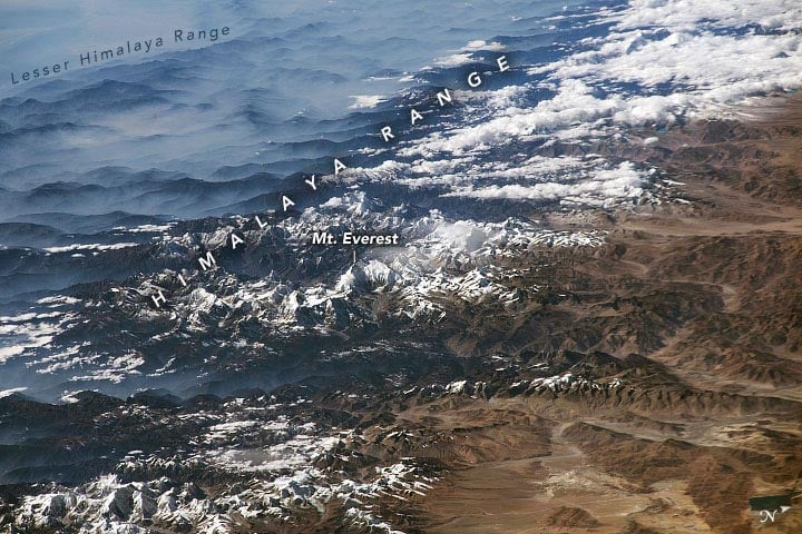
 

Himalayas, Near and Far: Two Astronauts. Two Clear Days. Two Gorgeous Views.

Himalayas ISS 2012 Annotated

May 23, 2012

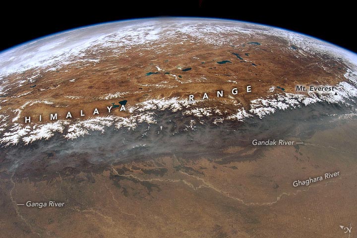
Two astronauts. Two clear days. Two gorgeous views around the roof of the world.

Astronauts onboard the International Space Station (ISS) shot these photographs of the Himalayas, the Tibetan Plateau, and the Indo-Gangetic plain.

The wide view above, taken in May 2012 by astronaut Don Pettit shows a dramatic 1000 kilometer (600 mile) stretch of the snow-capped peaks of the Himalayas. The Ganges/Ganga Plains occupy the foreground, and the numerous lakes and mountain glaciers of the Tibetan Plateau are visible beyond the mountains. The major rivers on the plains—the Ganges, Ghaghara, and Gandak—have transported vast amounts of sediment from the Himalayas over millions of years and deposited much of it in very large alluvial fans.

Due to the oblique viewing angle from the ISS, the curve of Earth’s limb defines the horizon visible from orbit. This photo view is close to the magnificent view that would have greeted Pettit’s eyes that day because the lens he used (16 mm) is fairly close to the focal length of the human eye (about 25 mm). To the unaided eye, Chomolungma/Mount Everest, the highest peak on Earth (8,848.86 meters or 29,031.7 feet) is indistinguishable in this panoramic view.

Himalayas ISS 2017 Annotated

December 5, 2017

The second photo was shot by astronaut Randy “Komrade” Bresnik in December 2017 while looking southwest through a much longer lens (420 mm). It shows details from the part of the range that includes Mount Everest, which appears without its usual cloud cover. The extensive monsoon cloudiness that brings rain had not yet set in, though southerly winds blew up some of the major valleys onto the Tibetan Plateau, causing cloud streamers to rise. Two of the largest valleys that cut through the Himalaya Range lie just east and west of Chomolungma/Everest.

Another reason for the clarity of the air on this day was that the usually hazy air pollution of the region was blown away by the winds. A gray mass of air pollution (upper left) still obscured some of the landscape detail on the plains.

Learn more about astronaut photography in the Picturing Earth video series: part 1 Astronaut Photography in Focus; part 2 Window on the World; and part 3 Behind the Scenes.

Astronaut photograph ISS031-E-67020 was acquired on May 23, 2012, with a Nikon D2Xs digital camera using a 16 millimeter lens. Astronaut photograph ISS053-E-317703 was acquired on December 5, 2017, with a Nikon D5 digital camera using a 420 millimeter lens. Both were provided by the ISS Crew Earth Observations Facility and the Earth Science and Remote Sensing Unit, Johnson Space Center. The images were taken by members of the Expedition 31 and Expedition 53 crews. The images have been cropped and enhanced to improve contrast, and lens artifacts have been removed. The International Space Station Program supports the laboratory as part of the ISS National Lab to help astronauts take pictures of Earth that will be of the greatest value to scientists and the public, and to make those images freely available on the Internet. Additional images taken by astronauts and cosmonauts can be viewed at the NASA/JSC Gateway to Astronaut Photography of Earth. Caption by Justin Wilkinson, Texas State University, JETS Contract at NASA-JSC.


Edge Of Tibetan Plateau From Space

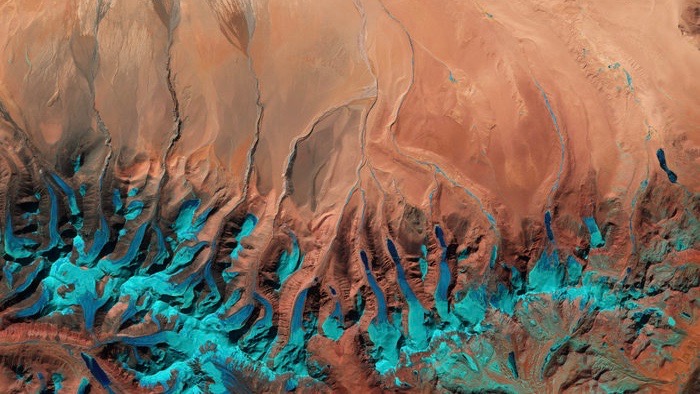
The southern-central edge of the Tibetan Plateau near the border with western Nepal and the Indian state of Sikkim is pictured in this Sentinel-2A image from 1 February 2016. Image via ESA.
The southern-central edge of the Tibetan Plateau near the border with western Nepal and the
 Indian state of Sikkim. Image via ESA/Sentinel-2A.

ESA released this image as its Earth observation image of the week on June 17, 2016. It’s a Sentinel-2A satellite image of the Tibetan Plateau. ESA said:

The Tibetan Plateau was created by continental collision some 55 million years ago when the north-moving Indian Plate collided with the Eurasian Plate, causing the land to crumple and rise. And rise it did. With an average elevation exceeding 4,500 meters (14,800 feet) and an area of 2.5 million square kilometers (about a million square miles), it is the highest and largest plateau in the world today.

The plateau is also the world’s third largest store of ice, after the Arctic and Antarctic. In recent years, rising temperatures have caused rapid melting.

Part of the Himalayas is visible along the bottom of the false-colour image, with the distinct pattern of water runoff from the mountains. At the end of these rivers and streams we can see the triangle-shapes of sediment deposits – alluvial fans – formed when the streams hit the plain and spread out.

One large alluvial fan is visible in the upper-central portion of the image, while smaller ones can be seen on the left.

Alluvial fans are subject to flooding, and these areas are increasingly at risk as climate change taking its toll on the world’s glaciers causes accelerated melting.

Bottom line: A Sentinel 2A image of the southern-central edge of the Tibetan Plateau.

Via ESA

Feral dogs aggravate biodiversity crisis in Himalayas

The booming population of strays causes economic hardship, risks the spread of disease and threatens conservation efforts – but NGOs and some state governments are taking action


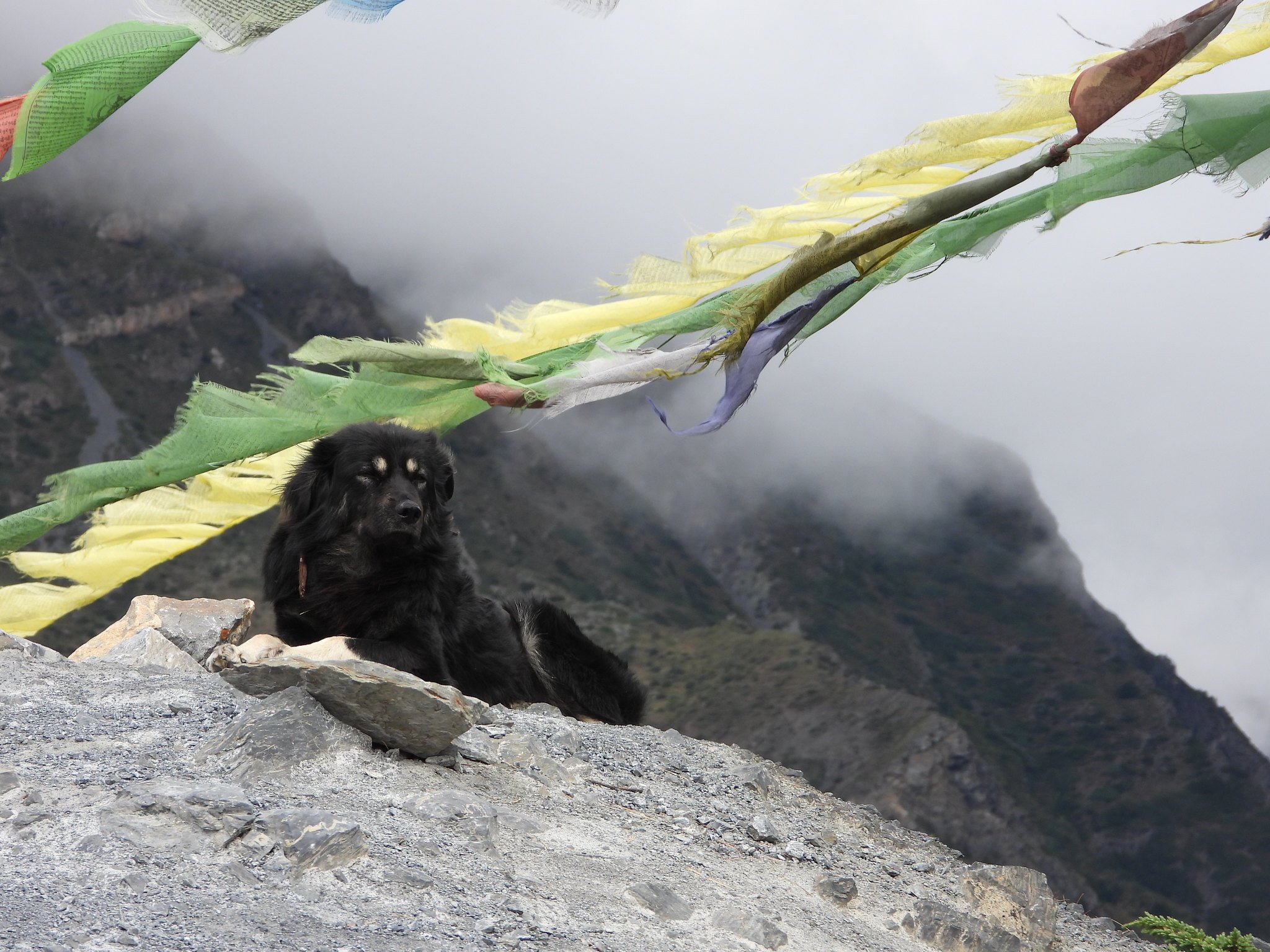
Dogs are a part of Himalayan life and culture. A dog rests outside a Karma Samten Ling monastery in Ngarwal, Annapurna Conservation Area
[image by: Debby Ng]


Mahima Jain
March 23, 2021

Wherever there are people, dogs seem to follow. Ecologist Chandrima Home knows this better than most.

Back in 2013, Home was studying feral domestic dogs in Spiti Valley, in the north Indian state of Himachal Pradesh, for her doctoral degree. She travelled extensively in the Himalayan landscape to understand the impacts of the animals.

“I estimated there were about 1,000 dogs in 25 villages covering over 4,000 square kilometres,” said Home. The canine population in India is an estimated 60 million, of which 35 million are feral or free-ranging. These numbers might be lower in the mountains, but they also have a more powerful impact.

In January 2021, the Himachal Pradesh government described the density of feral dogs as an “imminent threat” to the state’s ecosystem. This was in response to a survey conducted by a government-run conservation project called SECURE Himalaya, the forest department and Zoological Survey of India, which found there are on average nearly three feral dogs per 100 sq km in the remote, high-altitude region of Lahaul and Pangi.

RECOMMENDEDThe Himalayan state of Bhutan tackles its stray dog menace


RECOMMENDEDVideo: Abandoned Tibetan Mastiffs


RECOMMENDEDTibetan Mastiffs: Abandoned and dangerous

Danger to native wildlife

“Dogs threaten local wildlife through direct predation, competition with other carnivores and through potential disease transmission,” said Kulbhushan Suryawanshi, a scientist at Indian NGO Nature Conservation Foundation (NCF). For instance, they have been recorded chasing snow leopards away from their kills.

While it is hard to estimate the direct impact dogs have on wild animals and endangered species, Home’s research has found that 48% of reported attacks by packs of dogs on native Indian species happen in or near protected areas. Nearly half of these cause the death of the attacked animal, with dogs preying on local wildlife like blue sheep, red panda, musk deer, red foxes, weasels, martens, pika and marmots. With many species already critically endangered, conflict with dogs can seriously impede efforts to help populations recover.

A yellow-throated marten, a small wild carnivore that is native to the Himalaya. Villagers had attempted to rescue this individual from a pack of six dogs, but the marten died from its injuries soon after the dogs were chased away [image by: Bikram Gurung]

A pack of feral dogs can be ferocious and can even attack a large animalThinlay N. Bhutia, Sikkim Anti-Rabies & Animal Health Division

“A pack of feral dogs can be ferocious and can even attack a large animal. They have a significant advantage over small livestock and wild animals that roam alone,” said Thinlay N Bhutia, programme coordinator and joint director of the Sikkim Anti-Rabies and Animal Health (SARAH) division, the first state-wide anti-rabies government programme in India.
Livestock losses lead to culture change

Research indicates that in some areas of the Himalayas, dogs are responsible for more livestock kills than wild animals.

One study analysed dog attacks in 29 villages in the Spiti Valley between April and June 2013. Based on interviews with herders and pastoralists, it found nearly 63.5% of livestock losses were because of dog attacks, particularly on sheep and goats. Snow leopards and wolves were responsible for 28.5% and 8% respectively. Of the USD 46,662 worth of livestock lost to depredation and disease in 2013, dog attacks accounted for USD 17,522 (40%).


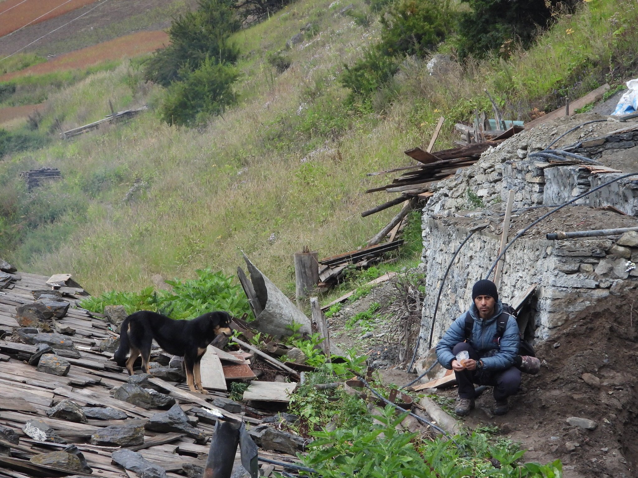
Research assistant with the Himalayan Mutt Project, Ajay Narsingh Rana, coaxes a dog down from the roof of a house in Upper Pisang village, Annapurna Conservation Area. A sample of blood was collected from the dog and analysed for pathogens, and the dog was sterilised by veterinarians [image by: Debby Ng]

Home told The Third Pole that predation by domestic dogs has changed livestock compositions in the past decade. Many villagers have reduced their small livestock holdings due to this and other socio-economic factors.
Feral dogs as vectors of disease

Dogs often carry viruses, bacteria and parasites that can cause disease – and indirectly affect wildlife and livestock. Feral dogs can also travel long distances to remote places, thus potentially infecting wolves, snow leopards and other wild carnivores.

In 2012, thousands of dogs died in Sikkim due to an outbreak of canine distemper, a lethal viral disease. In 2014, researchers found that the same virus was killing tigers and red pandas in Uttar Pradesh and West Bengal

.
RECOMMENDED Himalayan community beats Covid-19


Dog bites are also the main cause of rabies deaths in people. India, where about 20,000 people die from rabies every year, accounts for 36% of the global death toll from the disease. In remote Himalayan regions, where access to healthcare can be challenging, eliminating dog-mediated rabies is crucial.
Monitoring and population control

“Dogs are everywhere in the Himalayas. Camera traps documenting snow leopards at altitudes between 5,000-7,000 metres have spotted dogs. But we don’t know how abundant they are,” said Debby Ng, wildlife disease ecologist and co-founder of Himalayan Mutt Project (HMP), an organisation that carries out free neutering and vaccination of dogs in Nepal.

Suryawanshi, from NCF, explained that the problem often starts off small. Pets may be abandoned or left by pastoralists, who own dogs to guard their herds, during migrations. However, Suryawanshi said, the initially small population of strays then thrives on the food waste in rubbish dumps and left behind by tourists and military camps.

Dogs breed swiftly. They can have up to three litters a year, with as many as seven puppies per litter, who will then themselves breed quickly.

“Once dogs attain high densities, then it is very difficult to contain them,” Suryawanshi said. Dogs in this region are often a mix of Tibetan mastiff and local breeds. They are therefore bigger and more powerful than those in the plains, making them hard to catch.

As well as in Himachal Pradesh, the problem has been reported in Jammu & Kashmir, Ladakh, and parts of Uttarakhand and Sikkim. It is also a serious issue in Nepal, Tibet and Bhutan.
Human solutions for a human problem

In 2014, Ladakhi officials ordered the culling of 20 dogs after a woman was killed by a pack. (This was suspended after protests by animal rights activists.)

Experts stress that rather than brutal measures, tackling this issue needs a multi-pronged, systemic approach.

Bhutia, from SARAH, told The Third Pole that in recent years the state has reported fewer incidents of dog bites.

“By improving dog health, you can improve human health too,” said Helen Byrnes, a veterinarian at Vets Beyond Borders (VBB) and volunteer at SARAH.

Ng co-founded HMP in 2014 in Nepal to reduce community and wildlife conflict with dogs and stop culling. “The World Health Organization recommends a systematic animal birth control and vaccination drive [to prevent rabies and stabilise dog populations],” Ng pointed out.

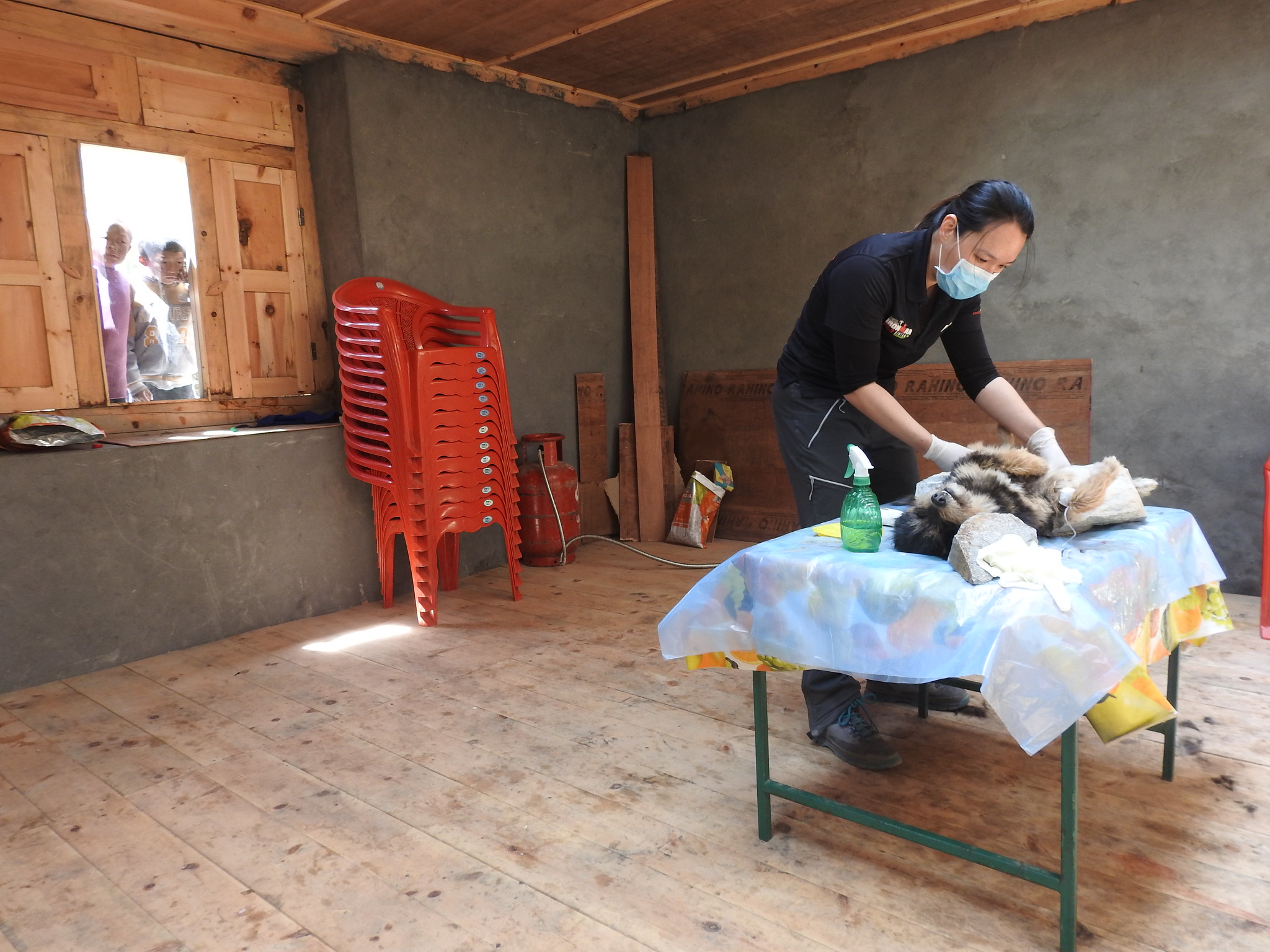
Gim Geok Ng prepares a dog for sterilisation as children watch her from the window at Pisang village, Annapurna Conservation Area [image by: Debby Ng]

HMP covers villages in Annapurna Conservation Area, Nepal’s largest protected area. It has neutered 621 dogs and vaccinated over 800.

SARAH and HMP have similar approaches. Dogs are tracked by trained handlers with community support; experienced veterinarians vaccinate and sterilise them; and after post-op care they are released or returned to their owners.

“Sterilised dogs are healthier, more active and less aggressive,” said Byrnes.

SARAH, along with volunteers from VBB and Fondation Brigitte Bardot, has vaccinated over 320,000 dogs and sterilised 78,000 since 2005. This involves communication and cooperation at various levels, from local people to state departments such as animal husbandry and health.

Bhutia explained that the economic losses from an uncontrolled feral dog population (rabies, loss of livestock, threats to wildlife) are far higher than the cost of running a track-neuter-release programme.

“Once you estimate the losses it is easier to persuade any government to start a systematic state-level programme,” he said. Sikkim’s response to the problem has been strengthened as there are strong pet ownership laws and penalties for violating them, he added.

However, there are many barriers to ensuring a rabies-free state and controlling the dog population. Sikkim shares a border with China, Bhutan and Nepal, and dogs can move between countries. Citizens also bring in dogs from other states.

“These are not one-off projects; we have to do them for years,” Bhutia said.

Another important factor is waste management, Home pointed out.

NCF has implemented dog-proofing at some rubbish sites, and found that there were fewer dogs in villages with these measures.

“We have to move away from seeing this as a dog problem. It really is a human problem,” said Ng. “Humans bring dogs into these places, and human choices can keep their population in check or cause it to explode.”
China marks Tibet anniversary with call to accept Communist rule

Beijing marks 70th anniversary of founding of Tibet Autonomous Region, with a call to accept the Communist Party’s rule.

A man stands in front of a sign marking 70 years since Chinese rule over the Tibet Autonomous Region, on the Potala Palace Square in Lhasa, Tibet [File: Martin Pollard/Reuters]
19 Aug 2021

China has marked the 70th anniversary of the founding of the Tibet Autonomous Region on the roof of the world, with a call to accept the rule of the Communist Party.

Beijing has ruled the remote western region since 1951, after its People’s Liberation Army marched in and took control in what it called a “peaceful liberation”.

“Tibet can only develop and prosper under the party’s leadership and socialism,” Wang Yang, who heads a national organisation responsible for uniting all races and all parties under the leadership of the Communist Party, said at the event on Thursday in the region’s capital, Lhasa.
Paramilitary police officers swap positions during a change of guard in front of Potala Palace in Lhasa [File: Thomas Peter/Reuters]

The celebration, attended by almost 10,000 people, was held at the foot of the iconic Potala Palace, a sacred Buddhist site associated with the Dalai Lamas.

A nationwide live telecast of the celebration prominently featured a four-storey-high portrait of Chinese President Xi Jinping towering over the audience.

Propagandists in the 1950s and 1960s used to extensively display Mao Zedong’s portraits at rallies and celebrations to whip up a personality cult around him and cultivate loyalty.

Most leaders after Mao forbade the practice, although under Xi’s rule, his solo portraits as well as those with him and four previous leaders have been placed extensively in Tibet.


The party’s atheist Han leaders in Beijing have also made extra efforts to cultivate loyalty among Tibetans, many of whom are devout Buddhists and traditionally view the Dalai Lamas as their spiritual leaders.

Beijing brands the current Dalai Lama, exiled in neighbouring India, as a dangerous separatist and instead recognises the current Panchen Lama, put in place by the party, as the highest religious figure in Tibet.

As a mark of the party’s rule over Tibetan Buddhism, Wang presented the Panchen Lama with a commemorative plaque at the ceremony.

SOURCE: NEWS AGENCIES

Rise of domestic social media in Tibet amid growing Chinese suppression
A woman in a costume poses for a commercial photographer as Tibetans perform a pilgrimage around the Jokhang Temple in Lhasa, Tibet Autonomous Region, China, October 15, 2020. Picture taken during a government-organised tour. Picture taken October 15, 2020. 

REUTERS/Thomas Peter (REUTERS)3 min read . 
Updated: 03 Dec 2020, 

Despite the attempts by the authoritarian Chinese Communist Party to curb freedom of expression, right to information, association and religion in Tibet, there has been a rise in domestic social media

Taipei [Taiwan]: Despite the attempts by the authoritarian Chinese Communist Party (CCP) to curb freedom of expression, right to information, association and religion in Tibet, there has been a rise in domestic social media giving platform to voices challenging the government-sponsored news.

The CCP censors the internet and maintains intensive surveillance apparatus in the form of facial recognition technology and Global Positioning System (GPS) coordination in its occupied territories including Tibet, East Turkistan (Xinjiang), and Southern Mongolian (Inner Mongolia), reported The Taiwan Times.

With the aim to control the "digital ecosystem", the social media accounts linked to the CCP propaganda campaign is being used to spread disinformation on social media such as Twitter, Facebook, etc.

They have been used to promote content attacking critics of the Chinese government and to spread conspiracy theories blaming the US for waging a biological war against China, The Taiwan Times reported.

Meanwhile, the government has blocked websites run by human rights groups, foreign media, Google search engine and social media sites such as Facebook, Twitter, etc.

China is considered to be having one of the most pervasive online censorship system in the world, the country's infamous "Great Firewall" blocks access and censors numerous websites, The Taiwan Times reported.

Despite these attempts, a series of images and videos of 156 Self Immolators inside Tibet were sent through social media, the Taiwanese media outlet informed. During the coronavirus pandemic information on personal accounts of life under lockdown was shared on social media. Besides, intensive discussions were leaked with images and videos exposing high ranking officials of their mismanagement, lack of transparency and accountability, The Taiwan Times said.

With the aim to muzzle the voices of Tibetans, the CCP this year arrested 10 Tibetans in Lhasa for spreading 'rumors' about the coronavirus outbreak on March 12 on WeChat, The Taiwan Times reported.

"In July two Tibetan lyricists, Khado Tsetan and singer Tsegao, were sentenced to seven years and three years in prison respectively by a Chinese court in North-Eastern Tibet without a trial after they composed, sang and circulated a song praising Tibetan spiritual leader, H.H. the Dalai Lama. They have been charged for alleged involvement in "subversion of state law and leaking information to the outside world, which is considered as a "state security crime," said the Free Tibet website.

Meanwhile, a Tibetan girl was arrested from the same region for having shared the song on social media.


It is a common practise across Tibet and East Turkistan (Xinjiang) that if complaints were made and voices raised, they are liable to face further punishments, The Taiwan Times said while adding that after their release the political prisoners are put under strict surveillance where every move is constantly watched.

Besides putting the families of these political prisoners under surveillance, they are also denied access to subsidies and government jobs.

Citing the example of Tibetan language rights advocate Tashi Wangchuk, The Taiwan Times further said that he was sentenced to five years for "inciting separatism" in a closed-door trial by Yushu Intermediate People's Court for voicing concerns in an interview with The New York Times.

Despite the global outcry, the Chinese court rejected his appeal and also denied him access to his lawyer.


Human Rights Watch's China director, Sophie Richardson was quoted as saying: "Tashi Wangchuk's only 'crime' was to peacefully call for the right of minority peoples to use their own language".

In the seventh Tibet Work Forum held in Beijing from August 28 and 2, President Xi Jinping emphasised on intensifying and Sinicising Tibetans and their culture through the "patriotic reeducation". He also emphasized against "anti-Dalai Lama Campaigns in Tibet" with the expansion of mass education to promote "socialism with Chinese Characteristics", said The Taiwan Times.

To counter or rather silence these criticisms, the state media like Global Times and Xinhua had to resort to regular publishing of opinion articles. Further, the CCP has used both the electronic and print media to be its mouthpiece for propaganda. (ANI)
Evolution of vegetation and climate variability on the Tibetan Plateau over the past 1.74 million years


Abstract

The Tibetan Plateau exerts a major influence on Asian climate, but its long-term environmental history remains largely unknown. We present a detailed record of vegetation and climate changes over the past 1.74 million years in a lake sediment core from the Zoige Basin, eastern Tibetan Plateau. Results show three intervals with different orbital- and millennial-scale features superimposed on a stepwise long-term cooling trend. The interval of 1.74–1.54 million years ago is characterized by an insolation-dominated mode with strong ~20,000-year cyclicity and quasi-absent millennial-scale signal. The interval of 1.54–0.62 million years ago represents a transitional insolation-ice mode marked by ~20,000- and ~40,000-year cycles, with superimposed millennial-scale oscillations. The past 620,000 years are characterized by an ice-driven mode with 100,000-year cyclicity and less frequent millennial-scale variability. A pronounced transition occurred 620,000 years ago, as glacial cycles intensified. These new findings reveal how the interaction of low-latitude insolation and high-latitude ice-volume forcing shaped the evolution of the Tibetan Plateau climate.


INTRODUCTION

The Tibetan Plateau has long been a focus of geoscientific studies because of its importance in global tectonics and Asian and global climate change across a wide range of time scales (1). However, with only few available paleoarchives of coarse resolution [>8 thousand years (ka)] (2, 3), little is known about its environmental history through the Quaternary ice ages. To understand the mode and tempo of changes and, ultimately, the underlying drivers during this period, we need long-term high-resolution records from the elevated plateau with well-constrained chronologies.

The Zoige Basin, occupied by a huge lake until the latest Pleistocene (3) and located on the eastern Tibetan Plateau within the South Asian monsoon zone (fig. S1), represents a potential site to fill this gap. Mean annual precipitation (MAP) at Zoige is ~600 to 650 mm, and the basin is primarily covered by alpine meadows, and the surrounding mountains have scattered forests up to ~4000 m above sea level (a.s.l.) (fig. S1). A sediment core extending over the past 0.9 million years (Ma) was previously recovered, but its analytical resolution and chronological reliability were insufficient to resolve orbital- and suborbital-scale changes (3).

CORE ACQUISITION AND CHRONOLOGY

New drilling (33°58.163′N, 102°19.855′E, 3434 m a.s.l.) was undertaken in 2013 in the central basin guided by a seismic survey. A 573.39-m core (ZB13-C2) was obtained with 96% recovery, mostly consisting of fine-grained freshwater lacustrine sediments. Only the upper 50 m contains two episodic fluvial sandy layers, 10.11 and 10.4 m thick, respectively.

Independent age control derived from magnetostratigraphy in combination with radiocarbon [accelerator mass spectrometry (AMS)] and luminescence [optically stimulated luminescence (OSL)] dating provides an initial chronological framework (Materials and Methods; figs. S2 and S3), according to which the ZB13-C2 core extends back to 1.74 Ma before present (BP) (Materials and Methods; fig. S3). Fluctuations in arboreal pollen abundances (AP%) based on an initial age model using a combination of 14C, OSL, and paleomagnetic control points (table S3) show clear ~100-, 40-, and 20-ka cyclicities (fig. S3), suggesting possible eccentricity (E), tilt (T), and precession (P) powers. The presence of astronomical frequencies in the Zoige Basin record is further supported by spectral analyses of AP% in the depth domain, which indicate the occurrence of ~34-, 15-, and 7.5-m cycles, whose ratios are close to those of 100:40:21; the ~7.5-m cycle appears to be stronger in the lower ~75 m, while the ~34-m cycle is stronger in the top ~200 m (Materials and Methods and fig. S3). On this basis, a more detailed age model was constructed by tuning the AP% record to an ETP record that is generated by normalizing and averaging variations in eccentricity, tilt, and reversed precession (4). As this approach may artificially introduce astronomical frequencies in our record, we compared the ETP age model against an age model constructed by aligning the Zoige AP% to the Chinese speleothem δ18Ocalcite record, an independently dated (U-Th) archive of changes in Asian monsoon intensity over the past 640 ka (5). Comparison of the ETP- and speleothem-based age models of Zoige reveals a close correspondence (fig. S3).

CLIMATE PROXIES

Pollen and sediment analyses (2787 and 3274 samples, respectively, with a mean sampling resolution of ~530 to 620 years), as well as x-ray fluorescence (XRF) scanning (~6-year resolution) data, yield a detailed multiproxy record back to 1.74 Ma BP.

The vegetation in the eastern Tibetan Plateau is strongly influenced by the Asian summer monsoon. A stronger monsoon with warmer and moister climate would cause an expansion of tree populations. However, in the alpine Zoige region, the density and elevational limits of forests are primarily controlled by temperature, as moisture availability is relatively plentiful (6, 7). This is confirmed by the distinct elevational distribution of modern vegetation (fig. S1), the good match of AP% and axis 1 of principal components analysis (PCA) on the pollen data (fig. S4), and the close relationship between summer temperature and PCA axis 1 in the significance test of the quantitative temperature reconstructions for core ZB13-C2 (fig. S4). Thus, on long time scales, variations in AP% in the core are mostly a reflection of changes in temperature, particularly summer temperature, but drought stress, for example, during weak monsoon or glacial intervals, would also have an impact on tree populations.

Pollen-based quantitative reconstruction of past climate variables was undertaken (Materials and Methods), providing the first independent paleotemperature history for the Tibetan Plateau because of the dominant control of temperature on local vegetation (figs. S1 and S4) (6, 7). The mean temperature of the coldest month (MTCM) and precipitation reconstructions failed the relevant statistical significance test and are thus less reliable (Materials and Methods).

Rubidium/strontium (Rb/Sr) ratios and carbonate content (Carb%) are used as supplementary proxies. Rb/Sr primarily reflects the chemical weathering intensity of the catchment or strength of summer monsoon and associated run-off (8). When weathering/run-off is stronger, there is greater Sr input into the lake, leading to a lower Rb/Sr ratio. However, Sr contained in carbonate can influence Rb/Sr ratios from bulk scanning data, rendering climate interpretations less reliable. We therefore measured Rb/Sr ratios on bulk samples after removing the carbonate content (Materials and Methods). This showed good agreement with the high-resolution XRF scanning data (fig. S5), supporting the view that the ZB13-C2 Rb/Sr signal derived from XRF scanning is largely independent of changes in carbonate content. Grain size changes could also distort the climate signal of Rb/Sr, but examination of core ZB13-C2 shows a weak correlation between Rb/Sr and grain size changes (fig. S5). The Zoige lake sediments are generally fine and have no large variations, except the two sandy layers near the top. The high correlation between Rb/Sr and the chemical index of alteration (CIA) at Zoige further support the weathering interpretation (fig. S5) that the proxies are sensitive to both summer precipitation and temperature conditions.

Previous studies from core RH nearby ZB13-C2 suggest that carbonate content mainly represents authigenic chemical precipitation, as both detrital carbonate content and shell carbonate are in trace amounts (3). The measured Carb% in core ZB-C2 should mainly reflect processes of chemical precipitation in the lake, which are largely related to summer temperature and precipitation. High temperature could increase the precipitation of carbonate through changing the precipitation-dissolution equilibrium and photosynthesis process. Precipitation could also enhance carbonate content by washing more Ca2+ and HCO3− into the lake through chemical weathering. Carb% therefore indicates warm and wet climate. Carbonate content from core RH shows good positive correspondence with hydrogen index, a proxy of the effect of lake water depth (3). Our loss-on-ignition (LOI) measurements of surface mud samples, taken along water-depth transects from four lakes near ZB13-C2, also reveal that Carb% generally increases with water depth in each lake (fig. S5). High Carb% from core ZB13-C2 likely agrees with high lake level, which depends on the balance between precipitation and evaporation.

The coherent variations in AP%, Rb/Sr, and Carb% (fig. S5), with low Rb/Sr and high Carb% corresponding to high AP%, therefore suggest that coupled changes of temperature and precipitation occurred over the past 1.74 Ma.

READ OR DOWNLOAD HERE Evolution of vegetation and climate variability on the Tibetan Plateau over the past 1.74 million years | Science Advances (sciencemag.org)


View ORCID ProfileYan Zhao1,2,*,
View ORCID ProfilePolychronis C. Tzedakis3,
View ORCID ProfileQuan Li1,
Feng Qin1,
View ORCID ProfileQiaoyu Cui1,
Chen Liang1,
View ORCID ProfileH. John B. Birks3,4,
Yaoliang Liu1,
Zhiyong Zhang1,5,
View ORCID ProfileJunyi Ge6,7,
Hui Zhao8,
View ORCID ProfileVivian A. Felde4,
View ORCID ProfileChenglong Deng9,
Maotang Cai1,
Huan Li10,
Weihe Ren1,
Haicheng Wei11,
View ORCID ProfileHanfei Yang1,
Jiawu Zhang12,
View ORCID ProfileZicheng Yu13,14 and
View ORCID ProfileZhengtang Guo2,9

See all authors and affiliations
Science Advances 06 May 2020:
Vol. 6, no. 19, eaay6193
DOI: 10.1126/sciadv.aay6193

Article
Figures & Data
Info & Metrics
eLetters
PDF

To evade humans, this medicinal plant has evolved to hide in plain sight


Peer-Reviewed Publication

CELL PRESS

Uncamouflaged plant 

IMAGE: FRITILLARIA DELAVAYI IN POPULATIONS WITH LOW HARVEST PRESSURE AND NO CAMOUFLAGE. view more 

CREDIT: YANG NIU

Bulbs of the plant known as Lu Bei (Fritallaria delavayi) have been used in Chinese medicine for more than two thousand years. Now, researchers reporting November 20 in the journal Current Biology have found that, in places where the herb is harvested more, the plant has evolved to blend in better with the background, making them harder for people to find. As a result, the plant varies in color from brown or grey to green, depending on whether it lives in a place that is frequented by human collectors or not.

"We've found that human harvesting of a traditional medicine plant has led to the evolution of camouflage by the plants, to evade detection by collectors," said Martin Stevens of University of Exeter. "And that camouflage is better in locations where collection intensity has been higher."

First author of the new study Yang Niu, Kunming Institute of Botany, Chinese Academy of Sciences, had been studying the evolution of alpine plants for years. He and his colleagues had noticed that the color of F. delavayi showed obvious variation among populations. They also knew it had a long history of use in traditional medicine. Could human harvesting be responsible for those differences in color they were seeing?

It appears that the answer is yes. The researchers found that the degree to which the plants' color matches its mountainous background is associated with estimates of how heavily they are harvested in particular places. Where they are heavily collected, the plants are camouflaged and therefore more cryptic.

CAPTION

This photo shows Fritillaria delavayi in populations with high harvest pressure where camouflage is evident.

CREDIT

Yang Niu

To confirm that the plant colors influenced the ability of people to find them, the researchers developed an online citizen science experiment "Spot the Fritillaria." People were asked to spot the plants as quickly as they could. Not surprisingly, those plants that more closely matched the background took longer for people to find.

While it's possible that other animals could exert similar pressures, the researchers say they don't think that's likely. There's no evidence that the plants are a popular food item for other animals living in the area. The plants also produce chemicals that are known to deter rodents. Ironically, it is those same compounds that make them attractive to people as a medicinal herb.

For the plant, the camouflage may have downsides, which the researchers hope to explore in future studies. "In heavily collected populations, camouflage in flowers may weaken their attractiveness to pollinators such as bumblebees," Niu said. "We aim to find out how the plants deal with this problem."

Stevens says his team is "further exploring how animals and plants are being affected by human actions, including how their defensive behaviors and coloration are being influenced by selection pressure and stresses imposed by humans, from noise pollution to climate change."

This work was supported by the Second Tibetan Plateau Scientific Expedition and Research (STEP) program, the Strategic Priority Research Program of the Chinese Academy of Sciences, NSFC, Yunnan Ten Thousand Talents Plan Young & Elite Talents Project, Youth Innovation Promotion Association of CAS, the Major Program of the National Natural Science Foundation of China, the Key Projects of the Joint Fund of the National Natural Science Foundation of China, and the National Key R&D Program of China.

Current Biology, Niu et al.: "Commercial Harvesting Has Driven the Evolution of Camouflage in an Alpine Plant" https://www.cell.com/current-biology/fulltext/S0960-9822(20)31655-9

Current Biology (@CurrentBiology), published by Cell Press, is a bimonthly journal that features papers across all areas of biology. Current Biology strives to foster communication across fields of biology, both by publishing important findings of general interest and through highly accessible front matter for non-specialists. Visit: http://www.cell.com/current-biology. To receive Cell Press media alerts, contact press@cell.com.

Pakistan’s Real Challenge: Water Crisis

Despite the mighty K2 and ferocious Indus river water resources in Pakistan are depleting fast. IMF has ranked Pakistan third among the countries facing severe water shortages in the world. Yet Pakistan’s policymakers refuse to acknowledge the scale of the challenge and remain ignorant of even small changes that could be made to to resolve the issue, an ex-World Bank Adviser argues.

By Manzoor Ahmad Khan
13 August 2021


Water is a critical component for the existence and sustainable development of a society and is a fundamental human right on this planet. It is vital for countries like Pakistan, where it is almost priceless for agriculture, which exploits about 96 percent of available freshwater, while other sectors use the 4 percent left over.

By virtue of its ever-increasing population growth, urbanization, and climate change, conflicts over water resources are expected to increase, with dire consequences for the food production system in the country.

Despite hosting the third pole (the Hindu Kush, Himalayas mountain range, and the Tibetan Plateau), Pakistan is still highly vulnerable to the impacts of water scarcity due to climate change. Planet Earth comprises 71 percent water and 29 percent land, but most of the water is not useable, so water scarcity has become a global problem.


Gulf countries, especially Saudi Arabia, have severe water scarcity problems and use desalination plants to get fresh water from seawater, which is an energy-intensive process. Pakistan has also recently established a desalination plant in Gwadar with the help of China.

Read More: Pakistan aiming to conserve water builds & upgrades water courses

The majority of Pakistan’s landmass, almost 80 percent, is classified as having a semi-arid to an arid climate. More than 30 million people lack clean drinking water access in Pakistan, and more than 50 million people do not have electricity.
Understanding the scale of Pakistan’s Water scarcity

Water scarcity occurs when water demand is greater than the available supply. Intensified water scarcity leads to desertification that United Nations has recognized as a global challenge. UN Convention to Combat Desertification (UNCCD) is working globally to solve related desertification and land degradation issues.


Pakistan ranks as the world’s fourth highest water user per capita. The amount of water consumed per unit of Gross Domestic Product (GDP) is the highest globally, implying the water-intensive economy of Pakistan is at the top of the list.

International Monetary Fund (IMF) has ranked Pakistan third among the countries facing severe water shortages. The mighty Indus, the mighty K2, and the world’s renowned peaks comprising the third pole on earth may still not be able to save Pakistan from the devastation of desertification and water scarcity.

Read More: Pakistan launches first green Eurobond to ensure water security

Punjab: deserts can revisit in a century?

The irrigation system for the plains of Punjab was built during the British era. Edward Calvert and Sir Malcolm Darling, who surveyed Punjab’s irrigation system during the 1930s, stated that it is a fragile system dependent on hill forests. They mentioned in their report that “deserts will revisit in a century.”


Since hill forests are being destroyed and degraded, we see their words come true as deserts are revisiting. Thus, there is an urgent need for afforestation. Despite having more glaciers than anywhere else globally and the mighty Indus River, Pakistan faces acute water scarcity.

Stress is increasing on water resources, surface, and groundwater, and severe extreme conditions increasingly occur in different parts of the country. Flood irrigation- highly inefficient use of water- is being used to grow water-intensive crops.

Sugarcane and rice crops need to be restricted to some regions of the country which can sustain them. Argo-ecological zones (a division of land into a resource mapping unit based on areas topology, climate, etc.) of Punjab were developed by the team at Argo-climatology lab, University of Agriculture Faisalabad, and have been evaluated, endorsed, and published by Food and Agricultural Organization (FAO).

Read More: Haleem Adil exposes Sindh govt’s drama over water issue

These zone-specific crop systems can help to boost sustainable production and provide opportunities to replace water-intensive crops, i.e., sugarcane and rice from non-core zones, with cotton, oil seed crops, vegetables, and high-value crops.

Pakistan’s Water Challenge: Obsolete infrastructure and lack of dams

Obsolete water infrastructure in Pakistan, lack of dams/ reservoirs, non-concrete canals having low water efficiency, and sediments filled reservoirs bring a potential threat to future water security. Furthermore, clean and drinking water reservoirs are polluted by poor agricultural practices of extensively used agrochemicals, humans, and industrial waste.

Tackling water scarcity needs a proper understanding of the problem before it becomes impossible to solve and we reach a point of no return. Urgent investment is required in order to build infrastructure to store water from local lakes, village ponds, and rainwater harvesting.

About 70 percent of freshwater by rainfall is received during July to September, in the monsoon season, but due to lack of awareness and poor infrastructure, we turn this blessing into a curse by not conserving this precious natural resource.

Read More: Pakistan will run out of water in 4 years
Pakistan: Need to stop flood irrigation & control seepage from canals

The Kalabagh dam issue needs to be resolved also. Yes, environmentalists believe we need to restore natural pathways and shift to nuclear and other renewable energy sources. Still, we are not in that position and cannot deny the importance of water reservoirs and the blessings of natural slopes existing from K2 to Clifton, those slopes and the natural gravity flow are a huge blessing to this part of the world.

We can deal with the excessive seepage problems of canals instead of using concrete to seal them, which is very time-consuming and requires high capital; other alternatives are present, such as sealing polymer.

The application of sealing polymers can lower the seepage problem by up to 80 percent, require little to no time, and can be done on a meager budget all across the country. Ironically, some of our areas are waterlogged while we do not have water at the tail of watercourses.

Flood irrigation is an ancient and inefficient method of irrigation where more water is applied than the crop-water requirement, wasting much water that other farmers can use. Flood irrigation causes stress and wastage of precious nutrient resources; thus, crop yield remains below average than the rest of the world.

Read More: World’s water woes and how climate change caused this crisis

The government of Punjab is doing very active work to control the water scarcity problem, through the department of On-Farm Water Management (OFWM), by concreting the watercourses and by giving subsidies to farmers to install the High-Efficiency Irrigation Systems (HEIS) to solve the water scarcity issues in Punjab, through efficiency enhancement and mechanization.

The solution lies in educating farmers about the benefits of using HEIS like center pivot irrigation systems, drip irrigation systems, etc., and applying metering and taxes on water usage. Campaigns about water scarcity, its possible causes, and solutions need to be launched on an emergency basis.

On the industrial side, there is a need for strict implementation of laws. Treatment of sewage and industrial water is essential to the sustainable availability of freshwater. Metering, taxing, and efficient monitoring solves most of the water-related problems in industrial sectors.

Water scarcity is getting severe in large cities of Pakistan due to unplanned expansions of the cities. Groundwater that was available at double-digit meters has, over the years, fallen and now has to be dug in hundreds of meters below the surface across the country.

Large cities should be expanded according to their master plans rather than uncontrolled growth so that everyone can get an adequate quantity of freshwater. Cultural practices need to alter for better water usage as well. Possibilities to cope with water scarcity can be divided between demand management and supply enhancement.

Author is a Former Senior Advisor, The World Bank. A slightly different version of this piece appeared under the title, “Pakistan’s Mighty Challenge: Water” in the August issue (print) of Global Village Space Magazine.

 IN TIBET

First evidence of mysterious, ancient humans called Denisovans found outside of their cave


By Ashley Strickland, CNN
Wed May 1, 2019

CNN —

A 160,000-year-old Denisovan jawbone fossil has been found in a cave on the Tibetan plateau, according to a new study. This marks the first evidence of Denisovans found outside Denisova Cave in Siberia since the mysterious ancient human group was discovered in 2010.


Denisovans, who lived during a time that overlapped with Neanderthals, are known only from a few fossils discovered in a Siberian cave. But they also left a genetic legacy that lives on today in the DNA of some Asian, Australian and Melanesian humans. A Denisovan genome was sequenced in 2012 and compared with that of modern humans, revealing the trait.

Tibetans and Sherpas have a genetic variant that helps them live in low oxygen at high altitudes, which can be traced back to Denisovans.

But before the discovery of this jawbone, researchers wondered why this genetic variant existed. Tiny, fragmented remains of Denisovans had only ever been found in Denisova Cave, which sits at an altitude of 2,296 feet.

Baishiya Karst Cave on the Tibetan Plateau, where the jawbone was found, has an altitude of 10,761 feet.

No DNA was preserved in the fossil, but the researchers were able to extract ancient proteins and analyze them, as well as conduct radioisotopic dating of the fossil. The study on their findings was published Wednesday in the journal Nature.


This cave sheltered some of the first known humans 300,000 years ago


The jawbone was well-preserved and featured a primitive shape, as well as a few large molars that were still attached.

At 160,000 years old, the fossil predates other evidence of ancient humans at such a high altitude in the area, which was previously set at between 30,000 and 40,000 years ago.

The age and features of the fossil are also similar to those of the oldest known Denisovan fossils from Denisova Cave, which suggests that the populations were closely related.


Dongju Zhang/Lanzhou University
The entrance to the Baishiya Karst Cave.

The jawbone was found by a monk in 1980 and eventually made its way to Lanzhou University, where researchers have been studying the cave site since 2010. They began analyzing the jawbone in 2016.

“Archaic hominins occupied the Tibetan Plateau in the Middle Pleistocene and successfully adapted to high-altitude low-oxygen environments long before the regional arrival of modern Homo sapiens,” said Dongju Zhang, study author and lecturer at Lanzhou University’s Research School of Arid Environment and Climate Change, in a statement.


Mysterious Denisovans interbred with modern humans more than once


The discovery shows that Denisovans lived in East Asia and adapted to the conditions there.

“Our analyses pave the way towards a better understanding of the evolutionary history of hominins in East Asia,” Jean-Jacques Hublin, study author and director of the Department of Human Evolution at the Max Planck Institute for Evolutionary Anthropology, said in a statement.


Evolutionary study suggests prehistoric human fossils ‘hiding in plain sight’ in Southeast Asia


A Homo erectus skull from Java, Indonesia. This pioneering species stands at the root of a fascinating evolutionary tree. Scimex


March 23, 2021 

Island Southeast Asia has one of the largest and most intriguing hominin fossil records in the world. But our new research suggests there is another prehistoric human species waiting to be discovered in this region: a group called Denisovans, which have so far only been found thousands of kilometres away in caves in Siberia and the Tibetan Plateau.

Our study, published in Nature Ecology and Evolution, reveals genetic evidence that modern humans (Homo sapiens) interbred with Denisovans in this region, despite the fact Denisovan fossils have never been found here.

Conversely, we found no evidence that the ancestors of present-day Island Southeast Asia populations interbred with either of the two hominin species for which we do have fossil evidence in this region: H. floresiensis from Flores, Indonesia, and H. luzonensis from Luzon in the Philippines.

Together, this paints an intriguing — and still far from clear — picture of human evolutionary ancestry in Island Southeast Asia. We still don’t know the precise relationship between H. floresiensis and H. luzonensis, both of which were distinctively small-statured, and the rest of the hominin family tree.

Get news that’s free, independent and based on evidence.Sign up for newsletter

And, perhaps more intriguingly still, our findings raise the possibility there are Denisovan fossils still waiting to be unearthed in Island Southeast Asia — or that we may already have found them but labelled them as something else.
An ancient hominin melting pot

Stone tool records suggest that both H. floresiensis and H. luzonensis are descended from Homo erectus populations that colonised their respective island homes about 700,000 years ago. H. erectus is the first ancient human known to have ventured out of Africa, and has first arrived in Island Southeast Asia at least 1.6 million years ago.

This means the ancestors of H. floresiensis and H. luzonensis diverged from the ancestors of modern humans in Africa around two million years ago, before H. erectus set off on its travels. Modern humans spread out from Africa much more recently, probably arriving in Island Southeast Asia 70,000-50,000 years ago.

We already know that on their journey out of Africa about 70,000 years ago, H. sapiens met and interbred with other related hominin groups that had already colonised Eurasia.

The first of these encounters was with Neanderthals, and resulted in about 2% Neanderthal genetic ancestry in today’s non-Africans.

The other encounters involved Denisovans, a species that has been described solely from DNA analysis of a finger bone found in Denisova Cave in Siberia.
Only a handful of Denisovan fossils have been found, such as this jawbone unearthed in a Tibetan cave. Dongju Zhang/Wikimedia Commons, CC BY-SA

Intriguingly, however, the largest amounts of Denisovan ancestry in today’s human populations are found in Island Southeast Asia and the former continent of Sahul (New Guinea and Australia). This is most likely the result of local interbreeding between Denisovans and modern humans — despite the lack of Denisovan fossils to back up this theory.

Read more: Southeast Asia was crowded with archaic human groups long before we turned up

To learn more, we searched the genome sequences of more than 400 people alive today, including more than 200 from Island Southeast Asia, looking for distinct DNA sequences characteristic of these earlier hominin species.

We found genetic evidence the ancestors of present-day people living in Island Southeast Asia have interbred with Denisovans — just as many groups outside Africa have similarly interbred with Neanderthals during their evolutionary history. But we found no evidence of interbreeding with the more evolutionarily distant species H. floresiensis and H. luzonensis (or even H. erectus).

This is a remarkable result, as Island Southeast Asia is thousands of kilometres from Siberia, and contains one of the richest and most diverse hominin fossil records in the world. It suggests there are more fossil riches to be uncovered.
So where are the region’s Denisovans?

There are two exciting possibilities that might reconcile our genetic results with with the fossil evidence. First, it’s possible Denisovans mixed with H. sapiens in areas of Island Southeast Asia where hominin fossils are yet to be found.

One possible location is Sulawesi, where stone tools have been found dating back at least 200,000 years. Another is Australia, where 65,000-year-old artefacts currently attributed to modern humans were recently found at Madjebebe.

Read more: Buried tools and pigments tell a new history of humans in Australia for 65,000 years

Alternatively, we may need to rethink our interpretation of the hominin fossils already discovered in Island Southeast Asia.

Confirmed Denisovan fossils are extremely rare and have so far only been found in central Asia. But perhaps Denisovans were much more diverse in size and shape than we realised, meaning we might conceivably have found them in Island Southeast Asia already but labelled them with a different name.

Given that the earliest evidence for hominin occupation of this region predates the divergence between modern humans and Denisovans, we can’t say for certain whether the region has been continuously occupied by hominins throughout this time.

It might therefore be possible that H. floresiensis and H. luzonensis (but also later forms of H. erectus) are much more closely related to modern humans than currently assumed, and might even be responsible for the Denisovan ancestry seen in today’s Island Southeast Asia human populations.

If that’s true, it would mean the mysterious Denisovans have been hiding in plain sight, disguised as H. floresiensis, H. luzonensis or H. erectus.

Solving these intriguing puzzles will mean waiting for future archaeological, DNA and proteomic (protein-related) studies to reveal more answers. But for now, the possibilities are fascinating.


Authors
João Teixeira
Research associate, University of Adelaide
Kristofer M. Helgen
Chief Scientist and Director, Australian Museum Research Institute, Australian Museum
Disclosure statement

João Teixeira receives funding from the Australian Research Council.

Kristofer M. Helgen received funding from the Australian Research Council’s Centre for Australian Biodiversity and Heritage (CABAH).