NASA catches the re-birth of zombie tropical cyclone Francisco

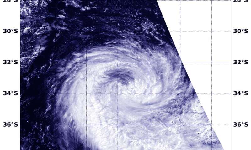
The low-pressure area that had once been Tropical Cyclone Francisco has been lingering in the Southern Indian Ocean since Feb. 6 when it weakened below tropical cyclone status. Since then, Francisco's remnants moved into an area of warm waters and low wind shear allowing the low-pressure area to re-organize, consolidate and re-form. NASA's Aqua satellite provided forecasters with a visible image of the zombie storm.
On Feb. 14, the Moderate Resolution Imaging Spectroradiometer or MODIS instrument that flies aboard NASA's Aqua satellite provided a visible image that showed the storm had re-developed a rounded shape with bands of thunderstorms spiraling into the low-level center. A more rounded shape of a tropical cyclone indicates it is becoming a more organized storm. Satellite imagery shows a compact system with strong thunderstorms persisting over the low-level circulation. In addition, satellite microwave imagery indicates deep convective banding of thunderstorms over the western semicircle wrapping into the north and east quadrants of a defined low-level circulation center.
On Feb. 14 at 4 a.m. EST (0900 UTC), the Joint Typhoon Warning Center (JTWC) noted that Francisco's maximum sustained winds powered back up to 40 knots (46 mph/74 kph). Francisco re-formed near latitude 19.0 degrees south and longitude 49.3 east, approximately 114 nautical miles east of Antananarivo, Madagascar. Francisco has tracked southwestward.
Meteo Madagascar issued a Red Vigilance Advisory for heavy rain over central and eastern Madagascar that includes Toamasina, Brickaville, Mahanoro, and the Vatomandry Districts.
The JTWC forecast said the system is expected to make landfall later today over the southeast coast of Atsinanana Region, close to Vatomandry City. That is far to the south of the coastal city of Toamasina. Francisco is expected to weaken steadily as it tracks inland and dissipate sometime on Feb. 15 over land.
NASA's Aqua satellite is one in a fleet of NASA satellites that provide data for hurricane research.
Tropical cyclones/hurricanes are the most powerful weather events on Earth. NASA's expertise in space and scientific exploration contributes to essential services provided to the American people by other federal agencies, such as hurricane weather forecasting.
No comments:
Post a Comment