Everest region glaciers thinning at high altitudes
by University of St Andrews

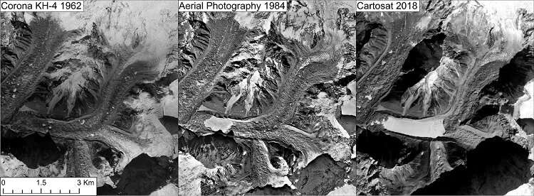
Figure 1: The retreat of Lhotse Shar/Imja Glacier and the associated development and expansion of Imja Tsho glacial lake, captured by declassified Corona KH-4 imagery in 1962, aerial photographs used to compose the 1988 National Geographic Everest map and 2018 Cartosat satellite imagery. The glacier has retreated more than 2.5km due to the expansion of the glacial lake. Credit: Atanu Bhattacharya, University of St Andrews
The behavior of glaciers around Mount Everest over the last six decades is now revealed in research published today in the multidisciplinary journal One Earth.
The project, which is part of the 2019 National Geographic and Rolex Perpetual Planet Everest Expedition, used a combination of declassified spy satellite imagery from the 1960s and 1970s, data from early aerial surveys of the topography of Mount Everest and its surrounding valleys from the 1980s, a range of modern satellite data and lidar data from the 2019 Everest Expedition to constrain the rate of ice mass loss from the region's glaciers over the longest possible time period using satellite archives.
The work also documented the first known example of glacier surge behavior around Mount Everest—a phenomenon previously thought to be restricted to glaciers located in other locations.
Dr. Owen King, of the School of Geography and Sustainable Development at the University of St Andrews, who led the study said: "Our results show that ice mass loss rates have consistently increased since the early 1960s and are now similar to the average global rate of ice loss, despite the regions extreme elevation. Ice loss has even occurred above 6000m above sea level which emphasizes the impact of climatic change on the harsh high mountain environment."

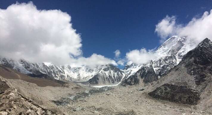
Upper part of the tongue of Khumbu Glacier in 2016. Credit: Owen King, University of St Andrews


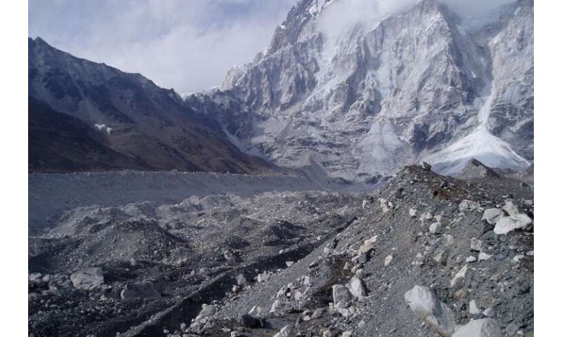
Nuptse Glacier in 2006: The glacier was hardly visible any more already more than ten years ago. Credit: Tobias Bolch, University of St Andrews
Dr. Atanu Bhattacharya, also of the School of Geography and Sustainable Development at the University of St Andrews, added: "The behavior of glaciers high in the Himalaya provides the clearest evidence of the far-reaching impacts of climate change on this remote region."
An increased rate of glacier recession in response to long-term warming will impact both local mountain communities and those further downstream because of its effect on the magnitude and timing of meltwater supply to rivers and because it enhances the risk from glacial hazards.
Dr. Tobias Bolch, of the School of Geography and Sustainable Development at the University of St Andrews, who has studied glaciers in the Himalaya for nearly two decades and led the remote-sensing based investigations, said: "The results of the study provide a valuable reference for future projections of ice loss from the region and will help to more accurately understand the stress placed on water resources across the Himalaya in coming decades."

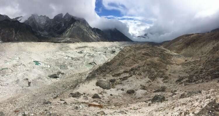
Lower part of the tongue of Khumbu Glacier in 2016. Credit: Owen King, University of St Andrews
Alex Tait, Geographer of National Geographic who led the mapping component of the 2019 Everest Expedition, said: "It's hard enough to just fly a helicopter above Everest Base Camp, our team completed a sub-decimeter resolution lidar survey using helicopters from the head of the Khumbu Glacier to its terminus. Our lidar data was an important baseline data for this study and will enable further detailed in-depth investigations about past changes to the world's highest glacier; it will also be useful for years to come as change accelerates in the water towers of High Mountain Asia."
Explore further Himalayan lakes are exacerbating glacial melt
More information: Owen King et al. Six Decades of Glacier Mass Changes around Mt. Everest Are Revealed by Historical and Contemporary Images, One Earth (2020).
Journal information: One Earth
Provided by University of St Andrews
66 shares
Feedback to editors
Featured
Last Comments
Popular
Researchers observe instance of cannibalism in wild white‐faced capuchin monkeys
7 HOURS AGO
0
Minimal-interface structures constrained in polycrystalline copper with extremely fine grains
8 HOURS AGO
0
X-ray and radio bursts detected from magnetar 1E 1547.0–5408
8 HOURS AGO
4
A stochastic equation for modeling population growth in cities
NOV 20, 2020
0
Study of polycyclic aroma shows molecules following same relaxation pathway and behaving more like solids than molecules
NOV 20, 2020
1
No comments:
Post a Comment