La Palma volcano, live updates today: eruption, tsunami warning and latest news | Canary Islands
AS USA
Update 7 December 2021
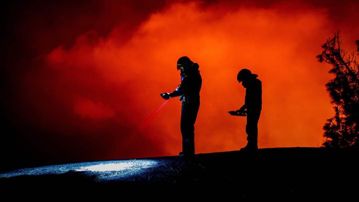
Good morning and welcome to our live coverage of the eruption of the Cumbre Vieja volcano on the Canary Island of La Palma. It has now been over 11 weeks since the volcano began erupting on 19 September.
The lava flowing from the Cumbre Vieja now covers approximately 1,155 hectares of land on La Palma, in addition to forming close to 50 hectares of deltas off the coast of the island.
Nearly 3,000 buildings have now been destroyed by the lava stream, according to figures compiled by the EU's Copernicus Earth observation programme.
Update on volcano in La Palma: latest news from Cumbre Vieja eruption
Headlines
- Local airline Binter cancels flights due to ash cloud. Will resume operations when safe to do so.
- Access to exclusion zone closed until further notice
- 15 earthquakes registered on Tuesday morning, three rated at a magnitude of 3.5 in the Fuencaliente and Villa de Mazo areas.
- Lava continues to flow west from the main Cumbre Vieja vent, mostly through lava tubes.
- Cumbre Vieja volcano has been erupting for over 11 weeks
- Early-December holiday weekend has seen tourists flock to La Palma to see the volcano first hand.
- Just over 2,700 buildings destroyed on La Palma, according to Copernicus Earth observation programme
Useful information
- Expert in volcanology speaks to AS about the effects of lava reaching the sea
- The lowdown on the active volcanoes on the Canary Islands
- Where are most volcanoes located on Earth and how are they formed?
La Palma eruption: related articles
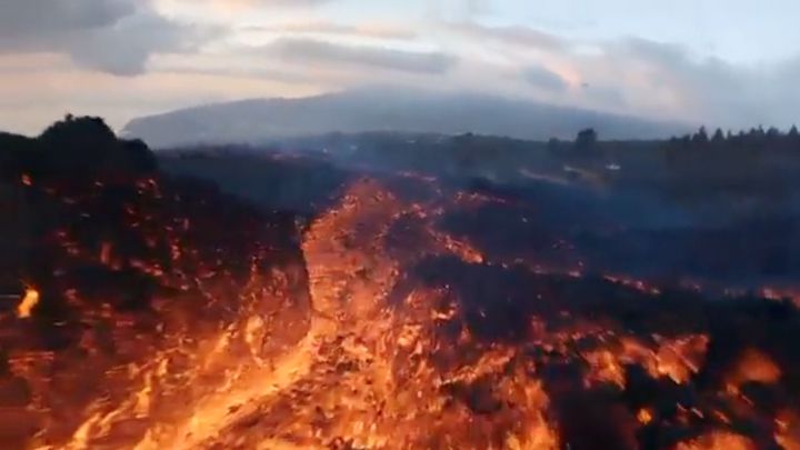
La Palma volcano eruption: drone flies low over rivers of lava
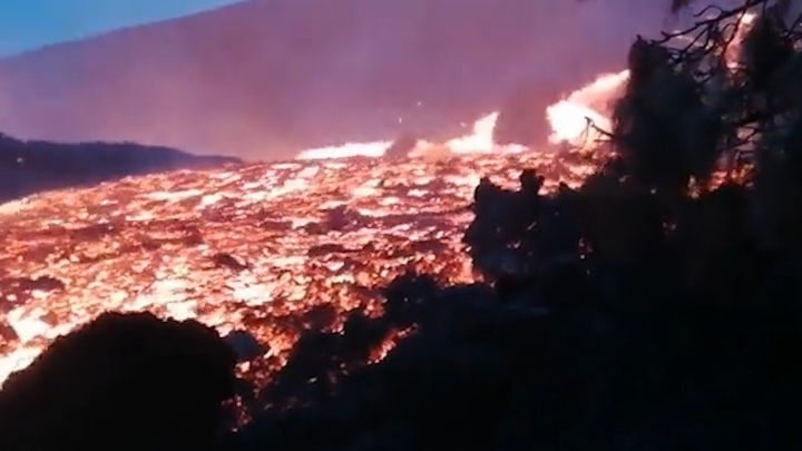
La Palma eruption: new lava flow races down side of volcano
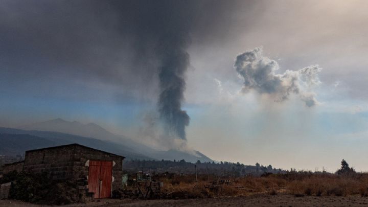
La Palma eruption: Cumbre Vieja volcano claims life of volunteer
Where are most volcanoes located?
How are volcanoes formed? Where are they most likely to be located on Earth?
AS USA's Greg Heilman takes a look
Forces from the Spanish military have been deployed to La Palma to help with the removal of ash from communities across the island. While, many were luck that their homes were not destroyed by the river of lava, thousands of structures have become buried under piles of ash that can cause many structural issues.
Additionally, it is critical that the ash be removed quickly because rain could create sort of a concrete like substance that would make its removal even more difficult.
Will a tsunami hit the island of La Palma or the US East Coast?
Concerns over the seismic activity causing a tsunami on the island of La Palma has been a troubling prospect for scientist. However, the risk remains low. Additionally some reports of the volcano creating a tsunami on the East Coast of the US have also circulated.
Politifact released a fact check on this reporting yesterday and after evaluating the origins of the claim reporters said: "We rate this claim False." Additionally, the US government agency, National Tsunami Warning Center, tasked with monitoring these sorts of extreme whether events reported on 19 September, "There is NO tsunami danger for the U.S. East Coast at this time, following the eruption of Cumbre Vieja volcano, La Palma, Canary Islands. The National Tsunami Warning Center is monitoring this situation, and based on all available data, including nearby water level observations, there is no tsunami hazard for the U.S. East Coast."
The claims began on social media, which increasingly is becoming a hotbed of misinformation.
Could Mount Teide on Tenerife erupt?
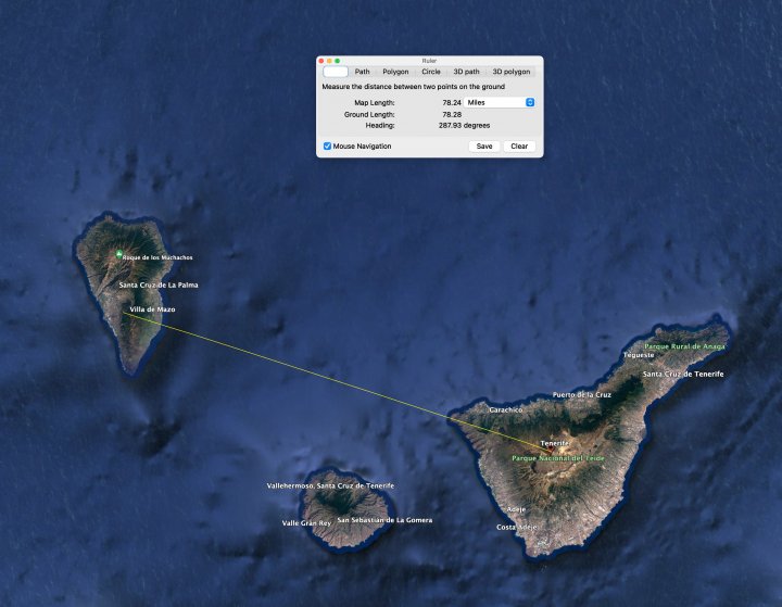
Mount Teide, on the island of Tenerife is less than 80 miles away as the crow flies from the vent on La Palma and it is also an active volcano - although its last eruption was in 1909, from the El Chinyero vent on the Santiago Ridge. So what are the risks Mount Teide could erupt in the wake of the eruption on La Palma?
Very low, apparently. According to Robin George Andrew, a volcanologist who spoke to The Guardian, volcanoes are "not like bombs: they don't set one another off, even if they are somewhat nearby." He says that if there were an eruption on another island it would be simply be a coincidence, and a "remarkable and improbable" one at that.
Even though the eruption on La Palma won't set off Mount Teide, will the volcano on Tenerife erupt at some point? Nobody can say for sure, but it seems likely that Mount Teide WILL erupt in the future, though eruptions have only occurred at a rate of four to six per 1000 years in the past 30,000 years. And they were low hazard eruptions.
There are currently active fumaroles at the summit of Mount Teide, emitting sulphur dioxide and other gases and in 2003 there was an increase of seismic activity and a rift opened on the north-east side of the volcano, though no eruption followed. As ever with volcanoes the best thing is to listen to what the experts have to say.
Changing wind conditions on La Palma
In this hypnotic video from the Canary Islands Meteorological Service you can see the changing wind conditions this afternoon, which is what led to local airline Binter cancelling its flights, as it was unsure about safety with the ash cloud being produced by the volcano.
The tweet reads: "Surprising timelapse video recorded this afternoon close to El Paso by our colleague in La Palma, Fernando Bullón. The changes in the wind at different heights can be seen, as well as the clouds around the volcano on La Palma. #WeAllStandWithLaPalma
Binter cancels flights
Local airline Binter has cancelled flights to and from La Palma due to the ash cloud from the volcano. Earlier in the day the wind was blowing the ash to the west, away from the airport, however the airline has decided to take full precautions and has cancelled its remaining flights for today.
Binter said in this tweet, announcing the decision, that it would begin operating flights when it is safe to do so.
Video of the eruption
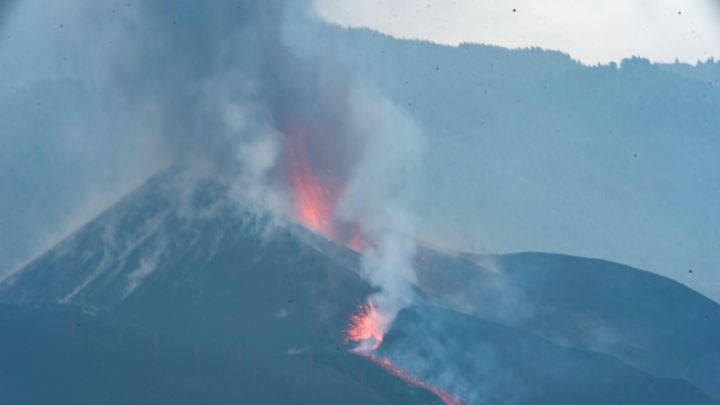
The volcano grumbling on this afternoon, with the ash being ejected clearly visible. It's being pushed out to the west and the open Atlantic Ocean by the wind.
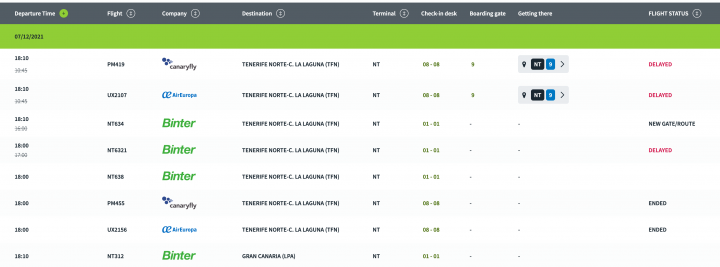
La Palma airport open UPDATE - Binter cancels flights
The airport on La Palma is in operation today, with the wind pushing the column of ash from the volcano to the west. The airport is on the east side of the island, just south of Santa Cruz de La Palma.
These departure times are from AENA, Spain's airport operator. You'll note that while the airport is open, the flight times have moved around a bit, though it's not clear that is actually due to the volcano.
Lava destroys more buildings
Lava from the Cumbre Vieja volcano that erupted 79 days ago on La Palma has destroyed 60 buildings in the last few hours, according to the technical director of the Canary Islands Volcanic Emergency Plan (Pevolca) on Tuesday.
Video: La Palma devoured by lava
Reuters - This drone footage shows the devastation left behind by the Cumbre Vieja volcano on La Palma.
Government sends €2.5 million to La Palma researchers
On Tuesday, the Spanish government approved the direct granting of aid worth €2.5 million to research centres working on the island of La Palma since the eruption of the Cumbre Vieja volcano.
SAVE THE DOGS
Award-winning photographer Emilio Morenatti has posted a photo of abandoned dogs not too far away from the lava flowing out of the volcano on the Canary island of La Palma.
Drone video of lava reaching Las Hoyas
Windy weather conditions meant that authorities were unable to send drones up into the air on Tuesday morning but here were have aerial footage taken on Monday of Cumbre Vieja errupting and lava flows encroaching on the Las Hoyas district on La Palma.
Lava stream claims an additional 26.7 hectares
The mass of molten lava on La Palma grew by 26.7 hectares between Saturday and Monday, according to IGN data and visualised here in this excellent graphic by Pedro Suárez. In the image we can see the area already covered by lava in light purple and the land claimed by lava over the weekend in red. The total surface area now under lava is believed to be 1181.59 hectares.
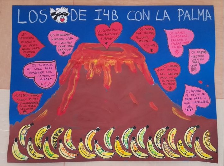
Messages of support and solidarity from Madrid schoolchildren
Madrid schoolchildren have been getting involved with events in La Palma. They have made their own cards with messages of support - 6,800 drawings and cards have been sent to other children on the island from the capital.
Who owns the new bit of land in the sea?
The lava delta that has formed in the ocean belongs to the Spanish state, under the Law of the Coasts, which states that land or islands that are created due to "natural causes" in the sea automatically become property of the state.
15 tremors registered on La Palma on Tuesday morning
The National Geographical Institute (IGN) reported 15 tremors or minor earthquakes on La Palma on Tuesday morning - three of them were rated magnitude 3.5 in Fuencaliente, and Villa de Mazo.
The National Security Departament has confirmed that lava streams continue to flow in the southern and central parts of the exclusion zone as well as on the delta, while there are no changes in the northern zone.
South lava stream has come to a halt
The new lava stream which emerged on Saturday north of Cogote mountain, and which destroyed a large number of houses, has lost momentum while the southern lava flow has come to a halt.
According to Pevolca officials Miguel Ángel Morcuende and Carmen López, the main movement of lava is currently in the central zone, and mostly through lava tubes which is why they are not seen over land.
Volcanic Nativity Scene
The volcanologists of the National Geographic Institute, who have been working day-in, day-out since the start of the eruption on the 19 September, have built a Nativity Scene entirely from lava and pyroclastic materials (cooled, we understand...), in order to wish everyone a very Merry Christmas.
Bird's eye view of La Palma in 3D
A neat fly-over of the map of the lava flows from the Cumbre Vieja eruption site and down to the Atlantic Ocean showing how they've grown over the past two weeks.
Info from Copernicus overlaid onto Spain's National Geographic Institute map. (Talking of the National Geographic Institute's maps, you can get very cool relief maps of the Canary Islands, as well as other parts of Spain from their online shop - will be interesting to see when they release the updated map with the new land from the lava flows on it)
Tourists numbers up on La Palma during December mini-break
The number of tourists visiting La Palma during the December 'puente'* have equalled those recorded at the height of summer last August. Officials say that hotel bookings in the east and north are up with 85% occupancy from the weekend to Wednesday. Binter, the Canary Islands' principal airline, has scheduled 32 extra flights between La Palma and Tenerife Norte and Gran Canaria between 5 and 9 December while Fred Olsen will be putting on two extra ferry services between Los Cristianos and Santa Cruz de La Palma during the mini-break.
*Spaniards describe a long weekend created by a public holiday as a 'puente', meaning bridge. Strictly to be a 'puente' the bank holiday has to fall such that by taking a day's vacation it creates a 'bridge' to the public holiday from a weekend, however in common usage 'puente' now just means any long weekend created by a public holiday, even when it falls on a Friday or a Monday.
The 6th and 8th of December are public holidays in Spain, meaning the 7th can be taken to bridge the gap between them. This year as the 6th is a Monday, it connects perfectly to create 5 days off, only needing one day's vacation, on the Tuesday.
Time-lapse video of Monday's erruption
INVOLCAN have treated us to more time-lapse footage of Cumbre Vieja volcano in action - here, a 13-minute video recorded in time lapse mode at Cabeza de Vaca early on Monday evening.
Access to La Palma exclusion zone closed
La Palma local government announced on Tuesday that access to the exclusion zones affected by the volcanic errupcion is probihited until further notice. Until conditions improve, residents will not be allowed to pick up belongings from their homes and all access, via land or sea, is not allowed both in the north and south regions. Access was permitted on Monday, to those in possession of a permit, due to the reduced levels of toxic gases.
No comments:
Post a Comment