UPDATED
Iceland volcano erupts on Reykjanes peninsula following hundreds of earthquakes

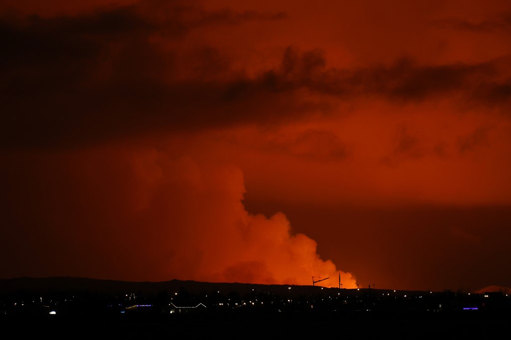
Dec. 18 (UPI) -- A volcano on Iceland's Reykjanes peninsula started erupting Monday night following hundreds of earthquakes over the past few weeks, according to the Icelandic Meteorological Office.
The Icelandic Met Office said the eruption started at about 10:17 p.m., local time, following an "earthquake swarm" about an hour earlier near the fishing town of Grindav
"An eruption has started on the Reykjanes peninsula," scientists at the Icelandic Met Office wrote in a post on X, formerly Twitter, with a photo of the eruption.
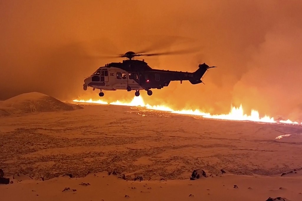
"A Coast Guard helicopter will take off shortly to confirm the exact location and size of the eruption," the meteorological office added.
"An eruption has begun near the evacuated town of Grindavík," President Guòni Th. Jóhannesson of Iceland also warned Monday in a post on X.
"Our priorities remain to protect lives and infrastructure. Civil Defense has closed off the affected area. We now wait to see what the forces of nature have in store," Jóhannesson added. "We are prepared and remain vigilant."
Last month, scientists predicted the impending eruption of Fagradalsfjall volcano as they pointed to multiple earthquakes and a river of magma running underneath the town of Grindavik.
"Since midnight Nov. 12, around 1,000 earthquakes have been recorded within the dike boundaries, and all of them have been below M3.0 magnitude," said Icelandic Met Office scientists. "The most seismic activity has been from the center of the corridor to the north and south under Grindavik."
In preparation, Iceland shut down its iconic geothermic spa, Blue Lagoon, and evacuated the town's 3,000 residents in the country's Reykjanes peninsula.
Fagradalsfjall had been dormant for 800 years before erupting in 2021 and 2022.
As evacuations were ordered last month, the government reassured the country that it was ready.
"Icelandic authorities and the public are highly prepared for such events, and Iceland has one of the world's most effective volcanic preparedness measures," the government stated. "Iceland's geoscientists possess vast experience in dealing with volcanic activities."
Iceland volcano - latest: Lava pouring from
two-mile crack - and 'may head towards'
nearby town
Lava is emerging from a crack in the earth's surface which is around 3.5km (two miles) long and has grown rapidly. The Icelandic Meteorological Office has warned the nearby town of Grindavik may be at risk. You can watch live footage of the eruption below.
Tuesday 19 December 2023 , UK
LIVE
Watch live: Volcano erupts in Iceland after thousands evacuated from tow
Key pointsWhat we know so far as lava spews from two-mile crack in Iceland - as nearby town at risk View post
Explained:What is happening under the surface? View post
Aerial teams have already flown over the fissure to get this incredible view of the flow of lava - which is considerable.
The eruption is said to have started around 4km (2.4 miles) from the town of Grindavik, the Icelandic Meteorological Office has said.
There is some speculation the eruption began at 10.17pm local time last night, with some webcam footage purporting to show the moment it started (which you can see in our 7.19am post).
Watch:Aerial video shows scale of Iceland eruption View post
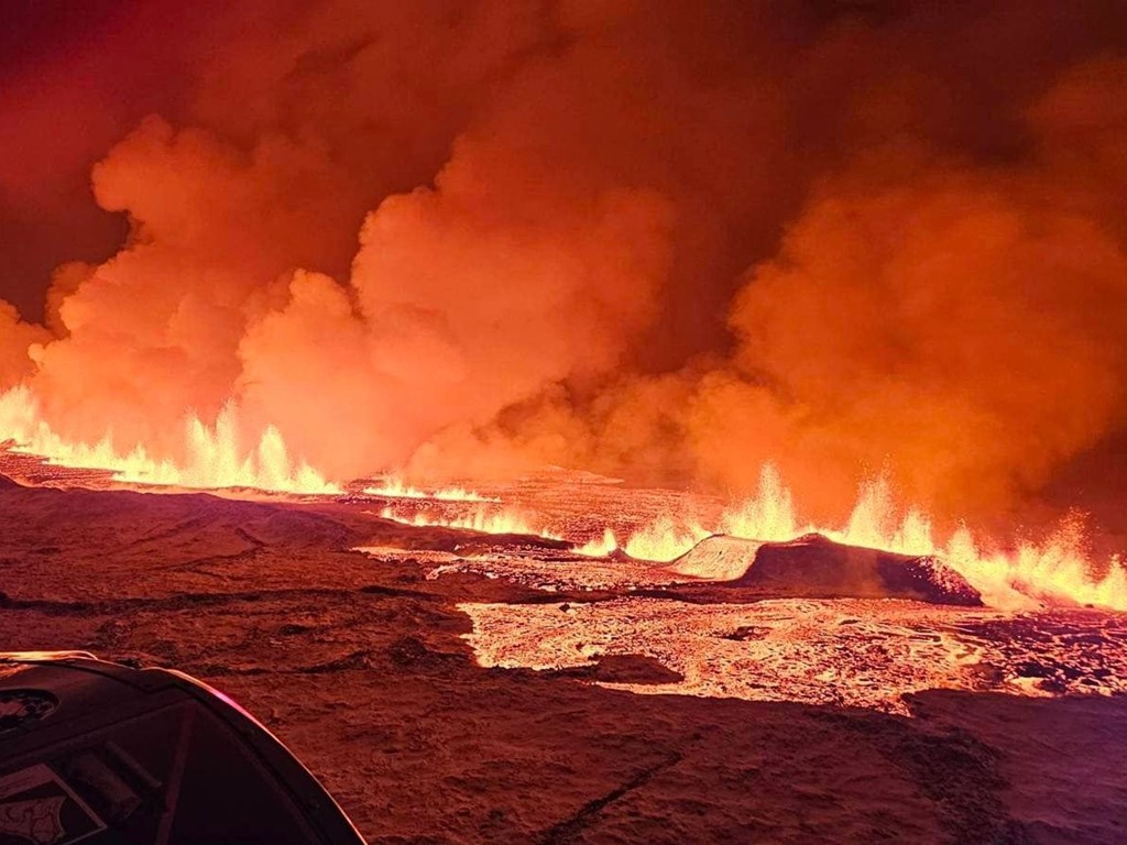
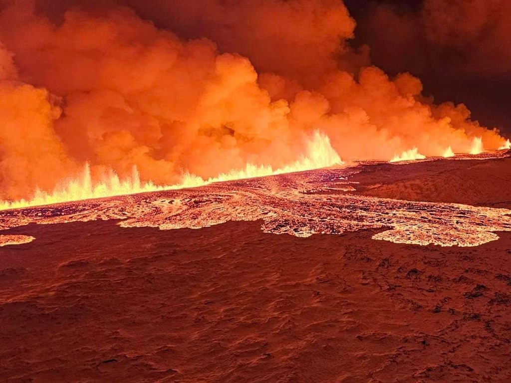
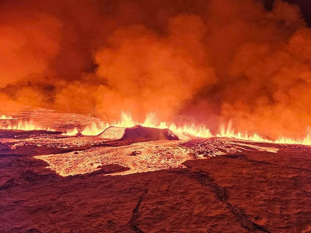
In pictures: Lava cascading downhill as eruption continues
Some more images to bring from the site of the eruption now.
The Icelandic Meteorological society said the intensity was beginning to decrease in its latest update, but lava is still continuing to flow.
As our correspondent Ashna Hurynagdescribed, "we can see pictures that show some of this lava now cascading downhill and almost seeping into the kind of mountains and surrounding areas".
How long can we expect the eruption to last?
Well, Magnus Tumi Gudmundsson, a scientist who flew over the site this morning onboard a coast guard research flight, said it was difficult to be precise, but offered a rough estimate based on what he's seen.
He said the eruption was expected to continue decreasing in intensity but that scientists generally had no idea how long it would last.
"It can be over in a week, or it could take quite a bit longer," Mr Gudmundsson told told Icelandic broadcaster RUV.
He also estimated the crack in the earth had seen twice as much lava spewed than the entire month-long eruption in the peninsula this summer.
What happened during Iceland's last major volcanic eruption?
The eruption of Eyjafjallajokull in 2010 was the second-largest of the 20th century, stranding tens of thousands of air travellers for days and sending a huge ash cloud into the sky.
More than 95,000 flights were cancelled across Europe during the six-day airspace ban - accounting for 48% of total air traffic.
The volcanic event began on 20 March and lasted until 23 June.
At first, lava shot several hundred metres into the air.
By April, ash was sent to over 26,000ft into the atmosphere.
Luckily, no deaths were recorded as there are warning systems in place and people in the area were evacuated.
But the ash cloud that darkened the air drastically dropped the air quality, with ash raining down on farms and villages surrounding Eyjafjallajokull.
Although experts had initially feared the predicted eruption this year could reach similar proportions, concern has been scaled back somewhat.
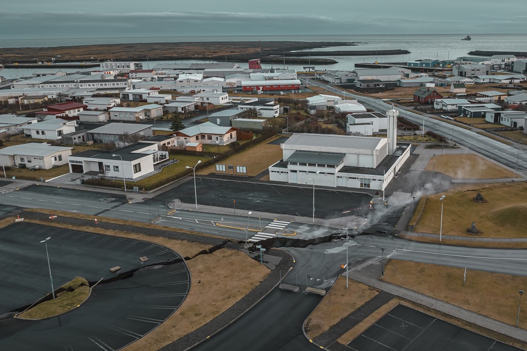
What's the latest with the nearby town of Grindavik?
As we've been reporting, a crack in the earth has been spewing lava close to the town of Grindavik.
The Icelandic Met Office said: "Seismic activity together with measurements from GPS devices indicate that the magma is moving to the southwest and the eruption may continue in the direction of Grindavik."
A subsequent update said the crack's southernmost point was still 3km away from Grindavik, meaning the risk is now lower.
A geologist went further, suggesting the flow of lava could not reach the town currently.
"The eruption is taking place north of the watershed, so lava does not flow towards Grindavik," geologist Bjorn Oddson told public broadcaster RUV.
Nevertheless, the fishing town has seen an evacuation take place in recent days, moving nearly 4,000 people out, as fears grew of an eruption from the Reykjanes peninsula.
Our correspondent Ashna Hurynag said, as a result, "there aren't currently any any people in imminent danger".
"Their homes, though, may be significantly damaged by this" if the lava does reach the town.
Are flights disrupted?
Today's developments will remind many readers of the mass travel disruption caused by the eruption of Eyjafjallajokull in 2010.
For now, the international airport in Reykjavik, Iceland's capital, which is located near the two-mile long lava-filled crack, remains open.
"The eruption does not present a threat to life," an Icelandic government statement said.
"There are no disruptions to flights to and from Iceland and international flight corridors remain open."
British holidaymaker Helen Hope was on a plane waiting for her flight back to Manchester to take off.
She told Sky News: "Most people were intrigued by it. People possibly started worrying more as we were delayed longer. Some passengers noticed it and then people were scrambling to have a look.
"The pilot has been waiting for the OK from various people in charge of safety to check which way the wind and any ash is blowing."
Eyewitness: 'Bittersweet' moment as eruption begins
We can bring you a bit of reaction from the ground now.
Asked for his thoughts, French tour guide Ael Kermarec, who is living in Iceland, said: "It's kind of a mixed feelings, to be honest.
"Let's see how it goes and how long it lasts - it's still amazing to see but, yeah, that's kind of a bittersweet feeling at the moment."
Tourist Robert Donald Forrester III is a little more excited by the morning's events.
"I'm very excited to be here in this place, in this time, just being able to see this natural phenomenon happened," he said.
"Just seeing lava emerge from the ground. Even if it's in a particular continent, it's just fascinating to see nature in action.
"It's just [like] something from a movie!"
Explained: What is happening under the surface?
By Thomas Moore, science correspondent
Iceland has been forged by the heat of the Earth's core.
The molten rock that sat 800 metres below the fishing village of Grindavik has finally spewed out of fissures in the ground, after nearly two months of activity.
The Icelandic Met Office said in the early hours of Tuesday that the eruptive fissure is about 4km (2.48 miles) long, with the northern end just east of Stora-Skogfell and the southern end just east of Sundhnuk.
The distance from the southern end to the edge of Grindavik is shorter, at just shy of 3km (1.8 miles).
Around 4,000 inhabitants were evacuated in the early hours of Saturday in anticipation of the eruption.
Movement beneath the surface started in October, where there had been more than 1,000 tremors in just a few hours caused by the magma forcing its way upwards.
Iceland had declared a state of emergency over the activity.
The Reykjanes volcanic system is barely 35 miles from the capital, Reykjavik. It had been dormant for 800 years until it erupted from a fissure in March 2021.
The lava fountain became a tourist attraction over a six-month period.
There have been two more eruptions in the same area since then. But the amount of molten rock just below the surface this time was substantial enough to cause an overflow of magma.
According to RUS.is, at around 2.45am on Tuesday, geophysicist Bjorn Oddson said a team in a helicopter saw "a four-kilometre-long fissure that lines up in the old crater sequence".
"It's in the best place if there was to be an eruption there," he said after a status meeting of the Civil Defence in Skogarhlid, Reykjavík.
"The eruption is taking place north of the watershed (in which lava clearly flows one way or the other), so lava does not flow towards Grindavik."
Iceland is one of the most volcanic regions on the planet, sitting on the mid-Atlantic ridge, where the tectonic plates of North America and Eurasia are pulling apart by 2cm a year.
Over millions of years, a plume of molten rock poured from the rift, eventually breaching the ocean surface to form an island.
On average there is an eruption from one of Iceland's 32 active volcanoes every four or five years, with rivers of lava shaping the stark landscape.
Some of the eruptions have been catastrophic.
In 1783, around a quarter of the population was killed following an eruption of the Laki/Skaftareldar volcano.
The biggest current concern is over Katla, which last erupted in 1918. It lies under hundreds of metres of ice and any eruption is likely to cause widespread flooding.
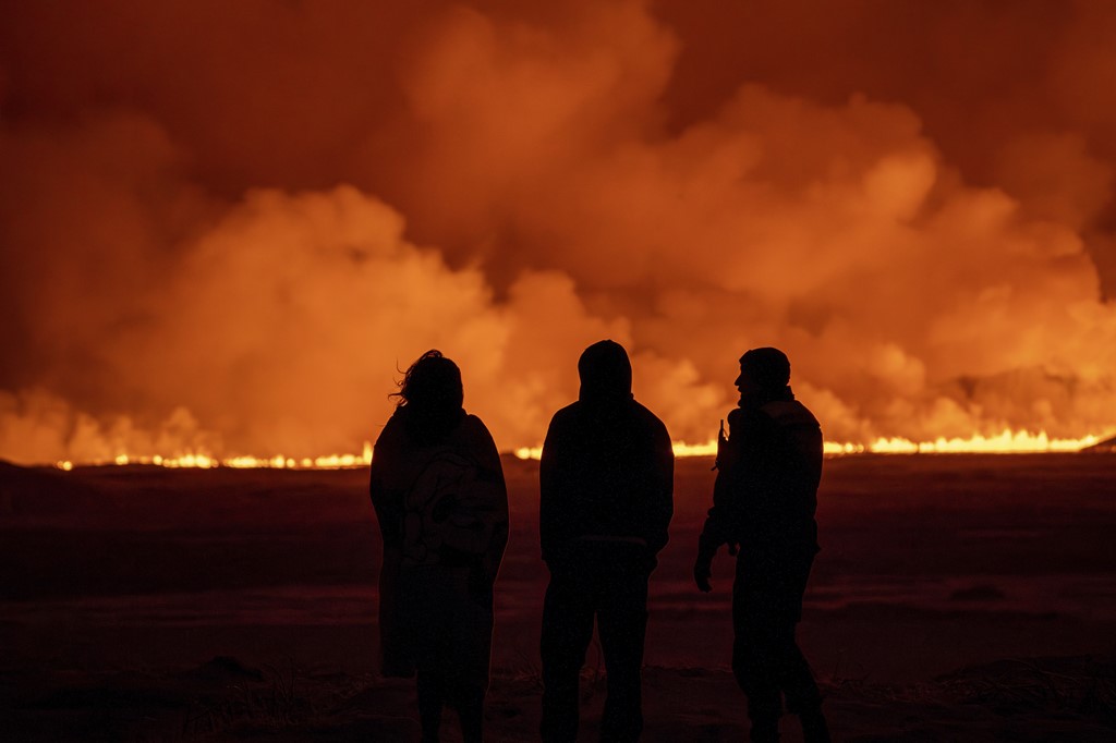
Iceland no stranger to volcanic eruptions
The country's geography means it is vulnerable to eruptions.
Iceland sits on the Mid-Atlantic Ridge, where the North American and Eurasian tectonic plates diverge.
This makes it one of the most active volcanic regions in the world.
It regularly suffers seismic events ranging from minor tremors to significant earthquakes.
This seismic activity is often due to magma movement beneath the earth's crust - which sometimes will result in the magma taking the easiest path to the surface and becoming a volcanic eruption.
Authorities are constantly monitoring the situation, and although there is no way of accurately predicting whether, where or when an eruption will occur, scientists are alert to the warning signs.
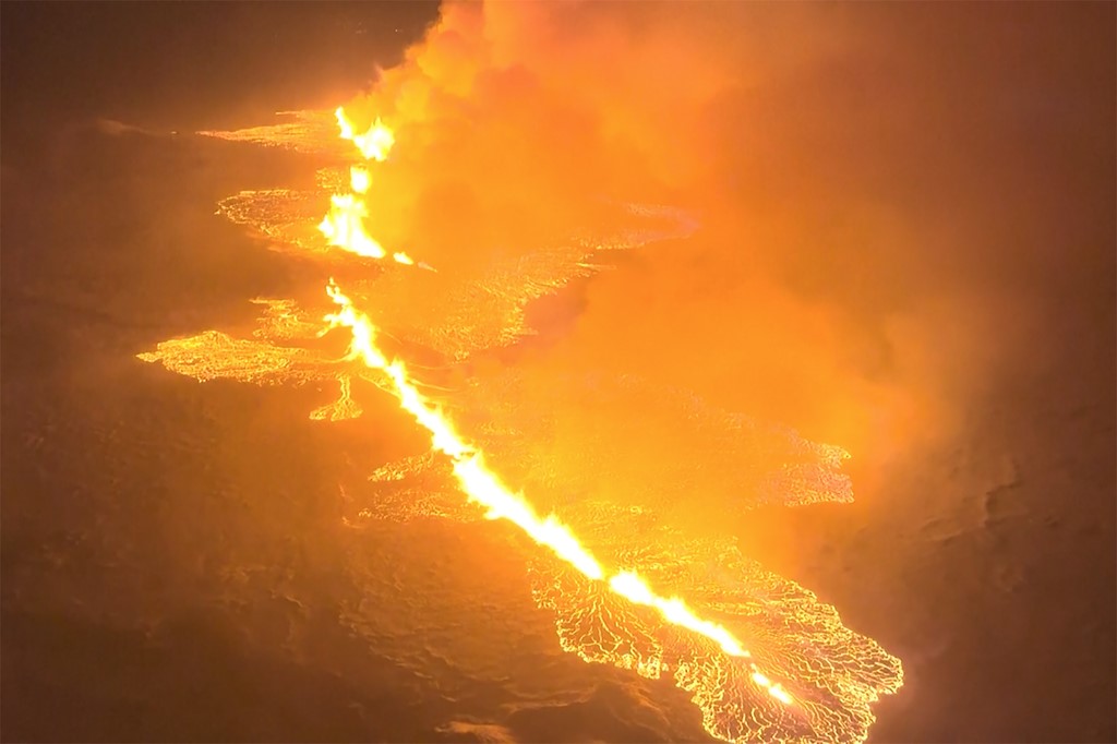
In pictures: Two-mile long crack spewing lava
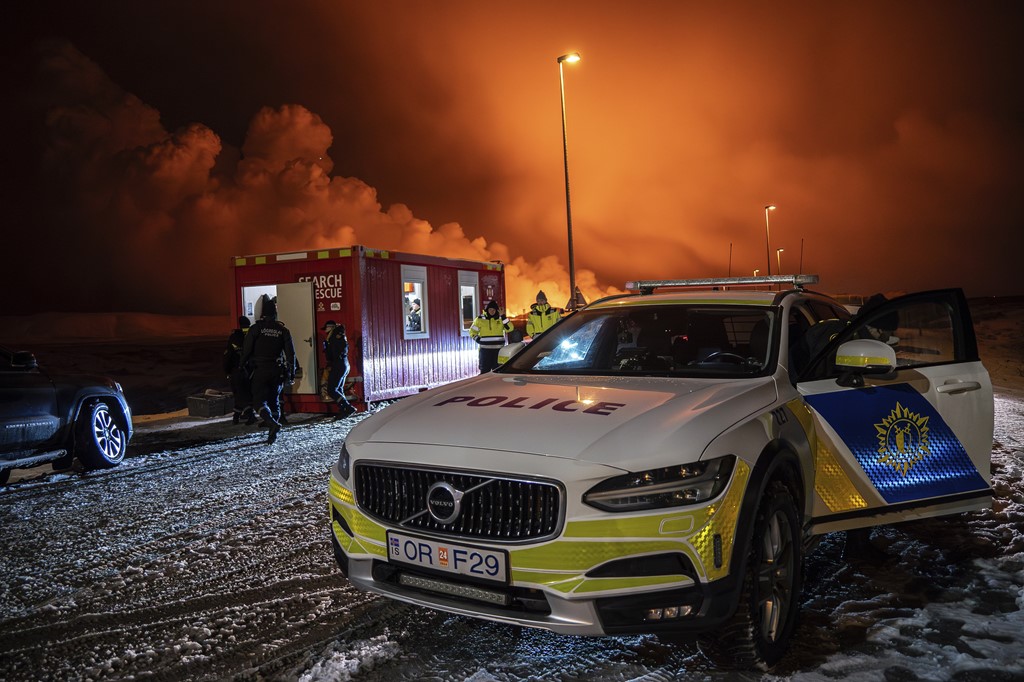
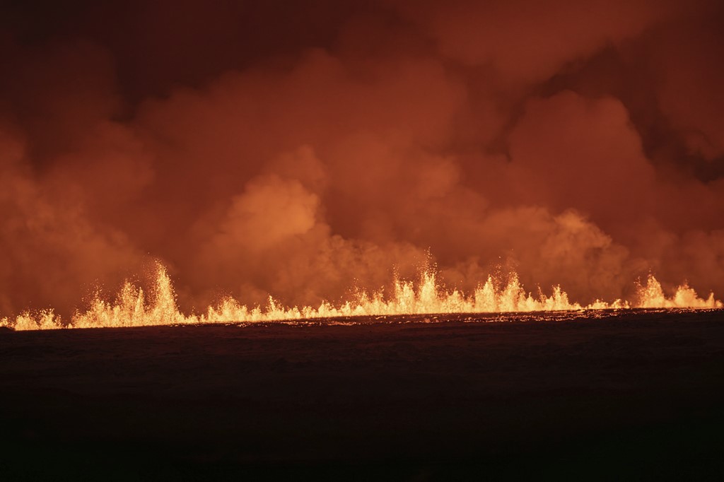
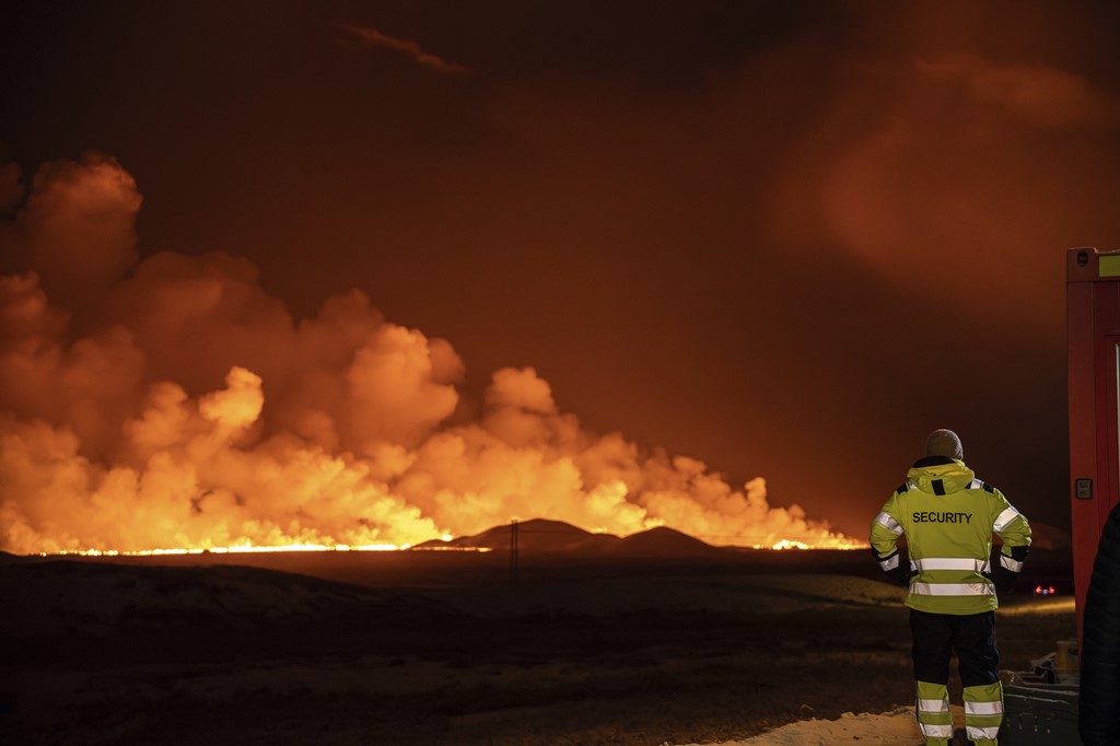
These images, captured by the Icelandic coast guard, show the two-mile long crack in the earth spewing lava.
Police are keeping a watchful eye on developments, but as we just told you, an evacuation had already taken place in recent days in the fishing town of Grindavik.
What we know so far
Molten rock has been spewing spectacularly from fissures in the ground after a volcano erupted in Iceland following weeks of intense earthquake activity.
The Icelandic Meteorological Office has said the lava is emerging from a crack in the earth's surface which was around 3.5km (two miles) long and had grown rapidly.
An evacuation had already taken place in recent days, moving nearly 4,000 people out of the fishing town of Grindavik in the country's southwest, as fears grew of an eruption from the Reykjanes peninsula.
There have been several eruptions in unpopulated areas in the peninsula in recent years, but the current outbreak was believed to pose an immediate risk to the town, authorities have said.
The Icelandic Met Office said: "Seismic activity together with measurements from GPS devices indicate that the magma is moving to the southwest and the eruption may continue in the direction of Grindavik."
No comments:
Post a Comment