The World's Coral Reefs are 25 Percent Bigger Than We Thought

[By Mitchell Lyons and Stuart Phinn]
The world’s coral reefs are close to 25% larger than we thought. By using satellite images, machine learning and on-ground knowledge from a global network of people living and working on coral reefs, we found an extra 64,000 square kilometers of coral reefs – an area the size of Ireland.
That brings the total size of the planet’s shallow reefs (meaning 0-20 meters deep) to 348,000 square kilometers – the size of Germany. This figure represents whole coral reef ecosystems, ranging from sandy-bottomed lagoons with a little coral, to coral rubble flats, to living walls of coral.
Within this 348,000 km² of coral is 80,000 km² where there’s a hard bottom – rocks rather than sand. These areas are likely to be home to significant amounts of coral – the places snorkellers and scuba divers most like to visit.
You might wonder why we’re finding this out now. Didn’t we already know where the world’s reefs are?
Previously, we’ve had to pull data from many different sources, which made it harder to pin down the extent of coral reefs with certainty. But now we have high resolution satellite data covering the entire world – and are able to see reefs as deep as 30 metres down.
We coupled this with direct observations and records of coral reefs from over 400 individuals and organisations in countries with coral reefs from all regions, such as the Maldives, Cuba and Australia.
To produce the maps, we used machine learning techniques to chew through 100 trillion pixels from the Sentinel-2 and Planet Dove CubeSat satellites to make accurate predictions about where coral is – and is not. The team worked with almost 500 researchers and collaborators to make the maps.
The result: the world’s first comprehensive map of coral reefs extent, and their composition, produced through the Allen Coral Atlas.
The maps are already proving their worth. Reef management agencies around the world are using them to plan and assess conservation work and threats to reefs.
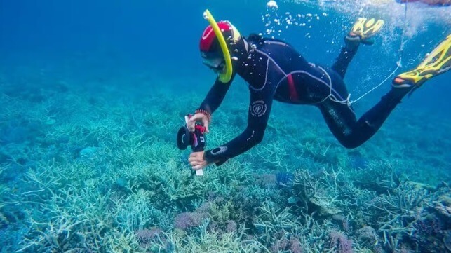
 We combined satellite data with real world observations. Here, Dr Eva Kovacs tows a GPS on the Great Barrier Reef. Allan Coral Atlas, CC BY-SA
Where is this hidden coral?
You can see the difference for yourself. Below, red indicates the newly detected coral in reefs off far north Queensland.

Allen Coral Atlas, CC BY-SA
This infographic shows the new detail we now have for the Tongue Reef, in the seas off Port Douglas in Far North Queensland.
 Allen Coral Atlas, CC BY-SA
Our maps have three levels of detail. The first is the most expansive – the entire coral reef ecosystem. Seen from space, it has light areas of coral fringed by darker deeper water.
Then we have geomorphic detail, meaning what the areas within the reef look like. This includes sandy lagoons, reef crests exposed to the air at low tide, sloping areas going into deeper water and so on.
And finally we have fine detail of the benthic substrates, showing where you have areas dominated by coral cover.
Coral can’t grow on sand. Polyps have to attach to a hard surface such as rock before they can begin expanding the reef out of their limestone-secreting bodies.
Some of our maps include fine detail of benthic substrates, meaning where coral is most likely to be and the substrates (seafloor) available to the polyps, such as existing coral, sand, rubble, or seagrass.
It’s a crucial time for the world’s coral reefs. We’re discovering the full extent of shallow water reefs – while other researchers are finding large new black coral reefs in deeper water.
But even as we make these discoveries, coral reefs are reeling. Climate change is steadily heating up the sea and making it more acidic. Coral polyps can’t handle too much heat. These wonders of biodiversity are home to a quarter of the ocean’s species. In good news, these maps are already leading to real-world change. We’ve already seen new efforts to conserve coral reefs in Indonesia, several Pacific island nations, Panama, Belize, Kenya and Australia, among others.
Mitchell Lyons is a postdoctoral research fellow at The University of Queensland.
Stuart Phinn is Professor of Geography, Director - Remote Sensing Research Centre, Chair - Earth Observation Australia, The University of Queensland.
This article appears courtesy of The Conversation and may be found in its original form here.
No comments:
Post a Comment