CBC
Sun, November 19, 2023
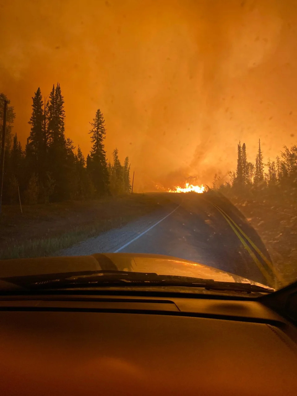
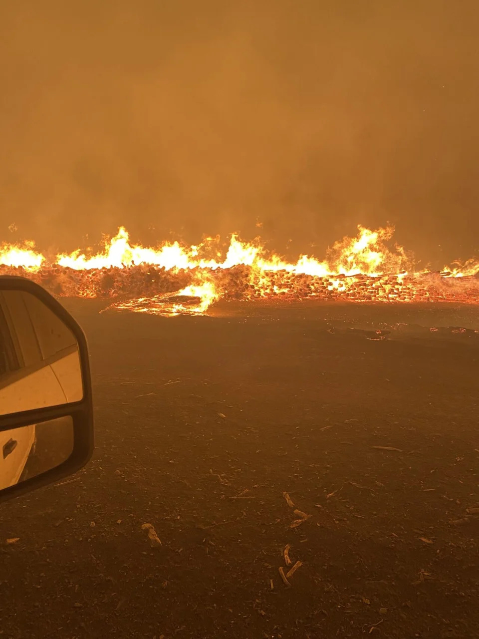
When it's time to evacuate, there's no guarantee the way out will still be safe, Here, Franco Nogarin drove into an ominous orange sky while fleeing fires near Hay River, N.W.T., on Aug. 13, but the first route they chose led them straight into the flames. (Submitted by Franco Nogarin - image credit)
Charlie Kesslar vividly remembers the day he was forced to leave Drayton Valley, Alta., six months ago because of a wildfire.
On the evening of May 4, the town was put under an evacuation order. Kesslar and his wife packed up their belongings, piled into their motor home and tried to make their way out of town.
"It was really difficult because there was so much traffic," Kesslar said.
What should have been about a 25-minute drive out of town to a nearby hamlet ended up taking close to four hours, arriving at 3:30 a.m.
"It was scary not knowing what was going to happen," he said.
Kesslar was one of tens of thousands of Canadians who had to flee their communities this past spring and summer in the worst wildfire season the country has seen in a century.
As of Nov. 2, according to the Canadian Interagency Forest Fire Centre, more than 18 million hectares has been burned — six times more than the 10-year average.
Now, researchers are working on ways to make the evacuation process smoother.
Human behaviour
Stephen Wong, a civil and environmental engineering assistant professor at the University of Alberta in Edmonton, is collaborating with two other researchers to try to improve the evacuation process for residents.
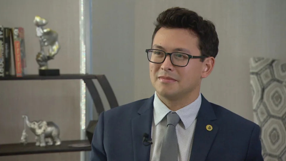
Stephen Wong is an assistant professor in civil and environmental engineering at the University of Alberta in Edmonton. (Richard Marion/CBC)
The trio is looking at five communities — three in B.C. (Quesnel, Salmon Arm and Nelson) and two in Alberta (Whitecourt and Canmore) — and creating evacuation simulation models based on each community's wildfire exposure, human behaviour and traffic simulation.
Wong's focus will be on human behaviour; he is sending out surveys to residents in all five communities to better understand how and what decisions are made by evacuees.
"Such as, will I evacuate or will I stay? But then there's a whole host of other key decisions that are made after that that involve our transportation system," he said.
"That includes the mode of transportation that we use, the route, departure time, where people decide to go and the host communities that might be involved as part of that."
He said the information collected can help figure out whether certain groups need more resources to evacuate, need different methods of communications to encourage them to evacuate or to use certain modes of transportation to leave a community.
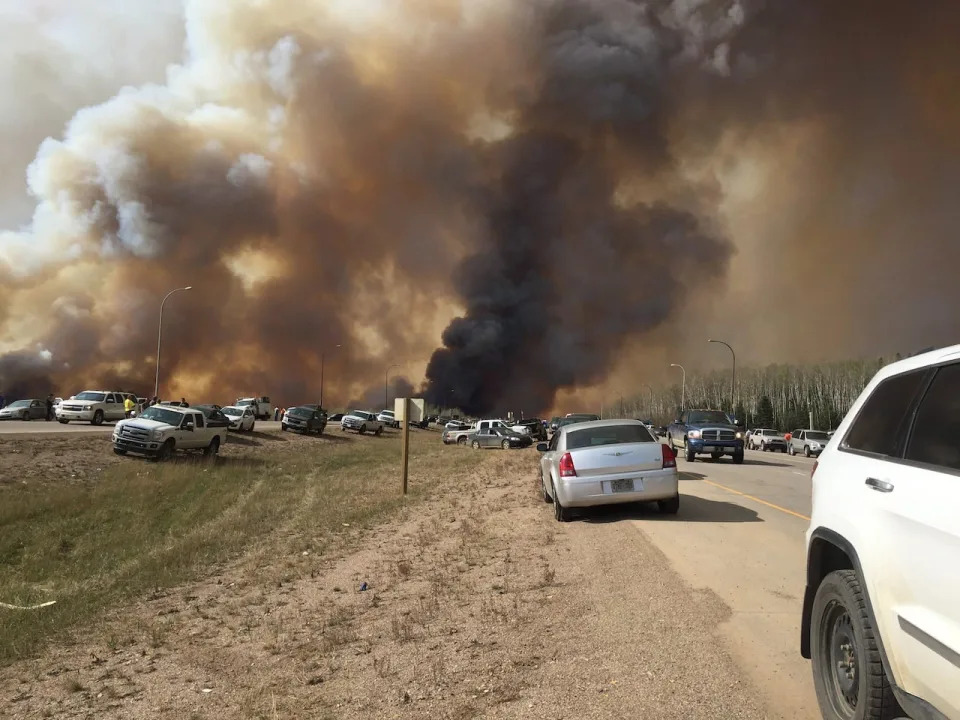
. Fuel shortages are being reported in the evacuation area. There was gridlock oh Highway 63 and some abandoned vehicles as residents fled Fort McMurray, Alta., when a wildfire engulfed the city in May 2016.
(Brian Langton/Handout/Canadian Press)
Fire vulnerabilities
Co-researcher Jen Beverly, who studies wildland fire at the University of Alberta, is focusing on the biophysical environment around a community, such as where a fire may ignite and where it may spread.
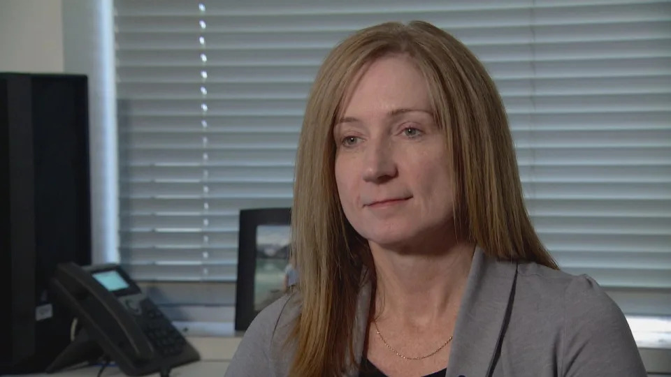
Jen Beverly is an associate professor studying wildland fire at the University of Alberta in Edmonton. (Peter Evans/CBC)
That information is then overlaid onto maps showing the road network.
"If you have a community, for example, with really limited roads out and … one of those escape roads happens to be a key pathway for a fire to move into the community, then you can imagine a scenario where you've got a fire moving into town, it's going to block one of the roads out … It's basically going to create a bottleneck," Beverly said.
The data collected will help create wildfire evacuation models showing how residents might get out of a community, to inform evacuation planning and infrastructure.
"The biggest change that we hope to make in this is informing evacuation plans. A lot of communities, either because of their size or their lack of time to be able to do it, don't have evacuation plans specifically for wildfires," Wong said.
The project will also look at how the built infrastructure and transportation system could change to help wildfire evacuations and other disasters.
Piles of logs on fire at the Patterson sawmill near Hay River, N.W.T., as wildfire moves through the area, Aug. 13. (Sandra Lester)
Fire can happen anywhere
The research started last year and was slightly paused during the 2023 wildfire season to ensure field partners could focus on the real-time wildfire response.
Beverly said the research is important considering what Canadians saw in the spring and summer.
"Fires can happen in places where maybe we haven't had a lot of fire and don't expect it to happen," she said. "What we've learned from this past season is that fire can happen there.
"If there's fuel and we're living in an uncertain climate situation, it's possible that any region of the country could experience extended drought, and we saw that in 2023, and when that happens, any fuel can burn."
The project is expected to be complete by early 2025.
Fire vulnerabilities
Co-researcher Jen Beverly, who studies wildland fire at the University of Alberta, is focusing on the biophysical environment around a community, such as where a fire may ignite and where it may spread.
Jen Beverly is an associate professor studying wildland fire at the University of Alberta in Edmonton. (Peter Evans/CBC)
That information is then overlaid onto maps showing the road network.
"If you have a community, for example, with really limited roads out and … one of those escape roads happens to be a key pathway for a fire to move into the community, then you can imagine a scenario where you've got a fire moving into town, it's going to block one of the roads out … It's basically going to create a bottleneck," Beverly said.
The data collected will help create wildfire evacuation models showing how residents might get out of a community, to inform evacuation planning and infrastructure.
"The biggest change that we hope to make in this is informing evacuation plans. A lot of communities, either because of their size or their lack of time to be able to do it, don't have evacuation plans specifically for wildfires," Wong said.
The project will also look at how the built infrastructure and transportation system could change to help wildfire evacuations and other disasters.
Piles of logs on fire at the Patterson sawmill near Hay River, N.W.T., as wildfire moves through the area, Aug. 13. (Sandra Lester)
Fire can happen anywhere
The research started last year and was slightly paused during the 2023 wildfire season to ensure field partners could focus on the real-time wildfire response.
Beverly said the research is important considering what Canadians saw in the spring and summer.
"Fires can happen in places where maybe we haven't had a lot of fire and don't expect it to happen," she said. "What we've learned from this past season is that fire can happen there.
"If there's fuel and we're living in an uncertain climate situation, it's possible that any region of the country could experience extended drought, and we saw that in 2023, and when that happens, any fuel can burn."
The project is expected to be complete by early 2025.

No comments:
Post a Comment