Sunday, July 26, 2020

Almost 100 workers recover from coronavirus at locked-down farm

By Carmelo Garcia Local Democracy Reporter


OUTBREAK AT FARM

Almost 100 farm workers at AS Green and Co have now recovered from coronavirus. Picture: Rob Davies

Almost 100 people who were infected with coronavirus at the locked-down Herefordshire farm have now fought off the disease.

Rook Row Farm in Mathon was placed into lockdown two weeks ago after more than 70 cases were detected there.

Health officials conducted mass testing on more than 200 people who work for vegetable producer AS Green & Co after an initial single positive case was confirmed at the farm.

The total number of positive cases at the farm has risen to 134 but health officers say there only 12 of these cases are active.

Herefordshire's public health director Karen Wright said things were much better two weeks on from the outbreak.

“There are now 96 people who have had Covid-19 and are now well and are out of the period they need to isolate – so, people can now actually get back to work which is great really.

“Now there are 12 people who are positive on site.

“The guidance for anyone who is positive is that they have to self-isolate for seven days.

“And then in addition to that they have got to have 48 hours in which they haven’t had any symptoms of a high temperature or feeling unwell.

“People who have Covid-19 could have a cough for weeks, a loss taste or of smell which lasts for a long time.

“But as long as you’ve not had a temperature for 48 and are not feeling generally unwell that mean you are no longer infections and can get back to normal.

Ms Wright said people who have had coronavirus and recovered could still test positive weeks after fighting off the disease.

“That’s because your body can still have the virus within it but it’s no longer infectious.”

During the first days of the outbreak, three workers fled the lockdown at the farm - one of them was known to be infected.


READ MORE: All the latest on AS Green and Co's coronavirus outbreak

Workers there had visited four shops in the week, raising the possibility that they have spread the virus further.

But health officials say there will not be a review into the response of all the parties involved.

“Yes, there was a very small number of people who left the farm but that’s not surprising given the situation,” Ms Wright said.

She said most people on the site had been cooperative and they had worked well with the farm owners.

“My reinforcing message is the need to regularly wash your hands, dry them, social distancing and to get tested at any sign of symptoms.

“There can be a temptation for some businesses to think I’m not going to get my staff tested – but please do.

“To be fair, that’s what they did do at Rook Row Farm and we got that mass testing done really quickly.”
Scientists flock to mysterious 'blue hole' off Florida's Gulf Coast
The phenomenon is located about 425 feet below the water's surface.


By Karma Allen 22 July 2020,


Scientists are flocking to Florida’s Gulf Coast for a glimpse of a mysterious 425-feet-deep "blue hole" on the ocean floor.

The glowing mystery hole, about 155 feet below the water’s surface, is similar to the sinkholes seen on solid land, according to the National Oceanic and Atmospheric Administration.

The site, dubbed the "Green Banana,” has been a hot topic for scientists and deep-sea explorers who've been hoping for a glimpse of the phenomenon from afar.

Surprisingly, the first reports of blue holes came from fishermen and recreational divers, not scientists or researchers. In general, the holes appear to host diverse biological communities full of marine life, including corals, sponges, mollusks, sea turtles and sharks.

NOAA scientists already have collected 17 water samples from the area surrounding the hole along with four sediment samples.


Scientists are flocking toward the coast of Florida to explore a mysterious "blue hole" on the ocean floor.Scientists are flocking toward the coast of Florida to explore a mysterious "blue hole" on the ocean floor.Mote Marine Laboratory via NOAA

Remarkably, they also discovered two dead but intact smalltooth sawfish, an endangered species, at the bottom of the hole, according to NOAA. Remains of one of the animals were recovered for examination.
MORE: Polar bears may be extinct by 2100 if Arctic ice melts at projected rate, according to new study

NOAA scientists plan to embark on a new mission to a second, deeper area of the hole in August. That mission will consist of a team of scientists from Mote Marine Laboratory, Florida Atlantic University, Georgia Institute of Technology and the U.S. Geological Society, according to NOAA.

Researchers are interested in studying the seawater chemistry in the holes for its unique qualities.


Divers found two deceased smalltooth sawfish, an endangered species, at the bottom of Amberjack Hole. The deceased sawfish were intact enough to be collected for research, and Mote scientists... moreDivers found two deceased smalltooth sawfish, an endangered species, at the bottom of Amberjack Hole. The deceased sawfish were intact enough to be collected for research, and Mote scientists quickly reported the discovery to NOAA and the Fish and Wildlife Conservation Commission and obtained the required permit for collection of one of the sawfish, a male measuring an impressive 12 feet long.Mote Marine Laboratory via NOAA

"Little is known about blue holes due to their lack of accessibility and unknown distribution and abundance," NOAA said in a statement. "The opening of a blue hole can be several hundred feet underwater, and for many holes, the opening is too small for an automated submersible."

Researchers don’t know much about blue holes, but scientists are hoping to learn if the holes are connected to Florida’s groundwater or if there is groundwater intrusion into the Gulf of Mexico.

They're also looking to see if a particular blue hole is secreting nutrients or harbors microenvironments or new species of microbes.
Humans may have arrived in Americas much earlier than thought, research shows

Artifacts discovered in a cave in Mexico are about 30,000 years old.


By Charles Q. Choi | INSIDE SCIENCE
26 July 2020
This is an Inside Science story.

The Americas may have been home to humans for more than 12,000 years longer than previously thought, new research finds.

The arrival of humans to the Americas from Asia marked a major step in humanity's journey across the globe, but the exact timing of this entry remains hotly debated. Based on stone tools dating back about 13,000 years, archaeologists long thought the first Americans were part of a prehistoric culture known as the Clovis. However, scientists have recently uncovered many sites that suggested humans were in the New World before Clovis, up to roughly 18,000 years ago. Now new studies extend that time to more than 30,000 years ago.

In the new work, researchers focused on Mexico, which is typically on the periphery of the hunt for the first Americans, given its distance from the Bering Strait and Beringia, the landmass that had connected Asia and North America. However, recent findings have unearthed hints of an ancient human presence in Mexico.


In this 2019 photo provided by Devlin A. Gandy, assistant professor Mikkel Winther Pedersen from the University of Copenhagen takes samples of cave sediments to look for DNA in Zacatecas,... moreIn this 2019 photo provided by Devlin A. Gandy, assistant professor Mikkel Winther Pedersen from the University of Copenhagen takes samples of cave sediments to look for DNA in Zacatecas, central Mexico. Artifacts from the site suggest people were living in North America much earlier than most scientists think.Devlin A. Gandy/AP

The scientists investigated Chiquihuite Cave in the Astillero Mountains of central Mexico, the most promising of dozens of sites they explored in the region. They spent a number of winters excavating a 3-meter-deep pit 50 meters from the cave's mouth. They lived inside the cave for seven to nine weeks in a row during the winters, cooking in the area and sleeping meters away from the dig while wary of drug cartels, said archaeologist Ciprian Ardelean at the Autonomous University of Zacatecas in Mexico.

Ardelean and his colleagues unearthed about 1,900 stone artifacts. Radiocarbon and optically stimulated luminescence dating of the objects suggest humans might have occupied the area 31,000 to 33,000 years ago. Given how far away Chiquihuite is from the coasts, much less Asia, the researchers suggest humans may have first arrived in the New World during a period 29,000 to 57,000 years ago. They detailed their findings in two studies in the July 23 issue of the journal Nature.

These newfound artifacts show a tool manufacturing style, or “lithic industry,” never previously known in the New World. "Actually, all pre-Clovis sites in the Americas have lithic industries that don't match each other," Ardelean said. "This seems to be the norm."

The cave is located roughly 2,740 meters above sea level (nearly 9,000 feet), almost on the top of the highest mountain in the region. Archaeologists looking for ancient sites in the New World typically focus on lake shores, rolling hills and other areas that we might find comfortable, Ardelean said. "I wanted to search for sites in all sorts of locations, even where we wouldn't go to live as modern people. The ice age was a different world, with different minds and psychologies, more courageous than ours. They were adapted to mountains, and for them, it must have been just normal." Although the area is now part of the southernmost section of the giant Chihuahuan desert, it was more like the Pacific Northwest during the last ice age, Ardelean said.


A prehistoric stone tool found at a cave in Zacatecas in central Mexico is seen in this image released on July 22, 2020.A prehistoric stone tool found at a cave in Zacatecas in central Mexico is seen in this image released on July 22, 2020.Ciprian Ardelean/via Reuters

"We anticipate that the results will spur new interest in surveying regions like this for new sites," said archaeological scientist Thomas Higham at the University of Oxford in England, a co-author on both studies. The fact that a high-altitude site such as Chiquihuite "contains earlier human presence will invite archaeologists to widen the places they seek to look for early archaeological sediments."

When the scientists examined the age of Chiquihuite and 41 other archaeological sites in North America and Beringia, their computer model suggested humans were likely present in the Americas before, during and immediately after the Last Glacial Maximum -- the period around 19,000 to 26,500 years ago when the ice age was at its peak and glaciers covered roughly one-third of Earth's land. During such early times, a land passage to the New World would have been blocked by either treacherous open water or impenetrable ice sheets, suggesting "the path humans took to the Americas was likely a coastal route," Becerra-Valdivia said.

"It changes our comprehension of the settlement of the Americas considerably," said bioanthropologist Mark Hubbe at the Ohio State University in Columbus, who was not involved in this work. "There have been a few sites in South America that have claimed earlier human occupations, but most of them have been largely dismissed because of a combination of unreliable evidence and the fact that they were such chronological outliers that it is more parsimonious to assume the dates were wrong. It is nice to see that we are broadening our perspective and allowing for the possibility that the Americas may have been occupied significantly longer than we ever thought possible."

Archaeologist John Hoffecker at the University of Colorado at Boulder, who did not participate in this study, noted that "for more than a decade and half, evidence of people in Beringia before the end of the Last Glacial Maximum has been accumulating," lending credence to a possible ancient human presence in Mexico. Still, "it continues to strike me as odd that, if people were present in the Western Hemisphere outside eastern Beringia at this earlier time, the evidence for their presence is so sparse, because at this time in northern Eurasia, people are all over the place, occupying large sites with abundant artifacts, many features, and heaps of food debris."

However, sparse evidence of humans in the New World during the last ice age "is not surprising; the harshness of the Last Glacial Maximum would have kept populations low, leaving little trace behind for archaeologists to discover in the future," Becerra-Valdivia said. "Once a warming period began, humans were then able to thrive and expand across the region."

Ardelean cautioned that scientists still need to discover more similarly early sites to confirm a human presence in the New World during or before the Last Glacial Maximum. "The evidence is still very scarce and blurry," Ardelean said. "Chiquihuite is simply a very dim light in a vast darkness ignored so far." 

Future research can investigate how related or not these ancient Americans were to later groups. "Did they contribute to form Native Americans, or were they an unsuccessful attempt to occupy the continent that was later replaced by the ancestors of Native Americans?" Hubbe said.

"We need to start exploring underwater sites, as has recently been done in Australia," added geographer Umberto Lombardo, who did not take part in this research. A research program taking hundreds of core samples along the coasts of North and Central America would cost a lot, "but it could be done by a large consortium of universities."

Inside Science is an editorially independent nonprofit print, electronic and video journalism news service owned and operated by the American Institute of Physics.
Remains of Aztec Palace of Axayácatl & House Built by Hernán Cortés Discovered


Archaeologists from the National Institute of Anthropology and History (INAH) have discovered basalt slab floors from the Palace of Axayácatl, and remains of a house built by the conquistador Hernán Cortés.

The discovery was made during works on the Monte de Piedad building in Mexico City, revealing basalt dressed stones that formed part of the palaces open plaza or courtyard.

Axayácatl reigned between 1469 and 1481 and was the father of Montezuma II, one of the last rulers of the Aztec Empire. Moctezuma brought the Spanish Conquistador Hernán Cortés to his palace in Tenochtitlán (present-day Mexico City) where the Spaniards lived as his guests for several months.

Montezuma was taken prisoner and subsequently killed. Two other Aztec rulers succeeded Moctezuma, but their reigns were short-lived and the Aztec Empire quickly collapsed under them.   
Part of the house of Hernán Cortés – Image Credit : Oliver Santana

Excavations also revealed a house built for Cortés from the early Viceregal period (1521-1620 AD). The house was where the Spanish conqueror resided for several years and would also become the seat of the first Cabildo of New Spain (around 1525) and of the Marquessate of the Valley of Oaxaca, granted to the conqueror four years later.

Archaeologists excavated a series of test pits that unearthed the remains of a stone masonry wall – 1.50 meters high by 1.25 m wide wall that served as a foundation and basal platform for a series of columns from the building.

INAH said: Vestiges of that pre-Hispanic palace, and of the remains of a later house built under the orders of Hernán Cortés, with reused materials from the previous Tenochca building, revives the memory of those historical events, five centuries later.

Header Image Credit : INAH

Rewriting History: New Evidence Challenges Euro-Centric Narrative of Early Colonisation

In American history, we learn that the arrival of Spanish explorers led by Hernando de Soto in the 1500s was a watershed moment resulting in the collapse of Indigenous tribes and traditions across the southeastern United States.

While these expeditions unquestionably resulted in the deaths of countless Indigenous people and the relocation of remaining tribes, new research from Washington University in St. Louis provides evidence that Indigenous people in Oconee Valley — present-day central Georgia — continued to live and actively resist European influence for nearly 150 years.
The findings, published July 15 in American Antiquity, speak to the resistance and resilience of Indigenous people in the face of European insurgence, said Jacob Lulewicz, a lecturer in archaeology in Arts & Sciences and lead author.

“The case study presented in our paper reframes the historical contexts of early colonial encounters in the Oconee Valley by way of highlighting the longevity and endurance of Indigenous Mississippian traditions and rewriting narratives of interactions between Spanish colonizers and Native Americans,” Lulewicz said.
It also draws into question the motives behind early explanations and interpretations that Euro-Americans proposed about Indigenous earthen mounds — platforms built out of soil, clay and stone that were used for important ceremonies and rituals.
‘Myths were purposively racist’

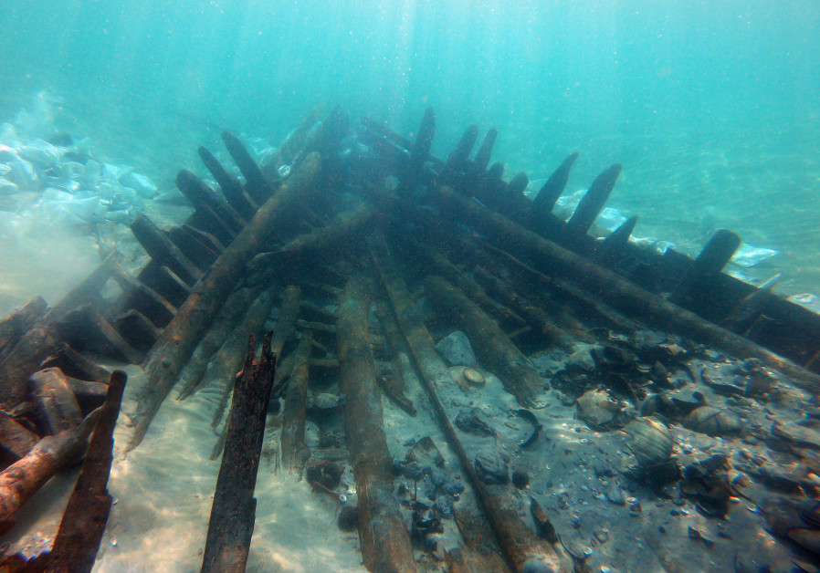
“By the mid-1700s, less than 100 years after the abandonment of the Dyar mound [now submerged under Lake Oconee], explanations for the non-Indigenous origins of earthen mounds were being espoused. As less than 100 years would have passed between the Indigenous use of mounds and these explanations, it could be argued that the motives for these myths were purposively racist, denying what would have been a recent collective memory of Indigenous use in favor of explanations that stole, and disenfranchised, these histories from contemporary Indigenous peoples,” Lulewicz said.
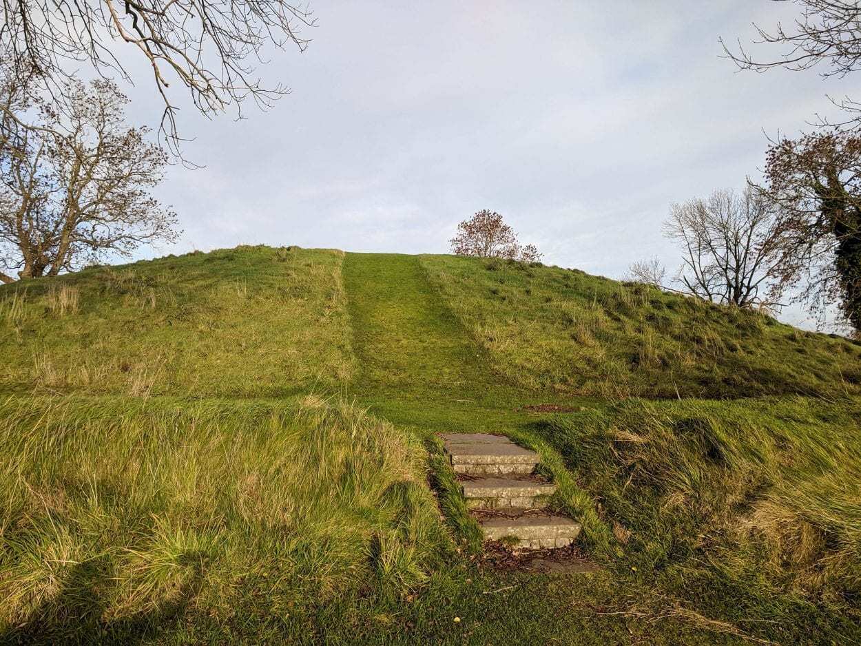
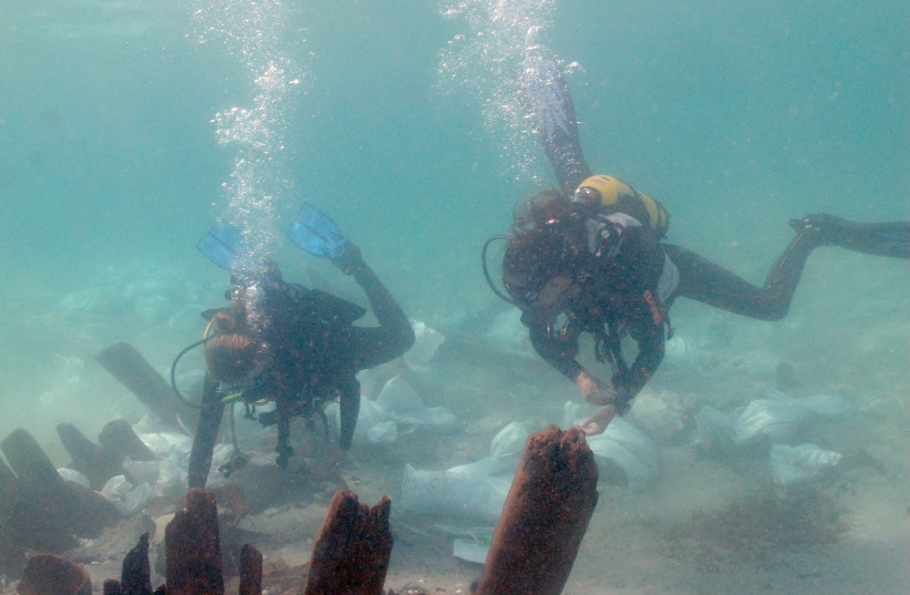
The Dyar mound was excavated by University of Georgia archaeologists in the 1970s to make way for a dam. Lulewicz and co-authors — Victor D. Thompson, professor of archaeology and director of the Laboratory of Archaeology at the University of Georgia; James Wettstaed, archaeologist at Chattahoochee-Oconee National Forests; and Mark Williams, director emeritus of the Laboratory of Archaeology at the University of Georgia — received funding from the USDA Forest Service to re-date the platform mound, which contained classic markers of Indigenous rituals and ceremonies.
Using advanced radiocarbon dating techniques and complex statistical models, modern-day archaeologists are able to effectively construct high-resolution, high-precision chronologies. In many cases, they can determine, within a 10- to 20-year range, dates of things that happened as far back as 1,000 years ago.
“Radiocarbon dating is really important, not just for getting a date to see when things happened, but for understanding the tempo of how things changed throughout time and really understanding the complex histories of people over hundreds of years,” Lulewicz said. “In archaeology, it’s really easy to group things in long periods of time, but it would be false to say that nothing changed over those 500 years.”
Their research yielded 20 new dates from up and down the mound, which provided a refined perspective on the effects that early Indigenous-colonizer encounters did, and did not, have on the Indigenous people and their traditions.
Missing from the mound was any sign of European artifacts, which is one of the reasons why archaeologists originally believed sites in the region were abruptly abandoned just after their first encounters with Spanish colonizers. “Not only did the ancestors of Muscogee (Creek) people continue their traditions atop the Dyar mound for nearly 150 years after these encounters, but they also actively rejected European things,” Lulewicz said.
According to Lulewicz, the Dyar mound does not represent an isolated hold-over after contact with European colonizers. There are several examples of platform mounds that were used beyond the 16th century, including the Fatherland site associated with the Natchez in Louisiana, Cofitachequi in South Carolina and a range of towns throughout the Lower Mississippi Valley.
“However, the mound at Dyar represents one of the only confirmed examples, via absolute dating, of continued Mississippian traditions related to mound-use and construction to date.”
Today, members of the Muscogee (Creek) Nation, descendants of the Mississippians who built platform mounds like the one at Dyar, live in Oklahoma. “We have a great, collaborative relationship with archaeologists of the Muscogee (Creek) Nation Historic and Cultural Preservation Department, so we sent them the paper to review. It was really well received. They saw, reflected in that paper, a lot of the traditions they still practice in Oklahoma and were generous enough to contribute commentary that bolstered the results presented in the paper,” he said.
“This is where the archaeology that we write becomes so important in the present. … Without this type of work, we are contributing to the disenfranchisement of Indigenous peoples from their history.”
“Of course, they already knew many of the things we ‘discovered,’ but it was still meaningful to be able to reaffirm their ancestral link to the land.”
In the end, Lulewicz said this is the most important part of the paper. “We are writing about real human lives — Indigenous lives that we have historically treated very poorly and who continue to be treated poorly today in some cases. With the use of advanced radiocarbon dating and the development of really high resolution chronologies, we are able to more effectively reinject lives into narratives of the past.”


Header Image – Jacob Lulewicz, lecturer in archaeology at Washington University in St. Louis, studies southeastern/midwestern ethnohistory and archaeology including Indigenous-colonizer dynamics; social networks and sociopolitics. Image Credit : WUSTL
Archaeologists Discover the Lost Dragon City, Capital of Xiongnu Empire


Archaeologists conducting excavations in central Mongolia along the Orkhon River believe they have discovered the “Dragon City” of Luut/Luncheng, the Xiongnu/Khunnu capital.

The Xiongnu were a tribal confederation that inhabited the eastern Eurasian Steppe from the 3rd century BC to the late 1st century AD. The ruler of the Xiongnu was called the Chanyu, who exercised direct authority over the central territory from Luncheng. Their relations with adjacent Chinese dynasties to the south-east were complex, with repeated periods of conflict and intrigue, alternating with exchanges of tribute, trade, and marriage treaties.

Excavations financed by the Ulaanbaatar State University in the Ulziit district of Arkhangai province first made the discovery in 2017, but details of the findings have only now been published in local media.
Image Credit : Iderkhangai Tumur-Ochir

Iderkhangai Tumur-Ochir, leader of the archaeological research team from Ulaanbaatar State University said: “The city is believed to have originated in the Khangai Mountains of Mongolia, according to ancient sources.”

The researchers revealed that the city has a double wall and a man-made pool used for water management or a reservoir. Excavations found the remains of a structure that was decorated with an ancient kanji inscription stating, “Son of Heaven” which is the first evidence found within the region to suggest the site is the Dragon City of Luncheng.

Iderkhangai told Xinhua “”As a result of more than a decade of research on the political centre of the Xiongnu Empire, I am very happy that we have discovered and excavated the empire’s capital Dragon City or Luncheng City”

Header Image Credit : Iderkhangai Tumur-Ochir
Climate Scientists Increasingly Ignore Ecological Role of Indigenous People


In their zeal to promote the importance of climate change as an ecological driver, climate scientists increasingly are ignoring the profound role that indigenous peoples played in fire and vegetation dynamics, not only in the eastern United States but worldwide, according to a Penn State researcher.

“In many locations, evidence shows that indigenous peoples actively managed vast areas and were skilled stewards of the land,” said Marc Abrams, professor of forest ecology and physiology. “The historical record is clear, showing that for thousands of years indigenous peoples set frequent fires to manage forests to produce more food for themselves and the wildlife that they hunted, and practiced extensive agriculture.”

Responding to an article published earlier this year in a top scientific journal that claimed fires set by Native Americans were rare in southern New England and Long Island, New York, and played minor ecological roles, Abrams said there is significant evidence to the contrary.


In an article published today (July 20) in Nature Sustainability, Abrams, who has been studying the historical use of fire in eastern U.S. forests for nearly four decades, refutes those contentions.

“The palaeoecological view — based on a science of analyzing pollen and charcoal in lake sediments — that has arisen over the last few decades, contending that anthropogenic fires were rare and mostly climate-driven, contradicts the proud legacy and heritage of land use by indigenous peoples, worldwide,” he said.

In his article, Abrams, the Nancy and John Steimer Professor of Agricultural Sciences in the College of Agricultural Sciences, argues that the authors of the previous paper assumed that the scarcity of charcoal indicated that there had not been burning. But frequent, low-intensity fires do not create the amount of charcoal that intense, crown-level, forest-consuming wildfires do, he pointed out.


Subscribe to more articles like this by following our Google Discovery feed - Click the follow button on your desktop or the star button on mobile. Subscribe

“Surface fires set by indigenous people in oak and pine forests, which dominate southern New England, often produced insufficient charcoal to be noticed in the sediment,” said Abrams. “The authors of the earlier article did not consider charcoal types, which distinguish between crown and surface fires, and charcoal size — macro versus micro — to differentiate local versus regional fires.”

Also, lightning in New England could not account for the ignition of so many fires, Abrams argues. In southern New England, lightning-strike density is low and normally is associated with rain events.

“The region lacks dry lightning needed to sustain large fires,” he said. “Moreover, lightning storms largely are restricted to the summer when humidity is high and vegetation flammability is low, making them an unlikely ignition source.”

Early explorers and colonists of southern New England routinely described open, park-like forests and witnessed, firsthand, Native American vegetation management, Abrams writes in his article, adding that oral history and numerous anthropological studies indicate long-term burning and land-use for thousands of years by indigenous people.

Burning near Native American villages and along their extensive trail systems constitutes large land areas, and fires would have kept burning as long as fuel, weather and terrain allowed, he explained. Following European settlement, these open oak and pine woodlands increasingly became closed by trees that previously were held in check by frequent fire.

The authors of the previous paper also argued that fire should not be used as a present-day management tool, a view that Abrams does not support.

The role of anthropogenic fires is front and center in the long-running climate-disturbance debate, according to Abrams, who notes that fires increased with the rise of human populations. The world would be a very different place without those fires, he contends.

“Surprisingly, the importance of indigenous peoples burning in vegetation-fire dynamics is increasingly downplayed among paleoecologists,” he writes. “This applies to locations where lightning-caused fires are rare.”

Abrams points out that he is not denying the importance of climate in vegetation and fire dynamics or its role in enhancing the extent of human fires. “However,” he writes, “in oak-pine forests of southern New England, Native American populations were high enough, lighting-caused fires rare enough, vegetation flammable enough and the benefits of burning and agriculture great enough for us to have confidence in the importance of historic human land management.”

PENN STATE

Header Image Credit : Public Domain
Google Launches Hieroglyphic Translator
Google has launched a new translator for Ancient Egyptian hieroglyphics based on machine learning.

The translator is part of Google’s arts & culture application “Fabricius” that has been in development through the Ubisoft Hieroglyphics Initiative first launched at the British Museum in 2017.

In collaboration with Google, the Australian Center for Egyptology, at Macquarie University, Psycle Interactive, Ubisoft, and Egyptologists from around the world, the project was created to determine the possibility of using machine learning to process and collate the language of the Ancient Egyptians.
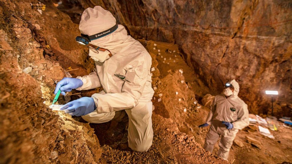
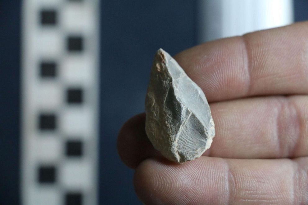
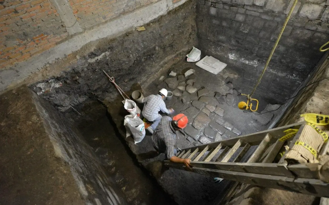
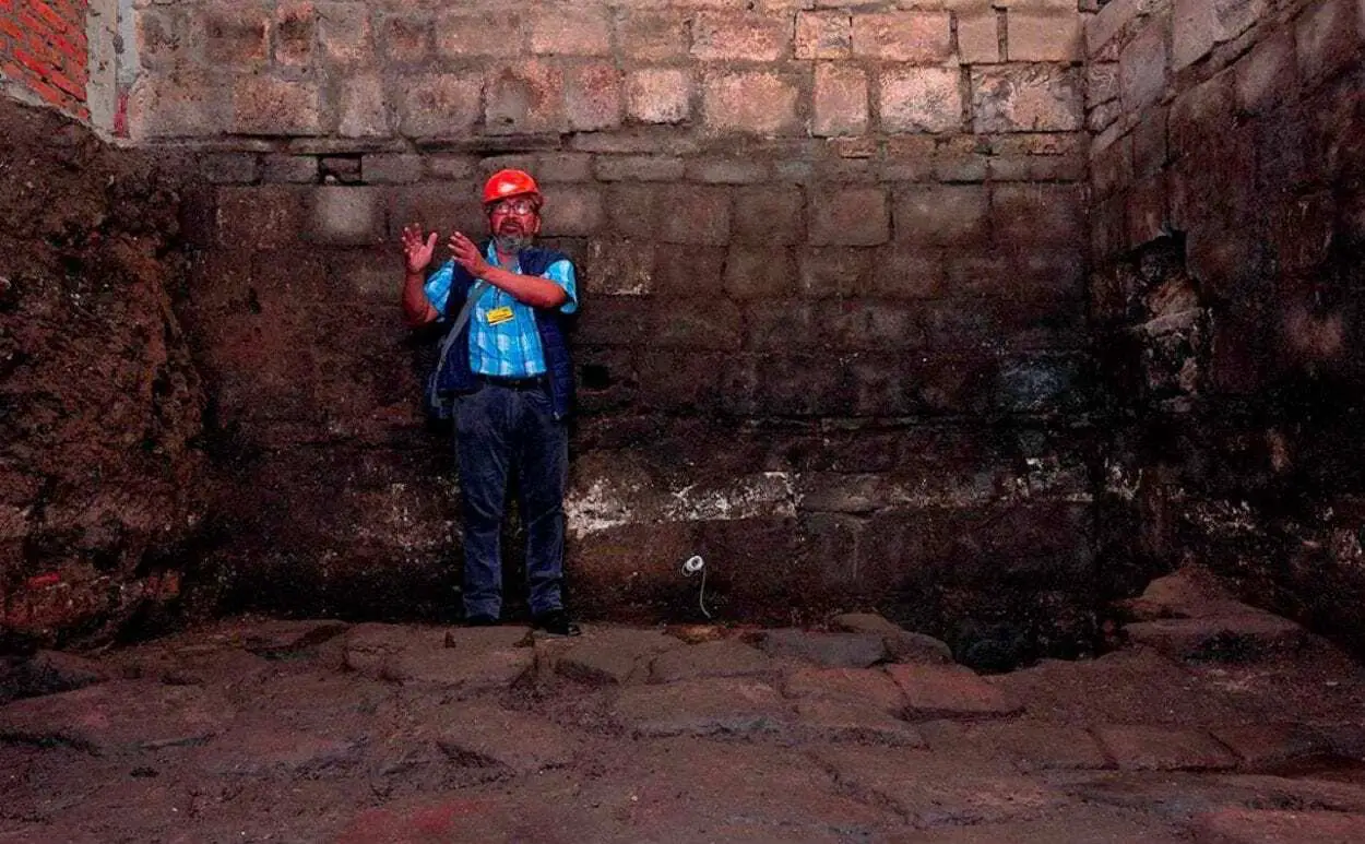
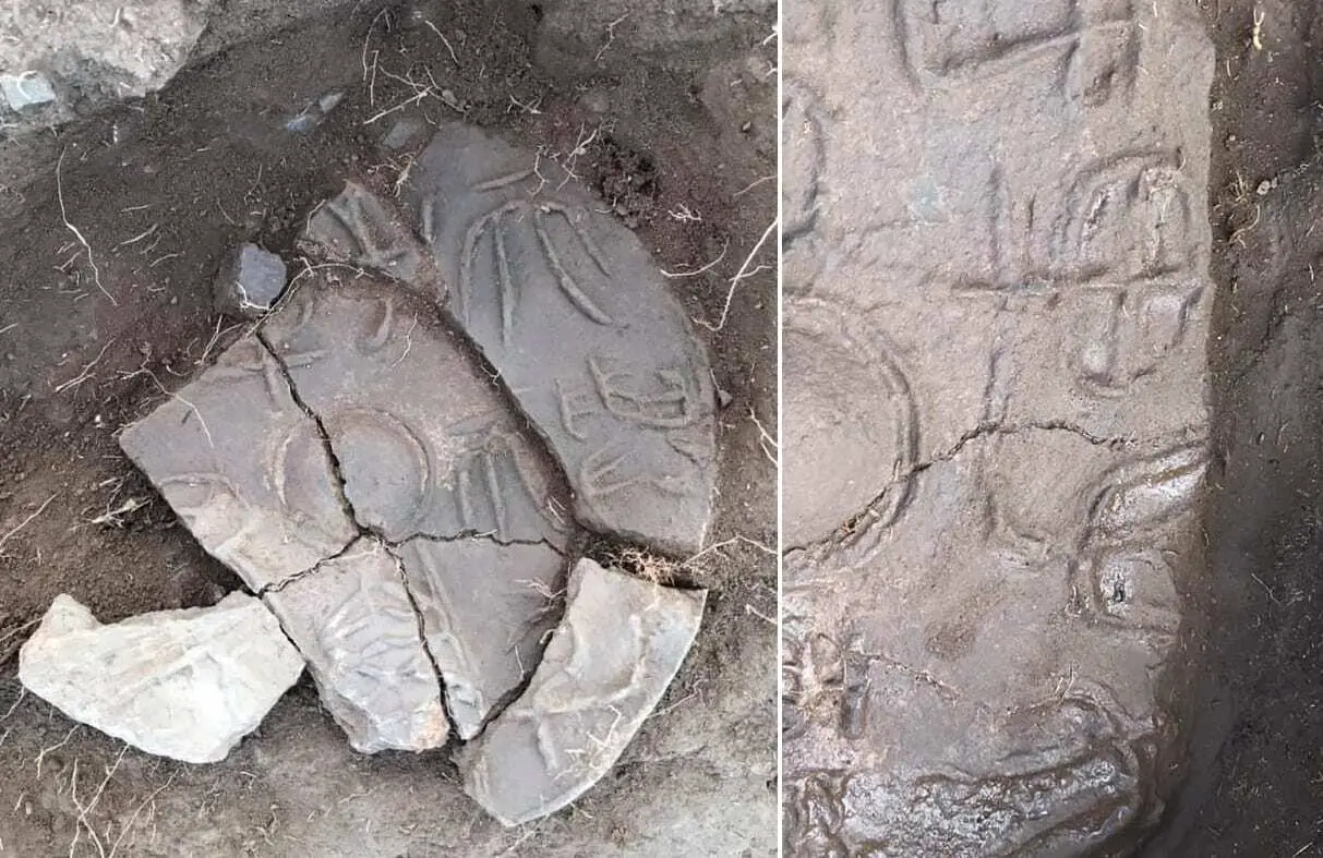
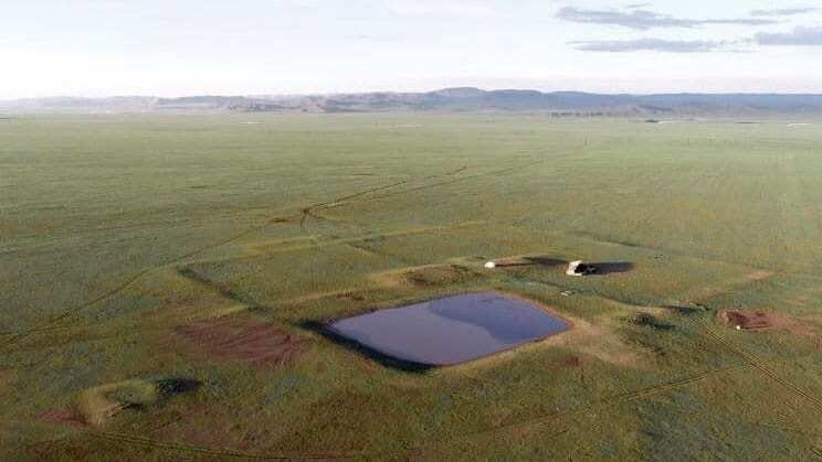
Image Credit : Google

Hieroglyphics was the formal writing system of Ancient Egypt, with the first decipherable sentence dating to the Second Dynasty (28th century BC). Hieroglyphics combine logographic, syllabic, and alphabetic elements with over 1,000 distinct characters.

With the final closing of pagan temples across Egypt in the 5th century, knowledge of hieroglyphic writing was lost until their decipherment in the 1820s by Jean-François Champollion, with the help of the Rosetta Stone.

Fabricius allows users to upload images of hieroglyphs, which the software then tries to match with symbols in a database and analyse historical records and definitions to decipher the different meanings.

Dr Alex Woods, from the Australian Centre for Egyptology told the BBC: “Digitising textual material that was up until now only in handwritten books will completely revolutionise how Egyptologists do business. Digitised and annotated texts could potentially help us to reconstruct broken texts on the walls and even to discover texts we didn’t know were there.”

Fabricius Application

Header Image Credit : Public Domain
Breakthrough in Studying Ancient DNA From Doggerland That Separates The UK From Europe


Thousands of years ago the UK was physically joined to the rest of Europe through an area known as Doggerland. However, a marine inundation took place during the mid-holocene, separating the British landmass from the rest of Europe, which is now covered by the North Sea.

Scientists from the School of Life Sciences at the University of Warwick have studied sedimentary ancient DNA (sedaDNA) from sediment deposits in the southern North Sea, an area which has not previously been linked to a tsunami that occurred 8150 years ago.

The paper, led by the University of Bradford and involving Universities of Warwick, Wales St. Trinity David, St. Andrews, Cork, Aberystwyth, Tartu as well as the Smithsonian and Natural History Museum, ‘Multi-Proxy Characterisation of the Storegga Tsunami and Its Impact on the Early Holocene Landscapes of the Southern North Sea’, published in the Journal Geosciences, sees Life Scientists from the University of Warwick work specifically on the sedimentary ancient DNA from Doggerland.


A number of innovative breakthroughs were achieved by the University of Warwick scientists in terms of analysing the sedaDNA. One of these was the concept of biogenomic mass, where for the first time they were able to see the how the biomass changes with events, evidence of this presented in the paper refers to the large woody mass of trees from the tsunami found in the DNA of the ancient sediment.

New ways of authenticating the sedaDNA were also developed, as current methods of authentication do not apply to sedaDNA which has been damaged whilst under the sea for thousands of years because there is too little information for each individual species. Researchers therefore came up with a new way, metagenomic assessment methodology, whereby the characteristic damage found at the ends of ancient DNA molecules is collectively analysed across all species rather than one.

Alongside this a key part of analysing the sedaDNA is to determine whether or not it was deposited in situ or has moved over time. This led researchers to develop statistical methods to establish which scenario was appropriate, using stratigraphic integrity they were able to determine that the sedaDNA in the sediment deposits had not moved a massive amount since deposition by assessing the biomolecules vertical movement in the core column of the sedaDNA.


Subscribe to more articles like this by following our Google Discovery feed - Click the follow button on your desktop or the star button on mobile. Subscribe

Identifying which organisms the ancient fragmented molecules of DNA came from is also challenging because often there is nothing to directly compare. In a fourth innovation the researchers refined algorithms to define these regions of “dark phylogenetic space” from where organisms must have originated overcome this issue.

Professor Robin Allaby from the School of Life Sciences at the University of Warwick comments: “This study represents an exciting milestone for sedimentary ancient DNA studies establishing a number of breakthrough methods to reconstruct an 8,150 year old environmental catastrophe in the lands that existed before the North Sea flooded them away into history.”

Professor Vince Gaffney from the School of Archaeological and Forensic Sciences at the University of Bradford said: “Exploring Doggerland, the lost landscape underneath the North Sea, is one of the last great archaeological challenges in Europe. This work demonstrates that an interdisciplinary team of archaeologists and scientists can bring this landscape back to life and even throw new light on one of prehistory’s great natural disasters, the Storegga Tsunami.

“The events leading up to the Storegga tsunami have many similarities to those of today. Climate is changing and this impacts on many aspects of society, especially in coastal locations.”

UNIVERSITY OF WARWICK

Header Image Credit : Daleyhl

Ancient Ancestors of Domestic Cat was Opportunistic


An international study by researchers from the Senckenberg Center for Human Evolution and Palaeoenvironment at the University of Tübingen has determined that the first known cats in Europe were opportunistic and did not rely directly on humans for survival.

The study reveals that around 6,200 to 4,300 years ago cats survived by hunting wild animals such as rodents and were closely associated with human agriculture.

The African wildcat (Felis silvestris lybica) is the ancestor of all present-day domestic cats. The sandy-colored animals originated on the African continent. “Around 6,000 years ago, the animals also became established in Europe, where they spread as domesticated cats,” explains Prof. Dr. Hervé Bocherens of the Senckenberg Center for Human Evolution and Palaeoenvironment at the University of Tübingen, and he continues, “The oldest fossils date back about 6,200 years and were discovered in Poland. We asked ourselves how these animals were domesticated after they spread into Europe.”


To answer these questions, Bocherens, together with the study’s lead author, Magdalena Krajcarz of the Nikolaus Kopernikus University in Toruń, Poland, and an international team, measured stable isotopes in the fossilized cats’ bone collagen.

The different isotope ratios allow scientists to make inferences about the animals’ diet. “We examined a total of six cat fossils from discovery sites in Poland. For comparison purposes, we also measured fossils of the oldest known domestic cats from Poland as well as 34 additional animals that occurred alongside the cats in Europe around 6,000 years ago,” explains the scientist from Tübingen.

The study aims to also reconstruct the historical connections between humans and cats by studying the ecology and sociology of the immigrated African wildcats.
The study’s results show that the newly arrived ancestors of the domestic cat did not entirely rely on humans. Bocherens explains, “The bones in the cat fossils contain evidence of rodents that occurred in close association with human agriculture, along with signs of wild prey animals.” These analysis results indicate that the ancestors of modern domestic cats continued to live in the wild and only obtained part of their diet near human habitations. “This means that the animals were not synanthropic, i.e., entirely adapted to humans and their environment, but – contrary to the dogs of that period – led an ‘opportunistic’ lifestyle.
When they were unable to find food in the wild, which they had to share with the native European wildcats, they were not averse to foraging in the vicinity of human dwellings,” says Bocherens in summary, and he adds, “The native European wildcats also fed on these rodents, so there really was a direct competition for food between the two forms. However, due to the ample food supply, this apparently did not lead to the displacement of either one of these felines.”
How Governments Resist World Heritage ‘in Danger’ Listings
A study published today found national governments repeatedly resisted the placement of 41 UNESCO World Heritage sites-including the Great Barrier Reef-on the World Heritage in Danger list.

This resistance is despite the sites being just as threatened, or more threatened, than those already on the in Danger list.

The study was co-authored by a team of scientists from Australia, the UK and the US.

World Heritage sites represent both natural and cultural heritage for global humanity. Their protection sits within the jurisdiction of individual countries. An in Danger listing is intended to raise awareness of threats to these sites and encourage investment in mitigation measures, such as extra protection.

Lead author Professor Tiffany Morrison from the ARC Centre of Excellence for Coral Reef Studies at James Cook University (Coral CoE at JCU) says national governments responsible for these World Heritage sites use political strategies of rhetoric and resistance to avoid a World Heritage in Danger listing.

“Avoiding an in Danger listing happens through partial compliance and by exerting diplomatic pressure on countries that are members of the World Heritage Committee,” Prof Morrison said.

She says World Heritage in Danger listings are increasingly politicised. However, until now, little was known about what that politicisation entailed, and what to do about it.

The study found the net number of in Danger listings plateaued since the year 2000. At the same time, low visibility political strategies–such as industrial lobbying and political trade-offs associated with the listings–intensified.

“Our results also challenge the assumption that poor governance only happens in less technologically advanced economies. Rich countries often have poor governance too,” Prof Morrison said.

“We show that the influence of powerful industries in blocking environmental governance is prevalent in many regions and systems.”

The Great Barrier Reef, under the custodianship of the Australian Government, is just one of the threatened sites that continues to evade the World Heritage in Danger list.

Professor Terry Hughes, also from Coral CoE at JCU, says there is no doubt that coral reefs are in danger from man-made climate change.

“The study makes no recommendation on which World Heritage sites should be formally recognised as in Danger but points out that virtually all sites are increasingly impacted by anthropogenic climate change,” Prof Hughes said.

“The Great Barrier Reef was severely impacted by three coral bleaching events in the past five years, triggered by record-breaking temperatures,” he said.

World Heritage in Danger listings are frowned upon by high-value natural resource industries such as mining, forestry and environmental tourism. Prof Morrison says the in Danger listings restrict the social license of fossil fuel industries to operate.

“Industry coalitions therefore often lobby governments, UNESCO and World Heritage Committee member countries,” she said.

“They claim an in Danger listing diminishes their nation’s international reputation and restricts foreign investment, national productivity, and local employment. Some also challenge the World Heritage system itself and undermine reports by scientists, non-governmental organisations and the media.”

These lobbying efforts heighten a government’s sense of political threat by linking the listings to national economic performance, as well as to the individual reputations of politicians and senior bureaucrats.

“At the same time, UNESCO is acutely aware of these dynamics and concerned about threats to its own reputation,” Prof Morrison said.

“Politicians and bureaucrats often work to conceal these dynamics, resulting in poor governance and continued environmental degradation.”

Prof Morrison says revealing and analysing these dynamics is a step closer to moderating them.

The study provides new evidence for how interactions, from 1972 until 2019, between UNESCO and 102 national governments, have shaped the environmental governance and outcomes for 238 World Heritage ecosystems. It also provides examples of how concerned stakeholders can, and are, experimenting with countervailing strategies that harness these politics.

“Given the global investment in environmental governance over the past 50 years, it is essential to address the hidden threats to good governance and to safeguard all ecosystems,” the study concludes.

ARC CENTRE OF EXCELLENCE FOR CORAL REEF STUDIES

Header Image Credit : Public Domain

Amud 9 is Shown to be a Neanderthal Woman Weighing 60 kg Who Lived in the Late Pleistocene


Adrián Pablos, a scientist at the Centro Nacional de Investigación sobre la Evolución Humana (CENIEH), co-leads a paper looking at the morphology and anatomy of a partial foot recovered over 25 years ago at Amud Cave (Israel), which confirms that the individual Amud 9 was a Neandertal woman from the Late Pleistocene, with a stature of some 160-166 cm***  and weight of 60 kg.

Over the course of several excavations conducted in the twentieth century at Amud Cave, remains of at least 15 Neandertals were found. A systematic and detailed study of one of these individuals, Amud 9, has found that the fossil possesses the traits usually associated with Neanderthals in the different elements of the foot, tarsals, metatarsals and phalanges, which differ from those of modern humans, both fossil and recent.

“Most of these traits are related to the typical, exceptional robustness of the postcranial skeleton, that is, from the neck down, observed in the majority of Neandertals”, explains Pablos.


Sex, weight and height

Sex, weight and height estimates in fossil populations are normally based on the dimensions of the large leg bones. However, in the case of Amud 9, only a fragment of tibia, the talus or ankle bone, one metatarsal or instep bone, and several phalanges are conserved.

As no long leg bones have been found, the researchers applied different mathematical estimates based upon the foot bones, thus obtaining an approximation to important paleobiological parameters.


“Knowing parameters such as the body size and sex of this individual helps us learn a bit more about what the Neandertals were like”, he says.


Subscribe to more articles like this by following our Google Discovery feed - Click the follow button on your desktop or the star button on mobile. Subscribe

The participants in this paper, entitled A partial Neandertal foot from the Late Middle Paleolithic of Amud Cave, Israel, are researchers from Spain (the CENIEH), the United States (University of New Mexico and Arizona State University), and Israel (Tel Aviv University and The Hebrew University of Jerusalem).

CENIEH
Header Image Credit : Osborjn M. Pearson y Adrián Pablos


*** FIVE FOOT TWO, EYES OF BLUE

https://www.calculateme.com/height/convert-cm-to-feet-inches/160-cm 


Five Foot Two, Eyes of Blue" (Art Landry, 1925)

HAS GREAT FOOTNOTES ON THE SONG AND PERFORMERS

Ancient Greek Sanctuaries & Temples Had Disabled Access Thousands of Years Age


A new study by archaeologists suggests that many temples and sanctuaries of the ancient Greeks incorporated ramps that gave mobility-impaired visitors disabled access thousands of years ago.

The study was conducted by Dr Debby Sneed, from the California State University, Long Beach who made the discovery whilst analysing the distribution of ramps in ancient Greece.
Many religious sites have incorporated ramps, but research by scholars have mostly overlooked the ramps in articles and textbooks in their studies of ancient Greek architecture and analysis of the monuments.

Dr Sneed said: “Archaeologists have known about ramps on ancient Greek temples, but have routinely ignored them in their discussions of Greek architecture. More than 2,000 years ago, ancient Greeks spent time and money building ramps to aid individuals who could not easily ascend or descend stairs, and all without targeted legislation requiring them to do so”


Dr Sneed found that these ramps were particularly common at healing sanctuaries, where large numbers of visitors suffering from various illness and mobility impairments came in search of help from the healing god Asclepius.

Image Credit : Antiquity

One of the most important healing sanctuaries, the Sanctuary of Asclepius at Epidauros had 11 stone ramps installed on nine structures within the sanctuary complex that was incorporated around 370 BC.

At a sanctuary of Asclepius in Corinth, a large number of dedications to the god represent legs and feet, suggesting that people requested healing in these limbs.

“The likeliest reason why ancient Greek architects constructed ramps was to make sites accessible to mobility-impaired visitors,” concluded Dr Sneed. This research, published in the journal Antiquity, would make these ramps the earliest known evidence of ancient societies adapting their architecture to meet the needs of disabled community members.


Antiquity
Matthew Hopkins – The Real Witch-Hunter


Matthew Hopkins was an infamous witch-hunter during the 17th century, who published “The Discovery of Witches” in 1647, and whose witch-hunting methods were applied during the notorious Salem Witch Trials in colonial Massachusetts.

From the 16th century, England was in the grips of hysteria over witchcraft, caused in part by King James VI, who was obsessed with the dark arts and wrote a dissertation entitled “Daemonologie” in 1599.

James had been influenced by his personal involvement in the North Berwick witch trials from 1590, and amassed various texts on magical studies that he published into three books to describe the topics of magic, sorcery, and witchcraft, and tried to justify the persecution and punishment of a person accused of being a witch under the rule of canonical law.


The published works assisted in the creation of the witchcraft reform, that led to the English Puritan and writer – Richard Bernard to write a manual on witch-hunting in 1629 called “A Guide to Grand-Jury Men”. Historians suggest that both the “Daemonologie” and “A Guide to Grand-Jury Men” was an influence that Matthew Hopkins would draw inspiration from and have a significant impact in the direction his life would take many years later.

Matthew Hopkins was born in Great Wenham, located in Suffolk, England, and was the fourth son of James Hopkins, a Puritan vicar of St John’s of Great Wenham. After his father’s death, Hopkins moved to Manningtree in Essex and used his inheritance to present himself as a gentleman to the local aristocracy.


Hopkins’ witch-finding career began in March 1644, when an associate, John Sterne alleged that a group of women in Manningtree were conducting acts of sorcery and were trying to kill him with witchcraft. Hopkins conducted a physical investigation of the women, looking for deformities and a blemish called the “Devil’s Mark” which would lead to 23 women (sources differ in the number) being accused of witchcraft and were tried in 1645. The trial was presided over by the justices of the peace (a judicial officer of a lower or puisne court), resulting in nineteen women being convicted and hanged, and four women dying in prison.

After their success in the trail, Hopkins and Stearne travelled throughout East Anglia and nearby counties with an entourage of female assistants, falsely claiming to hold the office of Witchfinder General and also claimed to be part of an official commission by Parliament to uncover witches residing in the populous by using a practice called “pricking”. Pricking was the process of pricking a suspected witch with a needle, pin or bodkin. The practice derived from the belief that all witches and sorcerers bore a witch’s mark that would not feel pain or bleed when pricked.

Although torture was considered unlawful under English law, Hopkins would also use techniques such as sleep deprivation to confuse a victim into confessing, cutting the arm of the accused with a blunt knife (if the victim didn’t bleed then they’d be declared a witch) and tying victims to a chair who would be submerged in water (if a victim floated, then they’d be considered a witch).

This proved to be a lucrative opportunity in terms of monetary gain, as Hopkins and his company were paid for their investigations, although Hopkins states in his book “The Discovery of Witches” that “his fees were to maintain his company with three horses”, and that he took “twenty shillings a town”. Historical records from Stowmarket shows that Hopkins actually charged the town £23, taking into account inflation would be around £3800 today.

Between the years of 1644 and 1646, Hopkins and his company are believed to be responsible for the execution of around 300 supposed witches and sent to the gallows more accused people than all the other witch-hunters in England of the previous 160 years.

By 1647, Hopkins and Stearne were questioned by justices of the assizes (the precursor to the English Crown Court) into their activities, but by the time the court resumed both Hopkins and Stearne retired from witch-hunting.

That same year, Hopkins published his book, “The Discovery of Witches” which was used as a manual for the trial and conviction of Margaret Jones in the Massachusetts Bay Colony on the east coast of America. Some of Hopkins’ methods were also employed during the Salem Witch Trials, in Salem, Massachusetts in 1692–93, resulting in hundreds of inhabitants being accused and 19 people executed.

Matthew Hopkins died at his home in Manningtree on the 12th August 1647 of pleural tuberculosis and was buried in the graveyard of the Church of St Mary at Mistley Heath. Within a year of the death of Hopkins, Stearne retired to his farm and wrote his own manual “A Confirmation and Discovery of Witchcraft” hoping to further profit from the infamous career path both men had undertaken that caused the death of hundreds of innocent souls.


Archaeologists Discover Evidence of Ancient Temple Complexes at Navan Fort


Archaeologists conducting research at the Navan Fort in County Armagh, Northern Ireland have discovered evidence for consecutive temple complexes dating from the Iron Age.

The Navan Fort (Emain Macha in old Irish), is one of Ireland’s proposed royal sites and capital of the Ulaidh, that was documented during the medieval period as one of the five capitals of the five fifths that divided Ireland.

According to Irish mythology, the fort was also the seat of Chonchobhar mac Nessa, the king of Ulster in the Ulster Cycle and was described in the epic saga Táin Bó Cúailnge about the exploits of Cú Chulainn and Conal Cernach.


The fort lies at the heart of the ‘Navan complex’, which includes the Haughey’s Fort (an earlier hilltop enclosure), the King’s Stables (an artificial ritual pool) and Loughnashade (a natural lake that has yielded votive offerings) and consists of a large bank and ditch circular hilltop enclosure which also contains a small circular mound and a ring barrow.
Image Credit : Allan Leonard

The study by academics from Queen’s University Belfast, and the University of Aberdeen, in conjunction with the German Archaeological Institute, conducted a series of geophysical surveys which has revealed a vast ceremonial temple complex with further evidence of continuous activity through to the medieval period.
Dr Gleeson from Queen’s University Belfast said: “Excavation in the 1960s uncovered one of the most spectacular series of buildings of any region of prehistoric Europe, including a series of figure-of-8 buildings of the Early Iron Age and a 40m timber-ringed structure constructed c.95 BC. Upon the latter’s construction, it was immediately filled with stones and burnt to the ground in order to create a massive mound that now dominates the site.

Dr Gleeson added: “Our discoveries add significant additional data, hinting that the buildings uncovered in the 1960s were not domestic structures lived in by kings, but a series of massive temples, some of the largest and most complex ritual arena of any region of later prehistoric and pre-Roman Northern Europe.”

Header Image Credit : Allan Leonard


Nuclear sites still dangerous in 24,000 years, say space archaeologists

Some nuclear tests were conducted also in outer space and nuclear fuel was employed as propellant for rockets.

By ROSSELLA TERCATIN
JULY 26, 2020 18:30

A mushroom cloud from the Trinity Nuclear Test.
(photo credit: Wikimedia Commons)
Advertisement

In July 1945, a test conducted in the deserts of New Mexico officially propelled humanity into the nuclear era. Only weeks after the Trinity Test, two atomic bombs were dropped on the Japanese cities of Hiroshima and Nagasaki.
In the following decades, while no other nuclear device was detonated in an act of war, military tests and studies continued.

Seventy-five years later, space archaeologists are wondering how to warn humanity of the future that the sites where these experiments were carried out are still dangerous, Alice Gorman, associate professor at Flinders University in Adelaide, Australia, told The Jerusalem Post.
“Teenagers nowadays do not understand how to work a dial telephone, a device that was incredibly common only one or two generations ago,” she said. “The type of plutonium used in the Trinity Test, plutonium-239, has a half-life of 24,000 years, meaning that after this time, only half of it will have decayed into a safe, non-radioactive element. How do we communicate to people living then that the site is dangerous?”
Gorman said the issue presents two challenging elements: What materials can survive such a long time, and what form of language can be used to deliver the actual message?
“As for the first difficulty, we know that stones and pottery last a very long time,” she said. “But the second point raises a big archaeological question related to symbolic communication. If we look at rock art from 20,000 years ago, we can see that there are pictures of animals, but we do not know what those pictures mean. Therefore, it is possible that our current symbols to mark radioactive sites, the yellow [and] black sign, will be interpreted as an invitation to explore the area, rather than to keep away from it.”
The issue is especially important for archaeologists of the future because in some cases, while the danger would be very limited or not even relevant on the surface, the nuclear waste and its radiation are deeper in the ground, and conducting a dig would be especially risky. For example, such is the case of Maralinga, a remote area in southern Australia where the UK conducted several nuclear tests.
Some nuclear tests were conducted in outer space, and nuclear fuel was employed as propellant for rockets.
If the UN Outer Space Treaty of 1967 prohibited nuclear weapons in space, the issue of its weaponization remains very relevant.
“Recently, Russia tested an anti-satellite weapon, reawakening the debate,” Gorman told the Post.
She began to work in space archaeology following years of work focused on stone-tool analysis and the aboriginal use of bottle glass after European settlement.
Space archaeology deals with the same issues of regular archaeology, understanding material culture, human behavior and the interaction with the surrounding environment, Gorman said.
“However, we are looking at the post-Second World War period, when the very same rockets that had been developed as missiles started to send spacecraft into orbit,” she said. “We are interested in all of what is on earth, like rocket launch sites or tracking antennas and reception development, as well as town or residential areas where people who worked on these projects live, but also satellites, space junk and all the places on other planets where humans have sent spacecrafts.”
“We are asking the same questions other archaeologists are, but we have the limitations that we cannot visit many of the sites in person, and instead, we have to rely on records or images,” she added.
Gorman was drawn to space archaeology by the idea of exploring space junk, those many objects that cannot even be seen in the sky circling the Earth. Currently, she is working on the archaeology of the International Space Station.
The recent attempt by Israel to land a robotic unit on the moon with the Beresheet mission represents a very interesting development for space archaeologists, Gorman said.
“For many decades, the only material cultures present on the moon were the American and the Soviet one,” she said. “As new countries have started to reach the moon, this has changed, bringing more diversity to the field.”

Christian, Muslim symbols found in 7th century shipwreck in Israel

Moreover, the ship also offers important insights in terms of ship construction tec
hniques.

By ROSSELLA TERCATIN
JULY 26, 2020 20:07


Students Maayan Cohen and Michelle Creisher examine the pottery near the bulkhead at Ma‘agan Mikhael B shipwreck.
(photo credit: A. YURMAN/LEON RECANATI INSTITUTE FOR MARITIME STUDIES OF THE UNIVERSITY OF HAIFA.)

About 1,300 years ago, a 25-meter-long ship sank just a few dozen meters from the coast of Israel. Most likely, nobody perished in the incident.
But its plentiful cargo included 103 amphorae filled with all forms of agricultural products, numerous daily objects used by the crew and many other unique features, such as several Greek and Arabic inscriptions. They were swallowed by the sea and the sand, which preserved their secrets for centuries.

First spotted by two members of nearby Kibbutz Ma’agan Michael, about 35 km. south of Haifa, the site was again covered by sand and rediscovered in 2015.
The shipwreck has been excavated by the University of Haifa’s Leon Recanati Institute for Maritime Studies since 2016. It has offered archaeologists unique insights into the life of the region at the time of the transition between Byzantine and Islamic rule, trade routes and ship construction.

Moreover, the site presents the largest maritime cargo collection of Byzantine and early Islamic pottery discovered in Israel, not devoid of mystery, since two of the six types of amphorae had never before been uncovered.
The first results of the excavations were examined in two academic papers recently published in the journals Levant and Near Eastern Archaeology.
“We have not been able to determine with certainty what caused the ship to wreck, but we think it was probably a navigational mistake,” University of Haifa archaeologist Deborah Cvikel, an author of both papers, told The Jerusalem Post. “We are talking about an unusually large vessel, which was carefully built and is beautifully conserved.”
Based on the findings, the researchers believe the ship must have made stops in Cyprus, Egypt and possibly a port along the coast of Israel before sinking, she said, adding: “It was definitely traveling around the Levant.”
The size and richness of the cargo seem to contradict the notion, currently popular among scholars, that during the transition between Byzantine and Islamic rule between the seventh and eighth centuries, commerce in the Eastern Mediterranean was limited.
Inscriptions found by the archaeologists have provided a glimpse of the fascinating complexity of the period, with both Greek and Arabic letters, as well as Christian and Muslim religious symbols, making their way to the ship – whether carved in the wood of the vessel or on the amphorae.
“We do not know whether the crew was Christian or Muslim, but we found traces of both religions,” Cvikel said.
The symbols include the name of Allah written in Arabic, as well as several crosses.
Among the products found in the pottery were olives, dates, figs, fish bones, pine nuts, grapes and raisins. Many animal bones were found on the ship, perhaps do to eating practices or because they were kept by the crew as pets.
“We have not found any human bone, but we assume that because the ship sank so close to the coast, nobody died in the wreckage,” Cvikel said.
What also makes the site unique is that among the six types of amphorae identified by the archaeologists, two typologies had never emerged anywhere else. Most of the other vessels appeared to have been made in Egypt.
Moreover, the ship also offers important insights in terms of ship construction techniques.
“Ships were built using a method called ‘shell-first’ construction, which was based on strakes, giving the hull its shape and integrity,” Cvikel told the Post. “The main characteristic of this method is the use of mortise-and-tenon joints to connect hull planks. During the fifth to sixth centuries CE, ‘skeleton-first’ construction, in which strakes were fastened to the preconstructed keel and frames, was used.
“This process of ‘transition in ship construction’ has been one of the main topics in the history of shipbuilding for about 70 years, and some issues have remained unanswered. Therefore, each shipwreck of this period holds a vast amount of information that can shed further light onto the process.”
The excavation of the site, which is carried out with the involvement of several master’s and doctoral students, is ongoing, even though this summer the coronavirus emergency has prevented the archaeologist from going back to it.
“We still need to uncover the rear part of the ship, where presumably the captain lived,” Cvikel said. “We also need to carry out more analysis on many of the findings, including the amphorae, their content, the everyday objects, such as the cookware, and the animal bones.”
An origin story for a family of oddball meteorites

by Massachusetts Institute of Technology
Credit: CC0 Public Domain

Most meteorites that have landed on Earth are fragments of planetesimals, the very earliest protoplanetary bodies in the solar system. Scientists have thought that these primordial bodies either completely melted early in their history or remained as piles of unmelted rubble.

But a family of meteorites has befuddled researchers since its discovery in the 1960s. The diverse fragments, found all over the world, seem to have broken off from the same primordial body, and yet the makeup of these meteorites indicates that their parent must have been a puzzling chimera that was both melted and unmelted.

Now researchers at MIT and elsewhere have determined that the parent body of these rare meteorites was indeed a multilayered, differentiated object that likely had a liquid metallic core. This core was substantial enough to generate a magnetic field that may have been as strong as Earth's magnetic field is today.

Their results, published in the journal Science Advances, suggest that the diversity of the earliest objects in the solar system may have been more complex than scientists had assumed.

"This is one example of a planetesimal that must have had melted and unmelted layers. It encourages searches for more evidence of composite planetary structures," says lead author Clara Maurel, a graduate student in MIT's Department of Earth, Atmospheric, and Planetary Sciences (EAPS). "Understanding the full spectrum of structures, from nonmelted to fully melted, is key to deciphering how planetesimals formed in the early solar system."


Maurel's co-authors include EAPS professor Benjamin Weiss, along with collaborators at Oxford University, Cambridge University, the University of Chicago, Lawrence Berkeley National Laboratory, and the Southwest Research Institute.

Oddball irons

The solar system formed around 4.5 billion years ago as a swirl of super-hot gas and dust. As this disk gradually cooled, bits of matter collided and merged to form progressively larger bodies, such as planetesimals.

The majority of meteorites that have fallen to Earth have compositions that suggest they came from such early planetesimals that were either of two types: melted, and unmelted. Both types of objects, scientists believe, would have formed relatively quickly, in less than a few million years, early in the solar system's evolution.


If a planetesimal formed in the first 1.5 million years of the solar system, short-lived radiogenic elements could have melted the body entirely due to the heat released by their decay. Unmelted planetesimals could have formed later, when their material had lower quantities of radiogenic elements, insufficient for melting.

There has been little evidence in the meteorite record of intermediate objects with both melted and unmelted compositions, except for a rare family of meteorites called IIE irons.

"These IIE irons are oddball meteorites," Weiss says. "They show both evidence of being from primordial objects that never melted, and also evidence for coming from a body that's completely or at least substantially melted. We haven't known where to put them, and that's what made us zero in on them."

Magnetic pockets

Scientists have previously found that both melted and unmelted IIE meteorites originated from the same ancient planetesimal, which likely had a solid crust overlying a liquid mantle, like Earth. Maurel and her colleagues wondered whether the planetesimal also may have harbored a metallic, melted core.

"Did this object melt enough that material sank to the center and formed a metallic core like that of the Earth?" Maurel says. "That was the missing piece to the story of these meteorites."

The team reasoned that if the planetesimal did host a metallic core, it could very well have generated a magnetic field, similar to the way Earth's churning liquid core produces a magnetic field. Such an ancient field could have caused minerals in the planetesimal to point in the direction of the field, like a needle in a compass. Certain minerals could have kept this alignment over billions of years.

Maurel and her colleagues wondered whether they might find such minerals in samples of IIE meteorites that had crashed to Earth. They obtained two meteorites, which they analyzed for a type of iron-nickel mineral known for its exceptional magnetism-recording properties.

The team analyzed the samples using the Lawrence Berkeley National Laboratory'sAdvanced Light Source, which produces X-rays that interact with mineral grains at the nanometer scale, in a way that can reveal the minerals' magnetic direction.

Sure enough, the electrons within a number of grains were aligned in a similar direction—evidence that the parent body generated a magnetic field, possibly up to several tens of microtesla, which is about the strength of Earth's magnetic field. After ruling out less plausible sources, the team concluded that the magnetic field was most likely produced by a liquid metallic core. To generate such a field, they estimate the core must have been at least several tens of kilometers wide.

Such complex planetesimals with mixed composition (both melted, in the form of a liquid core and mantle, and unmelted in the form of a solid crust), Maurel says, would likely have taken over several million years to form—a formation period that is longer than what scientists had assumed until recently.

But where within the parent body did the meteorites come from? If the magnetic field was generated by the parent body's core, this would mean that the fragments that ultimately fell to Earth could not have come from the core itself. That's because a liquid core only generates a magnetic field while still churning and hot. Any minerals that would have recorded the ancient field must have done so outside the core, before the core itself completely cooled.

Working with collaborators at the University of Chicago, the team ran high-velocity simulations of various formation scenarios for these meteorites. They showed that it was possible for a body with a liquid core to collide with another object, and for that impact to dislodge material from the core. That material would then migrate to pockets close to the surface where the meteorites originated.

"As the body cools, the meteorites in these pockets will imprint this magnetic field in their minerals. At some point, the magnetic field will decay, but the imprint will remain," Maurel says. "Later on, this body is going to undergo a lot of other collisions until the ultimate collisions that will place these meteorites on Earth's trajectory."

Was such a complex planetesimal an outlier in the early solar system, or one of many such differentiated objects? The answer, Weiss says, may lie in the asteroid belt, a region populated with primordial remnants.

"Most bodies in the asteroid belt appear unmelted on their surface," Weiss says. "If we're eventually able to see inside asteroids, we might test this idea. Maybe some asteroids are melted inside, and bodies like this planetesimal are actually common."
Ancient micrometeoroids carried specks of stardust, water to asteroid 4 Vesta
More information: Meteorite evidence for partial differentiation and protracted accretion of planetesimals, Science Advances (2020).
Journal information: Science Advances


Provided by Massachusetts Institute of Technology
Sunday, July 26, 2020

Well-preserved mammoth skeleton found in Siberian lake


Russian scientists are working to retrieve the well-preserved skeleton of a woolly mammoth, which has some ligaments still attached to it, from a lake in northern Siberia.

Fragments of the skeleton were found by local reindeer herders in the shallows of Pechevalavato Lake on the Yamalo-Nenets region a few days ago. They found part of the animal’s skull, the lower jaw, several ribs, and a foot fragment with sinews still intact.

Woolly mammoths are thought to have died out around 10,000 years ago, although scientists think small groups of them may have lived on longer in Alaska and on Russia’s Wrangel Island off the Siberian coast.

Russian television stations on Friday showed scientists looking for fragments of the skeleton in the lakeside silt.

Scientists have retrieved more bones and also located more massive fragments protruding from the silt. They said it would take significant time and special equipment to recover the rest of the skeleton — if it had all survived in position.

Read the rest of this article...