Thursday, August 12, 2021

PIE IN THE SKY

 A clean US hydrogen economy is within reach, but needs a game plan, energy researchers say
electric grid
Credit: CC0 Public Domain

Addressing climate change requires not only a clean electrical grid, but also a clean fuel to reduce emissions from industrial heat, long-haul heavy transportation, and long-duration energy storage. Hydrogen and its derivatives could be that fuel, argues a Commentary publishing August 11 in the journal Joule, but a clean U.S. H2 economy will require a comprehensive strategy and a 10-year plan. The commentary suggests that careful consideration of future H2 infrastructure, including production, transport, storage, use, and economic viability, will be critical to the success of efforts aimed at making clean H2 viable on a societal scale.

"We applaud the U.S. Secretary of Energy, Jennifer Granholm, for launching the ambitious Hydrogen Earthshot program with a technology-agnostic stretch goal of greenhouse gas-free H2 production at $1/kg before the end of this decade," write Arun Majumdar, a Jay Precourt Professor and Co-Director of the Precourt Institute for Energy at Stanford University and lead author of the commentary, and colleagues. "Similar R&D programs with techno-economic stretch goals are needed for H2 storage, use, and transport as well. The Hydrogen Earthshot is necessary to create a hydrogen economy, but it is not sufficient."

About 70 million metric tons of H2 are produced around the world each year, with the U.S. contributing about one-seventh of the global output. Much of this H2 is used to produce fertilizer and petrochemicals, and nearly all of it is considered "gray H2," which costs only about $1 per kilogram to produce but comes with roughly 10 kilograms of CO2 baggage per kilogram H2.

"An H2 economy already exists, but it involves lots of greenhouse gas emissions," says Majumdar. "Almost all of it is based on H2 from methane. A clean H2 economy does not exist today."

Researchers have plenty of colorful visions as to what a clean H2 economy might look like. "Blue H2," for example, involves capturing CO2 and reducing emissions, resulting in H2 with less greenhouse gas output. However, it currently costs about 50% more than gray H2, not including the cost of developing the pipelines and sequestration systems needed to transport and store unwanted CO2.

"To make blue H2 a viable option, research and development is needed to reduce CO2 capture costs and further improve capture completeness," write Majumdar and colleagues.

Another form of clean H2—dubbed "green H2"—has also captured scientists' attention. Green H2 involves the use of electricity and electrolyzers to split water, without any greenhouse gas byproducts. However, it costs $4 to $6 per kilogram, a price that Majumdar and colleagues suggest could be reduced to under $2 per kilogram with a reduction in carbon-free electricity and electrolyzer costs.

"Turquoise H2," which is achieved through methane pyrolysis, when methane is cracked to generate greenhouse gas-free H2, is also creating a buzz in the research world. The solid carbon co-product generated in this process could be sold to help offset costs, although Majumdar and colleagues point out that the quantity of solid carbon produced at the necessary scale would exceed current demand, resulting in a need for R&D efforts to develop new markets for its use

Whether blue, green, or turquoise, greenhouse gas-free (and, in actuality, colorless) H2 or its derivatives could be used in transportation, the chemical reduction of captured CO2, long-duration energy storage in a highly renewable energy-dependent grid, and chemical reductants for steel and metallurgy, and as high-temperature industrial heat for glass and cement production. But for these applications to become a reality, H2 production will have to hit certain cost benchmarks—$1 per kilogram for the production of ammonia and petrochemicals or for use as a transportation fuel or fuel cells.

The researchers also emphasize that the U.S. will need to consider how H2 pipelines will be developed and deployed in order to transport it, as well as how to store H2 cost-effectively at a large scale. "Developing and siting new pipeline infrastructure is generally expensive and involves challenges of social acceptance," write Majumdar and colleagues. "Hence, it is important to explore alternative approaches for a hydrogen economy that does not require a new H2 pipeline infrastructure. Instead, it is worth using existing infrastructure to transport the feedstock for H2—electric grid for transporting electricity for water splitting; natural gas pipelines to transport methane for pyrolysis."

"While there has been some systematic study of geological storage, the United States Geological Survey should be charged with undertaking a national survey to identify the many locations where underground storage of hydrogen is possible while also considering the infrastructure  needed to use these caverns," the researchers add.

Study offers plan to overcome hurdles for hydrogen energy

More information: Joule, Majumdar et al.: "A framework for a hydrogen economy" www.cell.com/joule/fulltext/S2542-4351(21)00345-7 , DOI: 10.1016/j.joule.2021.07.00

Journal information: Joule 

Provided by Cell Press 

Solar Power from Space? Caltech’s $100 Million Gambit

Billionaire makes secret donation for electricity from orbit

NED POTTER


A NASA artist's rendering from 1999 of a solar power station in orbit. Like many other space-based solar designs, it required many connected parts, which translates to considerable launch costs.
NASA


In 1941 Isaac Asimov, the science fiction writer, published a short story called "Reason." It was a cautionary tale about robotics and artificial intelligence, but it's also remembered now for its fanciful setting: A space station that gathered solar energy to send to the planets via microwave. Ever since, space-based solar power has been an out-there idea—something with potential to change the world, if we can ever master the technology, and muster the funds, to do it.

Donald Bren has done his share of reading about solar power, and since he is one of America's wealthiest real estate developers, he's in a position to help muster the funds. The California Institute of Technology has just announced that, since 2013, Bren and his wife Brigitte have given the school more than US $100 million to help make photovoltaic power from orbit a reality.

That's a lot of money, and, importantly, the work has been spread out over a decade. A team at Caltech is aiming for the first launch of a test array in late 2022 or 2023.

"This is something that's pretty daring," says Ali Hajimiri, a professor of electrical engineering and a co-director of Caltech's Space Solar Power Project. The long timeline, he says, "allows you take chances, and take risks. Sometimes they pay off and sometimes they don't, but when you do that, in an educated, controlled fashion, you end up with things that you never expected."

Bren, 89, made most of his fortune—estimated between $15.3 billion and $16.1 billion—building offices and homes in Orange County, California. He is majority owner of New York City's iconic MetLife Building. He's also donated land and money for environmental conservation. He gives few interviews (he declined to speak for this story), and while Caltech's Space Solar Power Project has been public, Bren's support of it was a secret until now.

High Earth orbit is a great place for a solar farm—the sun never sets and clouds never form. But to generate a meaningful amount of electricity, most past designs were unrealistically, and unaffordably, massive. Engineers depicted giant truss structures, usually measured in kilometers or miles, to which photovoltaic panels or mirrors were attached, absorbing or concentrating sunlight to convert to direct current, then transmit it to the ground via laser or microwave beams. Hundreds of rocket launches might be needed to build a single installation. It was technology too big to succeed.

"What was really required to make this compelling was to have a paradigm shift in the technology," says Harry Atwater, the Howard Hughes Professor of Applied Physics and Materials Science at Caltech and a leader of the project. "Instead of weighing a kilogram per square meter, we're talking about systems we can make today in the range of 100 to 200 grams per square meter, and we have a roadmap for getting down to the range of 10 to 20 grams per square meter."

How? Through no single step, but perhaps the biggest change in thinking has been to make solar arrays that are modular. Lightweight gallium-arsenide photovoltaic cells would be attached to "tiles"—the fundamental unit of the Caltech design, each of which might be as small as 100 square centimeters, the size of a dessert plate.

Each tile—and this is key—would be its own miniature solar station, complete with photovoltaics, tiny electronic components, and a microwave transmitter. Tiles would be linked together to form larger "modules" of, say, 60 square meters, and thousands of modules would form a hexagonal power station, perhaps 3 km long on a side. But the modules would not even be physically connected. No heavy support beams, no bundled cables, much less mass.

"You can think of this as like a school of fish," says Atwater. "It's a bunch of identical independent elements flying in formation."

Transmission to receivers on the ground would be by phased array—microwave signals from the tiles synchronized so that they can be aimed with no moving parts. Atwater says it would be inherently safe: microwave energy is not ionizing radiation, and the energy density would be "equal to the power density in sunlight."

Space solar power is probably still years away. Analysts at the Aerospace Corporation's Center for Space Policy and Strategy caution that it "will not be a quick, easy, or comprehensive solution." But there is ferment around the world. JAXA, Japan's space agency, is hard at work, as is China's. Launch costs are coming down and new spacecraft are going up, from internet satellites to NASA's moon-to-Mars effort. The Aerospace Corp. analysts say terrestrial power grids may not be the first users of solar power satellites. Instead, they say, think of…other space vehicles, for which a microwave beam from an orbiting solar farm may be more practical than having their own solar panels.

"Is there a need for a lot of additional work? Yes," says Hajimiri. But "some of the ingredients that were major showstoppers before, we are moving in the direction of addressing them."

All of this has the Caltech engineers excited. "It's important for us to be willing to take chances," Hajimiri continues, "and move forward with challenging problems that, if successful, would work toward the betterment of our lives."


Ned Potter  a writer from New York, spent more than 25 years as an ABC News and CBS News correspondent covering science, technology, space, and the environment.

Space Solar Power Project Set To Go Ahead Thanks To $100 Million Donation


TO MAKE THE OLD CENTURY-OLD DREAM OF SOLAR POWER BEAMED FROM SPACE A REALITY, ONE OF THE REQUIREMENTS IS ULTRATHIN, ULTRALIGHT SOLAR CELLS INTEGRATED WITH ANTENNA THAT CAN BEAM THE ENERGY PRODUCED TO RECEPTORS ON EARTH. IMAGE CREDIT: CALTECH


By Stephen Luntz
10 AUG 2021

Solar panels will soon be launched into space, not to power satellites or missions to other planets, but to test the practicality of beaming energy down to Earth. A prototype launch of this old dream is planned for 2023.

No matter how cloudy the weather where you live, there is somewhere 100 kilometers (62 miles) away that gets more sunlight than any desert; low Earth orbit. For decades this observation has inspired the idea to place solar cells in space, turn sunlight into electricity, and beam it down to Earth for use. The idea was proposed in the 1920s, and the first technical paper was published in 1968. At a minimum, there are no clouds to interfere, and if the panels are moved sufficiently far they can avoid the Earth's shadow, allowing them to collect sunlight 24/7, eliminating solar's intermittency problem.

Caltech trustees Donald and Brigitte Bren believe in the idea so strongly they donated more than $100 million dollars for Caltech to explore it, originally anonymously, in what is now called the Space-based Solar Power Project (SSPP). The Brens aren't investing in the idea and have no commercial interest in any development that may come out of it. “It shows the magnitude of the generosity," said Caltech Professor Ali Hajimiri, co-director of the SSPP, in a statement. "They really want to change the world and truly see this as an opportunity to make a lasting difference for the planet, while generating a broad range of novel technologies with impact in many areas such as wireless power, communications, and sensing."

Bren's contribution will literally get the project off the ground, but there remain very big questions about whether the idea will ever be viable compared to using batteries or other storage for electricity produced from ground-based solar. Once the electricity has been produced it needs to be beamed back to Earth, which the SSPP plans to do with radio frequency electrical power. This then needs to be captured and turned back into electricity, inevitably with some losses, before it is ready to use.

The initial prototypes will measure 1.8 meters by 1.8 meters (6 feet by 6 feet) and weigh about 4 kilograms (9 pounds), a tenth of the lightest solar cells previously manufactured. Conversion to radio frequency waves for transfer is integrated into the cells, avoiding the need to concentrate power at a central point.

Many satellites have larger solar arrays, so we know this is possible. However, it's still very expensive. After all, it costs an estimated $250,000 to take a person on a suborbital joyride.

In addition to the technical problems the project must face, it will also attract some other objections. Even people unsympathetic to 5G conspiracy theories or tales of wildfire-causing space lasers, may be worried about the targeting of beams carrying the energy to power a city.

Moreover, ground-based solar power promises to democratize electricity production. Some of the population can afford to put solar panels on their roofs, backed up with a battery system, giving themselves independence from power companies. Space solar power goes the opposite way, almost certainly operating on scales beyond anyone but governments and the world's largest companies.

On the other hand, even if the idea never works as planned, the advances in ultralight solar collection and transmission may have other uses that justify the investment.


Photo of some of the crew at the Pesâkâstêw Solar Project four kilometres southwest of the City of Weyburn.

 (courtesy of Kathleen Funke from Natural Forces)

Clean energy has become a popular subject in recent times and only a few kilometres from Weyburn a huge solar farm is currently in development to help supply some of that energy to the Saskatchewan electrical grid.

"So far on the project we're having great progress," shared Kathleen Funke, Communications Manager for Natural Forces a clean energy business based out of Halifax, Nova Scotia. "We kicked things off in May and things have been going steady. And we're very excited about installing all of the racking and panels very shortly."


A construction worker drilling holes for fence posts. (courtesy of Kathleen Funke from Natural Forces)

The Pesâkâstêw Solar Project is a 10 Megawatt solar farm being created approximately 4 km southwest of the city of Weyburn on land with low environmental sensitivity.

The plan is to have the farm operational by the end of 2021 is it will be able to provide electricity to approximately 3,367 homes and, in doing so, will displace between 15,246-18,150 tonnes of CO2 equivalent annually.

"Natural Forces has their own construction company that allows us to hire some small local companies that might have not been able to bid in individually," Funke told. "We don't have crews so we make sure to hire as much locally as possible. The Pesâkâstêw partnership is between Natural Forces, George Gordon Developments of George Gordon First Nation, and Red Dog Holdings a development branch of Star Blanket Cree Nation. We are looking at having Indigenous workers on the site and we have at least a couple every week from the local First Nations. So we'll hire some local engineering, definitely construction, we've got people that were out there digging holes for fencing, electrical, all kinds of stuff. It depends on which stage of the project but all kinds of folks from the Weyburn and local area."

This project will require approximately 93.26 acres of land and will connect directly to the SaskPower substation adjacent to the site later this year.

Weyburn was chosen because of the high solar potential that the city has being located in the southern part of the province.

Electrical work, as well as tracker and module installation, are already underway and the commissioning of the project is expected to be in November 2021.


Recent photo of the project. (captured by Glenn Rogers)

The first public open house for the Pesâkâstêw Solar Project was held on March 6th, 2019 at the Captain's Hall in Weyburn and they hope to hold a second open house sometime this year after having to postpone last year due to the pandemic.

"Not only is this a majority Indigenous-owned project but this is one of the projects that going to get Saskatchewan on to their target to achieve fifty percent renewable energy by 2030," explained Funke. "Projects like this one are owned by the community and the money stays in those communities. They really help with community growth and for all of these Indigenous peoples to have their own independent income. That's on top of adding clean energy to the Saskatchewan electrical grid which is incredibly important these days."

The Pesâkâstêw Solar Limited Partnership came to fruition through the First Nations Power Authority and all three partners agreed that there needed to be more support for the Indigenous peoples in the areas surrounding their projects through employment, electricity, and partnerships.

Regular on-site inspections of the equipment, including solar panels, electrical connections, inverters, and transformers will be done on the Weyburn site, and based on these inspections repairs and maintenance will be carried out as needed.

Land inspections will also be part of the maintenance plan, conducted to monitor site drainage, monitor erosion, and assess the risk of grass fires. Land repairs and maintenance will be driven by the results of land inspections and snow removal will be dependent upon the final design of the farm.

"Our crews and staff that we have flown in are absolutely in love with the Weyburn area," Funke expressed. "They love the people, the culture, and the atmosphere. Everyone has really made our folks at home. These are lifelong partnerships and friendships and we're just really excited to be part of the community."

Sheep are being considered for vegetation control around the project area. There are several methods of controlling the vegetation being considered with all of them involving local Weyburn and area workers.


A better look at the sign and all of the partners involved. (captured by Glenn Rogers)


Fukushima struggles on 10 years after devastating earthquake and tsunami

Tokyo Olympics had been touted as a chance to showcase the recovery efforts in the region

Inside Fukushima a decade after tsunami, nuclear disaster

8 days ago
8:26
Adrienne Arsenault visits Fukushima, Japan to see what life is like 10 years after the region was struck by an earthquake that set off a tsunami and nuclear disaster killing more than 18,000 people and displacing nearly half a million others. 8:26

When Tokyo bid for the Olympics in 2013, the healing of Fukushima and the country's Tohoku region was part of the pitch. A decade ago, northeastern Japan was rocked by the strongest earthquake in its recorded history. It triggered a tsunami that killed nearly 20,000 people and left more than 2,500 missing.

When the 15-metre tsunami flooded the Fukushima Daiichi Nuclear Power Plant, there were explosions and meltdowns. A contaminated cloud blew north and 150,000 people moved out of the way. 

Most haven't come back.

Japanese Olympic officials had wanted to use the Games to show confidence in the region's growth. The fresh flowers given to athletes at the medal ceremonies are from three prefectures affected by the disaster. Fukushima grew some of the food served in the athletes' village. The torch relay began there. The cauldron was lit with clean energy from the region.

It was a neat narrative constructed around a messier reality.

Nobuyoshi Ito has been measuring the radioactive properties in the food and soil in Iitate village for nearly a decade. (Stephanie Jenzer/CBC)

"There has been no recovery. Saying it's under control is a lie," Nobuyoshi Ito said through an interpreter. Ito is a former computer engineer who retired to the village of Iitate, in Fukushima, a year before the disaster.

"Iitate had 6,500 people before the accident, but only 1,400 have returned. Where did the others go? It's only when those people have returned that you can say for the first time that things have recovered."

This sort of anger can feel odd coming from a man sitting in Iitate, given Ito never left. When the earthquake hit there wasn't much damage in Iitate, and it was outside the zone first thought to be at risk from the cloud of radioactive materials. So he stayed.

Then, a few weeks later, the government reevaluated. It declared Iitate was contaminated after all.

Testing vegetables and soil

Ito, who became an apprentice farmer after his career, started collecting soil samples from throughout the village, and growing potatoes in them — not to eat, but to test. He has been measuring the radioactive properties in the food and soil for nearly a decade, trying to determine what is and isn't safe to eat, and where it is and isn't safe to go.

He carries a handheld radiation dosimeter with him, constantly evaluating the atmospheric contamination. And despite the evacuation orders being rescinded in Fukushima, Ito says people — especially children — shouldn't return to his village.

"It will take 300 years to restore the village to its original state, and it will continue to emit radiation for 300 years," he said. "The question is, can we bring our children, our newborn children, to such a village?"

But not everyone feels that way.

Masaru Mizoguchi, a professor of agricultural and life sciences at the University of Tokyo, says produce grown in Fukushima prefecture is safe if done properly. (Stephanie Jenzer/CBC)

Masaru Mizoguchi, a professor of agricultural and life sciences at the University of Tokyo, says he and others have learned to grow produce safely by consistently testing the soil and vegetables.

"I'm always surprised that all people don't believe that this kind of fruit or vegetables aren't safe," he said. "I am a scientist so I understand what occurs in the fields."

Dealing with the soil has been a priority for the Japanese government. When you drive through the region, you see fields of black bags, emerging like cruel crops on the landscape. They contain the contaminated vegetation and topsoil scraped away from areas near homes, public buildings and schools over the course of years.

Black bags containing radioactive soil can be found in many parts of Fukushima prefecture in northeastern Japan. (Stephanie Jenzer/CBC)

There are millions of cubic metres of it. Unnervingly, some appear next to rice paddies. Japan's government has said that, by 2045, the soil will move to a permanent site outside of Fukushima prefecture. But so far, there's no word on where the toxic waste will go.

Ito continues to have his doubts about just how much the region has recovered.

"It's all lies and deceit, isn't it?" he said.

And if the Olympics were intended to offer the needed boost to reconstruction and confidence for all, it was a chance denied.

The shiny, freshly painted barriers built to guide the throngs of spectators outside the Fukushima Azuma Baseball Stadium never got their Olympic moment. The people never came.

Those barriers were pulled down last week — the experience over, even before the Olympic cauldron goes out.

ABOUT THE AUTHOR

Adrienne Arsenault

Senior Correspondent

Emmy Award-winning journalist Adrienne Arsenault co-hosts The National. Her investigative work on security has seen her cross Canada and pursue stories across the globe. Since joining CBC in 1991, her postings have included Vancouver, Washington, Jerusalem and London.

Anatomy of an earthquake series

seismic waves
Credit: Pixabay/CC0 Public Domain

An international team led by scientists at GFZ Helmholtz Centre Potsdam, in collaboration with colleagues by Spanish, Italian and US institutions, is publishing a new scientific work on induced seismicity in Europe in the Journal Nature Communications.

The study focuses on the 2013  sequence at the Castor platform of a former oil field, about 20 km offshore the coast of Valencia, Spain. During the initial phase of the development of a gas storage facility in the former oil field, thousands of earthquakes with magnitudes below 4.1 took place after the injection of gas into the depleted layers of the reservoir. While similar gas storage operations worldwide are typically not stimulating substantial seismicity, the Castor sequence remains to date the most significant case of seismicity related to this  type of industrial operations in Europe.

The new study employs a combination of advanced seismological techniques applied to an enhanced waveform dataset to better understand the seismogenic process and the geometry of activated fault, which remained to date debated.

The new analysis identifies about 3,500 earthquakes, which took place at  between September and early October in the vicinity of the Castor injection platform. The study reveals for the first time three phases of the crisis. The first phase, accompanying gas injection from early to mid-September, was characterized by weak seismicity, progressively growing in magnitude. The  stop marks the beginning of a second phase, which will last until end of September, where seismicity slowly migrated towards SW, driven by pore-pressure diffusion. The third phase, lasting until early October, saw a fast, backward migration, with the occurrence of all largest earthquakes as the failure of loaded asperities. Seismicity mostly affected a secondary fault, located close below the reservoir, and dipping opposite from the reservoir bounding fault.

The study demonstrates that a detailed view of the dynamics of  seismic sequences can be resolved even in the lack of a dense local monitoring network, offering a benchmark for similar future studies elsewhere.

The insights are important also in the light that the Castor project has been abandoned after the occurrence of the earthquakes and the question of predictability of the risks and responsibility for such types of events are under public debate.Earthquakes continued after COVID-19-related oil and gas recovery shutdown

More information: Simone Cesca et al, Seismicity at the Castor gas reservoir driven by pore pressure diffusion and asperities loading, Nature Communications (2021). DOI: 10.1038/s41467-021-24949-1

Journal information: Nature Communications 

Provided by Helmholtz Association of German Research Centres 


Yellowstone sees 1,000+ earthquakes in July. Super-eruption to come?

Nathan Howes
Digital Reporter

Tuesday, August 10th 2021- The University of Utah seismograph stations recorded 1,008 earthquakes at Yellowstone Nationl Park in July, with the strongest tremor registering a 3.6 magnitude, says the United States Geological Survey (USGS).

July was fairly active seismically for Yellowstone National Park, which recorded a figure not seen since June 2017, according to a recent report from the United States Geological Survey (USGS).

The University of Utah seismograph stations recorded 1,008 tremors, but all of them registered as minor magnitudes. The strongest earthquake had a 3.6 magnitude, occurring at a depth of 17.7 km beneath Yellowstone Lake.

SEE ALSO: Yellowstone's Old Faithful geyser might stop erupting, here's why

"This number is preliminary and will likely increase, since dozens more small earthquakes from July 16 require further analysis. This is the most earthquakes in a month since June 2017, when [more than] 1,100 earthquakes were located," the USGS said.

 
(Videoblocks)

A swarm of 764 earthquakes occurred beneath Yellowstone Lake, beginning on July 16. The pack consisted of four earthquakes in the magnitude 3 range and 85 in the magnitude 2 range.

IS AN ERUPTION FORTHCOMING?

Yellowstone is adored for its picturesque scenery and known for its distinctive geothermal features, such as Old Faithful and its caldera complex. The latter is referred to by many as a supervolcano.

With the high number of earthquakes last month, does the tally indicate an imminent eruption at Yellowstone? Rest assured, the answer is no. The USGS says this level of seismicity is not unprecedented and it doesn’t reflect magmatic activity, as no other indicators were found.


"Earthquakes at Yellowstone are dominantly caused by motion on pre-existing faults and can be stimulated by increases in pore pressure due to groundwater recharge from snow melt. If magmatic activity were the cause of the quakes, we would expect to see other indicators, like changes in deformation style or thermal/gas emissions, but no such variations were detected," USGS said in the report.

The Yellowstone area experiences anywhere from 700 to 3,000 earthquakes every year, according to the National Park Service.

Although most are too small to be felt, the quakes are an indication of the state of the Yellowstone region -- one of the most seismically active areas in the United States. Each year, multiple tremors registering with magnitudes 3 or 4 are felt by people within the park.

THE CHANCES OF ANOTHER MASSIVE ERUPTION


Yellowstone has produced three extremely large volcanic eruptions (caldera-forming eruptions) in the past 2.1 million years, according to the USGS. In each cataclysmic event, large volumes of magma exploded at the surface and were sent into the atmosphere as mixtures of red-hot pumice, volcanic ash, and gas that disperse as pyroclastic flows in all directions.

Data from the agency suggests that the Yellowstone caldera system erupts approximately every 730,000 years, with the most recent explosion occurring 640,000 years ago.

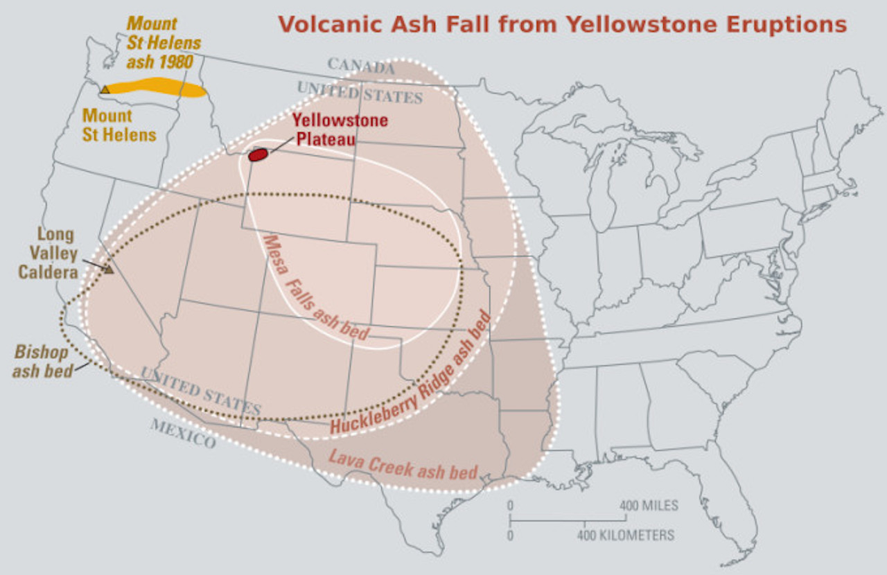
The last eruption created a 56-kilometre-wide, 80-kilometre-long Yellowstone caldera. Pyroclastic flows from the discharge left thick volcanic deposits known as the Lava Creek Tuff, which comprises the north wall of the caldera. Vast volumes of volcanic ash skyrocketed into the atmosphere, and some of it can still be found in places as far from Yellowstone as Iowa, Louisiana and California.

 
Map of the known ash-fall boundaries for major eruptions from Long Valley Caldera, Mount St. Helens and Yellowstone. (USGS)

If another catastrophic eruption from Yellowstone were to happen, the effects would be worldwide, the USGS says. Thick ash deposits would bury extensive areas of the United States, and huge volumes of volcanic gases would be shot into the atmosphere. It would likely affect the global climate and have "enormous effects on human activity, especially agricultural production, for many years."

"Fortunately, the Yellowstone volcanic system shows no signs that it is headed toward such an eruption. The probability of a large caldera-forming eruption within the next few thousand years is exceedingly low," the USGS said.

It added that a more likely scenario to occur is the eruption of a lava flow, which would be "far less" devastating than a large explosive, caldera-forming blast.

VIDEO: SUPERVOLCANO COULD ERUPT CAUSING ASH TO FALL OVER THE ENTIRE GLOBE


Thumbnail courtesy of Videoblocks.

With files from Isabella O'Malley.

Follow Nathan Howes on Twitter.

More than 1,000 earthquakes swarmed Yellowstone Park last month. Is 'the big one' nearing?

The answer is: Probably not.


By Brandon Specktor - Senior Writer 
Norris Geyser Basin at sunset (Image credit: Shutterstock)

The Earth is rumbling beneath Yellowstone National Park again, with swarms of more than 1,000 earthquakes recorded in the region in July 2021, according to a new U.S. Geological Survey (USGS) report. This is the most seismic activity the park has seen in a single month since June 2017, when a swarm of more than 1,100 rattled the area, the report said.

Fortunately, these earthquakes were minor ones, with only four temblors measuring in the magnitude-3 range (strong enough to be felt, but unlikely to cause any damage) — and none of the quakes signal that the supervolcano underneath the park is likely to blow, park seismologists said.

"While above average, this level of seismicity is not unprecedented, and it does not reflect magmatic activity," according to the USGS report. "If magmatic activity were the cause of the quakes, we would expect to see other indicators, like changes in deformation style or thermal/gas emissions, but no such variations were detected."


Related: Rainbow Basin: Photos of Yellowstone's colorful grand prismatic hot spring

Throughout July 2021, the University of Utah Seismograph Stations, which are responsible for monitoring and analyzing quakes in the Yellowstone park region, recorded a total of 1,008 earthquakes in the area. These quakes came in a series of seven swarms, with the most energetic event occurring on July 16. According to the USGS, at least 764 quakes rattled the ground deep below Yellowstone Lake that day, including a magnitude-3.6 earthquake — the single largest of the month.

The month's remaining six swarms were all smaller, including between 12 and 40 earthquakes apiece, all measuring below magnitude 3, the report said.

These quakes are nothing to worry about, the USGS added, noting that the earth-shaking is likely the result of motion on preexisting faults below the park. Fault movements can be stimulated by melting snow, which increases the amount of groundwater seeping under the park and increases pressure levels underground, the researchers said.

Yellowstone is one of the most seismically active regions in the U.S.; the area is typically hit by anywhere from 700 to 3,000 earthquakes a year, most of which are imperceptible to visitors, according to the National Park Service. The biggest quake on record in Yellowstone was the magnitude-7.3 Hebgen Lake quake, in 1959.

Why so shaky? The park sits atop a network of fault lines associated with an enormous volcano buried deep beneath the ground (this volcano last erupted about 70,000 years ago, according to the USGS). Earthquakes occur as the region's fault lines stretch apart, and as magma, water and gas move beneath the surface. These features also feed the park's reliable geysers and steamy hot springs.

The Yellowstone volcano has erupted several times in the past, with gargantuan eruptions occurring every 725,000 years or so. If this schedule is accurate, the park is due for another big eruption in about 100,000 years. Such an eruption would devastate the entire United States, clogging rivers with ash across the continent and causing widespread drought and famine, Live Science previously reported.

RELATED CONTENT

Yellowstone National Park: The early years (photos)

In Photos: Best national parks to visit during winter

Yellowstone's grizzly bear trapping photos

Originally published on Live Science.


Wildfire smoke may lead to less rain in the western US

Wildfire smoke may lead to less rain in the western US
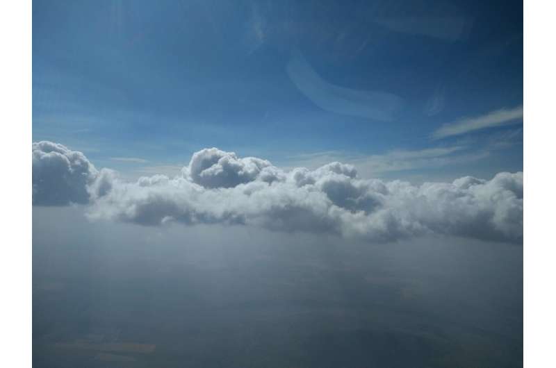
Cumulus clouds mingle with smoke from the August 2018 Cougar Creek fire in Washington state’s Okanogan-Wenatchee National Forest. Credit: Emily V. Fischer

As wildfires and heatwaves stress the western United States, concern over drought is rising: Dry landscapes burn more readily, and rain can help quell fires already raging. But wildfire smoke may keep that essential rain from falling.

A new study finds  in wildfire smoke affect the way  form in , potentially resulting in less  and exacerbating dry conditions that fuel fires.

When wildfires send smoke up into the atmosphere, tiny particles fly up with it. Water droplets can condense on the particles in clouds.

The study's authors expected an increase in the number of  forming in clouds as a result of wildfires, because more particles create more droplets. But the difference between smoky and clean clouds was bigger than expected, with smoky clouds hosting about five times the number of droplets than their clean counterparts. Smoky droplets were also half the size of pristine droplets.

That size difference is what could stop the drops from falling. Because small droplets are less likely to grow and eventually fall out as rain, wildfires in the western U.S. could mean less rain during wildfire season, according to the new study published in the AGU journal Geophysical Research Letters, which publishes high-impact, short-format reports with immediate implications spanning all Earth and space sciences.

"We were surprised at how effective these primarily organic particles were at forming cloud droplets and what large impacts they had on the microphysics of the clouds," said lead author Cynthia Twohy, an atmospheric scientist at NorthWest Research Associates and Scripps Institution of Oceanography. "I started thinking, 'What are the long-term effects of this? We have drought, and we have a lot of wildfires, and they're increasing over time. How do clouds play into this picture?'"

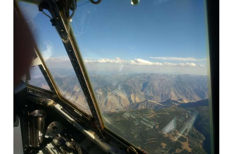
Twohy and a team of atmospheric chemists spent the summer of 2018 in a C-130 Hercules research plane, sampling mid-altitude altocumulus clouds while fires burned across the western U.S. Instruments on board the plane measured gases and particles emitted by wildfires and sampled droplets, whose chemistry Twohy analyzed back in the lab.

The work provides direct new insight into the microphysics and chemistry of wildfire-linked clouds that can help scientists understand potential causes and effects of atmospheric changes during wildfires.

Wildfire smoke may lead to less rain in the western US
A thin layer of cumulus clouds caps dense smoke from the Kiawah-Rabbit Foot fires in
 eastern Idaho during August 2018, as viewed from a C-130 research plane. 
Credit: Emily V. Fischer

Smoky cloud complexities

In clouds that reach high into the atmosphere, adding more particles can invigorate the clouds and cause rain, but the opposite is true for lower-altitude cumulus clouds like those Twohy studied. Previous work, unrelated to the present study, found similar changes in droplet size and concentration related to smoke in the Amazon, supporting the new findings.

"What really excited me about this paper were the connections to the hydrological cycle," said Ann Marie Carlton, an atmospheric chemist at the University of California-Irvine who was not involved in the new study. "They observe differences in cloud droplet size and precipitation, and cloud formation definitely impacts the hydrologic cycle. To have cloud-related findings so robust is sort of unusual, in my experience."

Cloud microphysics are complex, and Twohy notes that there are factors other than droplet size to consider for the overall impact smoky clouds have on regional climate. The new study focused on small cumulus clouds, which blanket about a quarter of the western U.S. in the summer, but other types of clouds, like higher-altitude thunderstorms, could behave differently. In shallower clouds, the more numerous, smaller droplets also can be more reflective, which could have a slight cooling effect at the surface.

With summer rain in the region decreasing, Twohy thinks the drying effects are winning out over factors that could increase rain, like cloud invigoration.

"Over the past couple decades, summer precipitation is down and temperatures are up. The cloud effects are likely an important part of all this. I'm hoping these results will spur detailed regional modeling studies that will help us understand the net impact of smoke on clouds and climate in the region," said Twohy.

If wildfire smoke is making rain less likely, feedback between smoke, dry spells and more wildfires could be more common in the future. Cloud microphysics are complex, so it may be a matter of time before these relationships are clear. Regardless, in connecting  smoke to cloud changes and tentatively, precipitation, Twohy's new research pushes atmospheric physics and chemistry to catch up with climate change.

"As humans have perturbed the composition of the atmosphere, there are all these feedbacks and interactions that we don't even know about," said Carlton. "This experiment we're doing on planet Earth is altering clouds and the hydrologic cycle, at least regionally. I think this paper is scratching the surface of what we don't know."

Seeding ice clouds with wildfire emissions

More information: Cynthia H. Twohy et al, Biomass Burning Smoke and Its Influence on Clouds Over the Western U. S., Geophysical Research Letters (2021). DOI: 10.1029/2021GL094224

Journal information: Geophysical Research Letters 

Provided by American Geophysical Union