Sunday, July 26, 2020

Rewriting History: New Evidence Challenges Euro-Centric Narrative of Early Colonisation

In American history, we learn that the arrival of Spanish explorers led by Hernando de Soto in the 1500s was a watershed moment resulting in the collapse of Indigenous tribes and traditions across the southeastern United States.

While these expeditions unquestionably resulted in the deaths of countless Indigenous people and the relocation of remaining tribes, new research from Washington University in St. Louis provides evidence that Indigenous people in Oconee Valley — present-day central Georgia — continued to live and actively resist European influence for nearly 150 years.
The findings, published July 15 in American Antiquity, speak to the resistance and resilience of Indigenous people in the face of European insurgence, said Jacob Lulewicz, a lecturer in archaeology in Arts & Sciences and lead author.

“The case study presented in our paper reframes the historical contexts of early colonial encounters in the Oconee Valley by way of highlighting the longevity and endurance of Indigenous Mississippian traditions and rewriting narratives of interactions between Spanish colonizers and Native Americans,” Lulewicz said.
It also draws into question the motives behind early explanations and interpretations that Euro-Americans proposed about Indigenous earthen mounds — platforms built out of soil, clay and stone that were used for important ceremonies and rituals.
‘Myths were purposively racist’

“By the mid-1700s, less than 100 years after the abandonment of the Dyar mound [now submerged under Lake Oconee], explanations for the non-Indigenous origins of earthen mounds were being espoused. As less than 100 years would have passed between the Indigenous use of mounds and these explanations, it could be argued that the motives for these myths were purposively racist, denying what would have been a recent collective memory of Indigenous use in favor of explanations that stole, and disenfranchised, these histories from contemporary Indigenous peoples,” Lulewicz said.
The Dyar mound was excavated by University of Georgia archaeologists in the 1970s to make way for a dam. Lulewicz and co-authors — Victor D. Thompson, professor of archaeology and director of the Laboratory of Archaeology at the University of Georgia; James Wettstaed, archaeologist at Chattahoochee-Oconee National Forests; and Mark Williams, director emeritus of the Laboratory of Archaeology at the University of Georgia — received funding from the USDA Forest Service to re-date the platform mound, which contained classic markers of Indigenous rituals and ceremonies.
Using advanced radiocarbon dating techniques and complex statistical models, modern-day archaeologists are able to effectively construct high-resolution, high-precision chronologies. In many cases, they can determine, within a 10- to 20-year range, dates of things that happened as far back as 1,000 years ago.
“Radiocarbon dating is really important, not just for getting a date to see when things happened, but for understanding the tempo of how things changed throughout time and really understanding the complex histories of people over hundreds of years,” Lulewicz said. “In archaeology, it’s really easy to group things in long periods of time, but it would be false to say that nothing changed over those 500 years.”
Their research yielded 20 new dates from up and down the mound, which provided a refined perspective on the effects that early Indigenous-colonizer encounters did, and did not, have on the Indigenous people and their traditions.
Missing from the mound was any sign of European artifacts, which is one of the reasons why archaeologists originally believed sites in the region were abruptly abandoned just after their first encounters with Spanish colonizers. “Not only did the ancestors of Muscogee (Creek) people continue their traditions atop the Dyar mound for nearly 150 years after these encounters, but they also actively rejected European things,” Lulewicz said.
According to Lulewicz, the Dyar mound does not represent an isolated hold-over after contact with European colonizers. There are several examples of platform mounds that were used beyond the 16th century, including the Fatherland site associated with the Natchez in Louisiana, Cofitachequi in South Carolina and a range of towns throughout the Lower Mississippi Valley.
“However, the mound at Dyar represents one of the only confirmed examples, via absolute dating, of continued Mississippian traditions related to mound-use and construction to date.”
Today, members of the Muscogee (Creek) Nation, descendants of the Mississippians who built platform mounds like the one at Dyar, live in Oklahoma. “We have a great, collaborative relationship with archaeologists of the Muscogee (Creek) Nation Historic and Cultural Preservation Department, so we sent them the paper to review. It was really well received. They saw, reflected in that paper, a lot of the traditions they still practice in Oklahoma and were generous enough to contribute commentary that bolstered the results presented in the paper,” he said.
“This is where the archaeology that we write becomes so important in the present. … Without this type of work, we are contributing to the disenfranchisement of Indigenous peoples from their history.”
“Of course, they already knew many of the things we ‘discovered,’ but it was still meaningful to be able to reaffirm their ancestral link to the land.”
In the end, Lulewicz said this is the most important part of the paper. “We are writing about real human lives — Indigenous lives that we have historically treated very poorly and who continue to be treated poorly today in some cases. With the use of advanced radiocarbon dating and the development of really high resolution chronologies, we are able to more effectively reinject lives into narratives of the past.”


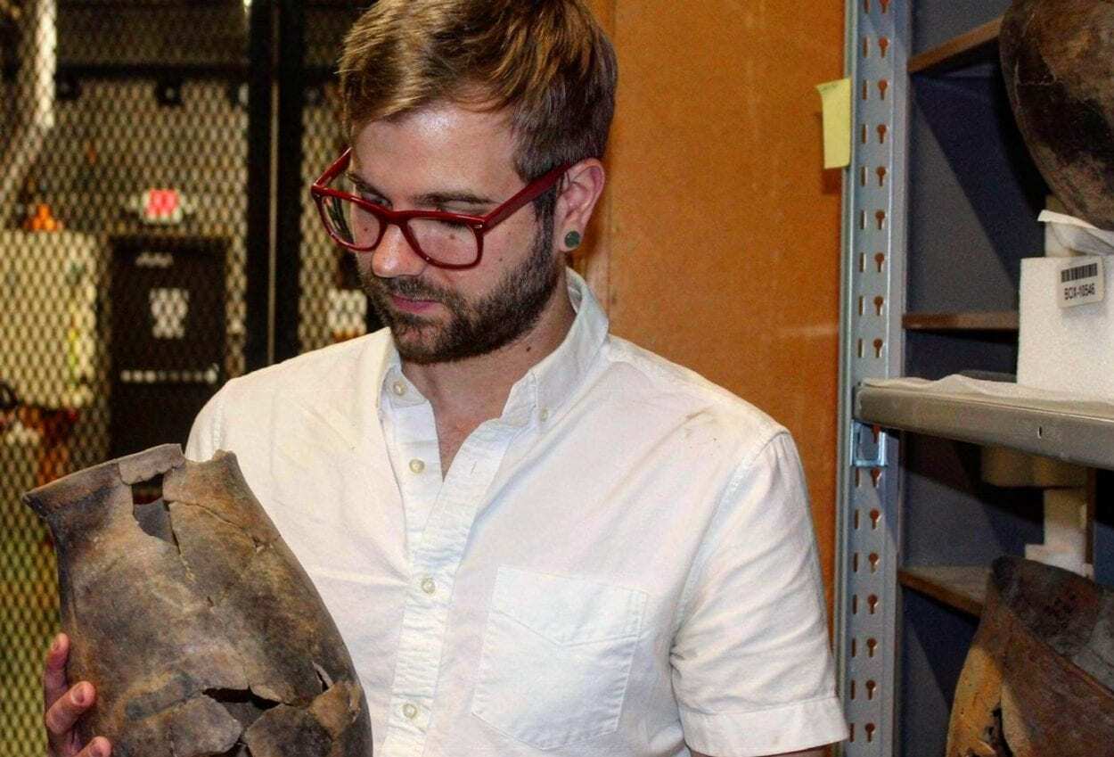
Header Image – Jacob Lulewicz, lecturer in archaeology at Washington University in St. Louis, studies southeastern/midwestern ethnohistory and archaeology including Indigenous-colonizer dynamics; social networks and sociopolitics. Image Credit : WUSTL
Archaeologists Discover the Lost Dragon City, Capital of Xiongnu Empire


Archaeologists conducting excavations in central Mongolia along the Orkhon River believe they have discovered the “Dragon City” of Luut/Luncheng, the Xiongnu/Khunnu capital.

The Xiongnu were a tribal confederation that inhabited the eastern Eurasian Steppe from the 3rd century BC to the late 1st century AD. The ruler of the Xiongnu was called the Chanyu, who exercised direct authority over the central territory from Luncheng. Their relations with adjacent Chinese dynasties to the south-east were complex, with repeated periods of conflict and intrigue, alternating with exchanges of tribute, trade, and marriage treaties.

Excavations financed by the Ulaanbaatar State University in the Ulziit district of Arkhangai province first made the discovery in 2017, but details of the findings have only now been published in local media.
Image Credit : Iderkhangai Tumur-Ochir

Iderkhangai Tumur-Ochir, leader of the archaeological research team from Ulaanbaatar State University said: “The city is believed to have originated in the Khangai Mountains of Mongolia, according to ancient sources.”

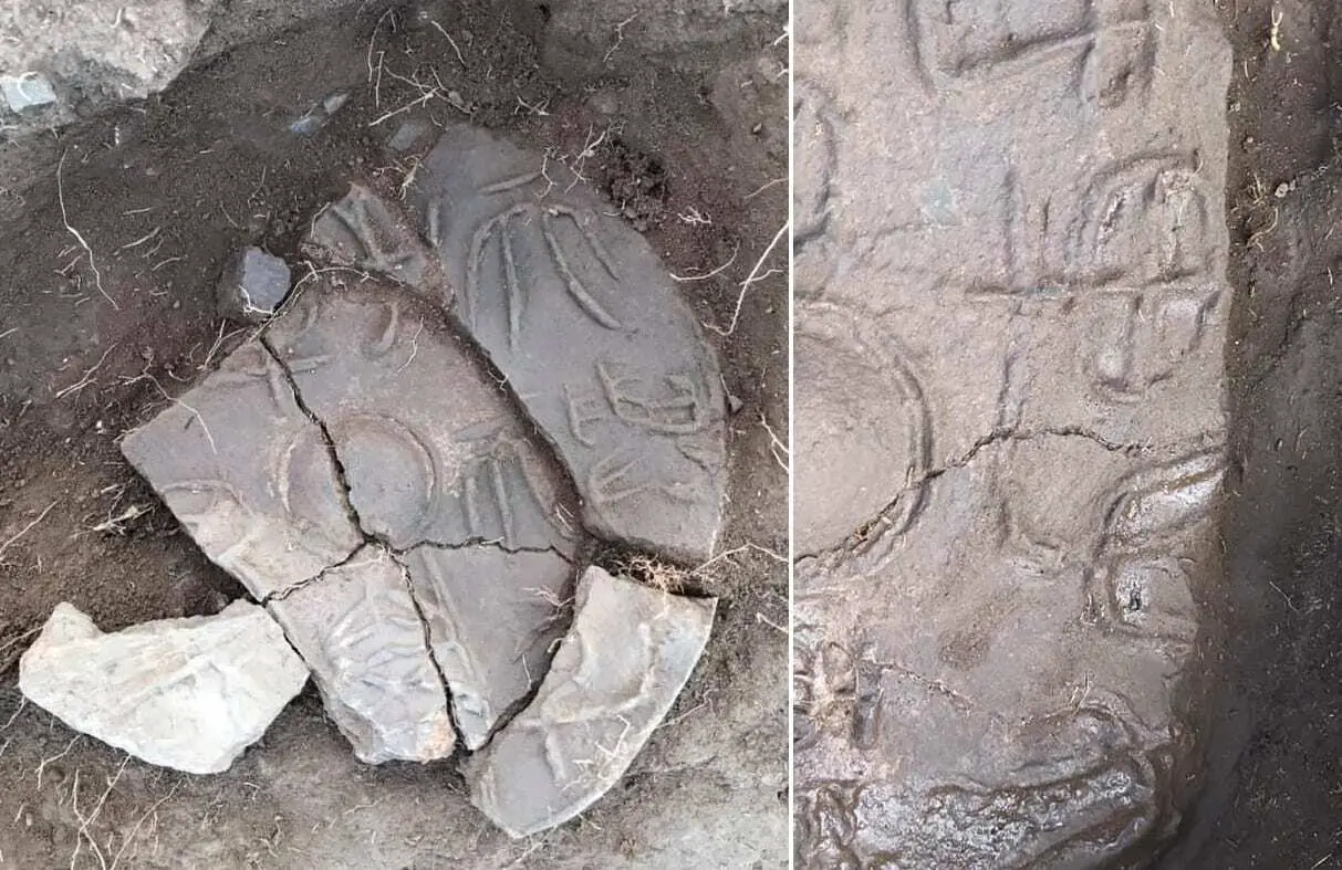
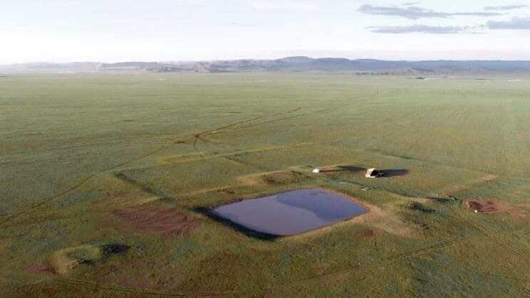
The researchers revealed that the city has a double wall and a man-made pool used for water management or a reservoir. Excavations found the remains of a structure that was decorated with an ancient kanji inscription stating, “Son of Heaven” which is the first evidence found within the region to suggest the site is the Dragon City of Luncheng.

Iderkhangai told Xinhua “”As a result of more than a decade of research on the political centre of the Xiongnu Empire, I am very happy that we have discovered and excavated the empire’s capital Dragon City or Luncheng City”

Header Image Credit : Iderkhangai Tumur-Ochir
Climate Scientists Increasingly Ignore Ecological Role of Indigenous People


In their zeal to promote the importance of climate change as an ecological driver, climate scientists increasingly are ignoring the profound role that indigenous peoples played in fire and vegetation dynamics, not only in the eastern United States but worldwide, according to a Penn State researcher.

“In many locations, evidence shows that indigenous peoples actively managed vast areas and were skilled stewards of the land,” said Marc Abrams, professor of forest ecology and physiology. “The historical record is clear, showing that for thousands of years indigenous peoples set frequent fires to manage forests to produce more food for themselves and the wildlife that they hunted, and practiced extensive agriculture.”

Responding to an article published earlier this year in a top scientific journal that claimed fires set by Native Americans were rare in southern New England and Long Island, New York, and played minor ecological roles, Abrams said there is significant evidence to the contrary.


In an article published today (July 20) in Nature Sustainability, Abrams, who has been studying the historical use of fire in eastern U.S. forests for nearly four decades, refutes those contentions.

“The palaeoecological view — based on a science of analyzing pollen and charcoal in lake sediments — that has arisen over the last few decades, contending that anthropogenic fires were rare and mostly climate-driven, contradicts the proud legacy and heritage of land use by indigenous peoples, worldwide,” he said.

In his article, Abrams, the Nancy and John Steimer Professor of Agricultural Sciences in the College of Agricultural Sciences, argues that the authors of the previous paper assumed that the scarcity of charcoal indicated that there had not been burning. But frequent, low-intensity fires do not create the amount of charcoal that intense, crown-level, forest-consuming wildfires do, he pointed out.


Subscribe to more articles like this by following our Google Discovery feed - Click the follow button on your desktop or the star button on mobile. Subscribe

“Surface fires set by indigenous people in oak and pine forests, which dominate southern New England, often produced insufficient charcoal to be noticed in the sediment,” said Abrams. “The authors of the earlier article did not consider charcoal types, which distinguish between crown and surface fires, and charcoal size — macro versus micro — to differentiate local versus regional fires.”

Also, lightning in New England could not account for the ignition of so many fires, Abrams argues. In southern New England, lightning-strike density is low and normally is associated with rain events.

“The region lacks dry lightning needed to sustain large fires,” he said. “Moreover, lightning storms largely are restricted to the summer when humidity is high and vegetation flammability is low, making them an unlikely ignition source.”

Early explorers and colonists of southern New England routinely described open, park-like forests and witnessed, firsthand, Native American vegetation management, Abrams writes in his article, adding that oral history and numerous anthropological studies indicate long-term burning and land-use for thousands of years by indigenous people.

Burning near Native American villages and along their extensive trail systems constitutes large land areas, and fires would have kept burning as long as fuel, weather and terrain allowed, he explained. Following European settlement, these open oak and pine woodlands increasingly became closed by trees that previously were held in check by frequent fire.

The authors of the previous paper also argued that fire should not be used as a present-day management tool, a view that Abrams does not support.

The role of anthropogenic fires is front and center in the long-running climate-disturbance debate, according to Abrams, who notes that fires increased with the rise of human populations. The world would be a very different place without those fires, he contends.

“Surprisingly, the importance of indigenous peoples burning in vegetation-fire dynamics is increasingly downplayed among paleoecologists,” he writes. “This applies to locations where lightning-caused fires are rare.”

Abrams points out that he is not denying the importance of climate in vegetation and fire dynamics or its role in enhancing the extent of human fires. “However,” he writes, “in oak-pine forests of southern New England, Native American populations were high enough, lighting-caused fires rare enough, vegetation flammable enough and the benefits of burning and agriculture great enough for us to have confidence in the importance of historic human land management.”

PENN STATE

Header Image Credit : Public Domain
Google Launches Hieroglyphic Translator
Google has launched a new translator for Ancient Egyptian hieroglyphics based on machine learning.

The translator is part of Google’s arts & culture application “Fabricius” that has been in development through the Ubisoft Hieroglyphics Initiative first launched at the British Museum in 2017.

In collaboration with Google, the Australian Center for Egyptology, at Macquarie University, Psycle Interactive, Ubisoft, and Egyptologists from around the world, the project was created to determine the possibility of using machine learning to process and collate the language of the Ancient Egyptians.
Image Credit : Google

Hieroglyphics was the formal writing system of Ancient Egypt, with the first decipherable sentence dating to the Second Dynasty (28th century BC). Hieroglyphics combine logographic, syllabic, and alphabetic elements with over 1,000 distinct characters.

With the final closing of pagan temples across Egypt in the 5th century, knowledge of hieroglyphic writing was lost until their decipherment in the 1820s by Jean-François Champollion, with the help of the Rosetta Stone.

Fabricius allows users to upload images of hieroglyphs, which the software then tries to match with symbols in a database and analyse historical records and definitions to decipher the different meanings.

Dr Alex Woods, from the Australian Centre for Egyptology told the BBC: “Digitising textual material that was up until now only in handwritten books will completely revolutionise how Egyptologists do business. Digitised and annotated texts could potentially help us to reconstruct broken texts on the walls and even to discover texts we didn’t know were there.”

Fabricius Application

Header Image Credit : Public Domain
Breakthrough in Studying Ancient DNA From Doggerland That Separates The UK From Europe


Thousands of years ago the UK was physically joined to the rest of Europe through an area known as Doggerland. However, a marine inundation took place during the mid-holocene, separating the British landmass from the rest of Europe, which is now covered by the North Sea.

Scientists from the School of Life Sciences at the University of Warwick have studied sedimentary ancient DNA (sedaDNA) from sediment deposits in the southern North Sea, an area which has not previously been linked to a tsunami that occurred 8150 years ago.

The paper, led by the University of Bradford and involving Universities of Warwick, Wales St. Trinity David, St. Andrews, Cork, Aberystwyth, Tartu as well as the Smithsonian and Natural History Museum, ‘Multi-Proxy Characterisation of the Storegga Tsunami and Its Impact on the Early Holocene Landscapes of the Southern North Sea’, published in the Journal Geosciences, sees Life Scientists from the University of Warwick work specifically on the sedimentary ancient DNA from Doggerland.


A number of innovative breakthroughs were achieved by the University of Warwick scientists in terms of analysing the sedaDNA. One of these was the concept of biogenomic mass, where for the first time they were able to see the how the biomass changes with events, evidence of this presented in the paper refers to the large woody mass of trees from the tsunami found in the DNA of the ancient sediment.

New ways of authenticating the sedaDNA were also developed, as current methods of authentication do not apply to sedaDNA which has been damaged whilst under the sea for thousands of years because there is too little information for each individual species. Researchers therefore came up with a new way, metagenomic assessment methodology, whereby the characteristic damage found at the ends of ancient DNA molecules is collectively analysed across all species rather than one.

Alongside this a key part of analysing the sedaDNA is to determine whether or not it was deposited in situ or has moved over time. This led researchers to develop statistical methods to establish which scenario was appropriate, using stratigraphic integrity they were able to determine that the sedaDNA in the sediment deposits had not moved a massive amount since deposition by assessing the biomolecules vertical movement in the core column of the sedaDNA.


Subscribe to more articles like this by following our Google Discovery feed - Click the follow button on your desktop or the star button on mobile. Subscribe

Identifying which organisms the ancient fragmented molecules of DNA came from is also challenging because often there is nothing to directly compare. In a fourth innovation the researchers refined algorithms to define these regions of “dark phylogenetic space” from where organisms must have originated overcome this issue.

Professor Robin Allaby from the School of Life Sciences at the University of Warwick comments: “This study represents an exciting milestone for sedimentary ancient DNA studies establishing a number of breakthrough methods to reconstruct an 8,150 year old environmental catastrophe in the lands that existed before the North Sea flooded them away into history.”

Professor Vince Gaffney from the School of Archaeological and Forensic Sciences at the University of Bradford said: “Exploring Doggerland, the lost landscape underneath the North Sea, is one of the last great archaeological challenges in Europe. This work demonstrates that an interdisciplinary team of archaeologists and scientists can bring this landscape back to life and even throw new light on one of prehistory’s great natural disasters, the Storegga Tsunami.

“The events leading up to the Storegga tsunami have many similarities to those of today. Climate is changing and this impacts on many aspects of society, especially in coastal locations.”

UNIVERSITY OF WARWICK

Header Image Credit : Daleyhl

Ancient Ancestors of Domestic Cat was Opportunistic


An international study by researchers from the Senckenberg Center for Human Evolution and Palaeoenvironment at the University of Tübingen has determined that the first known cats in Europe were opportunistic and did not rely directly on humans for survival.

The study reveals that around 6,200 to 4,300 years ago cats survived by hunting wild animals such as rodents and were closely associated with human agriculture.

The African wildcat (Felis silvestris lybica) is the ancestor of all present-day domestic cats. The sandy-colored animals originated on the African continent. “Around 6,000 years ago, the animals also became established in Europe, where they spread as domesticated cats,” explains Prof. Dr. Hervé Bocherens of the Senckenberg Center for Human Evolution and Palaeoenvironment at the University of Tübingen, and he continues, “The oldest fossils date back about 6,200 years and were discovered in Poland. We asked ourselves how these animals were domesticated after they spread into Europe.”


To answer these questions, Bocherens, together with the study’s lead author, Magdalena Krajcarz of the Nikolaus Kopernikus University in Toruń, Poland, and an international team, measured stable isotopes in the fossilized cats’ bone collagen.

The different isotope ratios allow scientists to make inferences about the animals’ diet. “We examined a total of six cat fossils from discovery sites in Poland. For comparison purposes, we also measured fossils of the oldest known domestic cats from Poland as well as 34 additional animals that occurred alongside the cats in Europe around 6,000 years ago,” explains the scientist from Tübingen.

The study aims to also reconstruct the historical connections between humans and cats by studying the ecology and sociology of the immigrated African wildcats.
The study’s results show that the newly arrived ancestors of the domestic cat did not entirely rely on humans. Bocherens explains, “The bones in the cat fossils contain evidence of rodents that occurred in close association with human agriculture, along with signs of wild prey animals.” These analysis results indicate that the ancestors of modern domestic cats continued to live in the wild and only obtained part of their diet near human habitations. “This means that the animals were not synanthropic, i.e., entirely adapted to humans and their environment, but – contrary to the dogs of that period – led an ‘opportunistic’ lifestyle.
When they were unable to find food in the wild, which they had to share with the native European wildcats, they were not averse to foraging in the vicinity of human dwellings,” says Bocherens in summary, and he adds, “The native European wildcats also fed on these rodents, so there really was a direct competition for food between the two forms. However, due to the ample food supply, this apparently did not lead to the displacement of either one of these felines.”
How Governments Resist World Heritage ‘in Danger’ Listings
A study published today found national governments repeatedly resisted the placement of 41 UNESCO World Heritage sites-including the Great Barrier Reef-on the World Heritage in Danger list.

This resistance is despite the sites being just as threatened, or more threatened, than those already on the in Danger list.

The study was co-authored by a team of scientists from Australia, the UK and the US.

World Heritage sites represent both natural and cultural heritage for global humanity. Their protection sits within the jurisdiction of individual countries. An in Danger listing is intended to raise awareness of threats to these sites and encourage investment in mitigation measures, such as extra protection.

Lead author Professor Tiffany Morrison from the ARC Centre of Excellence for Coral Reef Studies at James Cook University (Coral CoE at JCU) says national governments responsible for these World Heritage sites use political strategies of rhetoric and resistance to avoid a World Heritage in Danger listing.

“Avoiding an in Danger listing happens through partial compliance and by exerting diplomatic pressure on countries that are members of the World Heritage Committee,” Prof Morrison said.

She says World Heritage in Danger listings are increasingly politicised. However, until now, little was known about what that politicisation entailed, and what to do about it.

The study found the net number of in Danger listings plateaued since the year 2000. At the same time, low visibility political strategies–such as industrial lobbying and political trade-offs associated with the listings–intensified.

“Our results also challenge the assumption that poor governance only happens in less technologically advanced economies. Rich countries often have poor governance too,” Prof Morrison said.

“We show that the influence of powerful industries in blocking environmental governance is prevalent in many regions and systems.”

The Great Barrier Reef, under the custodianship of the Australian Government, is just one of the threatened sites that continues to evade the World Heritage in Danger list.

Professor Terry Hughes, also from Coral CoE at JCU, says there is no doubt that coral reefs are in danger from man-made climate change.

“The study makes no recommendation on which World Heritage sites should be formally recognised as in Danger but points out that virtually all sites are increasingly impacted by anthropogenic climate change,” Prof Hughes said.

“The Great Barrier Reef was severely impacted by three coral bleaching events in the past five years, triggered by record-breaking temperatures,” he said.

World Heritage in Danger listings are frowned upon by high-value natural resource industries such as mining, forestry and environmental tourism. Prof Morrison says the in Danger listings restrict the social license of fossil fuel industries to operate.

“Industry coalitions therefore often lobby governments, UNESCO and World Heritage Committee member countries,” she said.

“They claim an in Danger listing diminishes their nation’s international reputation and restricts foreign investment, national productivity, and local employment. Some also challenge the World Heritage system itself and undermine reports by scientists, non-governmental organisations and the media.”

These lobbying efforts heighten a government’s sense of political threat by linking the listings to national economic performance, as well as to the individual reputations of politicians and senior bureaucrats.

“At the same time, UNESCO is acutely aware of these dynamics and concerned about threats to its own reputation,” Prof Morrison said.

“Politicians and bureaucrats often work to conceal these dynamics, resulting in poor governance and continued environmental degradation.”

Prof Morrison says revealing and analysing these dynamics is a step closer to moderating them.

The study provides new evidence for how interactions, from 1972 until 2019, between UNESCO and 102 national governments, have shaped the environmental governance and outcomes for 238 World Heritage ecosystems. It also provides examples of how concerned stakeholders can, and are, experimenting with countervailing strategies that harness these politics.

“Given the global investment in environmental governance over the past 50 years, it is essential to address the hidden threats to good governance and to safeguard all ecosystems,” the study concludes.

ARC CENTRE OF EXCELLENCE FOR CORAL REEF STUDIES

Header Image Credit : Public Domain

Amud 9 is Shown to be a Neanderthal Woman Weighing 60 kg Who Lived in the Late Pleistocene


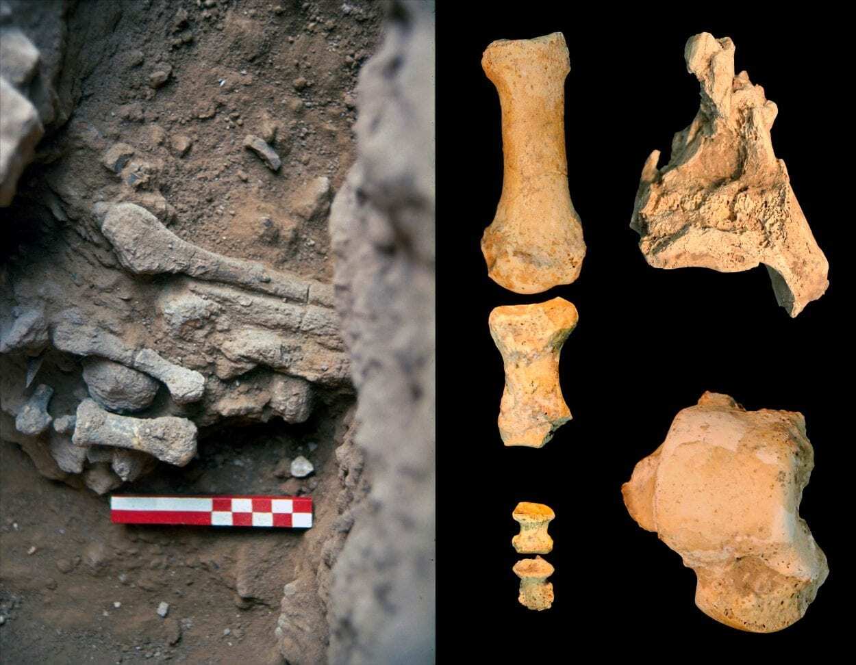
Adrián Pablos, a scientist at the Centro Nacional de Investigación sobre la Evolución Humana (CENIEH), co-leads a paper looking at the morphology and anatomy of a partial foot recovered over 25 years ago at Amud Cave (Israel), which confirms that the individual Amud 9 was a Neandertal woman from the Late Pleistocene, with a stature of some 160-166 cm***  and weight of 60 kg.

Over the course of several excavations conducted in the twentieth century at Amud Cave, remains of at least 15 Neandertals were found. A systematic and detailed study of one of these individuals, Amud 9, has found that the fossil possesses the traits usually associated with Neanderthals in the different elements of the foot, tarsals, metatarsals and phalanges, which differ from those of modern humans, both fossil and recent.

“Most of these traits are related to the typical, exceptional robustness of the postcranial skeleton, that is, from the neck down, observed in the majority of Neandertals”, explains Pablos.


Sex, weight and height

Sex, weight and height estimates in fossil populations are normally based on the dimensions of the large leg bones. However, in the case of Amud 9, only a fragment of tibia, the talus or ankle bone, one metatarsal or instep bone, and several phalanges are conserved.

As no long leg bones have been found, the researchers applied different mathematical estimates based upon the foot bones, thus obtaining an approximation to important paleobiological parameters.


“Knowing parameters such as the body size and sex of this individual helps us learn a bit more about what the Neandertals were like”, he says.


Subscribe to more articles like this by following our Google Discovery feed - Click the follow button on your desktop or the star button on mobile. Subscribe

The participants in this paper, entitled A partial Neandertal foot from the Late Middle Paleolithic of Amud Cave, Israel, are researchers from Spain (the CENIEH), the United States (University of New Mexico and Arizona State University), and Israel (Tel Aviv University and The Hebrew University of Jerusalem).

CENIEH
Header Image Credit : Osborjn M. Pearson y Adrián Pablos


*** FIVE FOOT TWO, EYES OF BLUE

https://www.calculateme.com/height/convert-cm-to-feet-inches/160-cm 


Five Foot Two, Eyes of Blue" (Art Landry, 1925)

HAS GREAT FOOTNOTES ON THE SONG AND PERFORMERS

Ancient Greek Sanctuaries & Temples Had Disabled Access Thousands of Years Age


A new study by archaeologists suggests that many temples and sanctuaries of the ancient Greeks incorporated ramps that gave mobility-impaired visitors disabled access thousands of years ago.

The study was conducted by Dr Debby Sneed, from the California State University, Long Beach who made the discovery whilst analysing the distribution of ramps in ancient Greece.
Many religious sites have incorporated ramps, but research by scholars have mostly overlooked the ramps in articles and textbooks in their studies of ancient Greek architecture and analysis of the monuments.

Dr Sneed said: “Archaeologists have known about ramps on ancient Greek temples, but have routinely ignored them in their discussions of Greek architecture. More than 2,000 years ago, ancient Greeks spent time and money building ramps to aid individuals who could not easily ascend or descend stairs, and all without targeted legislation requiring them to do so”


Dr Sneed found that these ramps were particularly common at healing sanctuaries, where large numbers of visitors suffering from various illness and mobility impairments came in search of help from the healing god Asclepius.

Image Credit : Antiquity

One of the most important healing sanctuaries, the Sanctuary of Asclepius at Epidauros had 11 stone ramps installed on nine structures within the sanctuary complex that was incorporated around 370 BC.

At a sanctuary of Asclepius in Corinth, a large number of dedications to the god represent legs and feet, suggesting that people requested healing in these limbs.

“The likeliest reason why ancient Greek architects constructed ramps was to make sites accessible to mobility-impaired visitors,” concluded Dr Sneed. This research, published in the journal Antiquity, would make these ramps the earliest known evidence of ancient societies adapting their architecture to meet the needs of disabled community members.


Antiquity
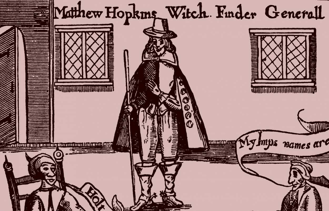
Matthew Hopkins – The Real Witch-Hunter


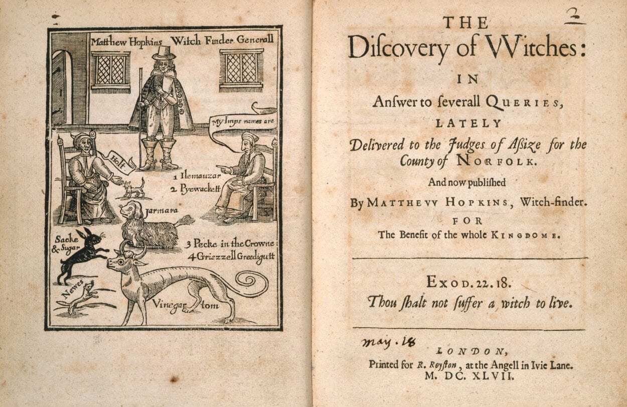
Matthew Hopkins was an infamous witch-hunter during the 17th century, who published “The Discovery of Witches” in 1647, and whose witch-hunting methods were applied during the notorious Salem Witch Trials in colonial Massachusetts.

From the 16th century, England was in the grips of hysteria over witchcraft, caused in part by King James VI, who was obsessed with the dark arts and wrote a dissertation entitled “Daemonologie” in 1599.

James had been influenced by his personal involvement in the North Berwick witch trials from 1590, and amassed various texts on magical studies that he published into three books to describe the topics of magic, sorcery, and witchcraft, and tried to justify the persecution and punishment of a person accused of being a witch under the rule of canonical law.


The published works assisted in the creation of the witchcraft reform, that led to the English Puritan and writer – Richard Bernard to write a manual on witch-hunting in 1629 called “A Guide to Grand-Jury Men”. Historians suggest that both the “Daemonologie” and “A Guide to Grand-Jury Men” was an influence that Matthew Hopkins would draw inspiration from and have a significant impact in the direction his life would take many years later.

Matthew Hopkins was born in Great Wenham, located in Suffolk, England, and was the fourth son of James Hopkins, a Puritan vicar of St John’s of Great Wenham. After his father’s death, Hopkins moved to Manningtree in Essex and used his inheritance to present himself as a gentleman to the local aristocracy.


Hopkins’ witch-finding career began in March 1644, when an associate, John Sterne alleged that a group of women in Manningtree were conducting acts of sorcery and were trying to kill him with witchcraft. Hopkins conducted a physical investigation of the women, looking for deformities and a blemish called the “Devil’s Mark” which would lead to 23 women (sources differ in the number) being accused of witchcraft and were tried in 1645. The trial was presided over by the justices of the peace (a judicial officer of a lower or puisne court), resulting in nineteen women being convicted and hanged, and four women dying in prison.

After their success in the trail, Hopkins and Stearne travelled throughout East Anglia and nearby counties with an entourage of female assistants, falsely claiming to hold the office of Witchfinder General and also claimed to be part of an official commission by Parliament to uncover witches residing in the populous by using a practice called “pricking”. Pricking was the process of pricking a suspected witch with a needle, pin or bodkin. The practice derived from the belief that all witches and sorcerers bore a witch’s mark that would not feel pain or bleed when pricked.

Although torture was considered unlawful under English law, Hopkins would also use techniques such as sleep deprivation to confuse a victim into confessing, cutting the arm of the accused with a blunt knife (if the victim didn’t bleed then they’d be declared a witch) and tying victims to a chair who would be submerged in water (if a victim floated, then they’d be considered a witch).

This proved to be a lucrative opportunity in terms of monetary gain, as Hopkins and his company were paid for their investigations, although Hopkins states in his book “The Discovery of Witches” that “his fees were to maintain his company with three horses”, and that he took “twenty shillings a town”. Historical records from Stowmarket shows that Hopkins actually charged the town £23, taking into account inflation would be around £3800 today.

Between the years of 1644 and 1646, Hopkins and his company are believed to be responsible for the execution of around 300 supposed witches and sent to the gallows more accused people than all the other witch-hunters in England of the previous 160 years.

By 1647, Hopkins and Stearne were questioned by justices of the assizes (the precursor to the English Crown Court) into their activities, but by the time the court resumed both Hopkins and Stearne retired from witch-hunting.

That same year, Hopkins published his book, “The Discovery of Witches” which was used as a manual for the trial and conviction of Margaret Jones in the Massachusetts Bay Colony on the east coast of America. Some of Hopkins’ methods were also employed during the Salem Witch Trials, in Salem, Massachusetts in 1692–93, resulting in hundreds of inhabitants being accused and 19 people executed.

Matthew Hopkins died at his home in Manningtree on the 12th August 1647 of pleural tuberculosis and was buried in the graveyard of the Church of St Mary at Mistley Heath. Within a year of the death of Hopkins, Stearne retired to his farm and wrote his own manual “A Confirmation and Discovery of Witchcraft” hoping to further profit from the infamous career path both men had undertaken that caused the death of hundreds of innocent souls.