In Pictures: Indonesia’s Merapi volcano unleashes river of lava
Mount Merapi’s new eruption has set off its longest lava flow since the volcano’s danger level was raised in November.


Mount Merapi’s new eruption has set off its longest lava flow since the volcano’s danger level was raised in November.

Mount Merapi is Indonesia's most active volcano [Agung Supriyanto/AFP]
27 Jan 2021
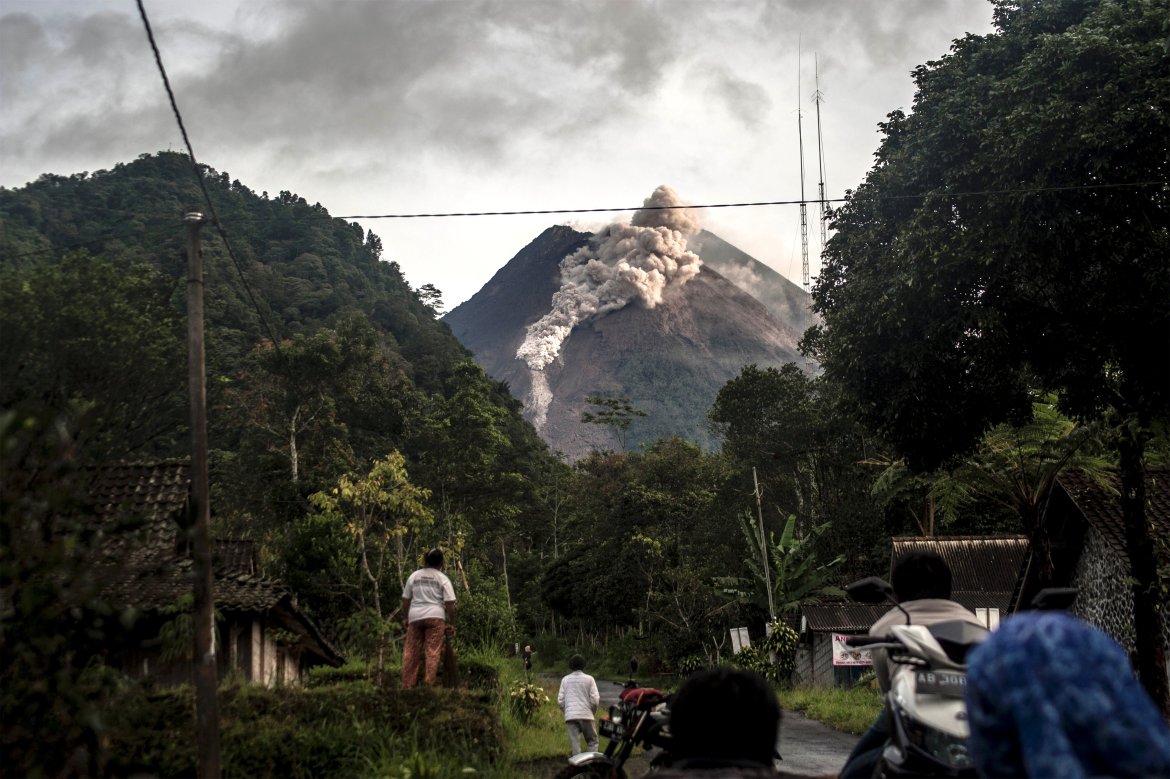
The Mount Merapi volcano on Indonesia’s Java island has spewed searing ash and other volcanic debris that poured down its slopes on Wednesday, the country’s geological agency said.
Pyroclastic flows – a fast-moving mixture of extremely hot rock fragments, gas, and ash – blasted from the volcano for four hours in the early morning, according to the Research and Development Center for Geological Disaster Technology, which monitors the volcano.
There were no reports of casualties and the alert level remained at the second-highest level, it said.
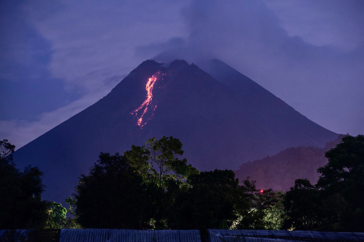
This was Mount Merapi’s biggest lava flow since authorities raised its danger level in November, said Hanik Humaida, head of Yogyakarta’s Volcanology and Geological Hazard Mitigation Center.
Authorities in November had evacuated nearly 2,000 people living on the mountain in Magelang and Sleman districts on Java Island but most have since returned. There has been no new evacuation.
The alert was being maintained at the second-highest level and authorities told people to stay out of the existing 5-kilometre (3-mile) danger zone around the crater as the local administrations in Central Java and Yogyakarta provinces closely monitor the situation.
The 2,968-meter (9,737-foot) volcano is on the densely populated island of Java and near the ancient city of Yogyakarta. It is the most active of dozens of Indonesian volcanoes and has repeatedly erupted with lava and gas clouds recently.
Merapi’s last major eruption in 2010 killed 347 people.
Indonesia, an archipelago of 270 million people, is prone to earthquakes and volcanic activity because it sits along the Pacific “Ring of Fire,” a horseshoe-shaped series of seismic fault lines around the ocean.

People look up at Mount Merapi, Indonesia's most active volcano, as it spews rocks and ash. [Agung Supriyanto/AFP]

This was Mount Merapi’s biggest lava flow since authorities raised its danger level in November. [Agung Supriyanto/AFP]

A volunteer monitors Mount Merapi during the new eruption. [Slamet Riyadi/AP Photo]

A man sprays insecticide on his crops as Mount Merapi is seen erupting in the background. There has been no new evacuation since authorities evacuated nearly 2,000 people in November, most of whom have since returned. [Slamet Riyadi/AP Photo]

Hot lava runs down from the crater of Mount Merapi, behind a mosque in Sleman. [Slamet Riyadi/AP Photo]

The 2,968-meter (9,737-foot) volcano is on the densely populated island of Java and near the ancient city of Yogyakarta. [Agung Supriyanto/AFP]


It is the most active of dozens of Indonesian volcanoes and has repeatedly erupted with lava and gas clouds recently. [Agung Supriyanto/AFP]
Indonesia: Hundreds evacuated as Mount Merapi spews hot clouds
Authorities evacuate residents from the fertile slopes of the mountain as it belches hot gas and debris.

7 Jan 2021
Indonesia’s Mount Merapi volcano spewed avalanches of hot clouds on Thursday morning as hundreds of residents were evacuated from its fertile slopes.
Lighter eruptions continued during the day, with a column of hot clouds rising 200 metres (656 feet) above the crater.
The initial eruption of pyroclastic clouds was obscured by fog over the mountain. The amplitude record and seismic recording data from Geological Disaster Technology Research and Development Center estimated the hot clouds spread less than 1km (0.6 miles) from the crater.

SOURCE : AP
KEEP READING
Authorities evacuate residents from the fertile slopes of the mountain as it belches hot gas and debris.

The geological authority had raised the alert level of Mount Merapi to the second-highest level in November after sensors picked up increasing activity [Taufiq Rozzaq/AP Photo]
7 Jan 2021
Indonesia’s Mount Merapi volcano spewed avalanches of hot clouds on Thursday morning as hundreds of residents were evacuated from its fertile slopes.
Lighter eruptions continued during the day, with a column of hot clouds rising 200 metres (656 feet) above the crater.
The initial eruption of pyroclastic clouds was obscured by fog over the mountain. The amplitude record and seismic recording data from Geological Disaster Technology Research and Development Center estimated the hot clouds spread less than 1km (0.6 miles) from the crater.

Mount Merapi’s last big eruption in 2010 had killed 347 people and caused the evacuation of 20,000 villagers [Ali Lutfi/EPA]Local authorities evacuated more than 500 people living on the mountain in Magelang district on Java Island.
“Until now, the potential danger is not more than 5 km [3 miles],” chief of Yogyakarta’s Volcanology and Geological Hazard Mitigation Center, Hanik Humaida, said in a statement.
The geological authority had raised the alert level of Mount Merapi to the second-highest level in November after sensors picked up increasing activity. Tourism and mining activities were halted.
The 2,968-metre (9,737-foot) mountain is about 30km (19 miles) from the Yogyakarta city centre. About a quarter-million people live within 10km (6 miles) of the volcano, according to authorities in surrounding districts.
It spewed ash and hot gas in a column as high as 6km (4 miles) into the sky in June, but no casualties were reported.
Its last big eruption in 2010 had killed 347 people and caused the evacuation of 20,000 villagers.
Indonesia, an archipelago of more than 250 million people, sits on the Pacific “Ring of Fire” and is prone to earthquakes and volcanic eruptions. Government seismologists monitor more than 120 active volcanoes.
SOURCE : AP
KEEP READING


 © (AP Photo/Susan Walsh) President Barack Obama, accompanied by Vice President Joe Biden and Secretary of State John Kerry, announces he’s rejecting the Keystone XL pipeline because he does not believe it serves the national interest, on Nov. 6, 2015.
