Tuesday, September 28, 2021

Quantifying change on barrier islands highlights the value of storms
Quantifying Change on Barrier Islands Highlights the Value of Storms
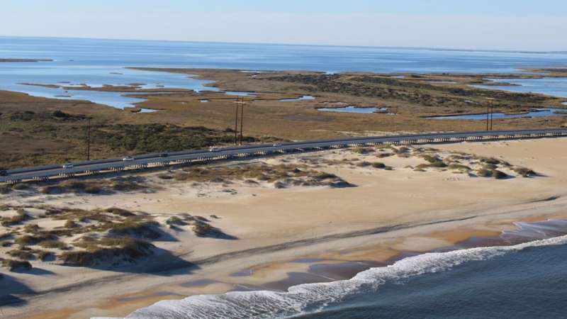
Birds-eye view of NC Highway 12 and Pea Island National Wildlife Refuge. 
Credit: Becky Harrison/USFWS

Researchers have developed a methodology for quantifying landscape changes on barrier islands and, in doing so, have found the storms that can devastate human infrastructure also create opportunities for coastal wildlife to thrive.

"Our goal for this project was to develop a method to quantify land cover changes from natural processes and storms on barrier islands," says Beth Sciaudone, co-author of the study and a research assistant professor of civil, construction and environmental engineering at North Carolina State University. "Ultimately, tracking and understanding these land changes can help us identify areas of coastal highway that are especially vulnerable to damage. It could also help us better understand how natural processes and  affect coastal ."

For this study, the researchers focused on Pea Island National Wildlife Refuge, on North Carolina's Outer Banks. Specifically, the researchers made use of detailed, color-infrared images of the island that were taken each year from 2011 through 2018. These images allowed them to track changes in land cover across the island. The images were also used to create terrain models that let researchers assess changes in topography across the island.

Using these tools, the researchers were able to assess the land cover on the island and divide it into a dozen categories, such as beach, vegetated sand dunes, marsh and estuarine ponds. They could then measure the amount of each land-type on the island and how it changed over time. For example, there might be five total acres of marsh, including one acre of estuarine pond that had shifted to marsh over the past year.

But the researchers also noticed something else regarding the relationship between storms and  .

The images highlighted the extent to which Hurricane Irene in 2011, and Hurricane Sandy in 2012, reshaped Pea Island National Wildlife Refuge.

"We already knew that bare sand is good wildlife habitat for many coastal species, but this work shed light on both how storms create habitat and how long that habitat lasts," Sciaudone says.

What the researchers found was that, on barrier , a lot depends on which direction the storm is coming from. For example, Hurricane Irene hit Pea Island from the Pamlico Sound to the west, while Hurricane Sandy hit the island from the Atlantic Ocean to the east. Both storms caused noteworthy changes in land cover. However, the long-term impact of the two storms has varied significantly.

When Hurricane Sandy wiped out vegetation, creating areas of bare sand, it took three to four years for the vegetation to recover. Meanwhile, Hurricane Irene fundamentally changed the hydrodynamics on the western side of the island, increasing the amount of habitat hospitable for shorebirds and other coastal species.

"Evaluating these habitat changes directly informs conservation management decisions on the refuge and helps us prioritize resource protection and restoration actions," says Rebecca Harrison, co-author of the study and supervisory refuge wildlife biologist at the refuge for the U.S. Fish & Wildlife Service.

"The methodology that we've developed here could be used to help quantify changes on  anywhere," Sciaudone says. "And working with regional wildlife experts can help us understand what those land cover changes mean for habitat.

"The takeaway is that we need to ensure our efforts to build and preserve coastal infrastructure take into account the role that coastal erosion and related natural processes play in creating and preserving wildlife habitat—and the work we've done here can inform that sort of decision-making."

The paper, "Land cover changes on a barrier island: Yearly changes,  effects, and recovery periods," is published in Applied Geography. Corresponding author of the study is Liliana Velasquez-Montoya, an assistant professor at the U.S. Naval Academy who worked on the project while a postdoctoral researcher at NC State. Co-authors include Margery Overton, a professor of civil, construction and environmental engineering at NC State; and Rebecca Harrison of the U.S. Fish & Wildlife Service. The work was done with support from the North Carolina Department of Transportation.'Crazy' ants that kill birds eradicated from Pacific atoll

More information: Liliana Velasquez-Montoya et al, Land cover changes on a barrier island: Yearly changes, storm effects, and recovery periods, Applied Geography (2021). DOI: 10.1016/j.apgeog.2021.102557

Provided by North Carolina State University 
Stigmatization prevents lessons from the HIV pandemic

HIV
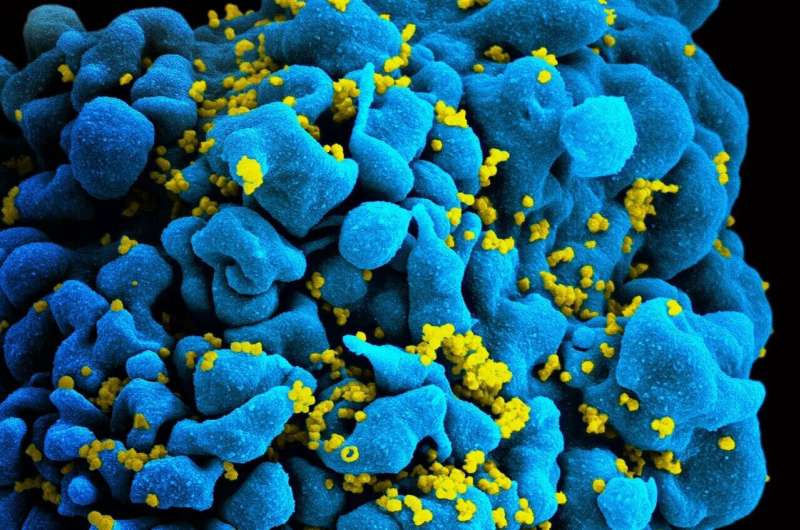
Scanning electromicrograph of an HIV-infected T cell. Credit: NIAID

The HIV pandemic hit the LGBTQI+ community, people who were already stigmatized, particularly early: This stigmatization prevented the lessons of the HIV pandemic from being adopted by broader parts of society—with consequences for dealing with the COVID 19 pandemic, argue researchers from the School of Public Health at Bielefeld University. In the journal Science, they show how society could learn better from the experiences of stigmatized communities. Their contribution is part of a project at the Research Institute Social Cohesion (FGZ) funded by the Federal Ministry of Education and Research.

"The consequence of stigmatization is to discredit the knowledge that certain people have acquired and the experiences they have gained," says Professor Dr. Oliver Razum. He heads the Department of Epidemiology and International Public Health at the School of Public Health. "This was the case during the HIV pandemic: because people from the LGBTQI+ community were stigmatized, their experiences with AIDS and the pandemic were devalued." LGBTQI+ stands for lesbian, gay, bisexual, trans, queer, and intersex.

This is why stigmatization results in many lessons from the HIV pandemic not reaching society. "The knowledge is there, but it's not accessible," says Dr. Yudit Namer, who co-authored the letter with Razum in the journal Science and is also a researcher in the same department. "This has implications for the COVID 19 pandemic. For example, with protective measures: HIV-affected communities have learned how to increase the acceptance of barrier methods—such as condoms. But these lessons were lost to broader society and had to be learned all over again when it came to wearing masks as a protective measure."

Moreover, stigmatization endangers societal cohesion: because it keeps  small or excluded, it helps to marginalize these groups—to push them to the edge—and thus perpetuate inequalities. The newly published letter by Namer and Razum is embedded in their project "Health Care for Marginalized Groups as an Indicator of Societal Cohesion," a sub-project of the Research Institute Social Cohesion (RISC).

The Federal Ministry of Education and Research supports the FGZ

The FGZ is an association of eleven universities and research institutes including Bielefeld University. Since 2020, it is being funded by the Federal Ministry of Education and Research for an initial period of four years. In their sub-project, Namer and Razum are investigating how different marginalized groups experience access to healthcare and how this strengthens or jeopardizes cohesion in society.

The ideas the researchers presented in Science were developed while preparing this project. "The collective experiences of marginalized groups are often overlooked, even in research. Both the HIV and COVID 19 pandemics show how important it is to include their perspectives explicitly in research," says Razum.

In order to learn from the experiences gained by the LGBTQI+ community during the HIV , the scientists propose using various research methods. These include, for example, digital "archives of survivorship" in which existing text or film material, but also interviews with those affected, are collected. In participatory action research, members of the affected community are even involved in studies as researchers themselves by developing their own research questions or conducting surveys.

Research must go hand in hand with combating stigmatization

Namer and Razum stress that this is not about demanding that marginalized groups should learn more from their experiences. "Instead, its the non-marginalized groups that need to learn the lessons from the experiences of those affected. Moreover, this can only be a first step, and must go hand in hand with combating marginalization and stigmatization," says Namer.

In other research projects, the scientists are also focusing on the experiences of marginalized groups. Razum is the spokesperson for the PH-LENS research group, which is using the example of the health of refugees to investigate broader health inequalities in Germany. The German Research Foundation (DFG) will continue to fund this research group until 2022.

"Our research serves as a magnifying glass: its goal is not just to learn about the experiences of marginalized groups—but also, to draw general conclusions about health and society from their experiences," Razum says.Pandemic policing undermines public health measures, disproportionately targets Black and minority ethnic communities

More information: Yudit Namer et al, Collective agency transforms societies, Science (2021). DOI: 10.1126/science.abl762

Journal information: Science 

Provided by Bielefeld University 


In Guatemala, archaeologists uncover hidden neighborhood in ancient Maya city

In Guatemala, archaeologist from Brown helps to uncover hidden neighborhood in ancient Maya city
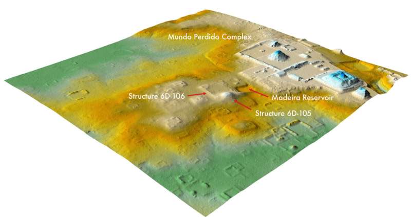
A recent lidar analysis revealed that an area once assumed to be natural hills, center,
 near Tikal's Lost World complex, right, is actually an 1,800-year-old ruined citadel. 
Credit: Thomas Garrison/PACUNAM

Scientists have been excavating the ruins of Tikal, an ancient Maya city in modern-day Guatemala, since the 1950s—and thanks to those many decades spent documenting details of every structure and cataloguing each excavated item, Tikal has become one of the best understood and most thoroughly studied archaeological sites in the world.

But a startling recent discovery by the Pacunam Lidar Initiative, a research consortium involving a Brown University anthropologist, has ancient Mesoamerican scholars across the globe wondering whether they know Tikal as well as they think.

Using light detection and ranging software, or lidar, Stephen Houston, a professor of anthropology at Brown University, and Thomas Garrison, an assistant professor of geography at the University of Texas at Austin, discovered that what was long assumed to be an area of natural hills a short walk away from Tikal's center was actually a neighborhood of ruined buildings that had been designed to look like those in Teotihuacan, the largest and most powerful city in the ancient Americas.

Houston said their lidar analysis, coupled with a subsequent excavation by a team of Guatemalan archaeologists led by Edwin Román Ramírez, has prompted new insights on, and big questions about, Teotihuacan's influence on the Maya civilization.

"What we had taken to be natural hills actually were shown to be modified and conformed to the shape of the citadel—the area that was possibly the imperial palace—at Teotihuacan," Houston said. "Regardless of who built this smaller-scale replica and why, it shows without a doubt that there was a different level of interaction between Tikal and Teotihuacan than previously believed."

The results, including lidar images and a summary of excavation findings, were published on Tuesday, Sept. 28 in Antiquity.

Tikal and Teotihuacan were radically different cities, Houston said. Tikal, a Maya city, was fairly populous but relatively small in scale—"you could have walked from one end of the kingdom to the other in a day, maybe two"—while Teotihuacan had all the marks of an empire. Though little is known about the people who founded and governed Teotihuacan, it's clear that, like the Romans, their influence extended far beyond their metropolitan center: Evidence shows they shaped and colonized countless communities hundreds of miles away.

Houston said anthropologists have known for decades that inhabitants of the two cities were in contact and often traded with one another for centuries before Teotihuacan conquered Tikal around the year 378 A.D. There's also ample evidence suggesting that between the second and sixth centuries A.D., Maya elites and scribes lived in Teotihuacan, some bringing elements of the empire's culture and materials—including its unique funerary rituals, slope-and-panel architectural style and green obsidian—back home to Tikal. Another Maya expert, David Stuart of U.T. Austin, has translated inscriptions that described the era when Teotihuacan generals, including one named Born from Fire, traveled to Tikal and unseated the local Maya king.

But the research consortium's latest lidar findings and excavations prove that the imperial power in modern-day Mexico did more than just trade with and culturally influence the smaller city of Tikal before conquering it.

"The architectural complex we found very much appears to have been built for people from Teotihuacan or those under their control," Houston said. "Perhaps it was something like an embassy complex, but when we combine previous research with our latest findings, it suggests something more heavy-handed, like occupation or surveillance. At the very least, it shows an attempt to implant part of a foreign city plan on Tikal."

Houston said that excavations following the lidar work, led by Román Ramírez, confirmed that some buildings were constructed with mud plaster rather than the traditional Maya limestone. The structures were designed to be smaller replicas of the buildings that make up Teotihuacan's citadel, down to the intricate cornices and terraces and the specific 15.5-degree east-of-north orientation of the complex's platforms.

"It almost suggests that local builders were told to use an entirely non-local building technology while constructing this sprawling new building complex," Houston said. "We've rarely seen evidence of anything but two-way interaction between the two civilizations, but here, we seem to be looking at foreigners who are moving aggressively into the area."

At an adjacent, newly uncovered complex of residential buildings, archaeologists found projectile points crafted with flint, a material commonly used by the Maya, and green obsidian, a material used by residents of Teotihuacan—providing seeming evidence of conflict.

And near the replica citadel, archaeologists also recovered the remains of a body surrounded by carefully placed vessels, ceramic fragments, animal bones and projectile points. The site was dotted with charcoal, suggesting it had been set ablaze. Houston said the scene bears little resemblance to other burials or sacrifices at Tikal but is strikingly similar to the remains of warriors found years ago in Teotihuacan's center.

"Excavations in the middle of the citadel at Teotihuacan have found the burials of many individuals dressed as warriors, and they appear to have been sacrificed and placed in mass graves," Houston said. "We have possibly found a vestige of one of those burials at Tikal itself."

Houston and his international colleagues still have much more to uncover and analyze. Andrew Scherer, an associate professor of anthropology at Brown and a bone specialist, will study the human remains to determine their origins, potentially revealing more about Teotihuacan's relationship with Tikal. This summer, as COVID-19-related travel restrictions began to ease, Houston joined Garrison, Román Ramírez and Morgan Clark, a Brown graduate student in anthropology, in Guatemala to uncover buildings, fortifications and storage tanks in related fortresses nearby. Excavations will resume this fall at Tikal, under the leadership of Román Ramírez.

The more they find out, Houston said, the more he hopes they understand about Teotihuacan's presence in Tikal—and, more broadly, how its imperial power changed the diverse cultural and political landscape in Mesoamerica.

"At this time, people are quite interested in the process of colonization and its aftermath, and in how our views of the world are informed or distorted by the expansion of economic and political systems around the globe," Houston said. "Before European colonization of the Americas, there were empires and kingdoms of disproportionate influence and strength interacting with smaller civilizations in a way that left a large impact. Exploring Teotihuacan's influence on Mesoamerica could be a way to explore the beginnings of colonialism and its oppressions and local collusions."

Modern activities follow the contours of ancient Teotihuacan

More information: Antiquity (2021). DOI: 10.15184/aqy.2021.140

Journal information: Antiquity 

Provided by Brown University 


Why we must reassess the komodo dragon's endangered status

Why we must reassess the komodo dragon's endangered status
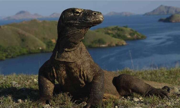
A Komodo dragon on Rinca Island, East Nusa Tenggara. Credit: Ministry of Environment and Forestry Republic of Indonesia

The Indonesian endemic world's largest lizard komodo dragons (Varanus komodoensis) recently entered the International Union for Conservation of Nature (IUCN) list of "Endangered" species, marking it as having high risk of extinction.

This announcement is quite shocking. Neither I nor other academics in the field of conservation—who are also IUCN members—from Indonesia were invited to discuss the reassessment of the komodo dragons status. Only taxonomists from Indonesia were invited to related meeting in Singapore last year.

Before the status change, the komodo dragons had been in "Vulnerable" status, or one level under Threatened, since 1996.

According to the IUCN, the komodo dragons are threatened by the impact of climate change and that in the next 45 years, the rising of global temperature and subsequent sea levels will reduce more than 30% of the ancient lizard's habitat in Komodo National Park.

Data accuracy is vital

In my experience assessing various species, Endangered status is decided with stringent criteria. Some questions would undoubtedly come up: is there a genetic change? Is there excessive poaching or habitat encroachment? Has their habitat been reduced?

Experts from all over the world will discuss all of those questions with strong scientific evidence.

However, the komodo 's recent assessment seems to be based on an assumption: the risk of sea-level rise caused by global warming.

This risk is based on a study published in July 2020. Using modeling and spatial analysis, the study analyzed the correlation between subsequent sea-level rise and the komodo dragon habitat.

The study predicts that the komodo dragon's habitat could decrease by around 8–87% by 2050. This decrease could reduce the lizard's population by between 27–99%.

These are predictions. What if the effects of global warming can be reduced drastically? If the sea level actually rise, could it reduce the dragon's population?

Why we must reassess the komodo dragon's endangered status
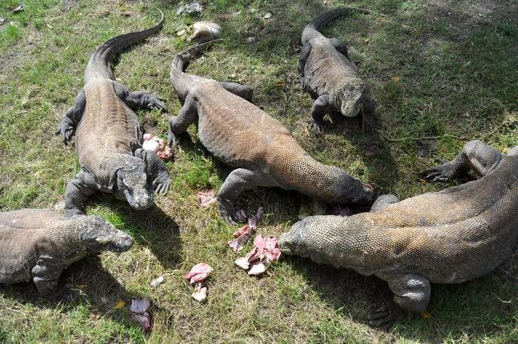
A number of adult Komodo dragons fight for meat while being fed at the Surabaya Zoo, East Java. Credit: Herman Dewantoro/Antara

These questions still need to be further investigated. We know komodo dragons actively move on hills

This species is also an excellent swimmer; they can even swim between islands. The komodo dragons are also capable of diving up to 4.5 meters deep.

Furthermore, since five years ago, komodo's population is stable. Currently, there are 3,458 komodo dragons, of which 1,383 are adults.

I suggest we reassess the komodo dragon's status on the Red List because limited evidence can lead to errors in actions.

We also need to recall that in 1996 the IUCN classified Javan gibbon (Hylobates moloch) as Critically Endangered—from previously Threatened. This  is one category away from Extinct in the Wild.

This classification raised controversy, leading to further discussions being carried out.

The discussions revealed that the IUCN only received limited data on the Javan gibbon population: around 2,000. In fact, valid data showed the population reached 5,000. Eventually, in 2008, IUCN classed gibbon as "Endangered."

Stronger conservation effort still needed

Although the population is stable, the komodo dragon is still a vulnerable species. We need a stronger effort to conserve them.

One thing that needs to be considered is limiting human interactions. Currently, tourists, especially on Rinca Island, can get quite close with the komodo dragons. This can lead to changes in the lizard's behavior and increase the risk of disease transmission.

The 15 tourist paths on Komodo Island must be strictly monitored. If necessary, for the sake of the lizard , some of the tracks should be moved to other islands.

Saving the  also means conserving their natural prey, such as deer and pigs. The dragon's predatory instincts must be maintained so that the species can survive in the wild, without excessive intervention from humans

Study reveals surprising history of world's largest lizard
Provided by The Conversation 
This article is republished from The Conversation under a Creative Commons license. Read the original article.The Conversation

Researchers uncover signs of ecosystem collapse in significant PNG wetland

Researchers uncover signs of ecosystem collapse in significant PNG wetland
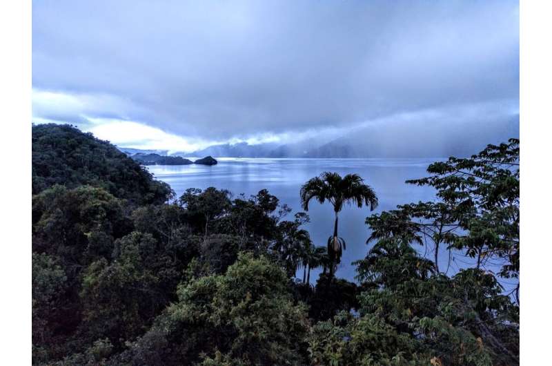
View over Lake Kutubu in Papua New Guinea. Credit: Professor Simon Haberle

A new study by researchers from The Australian National University (ANU) has identified warning signs of ecosystem collapse at a wetland of international significance in Papua New Guinea (PNG).

The internationally-recognized Ramsar Convention on Wetlands said ongoing ecological monitoring and the development of wetland management plans are needed to conserve PNG's second largest , Lake Kutubu.

The lake has been recognized as one of the most pristine freshwater sites in the Asia-Pacific region since being listed as a Ramsar site of international significance in 1998.

The researchers from the ANU School of Culture, History and Language (CHL), in collaboration with the University of Papua New Guinea and local land owners, analyzed  over several years from Lake Kutubu and found human impacts, including deforestation, mining and increased human populations in the area, have significantly transformed the lake during the past century.

Dr. Kelsie Long has examined the  and  at Lake Kutubu. She said changes in the algal, fungi and geochemical compositions of the lake sediments provide early indicators of ecosystem collapse.

Dr. Long said the potential for the sudden collapse of ecosystems in response to interacting pressures has been of increasing concern in ecological and conservation research, as well as to the  that rely on the ecosystem.

"The health of Lake Kutubu is changing. Villagers have been reporting the release of plumes of chemicals into the lake, fish kill events and subsequent health issues of people who rely on the lake for food and water," Dr. Long said.

"We can see these changes clearly in the chemical composition of sediments laid down at the bottom of the lake, before and after the start of resource extraction activities and increasing population growth in the region in the 1980s and 90s."

At 19 kilometers long, four kilometers wide and up to 70 meters deep, Lake Kutubu is an area of highly diverse rainforest flora and fauna, inhabited by human populations that are equally diverse both culturally and linguistically.

The research identified major shifts in algal composition and dung fungi in sediment occurring in the 1980s, suggesting a drop in water quality that matches the timing of increasing livestock and habitations in the areas around Lake Kutubu.

The research team also included CHL Director Professor Simon Haberle and Dr. Larissa Schneider, who have both been researching changes to Lake Kutubu's health over a number of years.

Dr. Schneider said the team's research shows how industrialisation and economic growth affects the life of traditional communities to a disproportionate extent.

"These communities don't have a strong political voice, so independent studies like ours are important to support traditional communities to stand up to environmental injustice," Dr. Schneider said.

CHL palaeoecologist Dr. Simon Connor did the statistical analysis in the .

"We have to remember that Ramsar wetlands are not museum exhibits—they are the result of all the changes that went on in the past and are responding every moment to the changes happening now," Dr. Connor said.

"Scientific studies like ours don't tell local communities anything they don't already know, but they can force governments and corporations to take action to prevent further damage."

Their paper, "Tropical Forests as Key Sites of the 'Anthropocene' - Past and Present Perspectives," has been published by the Proceedings of the National Academy of Sciences.

Image: Lake George, Uganda

More information: Kelsie E. Long et al, Human impacts and Anthropocene environmental change at Lake Kutubu, a Ramsar wetland in Papua New Guinea, Proceedings of the National Academy of Sciences (2021). DOI: 10.1073/pnas.2022216118

Journal information: Proceedings of the National Academy of Sciences 

Provided by Australian National University 


The clock is ticking on net-zero, and Australia's farmers must not get a free pass

The clock is ticking on net-zero, and Australia's farmers must not get a free pass
Good soil management aids a farm’s fertility. Credit: Shutterstock

Political momentum is growing in Australia to cut greenhouse gas emissions to net-zero by 2050. On Friday, Treasurer Josh Frydenberg was the latest member of the federal government to throw his weight behind the goal, and over the weekend, Prime Minister Scott Morrison acknowledged "the world is transitioning to a new energy economy."

But for Australia to achieve net-zero across the economy, emissions from  must fall dramatically. Agriculture contributed about 15% to Australia's  in 2019—most of it from cattle and sheep. If herd numbers recover from the recent drought, the sector's emissions are projected to rise.

Cutting agriculture emissions will not be easy. The difficulties have reportedly triggered concern in the Nationals' about the cost of the transition for farmers, including calls for agriculture to be carved out of any net-zero target.

But as our new Grattan Institute report today makes clear, agriculture must not be granted this exemption. Instead, the federal government should do more to encourage farmers to adopt low-emissions technologies and practices—some of which can be deployed now.

Three good reasons farmers must go net-zero

Many farmers want to be part of the climate solution—and must be—for three main reasons.

First, the  is uniquely vulnerable to a changing climate. Already, changes in rainfall have cut profits across the sector by 23% compared to what could have been achieved in pre-2000 conditions. The effect is even worse for cropping farmers.

Livestock farmers face risks, too. If global warming reaches 3℃, livestock in northern Australia are expected to suffer heat stress almost daily.

Second, parts of the sector are highly exposed to —for example, about three-quarters of Australia's red meat is exported.

There are fears Australian producers may face a border tax in some markets if they don't cut emissions. The European Union, for instance, plans to introduce tariffs as early as 2023 on some products from countries without effective  pricing, though agriculture will not be included initially.

Third, the industry recognizes action on climate change can often boost farm productivity, or help farmers secure resilient revenue streams. For example, trees provide shade for animals, while good soil management can preserve the land's fertility. Both activities can store carbon and may generate carbon credits.

Carbon credits can be used to offset farm emissions, or sold to other emitters. In a net-zero future, farmers can maximize their carbon credit revenue by minimizing their own emissions, leaving them more carbon credits to sell.

The agriculture sector itself is increasingly embracing the net-zero goal. The National Farmers Federation supports an economy-wide aspiration to be net-zero by 2050, with some conditions. The red meat and pork industries have gone further, committing to be carbon neutral by 2030 and 2025 respectively.

What can be done?

Australian agricultural activities emitted about 76 million tons of carbon dioxide-equivalent emissions in 2019. Of this, about 48 million tons were methane belched by cattle and sheep, and a further 11 million came from their excrement.

The sector's non-animal emissions largely came from burning diesel, the use of fertilizer, and the breakdown of leftover plant material from cropping.

Unlike in, say, the electricity sector, it's not possible to completely eliminate agricultural emissions, and deep emissions cuts look difficult in the near term. That's because methane produced in the stomachs of cattle and sheep represents more than 60% of agricultural emissions; these cannot be captured, or eliminated through renewable energy technology.

Supplements added to stock feed—which reduce the amount of methane the animal produces—are the most promising options to reduce agricultural emissions. These supplements include red algae and the chemical 3-nitrooxypropanol, both of which may cut methane by up to 90% if used consistently at the right dose.

But it's difficult to distribute these feed supplements to Australian grazing cattle and sheep every day. At any given time, only about 4% of Australia's cattle are in feedlots where their diet can be easily controlled.

Diesel use can be reduced by electrifying farm machinery, but electric models are not yet widely available or affordable for all purposes.

These challenges slow the realistic rate at which the sector can cut emissions. Yet there are things that can be done today.

Many manure emissions can be avoided through smarter management. For example, on intensive livestock farms, manure is often stored in ponds where it releases methane. This methane can be captured and burnt, emitting the weaker greenhouse gas, carbon dioxide, instead.

And better targeted fertilizer use is a clear win-win—it would save farmers money and reduce emissions of nitrous oxide, a potent greenhouse gas.

Governments must walk and chew gum

An economy-wide carbon price would be the best way for Australia to reduce emissions in an economically efficient manner. But the political reality is that carbon pricing is out of reach, at least for now. So Australia should pursue sector-specific policies—including in agriculture.

Governments must walk and chew gum. That means introducing policies to support emissions-reducing actions that farmers can take today, while investing alongside the industry in potential high-impact solutions for the longer term.

Accelerating near-term action will require improving the 's Emissions Reduction Fund, to help more farmers generate Australian carbon credit units. It will also require more investment in outreach programs to give farmers the knowledge they need to reduce emissions.

Improving the long-term emissions outlook for the agriculture sector requires investment in high-impact research, development and deployment. Bringing down the cost of new technologies is possible with deployment at scale: all governments should consider what combination of subsidies, penalties and regulations will best drive this.

Agriculture must not become the missing piece in Australia's net-zero puzzle. Without action today, the sector may become Australia's largest source of emissions in coming decades. This would require hugely expensive carbon offsetting—paid for by taxpayers, consumers and farmers themselves. 

Australia's farmers want more climate action, and they're starting in their own (huge) backyards
Provided by The Conversation 

This article is republished from The Conversation under a Creative Commons license. Read the original article.The Conversation

Researchers explore what drives animal infanticide

Researchers explore what drives animal infanticide
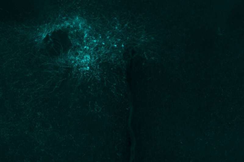
Urocortin-3-expressing neurons in the hypothalamic perifornical area (labeled here with a
 a fluorescent virus) are activated during infant-directed attacks in male and female mice, 
but not other behaviors. Credit: Anita Autry, Dulac Lab

At the end of the 1970s, infanticide became a flashpoint in animal behavioral science. Sociobiologist Sarah Hrdy, then a Harvard Ph.D. student, shared her observation in her published thesis that whenever a new langur male entered an established colony, infants would either begin to disappear or show evidence of wounds. Hrdy concluded this was done to eliminate the progeny of rivals and free up now infant-less females for mating. The work provoked an uproar.

"You can imagine, talking about infanticide and infanticidal . That just seemed absolutely awful," said Catherine Dulac, Lee and Ezpeleta Professor of Arts and Sciences and Higgins Professor of Molecular and Cellular Biology. "People said, "No, no, no, this, this can't be true. It's not a normal behavior. It's a pathological behavior." [Hrdy] maintained her thesis and people started to look, to observe."

Since then abusive behavior toward infants—ranging from  to avoidance and neglect—has been documented in a range of species, including certain primates, lions, and mice. It has spawned many  trying to better understand the phenomenon, and the neurobiological mechanisms controlling it are still being teased out. A recent study from Dulac's lab is helping shed new light on the neural circuitry involved.

Published in eLife, the work describes a specific set of neurons in the brain that controls the aggressive behavior of adult mice toward infants. Researchers believe these "anti-parental" circuits, found in a small area of the hypothalamus called the perifornical area, are triggered in virgin male and stressed female mice resulting in aggressive tendencies and neglectful behavior toward infants. The findings illustrate a novel role for these neurons controlling anti-parental interactions in male and female mice, research that has ramifications in fields such as neuroscience and animal behavior. It may also help scientists get a better handle on how stress and disease affect human parenting.

"The big finding is that there is a very specific set of neurons in the brain that controls that particular form of agonistic [or hostile] behavior," Dulac said. "Maternal aggression, adult-on-adult aggression—two males attack each other, a female protects her pups—all these other types of aggression rely on distinct circuitry. These circuits specifically orchestrate aggressive behavior toward infants, as well as avoidance and neglect."

Dulac was awarded a Breakthrough Prize in Life Sciences last year for her pioneering work identifying the  that regulates parenting behavior in both males and females. For her this kind of study speaks to one of the major goals of the field: understanding how brain activity generates specific behaviors.

"Why do we do what we do? One reason I'm interested in instinctive behaviors is the idea that somehow specific stimuli are driving us toward specific behaviors, whether it's eating when you're hungry or you see food, or thirst, or parenting behavior," she said. "What drives these behaviors? What drives parenting? What antagonizes the drive toward parenting is something interesting—just to try to understand how the brain is controlling behavior."

These behaviors arise on occasion in animals not raising offspring, such as virgins or sexually mature males that are strangers to a group. These anti-parental behaviors typically switch to caring interactions in these animals after the birth of their own offspring or familiarization to infants. Females in many species are also known to attack or neglect their young during stressful circumstances, such as food shortages or when there is a high risk of predation.

In humans, parenting quality is highly affected by stress and psychological conditions such as postpartum depression, which affects 10–20 percent of new mothers. The study of neural circuits that underlie behavior may help scientists better understand the effects of health and disease on parenting.

The Dulac lab typically focuses on studying parental behavior but a study in 2018 looking at smell receptors related to infant-directed aggression led them to follow up more on anti-parental behavior. The most recent work was led by Anita E. Autry, an assistant professor at Albert Einstein College of Medicine, while she was a researcher in the lab.

Next steps in the project involve further examination of the urocortin-3 neurons in the perifornical area, which their research suggests are involved in the aggression response against infants, and identifying an activation switch for them.

How mice are hardwired for parenting

More information: Anita E Autry et al, Urocortin-3 neurons in the mouse perifornical area promote infant-directed neglect and aggression, eLife (2021). DOI: 10.7554/eLife.64680
Journal information: eLife 
Provided by Harvard University 

Do depressions in Canadian prairies hold the key to groundwater recharge?

Do depressions in Canadian prairies hold the key to groundwater recharge?
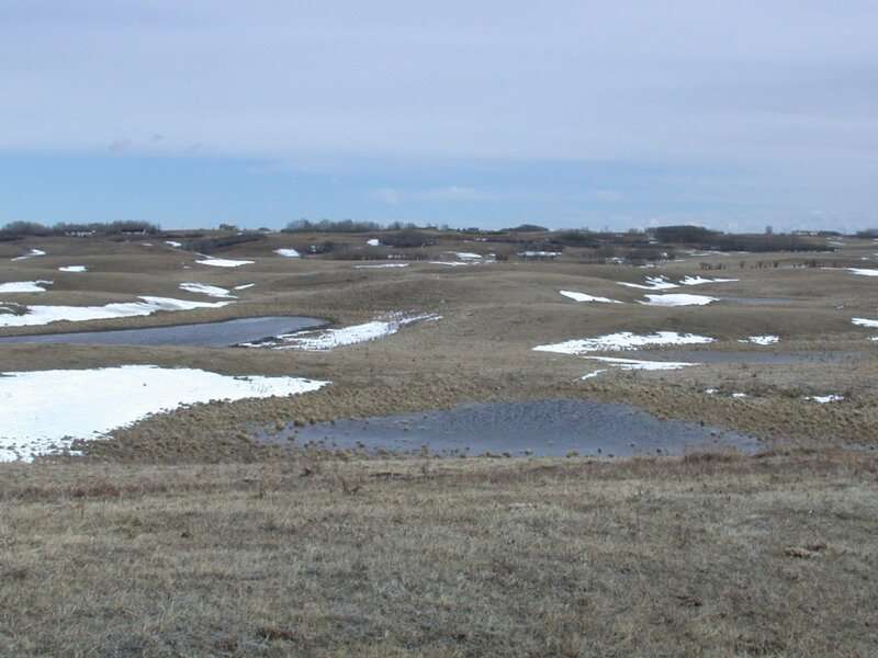
Depressions filled with snowmelt water dot a grassland in the Canadian prairies. 
They were left by glaciers when the last ice sheet left the Great Plains about 10,000 
to 12,000 years ago. They are 50 to 100 meters in diameter and 1 to 2 meters deep. 
Credit: Darren Sjogren

The water cycle is a delicate balance. In natural settings, water from rainfall or snowmelt can soak into soil or runoff to streams. Some of the water is stored in natural underground reservoirs—called groundwater. Plants use up the water to grow, and then new precipitation refills the groundwater—a process called groundwater recharge.

In dry climates, plants use up most of the water that enters the soil. So how does the  get refilled? For Canadian prairies the answer is found in depressions located in the landscape. In these depressions, runoff from the surrounding land accumulates and moves into the groundwater.

The depressions in the landscape were left by glaciers when the last ice sheet left the Great Plains about 10,000 to 12,000 years ago. Like a rain garden, they take in runoff from the surrounding environment, but are typically bigger. They are 50 to 100 meters in diameter and 1 to 2 meters deep.

However, scientists are worried changes in climate could impact this delicate groundwater recharge process.

Currently, most of the water in the depressions comes in the form of runoff from snowmelt as it flows over frozen soil and into the depressions. Researchers in Canada studied how this process may be disturbed in the future as the climate changes.

Masaki Hayashi and the team at University of Calgary recently published this work in Vadose Zone Journal, a publication of the Soil Science Society of America.

Do depressions in Canadian prairies hold the key to groundwater recharge?
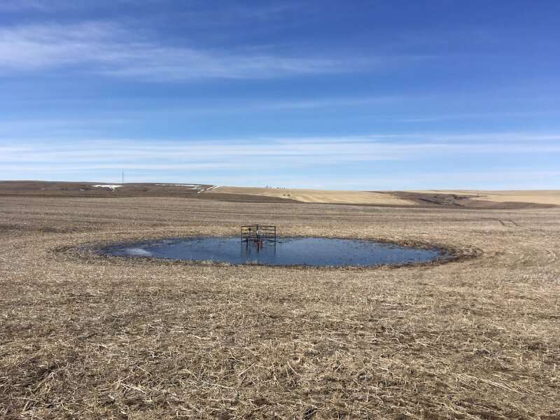
The researchers placed instruments directly into the depressions filled with snowmelt in
 the study area near Calgary. They took measurements of water levels at various times of 
the year to help test their model. Credit: Masaki Hayashi

"The motivation for this research came from the need to estimate recharge for sustainable management of groundwater in the Canadian prairies," says Hayashi. "We cannot manage a renewable resource unless we know how much is renewed every year. It would be like trying to manage expenses from a bank account without knowing the amount of revenue."

Experts predict that the future climate conditions of these prairies will be warmer and wetter. While it seems like this would result in more groundwater recharge, the scientists wanted to determine if that would be the case in these depressions.

These low areas collect snowmelt runoff and can even become ponds in the spring. Some of the larger depressions even have water that stays throughout the summer. Those are called prairie wetlands or prairie pothole wetlands and are home to many aquatic plants and animals in the area.

To determine how a warmer and wetter climate would impact groundwater recharge, the scientists used a model to simulate the environment. By placing instrumentation directly in the depressions, they gathered information on soil properties, the weather, and the size of the  and surrounding environment. Their work, a type of "soil water balance" model, used the data they gathered to simulate how the water may move from the surface into deeper soil layers in the future.

They found that snow accumulation as well as how much of and how long the soil is frozen in the winter will decrease. This means there will be less runoff to the depressions and less groundwater recharge.

Do depressions in Canadian prairies hold the key to groundwater recharge?
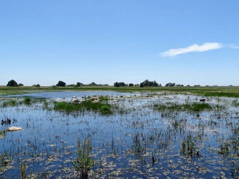
The US also has depressions in the land that fill after large amounts of snow melt. This one is located in the Santa Rosa Plateau in April 2019. California experienced a good snowfall year, and this “vernal pool” came alive for a short time in the spring, contributing to the ecosystem, as well as recharging groundwater supplies. Credit: Susan V. Fisk

"A wetter climate generally results in a higher recharge, but that does not seem to be the case in the northern Great Plains, where recharge is focused in depressions," Hayashi explains. "Even though the total precipitation may increase, we will have more rain and less snow. This means that snow accumulation in winter will decrease. Also, we will have a shorter duration of frozen soil and shallower penetration of soil frost."

He adds that this creates an issue because slow moving snowmelt flowing over frozen , which doesn't allow it to absorb quickly, is the key to the  getting to the depressions.

The decrease in  can have many effects on the environment, the researchers say. For example, many small springs are fed by groundwater and could be impacted.

"It may result in a decrease in the base flow of small streams fed by groundwater," Hayashi says. "Some of the perennial streams may become seasonal. This may have a strong influence on the stream ecosystem. Overall, these small depressions may seem less important compared to larger depressions holding prairie wetlands. However, there are many more small depressions, and they are collectively important for ."

Researcher gives a glimpse into a limited resource—groundwater
More information: Amro Negm et al, Effects of climate change on depression‐focused groundwater recharge in the Canadian Prairies, Vadose Zone Journal (2021). DOI: 10.1002/vzj2.20153
Provided by American Society of Agronomy