By Ian Wood | July 26, 2022

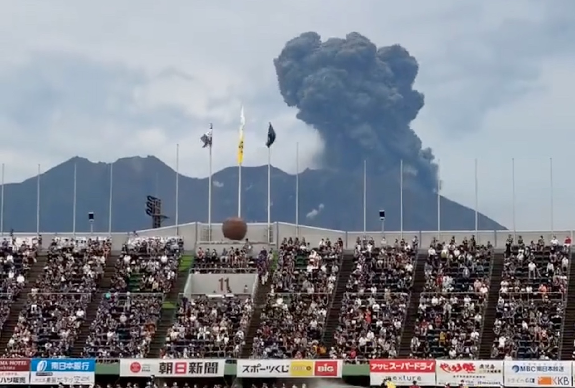
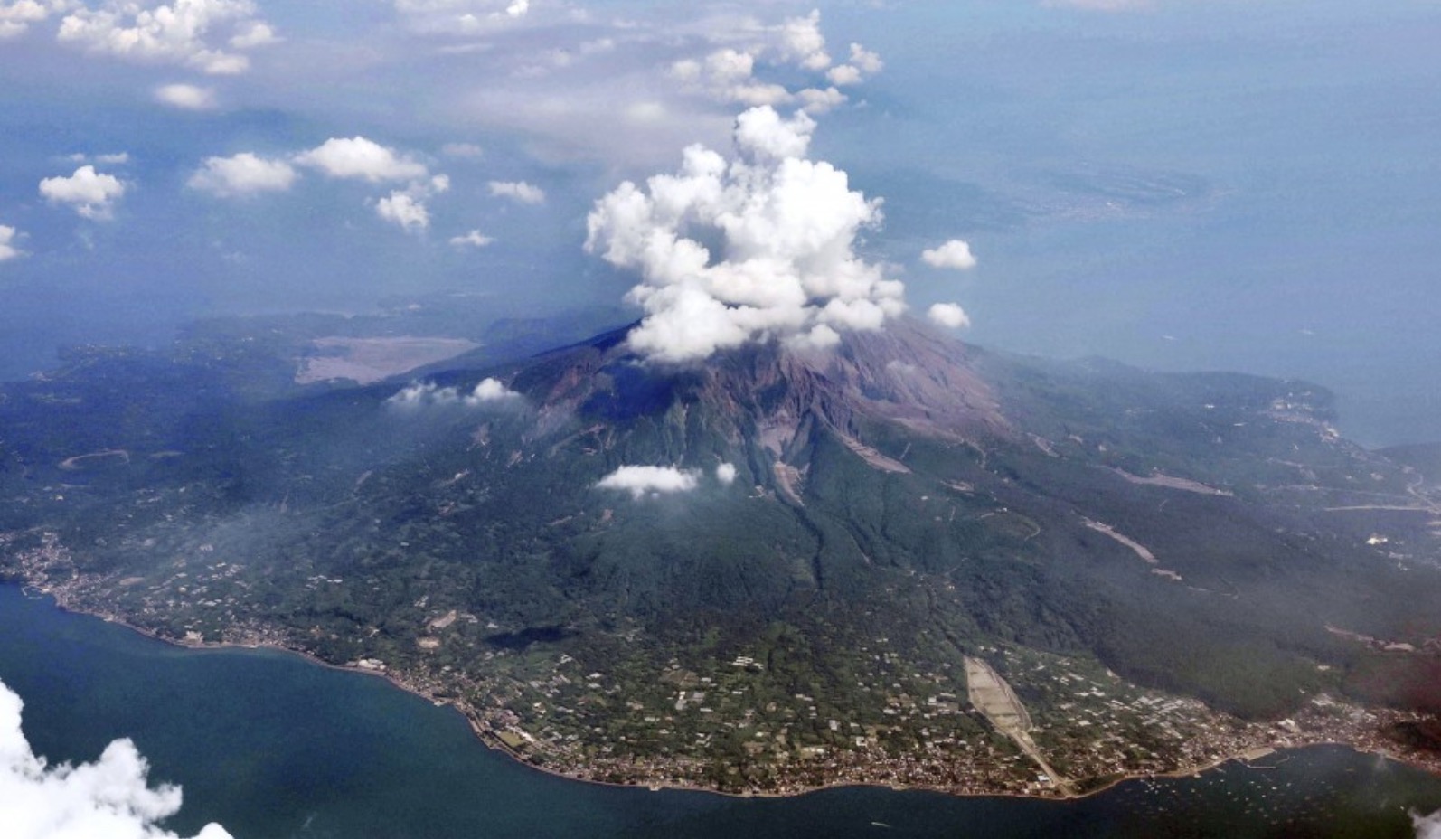
Sakurajima is a stratovolcano that’s located around six hundred miles away from Tokyo. The summit elevation is 3665 feet, and it has three distinct peaks. It was once on an island, but the continued eruptions made it located on a peninsula. The volcano is one of the most active in Japan, as it drops ash on the surrounding areas. Some videos of the wild situation are below.
Sakurajima volcano erupts as Japan raises highest alert level for mass evacuation

TOKYO (AP) — Dozens of people have evacuated two towns on Japan’s main southern island of Kyushu where a volcano spewed ash and large rocks into the nighttime sky.
Large rocks fell as far as 2.5 kilometers (1.5 miles) from the Sakurajima volcano Sunday night in the southern prefecture of Kagoshima. Footage on Japan’s NHK public television showed orange flames flashing near the crater and dark smoke with ash billowing high above the mountaintop.
Japan’s Meteorological Agency raised the eruption alert to the highest level of five and advised 51 residents in two towns facing the volcano to leave their homes.
By Monday morning, 33 of them left their homes for a nursing care facility in a safer part of the region, according to Kagoshima city. NHK said others subject to evacuation might have evacuated to other locations.
“We will put the people’s lives first and do our utmost to assess the situation and respond to any emergency,” Deputy Chief Cabinet Secretary Yoshihiko Isozaki told reporters. He called on residents to pay close attention to updates from local authorities to protect their lives.
A dusting of ash was visible on cars in Kagoshima, but no damage or injuries have been reported. Schools in the area are on summer recess but closed Monday for clubs and extracurricular activities.
JMA warned of the potential for falling volcanic rocks within 3 kilometers (1.8 miles) of the crater and possible flow of lava, ash and searing gas within 2 kilometers (1.2 miles).
The chances of more explosive violent eruptions were low, but residents still should be watchful for falling rocks, mudslide and pyroclastic flow, said Tsuyoshi Nakatsuji, a JMA official in charge of volcano watch. He also advised residents to close curtains and stay away from windows, which could break by the force of an eruption.
Sakurajima on the main southern island of Kyushu is one of Japan’s most active volcanos and has erupted repeatedly. It used to be an island but became a peninsula following an eruption in 1914 that killed 58 people.
Sakurajima is about 1,000 kilometers (600 miles) southwest of Tokyo.
Mari Yamaguchi, The Associated Press
- Research Article
- Published:
The 1914 Taisho eruption of Sakurajima volcano: stratigraphy and dynamics of the largest explosive event in Japan during the twentieth century
Bulletin of Volcanology 79, Article number: 72 (2017)
Abstract
The 1914 Taisho eruption of Sakurijima volcano was Japan’s highest intensity and magnitude eruption of the twentieth century. After a 35-year period of quiescence, the volcano suddenly rewoke a few days before the eruption, when earthquakes began to be felt on Sakurajima Island. The eruption began on January 12, 1914, from two fissures located on opposite sides of the volcano, and was characterized by a complex time evolution and changes in eruptive styles. The eruption began with a subPlinian explosive phase in which two convective columns rose from the two fissures. Both plumes were sustained for at least 2 days. This resulted in deposition of a widely dispersed tephra sequence. After this phase, the eruption evolved to a final, waning phase, shifting toward effusive activity that lasted until April 1914. During the first weeks, effusive activity was also accompanied by ash emission. The complex sequence of events, characterized by contemporaneous explosive and effusive activity, is typical of several recently observed mid-intensity eruptions, such as during the 2011 eruption of Cordón Caulle, Chile. The stratigraphic sequence of the eruptive deposits from the Taisho eruption comprises alternating coarse-to-fine lapilli beds with ash beds dispersed toward the ESE and SE. These deposits can be subdivided into three lapilli-bearing units (Units T1, T2 and T3, which correspond to the subPlinian phase) and one ash-bearing unit (Unit T4, which corresponds to the final ash venting, accompanying the first day/weeks of lava flow activity). Grain size analyses from each unit reveal a marked polymodal distribution generally described by the sum of two or three Gaussian subpopulations. Both the modes and the relative amounts of the coarse subpopulations vary with distance from vent, with those of the fine subpopulation remaining nearly constant. Within the vertical sequence, component analysis shows a progressive increase in lithic fragments, suggesting that conduit enlargement continued until the final stages of the eruption. The estimated volume of the tephra deposit of the subPlinian phase of the eruption is 0.33 ± 0.11 km3 (dense rock equivalent (DRE) volume = 0.09 ± 0.03 km3). The height of the eruption column was also assessed by using four different isopleth maps compiled based on different strategies for the characterization of the largest clasts. The maximum height attained by the eruption column is estimated at 15.0 ± 1.2 km above the vent, resulting in a maximum mass discharge rate of 3.6 ± 1.2 × 10⁷ kg s−1 (calculated taking into account the strong effect of wind advection). Finally, different classification schemes were applied to classify the eruption, which generally straddles the fields between Plinian and subPlinian.
READ ON
BEHIND PAY WALL


