Without climate action, property values will take a hit from escalating wildfire risk and tree mortality, study finds
Earth's rapidly changing climate is taking an increasingly heavy toll on landscapes around the world in the form of floods, rising sea levels, extreme weather, drought and wildfire.
Also at growing risk are the values of property where these hazards are projected to worsen, according to a new study by University of Utah scholars.
The research team, led by biology professor William Anderegg, attempted, for the first time, to quantify the value of U.S. property at risk in forested areas exposed to increased wildfire and tree mortality associated with climate stresses and beetle infestation. Their findings have been published in Environmental Research Letters.
"As a society, we have this tremendous capacity to deal with and minimize, adapt to and mitigate risk," said Anderegg, who heads the university's Wilkes Center for Climate Science & Policy. "We have insurance policies, we have seat belts in cars and airbags. All of these are to mitigate the risk of getting in a car accident or having a fire burn down your house. But fundamentally, all these tools to mitigate risk are predicated on knowing what the risks are and capturing how those risks might change."
A stark message from Maui
Climate change is a "game changer," according to Anderegg, because it promises to elevate threats, yet we don't know exactly where, when or by how much.
"This is a really clear case of where we need cutting-edge science and tools to tell us what are the risks and how are they possibly or likely to change this century due to climate change," said Anderegg, who studies forest ecology. "Climate change is going to drive wildfire and disturbance risks up and is already driving them up. Insurers leaving states like California really underscores that."
To help identify climate-related risks to property values, Anderegg teamed with faculty from the College of Social and Behavioral Sciences—geographer Tim Collins and sociologist Sara Grineski—and others outside Utah. Their study found more and more U.S. property will be exposed as climate change effects proliferate on forests.
"We find that property values exposed to these climate-sensitive disturbances increase sharply in future climate scenarios, particularly in existing high-risk regions of the western U.S.," the study determined, "and that novel exposure risks emerge in some currently lower-risk regions, such as the southeast and Great Lakes regions."
And as if to drive that point home, the tropical Hawaiian Islands were the scene of the nation's deadliest wildfire in a century after flames rampaged across Maui, destroying an entire city and leaving 96 dead in a toll that will certainly grow.
Most of the affected real estate is in the Southwest and California, where soaring values of private property near publicly owned woodlands are colliding with declining forest health and escalating fire risks.
The study deliberately avoided identifying specific areas at risk, but even a casual glance at Western real estate gives an idea of where the trouble spots are. Northern Utah's more valuable residential property happens to be located in scenic locales, such as Emigration Canyon and Summit Park, that face severe wildfire risks.
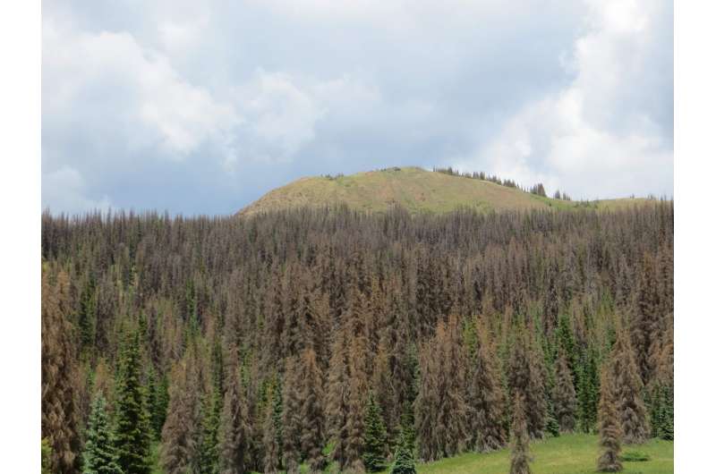
The study examined three different phenomena that impact property values: wildfire; tree mortality from drought and other climate stresses; and tree mortality from insect infestation.
Tale of two climate crisis responses
The study projected what may happen during two 30-year windows, mid-21st century and end of the century, under opposing scenarios. The team found carbon emission-reduction strategies, if implemented effectively, could substantially dampen exposure.
"We looked at two separate climate scenarios, one in which we don't really do anything [to reduce emissions driving warming]—it's just business as usual, and things get more dramatically worse—and one in which we implement mitigation more aggressively," said Collins, who co-directs the University of Utah's Center for Natural and Technological Hazards with Grineski.
"What the results show is that under a scenario in which we actually try to mitigate emissions in a way that reduces impacts of climate change, you see substantially less property value at risk in the future."
Looking at just privately owned lots one acre in size or larger, about $4 billion (in 2017 dollars) in property is currently exposed per year to wildfire in the contiguous United States, according to the study.
That volume is projected to grow to $22 and $45 billion, by 2049 and 2099, respectively, under the do-nothing scenario. The study found, however, the value of exposed property tops out at about $11 billion under the scenario in which aggressive climate action is undertaken.
Wooded areas can be desirable places to live, but if the trees die or burn, such properties lose their appeal and their market value will erode accordingly.
"What's interesting is that people are drawn to those environments because of the amenities associated with forest resources," Collins said. "This is where you're seeing the high value of these lands, like California—areas that are identified as wildland-urban interface—are some of the fastest growing landscapes in terms of residential development."
The findings are conservative since they don't consider anticipated growth in these at-risk landscapes.
"Under climate change, in the hot arid West, many people, as temperatures rise, are going to be increasingly drawn to these mountainous environments," Collins said.
"We actually just hold constant current levels of development, and we look at what is the effect of climate change and increased forest disturbance in terms of placing current property values at risk in the future. It doesn't even take into account the fact that more and more people are being drawn to these forest landscapes because of the amenities."
Collaborators on the project included Christophe Nolte of Boston University and Sarah Nicholls of Swansea University in Wales.
More information: Climate change greatly escalates forest disturbance risks to US property values, Environmental Research Letters (2023). DOI: 10.1088/1748-9326/ace639
Journal information: Environmental Research Letters
Provided by University of Utah
Climate change increases risks of tree death
Without aggressive climate action, U.S. property values will take a hit from escalating wildfire risk and tree mortality, study finds
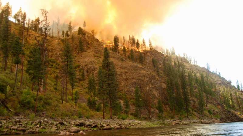
IMAGE: THE ELKHORN FIRE CHARRED MORE THAN 20,000 ACRES IN CENTRAL IDAHO'S PAYETTE AND NEZ PERCE-CLEARWATER NATIONAL FORESTS ON JULY 30, 2023, BURNING ALONG 10 MILES OF THE SALMON RIVER AND DESTROYING TWO HISTORIC RANCH COMPOUNDS. view more
CREDIT: BRIAN MAFFLY, UNIVERSITY OF UTAH
Earth’s rapidly changing climate is taking an increasingly heavy toll on landscapes around the world in the form of floods, rising sea levels, extreme weather, drought and wildfire.
Also at growing risk are the values of property where these hazards are projected to worsen, according to a new study by University of Utah scholars. The research team, led by biology professor William Anderegg, attempted, for the first time, to quantify the value of U.S. property at risk in forested areas exposed to increased wildfire and tree mortality associated with climate stresses and beetle infestation.
“As a society, we have this tremendous capacity to deal with and minimize, adapt to and mitigate risk,” said Anderegg, who heads the university’s Wilkes Center for Climate Science & Policy. “We have insurance policies, we have seat belts in cars and airbags. All of these are to mitigate the risk of getting in a car accident or having a fire burn down your house. But fundamentally, all these tools to mitigate risk are predicated on knowing what the risks are and capturing how those risks might change.”
A stark message from Maui
Climate change is a “game changer,” according to Anderegg, because it promises to elevate threats, yet we don’t know exactly where, when or by how much.
“This is a really clear case of where we need cutting-edge science and tools to tell us what are the risks and how are they possibly or likely to change this century due to climate change,” said Anderegg, who studies forest ecology. “Climate change is going to drive wildfire and disturbance risks up and is already driving them up. Insurers leaving states like California really underscores that.”
To help identify climate-related risks to property values, Anderegg teamed with faculty from the College of Social and Behavioral Sciences—geographer Tim Collins and sociologist Sara Grineski—and others outside Utah. Published Aug. 17 in the journal Environmental Research Letters, their study found more and more U.S. property will be exposed as climate change effects proliferate on forests.
“We find that property values exposed to these climate-sensitive disturbances increase sharply in future climate scenarios, particularly in existing high-risk regions of the western U.S.,” the study determined, “and that novel exposure risks emerge in some currently lower-risk regions, such as the southeast and Great Lakes regions.”
And[1] as if to drive that point home, the tropical Hawaiian Islands last week were the scene of the nation’s deadliest wildfire in a century after flames rampaged across Maui, destroying an entire city and leaving 96 dead in a toll that will certainly grow.
Most of the affected real estate is in the Southwest and California, where soaring values of private property near publicly owned woodlands are colliding with declining forest health and escalating fire risks.
The study deliberately avoided identifying specific areas at risk, but even a casual glance at Western real estate gives an idea of where the trouble spots are. Northern Utah’s more valuable residential property happens to be located in scenic locales, such as Emigration Canyon and Summit Park, that face severe wildfire risks.
The study examined three different phenomena that impact property values: wildfire; tree mortality from drought and other climate stresses; and tree mortality from insect infestation.
Tale of two climate crisis responses
The study projected what may happen during two 30-year windows, mid-21st century and end of the century, under opposing scenarios. The team found carbon emission-reduction strategies, if implemented effectively, could substantially dampen exposure.
“We looked at two separate climate scenarios, one in which we don't really do anything [to reduce emissions driving warming]—it's just business as usual, and things get more dramatically worse—and one in which we implement mitigation more aggressively,” said Collins, who co-directs the University of Utah’s Center for Natural and Technological Hazards with Grineski. “What the results show is that under a scenario in which we actually try to mitigate emissions in a way that reduces impacts of climate change, you see substantially less property value at risk in the future.”
Looking at just privately owned lots 1 acre in size or larger, about $4 billion (in 2017 dollars) in property is currently exposed per year to wildfire in the contiguous United States, according to the study.
That volume is projected to grow to $22 and $45 billion, by 2049 and 2099, respectively, under the do-nothing scenario. The study found, however, the value of exposed property tops out at about $11 billion under the scenario in which aggressive climate action is undertaken.
Wooded areas can be desirable places to live, but if the trees die or burn, such properties lose their appeal and their market value will erode accordingly.
“What's interesting is that people are drawn to those environments because of the amenities associated with forest resources,” Collins said. “This is where you're seeing the high value of these lands, like California—areas that are identified as wildland-urban interface—are some of the fastest growing landscapes in terms of residential development.”
The findings are conservative since they don’t consider anticipated growth in these at-risk landscapes.
“Under climate change, in the hot arid West, many people, as temperatures rise, are going to be increasingly drawn to these mountainous environments,” Collins said. “We actually just hold constant current levels of development, and we look at what is the effect of climate change and increased forest disturbance in terms of placing current property values at risk in the future. It doesn't even take into account the fact that more and more people are being drawn to these forest landscapes because of the amenities.”
The project was funded by grants from the David and Lucille Packard Foundation and the National Science Foundation. Collaborators included Christophe Nolte of Boston University and Sarah Nicholls of Swansea University in Wales.
JOURNAL
Environmental Research Letters
METHOD OF RESEARCH
Data/statistical analysis
SUBJECT OF RESEARCH
Not applicable
ARTICLE TITLE
Climate change greatly escalates forest disturbance risks to US property values
ARTICLE PUBLICATION DATE
17-Aug-2023
Colorado has more than 332,000 homes susceptible to wildfire damage, report says
A wet year may have provided a mental reprieve, but Colorado continues to have more homes at risk from wildfires than any state besides California, according to the Wildfire Risk Report from CoreLogic.
And within Colorado, metro Denver and Colorado Springs, not communities high up in the mountains, are where the largest property losses are most likely to occur.
CoreLogic, which provides risk estimates to insurers, utilities and local governments, estimates that 332,716 homes in the state have a moderate, high or very high risk of damage from wildfires. Rebuilding those homes, if they were destroyed, would cost an estimated $140.9 billion.
The only state with a higher wildfire exposure to its housing stock is California, with nearly 1.28 million homes at risk and an estimated replacement value of $760.8 billion. Texas has the third-highest wildfire risk ranking with 233,434 homes at risk and a reconstruction cost of $85.5 billion.
Although rural mountain communities have long dealt with forest fires, nearby urban areas are increasingly where the most severe losses are occurring. The fire that consumed Lahaina last week was the deadliest in recent U.S. history, costing 101 lives as of Tuesday and destroying $3.2 billion in property.
"There has been a lot of growth, especially in those Wildland Urban Interface areas. As we see the increase of population and development we will see that increase in total risk," said Jamie Knippen, senior product manager with CoreLogic.
In 2014, CoreLogic estimated Colorado had closer to 200,000 homes in the path of potential wildfires. But the number has increased substantially, with nearly half of the homes now located in five more heavily-populated Front Range metropolitan areas.
- Metro Denver has 69,284 homes at risk with an estimated replacement value of $32.6 billion.
- Colorado Springs has 51,321 homes at risk of wildfire damage with an estimated replacement value of $22.1 billion.
- Fort Collins has 14,352 homes at risk worth an estimated replacement value of $4.6 billion.
- Boulder has 9,754 homes at risk with an estimated replacement cost of $4.2 billion.
- Pueblo has 3,242 homes worth $1 billion at risk.
Metro Denver consists of six counties, while those other Colorado metro areas cover their entire counties. Homes on the western side of those counties are most at risk. But having forests and grasslands adjacent to densely populated areas can set the stage for "urban conflagrations."
The Waldo Canyon fire, after starting higher up in the mountains, reached into the Mountain Shadow neighborhood in Colorado Springs in 2012, destroying 347 homes. On Dec. 30, 2021, the Marshall fire, whipped by winds exceeding 100 mph, raced through Boulder County, destroying 1,084 homes and damaging another 149. Two people died in each fire.
Heavier moisture has meant fewer and less severe wildfires this year in Colorado and surrounding states, but wetter conditions are also creating more fuel to burn whenever drought conditions return, which climate scientists expect to happen due to higher levels of carbon dioxide in the atmosphere.
If CoreLogic is correct in its estimates, about 13% of the state's housing stock is vulnerable to wildfire damage, based on an estimated 2.45 million housing units counted in the state during the 2020 Census.
2023 MediaNews Group, Inc.
Distributed by Tribune Content Agency, LLC.

