Monday, October 23, 2023

 Artificial coral reefs showing early signs they can mimic real reefs killed by climate change, says study
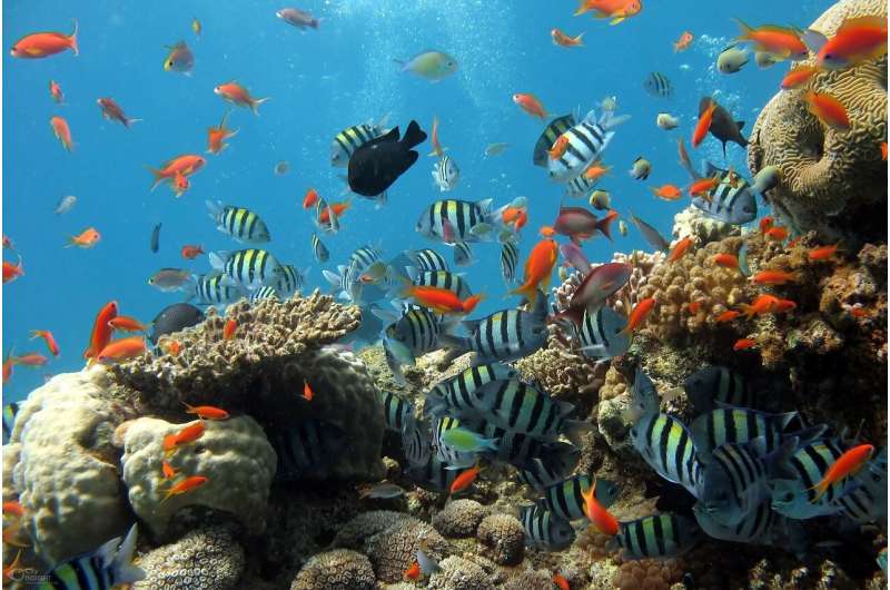
reef
Credit: CC0 Public Domain

Earth's average temperature in September 2023 was 1.75°C above its pre-industrial baseline, breaching (if only temporarily) the 1.5°C threshold at which world leaders agreed to try and limit long-term warming.

Persistent warming at this level will make it difficult for the ocean's  to survive. The same goes for those communities who rely on the reefs for food, to protect their coastline from storms and for other sources of income, such as tourism. Recent Intergovernmental Panel on Climate Change assessments have predicted that even if global heating is kept within the most optimistic scenarios, up to two-thirds of all coral reefs could deteriorate over the next few decades.

It will not be possible to restore all the reefs lost to . But we are scientists who study how to preserve these habitats, and we hope that artificial structures (made from concrete or other hard materials) could replicate the complex forms of natural reefs and retain some of the benefits they provide.

We know artificial reefs can attract fish and host high levels of biodiversity—often similar to natural reefs. This is partly due to them providing a hard surface for invertebrates like sponges and corals to grow on. Artificial reefs also offer a complex habitat of crevices, tunnels and other hiding places for species that move around a lot, such as fish, crabs and octopus.

Until now though, scientists were unsure if artificial reefs attracted wildlife which would otherwise live on nearby coral reefs or whether they helped support entirely new communities, enlarging existing populations. This is important, because if natural reefs do die, these artificial structures must be self-sustaining to continue benefiting species, including our own.

Our recent study published in Marine Biology is the first to examine whether artificial reefs in the tropics can function in the same way as their naturally formed counterparts. The answer is: not yet, but these  are beginning to mimic some of the key functions of coral reefs—and they should get better at it over time.

Follow the nutrients

Coral reefs support lots of different species in high numbers despite growing in  low in nutrients (chemicals such as nitrates and phosphates which boost plant growth). This puzzled naturalist Charles Darwin, and it became known as Darwin's Paradox. We now know reefs achieve this by circulating nutrients extremely rapidly through the invertebrates, corals and fish that live on them.

In a healthy coral  system, nutrients from dead animals and feces are rapidly consumed by animals living on the reef, such as small fish or invertebrates, and these small animals are frequently eaten by larger animals. This ensures these nutrients cannot accumulate and so they remain at low levels, preventing algae from overgrowing and smothering the reef.

If artificial reefs perform a similar function to natural reefs then we would expect them to rapidly process nutrients entering the system and keep overall nutrient levels low too. This would indicate they are also highly productive ecosystems, similarly capable of supporting diverse and abundant wildlife even if many natural reefs die.

We tried to make an accurate comparison of natural and artificial reefs by comparing  levels and how they are stored between the two.

From concrete to corals

Our study was conducted in north Bali, Indonesia. A local non-profit, North Bali Reef Conservation, which Zach co-founded, has been making artificial reefs for the last six years with the help of international volunteers and local fishers who use their boats to drop them offshore.

While over 15,000 reefs have been deployed so far, they only cover around 2 hectares—roughly the size of two football pitches.

But these structures are beginning to show signs of functioning like coral reef communities. In water we extracted from just under the sand near the artificial reefs we found high levels of phosphates—evidence of a large number of fish excreting. And in  from above the sediment, levels of all the nutrients we measured were low and similar to those recorded on natural reefs, indicating the artificial reef was rapidly recycling these nutrients.

However, the sediment around the concrete structures we tested appeared to be storing less carbon than that surrounding the natural reefs. We think the difference may be related to the relative abundance of invertebrate species such as hydroids (plant-like relatives of corals which feed by sifting detritus from seawater). These were common on the natural reefs we studied, but were only found in small, but increasing numbers on the artificial reefs. We think, as more of these species colonize the concrete over time, the reefs will function even more like their natural counterparts.

The study offers some hope that over time, artificial reefs can mimic more of the processes maintained by natural reefs. Our findings are an early indication that artificial reefs may be able to support  affected by reefs lost to climate change.

The climate threat to coral reefs will not be solved by artificial reefs. Only rapidly eliminating emissions of greenhouse gases can preserve a future for these ecosystems. But our research indicates that, where reefs have already been lost, through pollution, destructive fishing or coastal development, it may be possible to restore some of the lost benefits with .

Our study suggests it can take up to five years for  to begin functioning like coral reefs, so these recovery programs must begin right away.

More information: Zach Boakes et al, Nutrient dynamics, carbon storage and community composition on artificial and natural reefs in Bali, Indonesia, Marine Biology (2023). DOI: 10.1007/s00227-023-04283-4

Journal information: Marine Biology 


Provided by The Conversation 


This article is republished from The Conversation under a Creative Commons license. Read the original article.The Conversation

Man-made reefs: A compelling diving alternative


Further evidence of Earth's core leaking found on Baffin Island

More evidence of Earth's core leaking found on Baffin Island
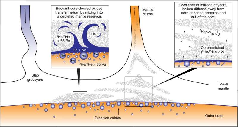
Schematic illustration of core-to-plume transfer. 
Credit: Nature (2023). DOI: 10.1038/s41586-023-06590-8

A combined team of geochemists from Woods Hole Oceanographic Institution and California Institute of Technology has found evidence of high levels of helium-3 in rocks on Baffin Island—possible evidence that the Earth's core is leaking. In their paper published in the journal Nature, the group describes their study of helium-3 and helium-4 on the Canadian Arctic Archipelago.

Prior researchers found trace elements of helium-3 in  on Baffin Island, hinting at the possibility that the Earth's core might be leaking. This is because it is an ancient isotope—it was prevalent during the time when Earth was forming and became trapped in the core. But because of its nature, helium-3 that makes its way to the surface soon escapes into the atmosphere and disappears into space. Thus, helium-3 is rare. If it is found on the surface, the odds are high that it made its way out of the core.

Intrigued by the possibility that the Earth's core might be leaking, the research team ventured to Baffin Island and began testing multiple lava flows. They found much higher levels of helium-3 than observed in prior research efforts—higher than anywhere else on Earth. They also found high ratios of helium-3 to helium-4 (a common isotope)—the highest that have ever been measured in terrestrial rock. Such high ratios, the researchers suggest, is another factor suggesting that the helium-3 is leaking from the core.

The research team notes that finding such high levels of helium-3 at a terrestrial site is a big deal, because if it can be proved that the material is indeed leaking from the core, it will provide scientists with a way to study core material, which has never been done before. That could reveal more about the core than previously thought possible. They note that if the  is coming from the core, then the other material around it should be as well, offering further physical examples of core material.

More information: F. Horton et al, Highest terrestrial 3He/4He credibly from the core, Nature (2023). DOI: 10.1038/s41586-023-06590-8


Journal information: Nature 

© 2023 Science X NetworkA theory to explain why helium-3 is leaking from Earth's core

New study shows Hunga-Tonga Hunga-Ha'apai eruption depleted ozone layer

New study shows Hunga-Tonga Hunga-Haapai eruption depleted ozone layer
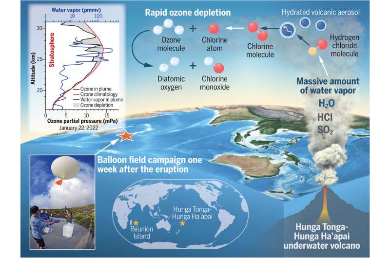
Eruption-triggered rapid O3 depletion. After the HT eruption, a balloon campaign took place
 at Réunion Island (left picture). Plume dynamics showcase the volcanic injection of H2O
 vapor, sulfur dioxide (SO2), and HCl, prompting rapid chlorine activation on hydrated
volcanic aerosol and O3 depletion in the stratosphere. The 22 January 2022 O3 profile
 (black line) contrasts with Réunion’s climatology (red line), displaying a notable decline.
 Illustration and map: Chelsea R. Thompson/NOAA; 
P\hoto: René Carayol/Université de la Réunion. 
Credit: Science (2023). DOI: 10.1126/science.adg2551

A large team of atmospheric specialists has found that when the Hunga-Tonga Hunga-Ha'apai volcano erupted last year, it took part of the ozone layer with it. Their findings are published in the journal Science.

Prior research has shown that the Hunga-Tonga Hunga-Ha'apai eruption was one of the more powerful explosions ever recorded. It was also unique in that instead of spewing just volcanic material, dirt and rocks, it also sent a very large amount of ocean water into the . In this new effort, the research team have found that all that saltwater reacting with other chemicals in the atmosphere, resulted in breaking down O3 in the  layer.

To learn more about the impact of the eruption, the researchers sent balloons with sensors into the atmosphere from nearby Réunion Island just five days after the volcano erupted. In studying the data from the sensors, the researchers found that ozone levels in the plume were approximately 30% below normal levels.

As the balloons continued to monitor the plume as it floated across the Indian and then Pacific Ocean, they found depletion totals of approximately 5%. The depletion, they found was due to  reacting with molecules in the atmosphere that contained chlorine, leading to a breakdown of ozone—in amounts that had never been seen before in such a short time.

The research team from Université de La Réunion, working with colleagues from the NOAA Chemical Sciences Laboratory, the University of Colorado, St. Edward's University, the University of Houston, the Finnish Meteorological Institute, the National Center for Atmospheric Research, the Swiss Federal Institute of Technology, NASA Goddard Space Flight Center and California Institute of Technology, notes that a 5% reduction in the ozone layer is not alarming both because it was localized and because in real-world terms, it was not that much. They note that the hole in the  over Antarctica sees a 60% depletion toward the end of every year.

Several chemical science experts have commented on the findings by the team; Dr. Laura Revell, for example, with the University of Canterbury noted that it is "fairly common to see short-term ozone losses following a  as a result of reactions involving volcanic aerosol and chlorine." And Olaf Morgenstern, with Atmosphere and Climate, NIWA, noted that "… the speed of the observed ozone depletion challenges our understanding of the chemistry occurring on the surfaces of these particles and droplets."

More information: Stephanie Evan et al, Rapid ozone depletion after humidification of the stratosphere by the Hunga Tonga Eruption, Science (2023). DOI: 10.1126/science.adg2551


 Journal information: Science 


© 2023 Science X NetworkWater in atmosphere from Tonga eruption may weaken ozone layer


LA REVUE GAUCHE - Left Comment: Search results for Hunga-Tonga

Scientists close the cycle on recycling mixed plastics


Scientists close the cycle on recycling mixed plastics

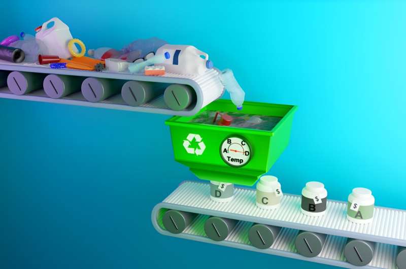
ORNL’s organocatalyst deconstructs mixed plastics at different temperatures, which 
facilitates recovering their individual monomers separately, in reusable form. 
Credit: Jill Hemman/ORNL, U.S. Dept. of Energy

Little of the mixed consumer plastics thrown away or placed in recycle bins actually ends up being recycled. Nearly 90% is buried in landfills or incinerated at commercial facilities that generate greenhouse gases and airborne toxins. Neither outcome is ideal for the environment.

Why aren't more mixed plastics recycled? It's usually easier and less expensive to make new  products than reclaim, sort and recycle used ones. Conventional recycling of mixed plastics has previously meant manually or mechanically separating the plastics according to their constituent polymers.

Addressing the issue, scientists at the Department of Energy's Oak Ridge National Laboratory used carefully planned chemical design,  and high-performance computing to help develop a new catalytic recycling process. The catalyst selectively and sequentially deconstructs multiple polymers in mixed plastics into pristine monomers—molecules that react with other  molecules to form a . The process offers a promising strategy for combating global plastic waste, such as bottles, packaging, foams and carpets.

The researchers' analysis, published in Materials Horizons, compared using the new multipurpose catalyst to using individual catalysts for each type of plastic. The new catalyst would generate up to 95% fewer , require up to 94% less energy input, and result in up to a 96% reduction in fossil fuel consumption.

"Our approach involves a tailored synthetic organocatalyst—a compound comprised of  that facilitate organic chemical transformations. The organocatalyst can convert batches of mixed plastic waste into valuable monomers for reuse in producing commercial-grade plastics and other valuable materials," said Tomonori Saito, an ORNL synthetic polymer chemist and corresponding author. "This exceptionally efficient chemical process can help close the loop for recycling mixed plastics by replacing first-use monomers with recycled monomers.

"Today, nearly all plastics are made from fossil fuels using first-use monomers made by energy-intensive processes. Establishing this kind of closed-loop recycling, if used globally, could reduce annual energy consumption by about 3.5 billion barrels of oil," Saito added.

A recycling solution for over 30% of all plastics

The new organocatalyst has proven to efficiently and quickly deconstruct multiple polymers—in around two hours. Such polymers include those used in materials such as safety goggles (polycarbonates), foams (polyurethanes),  (polyethylene terephthalates) and ropes or  (polyamides), which together comprise more than 30% of global plastic production. Until now, no single catalyst has been shown to be effective on all four of these polymers.

The process provides many environmental advantages by replacing harsh chemicals for deconstructing polymers, as well as offering good selectivity, thermal stability, nonvolatility and low flammability. Its effectiveness against multiple polymers also makes it useful for deconstructing the increasing amounts of multicomponent plastics, such as composites and multilayer packaging.

Small-angle neutron scattering at ORNL's Spallation Neutron Source was used to help confirm the formation of deconstructed monomers from the waste plastics. The method scatters neutrons at small angles to characterize the structure at different levels of detail, from nanometers to fractions of a micrometer.

Converting mixed plastics polymers to true recycled plastics

The organocatalyst deconstructs the plastics at different temperatures, which facilitates sequentially recovering the individual monomers separately, in reusable form. Polycarbonates deconstruct at 266° F (130° C), polyurethanes at 320° F (160° C), polyethylene terephthalates at 356° F (180° C) and polyamides at 410° F (210° C). Other plastics, additives and associated materials such as cotton and plastic bags are left intact because of the differences in their reactivity and can subsequently be recovered.

"The deconstructed monomers and the organocatalyst are water soluble, so we can transfer them into water, where any impurities such as pigments can be removed by filtration," said Md Arifuzzaman, the study's lead author and former postdoctoral synthetic organic chemist at ORNL. He is now an Innovation Crossroads Fellow and CEO and Founder of the Re-Du Company.

"The nearly pure monomers are then extracted, leaving the catalyst, which is almost entirely recovered by evaporating the water and can be directly reused for multiple deconstruction cycles."

More information: Md Arifuzzaman et al, Selective deconstruction of mixed plastics by a tailored organocatalyst, Materials Horizons (2023). DOI: 10.1039/D3MH00801K


Journal information: Materials Horizons 


Provided by Oak Ridge National LaboratoryTurning mixed plastic into useful chemicals


Extreme ocean temperatures threaten to wipe out Caribbean coral

“The entire Caribbean right now is bleaching," one researcher said, a situation that stokes fears of widespread bleaching that could lead to a catastrophic die-off.
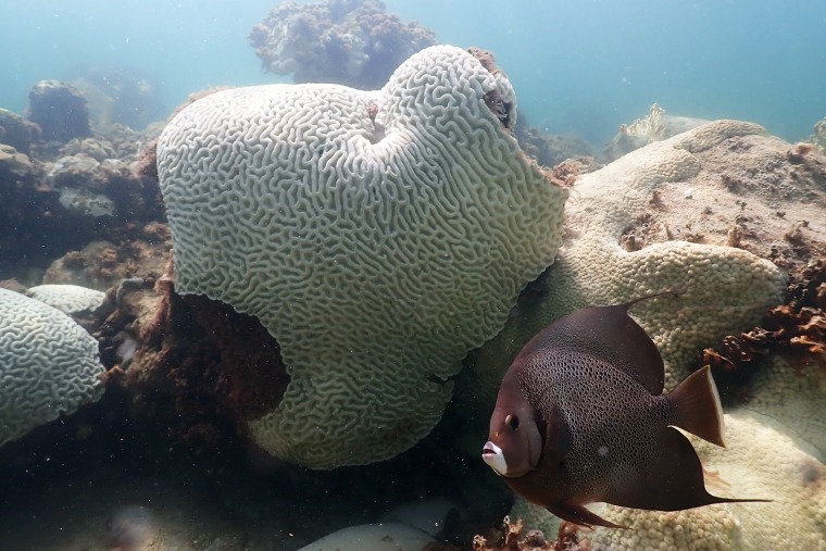
A fish swims near coral showing signs of bleaching at Cheeca Rocks, off Islamorada, Fla., on July 23
.Andrew Ibarra / NOAA via AP


Oct. 22, 2023
By Denise Chow

Unusually warm waters in the Caribbean Sea are fueling what some scientists say is the region’s worst episode of coral bleaching ever recorded — yet another worrisome development in what has been an off-the-charts year of warmth for the world’s oceans.

Reefs in and around the Caribbean are experiencing high levels of heat stress, according to researchers at the National Oceanic and Atmospheric Administration, stoking fears that widespread bleaching could lead to a catastrophic die-off of corals in the area. It comes on the heels of one of the worst bleaching events ever seen off Florida.

“Florida is just the tip of the iceberg,” said the coordinator of NOAA’s Coral Reef Watch Program, Derek Manzello, a coral reef ecologist. “The entire Caribbean right now is bleaching. If you picked a random spot on the map in the Caribbean and jumped in the water, you’re going to see bleached corals.”

Warm conditions are expected to linger in the Caribbean Sea in the coming weeks, while the Southern Hemisphere also transitions out of winter and into warmer spring temperatures. All told, it may be the start of what's known as a global bleaching event, Manzello said, which is characterized by widespread coral bleaching in all three ocean basins: the Atlantic, the Pacific and the Indian.
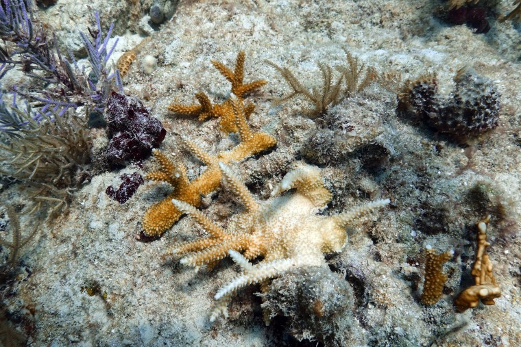
A partially bleached staghorn coral that scientists planted on Paradise Reef, near Key Biscayne, Fla., on Aug. 4.
Wilfredo Lee / AP file

The last such global event occurred from 2014 to 2017 — a period that, like this year, also featured the return of El Niño conditions, a natural climate cycle that can compound background warming from climate change, often boosting average air and sea temperatures.

Even with El Niño, the intensity of the marine heat waves, particularly off Florida, and their longevity came as a surprise, said Ian Enochs, a research ecologist at NOAA’s Atlantic Oceanographic and Meteorological Laboratory.

Recommended


CLIMATE IN CRISISIn search of 10 billion missing snow crabs, scientists eye marine heat waves


CLIMATE IN CRISISAs temperatures rise, songbirds struggle to keep young healthy, researchers find


Heat-induced bleaching occurs as a stress response to abnormal conditions, triggering corals to expel tiny photosynthetic algae that live in their tissues. That causes the colorful corals to turn an eerily "bleached" white hue.

Bleaching doesn’t necessarily cause corals to die, but the process weakens reefs and makes the marine invertebrates more susceptible to disease.

Sea surface temperatures around the world have smashed records in recent months, with some of the biggest and most persistent temperature spikes having been recorded in the North Atlantic Ocean, the Gulf of Mexico and the Caribbean basin. Over the summer, sea surface temperatures off Florida peaked over 90 degrees Fahrenheit and stayed elevated for weeks on end.

Part of Enochs’ research has focused on Cheeca Rocks, a reef within the Florida Keys. For more than a decade, Enochs has been monitoring the site, collecting data to compile 3D models of changes to the reef over time. This year, he said, Cheeca Rocks experienced 100% bleaching, with not a single part of the reef left unaffected.

“I have never ever seen anything to this extent at Cheeca Rocks,” he said. “We were experiencing heat stress levels that were double what we’ve ever experienced before at Cheeca Rocks. If that is not alarming in terms of the magnitude of this, I don’t know what is.”

Phanor Montoya-Maya, a marine biologist and restoration program manager at the Coral Restoration Foundation, a nonprofit ocean conservation organization, said marine heat waves were so intense this year that many corals didn’t have a chance to adjust.

“On those occasions where the temperature went up so quickly, they didn’t even have time to bleach. They were burned to death,” Montoya-Maya said.


The situation in the Caribbean isn’t yet as dire as it is off Florida. But, Manzello said, the bleaching event is still going on, and the full extent of this year’s record warmth may not be clear for months to come. What is apparent, however, is that the long-term trends are cause for alarm.

“It’s concerning because every time we’ve had a global bleaching event, they keep getting worse and worse,” he said.

Still, amid such ecological devastation, Enochs said, there is reason for optimism.

“There’s not much worse than the death of these important species, but at the same time, I have been truly surprised that we have not seen more destruction as of yet,” he said. “There’s been a whole bunch of mortality and death, but we have seen some recovery as water temperatures have dropped down. And that, to me, it means that in the face of all of this, there’s still hope.”
Manatees might return to the endangered species list

Posted by
Kelly Kizer Whitt
October 22, 2023
The U.S. Fish and Wildlife Service is considering whether manatees should be moved back onto the Endangered Species List. Sadly, in 2021, a record 1,101 manatees died in Florida, mostly of starvation.
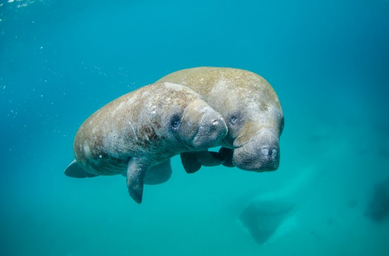
 Image via NOAA/ Unsplash.


Manatees are large, gentle marine mammals nicknamed sea cows. They’ve been battling for survival for decades but were downlisted from endangered to threatened in 2017. But in 2021 and 2022, Florida saw a two-year record in deaths for manatees, mostly due to starvation. On October 11, 2023, the U.S. Fish and Wildlife Service announced their review of petitions to relist manatees as endangered and said that the change “may be warranted.”

The process for getting on the endangered species list is not a quick one. In response to the petitions to relist the manatees as endangered, the U.S. Fish and Wildlife Service completed two 90-day studies. These studies found that the petitions may be warranted. But now, the Service will conduct 12-month studies to determine whether it will actually put manatees back on the endangered list. Mike Oetker, U.S. Fish and Wildlife Service acting regional director, said:

The Service has a long history of working to save the manatee from extinction since it was one of the first species listed under the 1967 precursor to the Endangered Species Act. We are committed to ensuring we are getting the most updated scientific information during this status review to protect and recover the species.

A deadly couple of years for manatees


Manatees were downlisted to threatened in 2017. That year, there were 538 manatee deaths in Florida. The following year, there were 824. And the past two years have been the worst of all. According to Inside Climate News:

Nearly 2,000 manatees died in Florida in 2021 and 2022: a two-year record. Conservation groups said the mortalities represented more than 20% of the state’s population.

Patrick Rose, executive director of the Save the Manatee Club, told Inside Climate News:

The best scientific information was available to the Fish and Wildlife Service when they went through the process of downlisting manatees, and we believe it was unjustified from a biological standpoint and that the risks and threats were actually increasing. Our warnings sadly unfortunately came true in a huge way.

After a record 1,101 manatees died in Florida in 2021 due mostly to starvation, wildlife officials began feeding manatees hundreds of thousands of pounds of lettuce. With the manatees’ food source choked out by algae blooms, tens of thousands of acres of sea grass went missing. So, state wildlife officials tossed romaine and iceberg lettuce into waters at the Indian River Lagoon. This 156-mile-long stretch along Florida’s east central coast saw more than half of the 2021 starvation deaths. Manatees seek out the warmer water here near a power station in the winter months.
Benefits and threats

Manatees are voracious eaters of sea grass. Their feasts help to keep the grass short and maintain the health of the environment. Sea grass grows in shallow water that receives filtered sunlight. So manatees spend most of their time in shallow water.

Shallow waters put manatees in danger of collisions with boats. Keeping the public informed of the presence of manatees can help reduce these collisions.

Another issue is that manatees feed and nest along waterways that are prime real estate for development. As NOAA said:

As new developments are built along waterways, natural nesting areas are destroyed. Sewage, manure and fertilizer runoff enters the water and causes algal blooms. Some of this algae is toxic and can kill manatees if they eat it.
Manatees are starving at unprecedented rates. 
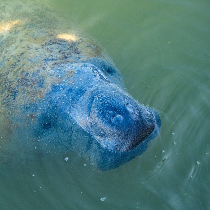
Image via Lars H. Knudsen/ Pexels.


How you can help

The Fish and Wildlife Foundation of Florida is a nonprofit group that raises money to help feed starving manatees. They are replanting sea grasses along the depleted coast. In 2022, they were the sole purchaser of the lettuce used to supplement the manatees. Learn more about this highly-rated charity here.

Do you live near or work in the waters where these manatees live? You may be able to help get them relisted. The petitions for returning manatees to the endangered list specifically involve the West Indian manatee and the Puerto Rican population of the Antillean manatee. These subspecies are both currently listed as threatened. The Service said that it is requesting new scientific and commercial data and other information regarding the West Indian manatee throughout its range. The public can submit data here, using docket number FWS-R4-ES-2023-0106 in the search box.

Bottom line: Manatees died in record numbers over the past two years. The U.S. Fish and Wildlife Service is considering relisting them as an endangered species.

Via U.S. Fish and Wildlife Service

Via Inside Climate News

Read more: Lifeform of the week: Florida manatee
STORM CHASING —
The quest to understand tornadoes
Scientists hope technology furthers their understanding of how and why tornadoes form.


CAROLYN WILKE, KNOWABLE MAGAZINE 
- 10/22/202

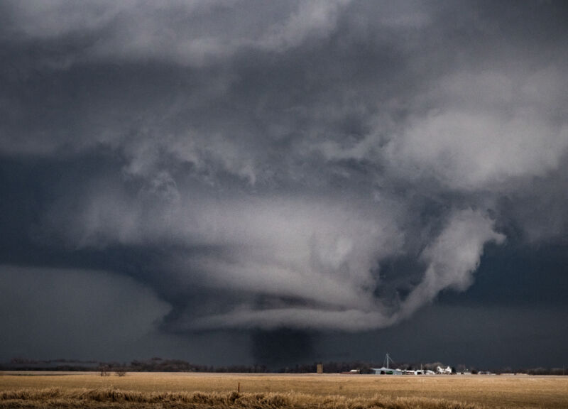
Enlarge / This stovepipe tornado formed under an intense rotating wall cloud near Keota, Iowa, on March 31, 2023.
Jonah Lange/Getty24WITH

One muggy day in July 1986, a news helicopter was recording footage of a festival in Minneapolis when the pilot and photographer glimpsed a tornado over nearby Brooklyn Park. They moved toward it, filming the powerful twister for 25 minutes, mesmerizing viewers watching it live on TV.

Watching as the helicopter hovered within maybe a half-mile of the twister was Robin Tanamachi, who was a kid growing up in Minneapolis at the time. “We were seeing all this really beautiful interior vortex structure,” she says. “I was just absolutely hooked on that, and I know I was not the only one.” Today, Tanamachi is a research meteorologist at Purdue University in West Lafayette, Indiana, and one of many researchers delving into twisters’ mysteries, searching for details about their formation that may bolster future forecasts.

Tornadoes can be elusive research subjects. Through chasing storms and using computer simulations, scientists have worked out the basic ingredients needed to spin up a twister, but two crucial questions continue to vex them: Why do some thunderstorms form tornadoes while others don’t? And how exactly do tornadoes get their spin?

Despite the logistically and scientifically challenging nature of the work, scientists are motivated to keep trying: Tornadoes can kill dozens to hundreds of people in the United States every year and cause billions of dollars in damage. Now researchers are chasing the killer storms that spawn tornadoes with cutting-edge technology, flying drones into the storms and harnessing more computing power than ever to simulate them in search of answers.

“Today, we’re simulating the atmosphere with unprecedented spatial resolution. We’re observing storms with unprecedented temporal and spatial resolution,” says atmospheric scientist Howie Bluestein of the University of Oklahoma in Norman. “But there’s still a lot of problems and a lot of things that need to be solved.”Advertisement


Scientists may be turning up new clues to tornado formation by studying what’s happening in the atmosphere around them and on the ground below them, and by comparing what they find in the field with new, higher-resolution models of the thunderstorms that generate them. Even as they chase these new leads, researchers are also trying to understand how climate change may affect when and where tornadoes form.
Chasing answers

Since scientists began studying tornadoes in earnest in the mid-20th century, they’ve put together a pretty good outline of the steps required to generate a twister. Most destructive tornadoes are spawned by supercell thunderstorms—giants that typically have a very tall cloud that widens into an anvil shape at the top. Supercells are characterized by a kilometers-wide rotating updraft called a mesocyclone that can last for hours. That rotation comes from wind shear, which sets wind nearer to the ground spinning horizontally like a spiraling football. These winds then become vertically oriented within an updraft like a spinning top.

A couple of things need to happen for a supercell to become tornadic: First, the giant mesocyclone at the heart of the storm needs to get air rotating closer to the ground. Then this vortex needs to be stretched upward. Stretching tightens the twister’s footprint, speeding its rotation, similar to what happens when figure skaters pull in their arms during a spin.

The first clues to the physics of tornadoes came from secondhand information and damage reports, as scientists tried to figure out what sorts of winds could blow down a barn or pluck a chicken, says Richard Rotunno, an atmospheric scientist at the National Center for Atmospheric Research in Boulder, Colorado, and the author of an overview of the fluid dynamics of tornadoes in the 2013 Annual Review of Fluid Mechanics.

The construction of the Interstate Highway System in the 1950s created a grid across the flat Great Plains that allowed enterprising scientists to get out in front of storms and sometimes directly observe tornadoes. A big advance came with the development of Doppler radar for meteorology. By emitting pulses of energy and detecting the reflected signal, the technology captures information about wind and precipitation. Radar allowed the detection of mesocyclones, which became the basis for tornado forecasts and a boon for chasers, who would stop at payphones periodically to call the lab for the latest radar intel.

But radar doesn’t catch all the clues scientists are after—such as the invisible forces in a storm that get winds moving—so they turned to models that simulate the physics of storms, says atmospheric scientist Paul Markowski at Penn State University in University Park. “In a computer simulation, we have all of those forces.”

The first three-dimensional simulations of supercells were created in the 1970s, helping scientists study the structures of updrafts and downdrafts and how precipitation evolves. As models improved over time, they revealed that updrafts can turn rotating areas of air into the massive mesocyclones in supercells. The models also showed how thunderstorms in the Northern Hemisphere can split into a left and a right cell, with the right one more likely to result in severe weather. These models were finally reproducing behavior observed in actual supercells and providing hints to how areas of cooler air, called cold pools, might play into tornado formation by shortening the time it takes for a twister to develop.

These models had relatively coarse resolution, but as computational power increased, simulations started to capture more detail about supercells, and researchers also worked to realistically capture the effects of rain, snow and hail. Still, the resolution was on the order of hundreds of meters—far too large to catch tornadoes, which tend to be closer to 20 meters wide.

Radar also got better and faster, and researchers started taking it into the field on trucks. In 1994, a host of scientists hoping to understand where tornadoes got their rotation began a multiyear campaign named Verification of the Origins of Rotation in Tornadoes Experiment, or VORTEX. They chased storms with all sorts of equipment, including sensor-loaded weather balloons, and instrumented cars that took temperature, pressure and wind measurements within supercells. But the scientists felt they needed further observations, leading to VORTEX-2 in 2009. “The big takeaway that we got from VORTEX-2 was that you can’t really tell whether a storm is going to be tornadic or non-tornadic just by how it looks on radar or what the weather balloons in its proximity show you,” Tanamachi says.Advertisement


Other field campaigns followed, but scientists still haven’t definitively answered why some supercell thunderstorms create tornadoes while others don’t progress beyond a mesocyclone. Now they are looking to new strategies and tools to fill in the rest of the story.

Send in the drones

Despite the drama of a churning twister, the center of a tornado probably isn’t where the answers lie. “Getting something into the tornado — it makes for good television, but it actually doesn’t tell us a whole lot,” Markowski says. “It tells us that it’s windy there and the pressure is low.”

Instead, scientists are using new tools to glean clues from the environment that could help them sift the tornadic supercells from the non-tornadic. “Detailed data on the structure of the atmosphere—its temperature, pressure, wind—below cloud base is largely absent,” Rotunno says. Researchers are starting to fly drones into storms to capture these observations.

Drones can take detailed measurements at higher altitudes than cars. And unlike weather balloons, they can cross boundaries between areas of a storm with different pressure or air density. “The reason we think they’re important is because tornadoes tend to form on these boundaries,” says atmospheric scientist Adam Houston of the University of Nebraska-Lincoln. Houston and his colleagues have been pairing drone observations with radar and other techniques in the field as part of the TORUS project since 2019. Now Houston’s team is digging through the data, looking for trends across storms for hints about whether these relatively small features influence tornado formation.

Scientists are also gathering information on what’s going on near the ground where the tornado forms. Both modeling and observations have shown that this is where the highest speeds occur. How air interacts with the land surface—features such as hills and forests—may play a role in starting and intensifying twisters, but radar tends to miss at least the first hundred meters just above the ground because of the geometry of the beam. Atmospheric scientist Jana Houser of Ohio State University in Columbus is hoping to learn more about what’s going on in that gap.Advertisement

Houser’s team chases storms, capturing radar measurements of a tornado’s size and intensity over time. Then they search for links between those data and the topography and roughness of the surface the storm has swept over. They’ve found that in most cases, changes in terrain affect the air getting sucked into the tornado and change the twister’s strength. This could be an important clue, but it’s proving difficult to puzzle out. “The problem,” Houser says, “is that sometimes the same type of occurrence in one case results in an intensification, and then in the next case, it results in a weakening.”

There may be a limit to how well researchers can understand and predict these storms, Markowski says. “When it comes tornadoes, I think we’re kind of butting up against chaos.” Perturbations that are so small they are essentially unmeasurable are everywhere in the atmosphere and may influence the formation of a tornado. Markowski and other scientists are starting to use machine learning to help better predict how these storms behave.

Finding the twist


Another big question has been swirling around twisters for decades: “We really don’t understand where the rotation that feeds the tornado ultimately comes from,” Houser says. The rotating air in a supercell’s mesocyclone is too high by the time it starts spinning vertically; the storms need additional rotation nearer to the ground to become tornadic. There are at least three hypotheses as to where this near-ground rotation comes from and, in any given twister, there may be multiple mechanisms at play, she says.

One hypothesis is based on how friction slows air moving near the ground. Air at higher altitudes moves faster and tumbles over the slower air and starts rolling like a barrel. The idea is that this rotating air could then be turned upright when it gets sucked into an updraft. Other hypotheses point to downdrafts related to precipitation and cooling air. The difference in density between cool air and neighboring warmer air can generate an air current that prompts spinning. Both observations and models have backed this idea and point to different areas of the storm where this may occur.

During either of these scenarios, there may also be many smaller pockets of swirling air that merge, combining into an area with enough rotation to get a tornado spinning. New support for this theory is emerging through higher-resolution storm simulations.

Most models working at coarser resolutions can’t actually see simulated tornadoes, inferring them instead based on areas of air with a lot of spin. Atmospheric scientist Leigh Orf of the University of Wisconsin-Madison has taken advantage of advances in supercomputing to build 10-meter-resolution models that can directly simulate tornadoes. At this scale, turbulence comes alive, Orf says. His models reveal how small areas of rotation could combine to kick off a tornado. “It fully resolves non-tornadic vortices that merge together in ways that are very compelling and I’ve never seen before,” he says.

Models can also provide hints of behavior to look for in the field. Orf’s models have helped him and his colleagues explore a feature they named the streamwise vorticity current, or SVC—a tail of swirling air off to the side of the storm that may amplify air rotation near the ground. Other scientists have now observed this feature in actual tornadic supercells.

Real-world observations don’t yet exist for the rotation mergers, but they may be coming. Plans to revamp the US radar system would employ a new generation of faster radar that can capture features that develop in a flash. “I am very confident that the things I’m seeing in the simulations will eventually be detected in the atmosphere, just like the SVC was,” Orf says.

High stakes


The landscape of tornado research has expanded from the Great Plains into the southeastern United States, driven by deadly storms and increasing tornado activity there. When a rash of tornadoes hit the region in 2011 starting in mid-April, more than 300 people were killed. “It was the largest outbreak on record since the super outbreak of 1974,” Tanamachi says. That motivated another campaign in 2015, VORTEX-SE, to study tornadoes there, but the work has proved difficult.

Not only do atmospheric conditions in the Southeast differ from the Great Plains, it’s also harder to observe twisters, Tanamachi’s team found. The hilly landscapes block views of storms, mucking up storm-chasing efforts. Instead, researchers have to forecast where a tornado might form and hunker down there. The one time this approach yielded a tornado sighting during VORTEX-SE, the radar was blocked by a stand of trees.Advertisement


Much of what scientists have learned about tornadoes elsewhere doesn’t apply to the Southeast because many of the tornadoes that occur there are not seeded by supercells. Instead, they grow from a line of storms called a squall line. “We have no clue how these work,” says atmospheric scientist Johannes Dahl of Texas Tech University in Lubbock. While these tornadoes are typically weaker than those from supercells, they can still cause damage and death.

Despite the challenges, understanding tornadoes in the Southeast remains a priority, especially as tornado activity has kicked up in the region in the last four decades or so. It’s not clear yet if this is due to climate change or something else, such as the climate pattern known as El Niño, Dahl says. Still, researchers have started to see some trends related to climate. A look at 60 years of US tornado data revealed that while the number of tornadoes didn’t change, the number of days on which multiple twisters occur has increased. Climate change appears to be aiding some of the ingredients for tornadoes at the expense of others. But it seems that on a good day for tornadoes, the conditions are very favorable, Houser says.

With increasingly powerful models, a possible upgrade to the US radar system and the help of machine learning, researchers will continue in their quest to unveil the inner workings of tornadoes. “Although research in this area has been going on for decades,” Dahl says, “it always seems like there are surprises.”

Even after 20 years of studying tornadoes, Houser finds herself “giddy, excited” by the prospect of catching a tornado in action—ideally over a field where it isn’t destroying someone’s home. “There’s this weird dichotomy between the beauty that they have and the volatility and intensity and violence that they wreak,” Houser says. “They’re so mysterious.”

Carolyn Wilke is a Chicago-based freelance science journalist who covers archaeology, chemistry, and the natural world. Find her @carolynmwilke. This article originally appeared in Knowable Magazine, an independent journalistic endeavor from Annual Reviews. Sign up for the newsletter.
Ancient pots hold clues about how diverse diets helped herders thrive in southern Africa

Published: October 22, 2023 
THE CONVERSATION
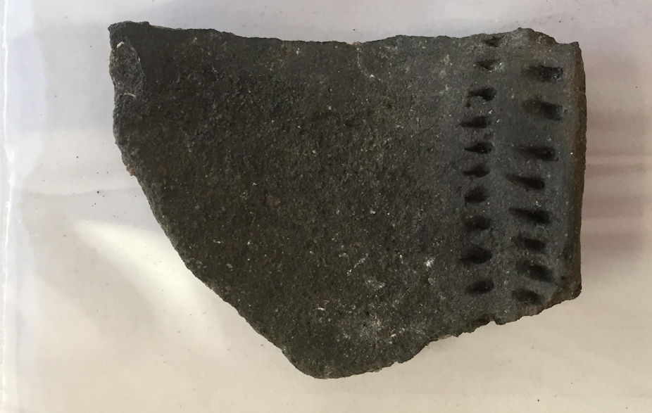
A potsherd from site. The portion shown is of a pot rim with incised parallel lines. 
Photo: Courtneay Hopper.


The introduction of herding – a way of life which centres on keeping herds of mobile domesticated animals – significantly changed Africa’s genetic, economic, social and cultural landscapes during the last 10,000 years. Unlike other parts of the world, mobile herding spread throughout the continent thousands of years before farming and did not replace foraging in many places. This gave rise to complex mosaics of foragers and food producers across sub-Saharan Africa.

Once herding reached southern Africa during the early first millennium AD, it spread rapidly throughout the region, in part because of presumed local adoption of sheep by diverse groups of foragers. Since these foragers and herders left similar types of artefacts it is difficult to pinpoint who was herding in the archaeological record, their dietary choices, and how this way of life spread.

Traditional archaeological data alone – such as the types of animal bones present at sites – can’t always help. So, researchers need to combine multiple lines of evidence from both traditional and biomolecular archaeology, which involves studying ancient lipids (fats) and proteins.

I am an anthropological archaeologist whose research focuses on understanding how herders thrived in the Namaqualand coastal desert of South Africa over the last 2,000 years.

Get your news from people who know what they’re talking about.Sign up for newsletter

Recently I was part of a research team that wanted to better understand how ancient herders in Namaqualand incorporated sheep into their diet. We analysed the residues of past meals preserved in archaeological pottery. By analysing lipids entrapped in ancient pottery we found evidence for dairy fats.

This may seem, at first glance, to be merely historical curiosity with no current applications. But in reality, conducting this research now – while herding is still a viable economic activity in Namaqualand – can contribute to the broader discussion about climate resilient landscape use. Herding initially spread to Namaqualand amid environmental, economic and social change. Similar forces threaten the practice’s future. Understanding how ancient herders managed their herds in an unpredictable environment may offer insights for altering or refining current practices.
Studying the pots

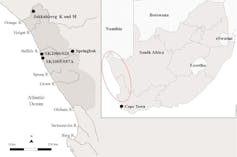
Namaqualand, which covers around 50,000km², is located in the westernmost part of South Africa’s Northern Cape province

.
Map of Southern Africa (inset) with Namaqualand enclosed in the darker grey area with approximate location of the archaeological sites and the town of Springbok marked.

It is bounded by the Atlantic Ocean to the west, the Kamiesberg Mountains about 100km to the east, the Oliphants River to the south and the Orange River to the north. This semi-arid desert has an average annual rainfall of 150mm; more than 66% of that falls in the winter months. The largest town in the region is Springbok, with a population of just under 13,000.

There generally aren’t many livestock bones present at archaeological sites in the region. This is because herders were highly mobile, with small herds, and didn’t regularly consume their sheep.

However, there is an archaeological resource that exists in abundance: pottery sherds. These contain microscopic traces of the ancient meals cooked in them. Analysing these pottery-bound lipids using a method called organic residue analysis allows researchers to identify ruminant (for example sheep, cow, antelope), non-ruminant (for example seal, shellfish, fish), and ruminant dairy fats that were cooked in the pots. Finding dairy fats in pottery provides evidence for livestock when their bones are absent or unidentifiable at archaeological sites.

Read more: Chemical traces in ancient West African pots show a diet rich in plants

We analysed pottery from four archaeological sites in the region dated to between AD 137 and AD 1643 to help unravel the dietary choices of ancient herders and foragers in Namaqualand.

The two inland sites located along the Orange River contained the remains of domesticated animals and pottery. The two coastal sites did not contain domesticate remains but did contain pottery, generally regarded as a proxy for herders.

We found that the people using these pots ate a variety of foodstuff including ruminant and non-ruminant animal fats. We also found the first direct evidence for people processing milk in South African pottery.

These findings suggest that low-intensity herders living in Namaqualand during the period we studied didn’t rely solely on their domesticated animals for all or even most of their daily dietary needs. Instead they had diverse diets and relied on a range of species for daily subsistence.
Looking ahead

Our next step is to characterise the ceramic-bound proteins preserved in the pottery. Organic residue analysis is a powerful tool. But it can only separate lipids into broad categories (dairy, ruminant, non-ruminant). Ceramic-bound proteins, meanwhile, are similar to DNA in that they encode fundamental genetic information that is key to identifying species. This species-level data is vital since early food producer sites consist of wild and domestic species that look similar.

Though this research focuses on the distant past, it has applications today, too.

Read more: Livestock are threatened by predators – but old-fashioned shepherding may be an effective solution

In Namaqualand, herding remains an important livelihood for many: 60% of households participate in some form of daily herding activity. Globally, many herders face serious water, food, and pasture scarcity. Herders in Namaqualand are being exposed to extreme temperatures and often have severely limited access to water and pasture.

So, this more targeted type of research on the resource use and subsistence decisions of archaeological herders who thrived in an unpredictable environment is important and timely.


Author
Courtneay Hopper
Postdoctoral researcher and Lecturer in Anthropology, University of British Columbia
Disclosure statement
Courtneay Hopper receives funding from the Social Science and Humanities Research Council (SSHRC).