Tuesday, April 16, 2024


Biden rule hikes fees for oil projects on public lands

Interior Secretary Deb Haaland described a new rule on oil and gas projects on public lands as the most significant reform to the program 'in decades'
Interior Secretary Deb Haaland described a new rule on oil and gas projects on public lands 
as the most significant reform to the program 'in decades'

Oil companies drilling on public lands must post larger bonds and pay higher royalties under a rule finalized Friday by the Biden administration.

The bonding requirements for development increased to $150,000 from $10,000, a level set in 1960 that no longer covers potential cleanup costs, the Bureau of Land Management (BLM) said in a press release.

In another shift, the Department of the Interior lifted royalty rates for leases to 16.67 percent from the previous level of 12.5 percent.

The changes were described by Interior Secretary Deb Haaland as the most significant reform to the leasing program "in decades" but were criticized by petroleum interests.

They come as President Biden emphasizes the environment in his reelection campaign against former president Donald Trump, who has mocked  as an issue.

Friday's action finalizes the department's preliminary step taken in July 2023 that the Biden administration described as part of a "transition to a ."

"Our  are owned by all Americans, and the Bureau of Land Management remains committed to managing them in a balanced, responsible way," said BLM Director Tracy Stone-Manning.

"This rule will help protect critical wildlife habitat, cultural resources, and recreational values, and it will ensure a fair return for American taxpayers."

Petroleum industry officials are reviewing the rule "to ensure the Biden administration is upholding its responsibilities to the American taxpayers and promoting fair and consistent access to federal resources," said Holly Hopkins, vice president of upstream policy at the American Petroleum Institute.

API, which had raised objections to the proposal during a public comment period, released figures on the economic contribution of petroleum development on federal lands, citing some 170,000 jobs in five states.

"As  continues to grow, oil and natural gas development on federal lands will be foundational for maintaining , powering our economy and supporting state and local conservation efforts," Hopkins said.

"Overly burdensome land management regulations will put this critical energy supply at risk," Hopkins added.

The environmental group Evergreen Action characterized the change as a "long overdue" step to boost biodiversity and the climate.

"Let's be real: We need to get these  off our public lands," said Evergreen Action's Mattea Mrkusic. "But for now, we're glad they won't get to stiff the public while they keep using ."

But Gladys Delgadillo, a climate campaigner at the Center for Biological Diversity, called on the Biden administration to go further.

"Updating oil and gas rules for federal lands without setting a timeline for phaseout is climate denial, pure and simple," said Delgadillo, who called for a complete shutdown of drilling on federal lands.

"Public lands should be places for people to enjoy nature and wildlife to roam free, not hotspots for toxic pollution," Delgadillo said.

© 2024 AFP


US seeks interest to build solar on public lands in the West


Scientists say coral reefs around the world are experiencing mass bleaching in warming oceans

Scientists say coral reefs around the world are experiencing mass bleaching in warming oceans
Bleached coral is visible at the Flower Garden Banks National Marine Sanctuary, off the 
coast of Galveston, Texas, in the Gulf of Mexico, Sept. 16, 2023. Reef scientists say coral 
reefs around the world are experiencing global bleaching for the fourth time due to 
prolonged warming of the oceans. 
Credit: AP Photo/LM Otero, File

Coral reefs around the world are experiencing global bleaching for the fourth time, top reef scientists declared Monday, a result of warming ocean waters amid human-caused climate change.

Coral reef bleaching across at least 53 countries, territories or local economies has been confirmed from February 2023 to now, scientists from the National Oceanic and Atmospheric Administration and International Coral Reef Initiative said. It happens when stressed coral expel the algae that are their food source and give them their color. If the bleaching is severe and long-lasting, the coral can die.

Coral reefs are important ecosystems that sustain underwater life, protect biodiversity and slow erosion. They also support  through tourism.

Bleaching has been happening in various regions for some time. In the world's largest coral reef ecosystem, Australia's Great Barrier Reef, bleaching affected 90% of the coral assessed in 2022. The Florida Coral Reef, the third-largest, experienced significant bleaching last year.

But in order for bleaching to be declared on a global scale, significant bleaching had to be documented within each of the major ocean basins, including the Atlantic, Pacific, and Indian oceans, in both the Northern and Southern Hemispheres.

Monday's news marks the second worldwide bleaching event in the last 10 years. The last one ended in May 2017. Brought on by a powerful El NiƱo climate pattern that heated the world's oceans, it lasted three years and was determined to be worse than the prior two bleaching events in 2010 and 1998.

This year's bleaching follows the declaration that 2023 was the hottest year on record.

"As the world's oceans continue to warm,  is becoming more frequent and severe," Derek Manzello, NOAA Coral Reef Watch coordinator, said in a statement.

Selina Stead, a  and chief executive of the Australian Institute of Marine Science, called climate change "the biggest threat to  worldwide." She said scientists are working to learn more about how coral responds to heat and to identify naturally heat-tolerant corals, but said it is "critical the world works to reduce carbon emissions."

One reef that fared better than others last year was the Flower Garden Banks National Marine Sanctuary, which was afforded some protection by its location in deeper water in the Gulf of Mexico about 100 miles off the Texas coast. Sanctuary officials didn't immediately respond to messages Monday seeking the latest on the health of the sanctuary's corals.

© 2024 The Associated Press. All rights reserved. This material may not be published, broadcast, rewritten or redistributed without permission.


Australia's Great Barrier Reef in grip of 'mass bleaching event'


Tandem heat waves, storm surges increasingly batter coasts: Study

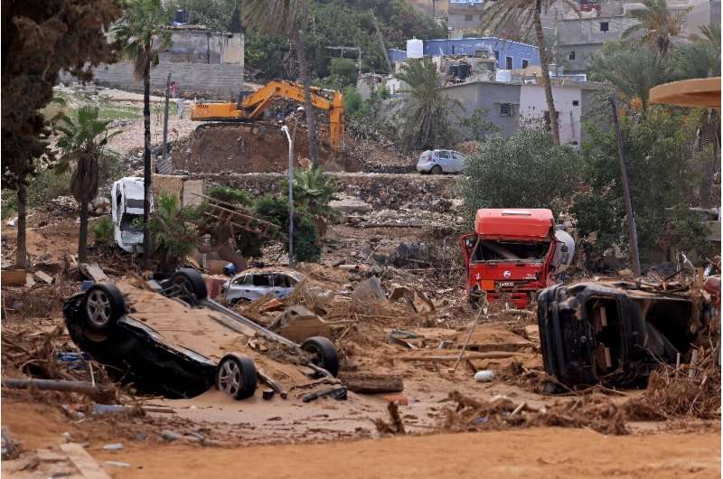
Deadly flash floods devastated Libya's coastal city of Derna in September 2023
Deadly flash floods devastated Libya's coastal city of Derna in September 2023.

Coastal communities need to prepare for simultaneous extreme weather events as heat waves increasingly overlap with surges in sea levels due to climate change, a study published on Thursday warned.

Extreme heat and sea levels are typically monitored and studied individually but researchers from Hong Kong Polytechnic University found they were occurring simultaneously—a phenomenon that could multiply fivefold by mid-century.

The study's lead author, Mo Zhao, told AFP these events pose "very dangerous" risks, from deadly heat to floods, that may "exceed the coping capacity" of communities to respond.

"We don't have sufficient resources or sufficient human resources to handle these two extremes," she said.

Previous studies have shown that heat contributes to storm systems like  that bring surging sea levels, said Shuo Wang, co-author and assistant professor of hydroclimatic extremes.

But the study published in the journal Communications Earth and Environment found that high temperatures not only precede storms but persist through them, leaving communities battered by two extremes at once.

Already, global coastal areas have seen these combined events occur an average of 3.7 days more per year between 1998 and 2017 compared to the previous two decades.

The study projected these events would increase by an average of 31 more days per year by 2049 under a worst-case scenario if planet-heating greenhouse gas emissions continue unabated.

Tropical regions such as southeast Asia, West Africa and eastern parts of South America would see the greatest increases.

Urgent emissions cuts required

With 40 percent of the world's population living in the tropics, the study said billions of people were facing the potentially deadly consequences.

And the solution is not as simple as air conditioning.

Cooling systems are not common in households in , the study noted.

Meanwhile, richer countries that do have them have shown that power cuts become a risk, particularly during storms.

"People cannot use air conditioners. But at the same time they suffer from heat... so we have adverse impacts on human health, especially for the elderly and children," Wang said.

The researchers said the world could avoid reaching this  by making rapid and deep cuts to emissions.

"If we take urgent action to mitigate the ... the situation would be better," Wang said.

But with the effects of climate change already being felt, extreme events cannot be avoided totally.

Instead, governments need to invest in adapting coastal infrastructure to better protect communities from the changing conditions, Wang said.

Early warning systems that measure the multiple variables contributing to complex crises are also needed so people can better prepare, he added.

More information: Mo Zhou et al, The risk of concurrent heatwaves and extreme sea levels along the global coastline is increasing, Communications Earth & Environment (2024). DOI: 10.1038/s43247-024-01274-1


Japan's Sapporo sees earliest 25C day since records began

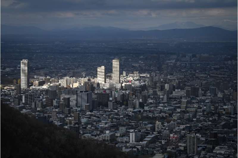
Sapporo, pictured here in November 2022, has seen its earliest 'summer's day' on record
Sapporo, pictured here in November 2022, has seen its earliest 'summer's day' on record.

Temperatures in Japan's northern city of Sapporo—famous for skiing—on Monday passed 25 degrees Celsius at the earliest point of any year on record, a weather agency official said.

Sapporo, the main city on the island of Hokkaido, hosted the 1972 Winter Olympics and each February holds a snow festival where massive ice sculptures draw tens of thousands of visitors.

"The temperature in Sapporo hit 26 degrees... and is still rising," Shuichi Yoshida, an official at the regional headquarters of the Japan Meteorological Agency, told AFP in the early afternoon.

It is the earliest that temperatures in the city have passed 25 degrees Celsius (77 Fahrenheit), which the JMA classifies as a "summer's day", since records began there in 1877.

Over 30 degrees is classed as "mid-summer" while over 35 is "extremely hot", according to the JMA's system.

"We can't rule out the possibility that climate change has played a role in the high temperature," Yoshida said.

Other factors such as high-pressure systems may have also contributed, he added.

On average between 1991 and 2020, the highest  in Sapporo on April 15 was 11.5 degrees Celsius, the JMA says.

Before Monday the earliest 25-degree day in the city was April 20, 1998, when the mercury reached 25.2 degrees.

Globally, this year has already been marked by  and rising , spurring fresh calls for more rapid action to limit global warming.

Every month since June 2023 has beaten its own "hottest-ever" tag—and March 2024 was no exception, according to Europe's climate monitor.

The JMA also says that  is making Japan's famous cherry blossoms appear earlier on average.

Last year's cherry blossoms, or sakura, began to flower in Tokyo on March 14, tied for the earliest ever alongside 2020 and 2021.

"Since 1953, the average start date for cherry blossoms to bloom in Japan has been becoming earlier at the rate of approximately 1.2 days per 10 years," the JMA says.

This year, however, the delicate pink and white blossoms arrived later than usual because of cold weather.

Sapporo had been seen as a favorite to host the 2030 Winter Olympics, but the city gave up its bid in October after corruption scandals connected to the 2020 Tokyo Games.

© 2024 AFP

Out on dry land: Water shortage threatens species in Ruaha National Park in Tanzania

Out on dry land: Water shortage threatens species in Ruaha National Park in Tanzania
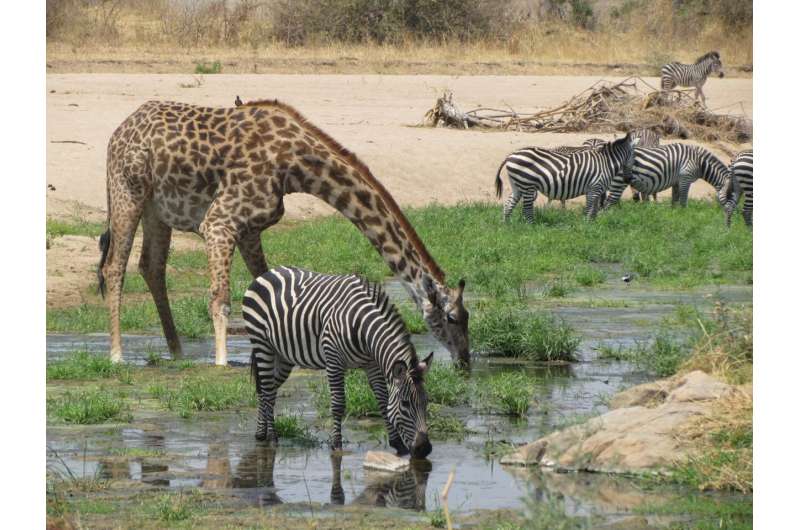
Zebras and giraffes in the Ruaha National Park in Tanzania.
 Credit: Claudia Schmied/Leibniz-IZW

Climate change is not the only cause of arid landscapes. A research team led by the Leibniz Institute for Zoo and Wildlife Research (Leibniz-IZW) has investigated the consequences of increased water abstraction for agriculture and livestock farming from the Great Ruaha River.

This river, which used to flow continuously, now dries up for months at a time. The scientists showed that some herbivores were able to partially compensate for the temporary lack of water through their diet, whereas others had little or no ability to do so. In particular, African buffalo, plains zebra and waterbuck were sometimes severely restricted in their habitat use as a result.

The effects of  on Ruaha National Park's biodiversity are described in an article in Wildlife Biology.

Although  across Africa aim to protect wildlife from the direct negative impacts of human activities such as bushmeat hunting, poaching, and livestock farming, wildlife populations are declining in many national parks. This is partly due to indirect human impacts, such as water abstraction from rivers outside national parks.

When little or no rain falls during the  in African countries, temporary water sources such as puddles, rain-filled depressions, and pools dry up. Many  respond by moving to the area around the remaining water.

"We wanted to find out which animal species cope best with water scarcity and which survival strategies they develop," explains first author Dr. Claudia Schmied, whose doctoral thesis on the consequences of water abstraction from the Great Ruaha River for the large animal community was supervised by the Leibniz-IZW. "During three dry seasons, we investigated which herbivores in Ruaha National Park changed their location and moved to sites where they find reliable water sources."

Some herbivores were more sensitive to water shortages than others, the scientists confirm. "There are animals that can partially compensate for the lack of drinking water through their diet, or have mechanisms to regulate their body temperature to limit water loss through feces and urine."

"Our results show that omnivores such as the crowned duiker and the warthog stayed put, so that their distance to the nearest water source in the late dry season significantly increased, so they did not follow the water," says Schmied. This was also the case for impala (Aepyceros melampus) and greater kudu (Strepsiceros zambesiensis), which have a mixed vegetarian diet.

"Our results suggest that these species are better able to cope with the decline in surface water than, for example, the African buffalo."

As grazers, African buffalo (Syncerus caffer), plains zebra (Equus quagga), and waterbuck (Kobus ellipsiprymnus) need constant access to drinking water. Omnivores such as the warthog (Phacochoerus africanus) and the crown duiker (Sylvicapra grimmia) have a broader diet, eating underground plants such as tubers and rhizomes, fruits, and smaller animals—food that contains more water than the grass during the dry season.

This advantage makes these species less dependent on access to drinking water.

The scientists mapped where the animals went in the early and late parts of the dry seasons to record in which locations they spent their time. The results were consistent with the expectation that some species were moving closer to the few remaining water sources in the upper Great Ruaha River.

"Our spatial analyses showed that the African buffalo completely withdrew from the study area during the dry season. These grazing animals are particularly dependent on water, as the moisture content of the grazed grasses is low during the dry season," says Professor Stephanie Kramer-Schadt, head of the Department of Ecological Dynamics at the Leibniz-IZW.

"The African buffalo in Ruaha National Park, therefore, loses large parts of its habitat during the dry season," adds Dr. Marion East, a scientist in the Department of Ecological Dynamics at the Leibniz-IZW and supervisor of Schmied's doctoral work.

At the end of the dry season, water-dependent herbivores increasingly congregated around the shrinking waterholes on the upper reaches of the Great Ruaha River. Larger predators, such as lions and leopards, move into these areas and consume a part of these populations.

However, little is known about the long-term effects of the loss of water from the Great Ruaha River on the ecology of Ruaha National Park and its high biodiversity. Increasing concentrations of animals around remaining water sources may facilitate the transmission of pathogens, the scientists suggest.

The high levels of water loss could also lead to a more rapid decline in nutrient quality and riparian vegetation, which in turn could affect the health of herbivores and have negative consequences for their populations.

Ruaha National Park in Tanzania was established in 1964 and expanded in 2008 to include the Usangu Game Reserve. Covering an area of 20,226 square kilometers, it is one of the largest national parks in Africa. It is considered to be one of the most important wildlife habitats in Africa. The Great Ruaha River is one of Tanzania's largest rivers and is regarded as the ecological backbone of Tanzania before it flows through Ruaha National Park (Tanzania), one of Africa's largest national parks.

More information: Claudia Schmied nĆ©e Stommel et al, Effect of human induced surface water scarcity on herbivore distribution during the dry season in Ruaha National Park, Tanzania, Wildlife Biology (2024). DOI: 10.1002/wlb3.01131

Provided by Leibniz-Institut fĆ¼r Zoo- und Wildtierforschung (IZW) im Forschungsverbund Berlin e.V.Global change may alter the way that hippos shape the environment around them: study


Record heat rots cocoa beans threatening Ivory Coast agriculture

Ivory Coast is the world's biggest producer of cocao
Ivory Coast is the world's biggest producer of cocao.

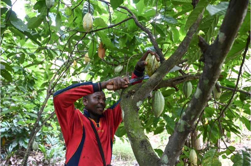
Surrounded by cocoa trees and intense heat, Christian Andre Yapi is forced to admit that the precious beans are no longer growing as they should, a major problem for the world's leading producer.

"The beans are turning black," and rotting, he tells AFP at his plantation near Agboville, 70 kilometers (nearly 45 miles) from the economic capital Abidjan.

"They are not growing properly because of the heat."

The leaves on the trees usually provide shade for the pods, but the sun "is drying them up and they are falling" off the trees.

It is so hot Yapi can work only in the morning, leaving plenty of spare time to dwell on his losses.

"Normally in the off season I get up to a tonne," but this year he expects just 300 kilograms (660 pounds).

Last year's heavy rains have given way to high temperatures, particularly from January to March, which have slashed the cocoa crop, which accounts for nearly 45 percent of global production.

The thermometer climbed to a record 41 degrees Celsius (106 Fahrenheit) at Dimbrokro in central Ivory Coast in February, said Daouda Konate, head of the national weather agency Sodexam.

Normal temperatures for that time of year would be 35C-36C (95-97F), he added.

Ivory Coast has not been alone in battling the hot weather over the region.

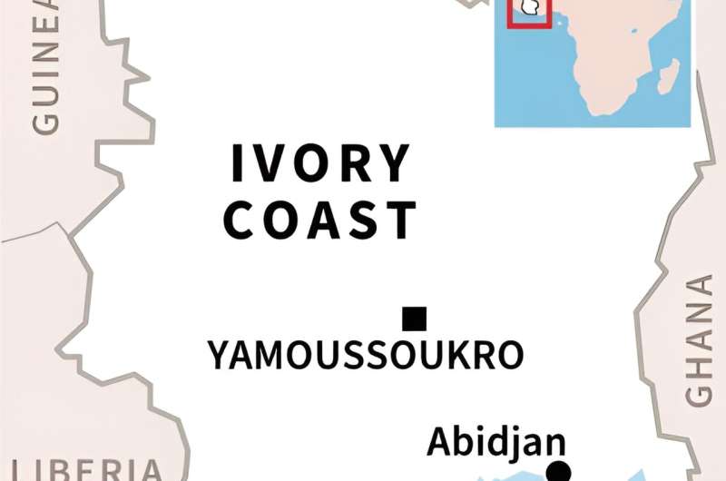
Ivory Coast
Map of Ivory Coast.

In Mali, the town of Kayes, in the southwest, suffocated under 48.5C (119F) in early April.

Long-lasting and intense periods of heat stress plants, said agronomist Siaka Kone, head of the higher school of agronomy in the Ivorian capital Yamoussoukro.

"The quantities of water available will not be sufficient for proper growth and there will be no blossom. Without flowers ... no fruit," he said.

Soil temperatures increase in line with air temperatures leading to greater water evaporation, noted Kone.

Agriculture represents a quarter of Ivory Coast's GDP and provides half of all employment.

Africa warming faster

"This year is different because of El NiƱo", a natural weather phenomenon which pushes up the temperature of a large part of the South Pacific, said Daouda Konate, recently appointed the first African vice-president of the UN's World Meteorology Organization.

"Human activity: what we consume and our industry," only make matters worse, said Nahounou Pierre Lautti Daleba, a geo-economist and environmental activist.

Africa has emitted only seven percent of global greenhouse gases since the mid-19th century, according to the UN  panel (IPCC), but temperatures have risen 1.4°C across Africa against 1.1 percent globally.

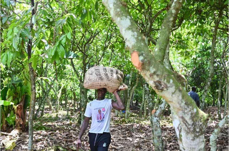
In Ivory Coast, with record heat the precious cocoa beans are no longer ripening as they should
In Ivory Coast, with record heat the precious cocoa beans are no longer ripening as they should.

Ivory Coast is aiming to cut emissions by more than 30 percent and preserve forests after losing 90 percent since 1960.

According to government forecasts, climate change could lead to annual GDP losses of 3-4.5 percent up to 2030.

Farmers "are not prepared for ", which are becoming repetitive, said Nahounou Pierre Lautti Daleba.

But there are ways to adapt, said Kone, who recommends water retention projects and not pulling up vegetation which protects against the sun.

Abidjan's rapid urbanization with a surging population of six million, has made it even more difficult to cope with the weather.

"Over the last 10 years the city of Abidjan has seen an increase in the number and scale of heat waves," said Felix Houphouet-Boigny university researcher Maimouna Ymba in a Red Cross report.

Combined with , this has created "islands of urban heat" where soil temperatures can rise 5-10 percent above the surrounding areas, she added.

© 2024 AFP


Top producer Ivory Coast fears for cocoa output after rains


Extreme heat is a problem in Virginia: Researchers want to help

extreme heat
Credit: Pixabay/CC0 Public Domain

The summers in Hampton Roads, Va., are hot, but for some residents, swelling temperatures and their impacts can be disproportionately worse.

 Portsmouth, Va., for example, a lack of green space and increase of development over time has created urban heat islands, said Elizabeth Malcolm, professor of ocean and atmospheric sciences and director of sustainability at Virginia Wesleyan University.

Urban heat islands occur when cities replace natural land cover with dense concentrations of pavement, buildings and other surfaces that absorb and retain heat. This effect increases energy costs, air pollution levels and heat-related illness and mortality.

"Remember when you were little and you were walking barefoot outside, and the grass was so much cooler than the the blacktop? So part of it is that change in albedo (reflective power), so the darker surfaces just absorb more sunlight and they retain the heat," Malcolm said.

"Also, the soil and the plants are also cooled by evaporative cooling—just like sweat cools our skin. When  evaporates or the plants are transpiring, you can get evaporative cooling.

"(In) urban areas, some of our processes like air conditioning and building release heat, so there's also anthropogenic heat released into the environment in urban areas."

Faculty at VWU received a grant to complete a two-year project to combat rising temperatures in Portsmouth. The first year will focus on mapping hot spots within the city's limits, and the second year will focus on community input from residents about  and other efforts.

Malcolm said  such as redlining have had lasting environmental impacts on Portsmouth. The University of Richmond has gathered maps and data related to redlining in cities in Virginia and beyond, including Hampton Roads.

An Environmental Protection Agency review of several studies found that some communities in the United States, particularly those that are  and with higher populations of people of color, have neighborhoods with higher temperatures relative to adjacent neighborhoods.

"Decisions that might have been made decades ago that affected how dense or how developed an area is—where the green spaces are or where they aren't—all have implications today for the health and well-being of the people who live in that neighborhood," Malcolm said.

Reducing  also can have economic and social effects, Malcolm added. A 2023 report from Rockefeller Institute of Government, a public policy research arm of the State University of New York, notes research reflected that the prevalence of trees in public right-of-ways are associated with lower crime rates. Other studies suggest reducing heat islands brings in development and lowers energy costs.

Extreme heat is the most dangerous weather event in terms of death, surpassing tornadoes, hurricanes and other severe storms, according to the National Weather Service. Each year, extreme heat events contribute to hundreds of deaths in the United States. Vulnerable populations, such as children,  and those with preexisting conditions become even more at risk as temperatures increase.

Garry Harris, a Portsmouth native and president of the Center for Sustainable Communities, said focusing on heat reduction can improve the lives of those who rely on being outside for jobs and for general quality of life since summers are only getting hotter due to climate change.

"(The project is for) the folks out there on the tarmac who are directly in those places, becoming dehydrated and falling ill," Harris said. "It's about gridlock. It is the single air conditioner in our homes, and if it goes out, you suffer. It's about those older folks who live in those redlined areas and (face) other housing injustice practices."

Community engagement in the project is going to be a major focus, Harris said. He said the group has already begun reaching out to civic leagues and religious groups, and making connections with residents about sustainability and taking care of the land will make community members more excited and engaged in the project. Harris said  is the key to more  and longevity.

"They experience on a daily basis particulates and those contaminants that the children are inhaling. Now, we layer on top of that: health disparities, , blood disease and heart disease," Harris said. "We layer on economic disparities, loss of jobs or no jobs (and) housing injustice. On top of that, we have severe weather, . That's what those communities are facing. That's what those people are facing.

"Planting trees is going to do something to help that out, but we're really proud of these folks that leap beyond that to do what's necessary to make their communities more sustainable and resilient for our residents."

2024 The Virginian-Pilot. Distributed by Tribune Content Agency, LLC.

Cities need plans for extreme heat, says expert, as heat waves stretch across the globe


Colorado will try turning off the electrical grid to prevent wildfires, an operation pioneered in California

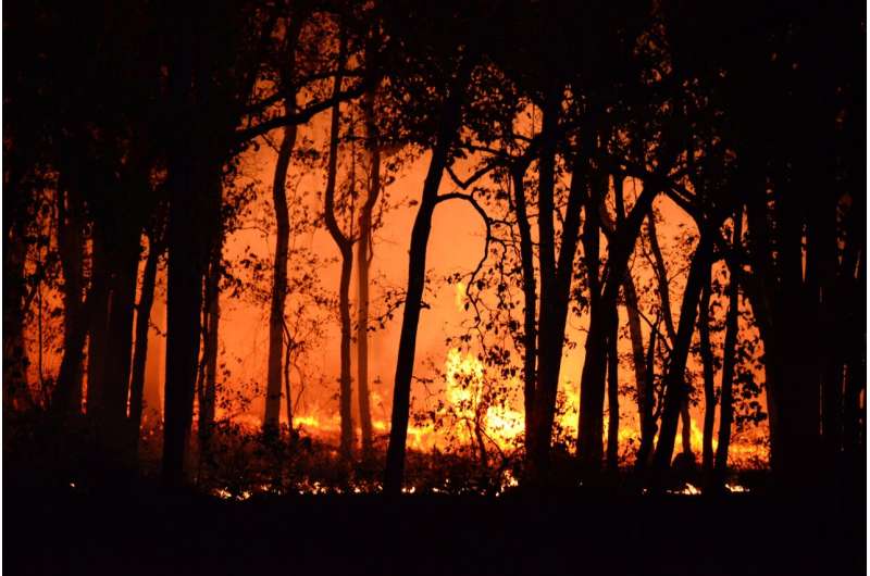
wildfire
Credit: Deep Rajwar from Pexels

The U.S. power grid is the largest and most complex machine ever built. It's also aging and under increasing stress from climate-driven disasters such as wildfires, hurricanes and heat waves.

Over the past decade, power grids have played roles in wildfires in multiple states, including California, Hawaii, Oregon and Minnesota. When  are high and humidity is low, electrical infrastructure such as aboveground  can blow into vegetation or spark against other components, starting a fire that high winds then spread.

Under , utilities may opt to shut off power to parts of the grid in their service areas to reduce wildfire risk. These outages, known as public safety power shutoffs, have occurred mainly in California, where wildfires have become larger and more destructive in recent decades.

On April 5-6, 2024, Colorado utility Xcel Energy carried out that state's first public safety power shutoff, cutting power to thousands of customers ahead of an intense windstorm. Public officials and Xcel customers complained that they had not received enough warning or explanation. Gov. Jared Polis has directed state regulators to investigate the incident and propose better procedures for the future.

I am an electrical and computer engineer, and study efficient operation of . I also live in Boulder County, where a wind-driven wildfire destroyed more than 1,000 homes in 2021. These shutoffs are likely to become more common in more places as climate-driven weather extremes stress aging grid components. This makes it important to understand and evaluate utilities' public safety shutoff plans.

An intricate system

Shutting off power and turning it back on—in utility-speak, de-energizing and re-energizing—requires more than flipping a switch. The power grid is a complex system that maintains a balance in real time between electricity flowing in from generating plants and out to customers.

Power lines don't have the capacity to store electricity for use later—it has to be used immediately. This makes the grid different from other critical infrastructure. Water networks can hold water in their pipes, and roadways can support cars at a standstill if traffic can't flow.


Coloradans describe how they were affected by the April outages.

Because the grid can't store electricity, de-energizing and re-energizing have to happen in stages to ensure that changes in the demand side of the power grid are not too rapid for the supply side to adapt to. Power plants can't turn on instantaneously: Some can start up within minutes, while others take hours, depending on their age, design and the type of fuel they use. And they generally can't raise their output from 10% of their generating capacity to 90% with the flick of a switch.

When a utility restores power after an outage, it produces a large, instantaneous spike in power use as devices in many homes turn back on. The grid also needs time to adapt to that surge in demand. And utilities may visually inspect power lines to check for damage before restoring power.

The complexities of local grids can make it seem as though these outages are being implemented unevenly or arbitrarily. The distribution transformer serving power to your home may be completely electrically disconnected from the one serving your neighbor across the street, putting your block in the dark while the next block's lights stay on.

And a utility may cut power because of a risk somewhere in its network that customers can't see. It's not always possible for utilities to fine-tune areas where power shutoffs happen.

Creating shutdown plans

California has been a test bed of sorts for public safety power shutoffs. The state's public utility commission approved them in 2012 as a way to mitigate the potential impacts of utility equipment-induced wildfires, and it has issued regulations guiding when utilities can de-energize power lines. The regulations require power companies to notify customers in advance and submit detailed reports within 10 days after each planned blackout.

Millions of Californians have experienced these shutdowns over the past decade. A 2023 review by PSE Healthy Energy, an independent research institute, found that the most-affected counties, mainly in Southern California, average four to five public safety outages yearly, which on average last 48 hours.

Oregon has followed suit, adopting public safety shutdown rules in 2022, but many other jurisdictions do not yet have formal protocols in place. Instead, these critical decisions rest with utilities. Developing sophisticated plans for public safety outages requires extensive knowledge of a utility's territory and accurate assessments of which zones are high-risk areas.

This Southern California Edison video explains how the utility determines whether a public safety power outage is required and how it manages these actions.

Utilities, however, don't always have abundant sensors in low-voltage distribution grids—the portion of the system that brings power into neighborhoods—and may lack extremely granular control over individual components. In fact, unplanned outages often must be manually reported. Many utilities are installing smart meters, some of which can automatically report outages back to the utility.

Power providers are also taking other steps to strengthen their grids against disasters, such as burying power lines. But depending on the location, this strategy can easily cost up to US$1 million per mile for low-voltage distribution grids and millions of dollars per mile for high-voltage transmission lines. These projects require intricate cost-benefit calculations, and their costs ultimately will trickle down to electricity consumers.

Preparing for public safety power shutdowns

For some people, losing power is a minor inconvenience. For others, it can mean the difference between life or death if they need electricity to keep essential medicine refrigerated, charge a portable oxygen concentrator or maintain their home temperature within a safe range.

Utilities should keep in contact with customers during every step of a public safety shutoff, starting with alerting them to charge essential devices and take other preparatory steps. They also should move people who have  or other issues that require access to power out of the blackout zone.

To make that kind of cooperation possible, utilities will need better insight into the state of the distribution grid, more detailed models of their systems, and improved measurement and sensing strategies that can help them develop accurate and granular assessments of wildfire risk.

Finally, utilities will need to make their decisions more transparent. No one likes losing power, so it is essential for ratepayers to understand why and how these outages happen and what their utility is doing to provide power as safely and reliably as possible.

Provided by The Conversation 

This article is republished from The Conversation under a Creative Commons license. Read the original article.The Conversation

Shifting power operations to reduce wildfires

The big dry: Forests and shrublands are dying in parched Western Australia

dry forest
Credit: Pixabay/CC0 Public Domain

Perth has just had its driest six months on record, while Western Australia sweltered through its hottest summer on record. Those records are remarkable in their own right. But these records are having real consequences.

Unlike us, trees and shrubs can't escape the heat and aridity. While we turn up the , they bear the full brunt of the changing climate. Our previous research has shown plants are more vulnerable to heat waves than we had thought.

Beginning in February 2024, large areas of vegetation started to turn brown and die off. With no real relief in sight, we unfortunately expect this mass plant death event to intensify and expand.

Just like a coral bleaching event, WA's plants are responding to the cumulative stress of the unusually long, hot and dry summer. And just like bleaching, global heating is likely to cause more regular mass plant deaths. The last time this happened in 2010-11, almost 20% of trees and shrubs in affected areas died.

This is in line with climate change models, which pinpoint south-western Australia as a warming and drying hotspot.

Which trees and shrubs are dying and where?

We have received reports from community members, colleagues, and authorities of dead and dying shrubs and trees spanning approximately 1,000 km from the Zuytdorp Cliffs near Shark Bay down to Albany on the southern coast.

In areas along the west coast where it was hottest, dead or dying patches are larger while further south in the forests, the damage is so far limited to pockets of dead trees and shrinking tree canopies.

At present, the die-off seems to have affected plants on and around shallow soils, including trees near granite outcrops and coastal heath.

While February heat waves directly killed some plants, it is likely the long, dry period finished the job. Despite some patchy rain last week, no substantial rain is forecast until May. It's likely more areas will be hit, including our iconic wet forests in the south.

How hot has it been?

Perth once again smashed temperature records this summer with a record thirteen days over 40°C in 2024 to date. Even in April, we had a 37°C day.

This comes off the back of last year's spring heat waves, which broke monthly maximum and minimum temperature records in both September and November.

While much of Australia's east coast had more than enough rain, the west largely missed out.

Rainfall has been below or very much below average over the past year, with the biggest rainfall deficits seen from Shark Bay's Gascoyne region right down to the southwest corner at Cape Leeuwin.

The summer's heat waves came from baking desert air, as high pressure systems directed hot dry easterly winds from Australia's arid interior over the region, just as we saw during the hot summer of 2021-2022,

Long hot and dry periods are expected to become more common as a result of our warming climate.

Declining rainfall will hit the historically wetter southwest hardest. This pocket of Australia is unique, cut off from the rest of the continent by desert. Here and only here live honey possums and numbats, towering karri and jarrah trees and red flowering gums. But it's the southwest which has lost most rainfall so far, with annual levels already 20% lower than 50 years ago.

It's happened before—but this time is worse

Over the summer of 2010-2011, we saw a similar event sweep south-western Australia. It came about when a winter drought gave way to widespread heat waves over summer. The result: die-off of forests and vegetation throughout the southwest.

On land, the effects extended over a smaller area than we are seeing now.

How bad was it? Pretty bad. Averaging across the region's affected areas, 19% of trees and shrubs died, while the forests of the south-west lost approximately 16,000 hectares of canopy, about 1.5% of the .

When forests die, the effects ripple through the ecosystem. The endangered Carnaby's black cockatoo population crashed, declining by 60%, while the jarrah forest east of Perth was so hard hit it was categorized at "risk of collapse" by the Intergovernmental Panel on Climate Change.

This time, the summer has been longer and hotter, with impacts on plants more widespread. Climate change is steadily warming the world. Last year was the hottest on record, with temperatures shooting past predictions.

What can we do?

Our trees and shrubs will keep browning off and dying until we get substantial rain. That means there's no way to tell when our extraordinary range of forest and shrubland species will have the opportunity to recover.

The longer term trend is not good. As with , the situation will worsen until we reverse climate change. Large-scale plant die-offs like this will become more likely.

What we do need are eyes on the ground to track what's happening across this enormous state. Our ability to understand, model and respond is hampered by a lack of field data.

If you want to help, take photos of dead or dying trees and upload them to the Dead Tree Detectives citizen science project hosted on the Atlas of Living Australia.

Provided by The Conversation 

This article is republished from The Conversation under a Creative Commons license. Read the original article.The Conversation

Flash droughts are becoming more common in Australia. What's causing them?