John Klyce, Memphis Commercial Appeal
Updated Wed, May 15, 2024

A 3D printed model, created by Dr. Christodoulos Kyriakopoulos with the University of Memphis’ Center for Earthquake Research and Information, demonstrates where the Axial Fault is during the New Madrid 1812 earthquake on Thursday, May 02 2024 at 3890 Central Avenue in Memphis, Tenn.
From Dec. 16, 1811, to Feb. 7, 1812, three major earthquakes violently shook part of the central United States. Trees bent and snapped. Sand blows erupted. Chimneys toppled and cabins collapsed. Crashing waves tormented boats on the Mississippi River, which appeared to run backward. A swath of marshes became the 15,000-acre Reelfoot Lake.
The earthquakes were so powerful they were felt in South Carolina, in Connecticut, and at the White House by President James Madison, who wrote in a Feb. 7 letter to Thomas Jefferson that “the re-iteration of earthquakes continues the uproar from certain quarters.”
Madison, however, didn’t have to worry about overseeing a widespread emergency response. The earthquakes were caused by the three faults in the New Madrid Seismic Zone, a chunk of the central U.S. that was sparsely populated. Where there were settlements, there was damage; but the area was still considered the frontier and contained no large cities.
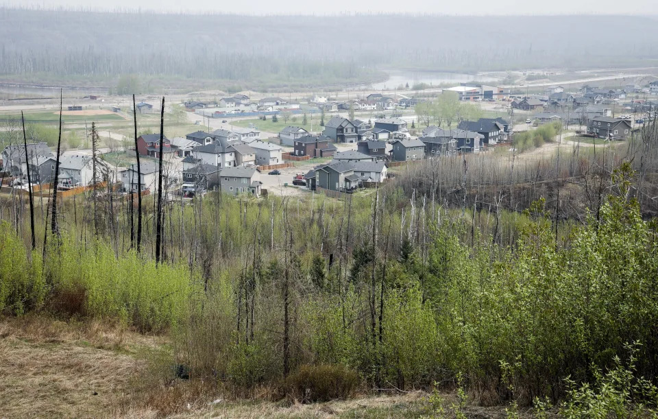
But as time passed, more people ventured into the area. In 1819, seven years after the last of the giant earthquakes, Memphis was founded, just 40 miles away from one of the three New Madrid faults. Its population grew, along with the populations of other nearby towns. They constructed homes, hospitals, restaurants, and hotels. They constructed towers visible from the sky.
And if earthquakes like the ones from 1811 and 1812 were ever again felt in the seismic zone, there would be no shortage of opportunities for destruction.
Memphis is near a major fault: Here's what experts say you can do to prepare for an earthquake
Will there be another major earthquake?
It’s no secret that Memphis is close to a major fault, and if you've lived here long enough, you've probably heard the theory that repeats of the 1811-12 earthquakes could devastate the city.
In 2008, a project funded by the Federal Emergency Management Agency simulated worse-case scenarios for the Central U.S. if there were earthquakes of a similar magnitude, and the results were startling. The number of casualties in Tennessee, it predicted, could eclipse 60,000, with most of them occurring in West Tennessee.
One line in the report was especially disconcerting: "Memphis in particular could see severe damage."
But don't panic. The chances of cataclysmic earthquakes striking the region in your lifetime are slim, and they aren't something you need to fret about in your day-to-day life.
That being said, a lot of seismologists believe a repeat of the 1811-12 earthquakes could happen. The University of Memphis is home to the Center for Earthquake Research and Information, which closely tracks and studies earthquakes. The organization is internationally recognized as an authority on seismology, and its staffers haven't ruled out the possibility of catastrophic earthquakes rocking the region.
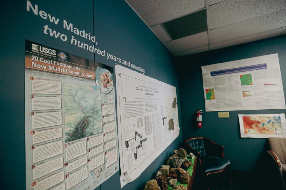
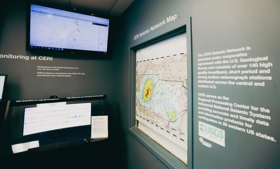
The seismic monitoring area at the University of Memphis’ Center for Earthquake Research and Information, can be seen during a tour on Thursday, May 02 2024 at 3890 Central Avenue in Memphis, Tenn.
“The odds are very good that we're going to get a repeat of 1811 and 1812,” said Mitch Withers, Ph.D., an associate research professor with CERI. “Nothing has changed that we’re aware of, that would stop that from happening again in the future sometime.”
According to the U.S. Geological Survey, the early 19th-century earthquakes weren’t the first ones in the New Madrid Seismic Zone. Similar sequences of earthquakes had already happened, around 1,450 AD and 900 AD, and other large earthquakes have also struck the region over the last 5,000 years.
“We know that similar sequences of earthquakes happened in the past at least three times,” Withers said. “So, if every 10 years your gate gets knocked down… you might guess that your gate is going to get knocked down again.”
Hard to predict 'the big one'
If a catastrophic earthquake were to come, it would likely be somewhere between a magnitude of seven and eight, which is the estimated strength of the 1811-12 earthquakes and enough to devastate communities. For comparison, earthquakes with a magnitude of 2.5 or less, which happen regularly, usually aren’t felt.
But just what are the chances of earthquakes like these returning to the seismic zone soon?
It’s difficult to say.
The USGS estimates that there’s a 7% to 10% chance the NMSZ would get a repeat of the 1811-12 earthquakes in the next 50 years. It also estimates that there’s a 25% to 40% chance it would get a 6.0 and greater earthquake ― which wouldn’t be as severe but could still cause significant damage ― in that same period.
But these are rough estimates; not exact predictions, and they don’t specify where in the NMSZ the earthquakes might occur. Would they be caused by the fault closest to Memphis, which is about 40 miles away in Marked Tree, Arkansas? Or would they stem from one of the other two major faults in the seismic zone ― which spans about 150 miles and covers portions of western Tennessee, northeast Arkansas, southeast Missouri, and western Kentucky?
Memphis could be affected regardless, and in 1811-12, all three faults ― not just one ― caused major earthquakes. Earthquakes of magnitude seven or more often come in sequences of two or three. But the questions do raise an important point: predicting earthquakes is difficult.
Previously: West Tennessee earthquake rattled nerves but no particular cause for concern, expert says
More: 5 things to know about earthquakes in the Memphis area
You can’t tell exactly where in the NMSZ major earthquakes would take place, just as you can’t tell when they would take place. Studies have shown that the sequences of earthquakes comparable to 1811-12 have occurred about every 500 years, but, as Withers noted, there’s “considerable variability in that.”
While you can make probabilities of the future that are based on the past, you can't predict earthquakes.
"The problem is, we can't tell you the 'when' of it," said Kent Moran, Ph.D., a research associate with CERI. "It's sort of like, 'When is the next earthquake?' When you feel it."
What would a massive earthquake do to Memphis?
If earthquakes similar to those of 1811-12 were to come, the effects on the Mid-South could be serious. When Withers spoke about damage, it wasn't initially clear if he was saying it would be “extensive” or “expensive.”
But really, either works.
One of the issues is that Memphis has a significant amount of unreinforced masonry buildings, which are typically older brick structures that predate building codes and are not braced by some kind of reinforcing material.

PhD student Navin Thapa explains how he interprets data to determine the magnitude of seismic activity in the Earthquake Physic Lab at the University of Memphis Center for Earthquake Research and Information on Wednesday, Feb. 14, 2024 in Memphis, Tenn.
When shaken by major earthquakes, they typically don’t fare well.
“Unreinforced masonry is probably one of the biggest concerns,” said Gary Patterson, a geologist and the director of education and outreach for CERI. “You have bricks without any steel reinforcement… If you move them a little bit in the mortar, they’re not going to return to where they were, and that means damage.”
Let's take another look at the FEMA-funded project produced in 2008, which simulated worse-case scenarios for the Central U.S. if the NMSZ produced magnitude 7.7 earthquakes.
According to the report, in Tennessee, over 250,000 buildings could be “moderately or more severely damaged,” economic losses could surpass $56 billion, and the number of casualties could eclipse 60,000. If the earthquake were to occur at 2 p.m., the number of casualties could reach 63,000 ― including nearly 4,100 fatalities ― and roughly 75% of them would occur in the 37 counties in west Tennessee. In addition, 263,000 people in Tennessee could also be displaced, and this, the report notes, is “likely due to the major population of Memphis, TN, incurring significant damage.”
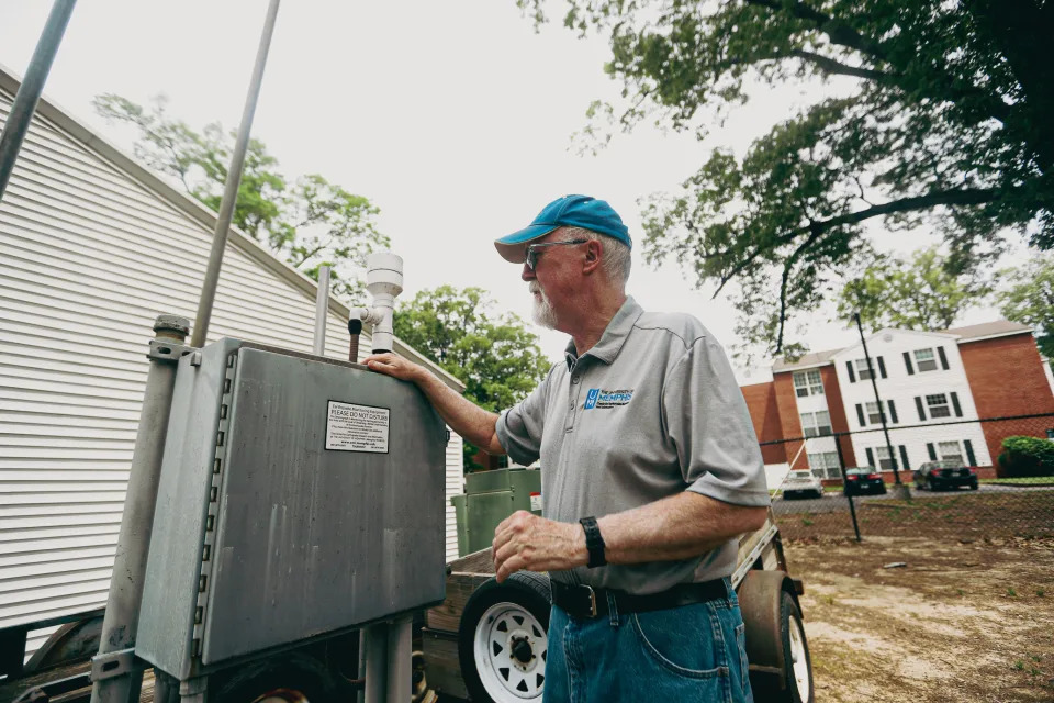
Dr. Kent Moran, with the University of Memphis’ Center for Earthquake Research and Information, explains how earthquake monitoring equipment works during a tour on Thursday, May 02 2024 at 3890 Central Avenue in Memphis, Tenn.
The situation grows even more severe when you think about the implications for the broader region. Tennessee likely wouldn’t be the only place affected, given the size of the NMSZ and the reach of severe earthquakes. As the report puts it:
“A recurrence of the 1811-1812 series could have devastating impacts on the region, with considerable national repercussions, as transportation routes, natural gas, and oil transmission pipelines are broken, and services are interrupted.”
Hospitals and strip malls
The report doesn’t exactly paint a rosy picture. But it was released 16 years ago, and if the simulations were done again today, the outlook might look different.
In the 1990s, more stringent building codes were adopted around the country, due to lessons learned from earthquakes in California. And in 2008, Memphis and Shelby County adopted a code that was already used by much of the U.S. and required new project designs to put more focus on seismic provisions (which help structures resist seismic forces during earthquakes).
Developers must adhere to the minimum seismic provisions required by the code, which would, in theory, keep the building upright in the event of a major earthquake, and protect the people inside. The building might still incur significant damage; it could even be ruined. But the risk of casualties is much lower.
A graph with information on the New Madrid 1812 earthquake can be seen during a tour on Thursday, May 02 2024 at 3890 Central Avenue in Memphis, Tenn.
Developers and businesses do have the option, however, to implement more comprehensive and expensive protections against earthquakes, which would allow them to not just withstand the shaking but hopefully remain operational. And for some structures built since 2008, these extensive provisions aren't optional. Generally, buildings key to the welfare of society ― like schools, hospitals, or fire stations ― must meet more stringent requirements.
Whereas a strip mall need only adhere to the minimum code standards, a hospital must be thoroughly prepared for the possibility of a major earthquake.
And if a developer takes a building constructed prior to the codes adopted in 2008, and changes what it’s used for, there’s a good chance they’ll have to evaluate it, and, if necessary, have it seismically retrofitted.
“More buildings have been designed to more current codes,” said Ryan McDaniel, the engineering systems practice leader and principal for the firm A2H. “I know we've done a number of retrofits… There are buildings that no longer exist; they've been knocked down. And we've got a lot of new buildings.”
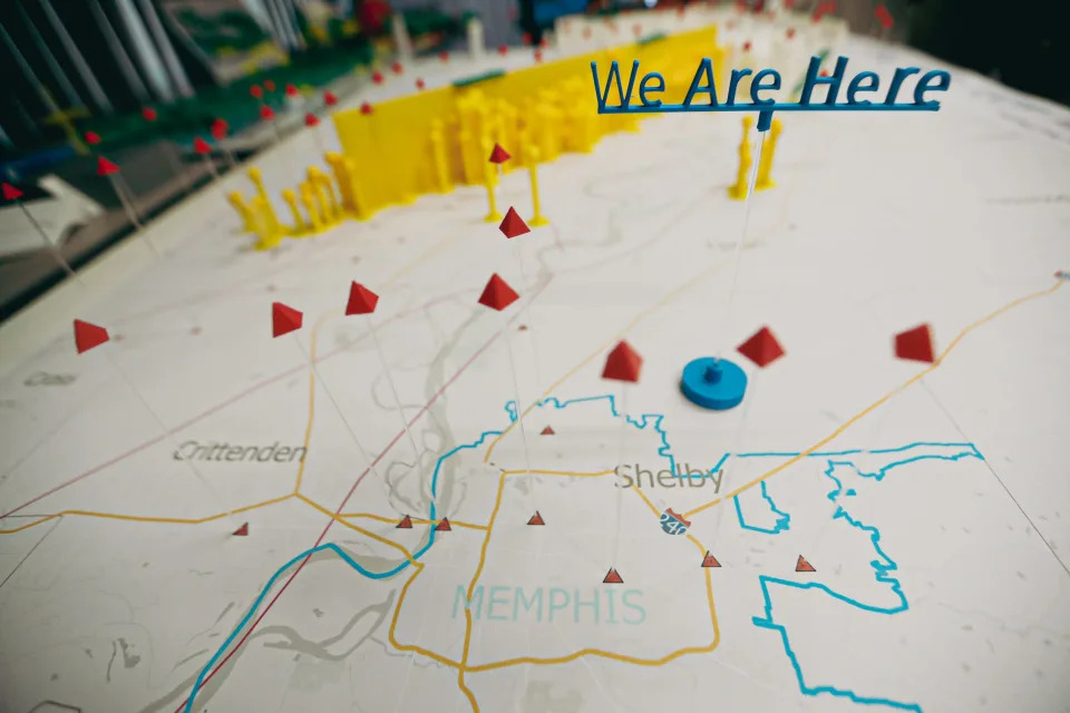
A 3D printed model, created by Dr. Christodoulos Kyriakopoulos with University of Memphis’ Center for Earthquake Research and Information, demonstrates the New Madrid 1812 earthquake on Thursday, May 02 2024 at 3890 Central Avenue in Memphis, Tenn.
Still, he acknowledged that calculating the damage difference between now and 2008 would be challenging. And it’s possible the results wouldn’t be dramatically better.
“2008 hasn’t been that long ago,” said Mike Sheridan, a structural engineer and senior VP for the firm Allen & Hoshall. “I think if you come back in 20 years, you might start to bring that down.”
The building codes adopted in 2008 also don’t require structures erected before that year to be seismically retrofitted, unless its purpose changes. And while building owners have the option to strengthen their structures against earthquakes, there can be questions over whether they should do so ― especially if it’s considered a historic structure.
Seismic retrofitting can be costly and invasive. If you’ve got a beloved, historic building, should you pour millions of dollars into earthquake protections that could alter its appearance, when the chances of an earthquake are slim?
"That's a societal question, more than an engineer's question," McDaniel said. "Oftentimes, seismic retrofits may be invasive and affect the appearance or other historical features of a building. So whether it should or should not [undergo seismic retrofits] is up to authorities of that jurisdiction, society, and people."
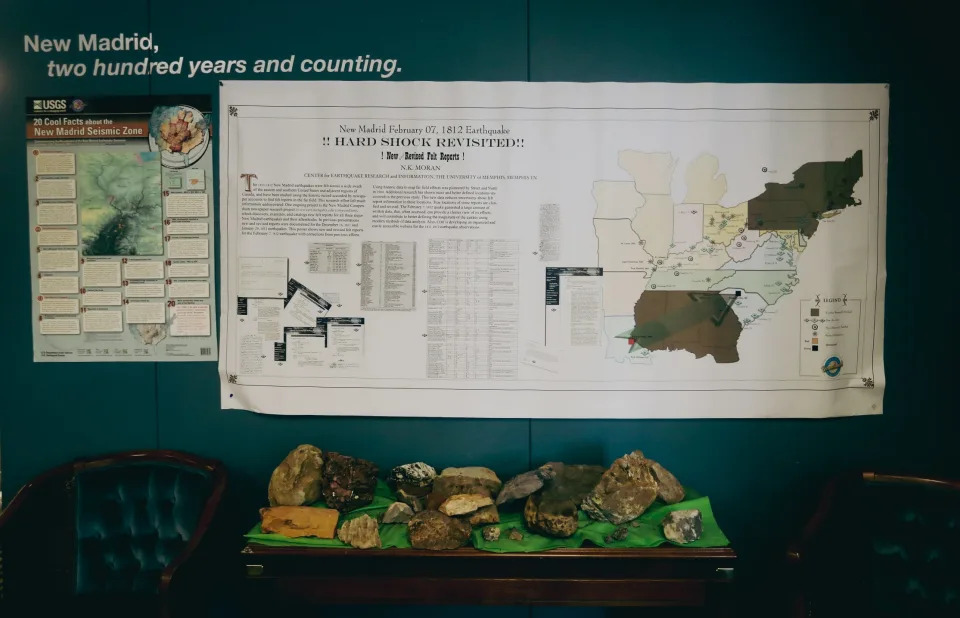
A graph with information on the New Madrid 1812 earthquake can be seen during a tour on Thursday, May 02 2024 at 3890 Central Avenue in Memphis, Tenn.
There are marquee facilities in Memphis that have either been designed to withstand earthquakes or seismically retrofitted. For example, the AutoZone headquarters and FedExForum were built with seismic provisions, and the Pyramid and the Interstate 40 bridge are among the local structures that have undergone extensive retrofits.
But there are also many buildings that don’t meet seismic standards and likely wouldn’t fare well in the event of an 1811-12 repeat.
Regional One Health at risk
Take, for example, the Medical District campus of Regional One Health.
Regional One President and CEO Dr. Reginald Coopwood explained that its facilities were constructed between 1950 and the mid-1980s, and its older structures don’t have any kind of seismic provisions ― putting the hospital in a potentially dangerous position if a major earthquake were to strike.
“That puts... some of the critical areas of our hospital [at risk]. One, the trauma center, today, sits up underneath our towers that are upon stilts. So, we’re at risk, in a devastating earthquake, that the trauma center would not exist,” Coopwood said.

Research associate Holly Withers explains how she watches for certain things on the duty review page to give information about how impactful an earthquake is at the University of Memphis Center for Earthquake Research and Information on Wednesday, Feb. 14, 2024 in Memphis, Tenn.
He means that the trauma center wouldn’t be able to provide the critical services that could be necessary amid a catastrophic earthquake. But a comprehensive seismic retrofitting of Regional One would come with a hefty price tag; it was estimated to be $568 million.
Instead, Regional One plans to build an entirely new hospital. The possibility of a cataclysmic earthquake, of course, isn’t the only reason for this ― but it is a major one.
“I hope it never comes,” Coopwood said. “But if it were to come, I want the region’s trauma center to be housed in a building that is seismically appropriate, so we can respond.”
Should we be worried about a big earthquake in Memphis?
None of this, of course, is meant to keep you up at night. Withers, the associate research professor at CERI, is still sleeping, and he's spent the bulk of his career studying earthquakes.
Does he think we should be prepared, in case catastrophic earthquakes do come? Yes. But does the idea of them scare him?
Not necessarily.
“You know, you can die of a lot of different things every day,” he said. “And if you’re walking around worried about all the things that can kill you, you forget to live.”
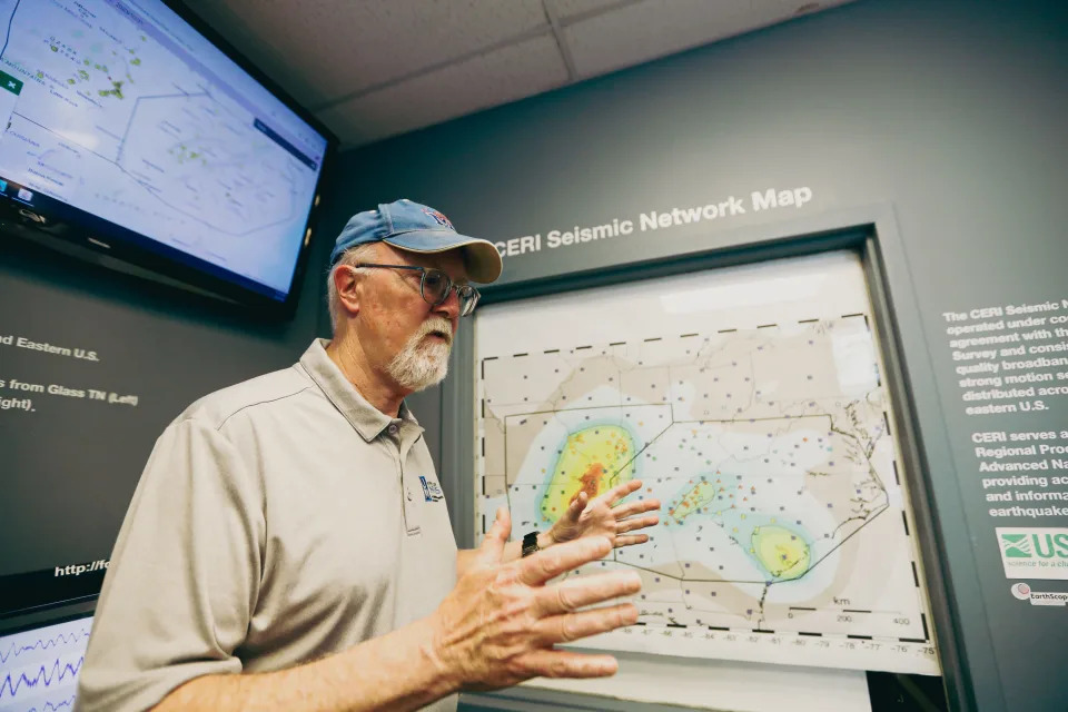
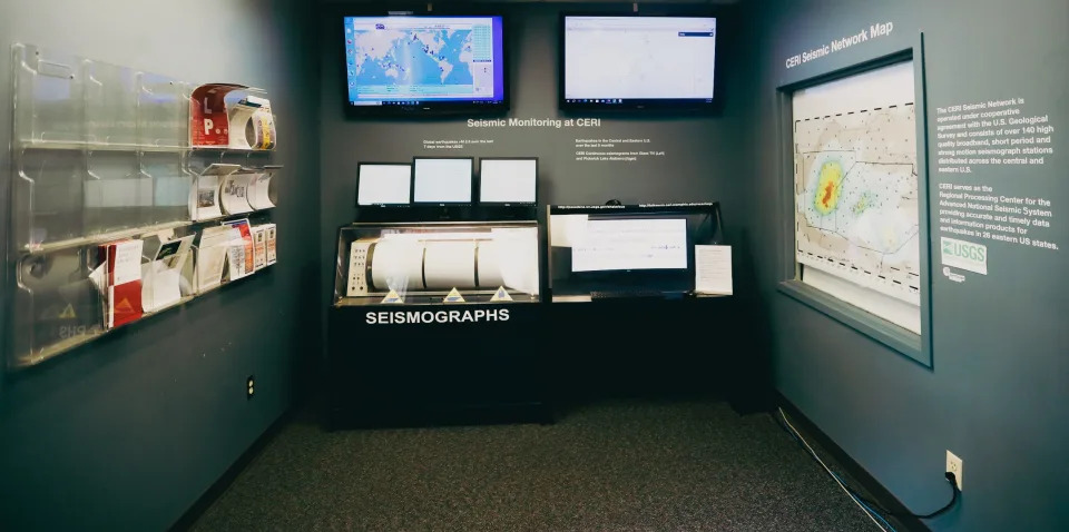
Dr. Kent Moran, with the University of Memphis’ Center for Earthquake Research and Information, explains the CERI Seismic Network Map during a tour on Thursday, May 02 2024 at 3890 Central Avenue in Memphis, Tenn.
John Klyce covers education and children's issues for The Commercial Appeal. You can reach him at John.klyce@commercialappeal.com.
This article originally appeared on Memphis Commercial Appeal: What are the odds of a massive earthquake hitting Memphis, Tennessee?
Memphis is near a major fault. What experts say you can do to prepare for an earthquake
John Klyce, Memphis Commercial Appeal
Tue, May 14, 2024
In late 1811 and early 1812, the Mid-South was rocked by three major earthquakes, and recently, The Commercial Appeal sought to answer a few questions: What are the chances that earthquakes of this magnitude could strike again, and what would the damage be?
Let’s entertain the possibility that a repeat of 1811-12 does come soon while bearing in mind that the chances of this are slim and that you shouldn’t panic.
How can you prepare? And what should you do if the earthquake comes?
You don’t want to have large, heavy things loose in the house. Mitch Withers, Ph.D., an associate research professor with the Center for Earthquake Research and Information, suggests strapping in your water heater and nailing your bookshelf to the wall.
The seismic network map at the University of Memphis’ Center for Earthquake Research and Information, can be seen during a tour on Thursday, May 02 2024 at 3890 Central Avenue in Memphis, Tenn.
A lot of the preparation for an earthquake can double up as preparation for other emergencies. Having an emergency kit that provides you with first aid supplies, as well as three to five days of water and nonperishable food, isn’t a bad idea.
If a 7-plus magnitude earthquake does come, the shaking would be so severe you likely wouldn’t be able to stand. But there is advice for what you should do in this scenario. If your clothes catch fire, you “stop, drop, and roll," and in the event of an earthquake, you “drop, cover, and hold on.”
From the experts: Could Memphis handle a massive earthquake, and how likely is one?
Get under a thick desk or table and hold on for dear life until the shaking stops. You don’t want to attempt to rush out while it’s still shaking.
“The biggest threat to people,” Withers explained, “is things falling on them.”
Once the shaking has stopped, then run outside ― while keeping in mind that there likely will be aftershocks.
But again, you shouldn’t spend your days fretting over the possibility of a catastrophic earthquake.
“The better way to go is to just prepare,” Withers said. “Do what you can to prepare and then just go live.”
This article originally appeared on Memphis Commercial Appeal: What should you do if there's a major earthquake in Memphis?