DW
June 24, 2024
2,500 years ago, an earthquake changed the course of one of Earth's largest rivers, totally altering the landscape. Could it happen again?

Can earthquakes be predicted?
Von Hagke said researchers needed to know more about the likelihood of large-scale river avulsion events in the future, particularly those from earthquakes.
The hard part, he said, was that scientists cannot predict when earthquakes will occur, or how big they will be when they do hit.
"For different earthquake scenarios, one could estimate landscape changes and then possible effects on rivers and water masses. But we cannot pinpoint the timing of an event that only happens every few hundred to a few thousand years," said von Hagke.
Chamberlain said, however, that knowing it was possible for earthquakes to completely reroute rivers, and the Ganges in Bangladesh in particular, meant that researchers could now begin to understand and predict how seismic events occur.
"We hope this knowledge can be helpful for hazard planning and mitigation before a modern event," she said.
The Ganges isn't the only river facing earthquake-related hazards. Others include China's Yellow River, Myanmar's Irrawaddy, the Klamath, San Joaquin and Santa Clara rivers on the US West Coast, and the Jordan River, which spans the borders of Syria, Jordan, the Palestinian West Bank and Israel.
Edited by: Zulfikar Abbany
Primary source:Cascading hazards of a major Bengal basin earthquake and abrupt avulsion of the Ganges River. Published in the journals Nature Communications by E.L. Chamberlain, S.L. Goodbred, M.S. Steckler, et al. 2024 (www.nature.com/articles/s41467-024-47786-4)
2,500 years ago, an earthquake changed the course of one of Earth's largest rivers, totally altering the landscape. Could it happen again?
The Ganges River was rerouted by a high-magnitude earthquake 2,500 years ago, and experts say it could happen again
Image: Payel Samanta/DW
A study has found a major earthquake 2,500 years ago caused one of the largest rivers on Earth to suddenly change course.
The high-magnitude earthquake completely rerouted the main channel of the Ganges River in what is now densely populated Bangladesh, and completely changed the surrounding landscape.
While it is "normal for river channels to move with time, this was an absolutely extreme event. The river moved to an entirely new area," said lead author Elizabeth Chamberlain of Wageningen University in the Netherlands.
The study, published in the journal Nature Communications, is the first evidence of a large river delta being completely relocated by an earthquake.
The study authors warn that Bangladesh is vulnerable to big quakes and that it is possible for the Ganges River to relocate again if another high-magnitude earthquake hit the region.
"Although infrequent, the risk of such an event could be huge, especially because Bangladesh hosts one of the most densely populated landscapes on the planet," said Chamberlain.
How an earthquake rerouted the Ganges River
The Ganges begins as streams in the Himalayas and flows for 2,500 kilometers (1,600 miles), eventually combining with other major rivers, including the Brahmaputra and the Meghna.
It's a huge delta river system that empties into a wide stretch of the Bay of Bengal, spanning Bangladesh and India.
As with other rivers, the Ganges periodically changes course due to the natural erosion of its riverbanks.
This process takes decades to occur, but "the Ganges-Brahmaputra river system has moved several times over the past 6,000 years," said Christoph von Hagke of the University of Salzburg, Austria, who also took part in the study.
The researchers used satellite imagery to spot the former main channel of the river around 100 kilometers south of the Bangladeshi capital, Dhaka.
The team had been exploring the area when they found signs of historical earthquakes — such as vertical dikes of light-colored sand cutting up through horizontal layers of darker mud.
Chemical analysis of the sand and mud showed several eruptions happened at the same time, about 2,500 years ago. The eruptions were estimated to be magnitude 7 to 8 — about the same as the earthquake which hit Turkey and Syria in 2023.

The team, led by Elizabeth Chamberlain (center), collected mud from the ancient Ganges River channel and used optically stimulated luminescence dating to analyze it
Image: Mahfuzur Rahman
The vast Ganges-Brahmaputra river system is located close to an active plate boundary and is a tectonically active region.
"This proximity brings frequent major earthquakes," said Till Hanebuth, a specialist in geosciences at Coastal Carolina University in the US. Hanebuth was not part of the study.
Bangladesh is particularly susceptible to catastrophic earthquake events due to its proximity to seismic zones.
While the region is not currently thought to be at risk, the researchers said it was possible for an earthquake to be strong enough to reroute the Ganges in the next few hundred to 1,000 years.
Ganges rerouting would be 'catastrophic for the region'
The researchers said their study showed it was entirely possible for delta rivers to be dramatically rerouted if they are hit by high-magnitude earthquakes.
"It was indeed a very extreme event — in fact two extreme events occurred. An earthquake of magnitude 7 to 8 is already extreme, but it caused redirection [known as avulsion] of the main channel of the Ganges," said von Hagke.
Von Hagke said a new event of the same size would be catastrophic for the region because it would hit "a super densely populated region."
River breaching and relocation does not only depend on earthquakes — they can also be caused by extreme weather, said Hanebuth.
"Abrupt river avulsions could be caused by a major monsoon or cyclone flooding event, or the collapse of a major river dam," Hanebuth said, adding that while such could be caused by natural events, they were also "largely human-made."

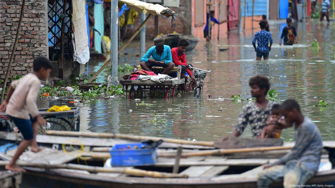
Experts say a huge earthquake could reroute the Ganges in the future and that the effect on local communities would be 'catastrophic'
Image: Sanjay Kanojia/AFP/Getty Images
Can earthquakes be predicted?
Von Hagke said researchers needed to know more about the likelihood of large-scale river avulsion events in the future, particularly those from earthquakes.
The hard part, he said, was that scientists cannot predict when earthquakes will occur, or how big they will be when they do hit.
"For different earthquake scenarios, one could estimate landscape changes and then possible effects on rivers and water masses. But we cannot pinpoint the timing of an event that only happens every few hundred to a few thousand years," said von Hagke.
Chamberlain said, however, that knowing it was possible for earthquakes to completely reroute rivers, and the Ganges in Bangladesh in particular, meant that researchers could now begin to understand and predict how seismic events occur.
"We hope this knowledge can be helpful for hazard planning and mitigation before a modern event," she said.
The Ganges isn't the only river facing earthquake-related hazards. Others include China's Yellow River, Myanmar's Irrawaddy, the Klamath, San Joaquin and Santa Clara rivers on the US West Coast, and the Jordan River, which spans the borders of Syria, Jordan, the Palestinian West Bank and Israel.
Edited by: Zulfikar Abbany
Primary source:Cascading hazards of a major Bengal basin earthquake and abrupt avulsion of the Ganges River. Published in the journals Nature Communications by E.L. Chamberlain, S.L. Goodbred, M.S. Steckler, et al. 2024 (www.nature.com/articles/s41467-024-47786-4)


