La Nina, which worsens hurricanes and drought, is gone


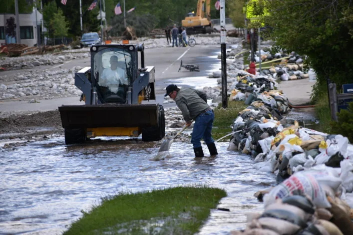
Residents of Red Lodge, Montana, are seen clearing mud, water and debris from the small city's main street on Tuesday, June 14, 2022, after flood waters courses through a residential area with hundreds of homes. After three nasty years, the La Nina weather phenomenon is gone, the National Oceanic and Atmospheric Administration said Thursday, March 9, 2023.(AP Photo/Matthew Brown, File)
SETH BORENSTEIN
Thu, March 9, 2023
WASHINGTON (AP) — After three nasty years, the La Nina weather phenomenon that increases Atlantic hurricane activity and worsens western drought is gone, the National Oceanic and Atmospheric Administration said Thursday.
That’s usually good news for the United States and other parts of the world, including drought-stricken northeast Africa, scientists said.
The globe is now in what’s considered a “neutral” condition and probably trending to an El Nino in late summer or fall, said climate scientist Michelle L’Heureux, head of NOAA’s El Nino/La Nina forecast office.
“It’s over,” said research scientist Azhar Ehsan, who heads Columbia University’s El Nino/La Nina forecasting. “Mother Nature thought to get rid of this one because it’s enough.”
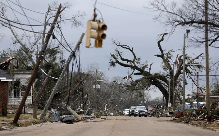
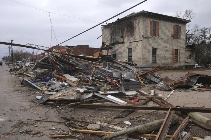
La Nina is a natural and temporary cooling of parts of the Pacific Ocean that changes weather worldwide. In the United States, because La Nina is connected to more Atlantic storms and deeper droughts and wildfires in the West, La Ninas often are more damaging and expensive than their more famous flip side, El Nino, experts said and studies show.
Generally, American agriculture is more damaged by La Nina than El Nino. If the globe jumps into El Nino it means more rain for the Midwestern corn belt and grains in general and could be beneficial, said Michael Ferrari, chief scientific officer of Climate Alpha, a firm that advises investors on financial decisions based on climate.
When there’s a La Nina, there are more storms in the Atlantic during hurricane season because it removes conditions that suppress storm formation. Neutral or El Nino conditions make it harder for storms to get going, but not impossible, scientists said.
Over the last three years, the U.S. has been hit by 14 hurricanes and tropical storms that caused a billion dollars or more in damage, totalling $252 billion in costs, according to NOAA economist and meteorologist Adam Smith said. La Nina and people building in harm's way were factors, he said.
Climate change is a major factor in worsening extreme weather, alongside La Nina, scientists said and numerous studies and reports show. Human-caused warming is like an escalator going up: It makes temperatures increase and extremes worse, while La Nina and El Nino are like jumping up and down on the escalator, according to Northern Illinois University atmospheric sciences professor Victor Gensini.
La Nina has also slightly dampened global average temperatures, keeping warming from breaking annual temperature records, while El Nino slightly turbocharges those temperatures often setting records, scientists said.
La Nina tends to make Western Africa wet, but Eastern Africa, around Somalia, dry. The opposite happens in El Nino with drought-struck Somalia likely to get steady “short rains,” Ehsan said. La Nina has wetter conditions for Indonesia, parts of Australia and the Amazon, but those areas are drier in El Nino, according to NOAA.
El Nino means more heat waves for India and Pakistan and other parts of South Asia and weaker monsoons there, Ehsan said.
This particular La Nina, which started in September 2020 but is considered three years old because it affected three different winters, was unusual and one of the longest on record. It took a brief break in 2021 but came roaring back with record intensity.
“I’m sick of this La Nina,” Ehsan said. L’Heureux agreed, saying she’s ready to talk about something else.
The few other times that there’s been a triple-dip La Nina have come after strong El Ninos and there’s clear physics on why that happens. But that’s not what happened with this La Nina, L’Heureux said. This one didn’t have a strong El Nino before it.
Even though this La Nina has confounded scientists in the past, they say the signs of it leaving are clear: Water in the key part of the central Pacific warmed to a bit more than the threshold for a La Nina in February, the atmosphere showed some changes and along the eastern Pacific near Peru, there’s already El Nino-like warming brewing on the coast, L’Heureux said.
Think of a La Nina or El Nino as something that pushes the weather system from the Pacific with ripple effects worldwide, L’Heureux said. When there are neutral conditions like now, there’s less push from the Pacific. That means other climatic factors, including the long-term warming trend, have more influence in day-to-day weather, she said.
Without an El Nino or La Nina, forecasters have a harder time predicting seasonal weather trends for summer or fall because the Pacific Ocean has such a big footprint in weeks-long forecasts.
El Nino forecasts made in the spring are generally less reliable than ones made other times of year, so scientists are less sure about what will happen next, L’Heureux said. But NOAA’s forecast said there’s a 60% chance that El Nino will take charge come fall.
There’s also a 5% chance that La Nina will return for an unprecedented fourth dip. L’Heureux said she really doesn’t want that but the scientist in her would find that interesting.
___ Follow AP’s climate and environment coverage at https://apnews.com/hub/climate-and-environment ___ Follow Seth Borenstein on Twitter at @borenbears ___
Associated Press climate and environmental coverage receives support from several private foundations. See more about AP’s climate initiative here. The AP is solely responsible for all content.
US forecaster says El Nino could arrive by summer 2023
By Seher Dareen
(Reuters) - La Niña has ended and ENSO-neutral conditions are expected to continue through the Northern Hemisphere spring and early summer 2023, a U.S. government weather forecaster said on Thursday, with El Niño possibly forming during summer 2023 and persisting through the fall.
"The forecaster consensus favors ENSO-neutral through summer 2023, with elevated chances of El Niño developing afterwards," the National Weather Service's Climate Prediction Center said.
The La Niña weather pattern is characterized by unusually cold temperatures in the equatorial Pacific Ocean.
There was an over 50% chance of the El Niño weather pattern emerging by the July-August-Septmeber period, the U.S. forecaster highlighted, as some regions braced for a hit to crop production.
The El Niño phenomenon is a warming of ocean surface temperatures in the eastern and central Pacific, sometimes causing crop damage, flash floods or fires.
"A weak monsoon – which has been observed in previous El Niño years - could lead to lower production of rice not only in India but across Southeast Asia," said Mark Brusberg, Chief Meteorologist at the U.S. Department of Agriculture.
In Australia, the wheat crop is likely to face risks from dry weather due to the El Niño weather pattern in the second half of the year, while India's weather office has warned that another heatwave in March is likely, especially in the key wheat-producing central and northern states.
"In contrast, an El Niño could lead to a rebound in U.S. wheat production if the drought on the southern Plains were to abate, and Argentina could return to its role as a key contributor to the world supply of wheat, corn, and soybeans," Brusberg added.
The emergence of El Nino could also strain global inventories of palm oil, as the condition usually results in below-average rainfall in main producers Indonesia and Malaysia.
No comments:
Post a Comment