Thursday, August 19, 2021


Rise of domestic social media in Tibet amid growing Chinese suppression
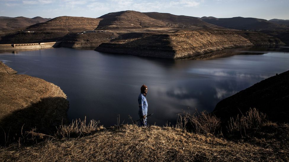
A woman in a costume poses for a commercial photographer as Tibetans perform a pilgrimage around the Jokhang Temple in Lhasa, Tibet Autonomous Region, China, October 15, 2020. Picture taken during a government-organised tour. Picture taken October 15, 2020. 

REUTERS/Thomas Peter (REUTERS)3 min read . 
Updated: 03 Dec 2020, 

Despite the attempts by the authoritarian Chinese Communist Party to curb freedom of expression, right to information, association and religion in Tibet, there has been a rise in domestic social media

Taipei [Taiwan]: Despite the attempts by the authoritarian Chinese Communist Party (CCP) to curb freedom of expression, right to information, association and religion in Tibet, there has been a rise in domestic social media giving platform to voices challenging the government-sponsored news.

The CCP censors the internet and maintains intensive surveillance apparatus in the form of facial recognition technology and Global Positioning System (GPS) coordination in its occupied territories including Tibet, East Turkistan (Xinjiang), and Southern Mongolian (Inner Mongolia), reported The Taiwan Times.

With the aim to control the "digital ecosystem", the social media accounts linked to the CCP propaganda campaign is being used to spread disinformation on social media such as Twitter, Facebook, etc.

They have been used to promote content attacking critics of the Chinese government and to spread conspiracy theories blaming the US for waging a biological war against China, The Taiwan Times reported.

Meanwhile, the government has blocked websites run by human rights groups, foreign media, Google search engine and social media sites such as Facebook, Twitter, etc.

China is considered to be having one of the most pervasive online censorship system in the world, the country's infamous "Great Firewall" blocks access and censors numerous websites, The Taiwan Times reported.

Despite these attempts, a series of images and videos of 156 Self Immolators inside Tibet were sent through social media, the Taiwanese media outlet informed. During the coronavirus pandemic information on personal accounts of life under lockdown was shared on social media. Besides, intensive discussions were leaked with images and videos exposing high ranking officials of their mismanagement, lack of transparency and accountability, The Taiwan Times said.

With the aim to muzzle the voices of Tibetans, the CCP this year arrested 10 Tibetans in Lhasa for spreading 'rumors' about the coronavirus outbreak on March 12 on WeChat, The Taiwan Times reported.

"In July two Tibetan lyricists, Khado Tsetan and singer Tsegao, were sentenced to seven years and three years in prison respectively by a Chinese court in North-Eastern Tibet without a trial after they composed, sang and circulated a song praising Tibetan spiritual leader, H.H. the Dalai Lama. They have been charged for alleged involvement in "subversion of state law and leaking information to the outside world, which is considered as a "state security crime," said the Free Tibet website.

Meanwhile, a Tibetan girl was arrested from the same region for having shared the song on social media.


It is a common practise across Tibet and East Turkistan (Xinjiang) that if complaints were made and voices raised, they are liable to face further punishments, The Taiwan Times said while adding that after their release the political prisoners are put under strict surveillance where every move is constantly watched.

Besides putting the families of these political prisoners under surveillance, they are also denied access to subsidies and government jobs.

Citing the example of Tibetan language rights advocate Tashi Wangchuk, The Taiwan Times further said that he was sentenced to five years for "inciting separatism" in a closed-door trial by Yushu Intermediate People's Court for voicing concerns in an interview with The New York Times.

Despite the global outcry, the Chinese court rejected his appeal and also denied him access to his lawyer.


Human Rights Watch's China director, Sophie Richardson was quoted as saying: "Tashi Wangchuk's only 'crime' was to peacefully call for the right of minority peoples to use their own language".

In the seventh Tibet Work Forum held in Beijing from August 28 and 2, President Xi Jinping emphasised on intensifying and Sinicising Tibetans and their culture through the "patriotic reeducation". He also emphasized against "anti-Dalai Lama Campaigns in Tibet" with the expansion of mass education to promote "socialism with Chinese Characteristics", said The Taiwan Times.

To counter or rather silence these criticisms, the state media like Global Times and Xinhua had to resort to regular publishing of opinion articles. Further, the CCP has used both the electronic and print media to be its mouthpiece for propaganda. (ANI)
Evolution of vegetation and climate variability on the Tibetan Plateau over the past 1.74 million years


Abstract

The Tibetan Plateau exerts a major influence on Asian climate, but its long-term environmental history remains largely unknown. We present a detailed record of vegetation and climate changes over the past 1.74 million years in a lake sediment core from the Zoige Basin, eastern Tibetan Plateau. Results show three intervals with different orbital- and millennial-scale features superimposed on a stepwise long-term cooling trend. The interval of 1.74–1.54 million years ago is characterized by an insolation-dominated mode with strong ~20,000-year cyclicity and quasi-absent millennial-scale signal. The interval of 1.54–0.62 million years ago represents a transitional insolation-ice mode marked by ~20,000- and ~40,000-year cycles, with superimposed millennial-scale oscillations. The past 620,000 years are characterized by an ice-driven mode with 100,000-year cyclicity and less frequent millennial-scale variability. A pronounced transition occurred 620,000 years ago, as glacial cycles intensified. These new findings reveal how the interaction of low-latitude insolation and high-latitude ice-volume forcing shaped the evolution of the Tibetan Plateau climate.


INTRODUCTION

The Tibetan Plateau has long been a focus of geoscientific studies because of its importance in global tectonics and Asian and global climate change across a wide range of time scales (1). However, with only few available paleoarchives of coarse resolution [>8 thousand years (ka)] (2, 3), little is known about its environmental history through the Quaternary ice ages. To understand the mode and tempo of changes and, ultimately, the underlying drivers during this period, we need long-term high-resolution records from the elevated plateau with well-constrained chronologies.

The Zoige Basin, occupied by a huge lake until the latest Pleistocene (3) and located on the eastern Tibetan Plateau within the South Asian monsoon zone (fig. S1), represents a potential site to fill this gap. Mean annual precipitation (MAP) at Zoige is ~600 to 650 mm, and the basin is primarily covered by alpine meadows, and the surrounding mountains have scattered forests up to ~4000 m above sea level (a.s.l.) (fig. S1). A sediment core extending over the past 0.9 million years (Ma) was previously recovered, but its analytical resolution and chronological reliability were insufficient to resolve orbital- and suborbital-scale changes (3).

CORE ACQUISITION AND CHRONOLOGY

New drilling (33°58.163′N, 102°19.855′E, 3434 m a.s.l.) was undertaken in 2013 in the central basin guided by a seismic survey. A 573.39-m core (ZB13-C2) was obtained with 96% recovery, mostly consisting of fine-grained freshwater lacustrine sediments. Only the upper 50 m contains two episodic fluvial sandy layers, 10.11 and 10.4 m thick, respectively.

Independent age control derived from magnetostratigraphy in combination with radiocarbon [accelerator mass spectrometry (AMS)] and luminescence [optically stimulated luminescence (OSL)] dating provides an initial chronological framework (Materials and Methods; figs. S2 and S3), according to which the ZB13-C2 core extends back to 1.74 Ma before present (BP) (Materials and Methods; fig. S3). Fluctuations in arboreal pollen abundances (AP%) based on an initial age model using a combination of 14C, OSL, and paleomagnetic control points (table S3) show clear ~100-, 40-, and 20-ka cyclicities (fig. S3), suggesting possible eccentricity (E), tilt (T), and precession (P) powers. The presence of astronomical frequencies in the Zoige Basin record is further supported by spectral analyses of AP% in the depth domain, which indicate the occurrence of ~34-, 15-, and 7.5-m cycles, whose ratios are close to those of 100:40:21; the ~7.5-m cycle appears to be stronger in the lower ~75 m, while the ~34-m cycle is stronger in the top ~200 m (Materials and Methods and fig. S3). On this basis, a more detailed age model was constructed by tuning the AP% record to an ETP record that is generated by normalizing and averaging variations in eccentricity, tilt, and reversed precession (4). As this approach may artificially introduce astronomical frequencies in our record, we compared the ETP age model against an age model constructed by aligning the Zoige AP% to the Chinese speleothem δ18Ocalcite record, an independently dated (U-Th) archive of changes in Asian monsoon intensity over the past 640 ka (5). Comparison of the ETP- and speleothem-based age models of Zoige reveals a close correspondence (fig. S3).

CLIMATE PROXIES

Pollen and sediment analyses (2787 and 3274 samples, respectively, with a mean sampling resolution of ~530 to 620 years), as well as x-ray fluorescence (XRF) scanning (~6-year resolution) data, yield a detailed multiproxy record back to 1.74 Ma BP.

The vegetation in the eastern Tibetan Plateau is strongly influenced by the Asian summer monsoon. A stronger monsoon with warmer and moister climate would cause an expansion of tree populations. However, in the alpine Zoige region, the density and elevational limits of forests are primarily controlled by temperature, as moisture availability is relatively plentiful (6, 7). This is confirmed by the distinct elevational distribution of modern vegetation (fig. S1), the good match of AP% and axis 1 of principal components analysis (PCA) on the pollen data (fig. S4), and the close relationship between summer temperature and PCA axis 1 in the significance test of the quantitative temperature reconstructions for core ZB13-C2 (fig. S4). Thus, on long time scales, variations in AP% in the core are mostly a reflection of changes in temperature, particularly summer temperature, but drought stress, for example, during weak monsoon or glacial intervals, would also have an impact on tree populations.

Pollen-based quantitative reconstruction of past climate variables was undertaken (Materials and Methods), providing the first independent paleotemperature history for the Tibetan Plateau because of the dominant control of temperature on local vegetation (figs. S1 and S4) (6, 7). The mean temperature of the coldest month (MTCM) and precipitation reconstructions failed the relevant statistical significance test and are thus less reliable (Materials and Methods).

Rubidium/strontium (Rb/Sr) ratios and carbonate content (Carb%) are used as supplementary proxies. Rb/Sr primarily reflects the chemical weathering intensity of the catchment or strength of summer monsoon and associated run-off (8). When weathering/run-off is stronger, there is greater Sr input into the lake, leading to a lower Rb/Sr ratio. However, Sr contained in carbonate can influence Rb/Sr ratios from bulk scanning data, rendering climate interpretations less reliable. We therefore measured Rb/Sr ratios on bulk samples after removing the carbonate content (Materials and Methods). This showed good agreement with the high-resolution XRF scanning data (fig. S5), supporting the view that the ZB13-C2 Rb/Sr signal derived from XRF scanning is largely independent of changes in carbonate content. Grain size changes could also distort the climate signal of Rb/Sr, but examination of core ZB13-C2 shows a weak correlation between Rb/Sr and grain size changes (fig. S5). The Zoige lake sediments are generally fine and have no large variations, except the two sandy layers near the top. The high correlation between Rb/Sr and the chemical index of alteration (CIA) at Zoige further support the weathering interpretation (fig. S5) that the proxies are sensitive to both summer precipitation and temperature conditions.

Previous studies from core RH nearby ZB13-C2 suggest that carbonate content mainly represents authigenic chemical precipitation, as both detrital carbonate content and shell carbonate are in trace amounts (3). The measured Carb% in core ZB-C2 should mainly reflect processes of chemical precipitation in the lake, which are largely related to summer temperature and precipitation. High temperature could increase the precipitation of carbonate through changing the precipitation-dissolution equilibrium and photosynthesis process. Precipitation could also enhance carbonate content by washing more Ca2+ and HCO3− into the lake through chemical weathering. Carb% therefore indicates warm and wet climate. Carbonate content from core RH shows good positive correspondence with hydrogen index, a proxy of the effect of lake water depth (3). Our loss-on-ignition (LOI) measurements of surface mud samples, taken along water-depth transects from four lakes near ZB13-C2, also reveal that Carb% generally increases with water depth in each lake (fig. S5). High Carb% from core ZB13-C2 likely agrees with high lake level, which depends on the balance between precipitation and evaporation.

The coherent variations in AP%, Rb/Sr, and Carb% (fig. S5), with low Rb/Sr and high Carb% corresponding to high AP%, therefore suggest that coupled changes of temperature and precipitation occurred over the past 1.74 Ma.

READ OR DOWNLOAD HERE Evolution of vegetation and climate variability on the Tibetan Plateau over the past 1.74 million years | Science Advances (sciencemag.org)


View ORCID ProfileYan Zhao1,2,*,
View ORCID ProfilePolychronis C. Tzedakis3,
View ORCID ProfileQuan Li1,
Feng Qin1,
View ORCID ProfileQiaoyu Cui1,
Chen Liang1,
View ORCID ProfileH. John B. Birks3,4,
Yaoliang Liu1,
Zhiyong Zhang1,5,
View ORCID ProfileJunyi Ge6,7,
Hui Zhao8,
View ORCID ProfileVivian A. Felde4,
View ORCID ProfileChenglong Deng9,
Maotang Cai1,
Huan Li10,
Weihe Ren1,
Haicheng Wei11,
View ORCID ProfileHanfei Yang1,
Jiawu Zhang12,
View ORCID ProfileZicheng Yu13,14 and
View ORCID ProfileZhengtang Guo2,9

See all authors and affiliations
Science Advances 06 May 2020:
Vol. 6, no. 19, eaay6193
DOI: 10.1126/sciadv.aay6193

Article
Figures & Data
Info & Metrics
eLetters
PDF

To evade humans, this medicinal plant has evolved to hide in plain sight


Peer-Reviewed Publication

CELL PRESS

Uncamouflaged plant 

IMAGE: FRITILLARIA DELAVAYI IN POPULATIONS WITH LOW HARVEST PRESSURE AND NO CAMOUFLAGE. view more 

CREDIT: YANG NIU

Bulbs of the plant known as Lu Bei (Fritallaria delavayi) have been used in Chinese medicine for more than two thousand years. Now, researchers reporting November 20 in the journal Current Biology have found that, in places where the herb is harvested more, the plant has evolved to blend in better with the background, making them harder for people to find. As a result, the plant varies in color from brown or grey to green, depending on whether it lives in a place that is frequented by human collectors or not.

"We've found that human harvesting of a traditional medicine plant has led to the evolution of camouflage by the plants, to evade detection by collectors," said Martin Stevens of University of Exeter. "And that camouflage is better in locations where collection intensity has been higher."

First author of the new study Yang Niu, Kunming Institute of Botany, Chinese Academy of Sciences, had been studying the evolution of alpine plants for years. He and his colleagues had noticed that the color of F. delavayi showed obvious variation among populations. They also knew it had a long history of use in traditional medicine. Could human harvesting be responsible for those differences in color they were seeing?

It appears that the answer is yes. The researchers found that the degree to which the plants' color matches its mountainous background is associated with estimates of how heavily they are harvested in particular places. Where they are heavily collected, the plants are camouflaged and therefore more cryptic.

CAPTION

This photo shows Fritillaria delavayi in populations with high harvest pressure where camouflage is evident.

CREDIT

Yang Niu

To confirm that the plant colors influenced the ability of people to find them, the researchers developed an online citizen science experiment "Spot the Fritillaria." People were asked to spot the plants as quickly as they could. Not surprisingly, those plants that more closely matched the background took longer for people to find.

While it's possible that other animals could exert similar pressures, the researchers say they don't think that's likely. There's no evidence that the plants are a popular food item for other animals living in the area. The plants also produce chemicals that are known to deter rodents. Ironically, it is those same compounds that make them attractive to people as a medicinal herb.

For the plant, the camouflage may have downsides, which the researchers hope to explore in future studies. "In heavily collected populations, camouflage in flowers may weaken their attractiveness to pollinators such as bumblebees," Niu said. "We aim to find out how the plants deal with this problem."

Stevens says his team is "further exploring how animals and plants are being affected by human actions, including how their defensive behaviors and coloration are being influenced by selection pressure and stresses imposed by humans, from noise pollution to climate change."

This work was supported by the Second Tibetan Plateau Scientific Expedition and Research (STEP) program, the Strategic Priority Research Program of the Chinese Academy of Sciences, NSFC, Yunnan Ten Thousand Talents Plan Young & Elite Talents Project, Youth Innovation Promotion Association of CAS, the Major Program of the National Natural Science Foundation of China, the Key Projects of the Joint Fund of the National Natural Science Foundation of China, and the National Key R&D Program of China.

Current Biology, Niu et al.: "Commercial Harvesting Has Driven the Evolution of Camouflage in an Alpine Plant" https://www.cell.com/current-biology/fulltext/S0960-9822(20)31655-9

Current Biology (@CurrentBiology), published by Cell Press, is a bimonthly journal that features papers across all areas of biology. Current Biology strives to foster communication across fields of biology, both by publishing important findings of general interest and through highly accessible front matter for non-specialists. Visit: http://www.cell.com/current-biology. To receive Cell Press media alerts, contact press@cell.com.

Pakistan’s Real Challenge: Water Crisis

Despite the mighty K2 and ferocious Indus river water resources in Pakistan are depleting fast. IMF has ranked Pakistan third among the countries facing severe water shortages in the world. Yet Pakistan’s policymakers refuse to acknowledge the scale of the challenge and remain ignorant of even small changes that could be made to to resolve the issue, an ex-World Bank Adviser argues.

By Manzoor Ahmad Khan
13 August 2021


Water is a critical component for the existence and sustainable development of a society and is a fundamental human right on this planet. It is vital for countries like Pakistan, where it is almost priceless for agriculture, which exploits about 96 percent of available freshwater, while other sectors use the 4 percent left over.

By virtue of its ever-increasing population growth, urbanization, and climate change, conflicts over water resources are expected to increase, with dire consequences for the food production system in the country.

Despite hosting the third pole (the Hindu Kush, Himalayas mountain range, and the Tibetan Plateau), Pakistan is still highly vulnerable to the impacts of water scarcity due to climate change. Planet Earth comprises 71 percent water and 29 percent land, but most of the water is not useable, so water scarcity has become a global problem.


Gulf countries, especially Saudi Arabia, have severe water scarcity problems and use desalination plants to get fresh water from seawater, which is an energy-intensive process. Pakistan has also recently established a desalination plant in Gwadar with the help of China.

Read More: Pakistan aiming to conserve water builds & upgrades water courses

The majority of Pakistan’s landmass, almost 80 percent, is classified as having a semi-arid to an arid climate. More than 30 million people lack clean drinking water access in Pakistan, and more than 50 million people do not have electricity.
Understanding the scale of Pakistan’s Water scarcity

Water scarcity occurs when water demand is greater than the available supply. Intensified water scarcity leads to desertification that United Nations has recognized as a global challenge. UN Convention to Combat Desertification (UNCCD) is working globally to solve related desertification and land degradation issues.


Pakistan ranks as the world’s fourth highest water user per capita. The amount of water consumed per unit of Gross Domestic Product (GDP) is the highest globally, implying the water-intensive economy of Pakistan is at the top of the list.

International Monetary Fund (IMF) has ranked Pakistan third among the countries facing severe water shortages. The mighty Indus, the mighty K2, and the world’s renowned peaks comprising the third pole on earth may still not be able to save Pakistan from the devastation of desertification and water scarcity.

Read More: Pakistan launches first green Eurobond to ensure water security

Punjab: deserts can revisit in a century?

The irrigation system for the plains of Punjab was built during the British era. Edward Calvert and Sir Malcolm Darling, who surveyed Punjab’s irrigation system during the 1930s, stated that it is a fragile system dependent on hill forests. They mentioned in their report that “deserts will revisit in a century.”


Since hill forests are being destroyed and degraded, we see their words come true as deserts are revisiting. Thus, there is an urgent need for afforestation. Despite having more glaciers than anywhere else globally and the mighty Indus River, Pakistan faces acute water scarcity.

Stress is increasing on water resources, surface, and groundwater, and severe extreme conditions increasingly occur in different parts of the country. Flood irrigation- highly inefficient use of water- is being used to grow water-intensive crops.

Sugarcane and rice crops need to be restricted to some regions of the country which can sustain them. Argo-ecological zones (a division of land into a resource mapping unit based on areas topology, climate, etc.) of Punjab were developed by the team at Argo-climatology lab, University of Agriculture Faisalabad, and have been evaluated, endorsed, and published by Food and Agricultural Organization (FAO).

Read More: Haleem Adil exposes Sindh govt’s drama over water issue

These zone-specific crop systems can help to boost sustainable production and provide opportunities to replace water-intensive crops, i.e., sugarcane and rice from non-core zones, with cotton, oil seed crops, vegetables, and high-value crops.

Pakistan’s Water Challenge: Obsolete infrastructure and lack of dams

Obsolete water infrastructure in Pakistan, lack of dams/ reservoirs, non-concrete canals having low water efficiency, and sediments filled reservoirs bring a potential threat to future water security. Furthermore, clean and drinking water reservoirs are polluted by poor agricultural practices of extensively used agrochemicals, humans, and industrial waste.

Tackling water scarcity needs a proper understanding of the problem before it becomes impossible to solve and we reach a point of no return. Urgent investment is required in order to build infrastructure to store water from local lakes, village ponds, and rainwater harvesting.

About 70 percent of freshwater by rainfall is received during July to September, in the monsoon season, but due to lack of awareness and poor infrastructure, we turn this blessing into a curse by not conserving this precious natural resource.

Read More: Pakistan will run out of water in 4 years
Pakistan: Need to stop flood irrigation & control seepage from canals

The Kalabagh dam issue needs to be resolved also. Yes, environmentalists believe we need to restore natural pathways and shift to nuclear and other renewable energy sources. Still, we are not in that position and cannot deny the importance of water reservoirs and the blessings of natural slopes existing from K2 to Clifton, those slopes and the natural gravity flow are a huge blessing to this part of the world.

We can deal with the excessive seepage problems of canals instead of using concrete to seal them, which is very time-consuming and requires high capital; other alternatives are present, such as sealing polymer.

The application of sealing polymers can lower the seepage problem by up to 80 percent, require little to no time, and can be done on a meager budget all across the country. Ironically, some of our areas are waterlogged while we do not have water at the tail of watercourses.

Flood irrigation is an ancient and inefficient method of irrigation where more water is applied than the crop-water requirement, wasting much water that other farmers can use. Flood irrigation causes stress and wastage of precious nutrient resources; thus, crop yield remains below average than the rest of the world.

Read More: World’s water woes and how climate change caused this crisis

The government of Punjab is doing very active work to control the water scarcity problem, through the department of On-Farm Water Management (OFWM), by concreting the watercourses and by giving subsidies to farmers to install the High-Efficiency Irrigation Systems (HEIS) to solve the water scarcity issues in Punjab, through efficiency enhancement and mechanization.

The solution lies in educating farmers about the benefits of using HEIS like center pivot irrigation systems, drip irrigation systems, etc., and applying metering and taxes on water usage. Campaigns about water scarcity, its possible causes, and solutions need to be launched on an emergency basis.

On the industrial side, there is a need for strict implementation of laws. Treatment of sewage and industrial water is essential to the sustainable availability of freshwater. Metering, taxing, and efficient monitoring solves most of the water-related problems in industrial sectors.

Water scarcity is getting severe in large cities of Pakistan due to unplanned expansions of the cities. Groundwater that was available at double-digit meters has, over the years, fallen and now has to be dug in hundreds of meters below the surface across the country.

Large cities should be expanded according to their master plans rather than uncontrolled growth so that everyone can get an adequate quantity of freshwater. Cultural practices need to alter for better water usage as well. Possibilities to cope with water scarcity can be divided between demand management and supply enhancement.

Author is a Former Senior Advisor, The World Bank. A slightly different version of this piece appeared under the title, “Pakistan’s Mighty Challenge: Water” in the August issue (print) of Global Village Space Magazine.

 IN TIBET

First evidence of mysterious, ancient humans called Denisovans found outside of their cave


By Ashley Strickland, CNN
Wed May 1, 2019

CNN —

A 160,000-year-old Denisovan jawbone fossil has been found in a cave on the Tibetan plateau, according to a new study. This marks the first evidence of Denisovans found outside Denisova Cave in Siberia since the mysterious ancient human group was discovered in 2010.


Denisovans, who lived during a time that overlapped with Neanderthals, are known only from a few fossils discovered in a Siberian cave. But they also left a genetic legacy that lives on today in the DNA of some Asian, Australian and Melanesian humans. A Denisovan genome was sequenced in 2012 and compared with that of modern humans, revealing the trait.

Tibetans and Sherpas have a genetic variant that helps them live in low oxygen at high altitudes, which can be traced back to Denisovans.

But before the discovery of this jawbone, researchers wondered why this genetic variant existed. Tiny, fragmented remains of Denisovans had only ever been found in Denisova Cave, which sits at an altitude of 2,296 feet.

Baishiya Karst Cave on the Tibetan Plateau, where the jawbone was found, has an altitude of 10,761 feet.

No DNA was preserved in the fossil, but the researchers were able to extract ancient proteins and analyze them, as well as conduct radioisotopic dating of the fossil. The study on their findings was published Wednesday in the journal Nature.


This cave sheltered some of the first known humans 300,000 years ago


The jawbone was well-preserved and featured a primitive shape, as well as a few large molars that were still attached.

At 160,000 years old, the fossil predates other evidence of ancient humans at such a high altitude in the area, which was previously set at between 30,000 and 40,000 years ago.

The age and features of the fossil are also similar to those of the oldest known Denisovan fossils from Denisova Cave, which suggests that the populations were closely related.


Dongju Zhang/Lanzhou University
The entrance to the Baishiya Karst Cave.

The jawbone was found by a monk in 1980 and eventually made its way to Lanzhou University, where researchers have been studying the cave site since 2010. They began analyzing the jawbone in 2016.

“Archaic hominins occupied the Tibetan Plateau in the Middle Pleistocene and successfully adapted to high-altitude low-oxygen environments long before the regional arrival of modern Homo sapiens,” said Dongju Zhang, study author and lecturer at Lanzhou University’s Research School of Arid Environment and Climate Change, in a statement.


Mysterious Denisovans interbred with modern humans more than once


The discovery shows that Denisovans lived in East Asia and adapted to the conditions there.

“Our analyses pave the way towards a better understanding of the evolutionary history of hominins in East Asia,” Jean-Jacques Hublin, study author and director of the Department of Human Evolution at the Max Planck Institute for Evolutionary Anthropology, said in a statement.


Evolutionary study suggests prehistoric human fossils ‘hiding in plain sight’ in Southeast Asia


A Homo erectus skull from Java, Indonesia. This pioneering species stands at the root of a fascinating evolutionary tree. Scimex


March 23, 2021 

Island Southeast Asia has one of the largest and most intriguing hominin fossil records in the world. But our new research suggests there is another prehistoric human species waiting to be discovered in this region: a group called Denisovans, which have so far only been found thousands of kilometres away in caves in Siberia and the Tibetan Plateau.

Our study, published in Nature Ecology and Evolution, reveals genetic evidence that modern humans (Homo sapiens) interbred with Denisovans in this region, despite the fact Denisovan fossils have never been found here.

Conversely, we found no evidence that the ancestors of present-day Island Southeast Asia populations interbred with either of the two hominin species for which we do have fossil evidence in this region: H. floresiensis from Flores, Indonesia, and H. luzonensis from Luzon in the Philippines.

Together, this paints an intriguing — and still far from clear — picture of human evolutionary ancestry in Island Southeast Asia. We still don’t know the precise relationship between H. floresiensis and H. luzonensis, both of which were distinctively small-statured, and the rest of the hominin family tree.

Get news that’s free, independent and based on evidence.Sign up for newsletter

And, perhaps more intriguingly still, our findings raise the possibility there are Denisovan fossils still waiting to be unearthed in Island Southeast Asia — or that we may already have found them but labelled them as something else.
An ancient hominin melting pot

Stone tool records suggest that both H. floresiensis and H. luzonensis are descended from Homo erectus populations that colonised their respective island homes about 700,000 years ago. H. erectus is the first ancient human known to have ventured out of Africa, and has first arrived in Island Southeast Asia at least 1.6 million years ago.

This means the ancestors of H. floresiensis and H. luzonensis diverged from the ancestors of modern humans in Africa around two million years ago, before H. erectus set off on its travels. Modern humans spread out from Africa much more recently, probably arriving in Island Southeast Asia 70,000-50,000 years ago.

We already know that on their journey out of Africa about 70,000 years ago, H. sapiens met and interbred with other related hominin groups that had already colonised Eurasia.

The first of these encounters was with Neanderthals, and resulted in about 2% Neanderthal genetic ancestry in today’s non-Africans.

The other encounters involved Denisovans, a species that has been described solely from DNA analysis of a finger bone found in Denisova Cave in Siberia.
Only a handful of Denisovan fossils have been found, such as this jawbone unearthed in a Tibetan cave. Dongju Zhang/Wikimedia Commons, CC BY-SA

Intriguingly, however, the largest amounts of Denisovan ancestry in today’s human populations are found in Island Southeast Asia and the former continent of Sahul (New Guinea and Australia). This is most likely the result of local interbreeding between Denisovans and modern humans — despite the lack of Denisovan fossils to back up this theory.

Read more: Southeast Asia was crowded with archaic human groups long before we turned up

To learn more, we searched the genome sequences of more than 400 people alive today, including more than 200 from Island Southeast Asia, looking for distinct DNA sequences characteristic of these earlier hominin species.

We found genetic evidence the ancestors of present-day people living in Island Southeast Asia have interbred with Denisovans — just as many groups outside Africa have similarly interbred with Neanderthals during their evolutionary history. But we found no evidence of interbreeding with the more evolutionarily distant species H. floresiensis and H. luzonensis (or even H. erectus).

This is a remarkable result, as Island Southeast Asia is thousands of kilometres from Siberia, and contains one of the richest and most diverse hominin fossil records in the world. It suggests there are more fossil riches to be uncovered.
So where are the region’s Denisovans?

There are two exciting possibilities that might reconcile our genetic results with with the fossil evidence. First, it’s possible Denisovans mixed with H. sapiens in areas of Island Southeast Asia where hominin fossils are yet to be found.

One possible location is Sulawesi, where stone tools have been found dating back at least 200,000 years. Another is Australia, where 65,000-year-old artefacts currently attributed to modern humans were recently found at Madjebebe.

Read more: Buried tools and pigments tell a new history of humans in Australia for 65,000 years

Alternatively, we may need to rethink our interpretation of the hominin fossils already discovered in Island Southeast Asia.

Confirmed Denisovan fossils are extremely rare and have so far only been found in central Asia. But perhaps Denisovans were much more diverse in size and shape than we realised, meaning we might conceivably have found them in Island Southeast Asia already but labelled them with a different name.

Given that the earliest evidence for hominin occupation of this region predates the divergence between modern humans and Denisovans, we can’t say for certain whether the region has been continuously occupied by hominins throughout this time.

It might therefore be possible that H. floresiensis and H. luzonensis (but also later forms of H. erectus) are much more closely related to modern humans than currently assumed, and might even be responsible for the Denisovan ancestry seen in today’s Island Southeast Asia human populations.

If that’s true, it would mean the mysterious Denisovans have been hiding in plain sight, disguised as H. floresiensis, H. luzonensis or H. erectus.

Solving these intriguing puzzles will mean waiting for future archaeological, DNA and proteomic (protein-related) studies to reveal more answers. But for now, the possibilities are fascinating.


Authors
João Teixeira
Research associate, University of Adelaide
Kristofer M. Helgen
Chief Scientist and Director, Australian Museum Research Institute, Australian Museum
Disclosure statement

João Teixeira receives funding from the Australian Research Council.

Kristofer M. Helgen received funding from the Australian Research Council’s Centre for Australian Biodiversity and Heritage (CABAH).
Under climate stress, human innovation set stage for population surge

Research highlights importance of social resilience in Bronze Age China


Summary:
Aridification in the central plains of China during the early Bronze Age did not cause population collapse, a result that highlights the importance of social resilience to climate change. Instead of a collapse amid dry conditions, development of agriculture and increasingly complex human social structures set the stage for a dramatic increase in human population around 3,900 to 3,500 years ago.


Climate alone is not a driver for human behavior. The choices that people make in the face of changing conditions take place in a larger human context. And studies that combine insights from archaeologists and environmental scientists can offer more nuanced lessons about how people have responded -- sometimes successfully -- to long-term environmental changes.


One such study, from researchers at Washington University in St. Louis and the Chinese Academy of Sciences, shows that aridification in the central plains of China during the early Bronze Age did not cause population collapse, a result that highlights the importance of social resilience to climate change.

Instead of a collapse amid dry conditions, development of agriculture and increasingly complex human social structures set the stage for a dramatic increase in human population around 3,900 to 3,500 years ago.

"In China, especially, there has been a relatively simplistic view of the effects of climate," said Tristram R. "T.R." Kidder, the Edward S. and Tedi Macias Professor of Anthropology in Arts & Sciences. The new study was posted online in Environmental Research Letters.

"Our work shows that we need to have a nuanced appreciation of human resilience as we consider the effects of climate and its effects on human societies," Kidder said. "We have remarkable capacity to adapt. But part of the lesson here is that our social, political and technological systems have to be flexible.

"People in the past were able to overcome climate adversity because they were willing to change," he said.

The new study is one of the first attempts to quantify the types and rates of demographic and subsistence changes over the course of thousands of years in the central plains of China.

By combining information about climate, archaeology and vegetation, the authors mapped out an ambitious story about what changed, when it changed and how those changes were related to human social structures at the time.

Researchers used pollen data from a lake sediment core collected in Henan Province to interpret historical climate conditions. In this area, they found that a warm and wet climate about 9,000 to 4,000 years ago shifted to a cool and dry climate during the Neolithic-Bronze Age transition (about 4,000 to 3,700 years ago). The researchers then used radiocarbon dating and other archaeological data to determine what people were growing and eating during periods of significant population surges and declines in this timeframe.

Confronted with the fluctuation and limitation of resources caused by episodes of climatic aridification, people expanded the number of plants they cultivated for food, the researchers found. They embraced new diversity in agriculture -- including foxtail millet, broomcorn millet, wheat, soybean and rice -- all of which reduced the risks of food production.

This also was a time marked by innovations in water management approaches for irrigation, as well as new metal tools. Social structures also shifted to accommodate and accelerate these examples of human adaptive ingenuity.

"Certainly, by 4,000 years ago, which is when we see this change in the overall environmental condition, this is a society with complicated political, social and economic institutions," Kidder said. "And what I think we are seeing is the capacity of these institutions to buffer and to deal with the climatic variation. When we talk about changes in subsistence strategies, these changes didn't happen automatically. These are human choices."

With this and other related research work, Kidder has argued that early Chinese cities provide an important context that closely resembles modern cities, where high-density urbanism is supported by intensive agriculture. They provide a better historical analog than the Maya world or those in southeast Asia, notably Angkor Wat and the Khmer Kingdom. Those were cities where lower density and food production did not put the same sorts of demands on the physical environment.

Lead author Ren Xiaolin, assistant professor at the Institute for the History of Natural Sciences at the Chinese Academy of Sciences in Beijing, worked closely with Kidder and others in his laboratory to develop the theory and framework for how to think about environmental changes and urbanism in China.

"Climate change does not always equal collapse -- and this is an important point in both a prehistoric and modern context," said Michael Storozum, another co-author and research fellow at The Hebrew University of Jerusalem. Storozum is a PhD graduate of Washington University, where he studied under Kidder.

"Humans have been heavily modifying their environments for thousands of years, often in the pursuit of increasing food production which grants societies a higher degree of social resilience," Storozum said.

He draws connections between the findings from this paper and his current research as part of The Wall project, a study of people and ecology in medieval Mongolia and China.

"As more environmental scientists and archaeologists work together, I expect that our understanding of what makes a society resilient to climate change in prehistoric and historical times will grow as well," Storozum said.

Kidder added: "We need to think carefully about how we understand the capacity of people to change their world."

Date: February 26, 2021
Source: Washington University in St. Louis

Journal Reference:
Xiaolin Ren, Junjie Xu, Hui Wang, Michael Storozum, Peng Lu, Duowen Mo, Tuoyu Li, Jianguo Xiong, Tristram R. Kidder. Holocene fluctuations in vegetation and human population demonstrate social resilience in the prehistory of the Central Plains of China. Environmental Research Letters, 2021; DOI: 10.1088/1748-9326/abdf0a

Washington University in St. Louis. "Under climate stress, human innovation set stage for population surge: Research highlights importance of social resilience in Bronze Age China." ScienceDaily. ScienceDaily, 26 February 2021. <www.sciencedaily.com/releases/2021/02/210226121247.htm>
How water shortages are brewing wars


(Image credit: Asaad Niazi/AFP/Getty Images)

By Sandy Milne
16th August 2021

Unprecedented levels of dam building and water extraction by nations on great rivers are leaving countries further downstream increasingly thirsty, increasing the risk of conflicts.


Speaking to me via Zoom from his flat in Amsterdam, Ali al-Sadr pauses to take a sip from a clear glass of water. The irony dawning on him, he lets out a laugh. "Before I left Iraq, I struggled every day to find clean drinking water." Three years earlier, al-Sadr had joined protests in the streets of his native Basra, demanding the authorities address the city's growing water crisis.

"Before the war, Basra was a beautiful place," adds the 29-year-old. "They used to call us the Venice of the East." Bordered on one side by the Shatt al-Arab River, the city is skewered by a network of freshwater canals. al-Sadr, a dockhand, once loved working alongside them. "But by the time I left, they were pumping raw sewage into the waterways. We couldn't wash, the smell [of the river] gave me migraines and, when I finally fell sick, I spent four days in bed." In the summer of 2018, tainted water sent 120,000 Basrans to the city's hospitals – and, when police opened fire on those who protested, al Sadr was lucky to escape with his life. "Within a month I packed my bags and left for Europe," he says.

Around the world, stories like al Sadr's are becoming far too common. As much as a quarter of the world's population now faces severe water scarcity at least one month out of the year and – as in al-Sadr's case – it is leading many to seek a more secure life in other countries. "If there is no water, people will start to move," says Kitty van der Heijden, chief of international cooperation at the Netherlands' foreign ministry and an expert in hydropolitics. Water scarcity affects roughly 40% of the world's population and, according to predictions by the United Nations and the World Bank, drought could put up to 700 million people at risk of displacement by 2030. People like van der Heijden are concerned about what that could lead to.

"If there is no water, politicians are going to try and get their hands on it and they might start to fight over it," she says.

Over the course of the 20th Century, global water use grew at more than twice the rate of population increase. Today, this dissonance is leading many cities – from Rome to Cape Town, Chennai to Lima – to ration water. Water crises have been ranked in the top five of the World Economic Forum's Global Risks by Impact list nearly every year since 2012. In 2017, severe droughts contributed to the worst humanitarian crisis since World War Two, when 20 million people across Africa and the Middle East were forced to leave their homes due to the accompanying food shortages and conflicts that erupted.

Peter Gleick, head of the Oakland-based Pacific Institute, has spent the last three decades studying the link between water scarcity, conflict and migration and believes that water conflict is on the rise. "With very rare exceptions, no one dies of literal thirst," he says. "But more and more people are dying from contaminated water or conflicts over access to water."


Falling water quality around Basra, southern Iraq, has been exacerbated by reduced river flows due to damming in Turkey (Credit: Haidar Mohammed Ali/AFP/Getty Images)


Gleick and his team are behind the Water Conflict Chronology: a log of 925 water conflicts, large and small, stretching back to the days of the Babylonian king Hammurabi. It is not, by any means, exhaustive and the conflicts listed vary from full blown wars to disputes between neighbours. But what they reveal is that the relationship between water and conflict is a complex one.

"We categorised water conflicts in three groups," says Gleick. "As a 'trigger' of conflict, where violence is associated with disputes over access and control of water; as a 'weapon' of conflict, where water or water systems are used as weapons in conflicts, including for the use of dams to withhold water or flood downstream communities; and as 'casualties' or 'targets' of conflicts, where water resources or treatment plants or pipelines are targeted during conflicts."

Leaf through the records he and his colleagues have compiled, however, and it becomes clear that the bulk of the conflicts are agriculture-related. It's perhaps not surprising as agriculture accounts for 70% of freshwater use. In the semi-arid Sahel region of Africa, for example, there are regular reports of herdsmen and crop farmers clashing violently over scarce supplies of water needed for their animals and crops.

But as demand for water grows, so too does the scale of the potential conflicts.

You might also like:
The city running out of water
How long can you survive without water?
The megacity digging a million wells

"The latest research on the subject does indeed show water-related violence increasing over time," says Charles Iceland, global director for water at the World Resources Institute. "Population growth and economic development are driving increasing water demand worldwide. Meanwhile, climate change is decreasing water supply and/or making rainfall increasingly erratic in many places."

Nowhere is the dual effect of water stress and climate change more evident than the wider Tigris-Euphrates Basin – comprising Turkey, Syria, Iraq and western Iran. According to satellite imagery, the region is losing groundwater faster than almost anywhere else in the world. And as some countries make desperate attempts to secure their water supplies, their actions are affecting their neighbours.

India's Northern Plains are one of the most fertile farming areas in the world, yet today, villagers regularly clash over water scarcity

During June 2019, as Iraqi cities sweltered through a 50C (122F) heatwave, Turkey said it would begin filling its Ilisu dam at the origins of the Tigris. It is the latest in a long-running project by Turkey to build 22 dams and power plants along the Tigris and the Euphrates that, according to a report by the French International Office for Water, is significantly affecting the flow of water into Syria, Iraq and Iran. It claims that when complete Turkey's Guneydogu Anadolu Projesi (GAP) could include as many as 90 dams and 60 power plants. (See how dams such as the Ilisu are reshaping our planet.)

As water levels behind the mile-wide Ilisu dam rose, the flow from the river into Iraq halved. Thousands of kilometres away in Basra, al-Sadr and his neighbours saw the quality of their water deteriorate. In August, hundreds of people began pouring into Basra's hospitals suffering from rashes, abdominal pain, vomiting, diarrhoea, and even cholera, according to Human Rights Watch.

"There's actually two parts to the story in Basra," Iceland says. "Firstly, you have the obvious discharge of wastewater into local waterways without any treatment. But you've also got to consider the damming at the Turkish border – with less freshwater flowing down the Tigris and Euphrates, saltwater is intruding further up the river (from the Persian Gulf). Over time, it's ruining crops and it's making people sick."

It's a complicated picture, but this ability to see links between the seemingly disparate has informed Iceland's work with the Dutch government-funded Water, Peace and Security (WPS) partnership, a group of six American and European NGOs (including the Pacific Institute and the World Resources Institute). They've developed a Global Early Warning Tool, which uses machine learning to predict conflicts before they happen. It combines data about rainfall, crop failures, population density, wealth, agricultural production, levels of corruption, droughts, and flooding, among many other sources of data to produce conflict warnings. They are displayed on a red-and-orange Mercator projection down to the level of administrative districts. Currently it is warning of around 2,000 potential conflict hotspots, with an accuracy rate of 86%. (Read more about how AI can help to identify conflicts before they happen.)

The Indus River is a vital water source for northern India and Pakistan, but originates in the mountains of Tibet that are controlled by China (Credit: Nadeem Khawar/Getty Images)


But while the WPS Tool can be used to identify locations where conflicts over water are at risk of breaking out, it can also help to inform those hoping to understand what is happening in areas that are already experiencing strife due to water scarcity.

India's Northern Plains, for example, are one of the most fertile farming areas in the world, yet today, villagers regularly clash over water scarcity. The underlying data reveals that population growth and high levels of irrigation have outstripped available groundwater supplies. Despite the area's lush-looking cropland, the WPS map ranks nearly every district in Northern India as "extremely high" in terms of baseline water stress. Several key rivers which feed the area – the Indus, Ganges and Sutlej – all originate on the Tibetan side of the border yet are vital for water supplies in both India and Pakistan. compounds the problem. Several border skirmishes have broken out recently between India and China, which lays claim to upstream areas. A violent clash in May last year in the Galwan Valley, through which a tributary to the Indus flows, left 20 Indian soldiers dead. Less than a month later there were reports that China was building "structures" that might dam the river and so restrict its flow into India.

But the data captured by the Global Early Warning tool also reveals some strange trends. In some of the most water-stressed parts of the world, there appears to be a net-migration of people into these areas. Oman, for example, suffers higher levels of drought than Iraq but received hundreds of thousands of migrants per year prior to the pandemic. That's because Oman fares far better than the latter in terms of corruption, water infrastructure, ethnic fractionalisation, and hydropolitical tension. "A community's vulnerability to drought is more important than the drought itself," says Lina Eklund, of a physical geography researcher at Sweden's Lund University.


Water shortages are not simply about drought but also about decreasing water quality due to pollution (Credit: Khaled Desouki/AFP/Getty Images)


The link between water scarcity and conflict, in other words, isn't as straightforward as it seems. Even where severe drought exists, a complex mix of factors will determine whether it actually leads to conflict: social cohesion being one of the most important. Take the Kurdistan region of Iraq, for example: an area which suffered through the same five-year drought that pushed one-and-a-half million Syrian farmers into urban centres in March 2011. The tight-knit Kurdish community didn't experience the same exodus, discontent, or subsequent infighting. Jessica Hartog, head of natural resource management and climate change at International Alert, a London-based NGO, explains this is because the Syrian government, aiming for food self-sufficiency, had long subsidised agriculture, including fuel, fertiliser, and ground water extraction. When Damascus abruptly scrapped these supports mid-drought, rural families were forced to migrate en masse to urban centres bringing a distrust of the al-Assad regime with them, fueling the bitter civil war that has torn the country to pieces.

But if potential flash-points for conflicts over water can be identified, can something be done to stop them in the future?

Unfortunately, there's no one-size-fits-all solution to water scarcity. In many countries simply reducing loss and leaks could make a huge difference – Iraq loses as much as two-thirds of treated water due to damaged infrastructure. The WPS partners also suggest tackling corruption and reducing agricultural over-abstraction as other key policies that could help. Iceland even suggests increasing the price of water to reflect the cost of its provision – in many parts of the world, humans have grown used to getting water being a cheap and plentiful resource rather than something to be treasured.

Much can also be done by freeing up more water for use through techniques such as desalination of seawater. Saudi Arabia currently meets 50% of its water needs through the process. "Grey", or waste water, recycling can also offer a low-cost, easy-to-implement alternative, which can help farming communities impacted by drought. One assessment of global desalination and wastewater treatment predicted that increased capacity of these could reduce the proportion of the global population under severe water scarcity from 40% to 14%.

At the international level, extensive damming by countries upstream are likely to increase the risk of disputes with those that rely on rivers for much of their water supply further downstream. But Susanne Schmeier, associate professor of water law and diplomacy at IHE Delft in the Netherlands, says that co-riparian conflict is easier to spot and less likely to come to a head. "Local conflicts are much more difficult to control and tend to escalate rapidly – a main difference from the transboundary level, where relations between states often limit the escalation of water-related conflicts," she says

Egypt, Sudan, and Ethiopia all depend on inflow from the Blue Nile and have long exchanged political blows over the upstream Great Ethiopian Renaissance Dam project

Around the world, there's plenty of examples where tensions are high though – the Aral Sea conflict comprising Kazakhstan, Uzbekistan, Turkmenistan, Tajikistan and Kyrgyzstan; the Jordan River conflict amongst the Levantine states; the Mekong River dispute between China and its neighbours in Southeast Asia. None have yet boiled over into conflict. But Schmeier also points towards one dispute that is showing signs it might.

Egypt, Sudan, and Ethiopia all depend on inflow from the Blue Nile and have long exchanged political blows over the upstream Great Ethiopian Renaissance Dam (GERD) project – a dam built at $5bn (£3.6bn), and three times the size of the country's Lake Tana.

When the Ethiopian government announced plans to press ahead regardless, Egypt and Sudan held a joint war exercise in May this year, pointedly called "Guardians of the Nile." It has perhaps the highest risk of spilling into a water war of all the disputes in today's political landscape, but there are several other hotspots around the world. Pakistani officials, for example, have previously referred to India's upstream usage strategy as "fifth-generation warfare", whilst Uzbek President Islam Karimov has warned that regional disputes over water could lead to war.

"I won't name specific countries, but all of this could deteriorate to the point where not just serious confrontation, but even wars could be the result," he said.


Ethiopia's Grand Renaissance Dam on the Blue Nile has led to rising tensions with Egypt and Sudan who rely on the river downstream (Credit: Eduardo Soteras/AFP/Getty Images)

Water-sharing agreements are a common way of de-escalating these kinds of dispute. More than 200 have been signed since the end of the Second World War – such as the 1960 Indus Waters Treaty between India and Pakistan, and an agreement between Israel and Jordan signed before their peace treaty. But a more than decade-long attempt by the UN to introduce a global Water Convention on transboundary rivers and lakes has only resulted in 43 countries agreeing to be bound by it.

Hartog says modern treaties will likely need to include a drought mitigation protocol, to assuage downstream countries' fears of being cut-off in a crisis and a dispute resolution mechanism, for when things turn ugly.

In fact, that would mirror the example set by Lesotho, South Africa, Botswana and Namibia who, after tensions bubbled to dangerous levels over shared resources in 2000, intensified cooperation via the Orange-Senqu River Commission (Orasecom). In that example, the establishment of shared watercourse agreements and enshrining the principles of reasonable use proved enough to de-escalate the situation. Where it becomes necessary to free up additional water, though, the research consistently suggests that desalination and wastewater treatment are two of the most efficient strategies.

Perhaps Egypt is heeding this message. The country's government last year brokered a number of deals to open as many as 47 new desalination plants in the country, along with the world's largest wastewater treatment plant. Although the Egyptian authorities have accelerated construction of the plants, the bulk of these projects not due to be completed until after 2030 and the country's water situation continues to degrade. Hartog believes Egypt, Ethiopia and Sudan may need to seek outside help if they are to avoid conflict.

"It looks unlikely that the three countries will find an agreement themselves and international diplomatic efforts need to be stepped up to avoid an escalation," she says, adding that pressure is mounting on the increasingly-isolationist government in Addis Ababa. "This might well be the best entry point for countries like the US, Russia and China to join forces to help the riparian countries to secure a trilateral binding agreement."

A water sharing agreement for the Orange-Senqu river basin was signed in 2000, but dams on its tributaries remain controversia
l (Credit: John Wessels/AFP/Getty Images)

And what of internal conflict? Several smaller nations are blazing their own trails to better manage water. Peru requires water utility providers to reinvest a portion of their profits into research and integrating green infrastructure into stormwater management. Vietnam is cracking down on industrial pollution along its portion of the Mekong Delta, and integrating traditional-built water infrastructure to ensure a more equitable distribution amongst its urban and rural residents.

As climate change and growing human populations continue to compound the problem of droughts around the world – such solutions will become ever more necessary to stop conflict and migration. In December last year – more than two years after Ali al-Sadr left Basra – fewer than 11% of households in the city had access to clean drinking water. An injection of $6.4m (£4.6m/€5.5m) from the Netherlands, facilitated by Unicef, at the end of 2020 is now helping to upgrade the city's creaking water infrastructure, but power cuts earlier this summer shut down many of the city's water pumps amid soaring temperatures.

For those al-Sadr left in the city, the wider implications of their plight are hard to see when faced with daily problems getting clean water and the city was hit by further unrest in recent months. Until the situation gets better, al-Sadr fears the angry demonstrations will continue.

"When I protested, I didn't know what was behind it all," says Ali. "I just wanted something to drink."


Climate change, battery boom threatens life on the 'roof of the world' — the Tibetan Plateau

ABC Radio National /
By Victoria Pengilley and Sasha Fegan for Late Night Live

Posted Tue 18 Sep 2018 
Tibetan nomads face many challenges to their traditional way of life, and climate change may be the biggest of all.( Getty: Kevin Frayer)

Climate change is sometimes discussed as a problem of the future, but on the "roof of the world", it has already arrived.

The remote, icy plains of the Tibetan Plateau — the highest and largest plateau on the planet — cover a massive 25 per cent of China's landmass.

It plays an important role — it contains the largest supply of fresh water outside the polar regions, and gives birth to some of Asia's most legendary rivers.

From the Mekong and the Ganges to the Yangtze and the Yellow River, it has nourished civilisations, sustained ecosystems, and inspired religions.

Today it is a lifeline to the estimated 1 billion people who rely on it.

But that lifeline is under threat.

A way of life in danger

Climate change has caused temperatures to rise on the plateau faster than anywhere else in Asia.

As a result, the region's glaciers and grassland are thawing at an alarming rate.

If melting continues, an estimated two-thirds of the plateau's glaciers will be gone by 2050, one scientist told the Asia Society conference in 2009.

That would have a huge impact, says Tsechu Dolma, a Tibetan refugee and founder of the Mountain Resiliency Project, which aims to empower local women with agribusinesses.


"[Around] 1.4 billion people out of the 7 billion human population actually depend on the water that originates from Tibet," she says.

"[The water] carries a lot of silt from the plateau downstream. This silt is needed for the rice paddies in South-East Asia … the food that is grown feeds the rest of the world."

A young Tibetan Buddhist monk with his yak herd.(Getty: Kevin Frayer)

Already thousands of lakes have dried up.

Desert now covers one-sixth of the plateau and places which once bloomed have been reduced to sand dunes.


The most vulnerable people affected, Ms Dolma says, are the traditional farmers and herders whose livelihoods depend on the land.

"The majority of the Tibetans who live inside Tibet continue living as herders and farmers, and for a lot of them their livelihood has become very difficult with climate change," she says.

"Women who gather water and firewood for cooking and eating have to travel further away from their homes, and a lot of young children and other shepherds have to travel further with their livestock to graze.

"[Farmers] are definitely realising how much more difficult it is for them to get food, how unpredictable the climate has been, how unpredictable the water sources have been."

Increased water supply is also said to have caused increased flooding and natural disasters in the area, and locals are now turning to the gods for answers.

"A lot of people are trying to use Buddhist epistemologies to understand what is happening around us," Ms Dolma says.

"They understand it is because of the fact that us humans, we are doing things to degrade our environment and to upset the spirits who live inside the land.

"Because of these disruptions, all these tragedies are happening in the form of floods and fires."

'A vicious cycle of repression and resistance'

It's not the only challenge facing Tibet, a region with a long history of turmoil.

While climate change is slowly transforming the landscape, so too is China, which controls the semi-autonomous region.

In the late 1950s, when China sent in troops to assert its claim over Tibet, thousands of nomads were dispersed and resettled into neighbouring Chinese provinces. Others fled as refugees to Nepal and India.

The mountains and grasslands of the Tibetan Plateau as seen from the air.
(Getty: Kevin Frayer)

Human rights organisations and advocates of Tibetan self-determination have previously denounced China's rule over Tibet, claiming it has led to an eradication of culture, language and traditions.

"Tibet has been under the Chinese occupation for the last 70-odd years, and for all these years there has been a vicious cycle of repression and resistance," says Kyinzom Dhongdue, a Tibetan refugee and journalist for the Times of India.

Ms Dhongdue was born to Tibetan parents in India, where she is a member of the Tibetan Parliament in Exile.

"Although I have never seen the physical Tibet, [it] is very much part of who I am," says Ms Dhongdue, who is now based in Australia.

"It has shaped me as an individual."
The impact of mining

In recent years the Chinese Government has stepped up mining in the Tibetan Plateau, along with transmigration — a forced relocation project that moves Chinese citizens to the region.

Beijing says the project will improve local herders' living standards by moving them to a less populated area.

But activists say it leaves Tibet's natural resources of lead, zinc, asbestos and lithium vulnerable to exploitation.

"The Chinese word for Tibet is called Xizang, which literally means 'western treasure house'," Ms Dhongdue says.
Development in the region is endangering traditional culture and language, Ms Dhongdue says.(Getty: Kevin Frayer)

According to the Environmental Justice Atlas, Tibet holds 90 per cent of China's lithium reserves, and has been a big drawcard for technology companies supplying lithium-based batteries for smart phones, tablets and electric cars.

But the mines are said to have caused increased pollution and villagers say that rivers once filled with fish are now empty.

"The Chinese Government likes to claim that they have brought a lot of development inside Tibet but it has come at a great cost," she says.Ms Dhongdue says development and increased tourism in the region has also exacerbated the already dire effects of climate change.

"It has brought loss of a culture and the development has actually facilitated the transmigration — the influx of a huge number of Chinese migrants to the Tibetan Plateau — and further enabled the marginalisation or the disempowerment of the Tibetan people inside Tibet.

"At face value, if tourists are allowed to go to Tibet, they can see roads being built or schools being built.

"But really at the end of the day we really have to ask the question: development on whose terms and development for whom?"