Showing posts sorted by relevance for query DEEPWATER HORIZON. Sort by date Show all posts

Friday, April 15, 2022

Going beyond the limit: WVU researcher develops novel exposure assessment statistical methods for Deepwater Horizon oil spill study

Peer-Reviewed Publication

WEST VIRGINIA UNIVERSITY

Deepwater Horizon Beach Cleanup 

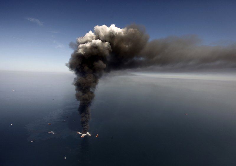
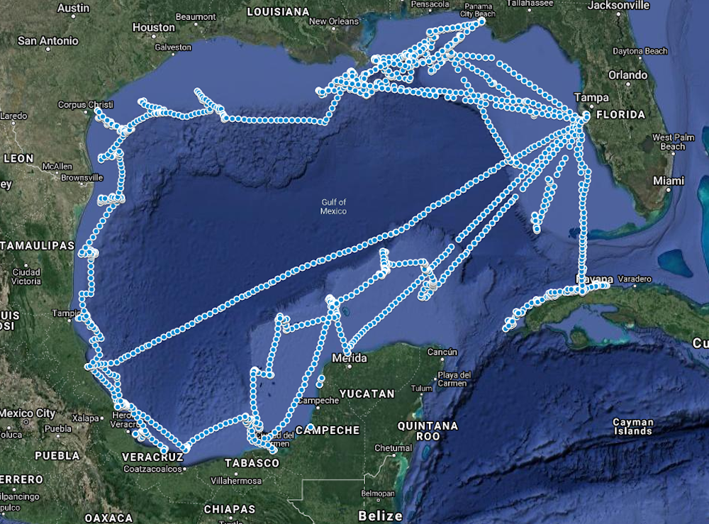
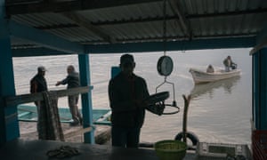
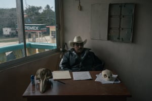
IMAGE: THE 2010 DEEPWATER HORIZON OIL SPILL INVOLVED OVER 9,000 VESSELS DEPLOYED IN THE GULF OF MEXICO WATERS ACROSS ALABAMA, FLORIDA, LOUISIANA AND MISSISSIPPI AND TENS OF THOUSANDS OF WORKERS ON THE WATER AND ON LAND. view more 

CREDIT: SUBMITTED PHOTO/NIEHS

Nearly 12 years after the Deepwater Horizon oil spill, scientists are still examining the potential health effects on workers and volunteers who experienced oil-related exposures.

To help shape future prevention efforts, one West Virginia University researcher – Caroline Groth, assistant professor in the School of Public Health’s Department of Epidemiology and Biostatistics – has developed novel statistical methods for assessing airborne exposure. Working with collaborators from multiple institutions, Groth has made it possible for researchers to characterize oil spill exposures in greater detail than has ever been done before.

With very few Ph.D. biostatisticians in the area of occupational health, there were few appropriate statistical methodologies for the assessment of inhalation exposures for the GuLF STUDY, a study launched by the National Institute of Environmental Health Sciences shortly after the Deepwater Horizon oil spill. The purpose of the study, which is the largest ever following an oil spill: examine the health of persons involved in the response and clean-up efforts. Groth was part of the exposure assessment team tasked with characterizing worker exposures and led by Patricia Stewart and Mark Stenzel.

Groth’s statistical methods, which she began in 2012, laid the framework for a crucial step for determining whether there are associations between exposures and health outcomes from the oil spill and clean-up work, which involved over 9,000 vessels deployed in the Gulf of Mexico waters across Alabama, Florida, Louisiana and Mississippi and tens of thousands of workers on the water and on land.  

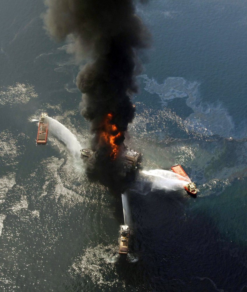
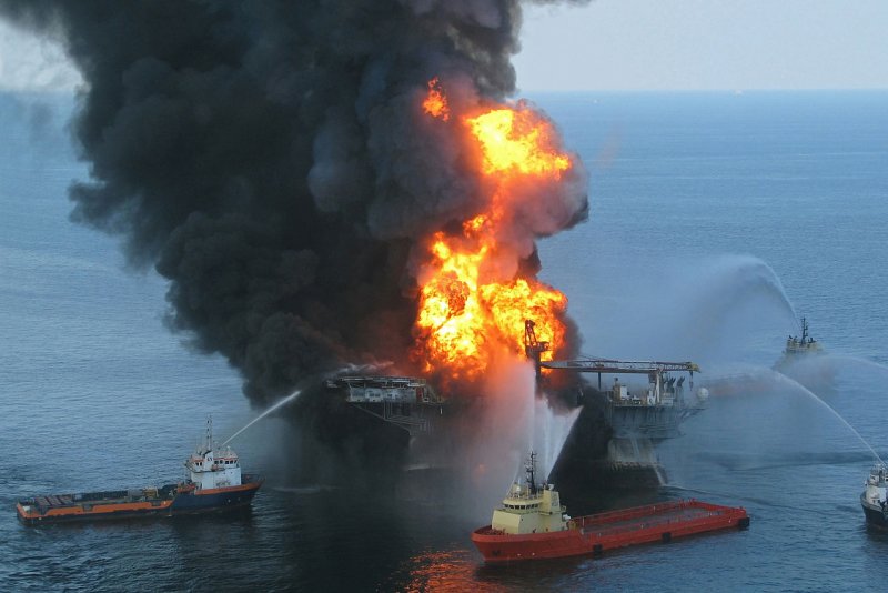
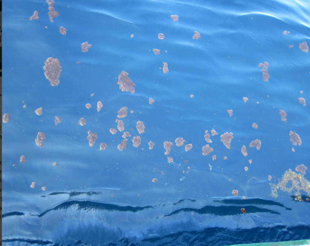
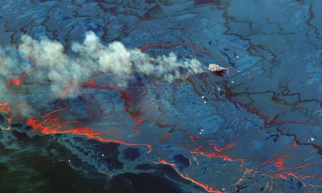
The Deepwater Horizon oil spill is considered the largest marine oil spill in the history of the U.S.

“Workers were exposed differently based on their activities, time of exposure, etc., and our research team’s goal was to develop exposure estimates for each of those scenarios and then link them to the participants’ work history through an ‘exposure matrix,’” Groth said.

These methods make it possible for other researchers to estimate individuals’ levels of exposure and link it to their health outcomes.  

Additionally, Groth uncovered a new way of accounting for exposures that instruments cannot detect. The threshold at which exposures cannot be detected is referred to as the LOD, or limit of detection. Groth’s methods go beyond that limit, accounting for the fact that there is uncertainty in exposure measurements below the LOD.

“Basically, what happens is the instrument reports undetectable, or ‘zero,’" Groth explained. “Previously, less reliable approaches were likely used – such as replacing it with a single value or forecasting. Those approaches do not consider actual variability in the data which, if not considered, can lead to inaccurate exposure estimates. However, we know with certainty they cannot be ‘zero.'

“We know it’s between that threshold and zero, and there is likely variability in these measurements that we should account for. Our methods allow us to account for this variability and get a quantitative estimate of concentration.”

Her findings, along with her team’s, were recently published in the Annals of Work Exposures and Health. Dale Sandler, chief of the Epidemiology Branch and senior investigator at the National Institute of Environmental Health Sciences, said the efforts of Groth – who served as primary author for two of the manuscripts and co-author for eight published manuscripts – and her colleagues have opened new doors.

“The Gulf Long-term Follow-up Study is larger and more long-term than research on other oil spills, but the major defining feature of the study is the level of detail on potential oil-spill exposures and the extensive efforts made to characterize the exposures of those who helped to clean up following this environmental and potential public health disaster,” Sandler, principal investigator of the study, said. “Dr. Groth, who has played a key role in characterizing the chemical exposures of persons participating in the GuLF Study, and her colleagues have allowed us to characterize respiratory exposures to a broad class of chemicals resulting from the oil spill.” 

Research continues to be conducted, with plans to continue following these workers for additional health effects going forward to determine if any exposures were associated with detrimental health outcomes. Both Groth and Sandler see the effort as an important step to identifying factors that contribute to long-term safety and health.

Sandler added, “This will help us identify links between specific exposures and health effects and could help us identify targets for future prevention efforts.”

Saturday, April 18, 2020

Survey shows pollution in Gulf 10 years after Deepwater Horizon spill

Researcher Erin Pulster, marine scientist at the University of South Florida, is pictured identifying fish specimens alongside research partners from the National Autonomous University of Mexico. Photo by USF

April 15 (UPI) -- For the first time, scientists have a conducted a Gulf-wide survey of oil pollution among fish populations.

The massive study -- comprising samples from 2,500 fish representing 91 species spread across 359 locations in the Gulf of Mexico -- suggests contamination from oil pollution remains widespread roughly 10 years after the Deepwater Horizon spill.

Researchers published the results of the record survey on Wednesday in the journal Scientific Reports.

"This is the largest comprehensive fish survey ever conducted in a large marine ecosystem and provides the first spatial and temporal baselines for polycyclic aromatic hydrocarbon in fishes in the Gulf of Mexico," study author Erin L. Pulster, marine scientist and postdoctoral researcher at the University of South Florida, told UPI in an email.

RELATED Toxic mineral selenium to blame for spinal deformities in California Delta fish
Polycyclic aromatic hydrocarbons, or PAHs, are one of the most toxic chemical components found in crude oil. The toxins, which have been linked to heart disease and cancers in humans, get trapped in the bile of fish.

"This study demonstrates the chronic and widespread oil pollution in this ecosystem," Pulster said. "Given the extensive oil and gas extraction activities in the Gulf of Mexico for the last eight decades, it is unclear why this has not been conducted prior to the Deepwater Horizon oil spill."

The new survey revealed elevated levels of PAH in every surveyed fish species living in the Gulf, but the highest levels were found in yellowfin tuna, golden tilefish and red drum.

RELATED Deepwater Horizon oil spill was bigger than previously thought, study finds

Elevated levels were expected in tilefish, which spend most of their lives stirring up seafloor sediment, where oil pollution settles. But researchers were surprised to find such elevated PAH levels in tuna, which live their lives in the water column, where oil pollution tends to persist for only short amounts of time.

As part their research, scientists also mined data from previous PAH exposure surveys. The research team found evidence of elevated PAH levels in the tissue and bile of 10 popular grouper species.

"The elevated and increasing PAH levels in fish is the result of a combination of sources which include both anthropogenic and natural sources," Pulster said. "Anthropogenic sources include the Deepwater Horizon oil spill, leaking infrastructure, riverine discharge, marine vessel traffic and the resuspension of contaminated sediments. Natural sources are mainly natural oil seeps and submarine groundwater discharge located throughout the Gulf of Mexico."
RELATED Biologists publish first global map of fish genetic diversity

Not all fish populations show the same levels of contamination. Scientists measure higher concentrations of the toxins near places with greater oil and gas activity. Researchers also found PAH hotspots among fish populations near coastal cities like Tampa Bay, which suggests urban runoff can exacerbate oil pollution problems.

"The continued degradation of the Gulf of Mexico ecosystem is demonstrated by the chronic, widespread oil pollution," Pulster said.

Despite the alarming results, scientists suggest the evidence of PAH contamination is more concerning for the health of Gulf ecosystems and fish populations than the health and safety of consumers of Gulf seafood. Toxin levels in the flesh of commercial fish species are closely monitored and PAH levels in fish flesh remain below public health advisory levels.
RELATED Changes in oxygen, temperature could reshape deep sea fish communities

However, prolonged exposure to elevated PAH and other oil-related toxins can cause the liver to shutdown, threatening the health of fish in the Gulf. Previous studies have revealed 50 to 80 percent population declines in deep water, or mesopelagic, fish populations near the Deepwater Horizon blowout site.

Researchers hope their baseline study of PAH contamination among Gulf fish is only the beginning of a more robust monitoring effort.

"Providing funding is available, our research efforts will continue to monitor and evaluate PAH levels in fish and the subsequent sub lethal effects," Pulster said. "Additionally, a major research focus will be geared toward identifying the sources of PAHs in surface waters that are impacting pelagic [openwater] species."

Sunday, April 21, 2024

We know how to prevent the next Deepwater Horizon spill: stop fast-tracking approval for drilling 

BY DONALD BOESCH, OPINION CONTRIBUTOR - 04/20/24 

FILE – A large plume of smoke rises from fires on BP’s Deepwater Horizon offshore oil rig in the Gulf of Mexico, more than 50 miles southeast of Venice on Louisiana’s tip on April 2010. A new National Academy of Science study says that 13 years after a massive BP oil spill fouled the Gulf…

Fourteen years ago, the British Petroleum (BP) Deepwater Horizon offshore drilling rig suffered a blowout in water a mile deep. The Gulf of Mexico explosion took the lives of 11 people, released 134 million gallons of oil into the Gulf over 87 straight days, wreaked widespread ecological harm, displaced communities, and devastated local economies.

Ultimately, the worst oil spill in U.S. history cost $17.2 billion in damage. President Obama appointed me to the national commission to investigate the causes of this disaster.

Through the course of our investigation, my colleagues and I discovered that (in addition to multiple direct errors) the Interior Department had performed no meaningful analysis of the potentially significant environmental consequences when it considered BP’s applications for Deepwater Horizon. Instead, the government had essentially rubber-stamped BP’s exploration plans and drilling permits using a decades-old policy to exempt them from the typically mandatory environmental review. Known as a “categorical exclusion,” this became a routine practice — one that the Interior Department continues to regularly employ.

In 1978, faced with looming oil shortages, Congress passed the Outer Continental Shelf Lands Act to promote offshore development of oil and gas resources. The act expressly singled out the Gulf of Mexico, which is the source of about 97 percent of all U.S. offshore oil and gas production, for less rigorous oversight under the National Environmental Policy Act (NEPA). The Interior Department then created the categorical exclusion policy to further bolster oil production. This allowed the government to fast-track approval of oil companies’ offshore drilling permits, declaring them not subject to the rigorous oversight normally required under NEPA.

Our commission’s investigation also uncovered troubling evidence that government personnel responsible for reviewing offshore oil drilling permits were made to understand that flagging environmental concerns would “increase the burden” on oil companies by “creating unnecessary delays.” And it was also evident that staffers were simply too under-resourced to meet the extraordinary expansion of oil development in the Gulf.

To be clear, the Interior Department had conducted general environmental reviews evaluating impacts of oil and gas development in the Gulf at large. But by using categorical exclusion, the government did not analyze the unique risks at the Deepwater Horizon site, thereby failing to account for the geological complexity and susceptible deep-sea life specific to that area in the Gulf.

At the close of the investigation, our commission recommended that the Interior Department strengthen its oversight procedures through the oil exploration and development process.

Six years later, the department issued a memorandum directing the discontinuation of categorical exclusions for offshore oil project approvals. However, the policy revision was never published in the Federal Register. Then, in 2017, under President Trump, the government reversed course and reinstated fast-tracking approvals for offshore oil drilling.


Fast forward to today, and the categorical exclusion still hasn’t been retired, while many other things have greatly changed concerning energy and the Gulf of Mexico. Over the last 14 years, offshore oil and gas exploration and production has continued to shift into waters even deeper and riskier than where BP was drilling. Human-caused climate change has become more obvious, with the waters of the Gulf warming faster than the world’s oceans as a whole. This is setting the stage for increasingly powerful hurricanes, making offshore drilling even more dangerous. While oil production in the Gulf has been generally steady, reserves are being depleted, leaving the Gulf littered with unproductive platforms, inadequately plugged wells and 18,000 miles of abandoned pipeline on the seabed.

Over the same period, as a result of inland fracking, U.S. crude oil production has dramatically increased and is at an all-time high. Our country has become a net exporter of crude oil, with more than twice as much of it shipped from Gulf ports than produced in the offshore waters of the Gulf of Mexico.

Yet, there is global commitment to quickly reduce greenhouse gas emissions to avoid a climate catastrophe. This necessitates commensurate reduction in burning of fossil fuels and expansion of renewable energy. It is new renewable energy — wind, solar, and geothermal — that we must be fast-tracking (with appropriate environmental precautions), not more environmentally damaging production of fossil fuels.


Over the past five years, the Interior Department has fast-tracked approvals for more than 90 percent of proposed offshore oil projects, yet additional oil spills from risky wells have continued, including this year. It’s long past time to discontinue the routine use of categorical exclusions for offshore oil and gas development. This simple policy change could be the difference between setting the stage for the next Deepwater Horizon disaster and steering clear of another catastrophe — before it’s too late.

Donald Boesch, a professor of marine science, served as president of the University of Maryland Center for Environmental Science and vice chancellor for Environmental Sustainability.

Saturday, April 18, 2020

10 years after BP spill: Oil drilled deeper; rules relaxed

1 of 16
FILE - This April 21, 2010 file photo shows oil in the Gulf of Mexico, more than 50 miles southeast of Venice on Louisiana's tip, as the Deepwater Horizon oil rig burns. Ten years after an oil rig explosion killed 11 workers and unleashed an environmental nightmare in the Gulf of Mexico, companies are drilling into deeper and deeper waters where the payoffs can be huge but the risks are greater than ever. (AP Photo/Gerald Herbert, File)


NEW ORLEANS (AP) — Ten years after an oil rig explosion killed 11 workers and unleashed an environmental nightmare in the Gulf of Mexico, companies are drilling into deeper and deeper waters, where the payoffs can be huge but the risks are greater than ever.

Industry leaders and government officials say they’re determined to prevent a repeat of BP’s Deepwater Horizon disaster. It spilled 134 million gallons of oil that fouled beaches from Louisiana to Florida, killed hundreds of thousands of marine animals and devastated the region’s tourist economy.

Yet safety rules adopted in the spill’s aftermath have been eased as part of President Donald Trump’s drive to boost U.S. oil production. And government data reviewed by The Associated Press shows the number of safety inspection visits has declined in recent years, although officials say checks of electronic records, safety systems and individual oil rig components have increased.

Today companies are increasingly reliant on production from deeper and inherently more dangerous oil reserves, where drill crews can grapple with ultra-high pressures and oil temperatures that can top 350 degrees (177 degrees Celsius).

Despite almost $2 billion in spending by the industry on equipment to respond to an oil well blowout like BP’s, some scientists, former government officials and environmentalists say safety practices appear to be eroding. And there are worries that cleanup tactics have changed little in decades and are likely to prove as ineffective as they were in 2010.

In this June 3, 2010 file photo, a Brown Pelican is mired in oil from the Deepwater Horizon oil spill, on the beach at East Grand Terre Island along the Louisiana coast.(AP Photo/Charlie Riedel, File)

“I’m concerned that in the industry, the lessons aren’t fully learned — that we’re tending to backslide,” said Donald Boesch, a marine science professor at the University of Maryland who was on a federal commission that determined the BP blowout was preventable.

Regulators and industry leaders say they’ve employed lessons from the April 20, 2010, disaster to make deep-water drilling safer by setting tougher construction and enforcement standards.

“I think the event 10 years ago really initiated kind of a new day in offshore safety,” said Debra Phillips, of the American Petroleum Institute, a standards-setting trade association.

____

Companies have a financial interest in preventing a repeat of the 2010 disaster, which cost BP more than $69 billion in cleanup, fines, fees and settlements. Questions over environmental effects linger, and litigation continues over health problems suffered by cleanup workers.


Competing oil giants joined in the disaster’s wake to create the Marine Well Containment Co., which has equipment and vessels positioned regionwide to quickly corral oil if another major spill occurs.

“All of (the) industry wanted to make sure that nothing like it could ever happen again,” said CEO David Nickerson, at the company’s complex near Corpus Christi on Texas’ coast.

He was dwarfed by “capping stacks”″ — multistory structures of piping, valves and gauges designed to be lowered to halt a major high-pressure blowout.

The hope is that such equipment won’t be needed. Yet the Trump administration has relaxed rules adopted in 2016, including the frequency of drilling rig safety tests. That’s projected to save energy companies roughly $1.7 billion in compliance costs over a decade.

An AP review found the number of safety inspection visits by the U.S. Bureau of Safety and Environmental Enforcement — created after the spill — went down more than 20% over the past six years in the Gulf.

Industry advocates say inspection figures reflect greater emphasis on complex systems that influence safety rather than minor technical matters, and note there are fewer, if bigger, active oil platforms. They say the administration’s rule changes allow companies to deviate from “one-size-fits-all” standards not always suited to water pressure and other conditions at individual wells.

“Sometimes, when the regulations are quite prescriptive, it can actually inadvertently deteriorate safety,” said Phillips, of the American Petroleum Institute.

In this July 13, 2017, released by the U.S. Bureau of Safety and Environmental Enforcement, An oil industry facility in the Gulf of Mexico is seen. (U.S. Bureau of Safety and Environmental Enforcement via AP)

Environmentalists and critics say the changes appear to be eroding safety practices adopted after the spill.

“The industry itself is in the lead in trying to reduce its risk and protect its workers,” said Bob Deans of the National Resources Defense Council, one of several environmental groups suing over Trump administration changes. “The problem comes when you’re behind schedule, over budget and pressure comes from on top to get the job done and move on to the next project. That was the problem on Deepwater Horizon.″

The federal commission that studied the accident and the federal judge who oversaw myriad lawsuits put the blame on BP for poor management. In a key court ruling, U.S. District Judge Carl Barbier said “profit-driven decisions” on the rig were made in “conscious disregard of known risks.”

Debate over the strength of regulation and industry safety consciousness goes on as wells close to shore run dry and companies drill in deeper waters farther offshore.

The average depth of deep water drilling steadily increased, from about 3,500 feet (1,070 meters) beneath the surface in 1999 to more than 4,600 feet (1,400 meters) in 2019, according to an AP analysis of data from the U.S. Interior Department’s Bureau of Ocean Energy Management.

That’s an increase of about 32%.

Drilling deeper makes well sites harder to reach in a blowout or other accident.

FILE - This April 21, 2010 file photo shows the Deepwater Horizon oil rig burning after an explosion in the Gulf of Mexico, off the southeast tip of Louisiana. Ten years after an oil rig explosion killed 11 workers and unleashed an environmental nightmare in the Gulf of Mexico, companies are drilling into deeper and deeper waters where the payoffs can be huge but the risks are greater than ever. (AP Photo/Gerald Herbert, File)

In the past year, the industry began producing crude for the first time from ultra-high pressure crude reserves in the Gulf. Overall production hit a record 2 million barrels a day before the coronavirus pandemic caused demand to plummet.

Pressures in those wells can approach 20,000 pounds per square inch, compared with almost 12,000 pounds for Deepwater Horizon.

“Higher risk, higher pressure, higher temperatures, more reliance on technology — it’s just a tougher environment to operate in,” said Lois Epstein, a civil engineer at the Wilderness Society who served on a government advisory committee post-spill.

Trump administration changes have intensified debate over how tightly the government should regulate, and what decisions should be left to industry professionals.

Much of the discussion centers on rules intended to keep wells under control, such as requirements for blowout preventers that failed in the spill.

The 2016 rule required companies to test the blowout preventers every 14 days. The Trump administration allows companies to test every 21 days, saying more frequent testing would risk equipment failure.

As deep-water activity has expanded, the number of inspections carried out by the government’s safety bureau has declined.

Inspections fell from 4,712 in 2013 to 3,717 in 2019, according to government data reviewed by AP.

Bureau spokesman Sandy Day said the inspection figures reflect visits by inspectors to rigs, platforms and other facilities. Day said the data doesn’t reflect electronic records reviewed remotely or the increased time spent at each facility and all inspection tasks performed. Those, he said, have increased from 9,287 in 2017 to 12,489 last year. The agency didn’t provide a breakdown.

“While on the facility we did numerous inspections of different items,” Day said, including equipment for preventing blowouts, fires, spills, or other major accidents. He said electronic records allow more work to be done from shore, rather than digging through paperwork on site.

The number of warnings and citations issued to companies for safety or environmental violations peaked in 2012 and has since fallen even faster than inspections. The decline accelerated under the current administration, agency documents show.

Fewer inspection visits and fewer citations suggests the safety improvements that took hold after the 2010 spill are unraveling, said Matt Lee-Ashley, former deputy chief of staff at the Interior Department.

“There is a value in having inspectors on board frequently. You have to establish a culture of enforcement,” said Lee-Ashley, now with the Center for American Progress, a left-leaning advocacy group.


Industry representatives maintain that inspection numbers don’t automatically translate to less effective oversight. Inspectors are less interested than in the past in technical violations and are focused on making sure comprehensive safety systems are in place to prevent major accidents, said Erik Milito, of industry trade group the National Ocean Industries Association.

“If you think about going out with a checklist and see if there are enough eyewash bottles, everybody has steel-toed shoes — you can do that, and bounce around from facility to facility,” he said. “But there’s got to be an emphasis on your more significant potential incidents, potential blowouts.”

___

At the center of the debate is the agency formed to enforce offshore safety after Deepwater Horizon, the Bureau of Safety and Environmental Enforcement, and its director under Trump, Scott Angelle.

Angelle, a former Louisiana official who was a paid board member for an oil logistics company, has faced criticism from Democratic lawmakers and environmentalists for pushing through the relaxed safety rules against agency staff advice.

During a hearing last month before the House Natural Resources Committee, Rep. Mike Levin, D-Calif., accused Angelle of trying to hide information that didn’t support the administration’s goal of loosening regulations for petroleum companies.

Angelle said initial staff recommendations to keep the two-week testing frequency for blowout preventers “were not ready and ripe.” His office later released an Argonne National Laboratory study that concluded relaxing the testing regimen would have cost benefits and could improve safety, since frequent equipment testing can cause wear and tear that results in accidents.

Michael Bromwich, the safety agency’s director under Obama, credited the industry for taking action after the spill to overhaul drilling. But as time passed, Bromwich said companies became complacent and are now overseen by a man he calls an industry booster.

“You need to have somebody who believes in the regulatory mission and who doesn’t view themselves and doesn’t view their agency as a cheerleader for the industry,” Bromwich said.

Requests over several weeks to interview Angelle were declined. Spokesman Day said the director wants to make the bureau a “do-it-all” agency that can protect safety and the environment while advancing Trump’s goal of U.S. “energy dominance” globally.

Even if companies are prepared for another Deepwater Horizon, they could be overwhelmed by other accidents, such as of one of the Gulf’s frequent underwater mudslides wiping out a cluster of wellheads on the seafloor, said Florida State University oceanographer Ian MacDonald.

That could trigger a blowout that would be harder to stop due to the damaged wellheads being possibly hundreds of feet deep in muddy debris, said MacDonald, who helped determine the magnitude of the 2010 spill.

In addition to having ships and barges standing by to capture oil that escapes from accidents, the industry has stockpiled chemical dispersants to break up oil and it can mobilize thousands of workers to clean up crude that reaches the shore.

But the heavy use of dispersants during Deepwater Horizon stirred controversy both over its effectiveness and biological effects. And scientists say the technology applied to shore cleanups remains as rudimentary as it was 10 years ago.

Crews relied heavily on hand tools such as shovels and absorbent paper towels sometimes called “oil diapers.” Much of the crude was deemed unrecoverable and left to break down over time.

“It’s something you could have done 100 years ago,” said Louisiana State University engineering professor John Pardue. “We’re still moving oil around with minimum wage workers with their hands.”

___

Brown reported from Billings, Montana. Janet McConnaughey contributed to this story from New Orleans.

___

Follow Kevin McGill on Twitter: @mcgill56 and Matthew Brown on Twitter: @matthewbrownap

Friday, February 28, 2020

BEYOND PETROLEUM (BP)
Deepwater Horizon oil spill was bigger than previously thought, study finds


The Deepwater Horizon disaster was the largest oil spill in U.S. history. Photo courtesy of U.S. Coast Guard

Feb. 12 (UPI) -- Oil from the Deepwater Horizon disaster spread well beyond the spill footprint established by satellites, according to new analysis by scientists at the University of Miami.

To determine the true size of the 2010 Deepwater Horizon oil spill, researchers supplied oil-transport models with water sampling results and remote sensing data. The simulations confirmed that a portion of the oil spilled in the wake of the deadly explosion remained invisible to satellites, but proved toxic to marine wildlife.

"We found that there was a substantial fraction of oil invisible to satellites and aerial imaging," Igal Berenshtein, lead author of the new study and a postdoctoral researcher at Miami's Rosenstiel School of Marine and Atmospheric Science, said in a news release. "The spill was only visible to satellites above a certain oil concentration at the surface leaving a portion unaccounted for."

Over the course of three months in the spring of 2010, following the late-April explosion of the Deepwater Horizon oil rig, some 210 million gallons of crude oil spewed into the Gulf of Mexico. It was the biggest oil spill in U.S. history.


RELATED Report reveals elevated benzene levels at 10 U.S. oil refineries

In the wake of the spill, scientists used satellite images to measure the size of the oil slick created by the disaster. The spilled oil created an oil slick covering 57,000 square miles.

But the latest research, published Wednesday in the journal Science Advances, suggests the spill's true footprint was significantly larger.


According to the new models, the oil and its toxins reached the shores of Texas, the West Florida shelf and the Florida Keys. Oil was even carried by the Gulf Stream to the East Florida shelf.

RELATED Colossal oysters missing from parts of Florida's coastline

"Our results change established perceptions about the consequences of oil spills by showing that toxic and invisible oil can extend beyond the satellite footprint at potentially lethal and sub-lethal concentrations to a wide range of wildlife in the Gulf of Mexico," said senior study author Claire Paris, professor of ocean sciences at the Rosenstiel School.


"This work added a third dimension to what was previously seen as just surface slicks," Paris said. "This additional dimension has been visualized with more realistic and accurate oil spill models developed with a team of chemical engineers and more efficient computing resources."

Previous studies of the spill suggest as much as half of the oil spewed during the disaster may have ended up on the floor of the Gulf. One study showed an oil dispersant used during the cleanup, called concoction, actually prevents microbes from naturally breaking down the oil.

Friday, March 12, 2021

DEEPWATER HORIZON

Oil in the ocean photooxides within hours to days, new study finds

Study provides new details on the fate of spilled oil in the marine environment, effectiveness of chemical dispersants

UNIVERSITY OF MIAMI ROSENSTIEL SCHOOL OF MARINE & ATMOSPHERIC SCIENCE

Research News

IMAGE

IMAGE: SATELLITE IMAGE TAKEN ON MAY 9, 2010 OF THE DEEPWATER HORIZON OIL SPILL SITE IN THE GULF OF MEXICO. view more 

CREDIT: MODIS ON NASA'S AQUA SATELLITE, 9 MAY 2010 @ 190848 UTC. DOWNLINK AND PROCESSED AT THE UM ROSENSTIEL SCHOOL'S CENTER FOR SOUTHEASTERN TROPICAL ADVANCED REMOTE SENSING (CSTARS)

MIAMI--A new study lead by scientists at the University of Miami (UM) Rosenstiel School of Marine and Atmospheric Science demonstrates that under realistic environmental conditions oil drifting in the ocean after the DWH oil spill photooxidized into persistent compounds within hours to days, instead over long periods of time as was thought during the 2010 Deepwater Horizon oil spill. This is the first model results to support the new paradigm of photooxidation that emerged from laboratory research.

After an oil spill, oil droplets on the ocean surface can be transformed by a weathering process known as photooxidation, which results in the degradation of crude oil from exposure to light and oxygen into new by-products over time. Tar, a by-product of this weathering process, can remain in coastal areas for decades after a spill. Despite the significant consequences of this weathering pathway, photooxidation was not taken into account in oil spill models or the oil budget calculations during the Deepwater Horizon spill.

The UM Rosenstiel School research team developed the first oil-spill model algorithm that tracks the dose of solar radiation oil droplets receive as they rise from the deep sea and are transported at the ocean surface. The authors found that the weathering of oil droplets by solar light occurred within hours to days, and that roughly 75 percent of the photooxidation during the Deepwater Horizon oil spill occurred on the same areas where chemical dispersants were sprayed from aircraft. Photooxidized oil is known to reduce the effectiveness of aerial dispersants.

"Understanding the timing and location of this weathering process is highly consequential. said Claire Paris, a UM Rosenstiel School faculty and senior author of the study. "It helps directing efforts and resources on fresh oil while avoiding stressing the environment with chemical dispersants on oil that cannot be dispersed."

"Photooxidized compounds like tar persist longer in the environment, so modeling the likelihood of photooxidation is critically important not only for guiding first response decisions during an oil spill and restoration efforts afterwards, but it also needs to be taken into account on risk assessments before exploration activities" added Ana Carolina Vaz, assistant scientist at UM's Cooperative Institute for Marine and Atmospheric Studies and lead author of the study.

###

The study, titled "A Coupled Lagrangian-Earth System Model for Predicting Oil Photooxidation," was published online on Feb 19, 2021 in the journal Frontiers in Marine Science. The authors of the paper include: Ana Carolina Vaz, Claire Beatrix Paris and Robin Faillettaz.

The study was supported by the Gulf of Mexico Research Initiative (GoMRI): C-IMAGE III (Center for the Integrated Modeling and Analysis of the Gulf Ecosystem) and RECOVER 2 (Relationship of Effects of Cardiac Outcomes in ?sh for Validation of Ecological Risk).

Saturday, February 12, 2022

How autonomous underwater robots can spot oil plumes after an ocean spill

Neil Bose, Vice President (Research) 
and Professor, Ocean and Naval Architectural Engineering, 
Memorial University of Newfoundland 

Jimin Hwang, Postdoctoral Researcher, University of Tasmania -

 Thursday


On April 20, 2010, the offshore oil rig Deepwater Horizon exploded, burned, sank in the Gulf of Mexico and terrified the world. This horrific accident — recorded as the largest oil spill in history — killed 11 workers and released 210 million gallons of crude oil into the ocean


© (Shutterstock)Response teams often make assumptions about the way oil behaves in the ocean, but this means oil plumes can go undetected and get missed in the clean-up.

While about a half of the oil rose to the surface, the other half formed a suspended plume of many tiny oil droplets about 1,000 metres below the surface. Its extent and whereabouts couldn’t be determined from above.

Autonomous underwater vehicles (AUVs) are untethered marine robots that can explore the underwater world. AUVs were first used in oil probing missions when the Woods Hole Oceanographic Institution and the Monterey Bay Aquarium Research Institute rapidly deployed them to assess the extent of the submerged plume from the Deepwater Horizon spill.

Since then, AUVs have been developed to accommodate a variety of payloads that are similar to the sensing organs of humans, such as underwater cameras, sonars and chemical and sniffing sensors that operate like our eyes, ears and noses. In our research, we equip the AUV with a scanning sonar to find distant oil plumes and other sensors to take measurements — such as particle size and petrochemical type — when it comes into contact with the plume.

Impacts of marine oil pollution


Although AUVs were used to identify oil plumes in the Deepwater Horizon spill, they are not yet in regular use. They have also been operated with several assumptions about the way oil behaves in the ocean after a spill. This means that clean-up operations may miss large portions of the oil, which can have severe consequences on marine habitats, fish and birds.

Even a small amount of oil can be fatal to a bird. Oil-coated feathers make flying impossible and damages their body insulation. During the Exxon Valdez spill off the coast of Alaska in 1989, 250,000 seabirds were killed. The Deepwater Horizon spill killed 82,000 birds from 102 species, 6,165 sea turtles, 25,900 marine mammals and an incalculable number of fish.


© (AP Photo/Rich Matthews)Patches of oil from the Deepwater Horizon spill are suspended in the water, in the Gulf of Mexico, south of Venice, La., on June 7, 2010, nearly two months after the drilling rig exploded and the leak was discovered. It took 87 days to stop the initial leak.

If we can find these plumes and clean them up, we might be able to save some of the animals in the event of a disastrous spill.

To date, in designing AUV missions, operators have assumed that underwater oil plumes are continuous with a smooth concentration gradient. Yet real oil plumes consist of patchy clouds made up of oil droplets.

A better approach is needed to effectively track real oil plumes by detecting the plume from a distance and recognizing their true patchy nature.
An ear in the sea

We developed an approach to search for and detect patches of oil droplets in the ocean using sonar. Sonar works well for this because of the difference between the density of oil droplets and that of water, and the strength of the sound reflections from these clouds of oil droplets.

Integrating sonar with the AUV allows the vehicle to continuously detect its surroundings without having to make contact with the oil droplets.

As the on-board computer collects the data and processes it in real-time, it draws conclusions about the location of a patch of oil droplets and then sends the AUV an updated set of directions to help it build a three-dimensional map of the oil plume


© (Rich Blenkinsop)
Memorial University's Explorer AUV is equipped with sonars that can detect oil plumes from a distance.

The on-board computer acts like a backseat driver, overriding and adapting the pre-programmed mission as needed. These override instructions allow the AUV to track around a patch of oil droplets at a distance of up to 50 meters, recording the size and position of the patch.

Once an oil plume has been identified and mapped out, the backseat driver can instruct the AUV to enter the patch and take readings using additional chemical sensors, or collect a water sample to understand more about the composition of the oil itself.
Into the depths

We’ve carried out several marine oil pollution search missions using proxies for the oil in a sheltered coastal environment in Holyrood Bay, N.L. One of these was to design a search pattern that maximized spatial coverage, and reduced the total search time and distance travelled needed to find an oil spill of interest. Another tested the effectiveness of the backseat driver control to direct the AUV.

The tracking missions have been successfully tested in computer simulations and will be deployed in coastal waters where micro-air bubbles will be used to represent the oil. In 2023, we plan to test these sonar-equipped AUVs near Scott Inlet in Baffin Bay, where there are several naturally occurring oil seeps.

While we’ve developed this approach to sense patches of oil droplets in seawater, the principle could also be used for other targets in the ocean, including identifying plastic and micro-plastic debris, studying schools of fish, plankton or other biological matter or mapping seabed topography and searching for hydrothermal vents.

Read more:

Scientists aim to build a detailed seafloor map by 2030 to reveal the ocean’s unknowns
Why scientists intentionally spilled oil into a Canadian lake


Neil Bose receives funding from Memorial University, NSERC and DFO Canada. DFO funds three projects under the Multi-Partner Research Initiative (MPRI) including Oil Spill Reconnaissance and Delineation through Robotic Autonomous Underwater Vehicle Technology in Open and Iced Waters and Inshore Trials of Robotic Autonomous Underwater Vehicle Technology for Oil Spill Reconnaissance and Delineation using an Environmentally Friendly Proxy. One of the NSERC grants is under their Alliance program, Characterization and delineation of oil-in-water at the Scott Inlet seeps through robotic autonomous underwater vehicle technology, and is in partnership with Fugro Canada and International Submarine Engineering, BC. Neil Bose is a co-chair of the not for profit group Panel on Underwater Robotics, Society for Underwater Technology, UK.

Jimin Hwang receives funding from Memorial University and Australian Research Council's Special Research Initiative through the Antarctic Gateway Partnership under Project SR140300001. This work is supported in part by DFO through the Multi-Parner Research Initiative (MPRI) 1.03: Oil Spill Reconnaissance and Delineation through Robotic Autonomous Underwater Vehicle Technology in Open and Iced Waters and in part by the Australian Government Research Training Program Scholarship.

Saturday, November 13, 2021

ECOCIDE

Scientists have found oil from the Deepwater Horizon blowout in fishes' livers and on the deep ocean floor


Steven Murawski, Downtown Partnership-Peter Betzer Endowed Chair in Biological Oceanography, University of South Florida

Sherryl Gilbert, Assistant Director, C-IMAGE Consortium, University of South Florida

Thu, November 11, 2021

Researchers use Atlantic mackerel for bait on long-lining fishing sampling expeditions in the Gulf of Mexico.. C-IMAGE Consortium, CC BY-ND

Over the decade since the Deepwater Horizon spill, thousands of scientists have analyzed its impact on the Gulf of Mexico. The spill affected many different parts of the Gulf, from coastal marshes to the deep sea.

At the Center for Integrated Modeling and Analysis of the Gulf Ecosystem, or C-IMAGE at the University of South Florida, marine scientists have been analyzing these effects since 2011. C-IMAGE has received funding from the Gulf of Mexico Research Initiative – a broad, independent research program initially funded by a US0 million grant from BP, the company held principally responsible for the spill.

Our findings and those of many other academic, government and industry researchers have filled two books. These works seek to quantify the past and future impacts of oil spills, and to help prevent such accidents from ever happening again. Here are some important findings on how the Deepwater Horizon disaster affected Gulf of Mexico ecosystems.


Oil in fish and sediments

Before the spill, baseline data on oil contamination in fishes and sediments in the Gulf of Mexico did not exist. This kind of information is critical for assessing impacts from a spill and calculating how quickly the ecosystem can return to its previous, pre-spill state. Oil was already present in the Gulf from past spills and natural seeps, but the Deepwater Horizon was the largest accidental spill in the ocean anywhere in the world.

C-IMAGE researchers developed the first comprehensive baseline of oil contamination in the Gulf’s fishes and sediments, including all waters off the United States, Mexico and Cuba. Researchers spent almost 250 days at sea, sampling over 15,000 fishes and taking over 2,500 sediment cores.


Repeated sampling from 2011 through 2018 of the region around the spill site has produced estimates of how quickly various species are able to overcome oil pollution; impacts on the health of various species, from microbes to whales; and how fast oil stranded on the bottom has become buried in sediments.

Importantly, no fish yet sampled anywhere in the Gulf has been free of hydrocarbons – a telling sign of chronic and ongoing pollution in the Gulf. It is not known if similar findings would result from ecosystem-wide studies elsewhere because such surveys are rare.

Many commercially important fish species were affected by the Deepwater Horizon disaster. Researchers found skin lesions on red snapper from the northern Gulf in the months after the spill, but the lesions became less frequent and severe by 2012. There is other evidence of ongoing and increasing exposures to hydrocarbons over time in economically and environmentally important species like golden tilefish, grouper and hake as well as red snapper.

Increasing concentrations of hydrocarbons in liver tissues of some species, such as groupers, suggest these fish have experienced long-term exposure to oil. Chronic exposures have been associated with the decline of health indices in tilefish and grouper.

To complement field studies, scientists created an oil exposure test facility at Florida’s Mote Aquaculture Research Park to assess how contact with oil affected adult fishes. For example, southern flounder that were exposed to oiled sediments for 35 days showed evidence of oxidative stress, a cellular imbalance that can cause decreased fertility, increased cellular aging and premature death.

Fishes that live in deeper waters, from depths of about 650 to 3,300 feet (200 to 1,000 meters) were also affected. These fish are especially important because they are a food source for larger commercially relevant fish, marine mammals and birds.

Researchers found increased concentrations of polycyclic aromatic hydrocarbons – chemicals that occur naturally in crude oil – in fish tissues after the spill. In 2015-2016, PAH levels were still higher than pre-spill levels. Evidence indicates that the main sources of this contamination are through fishes’ diets and transfers from female fish to their eggs.
Oil on the sea floor

Much of the oil released in the spill created huge slicks at the water’s surface. But significant quantities of crude oil also were deposited at the bottom of the deep sea.

It was carried there by marine snow – clumps of plankton, fecal pellets, biominerals and soil particles washed into the Gulf from land. In a process that occurs throughout the world’s oceans, these particles sink through the water column, transporting large quantities of material to the sea floor. In the Gulf, they attached to oil droplets as they descended.


During the spill, responders set parts of the massive surface slick on fire in an effort to prevent it from reaching beaches and marshes. Crude oil contains thousands of different carbon compounds that become more toxic after they are burned. Post-spill studies showed that these compounds can be trapped in marine snow, covering the seabed and harming organisms that live there.

Researchers coined the term MOSSFA (marine oil snow sedimentation and flocculent accumulation) to describe this mechanism for deposition of significant oil on the seabed. Thanks to this research, MOSSFA has been incorporated into models that U.S. government agencies use for oil spill response. C-IMAGE researchers have also developed methods to predict the intensity of MOSSFA if a similar-sized oil spill occurs anywhere in the world.

Post-spill studies found that levels of oil compounds on the seafloor in the area affected by the spill were two to three times higher than background levels elsewhere in the Gulf. Sediment cores taken from around the wellhead showed that the density of minute single-celled organisms called foraminifera, which are abundant throughout the world’s oceans and are a food source for other fishes, squids and marine mammals, declined by 80% to 90% over 10 months following the event, and their species diversity declined by 30% to 40%.

Oxygen levels in these sediments also decreased in the three years following the spill, degrading conditions for organisms living at the sea floor. As a result of changes like these, researchers project that it will take perhaps 50 to 100 years for the deep ocean ecosystem to recover.


More transparency from the oil industry

Scientists are still assessing key questions about the Gulf’s ecological health, such as how long it will take for deep ecosystems to recover and what the lasting impacts are of episodic pollution events on top of chronic exposure. But here are some steps that would make it easier to measure both chronic effects of oil pollution and impacts from large-scale spills.

Today, the only discharge that offshore oil and gas producers are required to measure is from “produced water” – natural water that comes up from beneath the sea floor along with oil and gas. And they are only required to report its hydrocarbon concentrations, even though the water can contain metals and radioactive material.

In our view, they should also be required to routinely monitor oil contaminants in water, sediments and marine life near each platform, just as wastewater treatment plants periodically gather data on what they are discharging. This would provide a baseline for analyzing impacts from future spills and for detecting leaks hidden from the surface.

Researchers would also like to see more transparency in data sharing about the industry – including routine equipment failures, other discharges such as drilling muds and other operational details – and greater U.S. engagement with Mexico and Cuba on oil exploration and spill response. As oil and gas production moves into ever-deeper waters, the goal should be to respond faster, more effectively and with a better understanding of what’s happening in real time.

This article is republished from The Conversation, a nonprofit news site dedicated to sharing ideas from academic experts. It was written by: Steven Murawski, University of South Florida and Sherryl Gilbert, University of South Florida.

Read more:

A decade after the Deepwater Horizon explosion, offshore drilling is still unsafe

Fish larvae float across national borders, binding the world’s oceans in a single network

Deepwater corals thrive at the bottom of the ocean, but can’t escape human impacts

Steven Murawski receives funding from the Gulf of Mexico Research Initiative, the National Fish and Wildlife Foundation, the National Oceanic and Atmospheric Administration and the Tampa Bay Estuary program

Sherryl Gilbert receives funding from the Gulf of Mexico Research Initiative and the Tampa Bay Estuary Program through the University of South Florida.

Sunday, April 19, 2020

Deepwater Horizon
‘We’ve been abandoned’: a decade later, Deepwater Horizon still haunts Mexico 

A merchant weighs shrimp while fishermen talk and arrive to sell product by the edge of a lagoon in Tamiahua, Veracruz, on 27 February. Photograph: Luis Antonio Rojas/The Guardian

BP denied the oil reached Mexico, but fisherman and scientists knew it wasn’t true. Ten years on, Mexican communities haven’t received a cent in compensation‘I pray to God it never happens again’: US gulf coast bears scars of historic oil spill 10 years on

by Nina Lakhani in Saladero, Veracruz Sun 19 Apr 2020

Erica Ríos Martínez grew-up in a riverside community filled with food and fiestas thanks to a booming fishing industry which supported tens of thousands of families across the Gulf of Mexico.

After high school, Ríos Martínez moved to a nearby town for college which she financed by selling blue crabs, shrimp and tilapia fished by her father in the Tamiahua lagoon – an elongated coastal inlet famed for its abundant shellfish.

Deepwater Horizon disaster had much worse impact than believed, study finds

But fish stocks began to decline in 2011 across the Gulf – the year after BP’s Deepwater Horizon drilling rig exploded 200 miles north of Mexican territory. The offshore rig sank and released almost 5m barrels of crude oil into the Gulf of Mexico over 87 days. Oil plumes coated hundreds of miles of shoreline, causing catastrophic damage to marine life, coral reefs and birds.

Amid public and political outrage in the US, BP took full responsibility for the worst oil spill of the 20th century, which killed 11 crew members and injured 17 others. The company has paid out $69bn, including more than $10bn to affected fishermen and businesses.

But BP denied the oil reached Mexico, claiming the ocean current propelled the huge spill in the opposite direction. However, fishermen and Mexican scientists knew this wasn’t true. 

Francisco Blanco Arango untangles a fishing with the help of her granddaughter Ada Guadalupe Blanco while Kevin Blanco Flores plays with a dog at their backyard. Photograph: Luis Antonio Rojas/The Guardian

“Before the spill we had freezers full of fish. Afterwards, my father couldn’t catch enough to support me, no matter how many hours he spent fishing. It was the same for the whole community, and it has just got worse and worse,” said Ríos Martínez, 31, who was forced to drop out of university and move away.

Ten years later, Mexican communities have not received a single cent in compensation.

“To claim the Gulf of Mexico ecosystem has borders is absurd, discriminatory and defies scientific knowledge,” said Eduardo Rubio, an expert in soil and water pollution at the College of Biologists.

Saladero is a picturesque sleepy village situated on the bank of the Papaloapan River which snakes into the south-westerly edge of the lagoon.

To claim the Gulf of Mexico ecosystem has borders is absurd, discriminatory and defies scientific knowledge Eduardo Rubio

Before the BP disaster, 95% of the village made a living – directly or indirectly – from fishing in the lagoon which stretches 65 miles from Tampico, Tamaulipas to Tuxpan, Veracruz.

The lagoon was famous for prawns and oysters fishermen recall giving away because stocks were so abundant.

Now, youngsters are forced to migrate to find factory work in maquilas in faraway cities.

“The village is full of us old people, there’s nothing for the young here any more,” said Juan Mar Aran, 78, a fisherman for 60 years. “Before, we worked hard and had money in our pockets, now we depend on our children, even the dogs are skinny. It’s very unjust, we’ve been completely abandoned.” 
 
A monument to the fishermen stands in the front of a gasoline station from Pemex, the Mexican state-owned petroleum company, in Tuxpan, Veracruz. Photograph: Luis Antonio Rojas/The Guardian
In 2010, the Saladero fishing cooperative registered 11,663kg of shrimp, 36kg of bass and 281,125kg of oysters. The decline has not been linear and publicly available official data is inconclusive, but in 2019, the co-op registered only 1,000kg of shrimp, 20kg of bass, and no oysters.

“The American fishermen supported by President Obama were properly compensated whereas we’ve been mocked, humiliated and discriminated against by British [Petroleum] … and let down by our own government. Ten years of struggle and nothing,” said Enrique Aran, 62, president of the cooperative.

In Tamiahua, a small town across the lagoon, Eduviges Mendoza lit a cigarette on his small fishing boat, parked beside a row of wooden poles waiting for shrimp to fill his small net.

It’s dusk, and chilly as Mendoza, 53, settled in for a second consecutive night on the lagoon with only a ratty blanket and a waterproof onesie for warmth. “There’s less fish, nobody can deny that. I’m lucky if I make enough to cover the petrol.” 
Enrique Aran Blanco, president for more than 20 years of the fishing cooperative of Saladero, sits in his office in front of a sword that was given symbolically by a lawyer working along them against BP, and beside skulls of a dolphin and a tortoise found dead at the beach about five years after the oil spill. Photograph: Luis Antonio Rojas/The Guardian

Despite such sentiments BP has claimed that aerial images prove the oil spill’s impact was contained in US waters.

Yet back in 2011, Sergio Jiménez, a leading government oceanographer in Tamaulipas state, discovered the BP oil fingerprint more than 200 metres below sea level. Hydrocarbon fingerprints, like human ones, are unique.

The oil from Deepwater Horizon was propelled south by the deep underwater current Рdistinct from the surface current, according to Jim̩nez, who in 2013 testified in a Louisiana court tasked with managing hundreds of claims against BP.

But the case was dismissed after the court ruled that Mexico’s lawsuit, filed by the then president, Enrique Peña Nieto, just days before the deadline, superseded individual state claims.

The case trundled along until in 2018, the Mexican government withdrew the lawsuit and settled the case for $25.5m – absolving BP from responsibility for polluting Mexican waters. The secret deal, exposed in a joint investigation by BuzzFeed and the transparency group Poder, means the company no longer faces claims by any Mexican government entity.

Around the same time, the outgoing President Peña Nieto made several multimillion-dollar deals with BP. Hundreds of the company’s petrol stations have opened across the country. 

 
Norberto Hernández Cruz, centre, representative of fishermen who do not belong to cooperatives, speaks with Carlos Zárate Noguera, left, and Hermilo Martínez Durán, right, after a meeting with other representatives of fishing communities from the Gulf of Mexico in Tuxpan, Veracruz. Photograph: Luis Antonio Rojas/The Guardian

Jiménez stands by his findings and a recent study by the University of Miami backed his research, concluding that the spread of oil was far greater and more catastrophic than previously thought, as satellites and aerial images failed to detect oil at lower concentrations below the surface.

This “invisible oil” was substantial enough and toxic enough to destroy 50% of the marine life it encountered, according to Science.

It could take at least 20 to 25 years for the ecosystem to recover because of the deepwater contamination.Luis Soto

In part, this is probably due to the unprecedented quantities of toxic chemicals (dispersants) BP applied in order to stop visible oil plumes making landfall.

As a result, up to 40% of the leaked oil could still remain on the seabed. These “invisible oil” blocks will eventually break down and spread gradually over years – possibly decades – to come.

“It could take at least 20 to 25 years for the ecosystem to recover because of the deepwater contamination,” said the investigative oceanographer Luis Soto.

But scientific study, like compensation, has been massively skewed.A man weighs shrimp brought from a nearby community at a local fishermen cooperative while women wait in line to buy some for their own business. Photographs by Luis Antonio Rojas/ The Guardian


In Mexico no long-term studies monitoring the impact of the spill and the dispersants have been conducted.

By contrast in the US, a research working group created by BP conducted more than 240 studies, which cost $1.3bn in less than five years after the spill. BP also set up a $500m, 10-year program to monitor US waters just over a month after the spill and aid to restore the ecosystem.

BP has not directly funded any studies or working groups in Mexico, but the battle for justice goes on.

In Mexico, a class-action lawsuit was launched against four BP subsidiaries – two headquartered in Texas, two in Mexico – in December 2015, by an NGO working with pro bono lawyers specialising in environmental disasters.

It took two years and several court orders to track down the correct addresses of the Mexican subsidiaries in order to kickstart proceedings. Finally, in September 2019, the lawsuit was authorised to proceed despite BP’s efforts to have it dismissed, but is currently on hold since BP appealed. 
 
Eduviges Mendoza smokes a cigarette while fishing shrimp on his motorless boat, where he slept for a second night in a row, at the lagoon of Tamiahua, Veracruz. Photograph: Luis Antonio Rojas/The Guardian
“BP’s pattern has been to deny everything, and claim the class action no merit, meanwhile settling many cases worth billions of dollars in the US. The position of BP is sad, but so is the position of the Mexican government which has ignored the plight of its own people,” said lawyer Karla Borja.

In 2019, Mexico’s new president, Andrés Manuel López Obrador (Amlo), promised the fishermen a fair deal. “Amlo promised to make the company pay. But so far we’ve seen nothing but nice words and meetings,” said Aran, the co-op president.

In Louisiana, more than 110 cases involving thousands of Mexicans remain open, but have yet to be heard. Scores more have been dismissed.

In March, the fishermen leading 41 of those cases wrote to the new CEO of BP, Bernard Looney, requesting he do the right thing and compensate the Mexicans affected by the oil spill.

In a statement BP said: “All available evidence confirms that oil from the Deepwater Horizon incident did not reach Mexican waters or shorelines … We value the opportunity to do business in Mexico, and we are committed to the highest standards of conduct and full compliance with the laws.”
 
A young mangrove stands in a lagoon near empty charangas, traps for shrimps made out of wood and fishing nets, in Saladero, Veracruz. Photograph: Luis Antonio Rojas/The Guardian
In Saladero, shortly before the 10th anniversary of the disaster, about 150 people turned out for the town hall-style meeting, to share stories of hardship resulting from the demise of the lagoon which has divided families and crushed educational and career ambitions.

The primary school has fewer than 30 enrolled pupils, compared with more than a hundred before the spill. The only gas station shut down and abandoned boats dot the riverbank.


Numerous parents said they were forced to pull their children out of college so they could start work and send home remittances to support the family.

“There’s no money because there’s no fish, that’s why all our young people leave,” said Juana Constantino, 59, who cares for her grandson while her daughter works in a maquila in Reynosa, one of Mexico’s most dangerous border towns. “We need compensation, we want justice.”