Showing posts sorted by date for query SAND. Sort by relevance Show all posts

Saturday, May 18, 2024

Mud bricks to smart concrete: Where are building materials headed next?


Dr. Tim Sandle
May 17, 2024


Barbican in London, a concrete paradise. — Image by © Tim Sandle

Concrete is the second-most consumed material in the world – second only to water. This reflects modern humanity’s focus on building and essential to most aspects of building is concrete.

Building material experts at Instarmac have been looking into the most important building materials used throughout history. They have provided the output to Digital Journal and we present the highlights below.

7500 BCE: Mud bricks

The oldest bricks discovered to date can be found at Tell Aswad in Syria, and date back to around 7500 B.C. These bricks were shaped with clay or mud and left to dry in the baking sun, allowing them to become sturdy enough to use in the creation of dwellings.

7000 BCE: Concrete

While concrete might appear to be a newer phenomenon, the earliest concrete structures can be traced back thousands of years. Early concrete, made by mixing quick lime with water and stone and leaving it to set, was found in a hut in Israel that dated back to 7000BC.

3700 BCE:: Knap of Howar

The oldest house found in the U.K. is thought to be the Knap of Howar, on the island of Papa Westray in Orkney, Scotland. This home was built with local stone, as are some of the other earliest dwellings from across the country. This indicates that the UK’s earliest homes were most likely built with the sturdiest materials their occupants could obtain.

43 CE: Concrete arrives in the UK

The Roman invasion of the UK in 43 CE heralded the arrival of plenty of new infrastructural advances, from roads to walls for homes and cities. The Romans brought concrete that was far more advanced than anything previously available in Britain and developed building techniques that would create a smooth finish, while protecting the building’s concrete core.

1200 – 1500 CE: Stone foundations or wattle and daub

Without Roman concrete for housebuilding, homes took somewhat of a step back. Early medieval city dwellers used a combination of stone, chalk and flint to build their homes and created thatched roofing with dry vegetation, such as straw or reeds.

Under Elizabeth I, timber frames known as wattle were primarily used for home construction. These would be filled in with daub, a mixture of wet sand, clay, dung and straw. This construction method was also adopted by the Tudors and provides the foundation for many of the Tudor houses remaining today.

1824 CE: Portland Cement

In the 18th century engineers took up a renewed interest in concrete, trialling new compounds to increase stability and durability for the demands of the modern world. In 1824, bricklayer Joseph Aspdin patented Portland Cement, the ingredient that would eventually constitute the base ingredient of today’s modern concrete.

Today: Smart concrete

Smart concrete is an umbrella term which covers a number of different forms of concrete, each of which have their own associated benefits. Self-healing concrete, made with mineral additions or superabsorbent polymers to encourage autogenous repairs, falls into this bracket.

Other forms of smart concrete might include self-sensing concrete, also known as self-monitoring concrete, which can sense the stress, strain and damage within itself.

The future

Innovations do not stop. NASA researchers have been working on waterless concrete for 3D printing on the moon. In addition, NASA scientists, in collaboration with Louisiana State University, are working to develop feasible robotic construction technology that could support life on the moon.

Why so many animals have a third eyelid, including our pets – yet humans don’t

The Conversation
May 17, 2024 11:28AM ET

You can see this dog’s third eyelid in the corner of its eye. 
Shooty Photography/Shutterstoc

Our family dog used to have a rather noticeable extra eyelid that became especially apparent when he dozed off, usually upturned on the rug. This is the fleshy curtain seen at the corner of each eye, closest to the nose. It’s also commonly called the nictitating (literally “blinking”) membrane.

You may have noticed these “third” eyelids on your pets appear occasionally, perhaps during their sleepy moments, or when they’re enjoying a bit of affection. But what does this unusual structure actually do? And why don’t we have one as well?

Third eyelids sweep in a generally horizontal direction across the eye, instead of vertically as the upper and lower lids do. They’re actually a specialised fold of the conjunctiva – the thin, moist membrane that coats the other lids and the exposed white of your eye (the sclera). They’re found in many mammalian species, but are not unique to them. Birds, reptiles, amphibians and fish can also have a third eyelid.

The structure varies too; in many species a cartilage skeleton provides support, while others contain glands that secrete tears. This variation is probably to help animals adapt to multiple different environments – to the sea, the air and even arboreal habitats in trees.

Several different studies have examined third eyelids to help understand their role in hedgehogs, kangaroos and brown bears.

And research has shown the third eyelid functions much as the upper and lower lids do. It protects the eye, and sweeps away any invading debris. It also distributes tears across the eye’s surface, keeping it moist and preventing ulcers forming. This is particularly important in brachycephalic (flat-faced) dogs, like pugs and King Charles spaniels, whose protruding eyes are not as well protected compared to other breeds.

In the wild

Both domestic and wild animals (including species from canine, feline and equine families) need eye shielding and protection from foreign bodies. Wild animals may need them even more, since they might be exploring grasslands, or contending with bites and scratches from prey or rival animals.

Preventing, trapping and removing debris is crucial for desert animals like camels, where sand and dirt might damage the eye. Their third eyelid is partially transparent and this helps camels retain some vision in the middle of a sandstorm, while covering their eyes.

In bushlands, aardvarks also have third eyelids, perhaps to protect their eyes as they root around for insects.

The third eyelid may offer protection from water, and a translucent membrane can aid underwater vision of aquatic animals, including manatees (curiously, manatees come from the order Afrotheria, which also includes aardvarks). Larger species of sharks (blues for instance) typically protect their eyes with their third eyelid when hunting and feeding.

For birds, fast air currents can prove equally damaging. So, in birds of prey like falcons, the eyelid is used during rapid flight in hunting. Often air gusts will set off third eyelid blinking in these birds (including owls) as a natural protective reflex.


This crow’s third eyelid is visible in this photo. Fotograf Julian/Shutterstock

In other avian species, it might protect against damage from sharp-beaked offspring. Imagine a bird returning with a prize of food to a nestful of voraciously hungry chicks, all pecking and scrabbling to get their share.

Studies suggest third eyelids play a unique role in woodpeckers, whose skulls undergo vibration trauma when drilling a tree trunk with their beak. Two problems arise as a result of this forceful head banging – damage to the softer eye tissue, and sawdust being thrown into them. In this case, the third eyelid may act as both a seatbelt and a visor.

In polar regions, where the white landscape reflects sunlight, ultraviolet rays can damage the eye. This can lead to temporary loss of vision – a condition known as snow blindness. So it’s possible that some arctic animals like polar bears have third eyelids that absorb UV light. There’s no established evidence of this yet, but their third eyelids are clear, assisting them in being skilled marine hunters.


Evolutionary loss


Humans and most primates (except lemurs and the calabar angwantibo, from the Lorisidae family) have evolved to the point where a proper third eyelid is no longer needed. Human and primate eyes are less likely to be damaged by hunting, rivalry and the environment. Plus, human eyes are highly sensitive and able to recognise and respond to danger by closing more quickly.

But the third eyelid isn’t entirely gone. Humans have a remnant of it called the plica semilunaris. This crescent-moon fold can be seen at the corner of our eyes too. Have a look yourself in the mirror.

Some scientists have argued the plica can still help drain tears. There are two small ducts at the angle of our eyelids, which allow excess and old tears to escape into the nasal cavity. That explains why you get a runny nose when you cry.

But would getting our true third eyelid back be of any use to us? Maybe the alien in Men in Black could offer an opinion. Perhaps it could allow us to naturally keep our eyes cleaner, less irritated, or dislodge that contact lens that won’t come out.

We’ll just have to accept we don’t share the clever nature of our pets’ third eyelids. But then we also can’t compete with their night vision, acute hearing or sense of smell. It’s a long list.


Dan Baumgardt, Senior Lecturer, School of Physiology, Pharmacology and Neuroscience, University of Bristol

This article is republished from The Conversation under a Creative Commons license. Read the original article.

Friday, May 17, 2024


Gaza Genocide 2.0


The most widely reported figure currently used for Palestinian casualties in Gaza since October 7, 2023, is more than 35,000 killed and 78,000 wounded. These are only the civilian casualties, reported by the Ministry of Health. More than two-thirds are women and children. Combatant casualties are not included. The Ministry of Health maintains a list of the casualties, by name, gender and age classification (e.g. “infant”). This usually means that a medical professional has tended to the individual, usually at a hospital. The list is conservative in the extreme: it reports only the casualties that it can identify and confirm.

The inevitable consequence of this sort of tally is that while it provides hard data, it vastly undercounts the actual total, since most of the hospitals have been destroyed, and many of the medical personnel either killed or taken captive. The uncounted casualties are therefore necessarily at least 200 or 300% greater than those reported, as Ralph Nader has pointed out, and as I discussed in “Not all of the genocide is being live-streamed” more than three months ago.

How many have died without ever being reported to the Ministry of Health? How many on the list of wounded die later for lack of treatment, but are never reported as dead from weapons of war? How many are nameless and unidentified bodies? How many are corpses that have not even been found? How many are newborn infants that died without ever having a registered name?

But there is another category, potentially even greater, that is becoming the new focus of Israel’s genocide: deaths by starvation, disease, exposure, and dehydration. These are not currently included in the Ministry of Health statistics, and they are largely anonymous deaths.

Israel loves anonymous deaths. It interprets condemnation of its genocide project as mainly an image problem, generating pressure to stop the elimination of the population in Gaza. Israel therefore loves deaths that do not appear on Al-Jazeera or even in social media. The media are only interested in death from the skies, demolition of neighborhoods, massacres of civilians, masses of refugees fleeing on foot with their few remaining possessions. Deaths due to “natural causes” are not this dramatic.

This is why Israel has modified its plans for the invasion of Rafah: fewer bombs, more starvation and deprivation. The first step was to capture and occupy the Rafah border crossing, in violation of Israel’s treaty with Egypt. This has enabled Israel to entirely stop relief supplies to the people of Gaza, whose limited farms and food production had already been destroyed along with their homes. Then they destroyed the hospitals and the sanitation and health services. In addition, they forced the population – many of them already living in makeshift tents – to flee once again, this time to more desolate locations with even fewer (zero) amenities, such as the barren al-Mawasi sand dunes, and thus more conducive to death by “natural causes”.

This quieter form of genocide suits Israel’s US accomplices in the Biden administration, as well. President Biden and Secretary Blinken have been under public pressure and criticism that they and their allies in the Israel lobby have been unable to quell by control of the news media, censorship of social media, or repression of freedom of speech and assembly, notably in the student movement. They are reluctant to withhold the tools of genocide from Israel, but welcome any change that might reduce the public outrage (and improve their chances in the November presidential elections).

Israel seems to think that removing and preventing the means to sustain life in Gaza, as an alternative to bullets, bombs and explosives, may achieve that objective. They seem to be taking a page from the Armenian genocide, which herded large numbers of the unwanted population into the Syrian desert and abandoned them there, or the native American genocide, where the food supply was destroyed.

If the list of casualties grows more slowly while a vastly larger number of Palestinians die uncounted, this will further the goal of killing and/or expelling the population of Gaza, and advances the day when an empty Gaza can be annexed to Israel, for developers to build beach condos for Zionist settlers, with subsidies and low-cost loans from the US and Germany.

POST SCRIPT: As this article heads for publication, the completion of the US floating pier on the shore of central Gaza was announced. Its ostensible purpose is to provide humanitarian aid to Palestinians. We are permitted to be skeptical. Why create such a cumbersome procedure to deliver aid, when mountains of supplies are waiting at the Egyptian border?

Why indeed? Some possibilities:

  • To put the US and Israel in total control of Gaza and shut out the UN
  • To export the Palestinians from Gaza
  • To create a “Guantanamo East” US naval base
  • To garner votes of the faithful for Biden before the election and then let Israel toss the Palestinians into the sea

I don’t have answers or even good speculations at this point, but stay tuned for Gaza Genocide 3.0


Paul Larudee is a retired academic and current administrator of a nonprofit human rights and humanitarian aid organization. Read other articles by Paul.
China's BYD just unleashed a hybrid pickup truck that has no rival in America — see the Shark

A BYD SharkBYD

OMG! IT LOOKS LIKE A TRUCK

Benjamin Zhang
Wed, May 15, 2024 


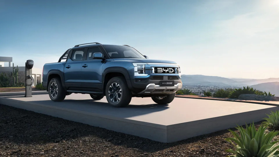
China's BYD Auto launched its all-new Shark plug-in hybrid pickup truck in Mexico on Tuesday.


The BYD Shark's hybrid drive system puts out 430 horsepower and has 62 miles of all-electric range.


The Shark starts at $54,000 in Mexico but is not for sale in the US.


BYD introduced its new Shark plug-in hybrid pickup truck in Mexico on Tuesday. It's the company's first truck and the first product launched outside its home market, China.

Mexico is growing in importance for BYD's global strategy as it aims to gain a foothold in North America — even as the company has made clear in recent months that it does not plan to enter the US market any time soon.

As a result, the Shark will not be available in the US but will go on sale in Mexico with a starting price of roughly $54,000 USD, or 899,980 pesos.

Therefore, the midsize Shark hybrid will be aimed squarely at major global players like the Toyota Hilux and Nissan Navarra.

In the US, the BYD Shark would have competed against midsize pickup stalwarts like the Toyota Tacoma, Chevrolet Colorado, Nissan Frontier, and Ford Ranger.

However, there are no plug-in hybrid midsize pickup trucks on sale in the US. The Tacoma does offer a hybrid but does not have the ability to be plugged in.

The Shark is built on BYD's Super Hybrid Off-road Platform.

The BYD Shark's hybrid system.BYD

The BYD Sharks' power comes from a longitudinally mounted 1.5-liter, turbocharged four-cylinder engine and two electric drive motors. Together, they produce a total system output of 430hp.

According to BYD, the Shark can make the run from 0-62 mph in just 5.7 seconds

As a result of the hybrid system, the Shark does not have a traditional mechanical all-wheel-drive system.

Instead, it sends power to the rear axle via an electric drive motor.

The Shark comes with a 29.6 kWh battery pack.

A BYD Shark hybrid pickup truck.BYD

According to BYD, the Shark has an all-electric range of 62 miles. The company also claims the pickup has a maximum combined range of 522 miles with the battery fully charged and a full tank of gas.

According to BYD, the Shark can tow up to 2,500 kg or 5,512 lbs.

A BYD Shark hybrid pickup truck.BYD

Don't expect to do much towing with just the battery, though.

Aesthetically, the Shark's aggressive looks are the work of BYD's design team led by Wolfgang Egger.

A BYD Shark doing a product demonstration drive at the launch event.BYD

According to BYD, Egger, the former chief designer at Audi and Alfa Romeo, sought inspiration from the aquatic predator for which the truck is named. In fact, the front grille was inspired by the open mouth of a shark.

At 215 inches in length, the Shark is a few inches longer than the Ford Ranger SuperCrew and the standard-wheelbase Nissan Frontier. However, it's about a foot shorter than the extended-length versions of the Frontier and the long-bed Toyota Tacoma.

Inside, the Shark's cabin is highlighted by a head-up display, a 10.25 LCD digital instrument display, and an impressive 12.8-inch central infotainment screen.

The BYD Shark's cabin.BYD

The 12.8-inch screen can change orientation from portrait and landscape. It's also equipped with Apple CarPlay and Android Auto as well as built-in apps for navigation, karaoke and music streaming.

The Shark is also equipped with a 540-degree panoramic view camera.

The BYD Shark's 12.8-inch infotainment screenBYD

BYD's 540-degree panoramic camera system is a 360-degree camera coupled with a 180-degree undercarriage view camera. The undercarriage camera is designed to help drivers get a better view of the terrain while offroading.

The Shark comes with a suite of advanced safety features, including adaptive cruise control, lane keep assist, and automatic emergency braking.

Like Tesla's Cybertruck, the Shark's features can be controlled via smartphone which can also serve as a key.

The BYD Shark's digital keyBYD

Tesla has long pioneered the use of its mobile app as an NFC key for vehicles.

The Shark's hybrid system can be used to power campsites or worksites.

The BYD Shark hybrid powers a video projector.BYD

Most electric trucks these days are rife with electrical outlets for the job site or campsite.


The incredible rise of Chinese Tesla rival BYD, which just unveiled a Cybertruck competitor


Camilo Fonseca,Ana Altchek
Wed, May 15, 2024 

The Seal U is one of BYD's latest electric-vehicle offerings.Anusak Laowilas/NurPhoto via Getty Images

The Chinese automaker BYD briefly eclipsed Tesla as the world's top seller of electric vehicles.


Even though it doesn't have access to the US market, BYD's affordable EVs are popular in China.


Here's how a little-known Chinese brand proved it could go toe-to-toe with an industry giant.

BYD may not be a household name in America, but it recently made itself known in a big way.

For a brief moment earlier this year, the Chinese automaker unseated Tesla as the world's top seller of electric cars.

Even though you won't see a BYD car in America (yet), the company has built an affordable brand that's popular in China and elsewhere.
ADVERTISEMENT


It also just announced a Cybertruck competitor, the BYD Shark.

Here's the story of the company that proved it could outsell Elon Musk.

BYD doesn't stand for anything — officially.

The BYD nameplate is associated with the slogan "Build Your Dreams," but that came after the company was formed.picture alliance

Wang Chuanfu and a cousin founded BYD in 1995. Then a 29-year-old government researcher, Wang came from a family of rice farmers. He earned a university scholarship and eventually moved to the Special Economic Zone in Shenzhen to start his new company.

The "YD" in the name came from Yadi, the village in Shenzhen where the company originally was, one South Korean newspaper reported. The "B" was added later as a promotional tool, the report said. Wang has said in interviews that, taken together, the BYD name doesn't stand for anything in particular.

It was only later that Wang derived the slogan "Build Your Dreams." The company has also acquired another nickname: "Bring Your Dollars."

The company was originally a cellphone-battery manufacturer.

Chinese Vice President Hu Jintao testing a Samsung cellphone in the 1990s. Samsung was one of BYD's earliest customers.Kim Jae-Hwang/AFP via Getty Images

The company's original business wasn't cars. It was cellphone batteries. BYD challenged the established Japanese suppliers Toyota and Sony by providing a cheaper alternative. By 2002, companies such as Motorola, Nokia, Sony Ericsson, and Samsung were all using BYD batteries.

They started making cars in 2003.

A BYD F3DM.Peter Parks/AFP via Getty Images

BYD moved into the car business after buying Xi'an Tsinchuan, a failing state-owned automaker that was then an arm of the defense contractor Norinco, the South China Morning Post reported.

The company launched its first car in 2005. The BYD F3 was a compact sedan that resembled the Toyota Corolla. It sold for as little as 40,000 yuan, or about $5,850.

Warren Buffett was a key early booster.

Wang Chuanfu welcomed the investors Charlie Munger, Warren Buffett, and Bill Gates to celebrate the launch of the BYD M6 in 2010.Visual China Group via Getty Images

The billionaire investor Warren Buffett was one of the high-profile names who took an interest in BYD early on. Looking to invest in China's booming car market, Buffett toured BYD's headquarters.

The Wall Street Journal reported that while the Berkshire Hathaway tycoon was there, Wang took a sip of battery fluid to prove how clean his batteries were. Buffett was so impressed by the experience that he offered to buy 25% of the company.

Wang declined that offer, but Buffett was not deterred. Berkshire Hathaway acquired a 10% stake in BYD — for $232 million — in 2008.

Their first electric car drew scorn from Elon Musk.

A BYD E6.Stan Honda/AFP via Getty Images

The company debuted its first fully electric vehicle, the E6, in 2010. Benefiting from Chinese government subsidies, it was able to compete with its Japanese counterparts.

But not everyone was impressed. Tesla CEO Elon Musk laughed in a 2011 interview when asked whether he considered BYD a serious rival to Tesla.

"Have you seen their car?" he said. "I don't think they make a good product. I don't think it's particularly attractive. The technology is not very strong."

BYD's hybrid cars turned it into a titan of Chinese automakers.

Chuanfu introduced the BYD Qin in 2012.AP Photo/Alexander F. Yuan

BYD established itself as one of the top automakers for hybrid vehicles in China in the 2010s. Its most popular offering was the Qin, introduced in 2012, which became one of the best-selling cars in China.

That wasn't the only offering that propelled BYD to prominence, however. The company also released the Tang, a hybrid SUV, and partnered with Daimler AG (now Mercedes-Benz) to make its Denza line.

BYD took the EV crown from Tesla — briefly.

A BYD Atto 3.Athit Perawongmetha/Reuters

Even though most of its sales in the fourth quarter of 2023 came from the Chinese market, BYD made headlines across the globe when it seemingly did the impossible — it unseated Tesla as the world's top seller of electric cars.

The Chinese automaker rode the EV wave on the back of its new Seagull, which debuted for 73,000 yuan, or about $10,000, as well as its Song, Qin Plus, Dolphin, Yuan Plus, and Han EVs.

Tesla reclaimed the crown in the first quarter of 2024, though both companies saw steep declines in their sales.

BYD's Shark takes aim at Tesla's Cybertruck

The BYD Shark is supposed to represent an actual shark, according to the launch event. BYD Auto México

The Shark, unveiled on Tuesday, is the latest model offered by BYD.

It's a midsize hybrid pickup truck, and the cabin's design fuses outdoor functionality with modern style and durability.

The truck has more than 430 horsepower, or 170 less than Tesla's all-wheel-drive Cybertruc. BYD says it can accelerate from zero to 100 kilometers an hour, or about 62 miles an hour, in roughly 5.7 seconds. The vehicle has five seats and a maximum towing capacity of 2,500 kilograms, which is just more than 5,500 pounds. That's about half of the Cybertruck's towing capability.

Designed for everyday trips and off-road driving, the Shark has three terrain modes: sand, mud, and snow.

It also has built-in features to make camping and off-roading more accessible. The vehicle offers bidirectional charging, according to BYD's site.

While the Shark isn't in direct competition with the Cybertruck as a hybrid model that doesn't sell in the US, it may entice EV fans looking for a more traditional pickup design. It's also priced competitively at about $53,451, which is lower than Cybertruck's $60,990 starting price tag.

Don't expect to see a BYD car on American roads anytime soon.

New BYD cars waiting to be loaded onto a ship in China's Shandong province.
Future Publishing

For a time, it looked as if we were just a few years away from getting Chinese electric cars in the United States. A BYD executive said as much in 2017, and the company even hired Leonardo DiCaprio as a brand ambassador for English-speaking customers.

Since then, BYD has expanded overseas. The Chinese automaker is planning a factory in Mexico — alarming US officials — and even created its own shipping fleet in a bid to cut down on export costs.

But the company says it has abandoned its plans of selling its EVs to Americans. Analysts have pointed to geopolitical tensions and trade barriers between the two countries, as well as the slumping demand for EVs in the United States.

Dozens of Egyptian pyramids, some in Giza, sat along a branch of the Nile, study says

Evan Bush
Thu, May 16, 2024

The pyramids in and around Giza have presented a fascinating puzzle for millennia.

How did ancient Egyptians move limestone blocks, some weighing more than a ton, without using wheels? Why were these burial structures seemingly built in the remote and inhospitable desert?

New research — published Thursday in the journal Communications Earth & Environment — offers a possible answer, providing new evidence that an extinct branch of the Nile River once weaved through the landscape in a much wetter climate. Dozens of Egyptian pyramids across a 40-mile-long range rimmed the waterway, the study says, including the best-known complex in Giza.


The waterway allowed workers to transport stone and other materials to build the monuments, according to the study. Raised causeways stretched out horizontally, connecting the pyramids to river ports along the Nile’s bank.

Drought, in combination with seismic activity that tilted the landscape, most likely caused the river to dry up over time and ultimately fill with silt, removing most traces of it.

The research team based its conclusions on data from satellites that send radar waves to penetrate the Earth’s surface and detect hidden features. It also relied on sediment cores and maps from 1911 to uncover and trace the imprint of the ancient waterway. Such tools are helping environmental scientists map the ancient Nile, which is now covered by desert sand and agricultural fields.

Experts have suspected for decades that boats transported workers and tools to build the pyramids. Some past research has put forward hypotheses similar to the new study; the new findings solidify the theory and map a much broader area.

“The mapping of the Nile’s ancient channel system has been fragmented and isolated,” an author of the new study, Eman Ghoneim, a professor of earth and ocean sciences at the University of North Carolina Wilmington, wrote in an email. “Ancient Egyptians were using waterways for transportation more often than we thought.”

The Red Pyramid. (Eman Ghoneim )

The study looks at 31 pyramids between Lisht, a village south of Cairo, and Giza. They were constructed over roughly 1,000 years, beginning about 4,700 years ago. The pyramid complexes contained tombs for Egyptian royals. High officials were often buried nearby.

Some of the granite blocks used to construct them were sourced from locations hundreds of miles south of their sites. In some cases, the blocks could be “mammoth,” weighing several tons, said Peter Der Manuelian, a professor of Egyptology at Harvard University and the director of the Harvard Museum’s Museum of the Ancient East.

Manuelian, who was not involved in the new study, said wheels were not used to move the large blocks, which is one reason researchers have long suspected the Egyptians moved materials by water.

“It’s all sledges,” he said. “Water helps an awful lot.”

In the past, researchers have posited that the Egyptians might have carved canals to the pyramid sites.

“Canals and waterway systems have been in the consciousness for decades now,” Manuelian said. But newer theories suggest that the Nile was closer to the pyramids than researchers once thought, he added, and new tools can provide some proof.

“Archaeology has gotten more scientific, and you have ground-penetrating radar and satellite imagery,” he said.

He added that the new study helps improve maps of ancient Egypt.


A map of the water course of the ancient Ahramat Branch. (Eman Ghoneim )

The findings suggest that millennia ago, the Egyptian climate was wetter overall and the Nile carried a higher volume of water. It separated into multiple branches, one of which — the researchers call it the Ahramat Branch — was about 40 miles long.

The locations of the pyramid complexes included in the study correspond in time with estimates of the river branch’s location, according to the authors, as water levels ebbed and flowed over centuries.

In addition, several pyramid temples and causeways appear to line up horizontally with the ancient riverbed, which suggests that they were directly connected to the river and most likely used to transport building materials.

The study builds on research from 2022, which used ancient evidence of pollen grains from marsh species to suggest that a waterway once cut through the present-day desert.

Hader Sheisha, an author of that study who is now an associate professor in the natural history department at the University Museum of Bergen, said the new findings add much-needed evidence to bolster and expand the theory.

“The new study, in concordance to our study, shows that when the pyramids were built, the landscape was different from that we see today and shows how the ancient Egyptians could interact with their physical world and harness their environment to achieve their immense projects,” Sheisha said in an email.

The Step Pyramid. (Eman Ghoneim )

Ghoneim and her team explain in the study that the Ahramat Branch shifted eastward over time, a process that might have been propelled by drought about 4,050 years ago. Then it gradually dissolved, only to be covered in silt.

She said they plan to expand their map and work to detect additional buried branches of the Nile floodplain. Determining the outline and shape of the ancient river branch could help researchers locate the remains of settlements or undiscovered sites before the areas get built over.

Manuelian said that today, “housing almost goes right up to the edge of the Giza plateau. Egypt is a vast outdoor museum, and there’s more to be discovered.”

This article was originally published on NBCNews.com


Scientists may have solved mystery behind Egypt's pyramids

Malu Cursino - BBC News
Fri, May 17, 2024 

[Getty Images]


Scientists believe they may have solved the mystery of how 31 pyramids, including the world-famous Giza complex, were built in Egypt more than 4,000 years ago.

A research team from the University of North Carolina Wilmington has discovered that the pyramids are likely to have been built along a long-lost, ancient branch of the River Nile - which is now hidden under desert and farmland.

For many years, archaeologists have thought that ancient Egyptians must have used a nearby waterway to transport materials such as the stone blocks needed to build the pyramids on the river.

But up until now, "nobody was certain of the location, the shape, the size or proximity of this mega waterway to the actual pyramids site", according to one of the study's authors, Prof Eman Ghoneim.

Prof Ghoneim led the research team who made the discovery [Eman Ghoneim/UNCW]

In a cross-continental effort, the group of researchers used radar satellite imagery, historical maps, geophysical surveys, and sediment coring (a technique used by archaeologists to recover evidence from samples) to map the river branch - which they believe was buried by a major drought and sandstorms thousands of years ago.

The team were able to "penetrate the sand surface and produce images of hidden features" by using the radar technology, the study, published in the journal Communications Earth and Environment, said.

Among those features were "buried rivers and ancient structures" running at the foothills of where the "vast majority of the Ancient Egyptian pyramids lie," Prof Ghoneim said.

Researches from the US, Egypt and Australia were all involved in mapping the Ahramat branch of the River Nile [Suzanne Onstine]

Speaking to the BBC, one of the study's co-authors, Dr Suzanne Onstine, said "locating the actual [river] branch and having the data that shows there was a waterway that could be used for the transportation of heavier blocks, equipment, people, everything, really helps us explain pyramid construction".

The team found that the river branch - named the Ahramat branch, with "ahramat" meaning pyramids in Arabic - was roughly 64km (39 miles) long and between 200-700m (656-2,296 ft) wide.

And it bordered 31 pyramids, which were built between 4,700 and 3,700 years ago.

The discovery of this extinct river branch helps explain the high pyramid density between Giza and Lisht (the site of Middle Kingdom burials), in what is now an inhospitable area of the Saharan desert.

The river branch's proximity to the pyramid complexes suggests that it was "active and operational during the construction phase of these pyramids", the paper said.

Dr Onstine explained that ancient Egyptians could "use the river's energy to carry these heavy blocks, rather than human labour," adding, "it's just a lot less effort".

The River Nile was the lifeline of Ancient Egypt - and remains so to this day.

Newly mapped lost branch of the Nile could help solve long-standing pyramid mystery


Katie Hunt, CNN
Thu, May 16, 2024 

Egypt’s Great Pyramid and other ancient monuments at Giza exist on an isolated strip of land at the edge of the Sahara Desert.

The inhospitable location has long puzzled archaeologists, some of whom had found evidence that the Nile River once flowed near these pyramids in some capacity, facilitating the landmarks’ construction starting 4,700 years ago.

Using satellite imaging and analysis of cores of sediment, a new study published Thursday in the journal Communications Earth & Environment has mapped a 64-kilometer (40-mile) long, dried-up, branch of the Nile, long buried beneath farmland and desert.

“Even though many efforts to reconstruct the early Nile waterways have been conducted, they have largely been confined to soil sample collections from small sites, which has led to the mapping of only fragmented sections of the ancient Nile channel systems,” said lead study author Eman Ghoneim, a professor and director of the Space and Drone Remote Sensing Lab at the University of North Carolina Wilmington’s department of Earth and ocean sciences.

“This is the first study to provide the first map of the long-lost ancient branch of the Nile River.”

Ghoneim and her colleagues refer to this extinct branch of the Nile river as Ahramat, which is Arabic for pyramids.


Ancient Egyptians likely used the now-extinct Ahramat Branch to build many pyramids. - Eman Ghoneim et al

The ancient waterway would have been about 0.5 kilometers wide (about one-third of a mile) with a depth of at least 25 meters (82 feet) — similar to the contemporary Nile, Ghoneim said.

“The large size and extended length of the Ahramat Branch and its proximity to the 31 pyramids in the study area strongly suggests a functional waterway of great importance,” Ghoneim said.

She said the river would have played a key role in ancient Egyptians’ transportation of the enormous amount of building materials and laborers needed for the pyramids’ construction.

“Also, our research shows that many of the pyramids in the study area have (a) causeway, a ceremonial raised walkway, that runs perpendicular to the course of the Ahramat Branch and terminates directly on its riverbank.”

The Red Pyramid at the Dahshur necropolis is located near the now-defunct arm of the Nile. - Eman Ghoneim


Hidden traces of a lost waterway

Traces of the river aren’t visible in aerial photos or in imagery from optical satellites, Ghoneim said. In fact, she only spotted something unexpected while studying radar satellite data of the wider area for ancient rivers and lakes that might reveal a new source of groundwater.

“I am a geomorphologist, a paleohydrologist looking into landforms. I have this kind of trained eye,” she said.

“While working with this data, I noticed this really obvious branch or a kind of riverbank, and it didn’t make any sense because it is really far from the Nile,” she added.

Born and raised in Egypt, Ghoneim was familiar with the cluster of pyramids in this area and had always wondered why they were built there. She applied to the National Science Foundation to investigate further, and geophysical data taken at ground level with the use of ground-penetrating radar and electromagnetic tomography confirmed it was an ancient arm of the Nile. Two long cores of earth the team extracted using drilling equipment revealed sandy sediment consistent with a river channel at a depth of about 25 meters (82 feet).

It’s possible that “countless” temples might still be buried beneath the agricultural fields and desert sands along the riverbank of the Ahramat Branch, according to the study.

The researchers collected soil samples to confirm their findings. - Eman Ghoneim

Why this branch of the river dried up or disappeared is still unclear. Most likely, a period of drought and desertification swept sand into the region, silting up the river, Ghoneim said.

The study demonstrated that when the pyramids were built, the geography and riverscapes of the Nile differed significantly from those of today, said Nick Marriner, a geographer at the French National Centre for Scientific Research in Paris. He was not involved in the study but has conducted research on the fluvial history of Giza.

“The study completes an important part of the past landscape puzzle,” Marriner said. “By putting together these pieces we can gain a clearer picture of what the Nile floodplain looked like at the time of the pyramid builders and how the ancient Egyptians harnessed their environments to transport building materials for their monumental construction endeavors.”

The research team stands in front of the Unas’s Valley Temple, which would have acted as a river harbor in ancient Egypt. - Eman Ghoneim


Long-lost branch of the Nile was 'indispensable for building the pyramids,' research shows

Owen Jarus
Thu, May 16, 2024

A large pyramid made of stone with five distinct levels.


A branch of the Nile that no longer exists helped the ancient Egyptians construct 31 of their famous pyramids, including the pyramids at Giza, a new study finds.

Researchers found that this branch, called the "Ahramat" (Arabic for "pyramid"), was about 40 miles (64 kilometers) long and went close to the sites of many pyramids, making it easier to transport materials.

"Many of the pyramids, dating to the Old and Middle Kingdoms, have causeways that lead to the branch and terminate with valley temples which may have acted as river harbors," study first author Eman Ghoneim, a professor and director of the Space and Drone Remote Sensing Lab at the University of North Carolina Wilmington, told Live Science in an email.

The team used radar satellite imagery, deep soil coring and geophysical tests to find and map the remains of the Ahramat branch.

"The enormity of this branch and its proximity to the pyramid complexes, in addition to the fact that the pyramids' causeways terminate at its riverbank, all imply that this branch was active and operational during the construction phase of these pyramids," Ghoneim and colleagues wrote in the study, published Thursday (May 16) in the journal Communications Earth & Environment.

Related: How old are the Egyptian pyramids?


A map of northern Egypt that shows landmarks from the Giza Pyramids at the top to the Lisht Pyramids at the bottom. Vertically through the middle of the map, the modern Nile River cuts through, and to its left, a thinner line depicts projected and detected waterways. The Western Desert lies to the left.

The team found that the Ahramat branch shifted eastward as time went on. The Ahramat Branch was positioned further west during the Old Kingdom (circa 2649 to 2150 B.C.) and then shifted east during the Middle Kingdom (circa 2030 to 1640 B.C.), the team wrote in their paper.

Eventually, the branch dried up. "There is no exact date on when the branch come[s] to an end," Ghoneim said. But as drought condition intensified in the region, the water level of the Ahramat Branch fell, causing it to dry out, Ghonmein said.

Nowadays, the lost branch is hidden beneath farmland and desert, the researchers wrote.

Image 1 of 5

A large pyramid made of stone in the foreground with a smaller one in the background to the right. A few stones are on top of the sand to the left and a small person is in front of the pyramid.

Image 2 of 5


A pyramid made of stone in the desert. The shape is more rounded and the top is at a lower angle than the bottom, giving it a

Image 3 of 5


Five people stand around a table that has bags of soil samples on top of it. One man and woman both point to a piece of paper on top of some of the samples with photographs printed on it

Image 4 of 5

A team of seven people stands in front of a stone base with a pillar on top of it. A few palm trees are also in the background and a pyramid

Image 5 of 5

A woman stands in the foreground wearing jeans and a blue shirt with white polka dots. She holds a piece of rock and is looking at it. A pyramid, some stone structures and the Great Sphynx of Giza are all in the background

Hader Sheisha, an associate professor of natural history at the University of Bergen in Norway who wasn't involved with the study, told Live Science in an email that "these findings show clearly that the Nile hydrological [network] was indispensable for building the pyramids."

The findings did not surprise Sheisha. She was the lead author of a 2022 study that found that a branch of the Nile went close to the Great Pyramid at Giza, making it easier to transport goods and materials. Sheisha also noted that earlier studies proposed that goods were brought to pyramid sites through river branches that have since dried up.

RELATED STORIES

Mysterious L-shaped structure found near Egyptian pyramids of Giza baffles scientists

Who built the Egyptian pyramids?

What did the ancient Egyptian pyramids look like when they were built?

"The new study could be considered as a contribution to these previous hypotheses," Sheisha said.

Zahi Hawass, a former Egyptian antiquities minister, also told Live Science that the finds are not surprising. An ancient papyrus that contains the logbook of a man named Merer notes that while the Great Pyramid was being constructed, workers brought materials to it by way of a nearby harbor. Additionally, excavations conducted at Giza have revealed evidence of a harbor.

Nick Marriner, a research director at the French National Center for Scientific Research (CNRS) who wasn't involved in the study, spoke positively of the research, as it "demonstrates that, when the pyramids were built, the geography and the riverscapes of the Nile floodplain differed significantly to those of today," Marriner told Live Science in an email. "Reconstructing how, when and where these former Nile channels evolved can help us to understand how the ancient Egyptians harnessed the natural environment, and the Nile's flood cycles, to transport building materials to the site for the construction of the pyramids."


Long-lost Nile branch may explain landlocked pyramids

Andrew Paul
Thu, May 16, 2024 

The Red Pyramid at the Dahshur necropolis, constructed during the Fourth Dynasty.


A long lost portion of the Nile may answer a mystery behind some of ancient Egypt’s most famous pyramids. According to researchers, 31 structures—including the pyramids of Giza—at one time stood near the banks of a now dry river branch, buried under sand and silt for thousands of years. If so, this could explain how builders managed to transport the monuments’ materials, as well as potentially guide researchers towards undiscovered sites in the future.

Although the roughly 40 mile stretch of Western Desert Plateau foothills is largely inhospitable terrain today, river sediment located deep underground indicates that wasn’t always the case. Eman Ghoneim and his colleagues at the University of North Carolina Wilmington believe this area was at one time a much more arable and vibrant region, particularly around 4,700 years ago when the Nile branched far more than now. This is also the era in which construction began on the area’s first pyramids.

“Monumental structures, such as pyramids and temples, would logically be built near major waterways to facilitate the transportation of their construction materials and workers,” Ghoneim and his colleagues wrote in their new paper published today in Communications Earth & Environment. “Yet, no waterway has been found near the largest pyramid field in Egypt, with the Nile River lying several kilometers away.”


The water course of the ancient Ahramat Branch borders a large number of pyramids dating from the Old Kingdom to the Second Intermediate Period, spanning between the Third Dynasty and the Thirteenth Dynasty. Credit: Eman Ghoneim et. al.

But after a detailed review of satellite imagery, remote sensing, geological data, and sediment analysis, Ghoneim’s team thinks they have located one of the Nile’s former waterways. The branch, which they suggest naming “Ahramat” (Arabic for “pyramids”), would explain why so many monumental buildings are concentrated near the ancient Egyptian capital of Memphis. The new study also bolsters similar theories proposed in recent years by other archeologists.

Also bolstering their claim are a number of causeways that begin at the pyramids and end at the theorized Ahramat riverbanks. These would lend credence to the idea that ancient Egyptians relied on the Nile to transport construction materials for pyramid projects.

Around 4,200 years ago, however, Ahramat’s luck was running dry. In reviewing the data, researchers noticed a sizable build-up of windblown sand corresponding to a major drought known to occur near that same time. Such a shift in climate could likely have been behind the branch’s receding and eventual disappearance—but those 31 pyramids weren’t going anywhere by then, of course.

Ghoneim’s team believes their potential rediscovery of the Ahramat branch not only could lead to a better understanding of Pharaonic Egypt, but also identify and protect regions for further study.

[Related: Archeologists uncover ingredients for mummy balm.]

“Revealing this extinct Nile branch can provide a more refined idea of where ancient settlements were possibly located in relation to it and prevent them from being lost to rapid urbanization. This could improve the protection measures of Egyptian cultural heritage,” the researchers write in their paper’s conclusion.

Following their methodology, the team thinks archeologists can become better equipped to prioritize locations for future excavations and investigation, as well as highlight new sites for conservation against modern urban planning projects. There’s also the possibility of discovering even more long-gone Nile river branches that could expand knowledge of society in ancient Egypt.


The US is worried about an invasion, but China could take control of Taiwan without firing a shot, war experts warn

Chris Panella
Thu, May 16, 2024

The US is worried about an invasion, but China could take control of Taiwan without firing a shot, war experts warn


The US and its allies are focused on preventing a Chinese invasion of Taiwan.


A new report argues there's a lack of readiness for other ways China could take control of Taiwan.


An aggressive Chinese coercion campaign is far more likely than an invasion and already happening, experts warn.

With the US and its allies focused on what a Chinese invasion of Taiwan could look like, and how American forces could defend Taiwan if necessary, they're missing a glaring alternative strategy China could employ to capture Taiwan, a new report argues.

Defense experts say that an aggressive Chinese coercion campaign, short of war but still threatening, is more likely than a full-scale invasion and the US needs to prepare for such an event.

A new report co-authored by war experts from the American Enterprise Institute and the Institute for the Study of War explores a scenario where China undergoes a "coercion campaign that remains far short of invasion but nevertheless brings Taiwan under Beijing's control," identifying such an event as a "significant gap in US strategic thought."


Elements of such a campaign are already underway and include China's military exercises both in the Taiwan Strait and around the island, which are growing in scale and raising worries about escalation. Economic and diplomatic pressure is notable, and Chinese misinformation operations and the potential to slowly set up a blockade of Taiwan are also concerns.

The increasing Chinese military presence around Taiwan, the report says, could exhaust and overwhelm Taiwan's military and fuel a narrative that it is unable to defend the island, decreasing "trust in the military and feelings of security among the Taiwanese populace."

Taiwan's AAV7 amphibious assault vehicle maneuvers across the sea during the Han Kuang military exercise, which simulates China's People's Liberation Army (PLA) invading the island, on July 28, 2022 in Pingtung, Taiwan.Annabelle Chih/Getty Images

The report identifies four things key to resisting Chinese coercion. The first is a US-Taiwanese strategic relationship that foregoes concerns that "cooperation directly precipitates further escalation, whereas peace and prosperity are just around the corner if this partnership is halted."

Second, Taiwan's government must function despite Chinese efforts to undermine it in the eyes of the Taiwanese people through things like "economic warfare, cyber warfare, sabotage, rigorous (and pseudo-legal) inspections of ships carrying goods to Taiwan, air and sea closures, electronic warfare, and propaganda critical of government mismanagement."

These efforts include significantly degrading Taiwan's essential services, like clean water and electricity.

The third point is that Taiwanese people must resist Chinese "cognitive and psychological campaigns" aimed at breaking their rejection of the Chinese government, including "intimidating supporters of resistance, sowing doubt and fear among the population, and generating demands to trade political concessions for peace."

And lastly, there has to be resistance against "widespread information campaigns" that "aim to decrease the US public's and political leadership's willingness to support Taiwan." Such campaigns are already occurring, prompting anxiety that the US public and government may see getting involved in defending Taiwan as heightening risks of war at a significant cost with little to gain. The AEI and ISW experts argue that is not the case.

Notably, the report says that "Taiwan is strategically vital to the larger US-led coalition to contain" China, arguing that a US-friendly Taiwan links America's allies in the northwestern Pacific with US partners and allies to the south."

A China-controlled Taiwan, however, "would become a springboard for further PRC aggression and would seriously compromise the US-led coalition's ability to operate cohesively."

A US-made AH-1W Super Cobra helicopter launches flares during an annual drill at the a military base in the eastern city of Hualien on January 30, 2018.MANDY CHENG/AFP via Getty Images

The authors of the new report present coordinated actions China could pursue to prompt Taiwan and its partners to accept reunification, referring to it as a "short-of-war coercion course of action."

Some of Beijing's biggest problems are Taiwanese resistance to China, which continues to grow, especially after the historic election of Democratic Progressive Party candidate Lai Ching-te, who is currently the vice president, in January, and continued support from the US and its regional allies.

The new report looks at a hypothetical timeline that begins with the inauguration of Lai this month and leads into 2028, imaging how China and Taiwan could, by that point, come to a "peace" agreement. China could ultimately be successful in such a campaign, the authors say, if the US and its allies fail to recognize Beijing's coercive tactics or strategically plan to deter them.

The US must clearly "recognize the possibility and danger of a coercion campaign that is far more intense than the one currently ongoing against Taiwan and develop ways to prevent Taiwan's isolation through means short of war," they write.

The report's authors argue that "increased efforts in the information domain will be key to ensuring that the US government and friendly international audiences do not fall prey to [Chinese] information operations intended to reshape the way Americans and key international actors think."

CM-11 tanks fire artillery during the 2-day live-fire drill, amid intensifying threats military from China, in Pingtung county, Taiwan, 7 September 2022.Ceng Shou Yi/NurPhoto via Getty Images

US-Taiwanese relations and concerns about an aggressive China in the Pacific region are often at the forefront of the minds of US officials and experts, but the focus is frequently on hard power elements, even if there is recognition of some of the coercive aspects of Chinese behavior.

In March, US Navy Adm. John Aquilano, then the commander of US Indo-Pacific Command, stressed that China was pursuing a massive military build-up not seen since World War II and "all indications" pointed to it "meeting President Xi Jinping's directive to be ready to invade Taiwan by 2027." He also told the US Armed Services House Committee China's actions indicated it would ready to unify Taiwan by force, if necessary.

Aquilano urged lawmakers to intensify the US' military development and posturing in the Pacific in order to deter such a fight.

And, earlier this month, over a dozen US lawmakers wrote to US Navy Secretary Carlos Del Toro and Air Force Secretary Frank Kendall, raising concerns about what preparations were being made to harden the US presence in the Pacific and deter military action from China.

Of the lawmakers' concerns, the most prominent appeared to be the lack of active and passive defenses protecting US bases in the area, specifically on Guam and in Japan. "We are concerned about the alarming lack of urgency by the Department of Defense in adopting such defensive measures," they wrote, adding that "it is apparent that the Pentagon is not urgently pursuing needed passive defenses" to harden US bases and airfields from a vicious, preemptive strike by China's threatening missile force


Tracking China's 'grey zone' balloon flights over Taiwan

Thu, May 16, 2024 

Illustration shows Chinese and Taiwanese flags

By Jackie Gu and Yimou Lee

TAIPEI (Reuters) - About a month before Taiwan's January presidential election, China began sending intruders over the Taiwan Strait: more than 100 balloons, some of which passed through the island's airspace or busy, Taipei-controlled air corridors for civil aviation.

Experts say the balloons could be psychological warfare, carry surveillance tools or simply gather meteorological data. On some days, as many as eight were detected within a few hours; at other times, weeks passed without any balloons at all. In the week leading up to Taiwan's presidential election on Jan. 13, an average of three balloons were spotted each day.

Then on April 11, they stopped altogether.

The increased frequency has raised alarms both domestically and abroad.

A senior Taiwanese security official briefed on the matter said Chinese balloon flights near Taiwan took place on an "unprecedented scale" in the weeks leading up to Taiwan's elections and described the incidents as part of a Chinese pressure campaign – so-called grey-zone warfare designed to exhaust a foe using irregular tactics without open combat.

Taiwan inaugurates its new president, Lai Ching-te, on May 20. China, which views democratically governed Taiwan as its own territory despite the island's objections, has a strong dislike of Lai, believing him to be a dangerous "separatist", whose repeated offers of talks it has rejected, including one in May.

China's defence ministry did not respond to a request for comment.

China's Taiwan Affairs Office referred Reuters to its comment on Jan. 31, in which it dismissed complaints about the balloons, saying they were for meteorological purposes and should not be hyped up for political reasons.

Before Dec. 8, balloon data was not public, making historical comparisons impossible.

But Jan Jyh-horng, the deputy head and spokesperson of the Mainland Affairs Council, Taiwan's top China policy-making body, told Reuters that in the past, a balloon would be spotted "maybe once a month".

Between December 2023 and April 2024, more than four balloons were detected on eight separate days. In total, just over a hundred balloons were flown during that period.

Three Taiwanese officials briefed on the matter confirmed that the number of Chinese balloons had increased significantly in recent months. The majority are weather balloons collecting atmospheric data, including wind, temperature and humidity, they said, but Taiwan still sees them as Chinese harassment.

The balloons have flown at an altitude of 11,000 to 38,000 feet, with a mean altitude of 22,294 feet – well under the usual altitude for meteorological balloons. According to the U.S. National Weather Service, weather balloons typically reach altitudes of more than 100,000 feet.

"Sending them over at that kind of altitude is dangerous," said Alexander Neill, strategic adviser on Indo-Pacific geopolitics formerly at the International Institute for Strategic Studies and the Royal United Services Institute. "You are within air traffic corridors, and the potential for a collision is concerning."

Jan agreed, saying the balloons are threats to aviation safety.

"They fly very slowly while planes move speedily," he said. "It could be too late when they were spotted, if they were sucked into the engines."

China's most frequent form of "grey zone" activity has been the almost daily air force and navy missions in the waters and skies around Taiwan, forcing the island's armed forces to repeatedly scramble to see off the intruders.

Other tactics Taiwanese officials have expressed concern about include sand dredging close to the Taiwan-controlled Matsu islands, which sit near the Chinese coast.

(For an interactive graphic tracking balloon’s over Taiwan, click )

A second senior Taiwanese senior security official said, citing intelligence gathered by Taiwan, that the data potentially collected by the balloons would be useful for the PLA's rocket forces, because atmospheric factors could affect missile launches.

"If China was planning to mount an air assault onto Taiwan, they would need to understand the meteorological conditions and wind patterns of the island," Neill said.

Wang Ting-yu, a senior lawmaker for Taiwan's ruling Democratic Progressive Party and chair of parliament's foreign affairs and defence committee, told Reuters balloons are hard for military radars to detect unless their sensitivity is set to high levels.

But ultra-sensitive radars are likely to spot objects such as birds, and as a result, Taiwan's military might miss other vital targets such as incoming missiles.

"It's a challenging task," he said.

Raymond Kuo, director of the RAND Corporation's Taiwan Policy Initiative, says he thinks the purpose of the balloons is primarily psychological.

"I personally am sceptical of what additional intelligence China could get from balloons that they couldn't get from other platforms," Kuo said. "I think they're mostly meant to signal to Taiwan that they can't even defend their airspace."

(Reporting by Jackie Gu and Yimou Lee; Additional reporting by Ben Blanchard, and Ryan Woo in Beijing. Editing by Gerry Doyle)

Thursday, May 16, 2024

Could Memphis handle a massive earthquake, and how likely is one? What the experts say

John Klyce, Memphis Commercial Appeal
Updated Wed, May 15, 2024 

A 3D printed model, created by Dr. Christodoulos Kyriakopoulos with the University of Memphis’ Center for Earthquake Research and Information, demonstrates where the Axial Fault is during the New Madrid 1812 earthquake on Thursday, May 02 2024 at 3890 Central Avenue in Memphis, Tenn.

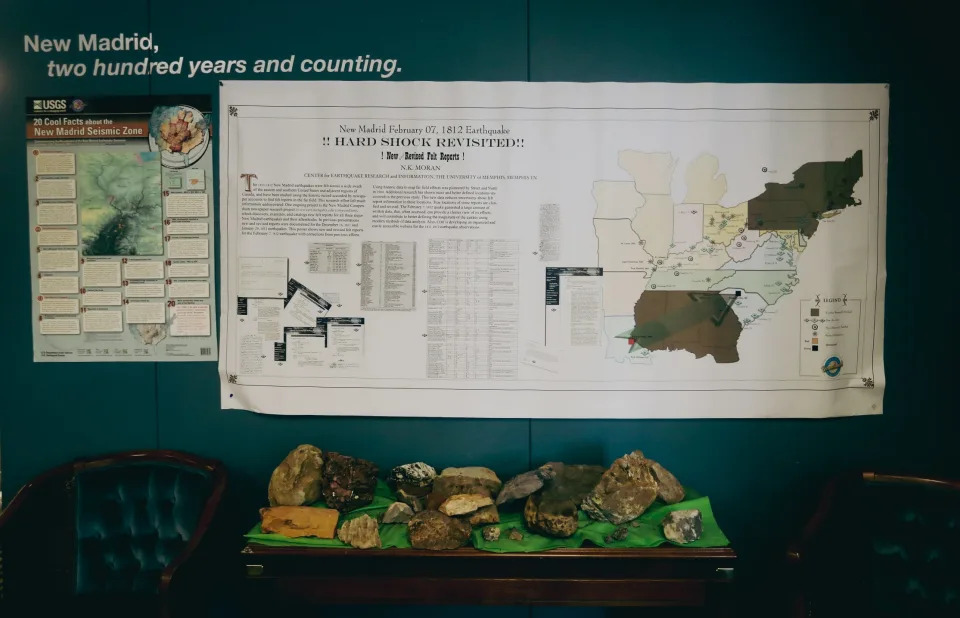
From Dec. 16, 1811, to Feb. 7, 1812, three major earthquakes violently shook part of the central United States. Trees bent and snapped. Sand blows erupted. Chimneys toppled and cabins collapsed. Crashing waves tormented boats on the Mississippi River, which appeared to run backward. A swath of marshes became the 15,000-acre Reelfoot Lake.

The earthquakes were so powerful they were felt in South Carolina, in Connecticut, and at the White House by President James Madison, who wrote in a Feb. 7 letter to Thomas Jefferson that “the re-iteration of earthquakes continues the uproar from certain quarters.”

Madison, however, didn’t have to worry about overseeing a widespread emergency response. The earthquakes were caused by the three faults in the New Madrid Seismic Zone, a chunk of the central U.S. that was sparsely populated. Where there were settlements, there was damage; but the area was still considered the frontier and contained no large cities.


But as time passed, more people ventured into the area. In 1819, seven years after the last of the giant earthquakes, Memphis was founded, just 40 miles away from one of the three New Madrid faults. Its population grew, along with the populations of other nearby towns. They constructed homes, hospitals, restaurants, and hotels. They constructed towers visible from the sky.

And if earthquakes like the ones from 1811 and 1812 were ever again felt in the seismic zone, there would be no shortage of opportunities for destruction.

Memphis is near a major fault: Here's what experts say you can do to prepare for an earthquake
Will there be another major earthquake?

It’s no secret that Memphis is close to a major fault, and if you've lived here long enough, you've probably heard the theory that repeats of the 1811-12 earthquakes could devastate the city.

In 2008, a project funded by the Federal Emergency Management Agency simulated worse-case scenarios for the Central U.S. if there were earthquakes of a similar magnitude, and the results were startling. The number of casualties in Tennessee, it predicted, could eclipse 60,000, with most of them occurring in West Tennessee.

One line in the report was especially disconcerting: "Memphis in particular could see severe damage."

But don't panic. The chances of cataclysmic earthquakes striking the region in your lifetime are slim, and they aren't something you need to fret about in your day-to-day life.

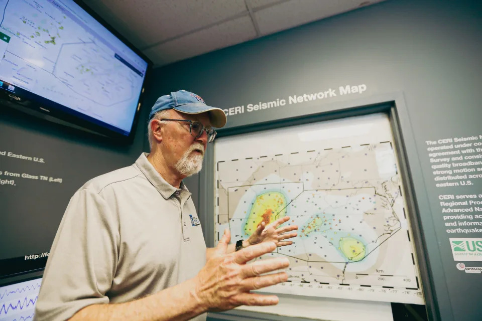
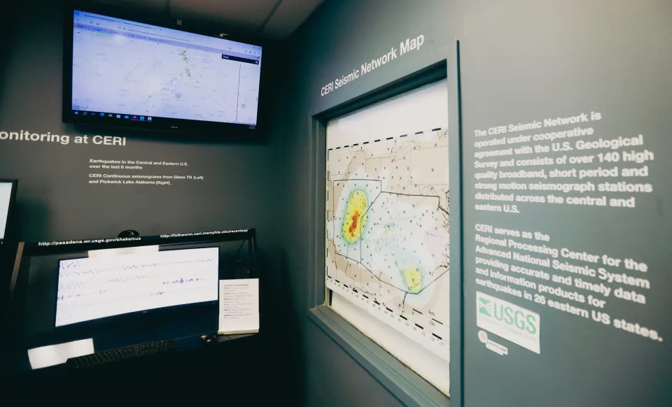
That being said, a lot of seismologists believe a repeat of the 1811-12 earthquakes could happen. The University of Memphis is home to the Center for Earthquake Research and Information, which closely tracks and studies earthquakes. The organization is internationally recognized as an authority on seismology, and its staffers haven't ruled out the possibility of catastrophic earthquakes rocking the region.

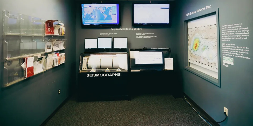
The seismic monitoring area at the University of Memphis’ Center for Earthquake Research and Information, can be seen during a tour on Thursday, May 02 2024 at 3890 Central Avenue in Memphis, Tenn.

“The odds are very good that we're going to get a repeat of 1811 and 1812,” said Mitch Withers, Ph.D., an associate research professor with CERI. “Nothing has changed that we’re aware of, that would stop that from happening again in the future sometime.”

According to the U.S. Geological Survey, the early 19th-century earthquakes weren’t the first ones in the New Madrid Seismic Zone. Similar sequences of earthquakes had already happened, around 1,450 AD and 900 AD, and other large earthquakes have also struck the region over the last 5,000 years.

“We know that similar sequences of earthquakes happened in the past at least three times,” Withers said. “So, if every 10 years your gate gets knocked down… you might guess that your gate is going to get knocked down again.”
Hard to predict 'the big one'

If a catastrophic earthquake were to come, it would likely be somewhere between a magnitude of seven and eight, which is the estimated strength of the 1811-12 earthquakes and enough to devastate communities. For comparison, earthquakes with a magnitude of 2.5 or less, which happen regularly, usually aren’t felt.

But just what are the chances of earthquakes like these returning to the seismic zone soon?

It’s difficult to say.

The USGS estimates that there’s a 7% to 10% chance the NMSZ would get a repeat of the 1811-12 earthquakes in the next 50 years. It also estimates that there’s a 25% to 40% chance it would get a 6.0 and greater earthquake ― which wouldn’t be as severe but could still cause significant damage ― in that same period.

But these are rough estimates; not exact predictions, and they don’t specify where in the NMSZ the earthquakes might occur. Would they be caused by the fault closest to Memphis, which is about 40 miles away in Marked Tree, Arkansas? Or would they stem from one of the other two major faults in the seismic zone ― which spans about 150 miles and covers portions of western Tennessee, northeast Arkansas, southeast Missouri, and western Kentucky?

Memphis could be affected regardless, and in 1811-12, all three faults ― not just one ― caused major earthquakes. Earthquakes of magnitude seven or more often come in sequences of two or three. But the questions do raise an important point: predicting earthquakes is difficult.

Previously: West Tennessee earthquake rattled nerves but no particular cause for concern, expert says

More: 5 things to know about earthquakes in the Memphis area

You can’t tell exactly where in the NMSZ major earthquakes would take place, just as you can’t tell when they would take place. Studies have shown that the sequences of earthquakes comparable to 1811-12 have occurred about every 500 years, but, as Withers noted, there’s “considerable variability in that.”

While you can make probabilities of the future that are based on the past, you can't predict earthquakes.

"The problem is, we can't tell you the 'when' of it," said Kent Moran, Ph.D., a research associate with CERI. "It's sort of like, 'When is the next earthquake?' When you feel it."
What would a massive earthquake do to Memphis?

If earthquakes similar to those of 1811-12 were to come, the effects on the Mid-South could be serious. When Withers spoke about damage, it wasn't initially clear if he was saying it would be “extensive” or “expensive.”

But really, either works.

One of the issues is that Memphis has a significant amount of unreinforced masonry buildings, which are typically older brick structures that predate building codes and are not braced by some kind of reinforcing material.

PhD student Navin Thapa explains how he interprets data to determine the magnitude of seismic activity in the Earthquake Physic Lab at the University of Memphis Center for Earthquake Research and Information on Wednesday, Feb. 14, 2024 in Memphis, Tenn.

When shaken by major earthquakes, they typically don’t fare well.

“Unreinforced masonry is probably one of the biggest concerns,” said Gary Patterson, a geologist and the director of education and outreach for CERI. “You have bricks without any steel reinforcement… If you move them a little bit in the mortar, they’re not going to return to where they were, and that means damage.”

Let's take another look at the FEMA-funded project produced in 2008, which simulated worse-case scenarios for the Central U.S. if the NMSZ produced magnitude 7.7 earthquakes.

According to the report, in Tennessee, over 250,000 buildings could be “moderately or more severely damaged,” economic losses could surpass $56 billion, and the number of casualties could eclipse 60,000. If the earthquake were to occur at 2 p.m., the number of casualties could reach 63,000 ― including nearly 4,100 fatalities ― and roughly 75% of them would occur in the 37 counties in west Tennessee. In addition, 263,000 people in Tennessee could also be displaced, and this, the report notes, is “likely due to the major population of Memphis, TN, incurring significant damage.”

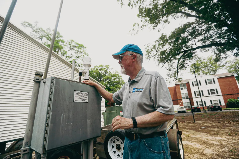
Dr. Kent Moran, with the University of Memphis’ Center for Earthquake Research and Information, explains how earthquake monitoring equipment works during a tour on Thursday, May 02 2024 at 3890 Central Avenue in Memphis, Tenn.

The situation grows even more severe when you think about the implications for the broader region. Tennessee likely wouldn’t be the only place affected, given the size of the NMSZ and the reach of severe earthquakes. As the report puts it:

“A recurrence of the 1811-1812 series could have devastating impacts on the region, with considerable national repercussions, as transportation routes, natural gas, and oil transmission pipelines are broken, and services are interrupted.”
Hospitals and strip malls

The report doesn’t exactly paint a rosy picture. But it was released 16 years ago, and if the simulations were done again today, the outlook might look different.

In the 1990s, more stringent building codes were adopted around the country, due to lessons learned from earthquakes in California. And in 2008, Memphis and Shelby County adopted a code that was already used by much of the U.S. and required new project designs to put more focus on seismic provisions (which help structures resist seismic forces during earthquakes).

Developers must adhere to the minimum seismic provisions required by the code, which would, in theory, keep the building upright in the event of a major earthquake, and protect the people inside. The building might still incur significant damage; it could even be ruined. But the risk of casualties is much lower.

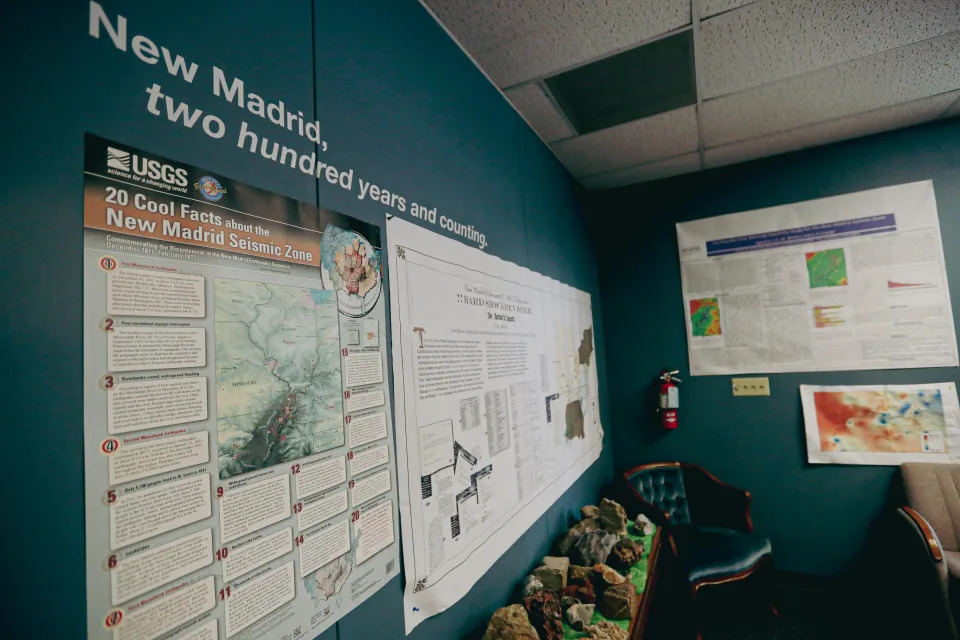
A graph with information on the New Madrid 1812 earthquake can be seen during a tour on Thursday, May 02 2024 at 3890 Central Avenue in Memphis, Tenn.

Developers and businesses do have the option, however, to implement more comprehensive and expensive protections against earthquakes, which would allow them to not just withstand the shaking but hopefully remain operational. And for some structures built since 2008, these extensive provisions aren't optional. Generally, buildings key to the welfare of society ― like schools, hospitals, or fire stations ― must meet more stringent requirements.

Whereas a strip mall need only adhere to the minimum code standards, a hospital must be thoroughly prepared for the possibility of a major earthquake.

And if a developer takes a building constructed prior to the codes adopted in 2008, and changes what it’s used for, there’s a good chance they’ll have to evaluate it, and, if necessary, have it seismically retrofitted.

“More buildings have been designed to more current codes,” said Ryan McDaniel, the engineering systems practice leader and principal for the firm A2H. “I know we've done a number of retrofits… There are buildings that no longer exist; they've been knocked down. And we've got a lot of new buildings.”

A 3D printed model, created by Dr. Christodoulos Kyriakopoulos with University of Memphis’ Center for Earthquake Research and Information, demonstrates the New Madrid 1812 earthquake on Thursday, May 02 2024 at 3890 Central Avenue in Memphis, Tenn.

Still, he acknowledged that calculating the damage difference between now and 2008 would be challenging. And it’s possible the results wouldn’t be dramatically better.

“2008 hasn’t been that long ago,” said Mike Sheridan, a structural engineer and senior VP for the firm Allen & Hoshall. “I think if you come back in 20 years, you might start to bring that down.”

The building codes adopted in 2008 also don’t require structures erected before that year to be seismically retrofitted, unless its purpose changes. And while building owners have the option to strengthen their structures against earthquakes, there can be questions over whether they should do so ― especially if it’s considered a historic structure.

Seismic retrofitting can be costly and invasive. If you’ve got a beloved, historic building, should you pour millions of dollars into earthquake protections that could alter its appearance, when the chances of an earthquake are slim?

"That's a societal question, more than an engineer's question," McDaniel said. "Oftentimes, seismic retrofits may be invasive and affect the appearance or other historical features of a building. So whether it should or should not [undergo seismic retrofits] is up to authorities of that jurisdiction, society, and people."

A graph with information on the New Madrid 1812 earthquake can be seen during a tour on Thursday, May 02 2024 at 3890 Central Avenue in Memphis, Tenn.

There are marquee facilities in Memphis that have either been designed to withstand earthquakes or seismically retrofitted. For example, the AutoZone headquarters and FedExForum were built with seismic provisions, and the Pyramid and the Interstate 40 bridge are among the local structures that have undergone extensive retrofits.

But there are also many buildings that don’t meet seismic standards and likely wouldn’t fare well in the event of an 1811-12 repeat.
Regional One Health at risk

Take, for example, the Medical District campus of Regional One Health.

Regional One President and CEO Dr. Reginald Coopwood explained that its facilities were constructed between 1950 and the mid-1980s, and its older structures don’t have any kind of seismic provisions ― putting the hospital in a potentially dangerous position if a major earthquake were to strike.

“That puts... some of the critical areas of our hospital [at risk]. One, the trauma center, today, sits up underneath our towers that are upon stilts. So, we’re at risk, in a devastating earthquake, that the trauma center would not exist,” Coopwood said.

Research associate Holly Withers explains how she watches for certain things on the duty review page to give information about how impactful an earthquake is at the University of Memphis Center for Earthquake Research and Information on Wednesday, Feb. 14, 2024 in Memphis, Tenn.

He means that the trauma center wouldn’t be able to provide the critical services that could be necessary amid a catastrophic earthquake. But a comprehensive seismic retrofitting of Regional One would come with a hefty price tag; it was estimated to be $568 million.

Instead, Regional One plans to build an entirely new hospital. The possibility of a cataclysmic earthquake, of course, isn’t the only reason for this ― but it is a major one.

“I hope it never comes,” Coopwood said. “But if it were to come, I want the region’s trauma center to be housed in a building that is seismically appropriate, so we can respond.”
Should we be worried about a big earthquake in Memphis?

None of this, of course, is meant to keep you up at night. Withers, the associate research professor at CERI, is still sleeping, and he's spent the bulk of his career studying earthquakes.

Does he think we should be prepared, in case catastrophic earthquakes do come? Yes. But does the idea of them scare him?

Not necessarily.

“You know, you can die of a lot of different things every day,” he said. “And if you’re walking around worried about all the things that can kill you, you forget to live.”

Dr. Kent Moran, with the University of Memphis’ Center for Earthquake Research and Information, explains the CERI Seismic Network Map during a tour on Thursday, May 02 2024 at 3890 Central Avenue in Memphis, Tenn.

John Klyce covers education and children's issues for The Commercial Appeal. You can reach him at John.klyce@commercialappeal.com.

This article originally appeared on Memphis Commercial Appeal: What are the odds of a massive earthquake hitting Memphis, Tennessee?


Memphis is near a major fault. What experts say you can do to prepare for an earthquake

John Klyce, Memphis Commercial Appeal
Tue, May 14, 2024 

In late 1811 and early 1812, the Mid-South was rocked by three major earthquakes, and recently, The Commercial Appeal sought to answer a few questions: What are the chances that earthquakes of this magnitude could strike again, and what would the damage be?

Let’s entertain the possibility that a repeat of 1811-12 does come soon while bearing in mind that the chances of this are slim and that you shouldn’t panic.

How can you prepare? And what should you do if the earthquake comes?

You don’t want to have large, heavy things loose in the house. Mitch Withers, Ph.D., an associate research professor with the Center for Earthquake Research and Information, suggests strapping in your water heater and nailing your bookshelf to the wall.

The seismic network map at the University of Memphis’ Center for Earthquake Research and Information, can be seen during a tour on Thursday, May 02 2024 at 3890 Central Avenue in Memphis, Tenn.

A lot of the preparation for an earthquake can double up as preparation for other emergencies. Having an emergency kit that provides you with first aid supplies, as well as three to five days of water and nonperishable food, isn’t a bad idea.

If a 7-plus magnitude earthquake does come, the shaking would be so severe you likely wouldn’t be able to stand. But there is advice for what you should do in this scenario. If your clothes catch fire, you “stop, drop, and roll," and in the event of an earthquake, you “drop, cover, and hold on.”

From the experts: Could Memphis handle a massive earthquake, and how likely is one?

Get under a thick desk or table and hold on for dear life until the shaking stops. You don’t want to attempt to rush out while it’s still shaking.

“The biggest threat to people,” Withers explained, “is things falling on them.”

Once the shaking has stopped, then run outside ― while keeping in mind that there likely will be aftershocks.

But again, you shouldn’t spend your days fretting over the possibility of a catastrophic earthquake.

“The better way to go is to just prepare,” Withers said. “Do what you can to prepare and then just go live.”

This article originally appeared on Memphis Commercial Appeal: What should you do if there's a major earthquake in Memphis?