Showing posts sorted by date for query HINDU KUSH. Sort by relevance Show all posts

Tuesday, April 23, 2024

Asia hit hardest by climate and weather disasters last year, says UN

Agence France-Presse
April 23, 2024 

A man with his camel wade across a flooded street after heavy monsoon rains in Pushkar, in India's Rajasthan state on July 10, 2023. © Himanshu Sharma, AFP


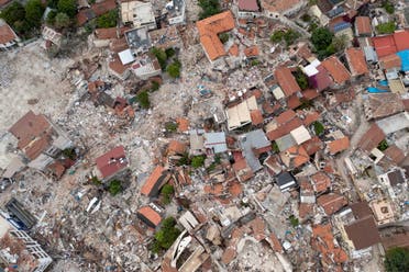
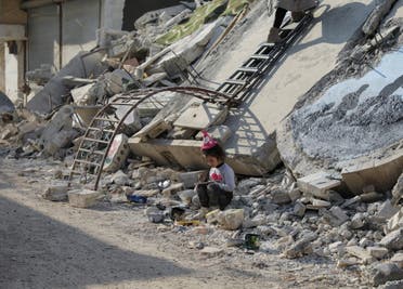
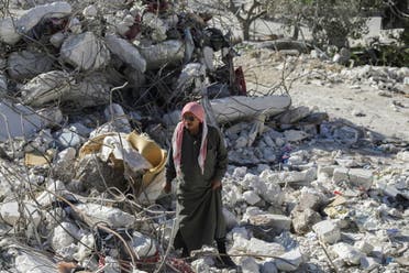
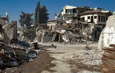
Asia was the world's most disaster-hit region from climate and weather hazards in 2023, the United Nations said Tuesday, with floods and storms the chief cause of casualties and economic losses.

Global temperatures hit record highs last year, and the UN's weather and climate agency said Asia was warming at a particularly rapid pace.

The World Meteorological Organization said the impact of heatwaves in Asia was becoming more severe, with melting glaciers threatening the region's future water security.

The WMO said Asia was warming faster than the global average, with temperatures last year nearly two degrees Celsius above the 1961 to 1990 average.

"The report's conclusions are sobering," WMO chief Celeste Saulo said in a statement.

"Many countries in the region experienced their hottest year on record in 2023, along with a barrage of extreme conditions, from droughts and heatwaves to floods and storms.

"Climate change exacerbated the frequency and severity of such events, profoundly impacting societies, economies, and, most importantly, human lives and the environment that we live in."

The State of the Climate in Asia 2023 report highlighted the accelerating rate of key climate change indicators such as surface temperature, glacier retreat and sea level rise, saying they would have serious repercussions for societies, economies and ecosystems in the region.

"Asia remained the world's most disaster-hit region from weather, climate and water-related hazards in 2023," the WMO said.

Heat, melting and floods

The annual mean near-surface temperature over Asia in 2023 was the second highest on record, at 0.91 degrees Celsius above the 1991-2020 average, and 1.87 C above the 1961-1990 average.

Particularly high average temperatures were recorded from western Siberia to central Asia, and from eastern China to Japan, the report said, with Japan having its hottest summer on record.


As for precipitation, it was below normal in the Himalayas and in the Hindu Kush mountain range in Pakistan and Afghanistan.

Meanwhile southwest China suffered from a drought, with below-normal precipitation levels in nearly every month of the year.

The High-Mountain Asia region, centered on the Tibetan Plateau, contains the largest volume of ice outside of the polar regions.

Over the last several decades, most of these glaciers have been retreating, and at an accelerating rate, the WMO said, with 20 out of 22 monitored glaciers in the region showing continued mass loss last year.

The report said 2023 sea-surface temperatures in the northwest Pacific Ocean were the highest on record.

'Urgency' for action

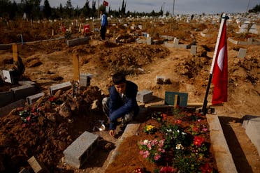
Last year, 79 disasters associated with water-related weather hazards were reported in Asia. Of those, more than 80 percent were floods and storms, with more than 2,000 deaths and nine million people directly affected.

"Floods were the leading cause of death in reported events in 2023 by a substantial margin," the WMO said, noting the continuing high level of vulnerability of Asia to natural hazard events.

Hong Kong recorded 158.1 millimeters of rainfall in one hour on September 7 – the highest since records began in 1884, as a result of a typhoon.

The WMO said there was an urgent need for national weather services across the region to improve tailored information to officials working on reducing disaster risks.

"It is imperative that our actions and strategies mirror the urgency of these times," said Saulo.

"Reducing greenhouse gas emissions and adapting to the evolving climate is not merely an option, but a fundamental necessity."


(AFP)

Wednesday, February 28, 2024

Seismic threats: Are earthquakes becoming more common and deadly in the Middle East?

Seismologists say while earthquakes are not increasing in frequency, they are becoming more deadly due to densely packed populations, poor infrastructure, and a lack of enforced earthquake-protected building codes


A damaged building gets knocked down in the aftermath of a deadly earthquake in Adana, Turkey, March 6, 2023. (Reuters)

Jennifer Bell, Al Arabiya English
Published: 26 January ,2024

After some of the most devastating earthquakes to decimate the region in recent years, some may fear quakes and seismic shocks are becoming a more common occurrence around the world.

Tremors have ripped apart communities across Afghanistan, Morocco, Turkey and Syria in the past 18 months.

Seismologists and geologists, however, have told Al Arabiya English that while shocks that cause such devastating damage are not increasing in frequency, they are nonetheless becoming more deadly due to densely packed populations, poor infrastructure, and a lack of earthquake-protected building codes to keep up with rampant population growth.
Turkey-Syria devastation, one year on

Almost a year has passed since the devastating and powerful earthquake that struck Turkey and Syria on February 6, 2023, claiming more than 60,000 lives and causing widespread destruction.


An aerial view shows Antakya's historical city center, the worst hit in an earthquake which killed more than 50,000 people in Turkey and leaving millions homeless, in Hatay province, Turkey May 5, 2023.

The 7.8-magnitude quake, followed by a second earthquake that notched up a 7.5 on the Richter Scale, was among the strongest ever recorded in the region, with hundreds of thousands more injured and scores of buildings leveled.

Other violent seismic shocks have since been reported across the Middle East and the wider world.

On September 8, 2023, a strong earthquake struck Morocco, killing more than 2,900 and leaving 5,500 injured. The 6.8 magnitude quake struck 72 kilometers southwest of Marrakech and leveled housing blocks.


Ait Abdellah Brahim, 86, gestures among rubble, in the aftermath of a deadly earthquake, in Talat N'Yaaqoub, Morocco, September 16, 2023. (Reuters)

Afghanistan is also frequently hit by earthquakes, especially in the Hindu Kush Mountain range, near the junction of the Eurasian and Indian tectonic plates. In October 2023, around 1,000 people were killed when a series of quakes with magnitudes measuring between 4.2 and 6.3 jolted western Afghanistan.

Speaking to Al Arabiya English, Suzan van der Lee, a professor in Earth and Planetary Sciences at Northwestern University, US, said each year, worldwide, there are about a dozen earthquakes with magnitudes of at least seven on the Richter scale, ten times more of magnitudes of at least 6, 100 times more of magnitudes of at least 5, and many more minor tremors across the globe.

“If one of these occurs near dense population and infrastructure and is unanticipated, then it can have devastating consequences,” said Van der Lee, who co-developed Earthtunes. In her research, she applies data science to millions of records of seismic waves in order to decode seismic signals, which hold vital information about the Earth’s interior dynamics.

Judith Hubbard, a Harvard graduate and earthquake scientist in the US, told Al Arabiya English that hundreds of thousands of earthquakes are recorded each year, but most of them are either too small or too far away from human habitation to cause any damage.

In most years, she says, there are more than 150 earthquakes with a magnitude of 6 on the Richter Scale, 10-15 with a magnitude of more than seven and up to four magnitude 8+ earthquakes.

A cross is seen on the wreckage of Greek Orthodox Church at Antakya's historical city center, the worst hit in an earthquake which killed more than 50,000 people in Turkey and leaving millions homeless, in Hatay province, Turkey May 4, 2023. (Reuters)

“Whether or not these cause damage really depends on where they occur: Whether they are close to population centers, and shallow or deep.”
What causes earthquakes, and how common are they?

The majority of earthquakes occur in the vicinity of tectonic plate boundaries, where large sections of the Earth’s crust and the uppermost portion of the mantle, situated directly beneath the crust, converge.

Van der Lee says in the Middle East and Asia, several belts of heightened seismic activity are associated with the present-day Eurasian, Arabian, Somalian, and Nubian tectonic plates. Additionally, a past plate boundary that subducted the Tethys Ocean contributes to seismicity in the region.

“They are associated with present or past tectonic plate boundaries. There may only be a few of the strongest earthquakes in a certain place in a given millennium. So, compared to human lifetimes, they are not frequent,” Van der Lee reasoned.

Hubbard said the Middle East lies along a boundary between colliding tectonic plates, and the whole region is deforming as a result.

“A large number of active faults have formed to accommodate that deformation, including the Dead Sea Fault (which runs through Syria, Lebanon and Israel), the East Anatolian Fault and North Anatolian Fault in Turkey, the various faults on the Zagros Thrust Belt in Iran, and many more.”
Are more earthquakes being detected?

Vefa Abdullah holds her nephew Ali Sulo, 3, as they sit in the rubble of what used to be their home in the aftermath of a deadly earthquake in Kahramanmaras, Turkey, March 9, 2023.

Van der Lee said experts have only been counting earthquakes for precisely half a century, “which is very short from a geological perspective.”

“In that context, most unexpected events are the results of typical statistical fluctuations (they are the result of chance) rather than systematic global trends, Van der Lee said, adding: “However, if one happens in our lifetimes, followed by a typical sequence of aftershocks, then it sure seems like earthquakes are becoming more frequent. Of course, they are more frequent during any aftershock sequence, but on a timescale of decades, the occurrences of these earthquakes are typical.”

However, the world “should expect more” of the types of earthquakes seen in Turkey and Syria, she said.

According to Hubbard, there has not been any significant change in earthquake patterns worldwide in recent years. “Earthquake patterns are by their nature irregular, so each year we see a different set of events,” she said. “However, there are no global trends in

the fundamental tectonics. There are, however, trends in how and where people live and their exposure to earthquake hazards.”

Hubbard said this also holds for the Middle East.

“People naturally focus on recent events, but the Middle East has always suffered periodic damaging earthquakes,” she said. “The February 6, 2023, earthquakes in Turkey were terrible, but so was the 1999 Izmit earthquake (17,000 deaths) and the 1939 Erzincan earthquake (32,000 deaths), among others.”

Hubbard said the 2022 earthquake in Kabul killed more than 1,000 people. The more recent October 2023 earthquakes near Herat killed more than 2,500. The 2003 earthquake in Bam, Iran, killed 26,000.

“Some of these extremely damaging earthquakes were not even that large by global standards. Their high death tolls reflect their location (close to people) and the vulnerability of the populations living near them (buildings that are not resistant to earthquakes).”
Denser populations lead to higher death tolls

Dr. Brian Baptie, a seismologist with the British Geographical Survey, told Al Arabiya English that more reportage of such natural disasters – and news shared on social media channels – can lead to the assumption that more earthquakes are happening, though that is not the case.

“I mean, all these devastating earthquakes that occurred do definitely give you the impression that there are more earthquakes and that they didn’t happen before. However, if you actually look back at the average statistics over the last 30 or even 100 years or so, on an average, the number of earthquakes is pretty much the same, or at least the average of the number of big earthquakes a year is the same,” he reasoned.

However, while the frequency of earthquakes is not changing, the scale of their devastation is, said Baptie, because global population is increasing, with many living in densely built-up areas. That includes areas such as Turkey in the Middle East and regions in India and Pakistan.

Eduardo Kausel, professor at the Massachusetts Institute of Technology, also told Al Arabiya English that earthquakes have produced more damage in recent decades “mainly because of the explosive rise in population and the fast growth of the built environment, but measured over millennia, quakes are surely not more intense or more frequent.”

Syrian artist Salam Hamed's daughter Sima sits in the rubble of damaged buildings in the rebel-held town of Jandaris, in the aftermath of a deadly earthquake, in Syria February 22, 2023.

Kausel added: “The known, historic seismic activity in that area of the world stretches back thousands of years. Although the activity itself hasn’t increased over the centuries, its reporting has increased, given that there are many more witnesses and people affected, not to mention modern media.”
Where do earthquakes most commonly occur?

Earthquakes predominantly strike in three major zones globally. The circum-Pacific seismic belt, known as the “Ring of Fire,” encircles the Pacific Ocean, hosting 81 percent of the world’s largest earthquakes. This belt thrives along tectonic plate boundaries, where plates subduct, causing slips and ruptures. Examples include the powerful M9.5 Chilean Earthquake (1960) and the M9.2 Alaska Earthquake (1964).

The Alpide earthquake belt spans Java to Sumatra, through the Himalayas, the Mediterranean, and the Atlantic, contributing to 17 percent of major earthquakes. Notably, the 2005 M7.6 Pakistan quake claimed over 80,000 lives, and the 2004 M9.1 Indonesia earthquake triggered a tsunami that killed over 230,000.

The third significant belt aligns with the submerged mid-Atlantic Ridge, a divergent plate boundary. While mostly underwater, Iceland, directly above this Ridge, has witnessed earthquakes up to at least M6.9. Though most seismic activity occurs in these belts, damaging earthquakes can still surprise outside these regions.

Hubbard also says most earthquakes occur along plate boundaries. Some places that are particularly prone to damaging earthquakes are the west coast of the Americas, the borders of Southeast Asia, the Philippines/Taiwan/Japan, eastern Africa, and the wide zone of collision between Eurasia and Africa/Arabia/India.

“This collisional belt, in particular, is especially hazardous,” she said. “It is more than 10,000 km long, reaching from North Africa and Spain in the west to India and China in the east. Deformation occurs at shallow depth over a very broad area, in some places more than 2,000 km wide. A huge number of countries are impacted by this

system, including parts of southern Europe, North Africa, the Middle

East, and South and East Asia.”
Deadliest earthquakes in history

In recent memory, the colossal Indian Ocean earthquake on December 26, 2004, stands as a stark reminder of nature’s destructive force. Recorded as the fifth deadliest earthquake in history, its epicenter was off the west coast of Sumatra in Indonesia. Ranging from 9.1 to 9.3 in magnitude, the earthquake occurred as the Indian Plate was subducted by the Burma Plate. Following the seismic shock, a series of deadly tsunamis swept through, eradicating everything in the path of the colossal waves. Indonesia bore the brunt of the disaster, followed by Sri Lanka, India, and Thailand. The US Geological Survey reported a staggering total of 227,898 casualties.

Salih Dogru, 12, and his cousin Eren Dogru, 14, visit earthquake victims' graves at Cankaya cemetery, where they moved to in the aftermath of a deadly earthquake in Iskenderun, Turkey, March 12, 2023. Last month's devastating earthquakes killed more than 54,000 people in Turkey and Syria and left millions homeless. Shortly after the first earthquake struck on Feb. 6, Salih’s uncle, undertaker Ali Dogru, 46, moved his family to the cemetery. They have been living there since (Reuters)

The Tangshan earthquake, another catastrophic event etched in history, struck Tangshan in Hebei, China, on July 28, 1976. This industrial city, home to about one million residents, faced unprecedented devastation, resulting in the loss of approximately 240,000 lives and severe injuries to an additional 164,000 people.

More recently, Hubbard said, the Turkey-Syria earthquakes were notable because of their magnitudes and the fact that there were two of them – the first a magnitude of 7.8 on the Richter Scale and the second a magnitude of 7.7 – occurring about nine hours after the first on a different Faultline, in addition to the usual aftershocks.

“Shaking intensities were very high along the faults that slipped,” she explained. “In the first earthquake, three-quarters of a million people experienced intense shaking ... we saw widespread building damage, including the collapse of a number of tall apartment complexes.”

In comparison, the 2022 earthquake in Afghanistan’s Kabul was much smaller.

“The October 2023 earthquakes in Afghanistan caused significant damage – a series of four M6.3 events over a series of about a week. The 2002 Bam earthquake in Iran was particularly damaging,” she further said.
Are climate change and human activity the factors?

Significantly, contrary to popular perception, Van der Lee says climate change is not a factor in earthquakes. “Most effects of climate or weather on seismic activity are small at best and only manifest in regions undergoing rapid melting of ice caps, for example. It is very unlikely that the seismicity in the Middle East is influenced by climate change,” she said.

However, human activities such as mining, reservoir-induced seismicity, or oil-and-gas extraction can contribute to seismic events in the Middle East, she added. “Human activities like that have induced and triggered small to moderate-magnitude earthquakes in several places around the world, so I wouldn’t be surprised if this included the Middle East.”

Hubbard also said there is no evidence linking climate change to seismic activity in the Middle East – or anywhere else – but agreed that “human activities can indeed cause earthquakes.” She pointed to reservoir-triggered seismicity, which has been observed near dams during construction, impoundment, and cyclic filling in many parts of the Earth, including Turkey.

“Occasional moderate earthquakes have been linked to reservoirs. For instance, the Atatürk Dam in Turkey has been linked to several (seismic) events,” Hubbard further said.

“It is well known that the oil-and-gas extraction process can trigger seismicity (especially the process of injecting wastewater back into the Earth). This has definitely been implicated in parts of the US.

Moreover, groundwater extraction has also been observed to be linked to earthquakes in some parts of the Middle East – for instance, along the Dead Sea Fault in Jordan at the Wadi Al-Arab basin.”

Shaking events associated with mining are regularly detected, said Hubbard.

“These are mostly detections of actual blasting and are not considered ‘earthquakes’ in the traditional sense, in that they don’t involve slip-on faults in the Earth. (In contrast, wastewater injection weakens faults, allowing them to slip.) Some forms of mining do involve injecting water into the subsurface, in which case they can

trigger earthquakes. However, thus far, the largest and most damaging earthquakes have not been linked to anthropogenic activities,” Hubbard further explained.
Monitoring earthquakes

Van de Lee said there is more that could be done to forewarn and forearm countries ahead of earthquakes.

Fadel El Jaber, stands on rubble of the building his son lived with his family, that collapsed from last month's deadly earthquake in the town of Salqin, Syria March 10, 2023.

“Earthquake monitoring has improved with humanity having expanded its instrumental sensing and recording activities, as well as methodologies for analyzing seismic data,” she said.

However, to date, no one is able to predict earthquakes accurately, she added. “The best we can do is anticipate and be prepared for them.”

That, she says, means early-warning systems in place to alert the public during any seismic activity.

Van der Lee says building codes in earthquake-prone countries are also key in order for new or existing buildings to meet the structural standards to cope with seismic disturbances. These ratings are instrumental in gauging a structure’s ability to withstand tremors, providing crucial insights into potential risks.
Building codes are key

A building, or specific sections of it, earns the ominous label of “earthquake-prone” if it is projected to surpass its ultimate capacity during a moderate earthquake. The implications are dire, as such structures, if they were to collapse, pose a significant threat of causing injury or even death to individuals within or near the building. Additionally, the collateral damage extends to adjacent properties, intensifying the urgency for comprehensive seismic assessments and mitigation strategies.

“Turkey, for example, has building codes,” said Van der Lee. “These codes need to be regularly reviewed and, updated and adhered to. This can really help prevent devastation. Most risks are posed by the built environment.”

Measures to mitigate earthquake damage include incorporation of comprehensive geoscience education into the national curriculum, the establishment of local earthquake centers to enhance monitoring and research, and effective science communication to dispel misinformation.

Development of an “earthquake culture” is the central theme, encouraging a collective consciousness about earthquakes through initiatives that promote memory, awareness, and community engagement.

Baptie also said there are ways the world can mitigate the impact of earthquakes – and making sure buildings are safer is priority number one.

“We cannot predict earthquakes, but we do have a pretty good idea of where most of those earthquakes occur, so we can establish where they’re likely to occur.”

Many countries that are in areas of high earthquake hazard activity said Baptie, have building codes, and that’s true in countries like Turkey and Iran.

The crucial thing is that building codes need to be enforced. He said it was “pretty clear” in the Turkey earthquakes last year that there were a lot of modern buildings that were recently constructed, after a time when other buildings had been strengthened following the major earthquakes in Turkey in 1999.

The remains of buildings destroyed during the earthquake are pictured in Antakya, southeastern Turkey Saturday, Aug. 5, 2023.

“The other things we can do is retrofit existing buildings, so we can do things to our buildings to make them stronger,” Baptie added.

The problem is that in many earthquake-sensitive areas, there are still large numbers of people living in quite vulnerable buildings.

“In places like Afghanistan, there are a lot of people who are living in just un-reinforced brick buildings. These are very, very vulnerable to earthquake shaking and that’s a major problem,” Baptie added.

Hubbard said the “only truly useful approach” to mitigating the impact of potential earthquakes is to build resilient buildings.
Effective disaster management

Another key step in minimizing the devastation from future earthquakes is by ensuring international coordination, said Van der Lee. “Every earthquake reveals new information that, after analysis and related research, helps us better understand earthquakes in general,” she said.

“Seismology has a long tradition of international collaboration that can and should be further strengthened. The power of the Earth and earthquakes surpasses humanity’s combined powers. We should, therefore, be united in learning to understand them and how to minimize the devastation that might result from some of them.”

Hubbard agrees.

“Earthquake prediction remains impossible,” she said. “Instead, we rely on earthquake forecasting (i.e. detecting zones that could be impacted by earthquakes on nearby active faults), aftershock forecasting (understanding the risk of continued events after a large earthquake), and earthquake early warning (detecting an earthquake early and sending a warning signal to nearby phones to alert people to incoming shaking, giving tens of seconds of warning time).”

Seismometer networks in the Middle East vary from country to country, said Hubbard. For instance, she says, Turkey has “excellent networks”, but some nearby countries have few seismometers.

Some countries in the Middle East are part of the EMSC (European-Mediterranean Seismological Centre) and report their data to that group – but not all, said Hubbard.

“The EMSC also operates a novel system that uses human responses to detect earthquakes, which really helps in areas where there are not so many seismometers.”

Hubbard said it was very clear following the February 2023 Turkey-Syria earthquakes that the world’s ability to “see” earthquakes was very regional.

“For instance, many people in Syria and Lebanon reported feeling aftershocks that were not detected by global seismological networks. In contrast, reports of shaking in Turkey were almost always matched to a detected event.”
International collaboration

Hubbard also stressed the importance of international collaboration to understanding earthquakes.

“Earthquakes are global phenomena. There are many cases where we know comparatively little about what happened in an earthquake because it occurred in an area without good instrumentation or a good understanding of the geology of a region. I have found that in most cases, scientists are willing to collaborate across political borders, but they are sometimes held up by regulations that prevent easy or effective collaboration,” she said.

“More work on building international links through science and hazard mitigation could strengthen existing relationships and help vulnerable communities,” Hubbard added.

A general view shows a damaged mosque in the aftermath of a deadly earthquake, in rebel-held al-Maland village, in Idlib province, Syria February 24, 2023. (Reuters)
Can AI future-predict earthquakes?

Baptie said, going forward, the use of artificial intelligence (AI) may be an incredibly helpful tool for earth scientists and geologists in earthquake mitigation and management.

“What we are interested in now is using AI to first detect and characterize earthquakes,” he said. “There have been big advances in this over the last four or five years.”

“AI at the moment is incredibly good at finding patterns. It can detect really small earthquakes that some of our other systems can’t. So, what it means is that we can get very data-rich catalogs of information that can help us understand the hazards a little better,” Baptie added.

“The next step is probably to try and use AI knowledge systems to try and make forecasts of earthquakes and to try and make short-term forecasts about earthquakes. That is still pretty much a work in progress. But it has potential.”

So, could one day earthquakes be predicted?

“That is the holy grail,” said Baptie.

Tuesday, January 16, 2024

Devil’s dung or dinner delight? The story behind hing, one of India’s most divisive ingredients

Shalbha Sarda, CNN
Mon, January 15, 2024

An appetizer or an abhorrent? A medicine or a pesticide?

Asafoetida sounds innocent enough – it’s a wild fennel plant native to Afghanistan, Iran and Uzbekistan.

The resin from its roots is used in Indian cooking – usually after it’s ground into powder and mixed with flour. To say it has a powerful smell would be an understatement. In fact, its scent is so pungent it might just be the most divisive ingredient in the country.

‘Asa’ means gum in Persian, and ‘foetida’ means stinky in Latin. But in India, it’s just called hing.

If you accidentally get hing on your hands, it lingers no matter how many times you wash them. Put an unadulterated pinch on your tongue, and your mouth will start burning.

At the Khari Baoli market in old Delhi, for instance, hing even manages to ‘out-smell’ all the other spices.

“Hing is the mother of all base notes of Indian cooking,” say Siddharth Talwar and Rhea Rosalind Ramji, co-founders of The School of Showbiz Chefs.

“It bridged the gap of flavors of onion and garlic that were prohibited due to religious beliefs in the largely vegetarian Indian communities such as Jain, Marwari and Gujarati. Despite the culinary diversity of India, hing is a constant.”

Jains, for example, eschew onion, garlic and ginger in addition to not eating meat.

Ramji admits that the smell can be a challenge: Raw hing has been compared to rotten cabbage. It’s even been given the nickname “devil’s dung.”

But a small amount goes a long way. Talwar advises that you put a miniscule amount of hing into hot oil.

Most people buy a powdered version that is mixed in with rice or wheat flour. However, more adventurous cooks will buy the solid crystal form, which looks like rock salt.

The history of hing

Some scholars credit Alexander the Great for first bringing hing to India.

“The popular theory is that Alexander’s army encountered asafoetida in the Hindu Kush mountains and mistook it for the rare silphium plant, which has similar characteristics to asafoetida,” explains culinary historian Dr. Ashish Chopra.

“They painstakingly carried the plant with them to India … only to find out later that it wasn’t what they (expected). Nevertheless, Indians have had their encounter with hing now; it came, it saw, and it stayed.”

The professor adds that hing was used in some Greco-Roman cooking but didn’t last long. These days, it’s mostly absent from Western food, with one notable exception: Worcestershire sauce.

But as global food patterns and appetites change, some chefs are trying to remake their recipes by skipping onion and garlic in favor of asafetida.

According to Talwar, “hing can enhance the umami taste sensation essential for stews and stocks.”

“The concept of umami was first introduced by Japanese food experts, but is now the fifth base note in gastronomy after sweet, bitter, sour and salty.”

American company Burlap & Barrel even sells a Wild Hing blend made with turmeric, marketed toward people with garlic sensitivity or those following a low FODMAP diet.

But the flavor isn’t the only reason you find jars of the proverbial genie on many spice racks of the world. According to the National Library of Medicine, asafoetida has been used as a cough expectorant, an anti-spasmodic and to kill parasites or worms. Some tout it as an effective Ayurvedic remedy for stomach gas.

Furthermore, not everyone has purchased hing for the purpose of eating it.

African and Jamaican people sometimes wore amulets of asafoetida, believing it could repel demons. In 1918, in the US, some people wore sachets or bags containing asafoetida to ward off the Spanish flu.

These days, its repulsive properties are put to better use as a pesticide in organic farming.

Surprisingly, even though India is the world’s highest consumer of asafoetida, it had never been grown in the country until recently.

About three years ago, in the cold desert side of the Himalayan region, farmers announced they were trying to cultivate their own hing.

The process of growing asafoetida can be slow. But if India manages to cultivate its own, that might mean saving some $100 million per year importing the product itself.

And, perhaps more importantly, Indians could have a favorite flavor that is wholly from India.


IT STINKS WHEN BURNT AS A PERFUME IN THE MAGICKAL RITUAL OF SATURN WHICH IS THE RULER OF THIS PLANT

Wednesday, December 20, 2023


Corona pandemic has reduced the melting of Himalayan glaciers


Clean air would make water supplies safer for billions of people


Peer-Reviewed Publication

LEIBNIZ INSTITUTE FOR TROPOSPHERIC RESEARCH (TROPOS)

Smog-1 

IMAGE: 

SMOG OVER NORTHERN INDIA ON THE EDGE OF THE HIMALAYAN GLACIERS.

view more 

CREDIT: NASA EARTH OBSERVATORY IMAGE BY JOSHUA STEVENS, USING VIIRS DATA FROM NASA EOSDIS/LANCE


Pune/Leipzig. Reducing air pollution to levels similar to those during the coronavirus pandemic could protect the glaciers in the Himalayas and prevent them from disappearing by the end of the century. This is the conclusion reached by an international research team analysing the situation during the COVID-19 lockdown in 2020. The cleaner air has ensured that less soot has been deposited on the glaciers, resulting in 0.5 to 1.5 mm less snow melting per day. The rapid retreat of glaciers and the loss of snow cover already pose a threat to the sustainable water supply of billions of people in Asia who live in the catchment areas of rivers such as the Indus, Ganges and Yangtze. If emissions of air pollutants such as soot could be reduced to at least the level of the lockdowns, snowmelt could be reduced by up to half. A switch to clean energy supplies and lower-emission modes of transport would therefore bring significant benefits for sustainable water supplies, agriculture and ecosystems in large parts of Asia, the researchers write in the journal Atmospheric Chemistry and Physics (ACP).


The mountains of the Hindu Kush Himalayas (HKH) and the highlands of Tibet in Central Asia form the largest snow-covered region outside the poles. The meltwater from these glaciers feeds rivers in India and China, which fuel agriculture, hydropower generation and the economies of these countries. The Himalayan snowmelt in spring provides around half of the annual fresh water for around 4 billion people in South Asia and East Asia. But resources are dwindling: Global warming has already led to a loss of around 40 per cent of the Himalayan glacier area compared to the Little Ice Age in the Middle Ages. With the exception of a few Karakoram glaciers, the snow mass there has also decreased significantly over the last 30 years. Model simulations for extreme scenarios show that the melting snow in the Himalayas could cause the glaciers there to disappear by the end of the 21st century. This is worrying news for the water supply of several billion people.


The fact that glaciers are becoming thinner and thinner is partly due to climate change with higher air temperatures and changes in precipitation - in other words, long-term causes that will take decades to combat. However, short-term factors such as the distribution and deposition of light-absorbing particles such as dust and soot (black carbon (BC)) also play a major role in glacier melting. Earlier studies have already shown that soot melts the snow on glaciers more than greenhouse gases in the atmosphere. The increasing energy demand of densely populated South Asia has greatly increased emissions of greenhouse gases and soot particles in recent decades, leading to increased darkening and melting of snow.


The economic slowdown caused by the lockdown measures during the coronavirus pandemic led to a drastic decline in passenger and freight transport, industrial emissions and energy consumption in this region in 2020. As a result, air pollution with greenhouse gases and especially soot also decreased significantly: satellite observations showed cleaner snow with almost a third less light-absorbing pollution during the lockdown in Asia between March and May 2020. This led to a decrease in snowmelt of 25 to 70 mm in 2020 - compared to the 20-year average for the months of March to May in the western Himalayas. The changes in snow absorption and surface albedo thus ensured that around 7 cubic kilometres of meltwater remained in the Indus catchment area.


The international team of researchers from India, Germany and the UK used global simulations to analyse in detail the impact of reduced air pollution over high mountains in Central Asia during the COVID-19 lockdowns between March and May 2020: They used the ECHAM6-HAMMOZ chemistry-climate model, updated with an improved soot-snow parameterisation, to compare corona time with typical air pollution conditions. The corona simulations were performed with a COVID-19 emission inventory where emissions were calculated based on Google and Apple mobility data. Various observational data was also included in the new study: Snow cover and atmospheric opacity were determined using MODIS spectral data from NASA. These data were supplemented by solar photometer measurements from two Aerosol Robotic Network (AERONET) stations in Lahore (Pakistan) and Dushanbe (Tajikistan). The AERONET measurements in Dushanbe were part of the joint German-Tajik CADEX project from 2014 to 2016, in which the Academy of Sciences of Tajikistan and TROPOS jointly analysed mineral dust over Central Asia.


The ECHAM6-HAMMOZ model simulations show that the COVID lockdown in spring 2020 led to a cleaner atmosphere over the mountains of the Hindu Kush Himalayas and the highlands of Tibet. "The aerosol optical thickness (AOD), i.e. the atmospheric opacity, over this region decreased by around 10 per cent in April 2020 compared to before the pandemic. This is supported by measurements from NASA's Moderate Resolution Imaging Spectroradiometer (MODIS), which also show a reduction in AOD compared to the average of the last 20 years," reports Dr Suvarna Fadnavis from the Indian Institute of Tropical Meteorology (IITM). The decrease in soot was also observed in the ground-based measurements of the Aerosol Radiative Forcing Over India Network (ARFINET): over the Indian Gangetic Plain (>50%), Northeast India (>30%), the Himalayan regions (16%-60%) and Tibet (70%).


The reduction in anthropogenic air pollution led to less soot being deposited on the snow in large parts of the high mountains of Central Asia. According to this study, there were around 25 to 350 micrograms less soot per kilogramme of snow in spring 2020, which corresponds to up to a third of the soot concentration in the snow there. However, according to the model, soot concentrations in the snow have also risen sporadically in some areas in the Hindu Kush, the eastern Himalayas and the Kunlun Mountains. The seemingly paradoxical differences are due to the fact that soot interacts with solar radiation not only on the surface, but above all in the atmosphere. This leads to complex adjustments in atmospheric circulation and thus to changes in the transport and deposition of air pollutants. "Our simulations show that the decrease in soot concentration in the snow and the general reduction in air pollution and associated radiative effects reduced the short-wave radiative forcing at the surface by up to 2 watts per square metre in March to May 2020, resulting in less atmospheric warming. This lower warming of the snowpack and the tropospheric column is the combined effect of less soot in the snow and the changes in atmospheric concentrations of sulphate and soot," explains Dr Bernd Heinold from TROPOS. "In the model, we were able to show that the decrease in air pollution reduced snowmelt in spring 2020 by 0.5 to 1.5 millimetres per day and thus reduced the runoff meltwater in the year by up to half." The reduction in man-made pollution during the COVID-19 lockdown has therefore benefited the high mountains of Central Asia in many ways: increased reflectivity of the snow surface, reduced snowmelt and increased snow cover, as well as an increase in stored water due to reduced surface water runoff.


"Our results make it clear that of the two processes causing the retreat of the Himalayan glaciers - global climate change and local air pollution - a reduction in air pollution in particular could be a short-term help," emphasises Prof. Ina Tegen from TROPOS. "Even if we were to stop CO2 emissions immediately, temperatures would not initially fall. However, our results confirm the importance of reducing short-lived climate drivers such as soot and their complementary role in CO2 mitigation. Reducing air pollution to similar levels as during the COVID-19 lockdowns in 2020 could protect the Himalayan glaciers, which are otherwise at risk of disappearing by the end of the 21st century." Since 2000, the glaciers in the Himalayas have lost almost half a metre of ice per year. If air pollution could be reduced to the level it was at during the coronavirus pandemic, for example, then snowmelt could be reduced by up to half. Clean air measures would therefore not only benefit the health of billions of people in Asia, but also the water supply, agriculture and ecosystems in large parts of Asia.

Thick clouds of smoke from straw fires over India.

CREDIT

European Union, Copernicus Sentinel-3 data - Processed by COPERNICUSEU

The impacts of reduced pollution on snow brightening in the Himalayas and reduced surface water runoff, as observed during the 2020 COVID-19 lockdown period.

CREDIT

Fadnavis, S., Heinold, B., Sabin, T. P., Kubin, A., Huang, K., Rap, A., and Müller, R.: Air pollution reductions caused by the COVID-19 lockdown open up a way to preserve the Himalayan glaciers, Atmos. Chem. Phys., 23, 10439-10449, https://doi.org/10.5194/acp-23-10439-2023 , 2023. Figure 6 (c)

Monday, December 18, 2023


Third Pole environment researchers study the risk of glacial lake Outbursts in the Third Pole


Numerical modeling results with updated datasets reveal that hundreds of thousands of people may be in the path of potential outburst floods


Peer-Reviewed Publication

CACTUS COMMUNICATIONS

Outburst floods from glacial lakes in the Third Pole threaten the livelihood of thousands of people living in the region. 

IMAGE: 

APPROXIMATELY 190,000 PEOPLE LIVE IN AREAS THAT ARE AT A RISK OF BEING FLOODED DUE TO OUTBURSTS FROM THE GLACIAL LAKES IN THE THIRD POLE REGION OF THE EARTH. IN THE ABOVE MAP, THE YELLOW SECTIONS IN PIE CHARTS INDICATE THE PERCENTAGE OF GLACIAL LAKES POSING VERY HIGH AND HIGH RISKS. THE BOX PLOTS ILLUSTRATE THE DISTANCE BETWEEN GLACIAL LAKES AND THE NEAREST DOWNSTREAM HUMAN SETTLEMENTS EXPOSED TO GLACIAL LAKE OUTBURST FLOODS (GLOFS) AND THE BASIC EARLY WARNING TIMES FOR GLOFS, GROUPED BY REGION.     

view more 

CREDIT: WEICAI WANG FROM THE TIBETAN PLATEAU EARTH SYSTEM, CHINESE ACADEMY OF SCIENCES


The Third Pole, which spans the Tibetan Plateau and the surrounding Himalayas, Hindu Kush, and Tianshan Mountain ranges, is extremely vulnerable to the effects of climate change. Warming temperatures and altered rainfall patterns have caused over 10,000 glaciers in the region to retreat over the past three decades, facilitating the formation of thousands of glacial lakes.

Though they appear harmless, these water bodies have a tremendous destructive potential, particularly due to their ability to cause glacial lake outburst floods (GLOFs). When triggered by events like glacier collapse, snow avalanches, landslides, or the collapse of natural dams, glacial lakes can release vast volumes of water swiftly, leading to destructive GLOFs.

Since GLOFs pose an immense threat to communities and industries located near glacial lakes at the Third Pole, efforts have been made to understand their triggers and assess their risks with the intention of facilitating preventive decision-making. Unfortunately, the methods used for assessing these risks have been significantly varied across these studies. For example, the number of glacial lakes reported varied in number from 10,000 to 30,000 in the 2015–2020 period, depending on the definition used. These inconsistencies make it difficult to create a reliable dataset for further data analysis and GLOF risk assessment.

Against this backdrop, a research team headed by Associate Professor Weicai Wang from the Institute of Tibetan Plateau Research, Chinese Academy of Sciences, China, decided to carry out a more detailed analysis of GLOF risks in the Third Pole. The study, published in Nature Communications journal on December 12, 2023, underscores the need for urgent action and regional cooperation for the economically disadvantaged and highly vulnerable regions in the Third Pole.

To this end, the researchers first obtained satellite images from the Sentinel-2A and Sentinel-2B missions between 2018 and 2022. Then, they identified and classified all glacial lakes based on their position and topological characteristics in relation to their source glacier. This updated inventory of glacial lakes, coupled with earlier datasets, enabled them to analyze the changes in this region over the past decades, revealing a worrisome continuous expansion of glacial lakes.

Further, they analyzed changes in GLOF activity by consolidating datasets of GLOF events in the Third Pole, tracing back as far as 1900. Their findings, in contrast to previous studies, revealed a worrisome trend, indicating an increase in GLOF occurrences from an average of 1.5 events annually during 1981–1990 to 2.7 events during 2011–2020. The researchers noted that the expansion of glacial lakes and the appearance of new ones will likely lead to an increase in the number of GLOFs per year in the future, underscoring the need for developing better analytical methods and datasets to stay one step ahead of potential disasters.

Finally, the team analyzed the susceptibility to GLOFs in 5,535 glacial lakes and identified 1,499 of those with a high potential for outburst floods. The researchers also investigated the ‘potential disaster volume’ based on GLOF simulations of these high-risk lakes. The results were concerning, to say the least. “Approximately 55,808 buildings, 105 existing or planned hydropower projects, 194 km2 of farmland, 5,005 km of roads, and 4,038 bridges are threatened by the potential GLOFs,” states Dr. Wang. “Moreover, by utilizing regional population distribution data, we estimated that roughly 190,000 lives are directly exposed within the GLOF paths,” he explains.

Overall, these findings are concerning, especially for countries exposed to GLOFs in the Third Pole, especially China, Kazakhstan, Nepal, India, and Pakistan. “Our findings underscore the significant challenges posed by the substantial potential disaster volumes in these economically disadvantaged and highly vulnerable regions,” says Dr. Wang. Explaining further, he says, “Considering the projected extension of GLOF threats under future climate change scenarios, it is crucial for the relevant nations surrounding the Third Pole to recognize the urgency of addressing GLOF threats and to promote regional cooperation.

Going ahead, this work will hopefully lead to better risk management strategies for GLOFs and foster cooperation between countries in the Third Pole. In addition, and perhaps most importantly, these findings should also raise awareness of the many ways in which climate change threatens our lives.


***


Reference

DOI: https://doi.org/10.1038/s41467-023-44123-z


Authors: Taigang Zhang1,2,3, Weicai Wang1, Baosheng An1,4, and Lele Wei1,2,3


Affiliations:

1State Key Laboratory of Tibetan Plateau Earth System, Environment and Resources (TPESER), Institute of Tibetan Plateau Research, Chinese Academy of Sciences

2College of Earth and Environmental Sciences, Lanzhou University

3Center for the Pan-Third Pole Environment, Lanzhou University

4School of Science, Tibet University


About Associate Professor Weicai Wang
Dr. Weicai Wang is an Associate Professor at the Institute of Tibetan Plateau Research of the Chinese Academy of Sciences, China. Dr. Wang obtained his Ph.D. in Physical Geography from the Institute of Tibetan Plateau Research (ITPR) in 2013, as well as M.S. and B.S. degrees in Environmental Engineering from the China University of Petroleum in 2008 and 2005, respectively. He became an Assistant Professor at ITPR in 2013 and was promoted to Associate Professor in 2016. His research focuses on glacial lake mapping, glacial lake outburst flood risk assessment, glacial lake monitoring, and early warning systems. He has published over 40 research papers on these topics. 

Friday, November 24, 2023

PAKISTAN
Mountain villages fight for future as melting glaciers threaten floods


Tariq Jamil, 51, chair of the Community Based Disaster Risk Management Centre, walks with a hiking stick to check the ice on the Shisper glacier, near Hassanabad village, Hunza valley, in the Karakoram mountain range in the Gilgit-Baltistan region of Pakistan, on October 10 2023.
Image: REUTERS/Akhtar Soomro

24 November 2023 - BY CHARLOTTE GREENFIELD


On the steep slope of a glacier jutting through the Hunza valley in Pakistan's mountainous far north, Tariq Jamil measures the ice's movement and snaps photos. Later, he creates a report that includes data from sensors and another camera installed near the Shisper glacier to update his village an hour's hike downstream.

The 51-year-old's mission: mobilise his community of 200 families in Hassanabad, in the Karakoram mountains, to fight for a future for their village and way of life, increasingly under threat from unstable lakes formed by melting glacier ice.

When glacial lakes overfill or their banks become unsound, they burst, sparking deadly floods that wash out bridges and buildings and wipe out fertile land throughout the Hindu Kush, Karakoram, and Himalayan mountain ranges that intersect in northern Pakistan.

Himalayan glaciers are on track to lose up to 75% of their ice by the century's end due to global warming, according to the International Centre for Integrated Mountain Development (ICIMOD).

After all the sensors are installed, village representatives will be able to monitor data through their mobiles, Jamil said. “Local wisdom is very important: we are the main observers. We have witnessed many things.”

Hassanabad is part of the UN-backed Glacial Lake Outburst Flood (GLOF) II project to help communities downstream of melting glaciers adapt.

Amid a shortfall in funding for those most vulnerable to the impacts of climate change, village residents say they urgently need increased support to adapt to threats of glacial lake floods.

“The needs are enormous,” said Karma Lodey Rapten, Regional Technical Specialist for Climate Change Adaptation at the United Nations Development Program (UNDP).

Pakistan is the only country to receive adaptation funding from the Green Climate Fund — the Paris Agreement's key financing pot — to ease the risk of such floods.

While countries like Bhutan have worked with other funders to minimise the threat from glacial lake floods, the $36.96m (R697.94m) GLOF II scheme — which ends in early 2025 — is a global benchmark for other regions grappling with this threat, including the Peruvian Andes and China.

Since 2017, weather stations as well as sensors measuring rainfall, water discharge, and river and lake water levels have been installed under the administration of Islamabad and UNDP. GLOF II has deployed speakers in villages to communicate warnings, and infrastructure like stone-and-wire barriers that slow floodwater.

In Hassanabad, a villager regularly monitors the feed from a camera installed high up the valley for water levels in the river by the glacier's base during risky periods such as summer, when a lake dammed by ice from Shisper glacier often forms.


Pakistan is among the world's most at-risk countries from glacial lake floods, with 800,000 people living within 15km of a glacier. Many residents of the Karakorams built their homes on lush land along rivers running off glaciers.

In neighbouring India in October, floods probably triggered by a partial glacial lake burst in the Himalayas, following an avalanche and heavy rains, likely killed 179 people. Many remain missing. An early warning system was being installed near the lake, but it had not been completed.

DEADLY RISKS


As many as 15-million people worldwide are at risk of glacial lake flooding, with 2-million of them in Pakistan, according to a February study published in scientific journal Nature Communications.

From 2018 to 2021, about 14 GLOFs occurred in Pakistan, but that spiked to 75 in 2022, according to UNDP.

Jamil's village had close calls from floods, according to residents and officials. Over the past three years, residents repeatedly evacuated just in time to avoid loss of life, and many fear a flood while they sleep. Others struggle financially as their land and homes were destroyed, most recently in 2022.

In Chalt village, a few hours away, a torrent of black water rushed down the valley last year. Zahra Ramzan's 11-year-old son Ali Mohammad was swept away.

“I'm in very deep grief. I could not see my son again, even a body,” said the 40-year-old.

The village has had little information about the risks, residents said. Ramzan gets nervous whenever there is heavy rain or flooding, refusing to allow her surviving children out of sight.

In Hassanabad, Jamil is trying to manage these risks. He and 23 other volunteers have trained in first aid and evacuation planning. They monitor the glacier and consult with outside experts and officials each summer.

They are hoping to receive international financing for 20 times the length of barrier wall than is currently funded. They also want interest-free loans to rebuild destroyed homes and adapt their housing with stronger material, as well as better mobile reception to access the monitoring feed.

PLEA FOR ADAPTATION FUNDING

With the UN's COP28 climate summit scheduled to begin on November 30, pressure is ramping up on wealthy countries to fulfil promises to help developing nations.

The Green Climate Fund said in October it had raised $9.3bn (R175.62bn), short of its $10bn (R188.84bn) target.

Wealthy nations are set to meet a broader $100bn (R1.89-trillion) climate finance pledge to developing countries this year, three years late and short of the actual needs, estimated by the UN at over $200bn (R3.78-trilion) annually by 2030.

ICIMOD said changes driven by global warming to glaciers in the Hindu Kush Himalayan region are “largely irreversible.” The region has over 200 glacial lakes considered dangerous.

Darkut village, also part of GLOF II, sits surrounded by mountains and glaciers above verdant plains where yaks graze. At the bottom of nearby Darkut Glacier lies a deep turquoise lake.

“Until 1978 ... this whole place was a glacier, the pool of water came later,” said 75-year-old Musafir Khan, pointing at the lake that formed as the glacier receded.

Unlike the ice-dammed lake at Shisper, Darkut is formed in the soil and rock landscape left by a receding glacier.

In northern Pakistan, such moraine-dammed lakes are linked to comparatively few GLOFs, according to ICIMOD researcher Sher Muhammad, but in other parts of mountainous Asia they have been associated with higher casualty rates than ice-dammed lakes.

The risks of both types of lakes may increase, Muhammad said.

Muhammad Yasin, an environmental sciences graduate researcher at Karakorum International University, is studying the extent to which Darkut glacier is melting.

“We have [told] the community that risk factors exist in this lake, you should be aware of this,” he said.

Many families have left over the years after previous flash floods, said Khan, who was born in the remote village, but hundreds rebuilt nearby.

In Hassanabad, the prospect of moving also fills many with disbelief. Their families have lived off orchard fields surrounded by soaring mountains for 400 years, growing produce and grazing livestock high in the plains. Many say they have no resources to move from the village, where their ancestors are buried.

“If the flood will cut us off, we will miss the nature of this village, our neighbours and relatives,” said Tehzeeb, Jamil's 15-year-old daughter.

“Like a bird in a cage,” Jamil said of moving to a city. He was open to exploring the option, but said he would focus on keeping the village alive.

“It's my responsibility to prevent the community from (facing) any disaster.”