Sunday, June 13, 2021

JUNE 10 2021 ECLIPSE PHOTOS

          ECLIPSE,  CALGARY ALBERTA


ECLIPSE IN RUSSIA FROM THE MOSCOW TIMES

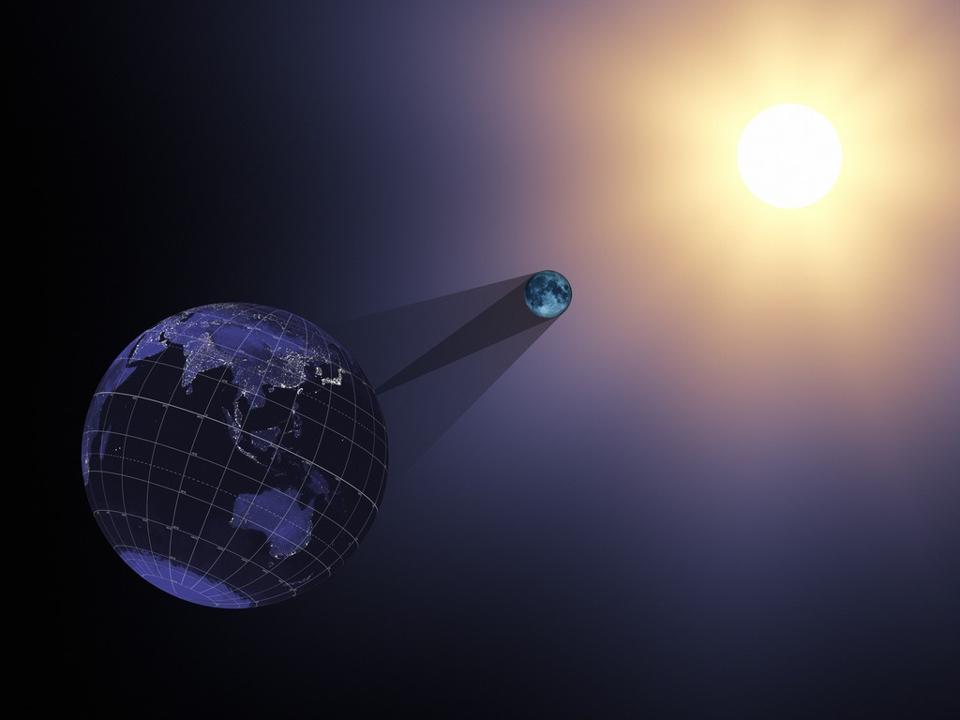
YOU CAN SEE THE MOON REFLECTION IN THE CLOUDS TO THE LEFT


‘Eclipse Season’ Is Over. The Next One Will Bring A 97% ‘Blood Moon’ And A Total Solar Eclipse

Jamie Carter
Senior Contributor
FORBES
Science
I inspire people to go stargazing, watch the Moon, enjoy the night sky

Discover the celestial mechanics behind eclipses and why they come in seasons.
NASA'S SCIENTIFIC VISUALIZATION STUDIO

Eclipse season is done. Thursday’s annular solar eclipse—mostly seen as a partial “bite” out of the Sun by the Moon, though to some as a “ring of fire”—was the second and final eclipse of the current season.

Wait. Eclipses come in seasons? Yes—and the next one beginning on November 19, 2021 is going to be way more spectacular than the one Earth just experienced.

Here’s everything you need to know—and the dates for your diary—of 2021’s second eclipse season, and the celestial mechanics behind these dramatic periods:
What is an ‘eclipse season’ and why do two eclipses follow each other?

Every 173 days an eclipse season begins. They last between 31 and 37 days and occur when the Moon is lined-up perfectly to intersect the ecliptic—the apparent path of the Sun through our daytime sky and the plane of Earth’s orbit of the Sun.

The Moon’s orbit of Earth is tilted by 5º to the ecliptic, so it must cross the ecliptic twice each month, but that tilt means it usually doesn’t align with the Sun and the Earth.

However, when it does align to cause a solar or lunar eclipse, it’s still precise enough a couple of weeks later to cause the other type of eclipse.


When is the next eclipse season?

2021’s second eclipse season begins with the full Moon of November 19, 2021 with a partial lunar eclipse that’s so nearly a total lunar eclipse. It will be visible in North America.

It will be followed on the next New Moon—December 4, 2021—with that most dramatic kind of eclipse of all, a total solar eclipse.


A full blood moon is see
n during a partial eclipse in Taipei on May 26, 2021 as stargazers across ... [+] AFP VIA GETTY IMAGES

What will the ‘Frosty Half-Blood Moon Eclipse’ look like?

November 19, 2021’s full Moon—known colloquially as the “Frosty Moon” is technically a partial lunar eclipse since the whole of the Moon won’t enter Earth’s shadow in space. But it will be so close! In fact, 97% will turn red as seen from North and South America, Australia and Asia.

Lunar eclipses can only occur at full Moon, when the Earth is between the Moon and the Sun.

Will it look at good as May’s “Super Flower Blood Moon,” which lasted for just 15 minutes? Probably not quite, but it’s going to be an awesome sight.


The diamond ring effect occurs with Baily's Beads at the end of totality during The Great American 

What will December’s total solar eclipse look like?

Occurring low in the sky above the floating icebergs of the Wedell Sea on December 4, 2021, this total solar eclipse in Antarctica won’t be witnessed by many, though over 20 cruise ships are planning to be in the area.

Solar eclipses can only occur at New Moon, when the Moon is between the Earth and the Sun.

They’ll feel the Moon’s shadow rush towards them and the temperature drop while the light plunges to twilight. With naked eyes in clear skies they’ll see the last ray of sunlight form a beautiful “diamond ring” around the Moon before the big reveal of the Sun’s delicate ice-white corona spraying into space.

Disclaimed: I am the editor of WhenIsTheNextEclipse.com

Wishing you clear skies and wide eyes.


Jamie Carter
I'm an experienced science, technology and travel journalist and stargazer writing about exploring the night sky, solar and lunar eclipses, moon-gazing, astro-travel, astronomy and space exploration. I'm the editor of WhenIsTheNextEclipse.com and the author of "A Stargazing Program for Beginners: A Pocket Field Guide" (Springer, 2015), as well as many eclipse-chasing guides.


Is The North Pole On Fire? Watch Last Week’s Eclipse Do Something No Other Will This Century

Jamie Carter
Senior Contributor
FORBES
Science
I inspire people to go stargazing, watch the Moon, enjoy the night sky
Jun 12, 2021


The Moon's shadow from yesterday's eclipse is easily visible on top of the Earth in this image from ... [+] NASA

If you glimpsed the solar eclipse last week you were witness to something really special—an eclipse that made the

In these incredible images from NASA’s EPIC satellite—taken during the solar eclipse on Thursday, June 10, 2021—it’s possible to see the Moon’s shadow as it passes across the Earth’s surface.


Although most of the world saw a partial solar eclipse, a narrow stretch of the surface experienced a “ring of fire” annular solar eclipse during which a dark shadow crossed from Canada to Russia.

This article’s main image, above, shows the shadow over the North Pole.

It was the only solar eclipse of the 21st century to do such a thing.

It was also the only one whose shadow across Earth first traveled north across Canada and Greenland, then south into Siberia.

Here’s another shot of Earth, taken minutes earlier by EPIC, of the start of the annular solar eclipse:


The Moon's shadow from yesterday's eclipse is visible on top left of the Earth in this image from ... [+] NASA

And another as the shadow moved into Siberia, eastern Russia:


The Moon's shadow from yesterday's eclipse is visible on top right of the Earth in this image from ... [+] NASA

The next solar eclipse (in the next “eclipse season”) is a total solar eclipse in Antarctica, whose shadow will get very close to—but not actually pass across—the South Pole.

That will occur on December 4, 2021

It will be see low in the sky above the floating icebergs of the Wedell Sea on December 4, 2021, with over 20 cruise ships planning to be in the area.

North America will see its next total solar eclipse in 2024.

Wishing you clear skies and wide eyes.


SPACE RACE 3.0


Venus Wins Stunning Third New Mission, This Time from Europe

EnVision will follow NASA’s DAVINCI+ and VERITAS


By Meghan Bartels, SPACE.com on June 12, 2021

An artist's depiction of Earth, Venus and ESA's EnVision spacecraft. 
Credit: European Space Agency, Paris Observatory and VR2Planets

Venus scientists have long complained that the planet wasn’t getting its due in robotic investigators. But those days are over: space agencies have announced three new missions to Earth’s mysterious twin in just over a week.

On June 2, NASA Administrator Bill Nelson announced that the agency would pursue two new Venus missions dubbed DAVINCI+ and VERITAS, aiming to launch the spacecraft between 2028 and 2030. Today (June 10), the European Space Agency (ESA) joined the rush to Venus, announcing that it would launch a mission dubbed EnVision to the planet in the early 2030s.

“A new era in the exploration of our closest, yet wildly different, Solar System neighbour awaits us,” Günther Hasinger, ESA’s director of science, said in a statement. “Together with the newly announced NASA-led Venus missions, we will have an extremely comprehensive science programme at this enigmatic planet well into the next decade.”

The mission was chosen over an astrophysics project called Theseus, which would have studied very distant gamma-ray bursts and other transient events, with the goal of understanding the life cycle of the very first stars, according to ESA.

The new mission won’t be Europe’s first visit to our neighboring world: ESA’s Venus Express spacecraft orbited the world from 2005 to 2014, studying the planet’s thick atmosphere, which is rich in carbon dioxide.

EnVision will also orbit Venus, but its instruments will be able to get a deeper look at the planet than those onboard Venus Express did. The spacecraft’s tools will include a sounder to investigate layers within the planet, spectrometers to analyze gases in Venus’ atmosphere and compounds on its surface, a radar instrument to map the planet’s surface, and a radio science experiment that will probe the planet’s structure and gravity field, according to ESA.

Although the project is led by ESA, the spacecraft’s radar instrument will come from NASA. “EnVision’s VenSAR will provide a unique perspective with its targeted studies of the Venus surface, enriching the roadmap of Venus exploration,” Adriana Ocampo, EnVision program scientist at NASA, said in a NASA statement.

Meanwhile, NASA’s VERITAS mission (short for Venus Emissivity, Radio Science, InSAR, Topography and Spectroscopy) will generate a global map of the topography of Venus. The data will be a vital upgrade compared to what we have from NASA’s Magellan mission, which used a much older version of the technology to map Venus between 1989 and 1994.

DAVINCI+ (Deep Atmosphere Venus Investigation of Noble Gases, Chemistry and Imaging) will be the only one of these new missions to venture through Venus’ atmosphere. The spacecraft includes a main orbiter plus a probe that will travel all the way down through the planet’s atmosphere to its surface, gathering measurements of how the atmosphere changes with depth.

EnVision will launch after the two NASA projects, with ESA officials evaluating Ariane 6 launch windows in 2031, 2032 and 2033. The spacecraft will then take 15 months to reach Venus and another 16 months to reach its final orbit.

Taken together, the three new missions will be a powerful tool for scientists looking to better understand how Earth and Venus started out so similar but became such different worlds, Tom Wagner, NASA’s Discovery Program scientist, said in the NASA statement.

“The combined results of EnVision and our Discovery missions will tell us how the forces of volcanism, tectonics and chemical weathering joined together to create and sustain Venus’ runaway hothouse climate.”

Copyright 2021 Space.com, a Future company. All rights reserved. This material may not be published, broadcast, rewritten or redistributed.

Meghan Bartels is a science journalist based in New York City.

SPACE
NASA Just Broke the 'Venus Curse': Here's What It Took

June 2, 2021 — Robin George Andrews


SPACE
NASA Picks Two Missions to Explore Venus, the First in Decades

June 3, 2021 — Robin George Andrews

 Quirks & Quarks·Analysis

Europe and NASA to send three new spacecraft to Venus

Three missions will be heading to our nearest neighbour to study its atmosphere and geology

The European Space Agency's EnVision mission and NASA's VERITAS and DAVINCI+ missions will explore Venus' geology and atmosphere. (NASA/JAXA/ISAS/DARTS/Damia Bouic/VR2Planets)

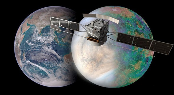
The European Space Agency has announced it will be launching its own mission to Venus that will join two American spacecraft announced earlier this month, to explore our sister planet. It is part of a broad effort to solve the mystery of why a world so much like ours turned out so differently.

The European mission, called EnVision, will orbit Venus and probe the surface with radar, looking for signs of volcanic activity both past and present. Volcanoes are believed to be the source of a planet's atmosphere and the atmosphere of Venus is incredibly different from ours and that of Mars.  

If you have felt the intense heat when you open the door of an oven that has been baking at 200 C, that would be considered a cold day on Venus. The temperature on the surface is more than twice that, an unimaginable 464 C — higher than the melting point of lead.

This image made available by NASA shows Venus with data from the Magellan spacecraft and Pioneer Venus Orbiter. On Wednesday, June 2, 2021, NASA’s new administrator, Bill Nelson, announced two new robotic missions to the solar system's hottest planet, during his first major address to employees. (NASA/JPL-Caltech/The Associated Press)

Any spacecraft we send there has little chance of surviving for long. The only craft to land on Venus were the Russian Venera series. In fact, Venera 3 was the first spacecraft to touch another planet in 1966. However, it was a crash landing, as the spacecraft failed in the atmosphere. 

Several following missions were lost due to the harsh conditions, and even those that landed successfully didn't last for long. Venera 9 operated for a full 53 minutes, but in that time was able to successfully send back the first image of Venus's surface. The Venera 13 mission survived for just a bit over two hours. In 1978, the U.S. sent its Pioneer Venus missions, and while one of the atmospheric probes survived to reach the surface, it succumbed after 45 minutes.

This panorama image, taken by the Venera 13 spacecraft on March 1, 1982, is one of the few images ever taken on the surface of Venus, Earth's nearest neighbour. The planet's thick clouds make its surface impossible for an orbiter to see. (NASA History Office)

Given the conditions, it's highly unlikely a human will ever set foot on Venus.

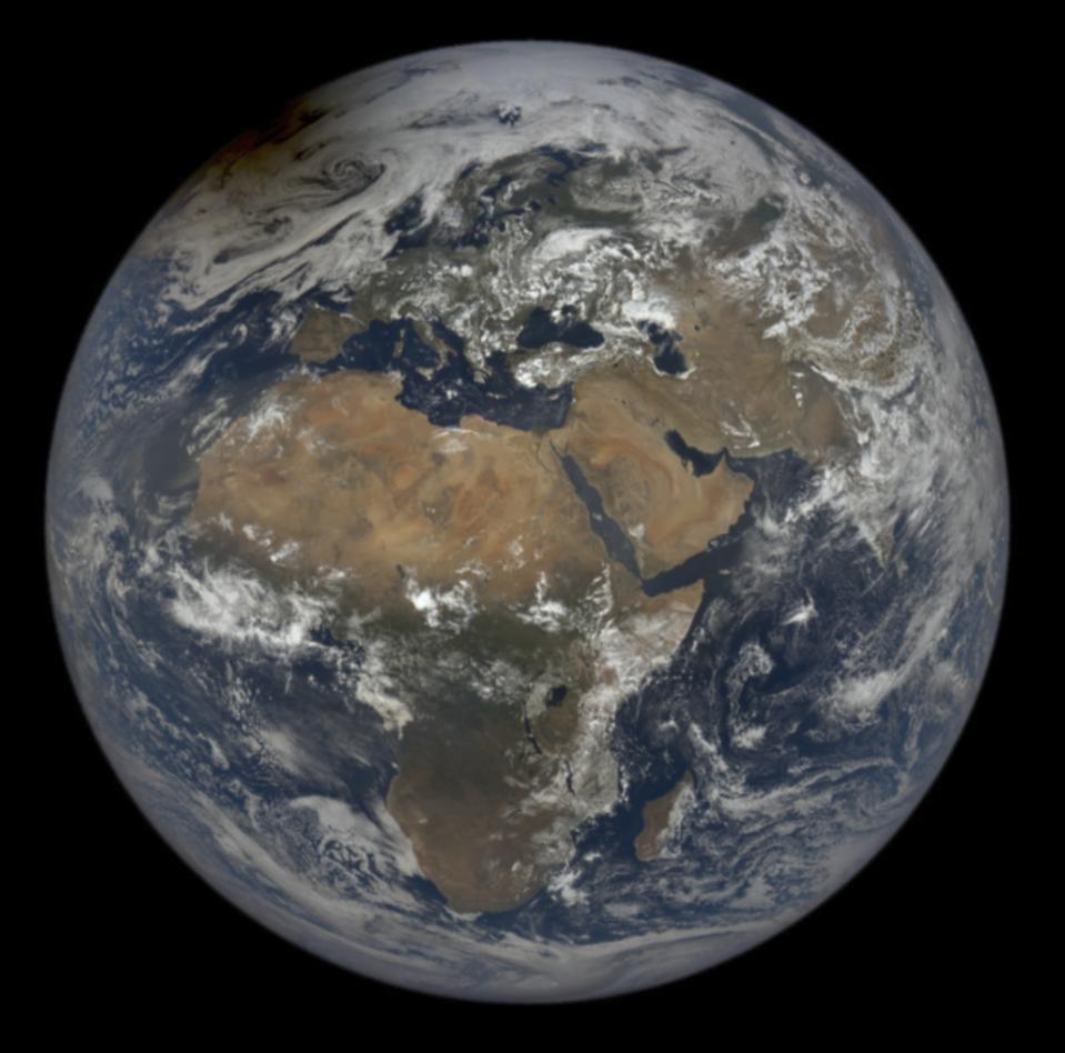
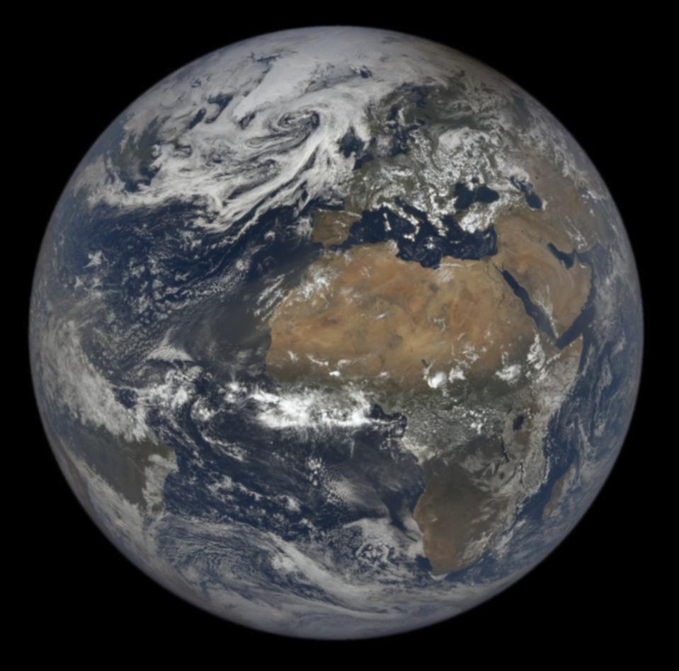
We have three planets in our solar system, Venus, Earth and Mars, all made of similar rocky materials, all within the habitable zone of the sun, but with three very different environments. One is a super-hot runaway greenhouse, enshrouded in a dense carbon dioxide atmosphere. One is in a permanent ice age with frigid temperatures under an extremely thin carbon dioxide atmosphere, and the other, right in the middle, is just right with nitrogen and oxygen air to breathe and live in.

The intriguing part of this mystery of why the planets are so different is the fact that at one time in the distant past, they were much more alike. There is evidence that billions of years ago Venus was cooler with liquid water on its surface and we're pretty sure that Mars was warmer and wetter as well. That means there could have been a time long, long ago when there were three blue planets.

This radar map from the Magellan spacecraft's visit to Venus in 1990 shows a Venusian mountain and lava fields. Conditions on the planet are incredibly hostile today, but a billion years ago might have been quite pleasant. (NASA)

The reason we explore other planets is to better understand our own. Venus and Mars changed from conditions that might have supported life to dramatically different environments and have remained that way ever since. The Earth on the other hand, is in a constant state of change, with ice ages and warm periods battling for dominance over geological time. 

It's clear that planets are capable of dramatic global transformations. In the past, those changes have been the result of volcanic activity, impact of objects from space or the movement of continents. Now we humans are affecting the climate on a global scale in a very short time, pushing a system that has the ability to transform profoundly. Nobody is suggesting that the Earth is in danger of turning into something like Venus or Mars. But they are a vivid illustration of what can happen to a planet when its climate goes awry.

ABOUT THE AUTHOR

Bob McDonald is the host of CBC Radio's award-winning weekly science program, Quirks & Quarks. He is also a science commentator for CBC News Network and CBC-TV's The National. He has received 12 honorary degrees and is an Officer of the Order of Canada


THE OIL PATCH LOVES BLUE HYDROGEN
Varcoe: A 'watershed event' as energy sector moves on net-zero action, hydrogen complex in Alberta

It’s important that Alberta and the industry make progress as the country has committed to net-zero emissions by 2050

Author of the article: Chris Varcoe • Calgary Herald
Publishing date: Jun 10, 2021 • 3 days ago • 

MEG CEO Derek Evans, photographed in 2015. 
PHOTO BY POSTMEDIA ARCHIVES

Is hydrogen the key to unlocking the climate aspirations of one of the world’s top oil and gas producing countries — and can the lion’s share of Canada’s oilsands production really get to net-zero emissions within three decades?

If Canadians want to see how serious the push is to reach the net-zero mark by 2050 and decarbonize the energy industry, two announcements on Wednesday provided some tangible evidence.

Pennsylvania-based Air Products, which operates in 50 countries and has a market capitalization of US$65 billion, announced it has plans to build a $1.3-billion net-zero hydrogen production and liquefaction complex in northeast Edmonton.

The company’s Alberta operations would produce more than 1,500 tonnes of hydrogen per day and, if built, the hub is expected to begin operating in 2024.


In a separate announcement, five major Canadian oilsands producers have formed a new alliance, pledging to work together to reach net-zero emissions from their operations by 2050.


AND LET'S NOT FORGET THE PROVINCIALLY FUNDED HEARTLAND REFINERY TO MAKE NATURAL GAS FOR BLUE HYDROGEN, AND PLASTICS IN FORT SASKATCHEWAN


It’s a commitment to collaborate by an oilsands industry that has faced relentless criticism over its greenhouse gas emissions for more than a decade.

“This is a watershed event,” said Derek Evans, CEO of oilsands producer MEG Energy, one of the five group members.

“I am going to be going home tonight and be able to look my kids in the eye and say, finally, we have turned the dial on this. We are going to make this thing happen.”

Those are bold proclamations.

New technology will need to be deployed, investments will be required for carbon capture utilization and storage (CCUS) projects and other net-zero initiatives.

Yet, if Canada’s oil and gas industry — and the thousands of people who work in it — can solve this conundrum, it provides an opportunity to produce petroleum in a decarbonized world that will still need such resources for decades to come.

It is significant but at the same time, it’s also inevitable. The world is changing,” said Simon Dyer, deputy executive director of the Pembina Institute.

“Climate risk is an existential risk to these companies. So it represents, finally, an acknowledgment that Canadian oil and gas is going to compete on price and carbon intensity.”

The new alliance includes industry heavyweights Suncor Energy, Canadian Natural Resources, Cenovus Energy, MEG and Imperial Oil, (EXXON,ESSO) the only member that hasn’t officially set a corporate objective to hit net-zero by 2050.

Together, they represent about 90 per cent of total oilsands output and generate about 68 megatonnes of emissions annually.

Their collective plan is to lower overall emissions by about 22 megatonnes by 2030 and cut another 25 megatonnes a decade later, before reaching net-zero status.

One of the group’s initial ideas is a proposed CO2 trunk line that would connect oilsands operations near Fort McMurray to a carbon sequestration hub in the Cold Lake area.

An aerial view Suncor’s Millennium Mine oilsands operation north of Fort McMurray, Alta. 
PHOTO BY RYAN JACKSON / POSTMEDIA

Evans hopes to see significant involvement by governments on the “enabling infrastructure,” although the group hasn’t made a specific financial request.

“Over the next 30 years, we think it will cost about $2.5 billion a year to get this up and running and achieve that emissions reduction target of 68 million tonnes. It’s not going to happen all at once,” he added.

Other ideas the alliance will examine include the use of clean hydrogen, CCUS projects, more electrification, as well as pivoting into evolving areas such as using small modular  
NUCLEAR reactors and direct-air capture initiatives.

The stakes are high.


“The producers with the most technically advanced teams will lead the energy transition over the next several decades,” analyst Travis Wood with National Bank of Canada said in a report.

“We see this announcement as a win for the energy sector.”

It’s important that Alberta and the industry make progress as the country has committed to net-zero emissions by 2050.

The entire oil and gas sector made up 26 per cent of Canada’s total emissions output in 2019, and overall industry emissions have risen since 2005 as oilsands production has increased.

Premier Jason Kenney noted the oilsands has lowered its emissions per barrel by about 30 per cent since 2000, although reductions to overall industry levels — and then getting to net-zero — will require a herculean effort and multiple steps.

“It is audacious and, let’s be honest, there is no easy path to achieving that goal,” Kenney told reporters.

“The application of technology is the solution.”

The hydrogen facility announced by Air Products, which is already operating in Alberta, is particularly significant.


The development has approval from the company’s board, contingent on finalizing agreements with the federal government.

Alberta’s TIER system fund will provide $15 million toward the complex; the project may also be eligible for money through the province’s new petrochemical incentive program.


The company says the project will create about 2,500 construction and engineering jobs.

Premier Jason Kenney announced, in Edmonton on Tuesday, Oct. 6, 2020, a strategy to grow and expand the natural gas sector. PHOTO BY CHRIS SCHWARZ /Government of Alberta

The Alberta facility will capture more than 95 per cent of carbon dioxide emitted from natural gas that’s used to create so-called “blue hydrogen” and inject them deep underground. Hydrogen-fuelled power will offset the remainder, while excess electricity will be exported into the provincial grid.

The project will also produce liquid hydrogen, which can be used for industrial purposes and in the transportation sector.


The era of oilsands megaprojects has waned, but these are the kinds of massive capital investments the energy sector will be making in the future, just as Suncor Energy is building a new $1.4-billion cogeneration project at its oilsands base plant.

Canada has the natural resources to capitalize on the low-carbon opportunities ahead, but it will need to attract investment.

Companies will require certainty from policy-makers to do that.

“These are 10-, 20-, 30-year projects and we can’t in the middle change our mind and . . . move it to somewhere else,” said Air Products CEO Seifi Ghasemi.

The news came the same day TC Energy and the provincial government officially terminated the Keystone XL project

KENNEY AND UCP INVESTED Alberta taxpayers invested $1.3 billion in the pipeline
WITHOUT OUR PERMISSION — after U.S. President Joe Biden revoked its cross-border permits, underscoring the opposition the industry faces today.

Wednesday’s twin announcements represent the flip side to the debate, an opportunity for an energy sector that is trying to map out its future in a net-zero world.

“To me, this is the difference between playing defence and offence,” concluded Evans.

“We are actually going out there to do things, as opposed to defending the status quo.”

Chris Varcoe is a Calgary Herald columnist.


NATURAL GAS IS A FOSSIL FUEL


New hydrogen supply chain model to accelerate shift away from fossil fuels

By George Heyneson Jun 09, 2021

Researchers at the Massachusetts Institute of Technology (MIT) have released a study on a new hydrogen supply chain that is expected to speed up the transition from fossil fuels to hydrogen.

Shifting the economy away from fossil fuels requires significant adjustments in current supply chains, to counteract this an MIT-led team has developed a new hydrogen supply chain planning model.

As mentioned by Guannan He, a postdoc at the MIT Energy Initiative (MITEI), “We propose flexible scheduling for trucks and pipelines, allowing them to serve as both storage and transmission.

“This is very important to green hydrogen produced from intermittent renewables, because this can provide extra flexibility to meet variability in supply and demand.”

Storage plays a crucial role in the new supply chain model with the trucks used as both a means of fuel transmission and storage since hydrogen can be stored in idled trucks.

This tactic reduces costs in the hydrogen supply chain by about 9% by bringing down the need for other storage solutions.

Read more: GET H2 consortium to launch a complete hydrogen supply chain

The researchers adopted the idea of a central planner interested in minimising system costs and maximising the societal benefit of the hydrogen supply chain.

To achieve this, the researchers looked at the costs associated with the four main steps in the hydrogen supply chain: production, storage, compression and transmission.

The group also included a wide range of hydrogen-related technologies, including SMR with and without carbon capture and storage, hydrogen transport as a gas or liquid and transmission via pipeline and trucks.

The study found that pipelines were less flexible than trucks for transmission and that hydrogen gas is less expensive than trucking hydrogen in liquid form, since liquefaction has much higher energy consumption and capital costs than gas compression.

The team also proposes a flexible scheduling and routing model for hydrogen trucks that would help enable the vehicles to be used as both transmission and storage.

Read more: Consortium to develop hydrogen supply chain between Australia and Japan

After this, the model supply chain was then tested by exploring the future hydrogen infrastructure needs of the US Northeast under various carbon policy and hydrogen demand scenarios.

Annual operations were simulated using 20 representative weeks from seven years of data, this helped to determine the optimal mix of hydrogen infrastructure types given different carbon prices and the capital costs of electrolysers.

Emre Gençer, MITEI research scientist, said, “We showed that steam methane reforming of natural gas with carbon capture will constitute a significant fraction of hydrogen production and production capacity even under very high carbon price scenarios.”

The results indicate that there is real synergy between the use of electrolysis for hydrogen generation and the use of compressed-gas trucks for transmission and storage.

Now that the hydrogen supply chain planning model has been created it is believed that the next step is to provide planners with broad access to the tool.

You can read the study here.

Greening up the global supply chain: Hydrogen-powered, low carbon shipping is on the horizon


The shipping industry is in the spotlight – facing environmental mandates that require a whole new way of thinking about ship propulsion. Incremental goals such as cleaner diesel are a start, but the reality is much more significant.

Monumental shifts are on the horizon, poised to drive new kinds of engines, cleaner fuels such as hydrogen, and modernised ships that reflect a greater level of environmental responsibility. Hydrogen generation on-vessel, on-demand unlocks it all. Guided by mandates from the International Maritime Organisation (IMO), a UN body, shipbuilders are tasked with reducing carbon emissions by 40% by 2030 and by at least 50% by 2050. (Note that using a 2008 baseline, the 2050 goal reduces carbon intensity overall by 70 percent.)

Want to continue reading? Click here.


HYDROGEN NEWS
Scientists hail golden age to trace bird migration with tech

Scientists hail golden age to trace bird migration with tech
GPS trackers have been used on larger raptors, but the technology has only recently become small, light enough for some songbirds


Avian ecologist and Georgetown University Ph.D. student Emily Williams measures the beak of an American robin as she gathers data to possibly fit the bird with an Argos satellite tag, Saturday, April 24, 2021, in Silver Spring, Md. The American robin is an iconic songbird in North America, its bright chirp a harbinger of spring. Yet its migratory habits remain a bit mysterious to scientists. (AP)


By AP
LAST UPDATED 11.06.2021

A plump robin wearing a tiny metal backpack with an antenna hops around a suburban yard in Takoma Park, then plucks a cicada from the ground for a snack.

Ecologist Emily Williams watches through binoculars from behind a bush. On this clear spring day, she’s snooping on his dating life. “Now I’m watching to see whether he’s found a mate,” she said, scrutinizing his interactions with another robin in a nearby tree.

Once the bird moves on at season's end, she’ll rely on the backpack to beam frequent location data to the Argos satellite, then back to Williams' laptop, to track it.

The goal is to unravel why some American robins migrate long distances, but others do not. With more precise information about nesting success and conditions in breeding and wintering grounds, “we should be able to tell the relative roles of genetics versus the environment in shaping why birds migrate,” said Williams, who is based at Georgetown University.

Also read: Drones come to the rescue of wildlife species

Putting beacons on birds is not novel. But a new antenna on the International Space Station and receptors on the Argos satellite, plus the shrinking size of tracking chips and batteries, are allowing scientists to remotely monitor songbird movements in much greater detail than ever before.

“We’re in a sort of golden age for bird research,” said Adriaan Dokter, an ecologist at Cornell University who is not directly involved with Williams’ study. “It’s pretty amazing that we can satellite-track a robin with smaller and smaller chips. Ten years ago, that was unthinkable.”


An antenna from an Argos satellite tag extends past the tail feathers of an American robin as it darts around a front lawn in Cheverly, Md., Sunday, May 9, 2021. (AP)

The device this robin is wearing can give precise locations, within about 30 feet (about 10 meters), instead of around 125 miles (200 kilometers) for previous generations of tags.

That means Williams can tell not only whether the bird is still in the city, but on which street or backyard. Or whether it’s flown from the Washington, D.C., suburbs to land on the White House lawn.

A second new tag, for only the heaviest robins, includes an accelerometer to provide information about the bird’s movements; future versions may also measure humidity and barometric pressure. These Icarus tags work with a new antenna on the International Space Station.

That antenna was first turned on about two years ago, “but there were some glitches with the power-supply and the computer, so we had to bring it down again with a Russian rocket, then transport it from Moscow to Germany to fix it,” said Martin Wikelski, director of the Max Planck Institute of Animal Behavior, whose scientific team is honing the technology. After “the usual troubleshooting for space science," the antenna was turned back on this spring.

As researchers deploy precision tags, Wikelski envisions the development of “an ‘Internet of animals’ — a collection of sensors around the world giving us a better picture of the movement of life on the planet.”


Avian ecologist and Georgetown University Ph.D. student Emily Williams fits an Argos satellite tag to an American robin, like a backpack, Saturday, April 24, 2021, in Silver Spring, Md. (AP)

The American robin is an iconic songbird in North America, its bright chirp a harbinger of spring. Yet its migratory habits remain a bit mysterious to scientists.

“It’s astounding how little we know about some of the most common songbirds,” said Ken Rosenberg, a conservation scientist at Cornell University. “We have a general idea of migration, a range map, but that’s really just a broad impression.”

An earlier study Williams worked on showed some robins are long-distance migrants — flying more than 2,780 miles (4,480 km) between their breeding area in Alaska and winter grounds in Texas — while others hop around a single backyard most of the year.

What factors drive some robins to migrate, while others don’t? Does it have to do with available food, temperature fluctuations or success in mating and rearing chicks?

Williams hopes more detailed data from satellite tags, combined with records of nesting success, will provide insights, and she's working with partners who are tagging robins in Alaska, Indiana and Florida for a three-year study.

Scientists have previously put GPS-tracking devices on larger raptors, but the technology has only recently become small and light enough for some songbirds. Tracking devices must be less than 5% of the animal’s weight to avoid encumbering them

Also read: Indian skimmer: Keeping the count for an iconic bird species

In a Silver Spring, Maryland, yard, Williams has unfurled nylon nets between tall aluminum poles. When a robin flies into the net, she delicately untangles the bird. Then she holds it in a “bander's grip" — with her forefinger and middle finger loosely on either side of the bird’s neck, and another two fingers around its body.

On a tarp, she measures the robin’s beak length, takes a toenail clipping and plucks a tail feather to gauge overall health.

Then she weighs the bird in a small cup on a scale. This one is about 80 grams, just over the threshold for wearing the penny-sized Argos satellite tag.

Williams fashions a makeshift saddle with clear jewelry cord looped around each of the bird’s legs. She then tightens the cord so the tag sits firmly on the bird’s back.

When she opens her hand, the robin hops to the ground, then takes a few steps under a pink azalea shrub before flying off.

Avian ecologist and Georgetown University Ph.D. student Emily Williams releases an American robin, too light to be fitted with an Argos satellite tag, after gathering samples and data and applying bands. (AP)

In addition to providing very precise locations, the satellite tags transmit data that can be downloaded from afar onto Williams’ laptop. The data on older tags couldn’t be retrieved unless the same bird was recaptured the following year — a difficult and uncertain task.

Wilkeski hopes the new technology will help scientists better understand threats birds and other creatures face from habitat loss, pollution and climate change.

“It is detective work to try to figure out why a population is declining,” said Ben Freeman, a biologist at the Biodiversity Research Centre at the University of British Columbia. Better information about migration corridors “will help us look in the right places.”

A 2019 study co-written by Cornell’s Rosenberg showed that North America’s population of wild birds declined by nearly 30%, or 3 billion, since 1970.

He said tracking birds will help explain why: “Where in their annual cycles do migratory birds face the greatest threats? Is it exposure to pesticides in Mexico, the clearing of rainforests in Brazil, or is it what people are doing in their backyards here in the U.S.?”

Queqiao: The bridge between Earth and the far side of the moon

by Space: Science & Technology
The far side of the Moon always faces away from the Earth, making communications from lunar equipment there much more challenging. Fortunately, relay communication satellites can act as a bridge or stepping stone between transmission from the far side towards Earth ground stations. Credit: Space: Science & Technology

China's Chang'e-4 probe marked the first soft-landing of a spacecraft on the far side of the Moon, which always faces away from Earth. To communicate with ground stations, Chang'e-4 relies on Queqiao, a relay communication satellite that orbits a point behind the Moon and bridges Earth and Chang'e-4. In a recent review, researchers explain the design of Queqiao and depict the future of lunar relay communication systems.

Because of a phenomenon called gravitational locking, the Moon always faces the Earth from the same side. This proved useful in the early lunar landing missions in the 20th century, as there was always a direct line of sight for uninterrupted radiocommunications between Earth ground stations and equipment on the Moon. However, gravitational locking makes exploring the hidden face of the moon—the far side—much more challenging, because signals cannot be sent directly across the Moon towards Earth.

Still, in January 2019, China's lunar probe Chang'e-4 marked the first time a spacecraft landed on the far side of the Moon. Both the lander and the lunar rover it carried have been gathering and sending back images and data from previously unexplored areas. But how does Chang'e-4 probe communicate with the Earth? The answer is Queqiao, a relay communications satellite, explains Dr. Lihua Zhang from DFH Satellite Co., Ltd., China.

As explained by Dr. Zhang in a review paper recently published in Space: Science & Technology, Queqiao is an unprecedented satellite designed specifically for one purpose: To act as a bridge between Chang'e-4 probe and the Earth. Queqiao was launched in 2018 and put into orbit around a point "behind" the Moon. This point is known as the Earth-Moon Libration point 2, where a special case of gravitational balance allows Queqiao to maintain an orbit such that it has almost constant direct line of sight with both the far side of the Moon and the Earth. Getting the satellite into this peculiar orbit required careful planning and maintenance management, and the success of this operation set a precedent for future attempts at putting satellites in orbit around other Earth-Moon libration points.

From its stable place in space, Queqiao helped guide the soft-landing and surface operations of the Chang'e-4 probe and has been our intermediary with it ever since. The satellite is equipped with two different kinds of antennas: A parabolic antenna and several spiral antennas. The former, which has a large diameter of 4.2 m, was designed to send and receive signals on the X band (7-8GHz) to and from the rover and lander on the surface of the Moon. Its large size is related to the expected noise levels and the low intensity of the transmissions that are sent by surface equipment.


ZHU RONG


On the other hand, the spiral antennas operate on the S band (2-4 GHz) and communicate with Earth ground stations, forwarding commands to the lunar surface equipment and exchanging telemetry and tracking data. Most notably, all these different links can transmit and receive simultaneously, making Queqiao highly versatile. The review paper addresses other important design considerations for Queqiao and future relay satellites, such as the use of regenerative forwarding, the various link data rates involved, and data storage systems for when no Earth ground station is accessible.

Over two years of exploration, a great amount of data has been received from the rover and lander through Queqiao. "Scientists in both China and other countries have conducted analysis and research based on the retrieved data, and they have produced valuable scientific results. The longer the operational life of Queqiao, the more scientific outcomes will be achieved," remarks Dr. Zhang. Based on current predictions, Queqiao should be operable on mission orbit for at least five years.

Dr. Zhang also addressed the prospects for future lunar missions and how relay communication systems should evolve to support them. Many unexplored areas on the Moon, such as the largest crater at the South Pole, call for multiple relay satellites to maintain constant communication links, which poses an expensive and time-consuming challenge. But what if relay satellites were suitable for more than a single mission? "A sustainable communication and navigation infrastructure should be established to benefit all lunar missions rather than dealing with each mission independently," comments Dr. Zhang. "This infrastructure should adopt an open and extensible architecture and provide flexible, interoperable, cross-supportable, and compatible communications services, which are critical to the success of future lunar explorations." It's likely that future endeavors on the far side of the Moon will be a test of how well we can cooperate to unveil the secrets of our natural satellite.


Explore further China satellite heralds first mission to far side of Moon
More information: Lihua Zhang, Development and Prospect of Chinese Lunar Relay Communication Satellite, Space: Science & Technology (2021). DOI: 10.34133/2021/3471608
This 2021 Solar Eclipse Timelapse Was Made from 50,000 Photos
JUN 11, 2021

MICHAEL BONOCORE


In the morning hours of June 10th, a “ring of fire” solar eclipse greeted sky observers in the northeast United States, northern Canada, Europe, northern Asia, Russia and Greenland. While most photographers captured single photos of the eclipse, Göran Strand decided to show the entirety of the rare eclipse from his backyard in Östersund, Sweden.


Using 50,000 still images that equaled over 250 gigabytes of data, Strand was able to show the two and a half hour eclipse in just 10 seconds. While most people will only see photos of the peak “ring of fire,” Strand’s resulting timelapse is an incredibly smooth depiction of how the moon moved in front of the sun.

This kind of ring-shaped event occurs when the moon is close to its farthest point from Earth during an eclipse, making the moon appear smaller than the sun in the sky, which doesn’t block the whole solar disk.


To add to the remarkable achievement of capturing the movement of the eclipse itself, Strand also captured all of the solar prominences. A solar prominence is a large, bright feature extending outward from the Sun’s surface. Strand also shows a close-up of the largest prominence with a scaled earth graphic beside it. With this remarkable graphic, it’s easy to see how roughly one million Earths could fit inside the massive star.


With so many frames captured, Strand told PetaPixel about how he went about editing the solar eclipse timelapse.

“To capture the timelapse, I took a series of 200 frames every 30 seconds for 2.5 hours,” he explains. “From each 200-frame clip, I stacked, aligned, and calibrated the best 50 frames. In total, I ended up with 250 calibrated still images that I then did further processing with. First, I aligned all of the 250 images, sharpened the details, and then extracted the data that showed all the prominences. Then I had my finished images for the timelapse.”

As eclipses and other notable astro events occur rarely, less than ideal weather is always a challenge for those photographers hoping to catch the action.

“I’ve been doing astrophotography for over 25 years now and one thing I’ve learned is to accept bad weather and the frustration it usually brings during events like this,” Stand says. “On this day, the weather forecast was quite good but clouds were forecasted for later in the day. When it was just 10-15 minutes left of the eclipse, some clouds were moving in but they stayed clear of the Sun, so I’m really glad that I got a perfect eclipse this time.

“Eclipses like these are so exciting to follow. Even though I’ve seen three total solar eclipses, events like these always gives me some goosebumps when you realize you’re actually capturing it.”


With over a quarter-century of experience, it is obvious that Strand is an experienced astrophotographer. For those who wish to follow in his footsteps, he gives his advice to newcomers.

“If you would like to get started with celestial photography I would recommend going slow. Don’t rush out and buy a big, expensive telescope and go planet-hunting. Planet photography is really hard and takes several years to master. Start with your telephoto lenses and capture photos of the moon that you then stack together to get even more detail,” he says.

“This is a technique called Lucky Imaging and is a great way to get sharp images of planets as well as the Sun and the Moon even through very turbulent air. When you have your images, it is time to practice editing them. AutoStakkert! is my favorite software for stacking images of celestial bodies. Above all, have fun and take a moment to realize how small we are in the grand scheme of space.”

Image credits: Photos by Göran Strand and used with permission.


Prehistoric cannibal victim found in death cave ID'ed as a young girl

The individual was formerly known as "The Boy of Gran Dolina."

A reconstruction of the Homo antecessor H3, now known as the "Girl of Gran Dolina." (Image credit: Tom Björklund)

About 800,000 years ago in what is now Spain, cannibals devoured an early human child who became known as "The Boy of Gran Dolina." But new analysis of these ancient remains has revealed a surprising twist: the child was a girl.

The child was a Homo antecessor, an early hominin species that lived in Europe between 1.2 million and 800,000 years ago. Discovered in 1994 in the Gran Dolina cave in northern Spain's Atapuerca Mountains, the species is known primarily from fragments of bones and teeth, which hampered researchers' efforts to determine the sex of H. antecessor individuals.

Recently, scientists tested a new technique, using a type of dental analysis that had successfully identified males and females in other early human species. They examined teeth from two Gran Dolina individuals: "H1" and "H3". H1, whose remains defined the H. antecessor species, was about 13 years old at the time of death and was long presumed to be male. The second individual, H3 — The Boy of Gran Dolina — died at the age of 11 years old and was also thought to be male.

Microscopic analysis of the tooth structure for the new study revealed variations between H1's and H3's teeth that researchers identified as sexually dimorphic — differing in appearance between males and females. Based on comparisons with teeth from humans and other hominins, the scientists determined that H1 was male, but H3 was likely female.

Certain skeletal features, such as pelvis shape, size of the brow ridge and robustness of bone where muscles attach, can reveal clues about the sex of extinct human relatives. But these features only indicate the sex of adult skeletons, and about 75% of the Gran Dolina remains belong to pre-adolescent children. What's more, those cave skeletons were highly fragmented, likely because they were cannibalized.

Teeth, however, are often well-preserved in ancient archaeological sites. Other researchers had previously analyzed canine teeth to determine sex in humans (with an accuracy up to 92.3%) in populations of Neanderthals from a site in Krapina, Croatia, and in earlier hominins from Spain's Sima de los Huesos ("Pit of Bones") site in Atapuerca.

Tooth crowns are fully formed by age 6, and since older children typically have at least some of their adult teeth, analysis of dental features "can be especially useful in paleoanthropology for estimating the sex of immature individuals," and could be applied to the children's remains from Gran Dolina, the scientists reported March 10 in the Journal of Anthropological Sciences.


Permanent canines of individuals from Gran Dolina. The upper row shows the maxilla of individual H3, while the lower row shows views of the left maxillary canine belonging to individual H1. (Image credit: García-Campos C, Martinén-Torres M, Modesto-Mata M, Martín-Francés L, Martínez de Pinillos M, Bermúdez de Castro JM./J Anthropol Sci. 2021 Mar 10;99.)

The whole tooth

For the new study, the researchers looked at upper canines — the most sexually dimorphic teeth — from H1 and H3. Using high-resolution X-ray scans, they measured tissue volume and surface area of the two teeth, and compared them with existing tooth scans from modern humans, remains from the Krapina site and from Atapuerca's "Pit of Bones."

The study authors discovered that the canine from H3 had more surface enamel than H1's canine, a feature associated with female teeth. By comparison, the canine from H1 had a higher crown with more dentin, the dense, bony tissue underneath the enamel; higher dentin content is a feature of male teeth, the scientists reported. Because H1's canines were also unusually large, experts had previously guessed that the individual was male, and the new analysis confirmed that hypothesis. However, the differences between the H1 and H3 canines matched sexually dimorphic variations in other human teeth, suggesting that H3 was female.

"'The Boy of Gran Dolina' would really have been 'The Girl of Gran Dolina,'" lead study author Cecilia García-Campos, a physical anthropologist at CENIEH, said in the statement.

RELATED CONTENT

In Photos: Hominin Skulls with Mixed Traits Discovered

Photos: Newfound Ancient Human Relative Discovered in Philippines

Image Gallery: A Real-Life Hobbit (Homo Floresiensis)

The girl would have been between 9 and 11 years old when she was killed and eaten, according to the study. And she wasn't the only victim; the remains from 22 H. antecessor individuals in Gran Dolina displayed signs of being cannibalized, with bones showing cuts, fractures where they had been cracked open to expose the marrow, and even tooth marks, Live Science previously reported.

One possible explanation for this ancient cannibalism is that humans were easier to catch and more nutritious than other animals, researchers wrote in 2019 in the Journal of Human Evolution. Compared with other types of prey, "a lot of food could be obtained from humans at low cost," CENIEH researcher Jesús Rodríguez, lead author of the 2019 study, said in a statement that year.


Originally published on Live Science.