Sunday, June 13, 2021

THE OIL PATCH LOVES BLUE HYDROGEN
Varcoe: A 'watershed event' as energy sector moves on net-zero action, hydrogen complex in Alberta

It’s important that Alberta and the industry make progress as the country has committed to net-zero emissions by 2050

Author of the article: Chris Varcoe • Calgary Herald
Publishing date: Jun 10, 2021 • 3 days ago • 

MEG CEO Derek Evans, photographed in 2015. 
PHOTO BY POSTMEDIA ARCHIVES

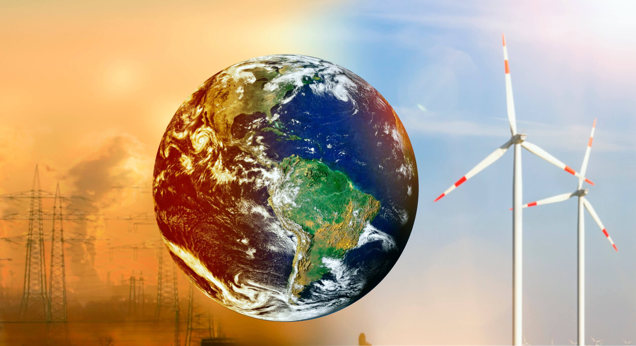
Is hydrogen the key to unlocking the climate aspirations of one of the world’s top oil and gas producing countries — and can the lion’s share of Canada’s oilsands production really get to net-zero emissions within three decades?

If Canadians want to see how serious the push is to reach the net-zero mark by 2050 and decarbonize the energy industry, two announcements on Wednesday provided some tangible evidence.

Pennsylvania-based Air Products, which operates in 50 countries and has a market capitalization of US$65 billion, announced it has plans to build a $1.3-billion net-zero hydrogen production and liquefaction complex in northeast Edmonton.

The company’s Alberta operations would produce more than 1,500 tonnes of hydrogen per day and, if built, the hub is expected to begin operating in 2024.


In a separate announcement, five major Canadian oilsands producers have formed a new alliance, pledging to work together to reach net-zero emissions from their operations by 2050.


AND LET'S NOT FORGET THE PROVINCIALLY FUNDED HEARTLAND REFINERY TO MAKE NATURAL GAS FOR BLUE HYDROGEN, AND PLASTICS IN FORT SASKATCHEWAN


It’s a commitment to collaborate by an oilsands industry that has faced relentless criticism over its greenhouse gas emissions for more than a decade.

“This is a watershed event,” said Derek Evans, CEO of oilsands producer MEG Energy, one of the five group members.

“I am going to be going home tonight and be able to look my kids in the eye and say, finally, we have turned the dial on this. We are going to make this thing happen.”

Those are bold proclamations.

New technology will need to be deployed, investments will be required for carbon capture utilization and storage (CCUS) projects and other net-zero initiatives.

Yet, if Canada’s oil and gas industry — and the thousands of people who work in it — can solve this conundrum, it provides an opportunity to produce petroleum in a decarbonized world that will still need such resources for decades to come.

It is significant but at the same time, it’s also inevitable. The world is changing,” said Simon Dyer, deputy executive director of the Pembina Institute.

“Climate risk is an existential risk to these companies. So it represents, finally, an acknowledgment that Canadian oil and gas is going to compete on price and carbon intensity.”

The new alliance includes industry heavyweights Suncor Energy, Canadian Natural Resources, Cenovus Energy, MEG and Imperial Oil, (EXXON,ESSO) the only member that hasn’t officially set a corporate objective to hit net-zero by 2050.

Together, they represent about 90 per cent of total oilsands output and generate about 68 megatonnes of emissions annually.

Their collective plan is to lower overall emissions by about 22 megatonnes by 2030 and cut another 25 megatonnes a decade later, before reaching net-zero status.

One of the group’s initial ideas is a proposed CO2 trunk line that would connect oilsands operations near Fort McMurray to a carbon sequestration hub in the Cold Lake area.

An aerial view Suncor’s Millennium Mine oilsands operation north of Fort McMurray, Alta. 
PHOTO BY RYAN JACKSON / POSTMEDIA

Evans hopes to see significant involvement by governments on the “enabling infrastructure,” although the group hasn’t made a specific financial request.

“Over the next 30 years, we think it will cost about $2.5 billion a year to get this up and running and achieve that emissions reduction target of 68 million tonnes. It’s not going to happen all at once,” he added.

Other ideas the alliance will examine include the use of clean hydrogen, CCUS projects, more electrification, as well as pivoting into evolving areas such as using small modular  
NUCLEAR reactors and direct-air capture initiatives.

The stakes are high.


“The producers with the most technically advanced teams will lead the energy transition over the next several decades,” analyst Travis Wood with National Bank of Canada said in a report.

“We see this announcement as a win for the energy sector.”

It’s important that Alberta and the industry make progress as the country has committed to net-zero emissions by 2050.

The entire oil and gas sector made up 26 per cent of Canada’s total emissions output in 2019, and overall industry emissions have risen since 2005 as oilsands production has increased.

Premier Jason Kenney noted the oilsands has lowered its emissions per barrel by about 30 per cent since 2000, although reductions to overall industry levels — and then getting to net-zero — will require a herculean effort and multiple steps.

“It is audacious and, let’s be honest, there is no easy path to achieving that goal,” Kenney told reporters.

“The application of technology is the solution.”

The hydrogen facility announced by Air Products, which is already operating in Alberta, is particularly significant.


The development has approval from the company’s board, contingent on finalizing agreements with the federal government.

Alberta’s TIER system fund will provide $15 million toward the complex; the project may also be eligible for money through the province’s new petrochemical incentive program.


The company says the project will create about 2,500 construction and engineering jobs.

Premier Jason Kenney announced, in Edmonton on Tuesday, Oct. 6, 2020, a strategy to grow and expand the natural gas sector. PHOTO BY CHRIS SCHWARZ /Government of Alberta

The Alberta facility will capture more than 95 per cent of carbon dioxide emitted from natural gas that’s used to create so-called “blue hydrogen” and inject them deep underground. Hydrogen-fuelled power will offset the remainder, while excess electricity will be exported into the provincial grid.

The project will also produce liquid hydrogen, which can be used for industrial purposes and in the transportation sector.


The era of oilsands megaprojects has waned, but these are the kinds of massive capital investments the energy sector will be making in the future, just as Suncor Energy is building a new $1.4-billion cogeneration project at its oilsands base plant.

Canada has the natural resources to capitalize on the low-carbon opportunities ahead, but it will need to attract investment.

Companies will require certainty from policy-makers to do that.

“These are 10-, 20-, 30-year projects and we can’t in the middle change our mind and . . . move it to somewhere else,” said Air Products CEO Seifi Ghasemi.

The news came the same day TC Energy and the provincial government officially terminated the Keystone XL project

KENNEY AND UCP INVESTED Alberta taxpayers invested $1.3 billion in the pipeline
WITHOUT OUR PERMISSION — after U.S. President Joe Biden revoked its cross-border permits, underscoring the opposition the industry faces today.

Wednesday’s twin announcements represent the flip side to the debate, an opportunity for an energy sector that is trying to map out its future in a net-zero world.

“To me, this is the difference between playing defence and offence,” concluded Evans.

“We are actually going out there to do things, as opposed to defending the status quo.”

Chris Varcoe is a Calgary Herald columnist.


NATURAL GAS IS A FOSSIL FUEL


New hydrogen supply chain model to accelerate shift away from fossil fuels

By George Heyneson Jun 09, 2021

Researchers at the Massachusetts Institute of Technology (MIT) have released a study on a new hydrogen supply chain that is expected to speed up the transition from fossil fuels to hydrogen.

Shifting the economy away from fossil fuels requires significant adjustments in current supply chains, to counteract this an MIT-led team has developed a new hydrogen supply chain planning model.

As mentioned by Guannan He, a postdoc at the MIT Energy Initiative (MITEI), “We propose flexible scheduling for trucks and pipelines, allowing them to serve as both storage and transmission.

“This is very important to green hydrogen produced from intermittent renewables, because this can provide extra flexibility to meet variability in supply and demand.”

Storage plays a crucial role in the new supply chain model with the trucks used as both a means of fuel transmission and storage since hydrogen can be stored in idled trucks.

This tactic reduces costs in the hydrogen supply chain by about 9% by bringing down the need for other storage solutions.

Read more: GET H2 consortium to launch a complete hydrogen supply chain

The researchers adopted the idea of a central planner interested in minimising system costs and maximising the societal benefit of the hydrogen supply chain.

To achieve this, the researchers looked at the costs associated with the four main steps in the hydrogen supply chain: production, storage, compression and transmission.

The group also included a wide range of hydrogen-related technologies, including SMR with and without carbon capture and storage, hydrogen transport as a gas or liquid and transmission via pipeline and trucks.

The study found that pipelines were less flexible than trucks for transmission and that hydrogen gas is less expensive than trucking hydrogen in liquid form, since liquefaction has much higher energy consumption and capital costs than gas compression.

The team also proposes a flexible scheduling and routing model for hydrogen trucks that would help enable the vehicles to be used as both transmission and storage.

Read more: Consortium to develop hydrogen supply chain between Australia and Japan

After this, the model supply chain was then tested by exploring the future hydrogen infrastructure needs of the US Northeast under various carbon policy and hydrogen demand scenarios.

Annual operations were simulated using 20 representative weeks from seven years of data, this helped to determine the optimal mix of hydrogen infrastructure types given different carbon prices and the capital costs of electrolysers.

Emre Gençer, MITEI research scientist, said, “We showed that steam methane reforming of natural gas with carbon capture will constitute a significant fraction of hydrogen production and production capacity even under very high carbon price scenarios.”

The results indicate that there is real synergy between the use of electrolysis for hydrogen generation and the use of compressed-gas trucks for transmission and storage.

Now that the hydrogen supply chain planning model has been created it is believed that the next step is to provide planners with broad access to the tool.

You can read the study here.

Greening up the global supply chain: Hydrogen-powered, low carbon shipping is on the horizon


The shipping industry is in the spotlight – facing environmental mandates that require a whole new way of thinking about ship propulsion. Incremental goals such as cleaner diesel are a start, but the reality is much more significant.

Monumental shifts are on the horizon, poised to drive new kinds of engines, cleaner fuels such as hydrogen, and modernised ships that reflect a greater level of environmental responsibility. Hydrogen generation on-vessel, on-demand unlocks it all. Guided by mandates from the International Maritime Organisation (IMO), a UN body, shipbuilders are tasked with reducing carbon emissions by 40% by 2030 and by at least 50% by 2050. (Note that using a 2008 baseline, the 2050 goal reduces carbon intensity overall by 70 percent.)

Want to continue reading? Click here.


HYDROGEN NEWS
Scientists hail golden age to trace bird migration with tech

Scientists hail golden age to trace bird migration with tech
GPS trackers have been used on larger raptors, but the technology has only recently become small, light enough for some songbirds


Avian ecologist and Georgetown University Ph.D. student Emily Williams measures the beak of an American robin as she gathers data to possibly fit the bird with an Argos satellite tag, Saturday, April 24, 2021, in Silver Spring, Md. The American robin is an iconic songbird in North America, its bright chirp a harbinger of spring. Yet its migratory habits remain a bit mysterious to scientists. (AP)


By AP
LAST UPDATED 11.06.2021

A plump robin wearing a tiny metal backpack with an antenna hops around a suburban yard in Takoma Park, then plucks a cicada from the ground for a snack.

Ecologist Emily Williams watches through binoculars from behind a bush. On this clear spring day, she’s snooping on his dating life. “Now I’m watching to see whether he’s found a mate,” she said, scrutinizing his interactions with another robin in a nearby tree.

Once the bird moves on at season's end, she’ll rely on the backpack to beam frequent location data to the Argos satellite, then back to Williams' laptop, to track it.

The goal is to unravel why some American robins migrate long distances, but others do not. With more precise information about nesting success and conditions in breeding and wintering grounds, “we should be able to tell the relative roles of genetics versus the environment in shaping why birds migrate,” said Williams, who is based at Georgetown University.

Also read: Drones come to the rescue of wildlife species

Putting beacons on birds is not novel. But a new antenna on the International Space Station and receptors on the Argos satellite, plus the shrinking size of tracking chips and batteries, are allowing scientists to remotely monitor songbird movements in much greater detail than ever before.

“We’re in a sort of golden age for bird research,” said Adriaan Dokter, an ecologist at Cornell University who is not directly involved with Williams’ study. “It’s pretty amazing that we can satellite-track a robin with smaller and smaller chips. Ten years ago, that was unthinkable.”


An antenna from an Argos satellite tag extends past the tail feathers of an American robin as it darts around a front lawn in Cheverly, Md., Sunday, May 9, 2021. (AP)

The device this robin is wearing can give precise locations, within about 30 feet (about 10 meters), instead of around 125 miles (200 kilometers) for previous generations of tags.

That means Williams can tell not only whether the bird is still in the city, but on which street or backyard. Or whether it’s flown from the Washington, D.C., suburbs to land on the White House lawn.

A second new tag, for only the heaviest robins, includes an accelerometer to provide information about the bird’s movements; future versions may also measure humidity and barometric pressure. These Icarus tags work with a new antenna on the International Space Station.

That antenna was first turned on about two years ago, “but there were some glitches with the power-supply and the computer, so we had to bring it down again with a Russian rocket, then transport it from Moscow to Germany to fix it,” said Martin Wikelski, director of the Max Planck Institute of Animal Behavior, whose scientific team is honing the technology. After “the usual troubleshooting for space science," the antenna was turned back on this spring.

As researchers deploy precision tags, Wikelski envisions the development of “an ‘Internet of animals’ — a collection of sensors around the world giving us a better picture of the movement of life on the planet.”


Avian ecologist and Georgetown University Ph.D. student Emily Williams fits an Argos satellite tag to an American robin, like a backpack, Saturday, April 24, 2021, in Silver Spring, Md. (AP)

The American robin is an iconic songbird in North America, its bright chirp a harbinger of spring. Yet its migratory habits remain a bit mysterious to scientists.

“It’s astounding how little we know about some of the most common songbirds,” said Ken Rosenberg, a conservation scientist at Cornell University. “We have a general idea of migration, a range map, but that’s really just a broad impression.”

An earlier study Williams worked on showed some robins are long-distance migrants — flying more than 2,780 miles (4,480 km) between their breeding area in Alaska and winter grounds in Texas — while others hop around a single backyard most of the year.

What factors drive some robins to migrate, while others don’t? Does it have to do with available food, temperature fluctuations or success in mating and rearing chicks?

Williams hopes more detailed data from satellite tags, combined with records of nesting success, will provide insights, and she's working with partners who are tagging robins in Alaska, Indiana and Florida for a three-year study.

Scientists have previously put GPS-tracking devices on larger raptors, but the technology has only recently become small and light enough for some songbirds. Tracking devices must be less than 5% of the animal’s weight to avoid encumbering them

Also read: Indian skimmer: Keeping the count for an iconic bird species

In a Silver Spring, Maryland, yard, Williams has unfurled nylon nets between tall aluminum poles. When a robin flies into the net, she delicately untangles the bird. Then she holds it in a “bander's grip" — with her forefinger and middle finger loosely on either side of the bird’s neck, and another two fingers around its body.

On a tarp, she measures the robin’s beak length, takes a toenail clipping and plucks a tail feather to gauge overall health.

Then she weighs the bird in a small cup on a scale. This one is about 80 grams, just over the threshold for wearing the penny-sized Argos satellite tag.

Williams fashions a makeshift saddle with clear jewelry cord looped around each of the bird’s legs. She then tightens the cord so the tag sits firmly on the bird’s back.

When she opens her hand, the robin hops to the ground, then takes a few steps under a pink azalea shrub before flying off.

Avian ecologist and Georgetown University Ph.D. student Emily Williams releases an American robin, too light to be fitted with an Argos satellite tag, after gathering samples and data and applying bands. (AP)

In addition to providing very precise locations, the satellite tags transmit data that can be downloaded from afar onto Williams’ laptop. The data on older tags couldn’t be retrieved unless the same bird was recaptured the following year — a difficult and uncertain task.

Wilkeski hopes the new technology will help scientists better understand threats birds and other creatures face from habitat loss, pollution and climate change.

“It is detective work to try to figure out why a population is declining,” said Ben Freeman, a biologist at the Biodiversity Research Centre at the University of British Columbia. Better information about migration corridors “will help us look in the right places.”

A 2019 study co-written by Cornell’s Rosenberg showed that North America’s population of wild birds declined by nearly 30%, or 3 billion, since 1970.

He said tracking birds will help explain why: “Where in their annual cycles do migratory birds face the greatest threats? Is it exposure to pesticides in Mexico, the clearing of rainforests in Brazil, or is it what people are doing in their backyards here in the U.S.?”

Queqiao: The bridge between Earth and the far side of the moon

by Space: Science & Technology
The far side of the Moon always faces away from the Earth, making communications from lunar equipment there much more challenging. Fortunately, relay communication satellites can act as a bridge or stepping stone between transmission from the far side towards Earth ground stations. Credit: Space: Science & Technology

China's Chang'e-4 probe marked the first soft-landing of a spacecraft on the far side of the Moon, which always faces away from Earth. To communicate with ground stations, Chang'e-4 relies on Queqiao, a relay communication satellite that orbits a point behind the Moon and bridges Earth and Chang'e-4. In a recent review, researchers explain the design of Queqiao and depict the future of lunar relay communication systems.

Because of a phenomenon called gravitational locking, the Moon always faces the Earth from the same side. This proved useful in the early lunar landing missions in the 20th century, as there was always a direct line of sight for uninterrupted radiocommunications between Earth ground stations and equipment on the Moon. However, gravitational locking makes exploring the hidden face of the moon—the far side—much more challenging, because signals cannot be sent directly across the Moon towards Earth.

Still, in January 2019, China's lunar probe Chang'e-4 marked the first time a spacecraft landed on the far side of the Moon. Both the lander and the lunar rover it carried have been gathering and sending back images and data from previously unexplored areas. But how does Chang'e-4 probe communicate with the Earth? The answer is Queqiao, a relay communications satellite, explains Dr. Lihua Zhang from DFH Satellite Co., Ltd., China.

As explained by Dr. Zhang in a review paper recently published in Space: Science & Technology, Queqiao is an unprecedented satellite designed specifically for one purpose: To act as a bridge between Chang'e-4 probe and the Earth. Queqiao was launched in 2018 and put into orbit around a point "behind" the Moon. This point is known as the Earth-Moon Libration point 2, where a special case of gravitational balance allows Queqiao to maintain an orbit such that it has almost constant direct line of sight with both the far side of the Moon and the Earth. Getting the satellite into this peculiar orbit required careful planning and maintenance management, and the success of this operation set a precedent for future attempts at putting satellites in orbit around other Earth-Moon libration points.

From its stable place in space, Queqiao helped guide the soft-landing and surface operations of the Chang'e-4 probe and has been our intermediary with it ever since. The satellite is equipped with two different kinds of antennas: A parabolic antenna and several spiral antennas. The former, which has a large diameter of 4.2 m, was designed to send and receive signals on the X band (7-8GHz) to and from the rover and lander on the surface of the Moon. Its large size is related to the expected noise levels and the low intensity of the transmissions that are sent by surface equipment.


ZHU RONG


On the other hand, the spiral antennas operate on the S band (2-4 GHz) and communicate with Earth ground stations, forwarding commands to the lunar surface equipment and exchanging telemetry and tracking data. Most notably, all these different links can transmit and receive simultaneously, making Queqiao highly versatile. The review paper addresses other important design considerations for Queqiao and future relay satellites, such as the use of regenerative forwarding, the various link data rates involved, and data storage systems for when no Earth ground station is accessible.

Over two years of exploration, a great amount of data has been received from the rover and lander through Queqiao. "Scientists in both China and other countries have conducted analysis and research based on the retrieved data, and they have produced valuable scientific results. The longer the operational life of Queqiao, the more scientific outcomes will be achieved," remarks Dr. Zhang. Based on current predictions, Queqiao should be operable on mission orbit for at least five years.

Dr. Zhang also addressed the prospects for future lunar missions and how relay communication systems should evolve to support them. Many unexplored areas on the Moon, such as the largest crater at the South Pole, call for multiple relay satellites to maintain constant communication links, which poses an expensive and time-consuming challenge. But what if relay satellites were suitable for more than a single mission? "A sustainable communication and navigation infrastructure should be established to benefit all lunar missions rather than dealing with each mission independently," comments Dr. Zhang. "This infrastructure should adopt an open and extensible architecture and provide flexible, interoperable, cross-supportable, and compatible communications services, which are critical to the success of future lunar explorations." It's likely that future endeavors on the far side of the Moon will be a test of how well we can cooperate to unveil the secrets of our natural satellite.


Explore further China satellite heralds first mission to far side of Moon
More information: Lihua Zhang, Development and Prospect of Chinese Lunar Relay Communication Satellite, Space: Science & Technology (2021). DOI: 10.34133/2021/3471608
This 2021 Solar Eclipse Timelapse Was Made from 50,000 Photos
JUN 11, 2021

MICHAEL BONOCORE


In the morning hours of June 10th, a “ring of fire” solar eclipse greeted sky observers in the northeast United States, northern Canada, Europe, northern Asia, Russia and Greenland. While most photographers captured single photos of the eclipse, Göran Strand decided to show the entirety of the rare eclipse from his backyard in Ă–stersund, Sweden.


Using 50,000 still images that equaled over 250 gigabytes of data, Strand was able to show the two and a half hour eclipse in just 10 seconds. While most people will only see photos of the peak “ring of fire,” Strand’s resulting timelapse is an incredibly smooth depiction of how the moon moved in front of the sun.

This kind of ring-shaped event occurs when the moon is close to its farthest point from Earth during an eclipse, making the moon appear smaller than the sun in the sky, which doesn’t block the whole solar disk.


To add to the remarkable achievement of capturing the movement of the eclipse itself, Strand also captured all of the solar prominences. A solar prominence is a large, bright feature extending outward from the Sun’s surface. Strand also shows a close-up of the largest prominence with a scaled earth graphic beside it. With this remarkable graphic, it’s easy to see how roughly one million Earths could fit inside the massive star.


With so many frames captured, Strand told PetaPixel about how he went about editing the solar eclipse timelapse.

“To capture the timelapse, I took a series of 200 frames every 30 seconds for 2.5 hours,” he explains. “From each 200-frame clip, I stacked, aligned, and calibrated the best 50 frames. In total, I ended up with 250 calibrated still images that I then did further processing with. First, I aligned all of the 250 images, sharpened the details, and then extracted the data that showed all the prominences. Then I had my finished images for the timelapse.”

As eclipses and other notable astro events occur rarely, less than ideal weather is always a challenge for those photographers hoping to catch the action.

“I’ve been doing astrophotography for over 25 years now and one thing I’ve learned is to accept bad weather and the frustration it usually brings during events like this,” Stand says. “On this day, the weather forecast was quite good but clouds were forecasted for later in the day. When it was just 10-15 minutes left of the eclipse, some clouds were moving in but they stayed clear of the Sun, so I’m really glad that I got a perfect eclipse this time.

“Eclipses like these are so exciting to follow. Even though I’ve seen three total solar eclipses, events like these always gives me some goosebumps when you realize you’re actually capturing it.”


With over a quarter-century of experience, it is obvious that Strand is an experienced astrophotographer. For those who wish to follow in his footsteps, he gives his advice to newcomers.

“If you would like to get started with celestial photography I would recommend going slow. Don’t rush out and buy a big, expensive telescope and go planet-hunting. Planet photography is really hard and takes several years to master. Start with your telephoto lenses and capture photos of the moon that you then stack together to get even more detail,” he says.

“This is a technique called Lucky Imaging and is a great way to get sharp images of planets as well as the Sun and the Moon even through very turbulent air. When you have your images, it is time to practice editing them. AutoStakkert! is my favorite software for stacking images of celestial bodies. Above all, have fun and take a moment to realize how small we are in the grand scheme of space.”

Image credits: Photos by Göran Strand and used with permission.


Prehistoric cannibal victim found in death cave ID'ed as a young girl

The individual was formerly known as "The Boy of Gran Dolina."

A reconstruction of the Homo antecessor H3, now known as the "Girl of Gran Dolina." (Image credit: Tom Björklund)

About 800,000 years ago in what is now Spain, cannibals devoured an early human child who became known as "The Boy of Gran Dolina." But new analysis of these ancient remains has revealed a surprising twist: the child was a girl.

The child was a Homo antecessor, an early hominin species that lived in Europe between 1.2 million and 800,000 years ago. Discovered in 1994 in the Gran Dolina cave in northern Spain's Atapuerca Mountains, the species is known primarily from fragments of bones and teeth, which hampered researchers' efforts to determine the sex of H. antecessor individuals.

Recently, scientists tested a new technique, using a type of dental analysis that had successfully identified males and females in other early human species. They examined teeth from two Gran Dolina individuals: "H1" and "H3". H1, whose remains defined the H. antecessor species, was about 13 years old at the time of death and was long presumed to be male. The second individual, H3 — The Boy of Gran Dolina — died at the age of 11 years old and was also thought to be male.

Microscopic analysis of the tooth structure for the new study revealed variations between H1's and H3's teeth that researchers identified as sexually dimorphic — differing in appearance between males and females. Based on comparisons with teeth from humans and other hominins, the scientists determined that H1 was male, but H3 was likely female.

Certain skeletal features, such as pelvis shape, size of the brow ridge and robustness of bone where muscles attach, can reveal clues about the sex of extinct human relatives. But these features only indicate the sex of adult skeletons, and about 75% of the Gran Dolina remains belong to pre-adolescent children. What's more, those cave skeletons were highly fragmented, likely because they were cannibalized.

Teeth, however, are often well-preserved in ancient archaeological sites. Other researchers had previously analyzed canine teeth to determine sex in humans (with an accuracy up to 92.3%) in populations of Neanderthals from a site in Krapina, Croatia, and in earlier hominins from Spain's Sima de los Huesos ("Pit of Bones") site in Atapuerca.

Tooth crowns are fully formed by age 6, and since older children typically have at least some of their adult teeth, analysis of dental features "can be especially useful in paleoanthropology for estimating the sex of immature individuals," and could be applied to the children's remains from Gran Dolina, the scientists reported March 10 in the Journal of Anthropological Sciences.


Permanent canines of individuals from Gran Dolina. The upper row shows the maxilla of individual H3, while the lower row shows views of the left maxillary canine belonging to individual H1. (Image credit: GarcĂ­a-Campos C, MartinĂ©n-Torres M, Modesto-Mata M, MartĂ­n-FrancĂ©s L, MartĂ­nez de Pinillos M, BermĂºdez de Castro JM./J Anthropol Sci. 2021 Mar 10;99.)

The whole tooth

For the new study, the researchers looked at upper canines — the most sexually dimorphic teeth — from H1 and H3. Using high-resolution X-ray scans, they measured tissue volume and surface area of the two teeth, and compared them with existing tooth scans from modern humans, remains from the Krapina site and from Atapuerca's "Pit of Bones."

The study authors discovered that the canine from H3 had more surface enamel than H1's canine, a feature associated with female teeth. By comparison, the canine from H1 had a higher crown with more dentin, the dense, bony tissue underneath the enamel; higher dentin content is a feature of male teeth, the scientists reported. Because H1's canines were also unusually large, experts had previously guessed that the individual was male, and the new analysis confirmed that hypothesis. However, the differences between the H1 and H3 canines matched sexually dimorphic variations in other human teeth, suggesting that H3 was female.

"'The Boy of Gran Dolina' would really have been 'The Girl of Gran Dolina,'" lead study author Cecilia GarcĂ­a-Campos, a physical anthropologist at CENIEH, said in the statement.

RELATED CONTENT

In Photos: Hominin Skulls with Mixed Traits Discovered

Photos: Newfound Ancient Human Relative Discovered in Philippines

Image Gallery: A Real-Life Hobbit (Homo Floresiensis)

The girl would have been between 9 and 11 years old when she was killed and eaten, according to the study. And she wasn't the only victim; the remains from 22 H. antecessor individuals in Gran Dolina displayed signs of being cannibalized, with bones showing cuts, fractures where they had been cracked open to expose the marrow, and even tooth marks, Live Science previously reported.

One possible explanation for this ancient cannibalism is that humans were easier to catch and more nutritious than other animals, researchers wrote in 2019 in the Journal of Human Evolution. Compared with other types of prey, "a lot of food could be obtained from humans at low cost," CENIEH researcher JesĂºs RodrĂ­guez, lead author of the 2019 study, said in a statement that year.


Originally published on Live Science.
Conservationists want to bring wily wolverines back to the Rockies

By Brent Brock - Wildlife Conservation Society 2 days ago
Wolverines live at high elevations in mountainous regions of the western United States. (Image credit: ©Peter Mather)

In 2002, on a cold March night in Wyoming's Teton Range, a young wolverine slipped inside what looked like a miniature log cabin in search of a meaty morsel and heard the dull thud of a log door dropping shut. The young male settled into the cozy leaves lining the bottom of his log cabin to sleep off the evening feast.

A team of Wildlife Conservation Society scientists led by Bob and Kris Inman opened the trap to discover a familiar friend. The wolverine had been captured there the year before and fitted with a GPS collar that allowed the scientists to track its wanderings in search of food and love as far as the Idaho town of Pocatello. Pocatello Pete, as he was dubbed, looked down on the lights below and, apparently unimpressed with what he saw, high-tailed it back to the Tetons.

Pete was not the only wolverine in the study that journeyed far and wide. They fitted another collar on another wolverine in December, 2008, which they called "M56," in northwest Wyoming; M56 then disappeared until he was located in the southern Greater Yellowstone Ecosystem at the southern end of the Wind River Range near Lander, Wyoming. After negotiating the Great Divide Basin south of the Wind River Range in Wyoming where he was observed scavenging a cow, the wolverine island-hopped south to cross Interstate 89 on Memorial Day, 2009.


THEY ARE MEAN, STINK AND HAVE A TEMPER, BUT OK IF YOU INSIST


Within a few days, M56 made his way to Rocky Mountain National Park in Colorado, where he became the first documented report of a Colorado wolverine since 1919. A wolverine here was exciting because habitat analysis suggests a potential for recovery in Colorado and New Mexico to secure this amazing critter's future in the lower 48.

The wolverine (Gulo gulo) is an endurance athlete. With snowshoe feet and crampon-like claws, wolverines prefer high elevations in the mountainous western U.S. As they face growing threats from loss of denning habitat caused by melting snow and a warming climate, and increasing development in valley bottoms that could sever movement between mountain ranges. WCS scientists hope to help them find a new foothold in the rugged terrain of the Colorado Rockies.

Wolverines live in low population densities, occupying huge home ranges scattered among island-like habitats in the high peaks of dispersed mountain ranges. There, they find persistent spring snow cover crucial for cozy dens to rear their cubs, an abundance of marmots and other prey, refrigerated food storage, and potentially less competition with predators like grizzly bears and wolves.


Wolverines are made for mountain life, with their snowshoe feet and crampon-like claws. (Image credit: ©Peter Mather)


The adventures of Pete and M56 required traversing roads, ranches and scrubby sage as the animals moved between isolated mountain ranges. Such movements are crucial to wolverine survival so they can diversify their genes, and yet are increasingly challenged by a voracious human footprint and climate change.

Rather than focus on a single park or even ecosystem to support the wolverines' survival, biodiversity conservation must look at how ecosystems are interconnected so the animals can exchange genes between isolated groups.

The scattering of wolverines among semi-isolated mountain islands presents challenges for wolverine survival because no single island can support enough breeding individuals to sustain a population over time. Wolverines must be able to carry their genes between island habitats to maintain a population large enough to survive into the future.

Today, we believe the Southern Rockies alone contains 21% of the potential wolverine habitat remaining in the lower 48 states, which could significantly bolster the population that is currently believed to be fewer than 300 individuals. Further, Southern Rockies habitat encompasses higher elevations that might provide more resilience against climate change and loss of persistent snow cover; the area also may pose fewer challenges for maintaining connectivity since the habitat is more connected than the dispersed mountain ranges to the north.

Although M56 proved that wolverine males are capable of moving to the Southern Rockies on their own, there is no evidence suggesting females would accomplish a similar journey. As such, we think that recovery in Colorado would require active rewilding.

If we want human imaginations to light up and jaws to drop at the sight of the small but mighty wolverine, we need action now. Let's work together to bring wolverines back to Colorado after a century-long absence and ensure their long-term survival as an iconic ambassador for the Wild Rockies.

Brent Brock is Northern Rockies Landscape Lead in the Rockies Program at WCS (Wildlife Conservation Society).


Boulders on asteroid Ryugu are surprisingly fluffy, Japan's Hayabusa2 probe finds

The rocks are about as porous as the building blocks of planets.


By Charles Q. Choi - Live Science Contributor 2 days ago
An animation of asteroid Ryugu with images from JAXA's Hayabusa2 mission. 
(Image credit: JAXA/University of Tokyo/Kochi University/Rikkyo University/Nagoya University/Chiba Institute of Technology/Meiji University/University of Aizu/AIST)

Boulders on asteroids can be three-quarters hollow or more, a discovery that could help yield insights on the way in which Earth and other planets formed, a new study finds.


The earliest stage of planetary formation started with building blocks known as planetesimals, chunks of rock ranging in size from asteroids to dwarf planets. Previous research suggested planetesimals might have begun as very porous, fluffy clumps of dust that heat, gravity and impacts compacted over time. But this idea remains unproven, study lead author Naoya Sakatani, a planetary scientist at Rikkyo University in Japan, told Space.com.

Recently, Japan's Hayabusa2 spacecraft discovered that Ryugu, a diamond-shaped 2,790-foot-wide (850 meters) near-Earth asteroid, is covered with rocks that are about 30% to 50% porous. Now Sakatani and his colleagues have found that those boulders may be more than 70% empty space, or about as porous as prior work suggested ancient planetesimals were, suggesting the rocks may contain remnants of the early solar system.

Related: Samples of asteroid Ryugu arrive in Japan after successful Hayabusa2 capsule landing

The researchers used Hayabusa2's thermal infrared camera to analyze Ryugu's surface and discovered two isolated hotspots. The spacecraft's telescope captured high-resolution images from one of them, revealing it possessed a cluster of boulders located near the center of a crater about 30 feet (9 m) wide.

The more porous areas on Ryugu are, the less matter they have and the easier they are to heat. Based on the heat from these hotspots, the scientists estimated the cluster of boulders in that first hotspot were 72% to 91% porous. Although they could not confirm whether the other hotspot had boulders, the heat they detected suggested the rock there was about 71% porous.

The researchers noted that Ryugu's hotspot boulders are about as porous as the bodies of comets. Prior work noted that comets are likely remnants of the original planetesimals, and Sakatani and his colleagues suggested that Ryugu's hotspot boulders may similarly be remnants of ancient planetesimals, which cosmic impacts blasted out from under Ryugu's surface.

One possible origin for these extremely porous boulders is that they formed after cosmic impacts. However, Hayabusa2 had fired a cannonball at Ryugu and did not see any similarly porous boulders appear in the aftermath of that artificial impact, suggesting the porous boulders on the asteroid did not arise from collisions.

Related: Strange bright rocks reveal glimpse of asteroid Ryugu's violent past

Uncovering details about the original nature of planetesimals could shed light on how the planets formed. For example, the scientists previously noted that if planetesimals are as fluffy as researchers increasingly suspect, then they might have crumbled more easily during impacts, making them less likely to eject fragments with great force to shatter other asteroids.

In 2019, Hayabusa2 captured samples from Ryugu's surface and successfully returned these specimens to Earth in December 2020. Bits of highly porous and likely extraordinarily ancient rock may be included within these samples, potentially helping reveal more about the nature of the solar system's building blocks. However, analyzing this rock will prove difficult "because of its fragile properties," Sakatani said.

The scientists detailed their findings online May 24 in the journal Nature Astronomy.

See the 'Star of India,' decades after it was nabbed in a heist

By Mindy Weisberger - Senior Writer 2 days ago
At 563 carats, the Star of India is the world’s largest gem-quality blue star sapphire, and is approximately 2 billion years old. (Image credit: D. Finnin/Copyright AMNH)


What does the legendary Star of India — a 563-carat star sapphire the size of a golf ball — have in common with a 35-million-year-old petrified redwood slab; a massive cluster of sword-like crystals that looks like it came from "Game of Thrones;" and a 5-ton (4.5-metric ton) stone pillar that can "sing?"

You can see all of them, along with 5,000 other amazing stones, in the newly renovated Mignone Hall of Gems and Minerals at the American Museum of Natural History (AMNH) in New York City, which is reopening after a four-year closure on Saturday (June 12). There, one-of-a-kind precious gems appear alongside odd-looking rocks — some of which date to billions of years ago — that have been uniquely warped and twisted by extreme temperatures and pressures.

Individually and together, these objects tell a story of the diverse geologic processes that shape minerals on Earth's surface and deep inside our planet, beginning when the world was young and continuing to this day, museum representatives told Live Science.

Related: 13 mysterious and cursed gemstones


The Star of India, which formed about a billion years ago, was discovered in Sri Lanka in the 18th century. It is one of the best-known gems in the world, in part because it was famously and brazenly stolen from AMNH in 1964, along with several more of the museum's prized stones, by a pair of thieves named Jack "Murf the Surf" Murphy and Allan Kuhn, Smithsonian reported in 2014, on the heist's 50th anniversary. (The one-of-a-kind sapphire was recovered and went back on display in 1965).

SEE


But there are many more sapphires on display in the museum alongside the Star of India, and they glow in a vibrant rainbow of colors that stem from the individual gems' chemical composition and formation, said Lauri Halderman, vice president of the AMNH exhibition department.

The exhibit will also display two towering amethyst geodes that are brimming with purple quartz crystals. They formed about 135 million years ago from mineral deposits carried by geothermal heated water, and are among the biggest in the world: One measures around 9 feet (2.7 meters) high and weighs about 11,000 pounds (5,000 kilograms), and the other is around 12 feet (3.6 m) high and weighs 9,040 pounds (4,100 kg).


The amethyst geode pictured here stands 9 feet (3 meters) tall, weighs around 12,000 pounds (5,440 kilograms), or about as much as four black rhinos, and was collected from the Bolsa Mine in Uruguay. (Image credit: D. Finnin/Copyright AMNH)

Another massive slab is the so-called Singing Stone, a nearly 5-ton pillar of blue azurite and green malachite ore that was exhibited at the 1893 World’s Fair in Chicago. It came to the museum after the fair closed and earned its name because changes in humidity in the exhibit hall (before it was climate-controlled) caused parts of the ore to vibrate and "sing," according to AMNH.

Beautiful creatures

In a temporary exhibit, the hall shines a spotlight on high-end gems that over the last 150 years were incorporated into jewelry resembling wildlife. "Beautiful Creatures," curated by jewelry historian Marion Fasel, features more than 100 gem-studded animals of the land, air and water, including birds, insects, fish, lizards and spiders. An ornate crocodile necklace holds 60.02 carats of yellow diamonds and 66.86 carats of emeralds, and a sinuous snake necklace is set with 178.21 carats of diamonds, according to AMNH.


According to legend, when actress María Félix commissioned this necklace, she carried live baby crocodiles into Cartier in Paris to serve as models for the design. (Image credit: Nils Herrmann, Cartier Collection/Copyright Cartier)

RELATED CONTENT

Photos: The world's 6 most famous rocks

Photos of dazzling minerals and gems

Photos: The world's weirdest geological formations

Minerals have been part of Earth's evolution since the first elements formed grains of dust that collected around our sun and began smashing together to form planets, said hall curator George Harlow, a curator in the Department of Earth and Planetary Sciences at AMNH, and a professor in the museum's Richard Gilder Graduate School. After Earth differentiated into a planet with a core, mantle and crust, "things like sodium, potassium and lithium started coming up to the surface and becoming more concentrated," Harlow explained. "Once they reach a certain concentration, then you get a new mineral." Over billions of years, water and oxygen's appearance on Earth gave rise to more minerals, and pressure from plate tectonics created still more, Harlow said.

Some of the minerals in the hall come from places that you might not expect, such as the 9-lb. (4-kg) Subway Garnet, a deep-purple almandine garnet that surfaced in New York City in 1885 during sewer construction on 35th Street. Other specimens have unusual and bizarre shapes or colors, such as grape agate, which looks like a cluster of purple grapes; pale-yellow gypsum, which resembles a messy pile of potato chips; and a slab from a zinc ore mine in Sterling Hill, New Jersey, which glows in brilliant stripes of neon red and green under shortwave ultraviolet light.

"Everywhere you look there are dazzling, beautifully displayed mineral and gem specimens," Halderman said. "When I look at the specimens they make me curious — how do you find it, how did it form, what do we know about it? Some of the stories are human, some of the stories are scientific — we tried to bring all those stories to the foreground."

AMNH's Mignone Hall of Gems and Minerals and the temporary exhibit "Beautiful Creatures" open to the public on June 12. "Beautiful Creatures" will be on view through September 19.

Originally published on Live Science.

Girl buried with finch in her mouth puzzles archaeologists

By Owen Jarus - Live Science Contributor 3 days ago

This girl was found buried in a cave with at least one finch in her mouth. The discovery was made in the 1960s, but was not analyzed in detail until now. (Image credit: Archives of Faculty of Archaeology, Warsaw University)

Archaeologists are trying to solve the mystery of a girl who was buried with the head of at least one finch in her mouth hundreds of years ago.

Although the skeleton was discovered by archaeologist Waldemar Chmielewski in southern Poland in Tunel Wielki Cave during excavations in 1967 and 1968, the burial had not been analyzed in detail until now. New radiocarbon dating indicates that the girl died around 300 years ago.

People in Europe stopped burying their dead in caves during the Middle Ages, making the burial of this girl highly unusual.

"Cave burials are generally absent from historical periods in Europe," a team of researchers wrote in a paper published online May 29 in the German journal Praehistorische Zeitschrift (Prehistoric Journal). "Consequently, the discovery of a post-medieval inhumation of a child buried with at least one bird head placed in the mouth in Tunel Wielki Cave is an exceptional find."

Related: In photos: 'Demon burials' discovered in Poland cemetery

The fact that she has at least one bird head stuffed in her mouth is also unusual, and no other examples are known from this time in Europe, the researchers wrote in the journal article.

After analyzing the skeleton, the researchers, from the University of Warsaw and other institutions in Poland, found the girl had died between 10 and 12 years of age. Her bones also showed signs of arrested growth in later years, possibly the result of a metabolic disease. They didn't find any evidence of trauma, nor any clues about how the girl died. No grave goods, aside from the bird head placed in her mouth, were found.

Who was she?

To try to solve the mystery of who the girl was and why she was buried in this way, the team conducted a series of scientific tests and examined historical records. DNA tests indicated that the girl was likely from an area north of Poland, possibly around modern-day Finland or Karelia

Historical records show that from 1655 to 1657, the area was occupied by an army led by King Charles X Gustav of Sweden. His army included many soldiers from Finland and Karelia, the records show, and those soldiers often traveled with their families. "The soldiers, for the most part of low rank, were commonly accompanied by wives, mistresses and sometimes maidservants," the researchers wrote.

Records from the 19th century also show that people in Karelia, a region that stretches over modern-day Russia and Finland, believed that someone who died in a forest had to be buried in a forest rather than in a cemetery. "Historically, this custom appears rooted in cosmological conceptions of a forest as being like a cemetery," the researchers wrote.

These finds led the researchers to suggest that this girl may have come to the area during the 1655-1657 war and that she may have died in the forest where the cave is located. The researchers noted that OjcĂ³w Castle, which housed many soldiers and their families, is located near the cave. The war pitted Sweden and its allies against a coalition of countries that included Poland, Russia and Denmark.

Why she was buried with at least one finch head in her mouth remains unknown.

"Among many cultures, the souls of children have also been conceived in the form of small birds," the researchers wrote. "Nevertheless, in the period in question, birds were never deposited into graves, let alone being placed in the mouth of the deceased. The riddle of the unique child burial from Tunel Wielki Cave cannot be fully explained."

Originally published on Live Science.

These eels can swallow prey on land, thanks to extendable jaws in their throats

No water? No problem


By Mindy Weisberger - Senior Writer 3 days ago

A snowflake moray eel prepares to swallow a squid snack. (Image credit: Rita Mehta and Kyle Donohoe)

Moray eels have a second, hidden set of jaws that are the stuff of nightmares. These extra jaws can snap forward in an instant to clamp into prey and drag the animal down into the eel's gullet.

Those terrifying slingshot jaws help a type of moray do something that's impossible for most fish: swallow their prey while on land, according to a new study. It's an unnerving sight, with researchers' video showing prey being yanked down the eel's throat as the moray's mouth gapes open.

Fish typically need moving water to carry food from their mouths into their bellies. But snowflake moray eels (Echidna nebulosa) can ambush crabs on land by wriggling from the sea to catch their prey during low tide, and researchers recently found that the recoil of the eels' secondary jaws was strong enough to help morays swallow their meal without having to retreat back into the ocean.

All bony fishes — those with skeletons made mostly of bone, rather than cartilage — have pharyngeal jaws in addition to their main jaws. Pharyngeal jaws lie behind the pharynx, or throat. They are smaller than the jaws in fishes' mouths and are used for gripping and piercing or crushing food, according to the Smithsonian National Museum of Natural History.

But unlike most fishes' pharyngeal jaws, those in moray eels "are highly mobile" and can spring past the throat and into the morays' mouths, said Rita Mehta, an associate professor in the Department of Ecology and Evolutionary Biology at the University of California Santa Cruz (UCSC).

In 2007, Mehta described how moray eels took advantage of this extreme movement while feeding in the water, with their pharyngeal jaws acting as "these wonderful forceps that grab prey," she previously told Live Science. In the new study, published June 7 in the Journal of Experimental Biology, Mehta and co-author Kyle Donohoe, a research assistant at the UCSC Pinniped Cognition and Sensory Systems Laboratory, filmed eels as they munched on meals while out of the water, Mehta told Live Science in an email.

"Based on what we knew about the mechanics of the pharyngeal jaws, it made sense that if morays were able to capture prey in the intertidal or on land, they could also swallow their prey on the land without relying on water," Mehta said.


Long muscles pull morays' pharyngeal jaws forward to grasp prey and then slide it down their throats. (Image credit: Zina Deretsky, National Science Foundation (after Rita Mehta, UC Davis))


Training snowflake moray eels to feed out of water in lab experiments — and then recording the results — took six years, according to the study. The scientists installed eels in aquariums equipped with platforms and ramps that were above water. They then trained the eels — named Benjen, Marsh, Qani, Jetsom, Frosty, Flatsom and LB — to climb up the ramps for pieces of squid. Over time, the food was moved higher up the ramp, until eventually the eels were independently wriggling out of the water and undulating up the ramps to find food.

"For the majority of terrestrial trials, snowflake morays undulated the upper third of their body from the water to capture prey on the ramp," the researchers reported. They analyzed 67 videos of eels' meals in water and on the ramp, finding that the fish used their pharyngeal jaws in the same way and at the same speed while in water or on land.

Morays aren't your average "fish out of water." They can function during temporary oxygen deprivation, and studies of a snowflake moray relative, the Mediterranean moray (Muraena helena), showed that lipids and mucus in morays' skin could protect the eels against drying out when they're exposed to air, the study authors wrote.

The experiments offered previously unseen examples of moray eel behavior, hinting at how morays might combine amphibious traits with a slingshot jaw to make them versatile and formidable hunters in wet or dry environments. These adaptations could allow morays to find new types of food if their regular supply disappears and may help the fish avoid competition in their ocean ecosystems by letting them feed in a different habitat, Mehta said.

The findings were published on June 7 in the Journal of Experimental Biology.

Originally published on Live Science.

Sep. 5, 2019 — Water samples analyzed for DNA are actually referred to as “environmental DNA” by scientists. After analyzing the samples, scientists determined ...


Hoard of silver coins may have been part of historic ransom to save Paris


By Tom Metcalfe - Live Science Contributor 
4 days ago
Only three coins of this type have ever been found before in Poland, which was well beyond the Carolingian realms. Archaeologists suspect they are linked to the Scandinavian trading emporium at Truso. (Image credit: Museum of OstrĂ³da)

A hoard of silver coins minted in the Carolingian Empire about 1,200 years ago has been unearthed in northeastern Poland and may have been part of a historic ransom to save Paris from a Viking invasion.

It's the first time anyone has found so many Carolingian coins in Poland. Only three such coins — of a distinctive style with Latin inscriptions and a central crucifix — have been found in the country before now.

The Carolingian Empire was founded by the Frankish king Charlemagne — Charles the Great — and spanned much of modern France, Germany, Switzerland and northern Italy in the eighth and ninth centuries.

Related: 12 bizarre medieval trends

Archaeologists think the newfound coins may have come from the Viking trading town of Truso, which was then located near the Baltic coast about 60 miles (100 kilometers) west of the farmer's field where they were found.

And if the coins did come from Truso, it's possible that they were part of an immense ransom of gold and silver paid by a Carolingian king to prevent invading Vikings from sacking the city of Paris.

"If a larger number of the coins can be attributed to Paris, then yes, it is possible — and some have already been attributed to Paris," said Mateusz Bogucki, an archaeologist and coin expert at the University of Warsaw in Poland. But "it is way too early to give such an interpretation," he told Live Science.

Regardless, the distinctiveness of the coins raises interesting questions about their origins, Bogucki said. At the time the hoard was hidden or lost, the first medieval Polish kingdom had yet to be established, and the Slavic tribes in the region used mainly Arabian silver dirhams paid in exchange for slaves by traders from the Muslim caliphate, based in Baghdad far to the south

Carolingian coins


Metal detectorists discovered the first handful of the coin hoard in November 2020, in a field near the town of Biskupiec.

The finders, who had permission from the provincial government for their activities, stopped any further searching and kept the location secret until experts from the nearby Museum of OstrĂ³da could investigate the find.

By March 2021, archaeologist Luke Szczepanski and his team had unearthed a total of 118 coins from the field — 117 of them minted during the reign of the Carolingian emperor Louis the Pious, who ruled from A.D. 814 until 840, and one coin minted during the reign of his son Charles the Bald, who ruled until A.D. 877.

Such coins are extremely rare in Poland, which was well beyond the lands ruled by the Carolingian dynasty. The only three Carolingian coins previously unearthed were found at the archaeological site at Truso, which had been established by Norse traders by the eighth century and was famous for its trade in amber, furs and slaves.

It seems likely that the owner of the hoard of coins found near Biskupiec had obtained them in Truso, Bogucki said, but there is a possibility that they had come from somewhere else and were being taken to Truso for trading. The coins have no marks that show exactly where and when they were minted, but researchers can learn more about their origins by studying characteristics like the shapes of the letters in their Latin inscriptions, he said.


Only three coins of this type have ever been found before in Poland, which was well beyond the Carolingian realms. Archaeologists suspect they are linked to the Scandinavian trading emporium at Truso. (Image credit: Museum of OstrĂ³da)


The silver coins are in a distinctive style used by successive Carolingian kings, with Latin inscriptions around a central crucifix and emblem of a temple. (Image credit: Museum of OstrĂ³da)


A total of 118 of the Carolingian silver coins, about 1,200 years old, were unearthed in a farmer's field near the town of Biskupiec in north-east Poland. (Image credit: Museum of OstrĂ³da)


Only three coins of this type have ever been found before in Poland, which was well beyond the Carolingian realms. Archaeologists suspect they are linked to the Scandinavian trading emporium at Truso. (Image credit: Museum of OstrĂ³da)


Viking shakedown


The archaeologists aren't sure how the hoard of silver coins came to be hidden or lost near Biskupiec. The region was probably an uninhabited wilderness at the time, and archaeologists have not found any traces of a nearby settlement, Szczepanski told Science in Poland.


One intriguing possibility, however, is that the coins came from Truso and that they were originally part of a ransom paid by the Carolingian king Charles the Bald to Vikings threatening Paris, his capital city.

Norse raiders frequently attacked the Frankish heartlands of the Carolingian Empire — today's northern France and western Germany — after the late eighth century. Historical records compiled by monks suggest that in A.D. 845 a large fleet of Viking ships sailed up the Seine and laid siege to Paris, then located on an island in the river.

Charles the Bald reportedly paid the invaders 7,000 livres, or more than 5 tons of silver and gold, to prevent them from sacking the city, Bogucki said, and it's possible that some of the coins found near Biskupiec were part of that ransom.

Charlemagne was King of the Franks in the late eighth century when his armies conquered most of western Europe. He was crowned Emperor of the Romans by the pope in Rome in A.D. 800; his rule and those of his dynasty are known as the Carolingian Empire, which later became Europe's Holy Roman Empire. Charlemagne's son Louis the Pious succeeded him as emperor in 814, and the empire was divided among Louis' sons in 840.

Charles the Bald, one of Louis' sons, ruled the western kingdoms and became the Carolingian emperor in 875. Portrayals from the time show him with a full head of hair; historians speculate that he may, in fact, have been very hairy and that the nickname was used ironically, or that his "baldness" referred to his initial lack of lands compared with those of his brothers.

Originally published on Live Science