Showing posts sorted by date for query Giant Tonga Eruption. Sort by relevance Show all posts

Wednesday, November 06, 2024

Something Weird Happened 15 Minutes Before the Giant Tonga Eruption of 2022

A previously overlooked seismic signal portended the gargantuan volcanic eruption.
Published November 5, 2024 
A satellite image of the Tonga eruption.
Images: NASA Earth Observatory / Joshua Stevens / Lauren Dauphin / CALIPSO data from NASA/CNES, MODIS and VIIRS data from NASA EOSDIS LANCE and GIBS/Worldview and the Suomi National Polar-orbiting Partnership, and GOES imagery courtesy of NOAA and the National Environmental Satellite, Data, and Information Service (NESDIS)

Two years ago, the Hunga Tonga-Hunga Ha’apai volcano blew its top, destroying the island of the same name, forcing mass evacuations, covering Tonga in ash, and causing several deaths. Predicting these sorts of natural disasters are exceedingly difficult, but a surprising new finding suggests some volcanoes give off a clue in the minutes preceding a cataclysmic eruption.

According to a team of researchers that reviewed some overlooked data from that data, the huge volcanic eruption that rocked the Pacific Ocean in 2022 was preceded by a seismic wave that shot across Earth’s surface. The data was collected by faraway seismometers, but the recent team posits that even those distant signals can help people prepare for future surprise eruptions.

Early warning systems for natural disasters—earthquakes, eruptions and tsunamis, as well as more predictable events like hurricanes, tornadoes, and typhoons—save lives. Any amount of notice is better than none, as even critical minutes of warning can make the difference between life and death.

“Early warnings are very important for disaster mitigation,” said study co-author Mie Ichihara, a volcanologist at the University of Tokyo, in an American Geophysical Union release. “Island volcanoes can generate tsunamis, which are a significant hazard.”

The team inspected seismometer data from stations in Fiji and Futuna—over 466 miles (750 kilometers) from the eruption. In that data, the researchers found a certain kind of surface-traveling seismic wave—called a Rayleigh wave—that emanated from the direction of the cataclysmic eruption about 15 minutes before the event itself. The Rayleigh wave was imperceptible to humans, but the seismometers had no problem picking it up.

“Referring to other seismic signals and satellite images, we concluded that the Rayleigh wave was the most significant eruption precursor with no apparent surface activity,” the researchers wrote in their work, published Monday in Geophysical Research Letters. “Including our findings and results of previous studies, we propose a scenario of the beginning of the caldera-forming eruption.”

The record-breaking eruption occurred on January 15, 2022. The eruption’s 36-mile-high (58-kilometer-high) volcanic plume was the largest ever recorded, and reached Earth’s mesosphere in just half an hour. The previous record-holder was the huge 1991 eruption of Mount Pinatubo in the Philippines.

As the team notes, the Hunga Tonga-Hunga Ha‘apai eruption was not preceded by any “apparent surface activity.” Consequently, the Rayleigh wave was the main indicator of the imminent destruction.

“When a usual earthquake occurs, seismic waves including the Rayleigh wave are instantaneously used to estimate the source parameters,” such as the epicenter, depth, magnitude, and mechanism, Ichihara told Gizmodo in an email. “Then, the source parameters are used to disseminate Tsunami early warning. However, there is no existing infrastructure to use the Rayleigh wave from an eruption precursor like the one identified in our article, though we believe it useful.”

“At the time of the eruption, we didn’t think of using this kind of analysis in real-time.”

In their paper, the researchers suggest that a fracture in the oceanic crust beneath the volcano’s caldera wall released the seismic wave detected in Fiji and Futuna. Then, magma from beneath the crust and ocean water above it poured into the volcano’s magma chamber beneath the surface, which caused the land above to collapse and kick off the eruption.

The team suggests that analyzing data from seismic stations located even hundreds of miles from an eruption can reveal the event before its worst impacts occur. “At the time of the eruption, we didn’t think of using this kind of analysis in real-time,” Ichihara said. “But maybe the next time that there is a significant eruption underwater, local observatories can recognize it from their data.”


Thursday, July 25, 2024

SPACE

NASA continues to delay return of Boeing Starliner, astronauts from ISS


By Ehren Wynder


 The Boeing Starliner Spacecraft docked to the International Space Station on June 5 for what was supposed to be a weeklong mission. Photo courtesy NASA/UPI | License Photo

July 25 (UPI) -- There still is no return date set for the Starliner astronauts aboard the International Space Station, officials with NASA and Boeing said Thursday.

NASA Commercial Crew Program Manager Steve Stich in a conference call Thursday morning said the agency has made significant progress in assessing the Starliner's return capability but there is no official plan to bring the astronauts home.

"We don't have a major announcement today relative to a return date. We're making great progress, but we're just not quite ready to do that," he said.

Stich said NASA needs to first conduct a review that won't happen until the first week of August before the agency can consider a return date

It has now been almost two months since astronauts Butch Wilmore and Sunita Williams docked to the ISS on June 5 for what was supposed to be a weeklong mission to test Boeing's long-delayed Starliner spacecraft.

The troubled mission has gone through numerous technical and software-related issues, which delayed it by about four years.

In the weeks leading up to its fateful launch, Starliner experienced issues with a vibrating oxygen valve and a small but persistent helium leak. After liftoff, the crew identified several other helium leaks, as well as failures of the reaction control system thrusters.

Boeing and NASA, meanwhile, have been troubleshooting copies of the malfunctioning RCS thrusters at a facility in White Sands, N.M. Stich on Thursday's call said the tests revealed a "bit of a bulge" in the Teflon seal, which was consistent with in-flight observations.

Boeing Vice President and Commercial Crew Program Manager Mark Nappi said in the call that the Starliner service module in White Sands had been exposed to propellant for about three years, "so it was a really good test case to go and do some leak checks on and then take that hardware apart.

"We did those leak checks. We found leaks," he said.

Nappi added the team will continue to test-fire the thrusters this weekend.

"The last several weeks have been really useful in understanding thruster and helium anomalies and how to address these problems for future flights," he said. "That's been the real goal here."

When asked about whether NASA had a contingency plan to bring the Starliner astronauts home, Stich said the agency has considered SpaceX's Crew Dragon spacecraft, but the focus has been on returning Boeing's craft to Earth.

"Obviously the backup option is to use a different system. I would rather not go into all those details until we get to that time -- if we ever get to that time," Stitch said. "We really have our team focused on, as we close in on this final flight rationale, returning Butch and Suni on Starliner."

SpaceX, which along with Boeing is contracted under NASA's Commercial Crew Program, ran into its own issue earlier this month when its highly successful Falcon 9 rocket suffered an anomaly that resulted in the loss of a payload of 20 Starlink satellites.

The rocket had over 300 successful launches and only three failures since its debut in 2015.

The most recent failure, besides being a stain on Falcon's otherwise illustrious track record, highlighted NASA's vulnerability in having just two vendors.

"It reminds other potential customers that it's in their interest for there to be multiple providers," astrophysicist and satellite tracker Jonathan McDowell said in an interview with Space.com.

"Maybe they should give some launches to some of SpaceX's rivals, even if they're not the cheapest, just to maintain the alternative, if SpaceX has another downtime."

Boeing and NASA have repeatedly insisted that Wilmore and Williams are not "stranded" in space and that their extended stay aboard the ISS was to gather more data about the Starliner.

The astronauts, for their part, have remained optimistic. Wilmore earlier this month said in a press conference broadcasted from the ISS that they are "absolutely confident" in Starliner's capability.

"I feel confident that, if we had to, if there was a problem with the International Space Station, we would get in [the Starliner spacecraft] and we could undock, talk to our team, and figure out the best way to come home," he said.

NASA and Boeing, however, haven't been able to ward off the bad publicity. The Atlantic writer Marina Koren in an article titled "NASA Should Ditch the Spin" said NASA bears responsibility "for its uneven supervision of Starliner's development leading up to launch and its overly guarded communications to the public since, which have done more to fan rumors about the state of the mission than dispel them."

Boeing already is under intense scrutiny for abandoning safety and quality control protocols after a fuselage blowout on an Alaskan Airlines jet in January.

NASA's ICON mission ends with critical breakthroughs on Earth, space weather


NASA's ICON, shown in this artist’s concept, studied the dynamic zone high in the atmosphere where terrestrial weather from below meets space weather above. On Wednesday, NASA announced the mission's official end. 
Photo courtesy of NASA/Goddard/Conceptual Image Lab

July 24 (UPI) -- Nearly five years after it launched, NASA's Ionospheric Connection Explorer -- or ICON -- mission has officially come to an end, the space agency announced Wednesday.

NASA's ICON mission gathered valuable data as it orbited the outermost layer of Earth's atmosphere, about 55 miles to 360 miles into space in the ionosphere, and provided critical breakthroughs on how space weather affects Earth's weather.

"The ICON mission has truly lived up to its name," said Joseph Westlake, heliophysics division director at NASA Headquarters in Washington, D.C. "Not only did ICON successfully complete and exceed its primary mission objectives, it also provided critical insights into the ionosphere and the interplay between space and terrestrial weather."

After successfully advancing our understanding of Earth's interface to space, the Ionospheric Connection Explorer (ICON) mission has come to an end.

"The ICON mission has truly lived up to its name," said Joe Westlake, director of NASA's Heliophysics Division. pic.twitter.com/yhpHitEZ3C— NASA Sun & Space (@NASASun) July 24, 2024


While ICON launched in October 2019 and accomplished its primary mission over the next two years, NASA lost communication with the specially equipped satellite in November 2022 and was forced to conclude the mission following several months of troubleshooting.

"ICON's legacy will live on through the breakthrough knowledge it provided while it was active and the vast dataset from its observations that will continue to yield new science," Westlake said. "ICON serves as a foundation for new missions to come."

Despite the setback, ICON had already gathered new details on airglow, information on the relationship between the atmosphere's ions and Earth's magnetic field lines, and the first concrete observation to confirm Earth's ionospheric dynamo.

NASA scientists were able to study the ionosphere's effect on satellites and radio signals through ICON, which impact communications with the International Space Station, while also tracking the colorful bands of airglow.

"It's like measuring a train's speed by detecting the change in the pitch of its horn -- but with light," said Thomas Immel, ICON mission lead at the University of California, Berkeley.

ICON also captured data on how the 2022 Hunga Tonga-Hunga Ha'apai volcanic eruption, under the southern Pacific Ocean, disrupted electrical currents in the ionosphere.

"ICON was able to capture the speed of the volcanic eruption, allowing us to directly see how it affected the motion of charged particles in the ionosphere," Immel said.

"This was a clear example of the connection between tropical weather and ionospheric structure. ICON showed us how things that happen in terrestrial weather have a direct correlation with events in space."


NASA telescope spots a super Jupiter that takes more than a century to go around its star


This illustration provided by the Max Planck Institute for Astronomy in July 2024 depicts a cold gas giant orbiting a red dwarf. Scientists had long suspected a big planet orbited the star Epsilon Indi A, but not this massive or far from its star. An international team led by Max Planck Institute for Astronomy’s Elisabeth Matthews in Germany collected the images in 2023 and published their findings Wednesday, July 24, 2024, in the journal Nature. (T. Müller (MPIA/HdA) via AP)

This image provided by the Max Planck Institute for Astronomy in July 2024 shows the exoplanet Epsilon Indi A b captured in different infrared wavelengths by the James Webb Space Telescope. Light from the star Epsilon Indi A, whose position is indicated by star symbols, is blocked by a coronagraph allowing the orbiting planet to be visible. An international team led by Max Planck Institute for Astronomy’s Elisabeth Matthews in Germany collected the images in 2023 and published their findings Wednesday, July 24, 2024, in the journal Nature. (T. Müller (MPIA/HdA), E. Matthews (MPIA) via AP)


BY MARCIA DUNN
 July 24, 2024

CAPE CANAVERAL, Fla. (AP) — A super Jupiter has been spotted around a neighboring star by the Webb Space Telescope — and it has a super orbit.

The planet is roughly the same diameter as Jupiter, but with six times the mass. Its atmosphere is also rich in hydrogen like Jupiter’s.

One big difference: It takes this planet more than a century, possibly as long as 250 years, to go around its star. It’s 15 times the distance from its star than Earth is to the sun.

Scientists had long suspected a big planet circled this star 12 light-years away, but not this massive or far from its star. A light-year is 5.8 trillion miles. These new observations show the planet orbits the star Epsilon Indi A, part of a three-star system.

An international team led by Max Planck Institute for Astronomy’s Elisabeth Matthews in Germany collected the images last year and published the findings Wednesday in the journal Nature.

Astronomers directly observed the incredibly old and cold gas giant — a rare and tricky feat — by masking the star through use of a special shading device on Webb. By blocking the starlight, the planet stood out as a pinpoint of infrared light.

Webb Space Telescope shows pair of intertwined galaxies
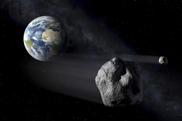

A harmless asteroid will whiz past Earth Saturday. Here’s how to spot it


China calls on scientists of all nations to study lunar samples, but notes obstacle with the US

The planet and star clock in at 3.5 billion years old, 1 billion years younger than our own solar system, but still considered old and brighter than expected, according to Matthews.

The star is so close and bright to our own solar system that it’s visible with the naked eye in the Southern Hemisphere.

Don’t bet on life, though.

“This is a gas giant with no hard surface or liquid water oceans,” Matthews said in an email.

It’s unlikely this solar system sports more gas giants, she said, but small rocky worlds could be lurking there.

Worlds similar to Jupiter can help scientists understand “how these planets evolve over giga-year timescales,” she said.

The first planets outside our solar system — dubbed exoplanets — were confirmed in the early 1990s. NASA’s tally now stands at 5,690 as of mid-July. The vast majority were detected via the transit method, in which a fleeting dip in starlight, repeated at regular intervals, indicates an orbiting planet.

Telescopes in space and also on the ground are on the hunt for even more, especially planets that might be similar to Earth.

Launched in 2021, NASA and the European Space Agency’s Webb telescope is the biggest and most powerful astronomical observatory ever placed in space.
___

The Associated Press Health and Science Department receives support from the Howard Hughes Medical Institute’s Science and Educational Media Group. The AP is solely responsible for all content.


More funding for Rolls-Royce space microreactor

23 July 2024


Rolls-Royce has secured an additional GBP4.8 million (USD6.2 million) in funding from the UK Space Agency to advance the development and demonstration of key technologies in its space nuclear microreactor.

The Rolls-Royce Micro-Reactor could enable many space operations, including propulsion for satellites (Image: Rolls-Royce)

The latest award was among more than 20 national space projects to be awarded funding totalling GBP33 million under the National Space Innovation Programme (NSIP), designed to invest in high-potential technologies, drive innovation and unlock growth across the UK.

Over the next 18 months, in collaboration with academic partners from the University of Oxford and Bangor University, the Rolls-Royce project will develop the whole microreactor system design, underlying capabilities and key technologies.

"The programme will help unlock the UK's participation in the developing space nuclear power markets and clearly demonstrate the UK's capability and readiness to move towards a detailed design," Rolls-Royce said. "An initial flight demonstration is anticipated by the end of this decade."

"We are delighted to win this award from the National Space Innovation Programme and to be continuing our collaboration with the UK Space Agency," said Jake Thompson, director of Novel Nuclear & Special Projects at Rolls-Royce. "This funding is a pivotal point in our microreactor programme and will accelerate our technology progression, bringing us a step closer to powering inspiring human endeavours in space.

"The future of space exploration is greatly dependent on the ability to generate high levels of consistent power and our nuclear microreactor is the solution that will offer safe, reliable and flexible power to a broad range of space missions."

UK Space Agency CEO Paul Bate added: "The National Space Innovation Programme will help kickstart growth, create high-quality jobs, protect our planet and preserve the space environment for future generations. New projects like this one, led by Rolls-Royce, go to the heart of what we want to achieve as a national space agency that supports cutting-edge innovation, spreads opportunity across the UK and delivers the benefits of space back to citizens on Earth."

The Rolls-Royce National Space Innovation Programme will have a total project cost of GBP9.1 million and aims to progress the microreactor's overall technology readiness level, which will bring the reactor closer to a full system space flight demonstration.

This latest investment follows the announcement of GBP1.18 million awarded to Rolls-Royce from the UK Space Agency in April this year, under Phase 2 of the International Bi-Lateral Fund. This was preceded by GBP2.9 million of funding awarded in 2023 under the Lunar Surface Nuclear Power Contract and Phase 1 of the IBF project in 2023, which delivered an initial concept of a UK lunar modular nuclear reactor.

Researched and written by World Nuclear News

Saturday, February 10, 2024

Scientists Baffled After Finding 4 Gigantic Mountains Lurking Under the Ocean


Victor Tangermann
Thu, February 8, 2024 


Underwater Mountain

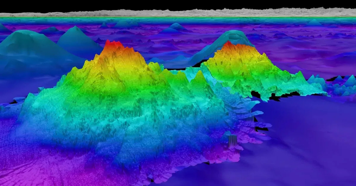
A team of scientists on board an exploration vessel off the coast of South America have made a startling discovery: four previously unknown massive underwater mountains, ranging from 5,200 to 8,800 feet tall. The discovery highlights just how little we know about the oceans covering much of our planet. According to recent estimates, more than 80 percent of the ocean has never been mapped, let alone explored.

"The tallest is over one-and-a-half miles in height, and we didn’t really know it was there," Schmidt Ocean Institute's Jyotika Virmani — whose team has been studying "seamounts" from on board the vessel Falkor — told New Scientist.
Gravity Anomalies

Using sonar equipment, Virmani and team investigated gravity anomalies while sailing down from Costa Rica to Chile. These anomalies are usually the result of a hard-to-discern mass — in this case, entire mountains sticking out of the ocean floor.


"I was thinking one, maybe two, but to find four is incredible," Virmani told New Scientist. "It does show how much we don’t know of what’s out there."

Thanks to their sloped sides, seamounts are usually teeming with life. Last year, an international team of scientists, including Virmani, discovered a deep-sea octopus nursery near a low-temperature hydrothermal vent by a previously unknown seamount off the coast of Costa Rica.

Virmani and his team have discovered 29 seamounts so far, a tiny fraction of the mountains we have yet to discover.

According to the National Oceanic and Atmospheric Administration's Ocean Exploration organization, there are likely more than 100,000 of them that are at least 3,300 feet high.

A different study last year examined global satellite observations, concluding that there were nearly 20,000 seamounts still to be found despite more than 24,600 that have already been mapped.

"The fact that we don’t have maps of our seafloor is crazy," University of Plymouth marine biologist Kerry Howell, who was not involved in the research, told New Scientist.

Especially thanks to their incredible biodiversity, it's more important than ever to study these hiding giants. Fortunately, scientists have been using high-tech mapping techniques to get a better view — research that could greatly support ongoing conversation efforts.


Colossal underwater canyon discovered near seamount deep in the Mediterranean Sea

Sascha Pare
Thu, February 8, 2024 

An underwater cave leading to a canyon.


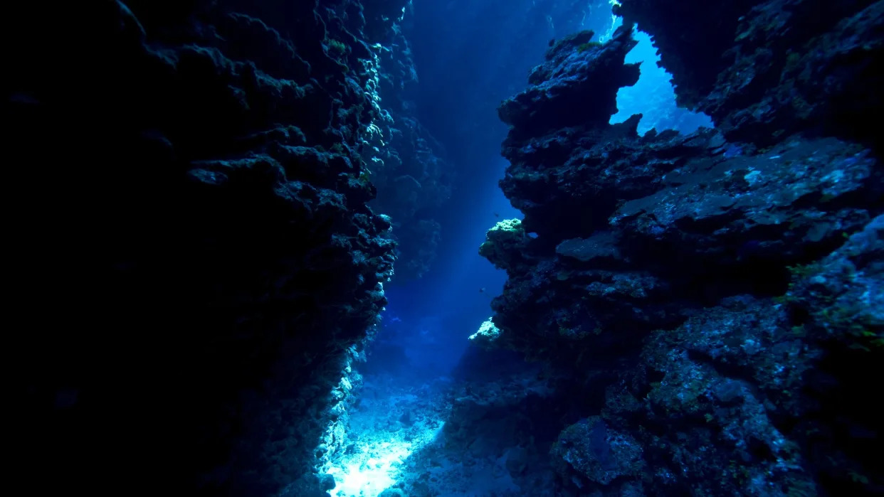
Scientists have discovered a giant underwater canyon in the eastern Mediterranean Sea that likely formed just before the sea transformed to a mile-high salt field.

The canyon formed around 6 million years ago, at the onset of the Messinian salinity crisis (MSC), when the Gibraltar gateway between the Atlantic Ocean and Mediterranean Sea narrowed and eventually pinched shut due to shifts in tectonic plates. The Mediterranean Sea became isolated from the world's oceans and dried up for roughly 700,000 years, leaving behind a vast expanse of salt up to 2 miles (3 kilometers) thick in some places.

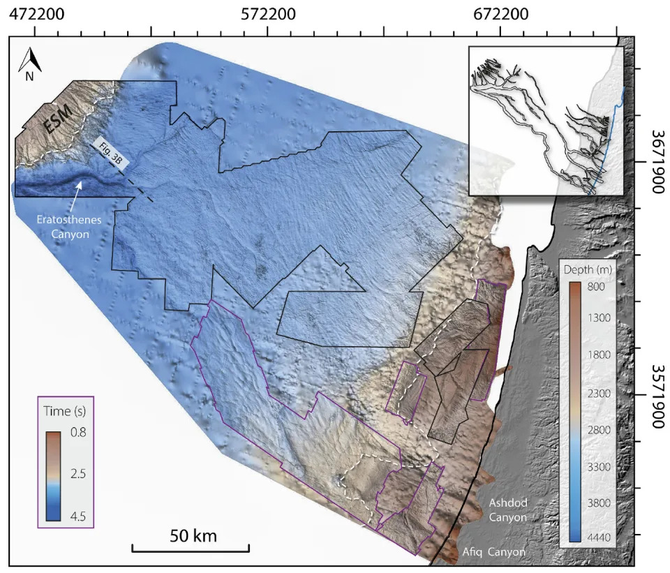
As sea levels dropped, increasingly salty currents eroded the seabed and incised gullies several hundred feet deep along the steepest edges of the Mediterranean Sea. In a study published in the January issue of the journal Global and Planetary Change, researchers now describe a giant U-shaped canyon located 75 miles (120 km) south of Cyprus, in the depths of the Mediterranean's Levant Basin.

The 1,640-foot-deep (500 meters) and 33,000-foot-wide (10 km) canyon, which the researchers named after the nearby Eratosthenes seamount, likely formed underwater shortly before salt piled onto the seabed. Unlike the more coastal gullies, the canyon had no older "pre-salt" roots, according to the study.

Related: 6 million-year-old 'fossil groundwater pool' discovered deep beneath Sicilian mountains

"To explain the submarine formation of the Eratosthenes Canyon, we suggest incision by dense gravity currents scratching and carving the deep-water seafloor," the researchers wrote in the study.

A map of the study area off the coast of Israel.

Weighed down with salt and sediment, these currents rushed along faster than the surrounding water and gradually scooped out enough of the seabed to form the colossal canyon. Precisely when this occurred remains unclear, but it likely coincided with the beginning of the MSC — between 5.6 million and 6 million years ago, according to the study. The incision process may have lasted anywhere from tens of thousands to half a million years.

The discovery sheds light on a decades-long debate over whether Messinian gullies and canyons that now lie underwater formed above or below the sea surface. "This new evidence strengthens the arguments that at least part of the erosion across continental margins occurred [below water]," the researchers wrote.

RELATED STORIES

Supervolcano 'megabeds' discovered at bottom of sea point to catastrophic events in Europe every 10,000 to 15,000 years

Underwater Santorini volcano eruption 520,000 years ago was 15 times bigger than record-breaking Tonga eruption

Never-before-seen volcanic magma chamber discovered deep under Mediterranean, near Santorini

The newly discovered canyon sits within a wider network of canyons and channels in an area known as the Levant Basin, which extends from the coast of Syria in the north to Gaza in the south, and northwest toward Cyprus.

To the northwest of the canyon, beyond the Eratosthenes seamount, sits the much deeper and older Herodotus basin, which receives currents loaded with sediment from the southeast. These currents may have crossed the area that now boasts the Eratosthenes Canyon long before it was incised, according to the study.

"The absence of older roots under the Eratosthenes Canyon does not rule out the possibility that a shallow pre-MSC channel system predated the Eratosthenes Canyon," the researchers wrote.
 

Wednesday, November 15, 2023

VULCANOLOGY
'Time's finally up': Impending Iceland eruption is part of centuries-long volcanic pulse

Hannah Osborne
Tue, November 14, 2023 

Fagradalsfjall volcano in Iceland erupting at dusk


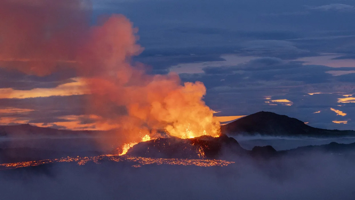
Iceland's potentially imminent eruption in the Reykjanes Peninsula is part of a 1,000-year cycle of volcanic activity that will likely cause eruptions for centuries, scientists say.

"Time's finally up," Edward W. Marshall, a researcher at the University of Iceland's Nordic Volcanological Center, told Live Science in an email. "We can get ready for another few hundred years of eruptions on the Reykjanes."

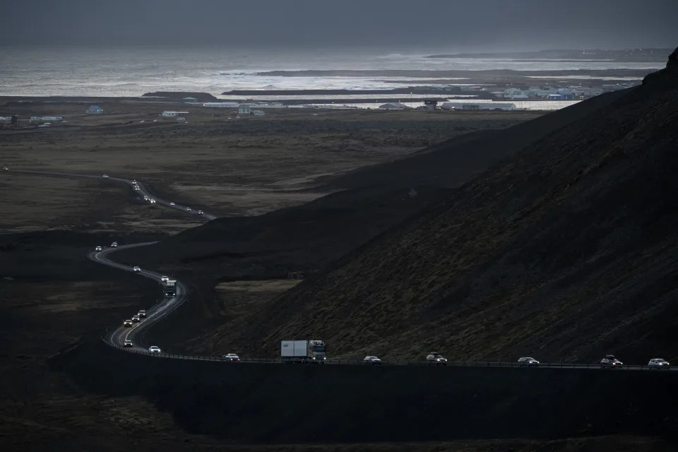
Seismic activity began increasing in the south of the peninsula in October, with hundreds of earthquakes recorded there each day. On Nov. 10, authorities evacuated the town of Grindavík, with experts warning an volcanic eruption could take place in just days.


Infographic showing the seismic activity that has hit Iceland in recent weeks

According to the Icelandic Met Office (IMO), a magma tunnel stretching 9.3 miles (15 kilometers) formed beneath the ground between Sundhnúkur in the north and Grindavík. The area affected also encompasses the Blue Lagoon geothermal spa — a tourist hotspot that attracts hundreds of thousands of visitors annually.

Magma in the tunnel — also known as a dike — appears to be rising to the surface, and there is a high risk of it breaking through. The greatest area of magma upwelling is currently close to Sundhnúkur, about 2 miles (3.5 km) northeast of Grindavík, according to the IMO. Researchers believe the amount of magma in the tunnel is "significantly more" than what was present during the eruptions at Fagradalsfjall, which sparked back to life in 2021 after more than 800 years of inactivity.

That 2021 eruption marked the start of a new cycle of volcanic activity on the Reykjanes Peninsula. Geological records show periods of inactivity last between 600 and 1,200 years, which is then followed by pulses of eruptions lasting between 200 and 500 years, Clive Oppenheimer, a professor of volcanology at the University of Cambridge in the U.K., told Live Science in an email.

"It looks like 2021 kicked off a new eruptive phase which might see the several fault zones crossing the [Reykjanes Peninsula] firing on and off for centuries," he said.

vehicles leaving the town of Grindavik, southwestern Iceland, during evacuation following earthquakes., with the sea in the background

The Reykjanes Peninsula sits above two tectonic plates that are being pulled apart. The strain that builds up is released in bursts as part of the cycle. "We are now in one of these pulses," David Pyle, a volcanologist and professor of Earth sciences at the University of Oxford, U.K, told Live Science in an email. "Each eruption releases just a bit more of the stored-up strain, and eventually, when all of that strain has been released, then the eruptions will stop."

It is currently unclear if an eruption will take place as a result of the magma tunnel. "These sorts of dikes are actually a tectonic, not a magmatic feature. In other words, the lava is filling a fracture, not forcing its way into the rock," Marshall said.

Should a fissure emerge, an eruption could last for several weeks. The large amount of magma involved compared with previous eruptions in the region could result in more lava flow at the surface, Oppenheimer said.

What happens next is a waiting game, Marshall said. "I predict — if an eruption occurs — that it will occur between a few days to threeish weeks. If it hasn't erupted in three weeks, I don't think it will happen. Cooling will begin to close the fractures."

Related:
Where is the largest active volcano in the world?

Emilee Speck
Tue, November 14, 2023 


Hawaii's Mauna Loa is the largest active volcano on Earth, with the summit more than 10 miles above its base, according to the U.S. Geological Survey.

Located inside Hawai'i Volcanoes National Park, Mauna Loa makes up more than half of the Big Island, standing at 13,681 feet above sea level, according to the National Park.

About 30,000 feet of Mauna Loa starts from the bottom of the sea, about 1,000 feet taller than Mount Everest, the planet's highest mountain above sea level.

WHAT ARE THE 4 CLASSIC TYPES OF VOLCANOES?

Hawaii's Mauna Kea volcano is taller at 33,500 feet. However, Mauna Loa is much larger by volume, according to the USGS.

Map notes the locations of Mauna Loa, along with nearby sister volcano Kilauea.

Mauna Loa is so massive that the sea floor caves in another 5 miles from the weight of the volcano.

Including the most recent eruption in November 2022, Mauna Loa has erupted 34 times since its first well-documented eruption in 1843, according to the USGS Hawaiian Volcano Observatory.

The 12-day eruption in 2022 marked the first since 1984.

About two months before its last eruption, Mauna Loa began displaying increased seismic activity, one of the signs geologists look for when an eruption is imminent.

WHAT HAPPENS BEFORE A VOLCANO ERUPTS?

Since its 2022 eruption, Mauna Loa has been mostly quiet, according to the Hawaii Volcano Observatory, but remains active with increasing seismic activity as recently as October.

Only about 20 miles from Mauna Loa, Kīlauea is Hawaii's second-largest active volcano and most recently erupted in September.

Mauna Loa and Kīlauea are classic examples of shield volcanoes and are among the most active in the world.

This type of volcano is typically the largest on Earth and covers a broad swath of terrain.

Volcanologists say the great width of these volcanoes is a result of thin lava flows. Eruptions are not considered to be eruptive and usually rank low on the VEI. Threats from landslides and volcanic smog are usually significant for these types of volcanoes.

Original article source: Where is the largest active volcano in the world?

Can one volcano's eruption trigger an eruption at another volcano?

Emilee Speck
Mon, November 13, 2023 


When there is one volcano in a region, there can be several or many others nearby, but if one volcano erupts, can that trigger an eruption at a nearby volcano or hundreds of miles away?

According to the U.S. Geological Survey, it is difficult to determine if one eruption caused another.

Active volcanic regions, such as the Rabaul Caldera in Papua New Guinea and Iceland's Reykjanes volcanic region, sometimes have common magma reservoirs that can trigger unrest.

WHAT HAPPENS BEFORE A VOLCANO ERUPTS?

According to the USGS, the largest volcano eruption in the 20th century happened in 1912 when Alaska’s Novarupta volcano began spewing magma that came from a reservoir 6 miles away beneath Mount Katmai. Even though it was the source of the magma, Mount Katmai did not erupt.

There are also volcanoes near one another that do not share this magma system, like Hawaii's Kilauea volcano, only 20 miles from Mauna Loa, but the two have individual magma reservoirs, according to the USGS.

There are multiple ongoing active eruptions worldwide at one time, and between 60 and 70 eruptions a year.

Most recently, officials warned of an impending volcanic eruption in Grindavík, Iceland, where the town has been evacuated following thousands of earthquakes. At the same time, Italy's Mount Etna began spewing lava fountains in the sky in November, just months after its August eruption.

However, according to the USGS, no definitive evidence exists that one eruption can trigger another eruption from a different volcano system that is hundreds of miles away or even on a different continent.

WHAT ARE THE 4 CLASSIC TYPES OF VOLCANOES?

There are signs of an impending eruption, including earthquakes, ground deformation and changes in gas emissions. Still, geology experts say predicting an eruption is not an exact science.

There are some historical examples of simultaneous eruptions within about 6 miles, but the USGS said it's unclear if one eruption caused the other.

Russia's tallest volcano spews out 1,000-mile-long river of smoke after giant eruption, satellite images reveal

Harry Baker
Tue, November 14, 2023 

A dark cloud of smoke flows from a lava flow on a volcano

Eurasia's tallest volcano has violently erupted, throwing a 1,000-mile-long (1,600 kilometers) cloud of dust and ash into the air, new NASA satellite images show.

Klyuchevskoy, sometimes referred to as Klyuchevskaya Sopka, is an active stratovolcano in Russia's Kamchatka Peninsula, which is home to more than 300 other volcanos. Klyuchevskoy's peak stands at 15,584 feet (4,750 meters) above sea level, making it taller than any other volcano in Asia or Europe, according to the Kamchatka Volcanic Eruption Response Team (KVERT).

Klyuchevskoy has been continually erupting since mid-June. But on Nov. 1, a massive volcanic explosion released a torrent of smoke and ash, which reached a maximum height of 7.5 miles (12 km) above Earth's surface, according to NASA's Earth Observatory.

The smoke and ash plume prompted KVERT to temporarily raise the aviation alert level to red (the highest possible level), which grounded planes in the area. Several schools were also evacuated due to the increase in air pollution.

The Landsat 8 satellite, which is co-run by NASA and the U.S. Geological Survey, captured a striking false-color image of the eruption plume (shown above), in which the red lava plume and grey smoke stand out against the surrounding blue-colored clouds.

NASA's Aqua satellite also captured a wider true-color image of the plume (shown below), which shows that the river of smoke was around 1,000 miles long at the time. But the plume may have eventually stretched up to 1,400 miles (2,255 km) long, according to the Smithsonian Institution's Global Volcanism Program.

Related: The 12 biggest volcanic eruptions in recorded history

The outburst only lasted for a few days, and it now appears that Klyuchevskoy may have stopped erupting altogether, according to KVERT.

The Kamchatka Peninsula is part of the Pacific Ring of Fire — a 25,000-mile-long (40,200 km) tectonic belt that circumscribes the Pacific Ocean and contains around three-quarters of the world's active volcanos.

The Ring of Fire has also recently been active in other areas: On Oct. 30, an underwater volcanic eruption off the coast of the Japanese island Iwo Jima birthed a brand new tiny island of hardened magma, which can also be seen from space.


A satellite image of a large eruption plume stretching across Russia and the Pacific Ocean

While the trail of smoke and ash given off by Klyuchevskoy was enormous, it is still quite a way off some of the largest eruption plumes ever seen.

The tallest eruption plume in recorded history was the towering pillar of smoke, ash and water vapor from the eruption of Tonga's underwater volcano in January 2022, which rose to 35.4 miles (57 km) above sea level.

related stories

Astronaut captures image of a glowering 'skull' lurking in a giant volcanic pit in the Sahara

One of the world's most active volcanoes is spewing out weird rings of smoke

Massive ancient lava flow seen from space looks like a giant black scar on the New Mexico desert

Following the Tonga eruption, scientists warned that the record amount of water vapor it released into the stratosphere could weaken the ozone layer. And in September this year, scientists partially attributed the eruption as the cause of an unusually large ozone hole above Antarctica.

However, Klyuchevskoy's latest eruption plume will likely have no real impact on the ozone layer because it contained much less water vapor and did not reach as high up in the atmosphere.

Sunday, November 12, 2023

GAIA LIVES
New island that emerged from the ocean off Japan is now visible from space

Hannah Osborne
Fri, November 10, 2023

The new island that emerged after an underwater volcanic eruption off Japan's Iwo Jima seen from space

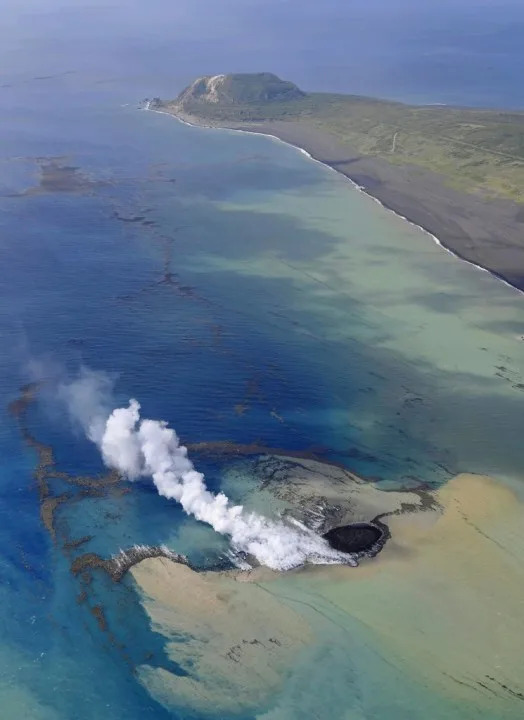
A newborn island that recently emerged from the Pacific Ocean after an underwater volcanic eruption is now visible from space, images from the European Space Agency (ESA) reveal. The satellite images show the new landmass sitting around 0.6 mile (1 kilometer) off the coast off Japan's Iwo Jima island.

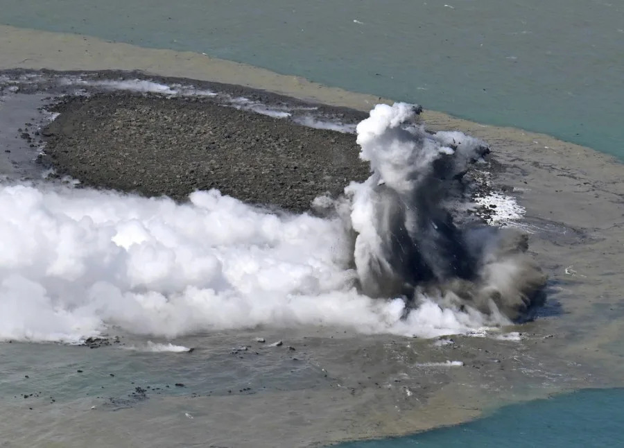
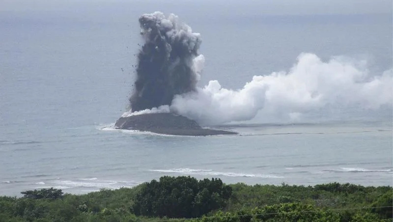
The submerged volcano began erupting on Oct. 21, with activity ramping up over the next 10 days. By Oct. 30, explosions were taking place every few minutes, according to a translated statement. The eruption threw large lumps of rock into the air, and shot a jet of gas and ash over 160 feet (50 meters) almost vertically above the water's surface.

Related: Scientists discover ancient, underwater volcano is still active — and covered in up to a million giant eggs

Since the volcano started erupting, "volcanic ash and rocks have piled up to form the new island, which is now also visible from space," a statement from the ESA said. The latest image was captured with the Landsat 9 satellite on Nov. 3. It shows Iwo Jima — which sits around 750 miles (1,200 km) south of Tokyo — before and after the latest eruption.


A close up of the new island that formed after a volcanic eruption.

Along with the new island, the volcano also produced a sea of floating pumice — an extremely porous type of rock that forms during explosive eruptions. New analysis of this pumice found its chemical composition differed from that of ejecta from other volcanoes in this chain, according to a different translated statement. The pumice likely came from an eruption along the back-arc rift zone — the area behind a volcanic arc, the statement noted.

RELATED STORIES

Earth's newest 'baby' volcano is painting Iceland's Fagradalsfjall region with incandescent lava

Perilous expedition to uninhabited island in South Atlantic confirms existence of world's 8th lava lake

California's supervolcano has a massive lid that causes swarms of earthquakes — and that's a good thing, scientists say

The latest eruption is in almost the exact same spot as one that took place in July 2022, suggesting magma activity is resuming at Iwo Jima. The eruption has now subsided, Yuji Usui, an analyst with the Japan Meteorological Agency, told the AP.

The new island was approximately 330 feet (100 m) wide and up to 66 feet (20 m) high, but it appears to be shrinking as the waves erode the "crumbly" rock, Usui said. Whether the new island will survive is unclear and depends on what it is made of: If it is lava, it could remain for longer. "We just have to see the development," he told the AP.

A volcanic eruption gave birth to a new island, and a NASA satellite saw it from space (photo)

Robert Lea
Fri, November 10, 2023 

A split-screen image of an island formed from a volcano eruption.

A NASA satellite has spotted a newly formed island off the coast of Japan that experienced a fiery birth at the end of October.

The joint NASA/U.S. Geological Survey satellite Landsat-9 saw the island rise from the sea off the coast of Iwo Jima island, part of the Volcano Islands archipelago in south Japan, on Nov. 3.

The island was born 750 miles (1,200 kilometers) south of Tokyo between 12:20 and 12:35 local time on Oct. 30 when blisteringly hot magma fell into the ocean and exploded, creating chunks of rock several feet long more than 160 feet (50 meters) into the air, according to the University of Tokyo.

"According to the Japan Meteorological Agency, the eruption appears to have started on October 21, 2023," University of Tokyo researchers wrote. "The location of this eruption is almost the same as the 2022 eruption location and is thought to indicate the resumption of magma activity on Iwo Jima."

The underwater eruptions broke the ocean's surface at two locations in the form of explosions at the southern tip of Iwo Jima, and rocks gathered to the north of these explosions. This growing rubble pile eventually formed a 330-foot (100-meter) wide island, around half a mile (1 kilometer) from Iwo Jima, sat in discolored water littered with very porous rock called pumice.

An extremely light rock, pumice is created when lava with a very high content of water and gases is discharged from a volcano. As gas bubbles escape this lava, it becomes "frothy," cooling and hardening into a bubble-filled rock.

Landsat-9 saw the island from its position 438 miles (705 kilometers) above Earth on Nov. 3, and this image was compared to observations of the region collected by the same satellite on Oct. 18 in which the island was not present.

The birth of the island was witnessed by a craft much closer to home when an aircraft owned by Mainichi Shimbun, a Japanese newspaper, was the initial stages of an underwater eruption in the southern part of the Izu-Ogasawara arc — an oceanic trench in the western Pacific Ocean.

The site of the new island has been a hotbed of underwater eruptions of steam and lava over recent years, University of Toyko researchers said, adding that this is one of the fastest-rising caldera volcanoes — a large depression formed when a volcano erupts and collapses — in the world.


Watch: New island appears off Japan coast – but it might not last long

Danielle Demetriou
Fri, November 10, 2023 

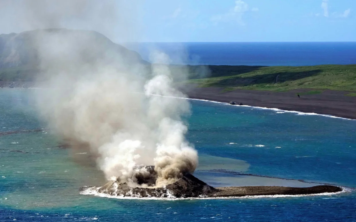
Earth and sand are sent into the air above a new islet off the coast of Iwoto island in Ogasawara, Tokyo, Japan - The Asahi Shimbun/Getty Images


A small new island has appeared unexpectedly off the coast of Japan following the eruption of an undersea volcano, although experts warn it may be washed away before long.

The land mass emerged from the Pacific Ocean after the volcano began a series of underwater eruptions late last month near the Ogasawara island chain.

It sits around 745 miles south of Tokyo and half a mile off Iwo Jima.

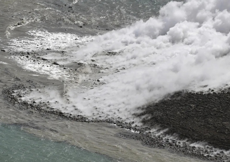
Eruptions led to volcanic ash and rocks accumulating on a shallow seabed and within 10 days, the tip of the unnamed island eventually emerged above the water.

The newly formed land mass then continued to grow, expanding to dimensions of around 330 feet in diameter, with a highest point of some 66 feet above sea level, by early November.

But volcanic activity at the site has since subsided and the island has now begun to shrink because its “crumbly” formation is easily washed away by waves, according to Yuji Usui, an analyst in the Japan Meteorological Agency’s volcanic division.

“We just have to see the development,” he said. “But the island may not last very long.”

The new landmass has risen from waters about half a mile off the coast of Iwoto – a volcanic island previously known as Iwo Jima, which was the scene of intense fighting during the Second World War.

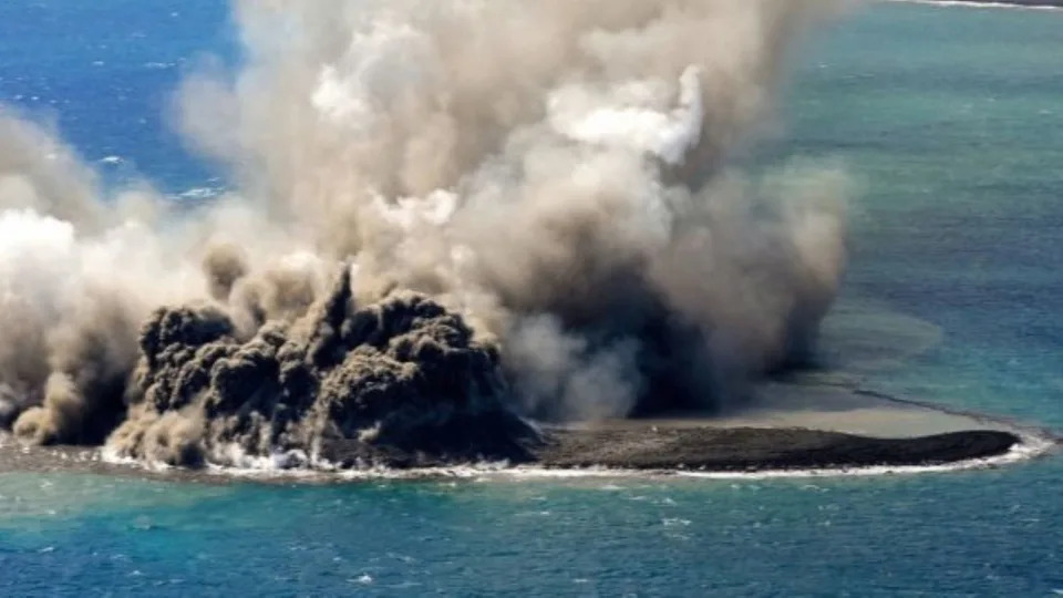
In this aerial photo, plume billows out from the water off the Ioto island, following an eruption in Ogasawara, southern Tokyo, Japan - Kyodo News via AP

Fukashi Maeno, an associate professor at the University of Tokyo’s Earthquake Research Institute, discussed the creation of the island after flying over the site late last month.

Magma and seawater reportedly interacted to cause plumes of smoke to rise as high as 160 feet into the air every few minutes during eruptions, with large rocks also spewed from the waters, Mr Maeno told local media.

The intensity of the eruptions also caused the seawater to change colour, while pumice stones were spotted floating around the new island, he added.

The emergence of a new island is the latest in a long history of intense volcanic activity for Japan, one of the most seismically sensitive countries in the world, with more than 100 active volcanoes.

Undersea volcanoes and seismic activities have formed new islands in the past.

In 2013, an eruption at Nishinoshima in the Pacific Ocean south of Tokyo led to the formation of a new island, which kept growing during a decade long eruption of the volcano.

Located in the Pacific Ring of Fire, the Japanese archipelago spans the convergence of several major tectonic plates, resulting in centuries of frequent earthquakes and volcanic eruptions.

Experts are currently monitoring the region surrounding the new island to determine whether it will become a permanent fixture on Japan’s map or disappear.

The new island could survive longer if it is made of lava, or something more durable than volcanic rocks such as pumice.

An official at the Japan Meteorological Agency told local media: “If only a cinder eruption, as it is now, it will be eroded by waves and is unlikely to remain for a long time, but if it turns into an eruption with lava, it may remain for quite a while.”

New island forms in Japan after undersea volcano erupts but experts warn it may not last long

Joanna Adhem
Fri, November 10, 2023

In a remarkable event that unfolded three weeks ago, the eruption of an undersea volcano off the southern coast of Iwo Jima has created a new island.

Despite the awe-inspiring nature of this phenomenon, experts caution that the newfound landmass may not last long.

The unnamed undersea volcano, located roughly 1 kilometre off the coast of Iwo Jima - known as Ioto in Japan - and 1,200 kilometres south of Tokyo, erupted on October 21.

In just 10 days, volcanic ash and rocks built up on the shallow seabed, forming an island that emerged from below the water's surface.

By early November it was approximately 100 meters in diameter and had reached a height of 20 meters above sea level, according to Yuji Usui from the Japan Meteorological Agency's volcanic division.

This supervolcano in Italy last erupted in 1538. Is it about to blow again?
How long do experts think the island will last?

Two similar undersea eruptions have been documented in recent years, but the emergence of a distinct landmass is a rare occurrence.

The fragile nature of its composition, described as "crumbly" by Usui, makes it susceptible to erosion by ocean waves. Ongoing analysis by experts includes an examination of the deposits to determine exactly what it is made of.

It is still possible that the island could survive for a more extended period if it is composed of more durable materials such as lava, as opposed to the easily weathered volcanic rocks like pumice.

Japan has 111 of the roughly 1,500 active volcanoes in the world, according to the Japan Meteorological Agency. It sits on the so-called Pacific “Ring of Fire” - a 40,000-kilometre-long chain of volcanos and seismically active sites which is home to much of the world’s volcanic and earthquake activity.

Watch the video above to learn more about Japan's newest volcanic island.

Volcano creates a new island off Japan, but it may not last

The Associated Press
Fri, November 10, 2023 


TOKYO (AP) — An undersea volcano erupted off Japan three weeks ago, providing a rare view of the birth of a tiny new island, but experts say it may not last very long.

The unnamed undersea volcano, located about 1 kilometer (half a mile) off the southern coast of Iwo Jima, which Japan calls Ioto, started its latest series of eruptions on Oct. 21.

Within 10 days, volcanic ash and rocks piled up on the shallow seabed, its tip rising above the sea surface. By early November, it became a new island about 100 meters (328 feet) in diameter and as high as 20 meters (66 feet) above the sea, according to Yuji Usui, an analyst in the Japan Meteorological Agency’s volcanic division.

This aerial photo shows steam billowing from the waters off Iwoto Island, Ogasawara town in the Pacific Ocean, southern Tokyo, on Oct. 30, 2023. A new island, 100 meters in diameter, formed by erupted rock, is seen near the steam, according to Kyodo News. (Kyodo News via AP)More


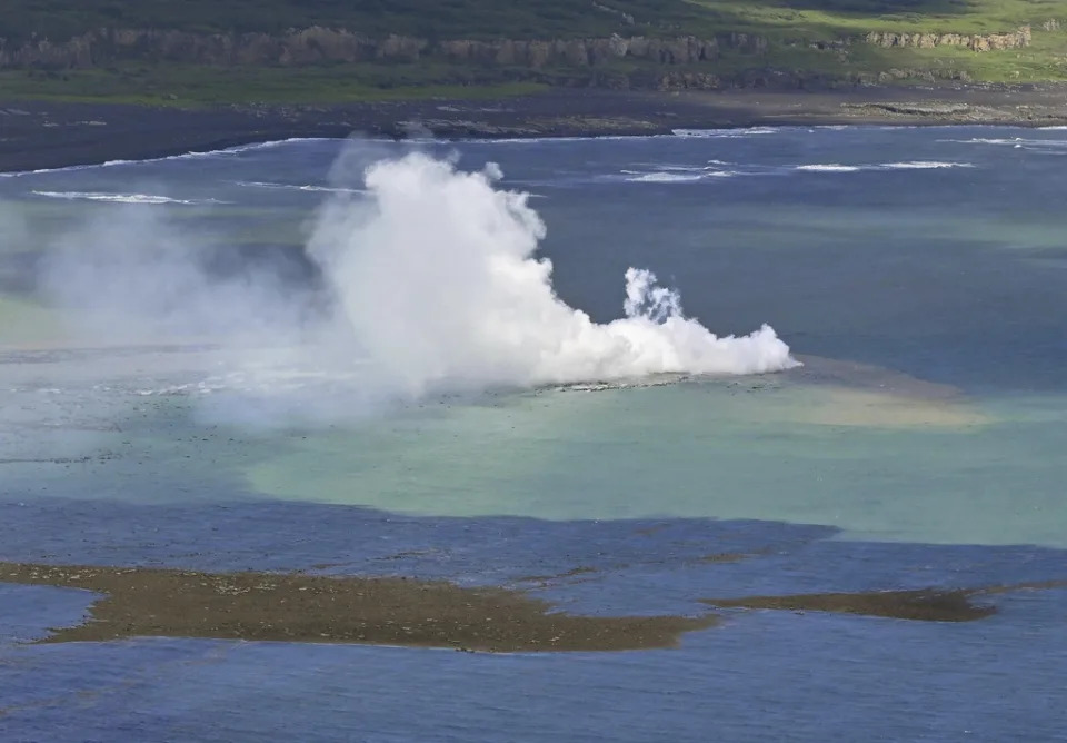
In this photo provided by the Japan Maritime Self-Defense Force, steam billows from the waters off Ioto island, Ogasawara town in the Pacific Ocean, southern Tokyo, on Nov. 1, 2023. An unnamed undersea volcano, located about 1 kilometer (half a mile) off the southern coast of Iwo Jima, which Japan calls Ioto, started its latest series of eruptions on Oct. 21. (Japan Maritime Self-Defense Force via AP)More


In this aerial photo, plume billows from the water off the Ioto island, following an eruption in Ogasawara, southern Tokyo, Japan, on Oct. 30, 2023. An unnamed undersea volcano, located about 1 kilometer (half a mile) off the southern coast of Iwo Jima, which Japan calls Ioto, started its latest series of eruptions on Oct. 21. (Kyodo News via AP)More


In this aerial photo, plume billows out from the water off the Ioto island, following an eruption in Ogasawara, southern Tokyo, Japan, on Oct. 30, 2023. An unnamed undersea volcano, located about 1 kilometer (half a mile) off the southern coast of Iwo Jima, which Japan calls Ioto, started its latest series of eruptions on Oct. 21. (Kyodo News via AP)More


In this aerial photo, plume billows from the water off the Ioto island, seen rear, following an eruption in Ogasawara, southern Tokyo, Japan, on Oct. 30, 2023. An unnamed undersea volcano, located about 1 kilometer (half a mile) off the southern coast of Iwo Jima, which Japan calls Ioto, started its latest series of eruptions on Oct. 21. (Kyodo News via AP)More


This aerial photo shows steam billowing from the waters off Iwoto Island, Ogasawara town in the Pacific Ocean, southern Tokyo, on Oct. 30, 2023. A new island, 100 meters in diameter, formed by erupted rock, is seen near the steam, according to Kyodo News. (Kyodo News via AP)More


This aerial photo shows steam billowing from the waters off Iwoto Island, Ogasawara town in the Pacific Ocean, southern Tokyo, on Oct. 30, 2023. A new island, 100 meters in diameter, formed by erupted rock, is seen near the steam, according to Kyodo News. (Kyodo News via AP)More


In this aerial photo, smoke billows from the water off the Ioto island, following an eruption in Ogasawara, southern Tokyo, Japan on Oct. 30, 2023. An unnamed undersea volcano, located about 1 kilometer (half a mile) off the southern coast of Iwo Jima, which Japan calls Ioto, started its latest series of eruptions on Oct. 21. (Kyodo News via AP)More


In this aerial photo, plume billows from the water off the Ioto island, following an eruption in Ogasawara, southern Tokyo, Japan, on Oct. 30, 2023. An unnamed undersea volcano, located about 1 kilometer (half a mile) off the southern coast of Iwo Jima, which Japan calls Ioto, started its latest series of eruptions on Oct. 21. (Kyodo News via AP)More

Volcanic activity has increased near Iwo Jima and similar undersea eruptions have occurred in recent years, but the formation of a new island is a significant development, Usui said.

Volcanic activity at the site has since subsided, and the newly formed island has somewhat shrunk because its “crumbly” formation is easily washed away by waves, Usui said.

He said experts are still analyzing the development, including details of the deposits. The new island could survive longer if it is made of lava or something more durable than volcanic rocks such as pumice.

“We just have to see the development,” he said. “But the island may not last very long.”

Undersea volcanoes and seismic activities have formed new islands in the past.

In 2013, an eruption at Nishinoshima in the Pacific Ocean south of Tokyo led to the formation of a new island, which kept growing during a decadelong eruption of the volcano.

Also in 2013, a small island surfaced from the seabed after a massive 7.7-magnitude earthquake in Pakistan. In 2015, a new island was formed as a result of a monthlong eruption of a submarine volcano off the coast of Tonga.

Of about 1,500 active volcanoes in the world, 111 are in Japan, which sits on the so-called Pacific “Ring of Fire,” according to the Japan Meteorological Agency.

Iwo Jima was the site of some of the fiercest fighting of World War II, and the photograph taken by AP photographer Joe Rosenthal of a flag-raising atop the island’s Mount Suribachi on Feb. 23, 1945, came to symbolize the Pacific War and the valor of the U.S. Marines.

World’s newest island forms off the coast of Japan thanks to undersea volcano

Rebecca Olds
Fri, November 10, 2023

In this photo provided by the Japan Maritime Self-Defense Force, steam billows from the waters off Ioto island, Ogasawara town in the Pacific Ocean, southern Tokyo, on Nov. 1, 2023. An unnamed undersea volcano, located about half a mile off the southern coast of Iwo Jima, which Japan calls Ioto, started its latest series of eruptions on Oct. 21. 
| Japan Maritime Self-Defense Force 


A new island formed a week ago off the coast of the Japanese island Iwo Jima thanks to the work of an undersea volcano.

The unnamed volcano first began erupting on Oct. 21 and has spewed enough volcanic ash and rocks to start the formation of a new island, reported The Associated Press. The island is about 328 feet across and 66 feet above sea level.

One expert, Yuji Usui from the Japan Meteorological Agency’s volcanic division, told the AP that the island’s “crumbly” formation could be washed away by waves.

“We just have to see the development,” Usui said. “But the island may not last very long.”

For now, the volcano continues to eject a mixture of large gray particles and magma. No injuries have been reported from the event, reported The New York Times.
How can islands be created?

Islands can be created in a variety of ways, but the new island off the coast of Japan is attributed to the build-up of enough material from the underwater volcano that the pile has reached the surface, per The Associated Press.
Did Japan find 7,000 new islands?

The new island adds to the thousands discovered earlier this year in the region.

The Guardian reported that it was previously thought that the Japanese archipelago had around 6,000 smaller islands with four main ones. Then, digital mapping discovered that there were actually more than twice that many.

More than 7,000 new islands were discovered in early 2023.

Japan recounts its number of islands, discovering more than 7,000

How many islands make up Japan in 2023?

With the discovery earlier this year, Japanese geographers believe there are a total of 14,152 islands in the region.

And it’s possible that more, smaller islands will continue to pop up since the area is part of the “Ring of Fire” region, known for volcanoes, per The Associated Press. Currently, 111 out of the world’s 1,500 active volcanos are in Japan.
What type of volcano is found on the islands of Japan?

The main type of volcano found in Japan is the stratovolcano, or composite volcano, per the National Parks of Japan. These volcanoes are created by layer after layer of ash and rock, especially pumice. There are also cinder cones and lava dome volcanoes in the country.
Are there any active volcanoes in Japan?

Most of the volcanos in Japan are considered “active” because they’ve erupted in the past 10,000 years, including the most famous Mount Fuji volcano, which hasn’t erupted since 1707, per the National Parks of Japan.

Sakurajima is considered the most active in the country because it experiences small eruptions almost daily, per the travel website Japan Guide.

Related
What’s going on with Italy’s supervolcano?