An Ex-Pat Anti-Capitalist Watches the World Cup
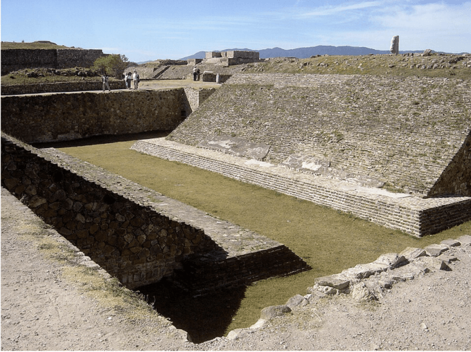
Ancient ball court of Monte Alban, in the Oaxaca region of Mexico. Photo by Bobak Ha’Eri. Wikimedia Commons.
Tump’s foul
There are reasons to love and reasons to hate the current World Cup, the six-week, quadrennial football match organized by FIFA, Fédération Internationale de Football Association. I’ll start with one of the second: corruption of a Trumpian scale. Atop the ticket-price gouging, fleecing of host cities, and migrant labor exploitation, (more on these below), Trump added his own je ne sais quoi by making FIFA capo Gianni Infantino an offer he couldn’t refuse: rescind the red-card suspension of American star Folarin Balogun so he could play the critical, round-of-sixteen match against Belgium — or else. The threats included mid-match lawsuits, bogus claims of match fixing, and possible Justice Department investigations. Infantino, who previously awarded the bellicose president a “FIFA Peace Prize,” didn’t have to be asked twice. He required his Disciplinary Committee to delay the ban for one year, implicitly accepting the legitimacy of the red card while delaying the sanction until it was more convenient.
Belgium delivered rough justice by trouncing the Americans 4 to 1. Afterwards, they celebrated in their locker room by performing the “Trump Dance” to the tune of YMCA — a better mockery than Democratic Party consultants been able to muster in a decade of trying. There’s little question that “Trump’s Foul,” as it shall forever be known, severely disadvantaged the U.S. side and motivated the Belgian. Balogun himself, it’s only fair to add, accepted the original suspension with grace. He and his coach, Mauricio Pochettino however, should have refused the pardon and rallied his team by video streaming a meal of frites and mayonnaise served in paper cones.
East Rutherford and “the beautiful game”
The final match of the World Cup will be played on Sunday, July 19 at MetLife Stadium in East Rutherford, New Jersey (pop. 10,522). MetLife, the insurance company after which the arena is named, is notable for its deceptive practices and the $21 million annual compensation package of its CEO, Michale Khalaf. The average salary of East Rutherford residents, few of whom, it’s safe to say, have ever seen much less played a soccer game, is $48,000. That also happens to be the official price of four of the best tickets to the World Cup Final.
The borough of East Rutherford, New Jersey is otherwise notable only for being adjacent to Rutherford, New Jersey, birthplace of the great, imagist poet William Carlos Williams, who wrote “The Crowd at the Ballgame” (1923) which includes the lines:
The crowd at the ball game
is moved uniformly
by a spirit of uselessness
which delights them—
all the exciting detail
of the chase
and the escape, the error
the flash of genius—
all to no end save beauty
the eternal…
Williams’ ballgame (he had baseball in mind) has “no end save beauty.” The Brazilian footballer Pelé, perhaps the greatest of all time, called football “The beautiful game.” As far as FIFA’s concerned, the end of football is money. The expected revenue from the current World Cup – ticket sales, broadcast rights, corporate sponsorships and licensing fees – is about $13 billion. Because FIFA is a Swiss-registered non-profit, it must spend all that money, except a one billion cash buffer. This it does, doling huge payouts to the national football federations to earn their loyalty, prize money to teams (partly dispensed to players), and large executive salaries. Infantino makes $6 million, his lieutenants in the lower millions. So avid is FIFA for money, that it violated its own rules in awarding the 2034 World Cup to Saudi Arabia, confident that the country and Saudi Aramco, the national oil company, would be willing and able to shell out the hundreds of billions required to build new stadia, hotels, transportation and other infrastructure deemed necessary for the games. Crown Prince Mohammed bin Salman, known as Prince Bonesaw for his complicity in the murder of Saudi-dissident, U.S.-based journalist Jamal Khashoggi, will personally ensure the construction proceeds quickly, regardless of risks to the safety of low-wage, migrant workers. An estimate 6,500 were seriously injured and 40 killed in the construction of World Cup facilities in Qatar in 2022.
The affection for money has corrupted the players too and undermined any working-class solidarity they might feel. While the elite layers, for example those in the English Premier League, earn three to four million pounds a year, (and some, much more, like Erling Haaland’s 27 million pounds), most players around the world make far less. Players in developing nations may earn as little as a thousand dollars a month. And while the payer’s union FIFPRO has no power of global collective bargaining, it could certainly demand that the wealthiest national associations share more of their profits with the poorest. Argentine Lionel Messi, (who plays for Inter Miami) makes about $80 million per year, and Christiano Rinaldi from Portugal (who plays for the Al Nasser club in Saudi Arabia) is paid $300 million. Some of the best players in the world, including Amad Diallo (Ivory Coast, now playing for Manchester United) and Ademolo Lookman (Nigeria and Atlético Madrid) come from West Africa, where players rarely earn more than $10,000 to $15,000 per year.
There is thus an enormous drain of athletes from lower to higher income countries. While the FIFPRO has managed to wrangle some concessions from FIFA concerning player safety during the World Cup, it has done nothing to change the global disparity of income between the different national teams. To do so would require it to recognize the nature of the capitalist labor arbitrage and “football neocolonialism.” Wealthy nations exploit low production costs in poor nations to extract raw talent, refine it, and capture nearly 100% of the value it generates. The less valuable remainder is left for the local population to support.
But don’t expect Ronaldo or Messi to demand better support for African players. The former is a friend of Trump. At a dinner with the president and Bin Salman last year, he said of the president: “He’s someone I like a lot, because I know he can help change the world and bring peace!” Messi, in the meanwhile, has always sworn off politics, but in March he attended a celebration of his team at the White House, and politely applauded after Trump boasted how well his bombers did destroying Iran. A few days before, the U.S. killed 165 schoolgirls at the Minab Elementary School. Then Messi handed the president a pink, Miami soccer ball.
Football in Zumbagua, Ecuador
I gave up watching sports some 40 years ago about the same time I stopped playing it. My golf and tennis games were increasingly more frustrating than relaxing, and as a young professor at Occidental College in Los Angeles, I had little time for them. My last serious engagement with sports was probably the 1986 World Series. That was the one made famous when poor Bill Buckner at first base for the Boston Red Sox allowed Mookie Wilson’s slow ground ball to pass between his legs in the 10th inning of game six, giving the New York Mets the go-ahead run. Two days later, the Mets (my home team and Queens neighbor) won the seventh game and the World Series.
In the decades since, I’ve occasionally watched parts of baseball, football or basketball games in the company of family or friends or in bars. However, my most vivid memory of sports back then was watching the televised Copa América tournament in summer, 1993 in Quito, Ecuador. I was there with my then wife Mary, in between visits to her friends (aka “informants”) in the indigenous community of Zumbahua, in Cotopaxi Province, about a three-hour drive from the capital city. We’d see the televised games in various bars and restaurants in Quito and cheer lustily for the national team. (Argentina won the final game, naturally, by 2-1 over Mexico.)
In Zumbahua (elevation 11,500 ft), where there was limited electricity and no television, fulbito was played more than watched. Driving up though the páramo — the high-altitude, alpine tundra grassland of the Northern Andes — you’d sometimes see clouds of dust rising from Zumbahua in the distance – that usually meant a football game was being played on a bare, dirt field. They’d play in shorts and shirts, but spectators would wear traditional clothes, including the ubiquitous felt fedoras. I’d rarely watch the matches except in passing – these were purely indigenous affairs, and unless I was in the company of our hosts, I’d be unwelcome. Mary, who spoke both Spanish and Quichua, undoubtedly felt more at ease than I did, but had little if any interest in the games.
Before coming up to visit or stay with Mary’s local friend Alfonso and his family, we’d typically buy presents for the children. These were usually foods that were hard to obtain in the highlands, like oranges, pineapples and bananas, as well as toys and games, coloring books and many, many crayons. On this occasion, inspired by the Copa América, I decided to buy the kids a good soccer ball. I remembered from a previous visit that the children usually played with a red, rubber kickball that bounced too much, or else just with a discarded can or something similar. Though Mary thought any soccer ball would do, I dragged her into successive sporting goods stores in Quito to buy the best one. Finally, in a high-end shop on the Avenida Naciones Unidas, I saw what I was looking for: A professional-standard, hand-stitched, Adidas Etrusco Unico, costing about 50 bucks. Mary told me that was more money than Alfonso made in a month doing construction work in Quito, but I insisted the kids deserved nothing but the best.
A few days later, we were up in Zumbahua handing out our gifts. The oranges were given to the eldest daughter, who in turn handed them out to each of the children. The crayon boxes were opened and the crayons handed out, again by the oldest child, to all the others with attention taken that each got a fair share of the best colors – red, yellow, blue, pink, and green. Finally, I tossed out my soccer ball to one of the boys, who happily received it and took it outside to play with whatever other boys were around. I was pleased.
About a year later, we came again to Zumbahua, as usual, bearing gifts. I didn’t bring another soccer ball because I presumed the professional model from the previous year was still being used. But when we arrived, I saw that the kids were playing football with a beat-up, red rubber ball. I asked one of the children (with Mary’s help) – his name was Lenin (a common appellation for generations of class-conscious peasants) – what happened to the Etrusco Unico? He took me into a dark corner of one of their traditional, mud and thatch chozas, and showed me a sad, shriveled thing that used to be a football. It turns out that professional-grade balls quickly deflate with use and require a pump and special needle to-re-inflate. Such pumps are unavailable in Zumbahua and would anyway be far too expensive for a family member to buy. It was my own pride in buying an expensive gift that denied the kids the pleasure of a cheap, but durable soccer ball.
Watching the beautiful game
Now retired, I think I’ll take up watching football. The World Club games my dear wife Harriet and I watch have for the most part been thrilling. We see them on my laptop during dinner or in bed, and yell, complain and cheer just like people who have been watching for decades. I’ve gotten to know who many of the best players are, learned what’s offside – though I couldn’t explain it to anybody – and the meaning of yellow and red cards. I’ve delighted at crisp passes from the French and Spanish teams, and the defensive prowess of the Cape Verde squad.
At first, I hated Erling Haaland – I thought he was just a big, arrogant stiff – but the two winning goals against Brazil were impressive: a header in the 79th minute and a few minutes later, a low rocket to the right corner of the net. I reluctantly admit that Messi is impressive. He can’t dribble for shit, but give him the ball near the net and he’ll put it in. Now, Lamine Yamal of Spain and Vinícius Júnior from Brazil can dribble; like in basketball, the key is to never look at the ball.
I can’t stand all the fouls in football – it slows up and game. But what’s worse is the players who fake being fouled – the divers. A supposedly fouled player will scream in agony, fall to the ground, and clutch his foot, ankle, knee, or back. Then, after a visit from the trainer, but before the referee can force him to leave the game, he jumps up as if nothing happened. Worse is the player who collapses to the ground after getting hit (supposedly) on the side of his face or back of the head. Unless it was a truly concussive blow, why are you on the ground at all? “Get up, ya bum! I’d say, in true, New York style. “Look, he’s hurt, poor man!” Harriet would say with sincere concern. It’s the only thing we ever argue about.
Football played well is a beautiful game – a game to be loved. But it would be far more beautiful if Infantino were gone, FIFA went on a diet, elite players used their clout to support the poorly paid ones in the global south, and football neocolonialism ended. While we’re at it, dump Trump, slash the U.S. defense budget (and that of the U.K. too), abolish nukes and stop global warming. They are all about equally likely to happen soon.
Brazil Fizzles Again: the Capitalist Rot at the Heart of Brazilian Football
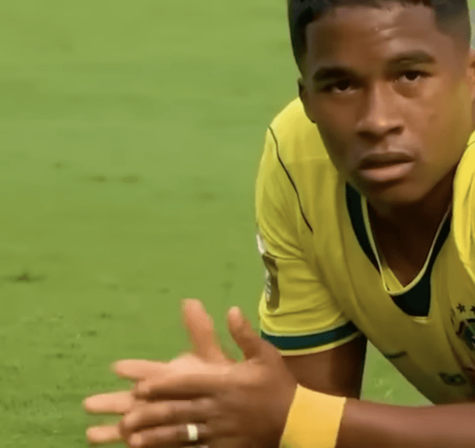
Endrick after missing an opportunity versus Norway. (Screen capture from video posted to X.)
After years of waiting for a small lawsuit from a car accident to settle, I moved to Rio de Janeiro in 1991. I had never visited Brazil before, but I was not there as a tourist. As a young man, I had made a decision that I did not want to spend the rest of my life living in a country where you only got 2 weeks of vacation a year. After a lot of informal research talking to fellow bellhops at the Palmer House in Chicago, mainly immigrants from all over the world, I decided on Rio de Janeiro.
I arrived and, after blowing my small lawsuit settlement on restaurant food, drinks, and taxis in the first month, got a job teaching conversational English to business executives. There, I met a coworker from Sweden named Bo and we started having a few drinks together from time to time. One day I arrived at his apartment and he sent me up. He answered the door completely naked, in the Swedish tradition, and said, “I’m going to get ready in a few minutes. I just want to watch the end of the Flamengo game.”
“OK,” I said, “I have to admit that I’m not much of a fan of soccer, though.”
He looked shocked. “Fucking hell, Brian!” he said, “if you are seriously thinking of living in this country, you have to learn how to love football.” As the shock of sitting in the living room with a naked Swedish guy wore off, he began explaining the game to me. Bo was a former back who played professionally in the second division in England and first divisions in Sweden and Greece, whose career was cut short by a knee injury. He’d moved to Rio de Janeiro because of his psoriasis after doctors told him he needed to get more sunlight, deciding on Brazil because of its football tradition.
“Look how they move the ball up the field. The Brazilians’ problem is that they love the ball too much. A Brazilian will kick the ball four or five times before passing. If you watch the Germans play, for example, they will only kick the ball once or twice. Nevertheless, on any given year, any list of the world’s best players will be made up mostly of Brazilians. They are the best individual players in the world, and any time they get a manager who can get them to play together as a team, they win the World Cup.”
That Summer Bo made it a personal project to get me to love football. He took me to watch legendary midfielder Junior play football for fun in an amateur league, barefoot on Copacabana beach, to the delirium of the hundreds of fans who came out to cheer him on. Then, in an act that caused me to really fall in love with football, he invited me to the Brazilian championship finals in the cheap seats in Maracana stadium, where 168,000 people had come out to watch Junior lead Flamengo to victory over Botofogo in the last great game of his career. Brazilian football was a lot different then. There was no wall separating rival fans, just hundreds of riot control military police standing in the aisles. We were in the Botofogo section near the dividing line between the two groups in solidarity with a Brazilian friend, and every time Flamengo scored, their entire fan section stood up, dancing and giving us the middle finger.
I was lucky enough to be live in Brazil for both the 1994 and 2002 World Cups, and being able to experience both of those victories on days when the entire country shut down, buses stopped running, and banks and schools closed, rank among the greatest experiences of my life. For the first 15 years I lived in Brazil, it really did seem like Brazil always had the best individual players in the world and all it needed was a manager who could get them to play together as a team for them to win the World Cup. Then things started going awry. Here are a few things that I have observed during my decades living in Brazil that have contributed to the decline of football.
The decline of samba
Samba is a genre of Afro-Brazilian music that was first mentioned in the 1840s in Pernambuco that was modernized and urbanized in Rio de Janeiro in the 1920s through fusion of musical traditions of people who had migrated to the city from places like the coffee plantations in Minas Gerais and Sao Paulo and the towns and quilombos in the Sao Francisco river valley. Over the years, it has branched out into different subgenres, and in 1991, when I first moved to Rio de Janeiro, two of its subgenres, Samba Canção and Pagode, were among the most popular forms of music. Brazilian football developed hand in hand with samba. As anyone who has ever been to a football match in Brazil knows, all of the organized fan groups have their own samba drum groups that beat out syncopated polyrhythms during entire games. It’s no exaggeration to say that Brazil’s unique flair for dribbling is closely related to samba dance steps. In the 90s, if a player was a good dribbler, people would say he had samba no pe (samba foot). In the late 90s, a new form of romantic pagode pushed traditional samba off the radio. Developed in Sao Paulo, it was based on a simplified rhythm that removed half of the percussion instruments, and the poetic themes full of double entendres that once taught young people how to survive in the favelas and exalted Afro-Brazilian gods and goddesses gave way to sappy ballads of guys whining for their ex-girlfriends to return. Meanwhile, as US-style evangelical prosperity gospel churches sprung up in Rio’s favelas, samba gave way to Brazilian funk that exalted consumerism and double entendre-free descriptions of sex. In the rest of Brazil’s poor areas, sertanejo, once an interesting regional form of folk music, was fused with American country music. I’ve never heard anyone describe a footballer as having sertanejo foot or funk foot. Whatever one may think of those genres, their dances haven’t translated to any kind of fancy footwork on the football pitch. As for samba, it has undergone a similar process to what happened with Jazz in the US. Although romantic Sao Paulo pop pagode is still capable of generating hit records, the rest of samba lives on as a niche genre primarily played by middle class music nerds.
The rise of Prosperity churches
As I wrote in 2014 for Vice Brasil, Rio de Janeiro’s drug trafficking gangs were evangelized and began a policy of kicking out any type of manifestation of Afro-Brazilian religion and culture from the favelas in favor of money laundering Funk parties. As a former leader of the Comand Vermelho I interviewed for a my article told me, to evangelical Christians, funk is acceptable because it represents the devil, which is something you can repent. Samba, Jongo, Capoeira and other traditions represent an alternative religious belief system were things that evangelicals needed to destroy. Whereas it is true that there were a few evangelical Christians on the 1994 and 2002 World Cup teams, most weren’t explicitly connected to prosperity gospel churches. This started with Kaka and Robinho, whose family belonged to the same prosperity gospel Church as Neymar. Neymar followed and has been a huge influence on the current generation of players. The 2026 squad only has one non-evangelical in the starting lineup. Keeper Alisson regularly baptises other footballers into his prosperity gospel church in the swimming pool behind his Liverpool mansion. Prosperity gospel indoctrinates its followers into believing that all of the success and failure in their lives is the result of an individual relationship with God, as opposed to traditional Catholic and Afro-Brazilian values of the importance of working with others to improve the World. This has resulted in narcissistic players who believe they are famous because they are more special than commoners, more holy than lesser players. It’s not very good for teamwork and this was exemplified by Neymar’s individualist histrionics when he came onto the pitch after the mandatory corporate advertising break in the second half of the game against Norway.
Child Trafficking
Before the 1990s, it was rare for Brazilians to ever play in Europe. When they did, they were often forgotten about back home and ended up not being selected for the national team. Up to that point, the level of club play in Brazil and Argentina was as good or better than that of the top teams in Europe, as the results of 70 years of confrontations between top South American and European teams proved. This can be exemplified by the fact that nearly all of the players on Brazil’s first 3 World Cup championship teams, including 1970, widely known as the greatest team of all time, played for South American clubs.
This began to change in the 1990s as the inflation crisis caused a series of successive currency collapses in Brazil and more money began pumping into the sport. Now, after 5 or 6 years proving themselves in the still top level Brazilian first division, players would move to Europe for a few years to make money. At this moment, the Dutch first division, which was still capable of competing with other top European divisions, became an incubator for some of Brazil’s best players. Romario and Ronaldo both played at PSV Eindhoven before moving to higher paying contracts in La Liga. As the years progressed, wealthy European teams started importing younger and younger players. Felipe Coutinho was sold to Inter at age 16 after playing in a handful of first division matches for Vasco da Gama. When he cropped up years later on the Selecao, few people in Brazil, where only the middle class had the money to watch European club leagues on satellite TV, even remembered who he was. Alexandre Pato is another player who was sold to Europe at age 16 after playing one professional game with Internacional de Porto Alegre.
For these two high profile examples, there are dozens more of players going straight from Brazil’s 3rd division to top level European teams as teenagers. For all the success stories, there are many more cases of talented players who were ruined in Europe. Robinho was the most talented right winger in Brazil when he landed his contract with Real Madrid. He was a great passer and his nickname was the King of the Dribble. Some Brazilian sports writers compared him to Garrincha. The problem is that the team already had a well-functioning starting lineup. This prompted the manager to move him off the wing to fit him in. He was a better-than-average striker but never reached his full potential because he simply had a weak shot. There is a long list of Brazilian players who didn’t have the benefit of incubating at a Dutch team, as that league began to collapse in the 2000s, made ill-informed decisions to go straight to top-level teams, and saw their careers fizzle. When the best players move abroad young, they are forced to unlearn their traditional Brazilian skills and fit into European tactical formations, which reward mathematical precision and athleticism more than creativity on the pitch. It also causes them to lose touch with Brazilian fans, especially kids. Contrary to what a lot of people in Europe assume, the vast majority of Brazilian fans do not watch European football. The Libertadores Cup has higher ratings than the Champions League, which is rarely even broadcast on open-air TV in Brazil.
For the last 16 years, I’ve watched my Brazilian friends scramble to figure out who the Seleção players even are the day after the managers announce the teams. Very few people in Brazil knew who David Luiz and Roberto Firmino were when they joined the team, for example. I only knew who Felipe Coutinho was because, as a Vasco fan, I remember thinking, ‘Why are they putting a 16 year old on the pitch’? The siphoning off of Brazil’s finest talent reached such a crisis point that the federal government had to step in, enacting a new law banning players under the age of 18 from playing professionally in Europe. This meant that, for example, Vini Jr. signed his contract with Real Madrid at age 16 but was only able to move there after his 18th birthday. I believe that the age limit should be increased to 21.
Brazil’s Inferiority Complex with Europe: the Stray Dog Complex
The morning after Brazil was eliminated in its earliest exit from the World Cup in 36 years, Peruvian football historian Jaime Pulgar Vidal wrote, “Brazil has spent years trying to overcome a supposed inferiority complex with Europe by attempting to Europeanize its football. Managers are obsessed with tactics, players are trained from adolescence forward in Europe, they focus on defensive transition, blocking, intensity, and rational occupation of space. The problem is that when the team does this it can’t compete with European teams precisely at what they know how to do best. Brazil has lost its identity, its essence.”
This inferiority complex is epitomized by the CBF’s decision to hire the first foreign manager in Brazilian history, Carlo Ancelotti. I’ve spent the last 2 years reading in local sports press that the reason Brazil was losing so many friendlies and qualifying matches was because Ancelotti was a genius who was playing 5D chess, allowing the team to lose because he was testing out different lineups and tactics in the lead up to the Cup. When Brazil barely qualified, it was just typical Ancelotti, I was told. He was the best manager in the world and one of his tactics was to always squeak by until his team won a tournament. I also heard this excuse after Brazil’s lackluster tie against Morocco in the opener. All of my doubts about Ancelotti were put to rest in Brazil’s final match against Norway, when he made two huge errors that contributed to Brazil’s earliest elimination from the World Cup since 1990, when a member of Argentina’s support staff gave Branco water doped with sedatives in the match that caused their early exit. After Brazil was awarded a penalty in the first half, Bruno Guimarães was chosen over Vini Jr. to shoot it. Visibly nervous, his weak shot was easily defended by Norwegian keeper Ørjan Nyland. After the game, it came out that Ancelotti’s ‘brilliant’ tactical decision to designate Guimarães to shoot the penalty was the result of a mathematical calculation based on the grand total of 3 shots taken in his history with the Seleção. The second huge error was playing Neymar, who hadn’t had a good game in 4 years before he was called in at a moment when the score was 0x0. Gravitating towards the center, an old and slow Neymar pushed Brazil’s two biggest scoring threats, Endrick and Vini Jr., to the sides of the pitch. Soon, Norway was up 2×0.
When Ancelotti was first announced as the new manager in 2023, President Lula, who was a fine amateur player in his day and had a lifelong friendship with football legend Socrates, said, “If he’s such a great manager, how come he’s never been able to fix Italy? It’s easy to coach a team when you have 11 starters who all play for their national teams. I’d like to see him try to manage a team like Corinthians.”
The fact is that managing a national team, which Ancelotti tried for the first time in this Cup, requires different skills from managing a club team, where one has the benefit of much more time to practice tactical formations and set plays. With the hugely diminished practice time allowed for national teams, leadership becomes one of the most important attributes. It’s hard to imagine how effective leadership can be conducted by someone who has little familiarity with the culture of his players.
In 1994, Carlos Alberto Perreira did interesting things with tactics, but, having a good understanding of his own leadership weaknesses, he brought in the first man to ever play on and manage World Cup champion teams, Mário Zagallo, as advisor and technical coordinator. In 2002, Luiz Scolari may have had a relatively easy task managing the greatest talent pool since the 1970 World Cup, but his leadership strategy of acting like a friendly Dad figure to his player ‘children’, was praised at the time.
Ancelotti appears to have ignored the cultural differences between Brazil and Europe. He hired his own son, a clear case of nepotism, and most of his staff were Europeans who didn’t seem to speak Portuguese. I find it hard to believe that he lost all of those friendlies and qualifying matches on purpose as part of a 5D chess strategy, but if that was really the case, how did he counteract the lack of confidence that that must have instilled in his players?
The bottom line is that Brazil has never had a shortage of talented managers. As I have laid out in the preceding text, the problems with Brazilian football today go far deeper than anything that could be fixed with the band aid of paying R$5 million/month for a celebrity manager.
Final thought: Brazil needs craques
Doctors said he would never play football. The team psychiatrist recommended he stay on the bench. Then, in the first 2 minutes of Brazil’s group stage match against the USSR in 1958, Manuel Garrincha left 4 USSR defenders on the ground, to the laughter of the crowd.
Legendary 1970 World Cup star, sports physiologist, and football writer Tostão defined what he viewed as the main problem with Brazilian football after Brazil was eliminated from the World Cup in 2010. Brazil, he wrote, was no longer producing craques. A craque is a mythological figure in Brazilian football who isn’t just one of the best in the world in his position, he brings an element of creative magic into the game. A craque is someone who defies logic, like Garrincha, who was diagnosed by doctors as not being physically able to play football because of his partially crippled leg, who went on to perform 4 of the top 5 highest numbers of dribbles per game in World Cup history. According to Tostão, a player could be one of the best in the world in his position and still not be a craque. Cafu, he wrote, was the world’s best right back for years, but was not a craque. The reason? He was unable to make a long pass curving around a defender into the feet of a teammate while running full speed up the pitch. “Brazil is no longer producing craques,” he wrote in 2011. “Some people say Neymar might develop into one, but the word is still out on that.” Tostão cited lack of investment by clubs in youth development in favor of selling young players off to Europe for a quick buck as reasons it would be a long time before Brazil developed another craque. Unfortunately, his prophecy has come to be. There were no craques on Brazil’s Seleção in 2026. Maybe next time.
World Cup Wonderwall
July 10, 2026
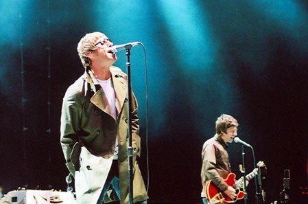
Liam and Noel Gallagher of Oasis performing in San Diego on September 18, 2005. Photo:
I am going to have to eat some of my words about the World Cup for this one.
Today is gonna be the day that they’re gonna throw it back to you
By now, you should’ve somehow realised what you gotta do
I don’t believe that anybody feels the way I do about you now
England football fans just can’t stop singing Wonderwall. Noel Gallagher originally said it was inspired by the 1968 film soundtrack Wonderwall Music by George Harrison in which the word “wonderwall” was meant to describe an imaginary friend or someone who “comes to save you from yourself”. Fans are hoping the team are coming to save them.
And backbeat, the word is on the street that the fire in your heart is out
I’m sure you’ve heard it all before, but you never really had a doubt
I don’t believe that anybody feels the way I do about you now
For years, Oasis fans thought it was about then-girlfriend Meg Mathews—Noel Gallagher publicly denied this fact and only after their divorce did he admit it was about her all along.
And all the roads we have to walk are winding
And all the lights that lead us there are blinding
Characterful brother Liam Gallagher, who I drank with long after midnight in LA once, didn’t write it but he certainly made it famous. Although Liam delivers the iconic vocal, every single word and note was written by brother Noel, who I also drank with one long night down some stairs in London’s Dean Street. In fact, the contrast between Noel’s songwriting and Liam’s voice became one of Oasis’s great strengths, even for those who liked to dismiss them as pastiche Beatles. What they went on to do separately never quite did it for me, but their saga kept running, their tiffs were kept active, and presumably their bank accounts kept swelling too.
There are many things that I would like to say to you
But I don’t know how
Because maybe
You’re gonna be the one that saves me
And after all
You’re my wonderwall
Why I reckon the song means so much to so many England football fans at the still controversial at times World Cup is its brittle hope. Maybe. So many fans’ dreams now rest on this maybe. It could be the one that saves them.
Today was gonna be the day, but they’ll never throw it back to you
By now, you should’ve somehow realised what you’re not to do
I don’t believe that anybody feels the way I do about you now
It’s actually one of the most-played songs in British music history. It’s been streamed billions of times and remains one of the most popular belters on radio, in pubs, and at weddings—even though it was released back in 1995.
And all the roads that lead you there were winding
And all the lights that light the way are blinding
There are many things that I would like to say to you
But I don’t know how
It was their first US Top 10 hit too. The lyrics are not exactly Philip Larkin but you don’t want them to be Philip Larkin. They are more than enough as they are. Even the occasional hollowness sounds real. It was Wonderwall that became the breakthrough that introduced them to mainstream American audiences, reaching the Top 10 of the Billboard Hot 100. Now it is back. It is back Stateside. And all the roads that led it back there are winding.
I said, “Maybe
You’re gonna be the one that saves me
And after all
You’re my wonderwall”
The music video didn’t do too badly either—over 508 million views when last looked. Lots of well-paid London visualists at the time used to pore over random elements within it such as the deliberately sparing blue on the acoustic guitar. Though hardly Godard, its largely black-and-white imagery went from tiresome clown to swinging saws with a kind of self-rocking ease. It also became an internet meme before memes were really memes. For years, guitar shops on Denmark Street in London’s Soho used to joke about every beginner walking in and immediately playing the opening chords. “Anyway, here’s Wonderwall” became one of the internet’s longest-running and funniest musical memes.
I said, “Maybe (I said maybe)
You’re gonna be the one that saves me
And after all
You’re my wonderwall”
Although it wasn’t written as a football anthem, England supporters now belt it out not just because the chorus is easy to join in on, but, I repeat, because of its vulnerability. For all of Liam’s consistent bravura, it is fetchingly non-macho. In fact, the slow build and emotional refrain makes it perfect for stadium singalongs. For me, it’s also a blessed relief not to have Sweet Caroline blasting out like it did among football fans for so long. Now, we have a bit of Mancunian tenderness.
I said, “Maybe (I said maybe)
You’re gonna be the one that saves me (saves me)
It probably doesn’t matter that many think the chorus begins with “Because maybe…” (It actually starts with “And after all…” before reaching the famous “You’re my wonderwall.”) The crowd often drowns out the first line anyway.
You’re gonna be the one that saves me (saves me)
You’re gonna be the one that saves me (saves me)
At this World Cup, Wonderwall has taken on a life all of its own and become a defining post-match football moment as many in the England team and country, almost teasingly, defy the tedious monoculturalisms meted out so regularly at their country by a curiously spiteful Vance and Musk.
Whatever happens next in the competition, they’re my wonderwall.
Artist: Oasis
Composition and lyrics: Noel Gallagher
Production & Engineering: Owen Morris and Noel Gallagher
Sources: Big Brother Recordings Ltd