Scores dead after worst earthquake in Nepal since 2015
Shock in Jajarkot in Karnali province about 300 miles west of Kathmandu caused at least 128 deaths and destroyed houses
Guardian staff and agencies
Fri 3 Nov 2023
At least 128 people have been killed and dozens injured after a strong earthquake struck western Nepal on Friday. Witnesses said houses in the area had collapsed and buildings were shaking hundreds of miles away.
The 5.6-magnitude quake hit the far west of the Himalayan country late Friday and was measured by the US Geological Survey at just 18 kilometres (11 miles) deep.
In Jajarkot district which is near the epicentre, 92 people were confirmed dead and another 55 injured, Nepal police spokesperson Kuber Kadayat said.
The quake killed at least 36 people in neighboring Rukum district, where numerous houses collapsed. At least 85 injured people had been taken to the local hospital, he said.
Troops were also clearing roads and mountain trails that were blocked by landslides triggered by the earthquake.
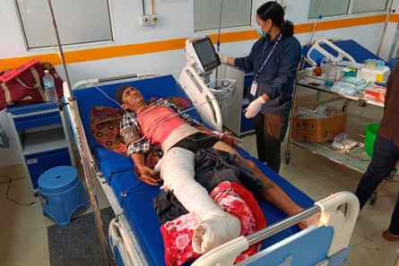
A doctor looks after a patient injured in an earthquake, evacuated from his village and brought to a hospital in Nepalgunj, Nepal.
Photograph: Krishna Adikari/AP
“The remoteness of the districts makes it difficult for information to get through,” Karnali Province police spokesperson Gopal Chandra Bhattarai told the AFP news agency.
Bhattarai said Nepali security forces had been deployed extensively to assist with search and rescue operations.
“Some roads had been blocked by damage, but we are trying to reach the area through alternate routes,” he added.
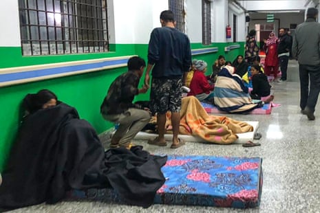
The district hospital was packed with residents bringing in injured victims.
Ramidanda, where the epicentre lies, has not been reached by authorities yet.
Videos and photos posted on social media showed locals digging through rubble in the dark to pull survivors from the wreckage of collapsed homes and buildings.
Mud houses were flattened or damaged as survivors crouched outside for safety, as the sirens of emergency vehicles wailed.
Nepal’s prime minister Pushpa Kamal expressed “his deep sorrow over the human and physical damage caused by the earthquake”.
Nepal’s National Seismological Centre said the quake occurred at 11.47pm (18.02 GMT) in Jajarkot, a district of Karnali province. Jajarkot is about 500km (310 miles) west of the capital, Kathmandu.
Buildings shook as far as away New Delhi, about 600km (375 miles) away, according to witnesses who spoke to Reuters. Videos on the social media platform X, formerly Twitter, showed people running into the street as some buildings were evacuated.
Reuters and Agence France-Presse contributed to this report
“The remoteness of the districts makes it difficult for information to get through,” Karnali Province police spokesperson Gopal Chandra Bhattarai told the AFP news agency.
Bhattarai said Nepali security forces had been deployed extensively to assist with search and rescue operations.
“Some roads had been blocked by damage, but we are trying to reach the area through alternate routes,” he added.
The district hospital was packed with residents bringing in injured victims.
Ramidanda, where the epicentre lies, has not been reached by authorities yet.
Videos and photos posted on social media showed locals digging through rubble in the dark to pull survivors from the wreckage of collapsed homes and buildings.
Mud houses were flattened or damaged as survivors crouched outside for safety, as the sirens of emergency vehicles wailed.
Nepal’s prime minister Pushpa Kamal expressed “his deep sorrow over the human and physical damage caused by the earthquake”.
Nepal’s National Seismological Centre said the quake occurred at 11.47pm (18.02 GMT) in Jajarkot, a district of Karnali province. Jajarkot is about 500km (310 miles) west of the capital, Kathmandu.
Buildings shook as far as away New Delhi, about 600km (375 miles) away, according to witnesses who spoke to Reuters. Videos on the social media platform X, formerly Twitter, showed people running into the street as some buildings were evacuated.
Reuters and Agence France-Presse contributed to this report
Earthquake Leaves Trail Of Destruction In Nepal
Helicopters and ground troops rushed to help people hurt in a strong earthquake that shook northwestern Nepal districts just before midnight Friday, killing more than hundred people and injuring dozens more, officials said Saturday.
UPDATED: 04 NOV 2023
1
Helicopters and ground troops rushed to help people hurt in a strong earthquake that shook northwestern Nepal districts just before midnight Friday, killing more than hundred people and injuring dozens more, officials said Saturday.
UPDATED: 04 NOV 2023
1
Earthquake in northwestern Nepal | Photo: AP/PTI
This handout photo provided by Nepal Prime Minister's Office shows an earthquake-affected area in northwestern Nepal.

This handout photo provided by Nepal Prime Minister's Office shows an earthquake-affected area in northwestern Nepal.
Nepal earthquake | Photo: PTI
Locals outside their houses after their collapse following a 6.4 magnitude earthquake, that killed at least 128 people and injured several others, in Nepal's Jajarkot.

Locals outside their houses after their collapse following a 6.4 magnitude earthquake, that killed at least 128 people and injured several others, in Nepal's Jajarkot.
Nepal earthquake | Photo: PTI
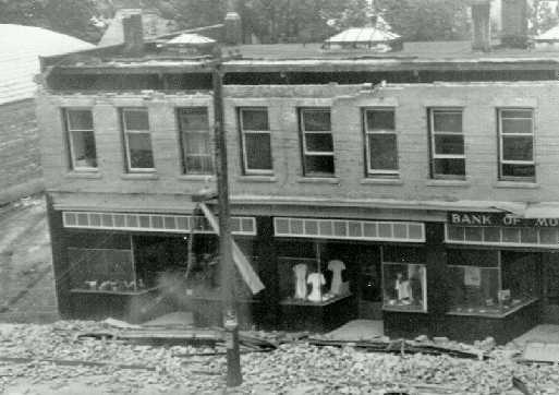
Damaged houses a day after a 6.4 magnitude earthquake that killed at least 128 people and injured several others, in Nepal's Jajarkot.

Damaged houses a day after a 6.4 magnitude earthquake that killed at least 128 people and injured several others, in Nepal's Jajarkot.
Nepal earthquake | Photo: PTI
Debris of the buildings a day after a 6.4 magnitude earthquake that killed at least 128 people and injured several others, in Nepal's Jajarkot.

Debris of the buildings a day after a 6.4 magnitude earthquake that killed at least 128 people and injured several others, in Nepal's Jajarkot.
Nepal earthquake | Photo: Sabin Dhamala via AP
This screen grab from video shows villagers stand in front of their damaged houses from last night earthquake in Jagarkot, Nepal.

This screen grab from video shows villagers stand in front of their damaged houses from last night earthquake in Jagarkot, Nepal.
Nepal earthquake | Photo: AP/Krishna Adikari
A doctor looks after a patient injured in an earthquake, evacuated from his village and brought to a hospital in Nepalgunj, Nepal.

A doctor looks after a patient injured in an earthquake, evacuated from his village and brought to a hospital in Nepalgunj, Nepal.
Nepal earthquake | Photo: PTI
Nepal's Prime Minister Pushpa Kamal Dahal 'Prachanda' during his visit at the earthquake site, in Jajarkot. At least 128 people were killed and several others injured.

Nepal's Prime Minister Pushpa Kamal Dahal 'Prachanda' during his visit at the earthquake site, in Jajarkot. At least 128 people were killed and several others injured.
Earthquake in Nepalgunj, Nepal | Photo: AP/PTI
People airlifted from an earthquake-affected area arrive in Nepalgunj, Nepal. A strong earthquake has shaken northwestern Nepal, and officials say more than 100 people are dead and dozens more injured as rescuers search mountain villages.
People airlifted from an earthquake-affected area arrive in Nepalgunj, Nepal. A strong earthquake has shaken northwestern Nepal, and officials say more than 100 people are dead and dozens more injured as rescuers search mountain villages.
Reuters
November 4, 2023
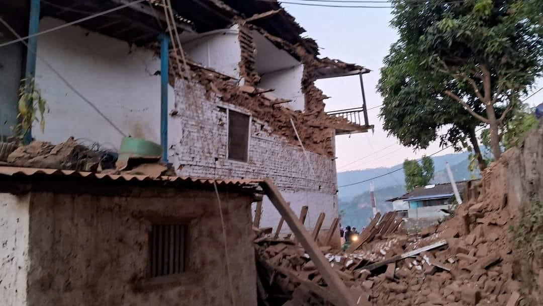
]A damaged building is seen after an earthquake in Jajarkot, Nepal, November 4, 2023. Prime Minister Office/Handout via REUTERS Acquire Licensing Rights
Nov 4 (Reuters) - The Himalayan country of Nepal was hit by an earthquake on Friday in which 128 people were killed and dozens injured, with officials fearing the toll could rise.
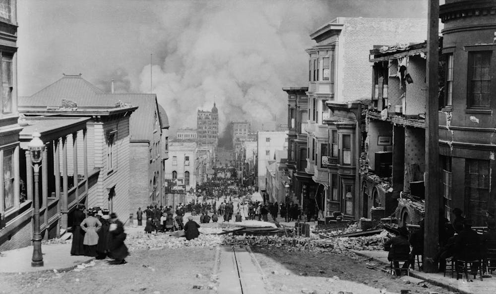
The poor, mountainous nation wedged between Asian giants China and India has been hit by quakes often, with the deadliest recorded in 2015 when about 9,000 people were killed in two earthquakes.
Whole towns, centuries-old temples and other historic sites were reduced to rubble then, with more than 1 million houses destroyed, at a cost to the economy of $6 billion.
Below are details of Nepal’s deadly quakes since 2015.
NOV 3, 2023
At least 128 people were killed and dozens injured when a strong earthquake struck the western area of Jajarkot. Houses in the area collapsed and buildings as far away as capital New Delhi in neighbouring India shook. The German Research Centre for Geosciences measured the quake at magnitude 5.7, while the U.S. Geological Survey pegged it at 5.6.
OCT 3, 2023
Two earthquakes rocked western Nepal, injuring 17 people, damaging homes and triggering a landslide that blocked a major highway. The landslide after the quakes of magnitude 6.3 and 5.3 in the district of Bajhang, bordering India, blocked the road to the southern plains.
JAN 24, 2023
At least one person died and more than two dozen houses were damaged in a remote Nepalese district after an earthquake of magnitude 5.6. Tremors were felt as far away as New Delhi.
NOV 12, 2022
An earthquake of magnitude 5.4 struck Nepal, shaking houses in the Himalayan country and India.
NOV 9, 2022
An earthquake in western Nepal killed at least six villagers, four of them children, as the tremor destroyed mud and brick houses in remote communities living in the foothills of the Himalayas.
SEPT 16, 2020
An earthquake measuring magnitude 6 struck Nepal and tremors caused by the quake were felt in the capital, Kathmandu.
APRIL AND MAY 2015
The worst earthquake in Nepal's history struck at four minutes to midday on April 25. It measured magnitude 7.8 and was followed by a second tremor 17 days later, killing 9,000 people in total.
The previous deadliest earthquake to strike the country, in 1934, killed at least 8,519 in Nepal, as well as thousands more in India.
Compiled by YP Rajesh in New Delhi; Editing by Jamie Freed


