Showing posts sorted by date for query BOUNDARY DAM. Sort by relevance Show all posts

Friday, July 05, 2024

 INDIA

Odisha: Tainted Waters of Tilia Put Life in Peril


Krishnanshu Panda 


Two ash ponds near Hirakud Reservoir pollute groundwater, affect health of villagers who live in constant fear of a breach.


Ash slurry dumped in Tilia's ash ponds (Photo - Krishnanshu Panda, 101Reporters)

Tilia, Odisha: Right next to Hirakud Reservoir are the two ash ponds spread across 260 acres. This spot at Tilia in Odisha’s Jharsuguda district is where state-owned Odisha Power Generation Corporation (OPGC) dumps ash slurry from its coal-based IB Thermal Power Station.

The power plant adopts two ways to dispose of the ash waste it generates — making ash slurry and discharging it into ash dykes using pipelines, and dumping fly ash in barren lands. Both methods have their own flaws, which affect the environment and lives of people in four villages of Tilia panchayat.

“My village is close to the ash pond. If it breaches, my house and farmland will be damaged. I filed a case before the National Green Tribunal in 2019, but the State Pollution Control Board, Collector's office and political leaders of the region got a stay order. They claimed that the ash ponds were in Tilia panchayat, while my village was in Rampela panchayat,” said Gautam Seth. The farmlands at risk are mostly paddy fields.

The problems do not end with this. According to Seth, the OPGC is taking measures to increase the capacity of the pond to hold more ash slurry. This move, along with the continuous disposal of slurry, instils fear of a possible breach among villagers.

Fear of breach

As per a report by Healthy Energy Initiative India and Legal Initiative for Forest and Environment, there were 17 major incidents of ash pond breaches, spills and accidents spanning seven states from April 2020 to March 2021. The Coal Ash in India – Vol II: An  Environmental, Social, and Legal Compendium of Coal Ash Mismanagement in India also shows that Odisha saw the highest number of six cases.  


Fly ash dumped on the road (Photo - Krishnanshu Panda, 101Reporters) 

The dread of Tilia residents is compounded by the breach that occurred last December at an OPGC-run ash dyke at Banharpali, located 11 km from Tilia panchayat. The breach in the ash pond polluted the Hirakud Reservoir and 420 acres of farmland.

“The ash ponds are right next to the reservoir… This area has been allotted for farming to those displaced by Hirakud Dam… If they make ash ponds in remote areas sans water sources or farmlands, it is a different thing. Otherwise, it is bound to leak and mix in water bodies and enter farmlands. We had protested when the IB plant construction began [the plant is operational since 1996],” Gopinath Majhi (67), a member of Hirakud Budi Anchal Sangram Samiti (a collective of displaced people) and Jharsuguda resident, told 101Reporters.

Six months after the breach, Majhi filed a petition with the NGT seeking directions to examine the impact of the breach at Banharpali and check if ash ponds complied with the conditions set for environmental clearance. The petition stated that ash dykes should be located at a distance of at least 500 m from the surface water source, the Hirakud Reservoir in this case.  

According to the environment clearance guidelines, it is mandatory that the ash pond be lined with high/low density polythene to prevent the ash slurry from seeping into the groundwater. Claiming compliance, OPGC, in their half-yearly environmental status report for October 2022-March 2023, said that ash ponds are equipped with High-density Polyethylene (HDPE) lining.

However, the ground reality is different. 101Reporters found the HDPE lining torn in many places in the ash pond units 3 and 4 of Tilia. “As a result, ash water seeped into the groundwater accessed through borewells by villagers. The HDPE liner on the ash dyke boundaries is torn at places where water seepage can happen, especially during rains. This may lead to soil erosion and cracks that can result in a breach."

Former Tilia sarpanch Thanasundar Sahu (49), who had campaigned against ash pond construction in his panchayat, and present sarpanch Pushpanjali Pradhan claimed that villagers were unaware of the health risks due to exposure to ash. Thanasundar also mentioned that OPGC tried to create some awareness, but the villagers ignored it.

Despite the risk, some villagers are earning their livelihood from the ash pond. One of them, Krushna Chandra Bhoi (51) of Tilia collects hollow ash particles floating on top of the stagnant water of the ash pond. “I can collect 15 to 20 kg of hollow ash every day. I sell it to Gobinda, a middleman, for Rs 16 per kg,” said Bhoi, who used to fish for a livelihood earlier. As per Seth, middlemen sell the ash to chemical plants.

Meanwhile, Thanasundar said it is illegal to enter ash ponds. “OPGC tells people not to enter, but they do not listen.”

Fly ash menace

The health risks are more with fly ash than ash slurry. “To make an ash pond, one needs to acquire land, compensate its owner, hire a contractor, excavate the land, build boundary walls, cover it with polythene, and set up a pipeline and a slurry-making machine that consumes power. Why go through this headache when they can dump the powdered ash,” asked Bharat Sahu (46), a former manager of Ind-Barath Energy (Utkal) power station in Tilia who lost his job when JSW Energy acquired it.


Ash pond next to JSW power plant without the HDPE liner (Photo - Krishnanshu Panda, 101Reporters).

“Imagine that I own a five-acre barren land. I can dig it up to 4 m, dump the ash powder and cover it. I will get money for this, but the land will no longer be cultivable,” he added.

While state-owned OPGC is obliged to make ash dykes, other private power plants prefer to dump fly ash. “As many as 40 trucks loaded with fly ash are sent out from private power plants every day,” claimed Bharat. This is also because of the higher ash content in Indian coal, which is generally 25% to 45%.

At Tilia, 101Reporters learned that JSW Energy Ind-Barath had created a small pond behind its power plant to dump ash. However, it does not comply with the norm of covering the pond with HDPE liner. It also dumps fly ash on roadsides, which gets airborne during strong winds. "Non-use of liners is the company's negligence. A thick liner costs Rs 80 to 100 per sq m," said Seth.  

“Fly ash can have a different chemical makeup depending on where the coal was mined. Broadly speaking, fly ash is a pollutant containing acidic, toxic and radioactive matter. It can contain lead, arsenic, mercury, cadmium and uranium. The Environmental Protection Agency has found that significant exposure to fly ash and other components of coal ash increases a person’s risk of developing cancer and other respiratory diseases.” said Fortis Chemicals Chief Executive Officer Jiban Krishna Pattnaik, also an expert in industrial safety, health and environment.

Inhalation of fly ash or ingesting contaminated water can impact the nervous system, causing cognitive defects and behavioural problems, while also increasing the chance of developing lung and kidney diseases, among others.

“Not all substances present in coal will burn, such as arsenic, barium, beryllium, boron, cadmium, nickel, lead, mercury, molybdenum, selenium and thallium. Elevated levels of radioactivity may also be present. Many of these substances, especially heavy metals, can negatively affect humans when ingested. Because of biomagnification, the concentration of unwanted chemicals in animals can increase up a food chain, similarly to mercury in tuna,” Pattnaik said.

Sustainable solutions

As per its environmental status report, OPGC have utilised 4,03,200 metric tonnes of ash waste produced in 2021-22. This was by setting up a fly ash brick production plant that could produce 10,000 bricks per day and by supplying fly ash to other such units around the area and for road construction. This amounts to 34% of the total ash waste produced. The rest was disposed of.

“As per the guidelines issued in 2000 by the Ministry of Environment, Forest and Climate Change, companies that produce ash waste are responsible for its disposal,” Dr Sundara Narayana Patro, president, Orissa Environmental Society, told 101Reporters.

The ministry has made it mandatory for thermal power plants to utilise ash waste fully. “There are three ways of ash disposal. First is to fill the void of open coal mines with ash waste. Second is utilising fly ash to make construction materials such as ash bricks and lastly, ash has some urea that can be used to make forest lands fertile.”

In its report, OPGC termed mine void backfilling of ash as the only means that ensures 100% ash utilisation. It added that despite repeated efforts, the Mahanadi Coalfields Limited has not allotted the Belpahar opencast mine to them for ash disposal.

Dr Patro said coal mines were bound to give permission for ash disposal in open cast mines as per the ash disposal rules. A former OPGC employee, on the condition of anonymity, told 101Reporters, “Filling open cast coal mines is an effective solution for ash disposal, and the government should make provision for this.” 

(Krishnanshu Panda is an Odisha-based freelance journalist and a member of 101Reporters, a pan-India network of grassroots reporters.)  

Tuesday, June 25, 2024

Would another earthquake reroute the Ganges River?
DW
June 24, 2024

2,500 years ago, an earthquake changed the course of one of Earth's largest rivers, totally altering the landscape. Could it happen again?


The Ganges River was rerouted by a high-magnitude earthquake 2,500 years ago, and experts say it could happen again
Image: Payel Samanta/DW

A study has found a major earthquake 2,500 years ago caused one of the largest rivers on Earth to suddenly change course.

The high-magnitude earthquake completely rerouted the main channel of the Ganges River in what is now densely populated Bangladesh, and completely changed the surrounding landscape.

While it is "normal for river channels to move with time, this was an absolutely extreme event. The river moved to an entirely new area," said lead author Elizabeth Chamberlain of Wageningen University in the Netherlands.

The study, published in the journal Nature Communications, is the first evidence of a large river delta being completely relocated by an earthquake.

The study authors warn that Bangladesh is vulnerable to big quakes and that it is possible for the Ganges River to relocate again if another high-magnitude earthquake hit the region.

"Although infrequent, the risk of such an event could be huge, especially because Bangladesh hosts one of the most densely populated landscapes on the planet," said Chamberlain.

How an earthquake rerouted the Ganges River

The Ganges begins as streams in the Himalayas and flows for 2,500 kilometers (1,600 miles), eventually combining with other major rivers, including the Brahmaputra and the Meghna.

It's a huge delta river system that empties into a wide stretch of the Bay of Bengal, spanning Bangladesh and India.

As with other rivers, the Ganges periodically changes course due to the natural erosion of its riverbanks.

This process takes decades to occur, but "the Ganges-Brahmaputra river system has moved several times over the past 6,000 years," said Christoph von Hagke of the University of Salzburg, Austria, who also took part in the study.

The researchers used satellite imagery to spot the former main channel of the river around 100 kilometers south of the Bangladeshi capital, Dhaka.

The team had been exploring the area when they found signs of historical earthquakes — such as vertical dikes of light-colored sand cutting up through horizontal layers of darker mud.

Chemical analysis of the sand and mud showed several eruptions happened at the same time, about 2,500 years ago. The eruptions were estimated to be magnitude 7 to 8 — about the same as the earthquake which hit Turkey and Syria in 2023.
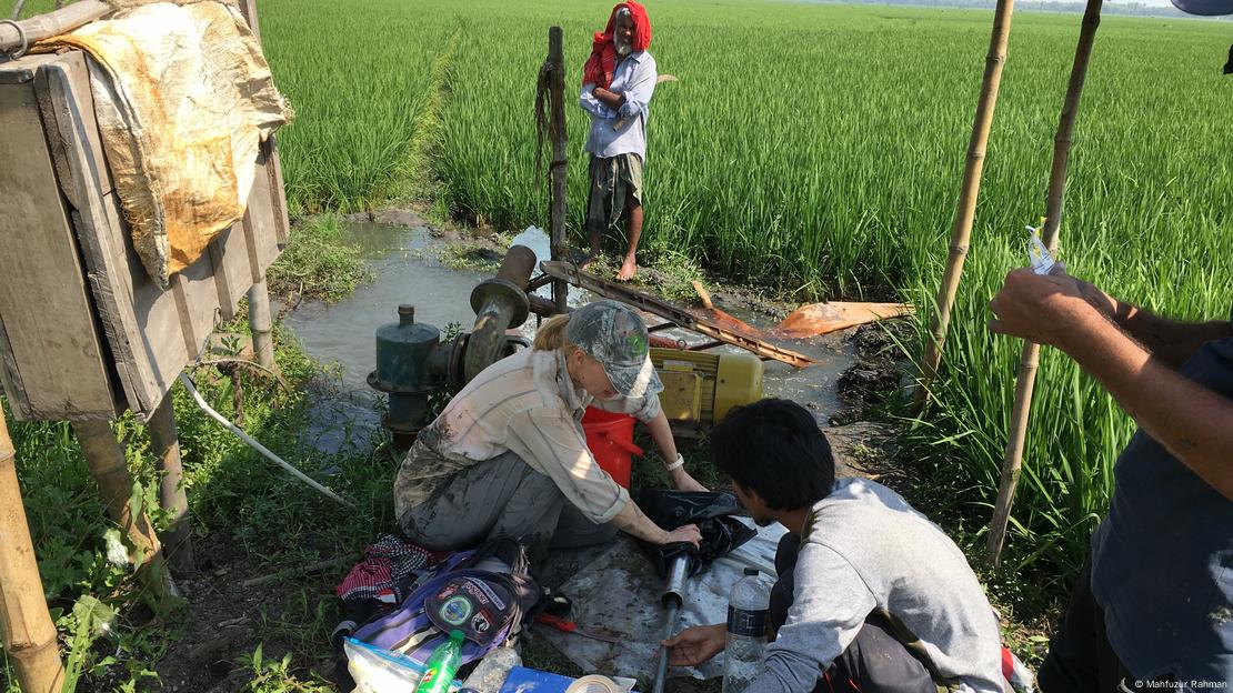
The team, led by Elizabeth Chamberlain (center), collected mud from the ancient Ganges River channel and used optically stimulated luminescence dating to analyze it
Image: Mahfuzur Rahman

The vast Ganges-Brahmaputra river system is located close to an active plate boundary and is a tectonically active region.

"This proximity brings frequent major earthquakes," said Till Hanebuth, a specialist in geosciences at Coastal Carolina University in the US. Hanebuth was not part of the study.

Bangladesh is particularly susceptible to catastrophic earthquake events due to its proximity to seismic zones.

While the region is not currently thought to be at risk, the researchers said it was possible for an earthquake to be strong enough to reroute the Ganges in the next few hundred to 1,000 years.

Ganges rerouting would be 'catastrophic for the region'

The researchers said their study showed it was entirely possible for delta rivers to be dramatically rerouted if they are hit by high-magnitude earthquakes.

"It was indeed a very extreme event — in fact two extreme events occurred. An earthquake of magnitude 7 to 8 is already extreme, but it caused redirection [known as avulsion] of the main channel of the Ganges," said von Hagke.

Von Hagke said a new event of the same size would be catastrophic for the region because it would hit "a super densely populated region."

River breaching and relocation does not only depend on earthquakes — they can also be caused by extreme weather, said Hanebuth.

"Abrupt river avulsions could be caused by a major monsoon or cyclone flooding event, or the collapse of a major river dam," Hanebuth said, adding that while such could be caused by natural events, they were also "largely human-made."


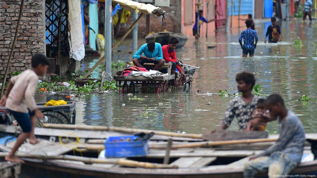
Experts say a huge earthquake could reroute the Ganges in the future and that the effect on local communities would be 'catastrophic'
Image: Sanjay Kanojia/AFP/Getty Images


Can earthquakes be predicted?


Von Hagke said researchers needed to know more about the likelihood of large-scale river avulsion events in the future, particularly those from earthquakes.

The hard part, he said, was that scientists cannot predict when earthquakes will occur, or how big they will be when they do hit.

"For different earthquake scenarios, one could estimate landscape changes and then possible effects on rivers and water masses. But we cannot pinpoint the timing of an event that only happens every few hundred to a few thousand years," said von Hagke.

Chamberlain said, however, that knowing it was possible for earthquakes to completely reroute rivers, and the Ganges in Bangladesh in particular, meant that researchers could now begin to understand and predict how seismic events occur.

"We hope this knowledge can be helpful for hazard planning and mitigation before a modern event," she said.

The Ganges isn't the only river facing earthquake-related hazards. Others include China's Yellow River, Myanmar's Irrawaddy, the Klamath, San Joaquin and Santa Clara rivers on the US West Coast, and the Jordan River, which spans the borders of Syria, Jordan, the Palestinian West Bank and Israel.

Edited by: Zulfikar Abbany

Primary source:Cascading hazards of a major Bengal basin earthquake and abrupt avulsion of the Ganges River. Published in the journals Nature Communications by E.L. Chamberlain, S.L. Goodbred, M.S. Steckler, et al. 2024 (www.nature.com/articles/s41467-024-47786-4)

Friday, May 24, 2024


Intense Construction Activities Are Weakening Himalayan Region’


Rashme Sehgal 


Interview with noted seismologist Dr CP Rajendran on his new book ‘The Rumbling Earth- The Story of Indian Earthquakes’.

Noted seismologists Dr CP Rajendran and Dr Kusala Rajendran have embraced earthquake studies as their area of research. Their interest was triggered while doing their post-doctoral research at the University of South California where a mysterious earthquake in 1886 had destroyed the historic town of Charleston. Returning to India, they have focused on the enigmatic mysteries associated with earthquakes in a country where one quake occurs every 1-3 days.

Their research during the past three decades has seen them publish `The Rumbling Earth- the Story of Indian Earthquakes’ (published by Penguin) which explores the history of earthquakes as also raises the question of how prepared we are to face another big earthquake in the country given that during the last decade, 274 seismic events with a magnitude of 4 occurred within 300 km of our borders. Dr CP Rajendran talks exclusively to Newsclick. Edited excerpts:

Rashme Sehgal: This (the book) is probably the first scientific documentation of earthquakes in the country which highlights how India has witnessed some of the most violent earthquakes in the world. Why is that?

CP Rajendran: Perhaps, it is the first of its kind reviewing most of the earthquakes that have occurred in India in recent and historical times. There are individual reports and scientific papers on many of these earthquakes. Ours happens to be the first book that collated the information. Perhaps our joint work for the past three decades provided a favourable platform -–for a first-time attempt to compile the science and the impact of a natural force for public understanding.

RS: The largest documented earthquake in history occurred in Northeast India on August 15, 1950. It was called the Assam earthquake. What kind of fallout did this have?

CPR: The Assam earthquake demonstrated that large earthquakes can significantly change the landscape, especially with a large river system. Of course, it was the largest earthquake in Independent India that pushed the idea of studying earthquakes as a part of scientific discipline.

RS: The first historically known large earthquake occurred in the Rann of Kutch on June 16, 1819. You have studied it at some length. What were some of your and Kusala’s findings?

CPR: Ours was the first study that excavated the area to find relics of past earthquakes. The most important finding was that the 1819 earthquake had predecessors of similar sizes and physical impacts, with a recurrence interval of about 1,000 years. These earthquakes raised a low-lying ocean creek and converted it into land. The other contribution was that we could physically map the Allah Bund – generated by the 1819 earthquake -- which was never surveyed before using modern equipment. This is the first modern study of the 1819 earthquake.

RS: Bhuj (Gujarat) was also witness to a deadly earthquake. Was this linked to the earlier Rann of Kutch earthquake?

CPR: In some ways, the 2001 Bhuj earthquake was a surprise as the region where it occurred has not experienced any earthquakes in the historic past. With one earthquake in 1819, which is quite far from Bhuj, no one expected an earthquake in less than 200 years, near Bhuj The most important fallout of our study was the recognition that there are multiple earthquake sources in the Kutch region (which hosted the 1819 earthquake and the 1956 Anjar earthquake) which may have different repeat intervals, of the order of a few thousands of years. The 1819 source seems to have a recurrence period different from the 2001 source near Bhuj.

RS: Did the Koyna dam (in Maharashtra) trigger the massive Killari earthquake in 1993. We are building huge hydro projects along the Himalayas without keeping in mind the ecological consequences in terms of earthquakes, landslides and the formation of glacial lakes. Can you elaborate on the consequences of large-scale construction?

CPR: The Koyna Dam did not trigger the 1993 Killari earthquake. The dam did trigger a similar earthquake in 1967 and it continues to trigger smaller earthquakes near the Koyna Reservoir. Usually, the reservoir-triggered earthquakes occur in response to the filling/recycling cycles and they are confined to a few kilometres, adjoining the dam (maybe about 30 km in the case of Koyna, mostly to the south, extending to the Warna Reservoir). The source of the Killari earthquake is more than 350 km away from the Koyna reservoir and that would not affect this region.

Building large dams in the Himalayan region has several consequences. It is anyway seismically very active and earthquakes are bound to happen. The real threat would come from landslides that can breach the dam, and cause flooding.

The intense construction-related activities are already weakening the Himalayan region. The vulnerability of the region is already high, and construction activities are increasing the risk. So, it is not just the dams, it is the environmental, ecological and structural stress (weakening the slopes etc.) that are creating multiple risks.

The complex relationship between the glacial lake outburst, floods and destruction of dams was evident in the disaster that occurred in Sikkim last year. A major earthquake in the upper reaches of the Himalayas can also result in glacial lake outbursts. Combined with unregulated constructions, hydroelectric projects and related anthropogenic activities, these events lead to massive disasters.

RS: At present, the Geological Survey of India has documented that we have 66 active fault lines, all of which can produce earthquakes. How serious can this problem be given rapid urbanisation and increasing population?

CPR: Most of the active faults are located in areas that have produced earthquakes either historically or in recent times -- like the Himalayas, Northeast India, Gujarat and the Andaman and Nicobar. Earthquakes are bound to happen in these regions, the only question is when.

Accelerated urbanisation, expanding built environment and population density are likely to amplify the effect of the earthquakes by causing more damage and death. Many engineered structures may not pass the stability test during an earthquake and are not designed to minimise the shaking effects. There must be a concerted effort from the disaster management authorities to create awareness among the people and facilitate better construction practices.

RS: While most of these fault lines occur along the Himalayas and in the Andaman- Nicobar region, why then did we witness a deadly earthquake on September 30, 1993 in Killari 42 km south of Latur (Maharashtra) which destroyed 67 villages and took over 10,000 lives, given that this is not regarded as a quake-prone zone?

CPR: It is well-known that most earthquakes around the world are confined to the plate boundaries where tectonic strain is felt most, like the Himalayas (the weak regions where the 100-km-thick plates that form the top part of the earth collide with each other). While the plate boundaries are subject to intense and more frequent earthquakes, regions away from the plate boundaries also produce earthquakes. These are usually moderate (magnitude less than 7.0 and far separated in time. Thus, a region like Latur, with no history of earthquakes, caused one in 1993.

Similar earthquakes have occurred in Australia, Canada and other places that are several thousand kilometres away from any active plate boundary. Because they are so infrequent, and their predecessors must have occurred much before recorded human history, they are unexpected and communities living in those areas are thoroughly unprepared to face such eventualities.

RS: Your book mentions how 90% of the world’s earthquakes occur along the rings of fire that are spread along the Pacific Ocean belt. But these earthquakes do not seem to have caused the kind of damage to lives and property caused by the earthquakes in India. Your comments.

CPR: The statement that 90% earthquakes occur along the plate boundaries (especially the Ring of Fire) includes all earthquakes, even those originating in the ocean. The real issue is that earthquakes kill more people in densely populated and economically backward countries, where preparedness is low.

The 2023 Turkey-Syria earthquake reportedly killed more than 50,000 people and levelled the cities. However, casualties and the level of destruction for a similar magnitude earthquake (magnitude 7.4) in Taiwan in April 2024 were limited. The low death toll is attributed to the country’s preparedness. Taiwan’s performance in reducing earthquake-related loss is a lesson for countries like India -- one of the most populous countries, but least prepared for natural hazards, including earthquakes, going by the previous performances.

RS: Earthquakes often result in dramatic changes to the earth’s structure. Please elaborate.

CPR: The changes are observed on the surface of the earth (not exactly the earth’s structure, which is a term used to describe the internal structure). One of the classic examples that demonstrate the changes caused to the earth’s surface is the 1906 San Francisco earthquake that occurred on the San Andreas Fault. It caused a lateral shift of about 6 meters visible on the railway tracks, fences and pavement.

RS: How far can seismology be considered a science when it cannot predict the occurrence of an earthquake?

CPR: Seismology is not just about predicting earthquakes. It is about imaging the interior structure of the earthquake, quantifying the size of earthquakes; predicting their effects and relating them to the causative faults, and much more. It is the study of the spatial distribution of global earthquakes that led to the theory of plate tectonics – a fundamental theory that provides the basis for all earth processes.

Unlike cyclonic storms, tornadoes and similar weather processes that can be monitored using measurable parameters, earthquakes originate several tens of kilometres below the surface, beyond the realm of observation and as the result of many emergent feedback processes that are not easily quantifiable or observable. Yet, there is hope that modern computational techniques will be able to take us closer to that goal.

RS: The earth’s mantle has two layers that are in constant motion and this provides the basic mechanism for the movement of the tectonic plates. How much is this movement affecting the Himalayas as a whole?

CPR: The Himalayas are the outcome of the collision of the India-Eurasia tectonic plates – an event that happened about 40 million years ago. The process is still ongoing. The grinding movement of these plates continues at about 20 mm per year along the Himalayas. This plate movement is what causes the build-up of tectonic stress along the Himalayas. When the strain increases on the fault to the point of failure to overcome the rock strength, it leads to the fault break and the earthquake. The strain release that causes the earthquakes occurs somewhat periodically and that also contributes to the rising of the mountain. Thus, the mountain owes its origin to the earthquake activities along the numerous faults.

Rashme Sehgal is an independent journalist.

Monday, April 29, 2024

Climate change to blame for acid rock drainage in certain parts of the world - study


29.04.2024


Copper, zinc, and sulphate concentrations in the waters of Colorado mountain streams affected by acid rock drainage have roughly doubled over the past 30 years, a new study finds.


The paper, published in the journal Water Resources Research, notes that natural chemical weathering of bedrock is the source of the rising acidity and metals, but the ultimate driver of the trend is climate change.


“Heavy metals are a real challenge for ecosystems,” lead author Andrew Manning, a geologist with the US Geological Survey in Denver, said in a media statement.
“Some are quite toxic. We are seeing regional, statistically significant trends in copper and zinc, two key metals that are commonly a problem in Colorado. It’s not ambiguous, and it’s not small.”


Although the mechanism coupling warming temperatures to increased sulphide weathering is still an open research question, the new results point to rock exposure once sealed away by ice as a top suspect.


The sudden appearance of “rusting Arctic rivers” flowing out of regions of thawing permafrost in the last couple of years is likely the same process, magnified.


Colorado is riddled with patches of bedrock rich in metal sulphides. Shiny iron sulphide, familiar to many Coloradans as fool’s gold or pyrite, is the most common of these sulphide minerals, but copper, zinc, and other metal sulphides are also common.


Exposure to air oxidizes the metal sulphides in bedrock, releasing the metals into groundwater, which flows into surface streams. Rusty red deposits in streambeds are distinctive signs of iron sulphide oxidation. Sulfides also acidify the water, which can accelerate weathering.


Some alpine streams sampled were found to have a pH as low as 3 or 4.Mining not to blameThe study drew on 40 years of water chemistry data, taking final samples from all sites in 2021 from 22 headwater streams in 17 watersheds that are naturally acidic and metal-rich enough to limit aquatic plants and animals.


Sampling sites were above 3,000 meters elevation and included a mix of pristine, untouched areas and places that had been mined historically but left alone for 50 to 100 years.


“The key point is no recent mining or remediation work has been done,” Manning said. “These watersheds have just been sitting there responding to nothing other than the climate.”


Mountain streams were sampled from mid-July to November, spanning the late summer and fall low-flow periods. Long-term records of flow volume from nearby stream gauges show stream flows have been dwindling with warming temperatures and smaller snowpacks, suggesting smaller water volumes could explain the higher metal concentrations.


But Manning and his colleagues found less water could only account for half the effect they observed. To reach the concentrations they were seeing, the mountains had to be putting metals and sulphate into streams at a faster rate.


The researchers noticed that as these metal-rich mountain streams flow down into larger rivers, the effect of the extra metal load is diluted.“I don’t think this is a big red flag for major metropolitan or agriculture users way downstream at lower elevations,” Manning said, “but some of our mountain communities get their water only a short distance down from these mineralized streams.”


In the scientist’s view, to help mitigate the water quality risk, managers could benefit from advanced knowledge of what metals are entering the stream and where and how fast they are increasing.


More metals and acidity in these mountain streams could also impact decisions about where to invest limited funds for remediation of those that have been altered by historical mining and where to stock fish to benefit tourism.


Global problem


Manning pointed out that colleagues are observing more subtle rising sulphate concentrations in mountain streams around the world.


The new study, however, is the first to statistically connect accelerated sulphide weathering to rising temperatures on a large scale across an entire region.


The study found the biggest gains in metal loads in the highest, coldest mountain streams.


This pattern points to thawing underground ice.


Colorado’s highest elevations have annual average temperatures close to zero degrees Celsius, putting them right at the boundary conditions for permafrost.


Some peaks have warmed past the freezing threshold since 1980.“Ice is like armour. Melt it and you create windows for groundwater to get into rock that has not seen water and oxygen for millennia, and it will begin to oxidize quite quickly,” Manning said.


Other possible mechanisms are falling water tables exposing fresh rock to air and melting rock glaciers, releasing pockets of concentrated metals stored in the ice.


Wetlands accumulate metals and may release a burst when water returns after dry periods.


Yet, the study did not find a correlation between rates of rising metal concentrations and the presence of wetlands, rock glaciers, or factors linked to falling water tables, although these could be playing a role in other regions.


All these possible mechanisms are consequences of climate change.“There’s just no other logical explanation than this is a changing climate signal,” Manning said. “Nothing else would reach all these watersheds universally.”


Warming climate is putting more metals into Colorado's mountain streams


Date: April 23, 2024
Source:  American Geophysical Union

Summary:
Warming temperatures are causing a steady rise in copper, zinc and sulfate in the waters of Colorado mountain streams affected by acid rock drainage. Concentrations of these metals have roughly doubled in these alpine streams over the past 30 years, presenting a concern for ecosystems, downstream water quality and mining remediation, according to a new study. Natural chemical weathering of bedrock is the source of the rising acidity and metals, but the ultimate driver of the trend is climate change, the report found, and the results point to lower stream volumes and exposure of rock once sealed away by ice as the likely causes.


FULL STORY

Warming temperatures are causing a steady rise in copper, zinc and sulfate in the waters of Colorado mountain streams affected by acid rock drainage. Concentrations of these metals have roughly doubled in these alpine streams over the past 30 years, a new study finds, presenting a concern for ecosystems, downstream water quality and mining remediation.


Natural chemical weathering of bedrock is the source of the rising acidity and metals, but the ultimate driver of the trend is climate change, the report found.

"Heavy metals are a real challenge for ecosystems," said lead author Andrew Manning, a geologist with the U.S. Geological Survey in Denver. "Some are quite toxic. We are seeing regional, statistically significant trends in copper and zinc, two key metals that are commonly a problem in Colorado. It's not ambiguous and it's not small."


The study was published in Water Resources Research AGU's peer reviewed journal for original research on the movement and management of Earth's water.

Although the mechanism coupling warming temperatures to increased sulfide weathering is still an open research question, the new results point to exposure of rock once sealed away by ice as a top suspect, Manning said. The sudden appearance of "rusting Arctic rivers" flowing out of regions of thawing permafrost in the last couple of years is likely the same process, magnified.

Colorado is riddled with patches of bedrock rich in metal sulfides. Shiny iron sulfide, familiar to many Coloradans as fool's gold, or pyrite, is the most common of these sulfide minerals, but copper, zinc and other metal sulfides are also common.

Exposure to air oxidizes the metal sulfides in bedrock, releasing the metals into groundwater, which flows into surface streams. Rusty red deposits in streambeds are distinctive signs of iron sulfide oxidation. Sulfides also acidify the water, which can accelerate weathering. Some alpine streams sampled were found have a pH as low as 3 or 4.


The study drew on 40 years of water chemistry data, taking final samples from all sites in 2021, from 22 headwater streams in 17 watersheds that are naturally acidic and metal-rich enough to limit aquatic plants and animals. Sampling sites were above 3,000 meters (10,000 feet) elevation and included a mix of pristine, untouched areas and places that had been mined historically, but left alone for 50 to 100 years.


"The key point is no recent mining or remediation work has been done," Manning said. "These watersheds have just been sitting there responding to nothing other than the climate."

Warming, drying mountains

Mountain streams were sampled from mid-July to November, spanning the late summer and fall low-flow period. Long-term records of flow volume from nearby stream gauges show streamflows have been dwindling with warming temperatures and smaller snowpacks, suggesting smaller water volumes could explain the higher metal concentrations.

But Manning and his colleagues found less water could only account for half the effect they observed. To reach the concentrations they were seeing, the mountains had to be putting metals and sulfate into streams at a faster rate.

As these metal-rich mountain streams flow down into larger rivers, the effect of the extra metal load is diluted, the researchers noted.

"I don't think this is a big red flag for major metropolitan or agriculture users way downstream at lower elevations," Manning said, "but some of our mountain communities get their water only a short distance down from these mineralized streams." To help mitigate the water quality risk, managers could benefit from advance knowledge of what metals are entering the stream, and where and how fast they are increasing, Manning said.


More metals and acidity in these mountain streams could also impact decisions about where to invest limited funds for remediation of those that have been altered by historical mining, and where to stock fish to benefit tourism.

Local case, global pattern

Colorado's watersheds are a dramatic case because of the unusual abundance of bedrock metal sulfides, Manning said, but scientists are observing more subtle rising sulfate concentrations in mountain streams around the world. The new study is the first to statistically connect accelerated sulfide weathering to rising temperatures on a large scale across an entire region.

The study found the biggest gains in metal loads in the highest, coldest mountain streams. Manning said this pattern points to thawing underground ice. Colorado's highest elevations have annual average temperatures close to zero degrees Celsius (32 degrees Fahrenheit), putting them right at the boundary conditions for permafrost. Some peaks have warmed past the freezing threshold since 1980.

"Ice is like armor. Melt it and you create windows for groundwater to get into rock that has not seen water and oxygen for millennia, and it will begin to oxidize quite quickly," Manning said.

Other possible mechanisms are falling water tables exposing fresh rock to air and melting rock glaciers releasing pockets of concentrated metals stored in the ice. Wetlands accumulate metals and may release a burst when water returns after dry periods. The study did not find a correlation between rates of rising metal concentrations and the presence of wetlands, rock glaciers or factors linked to falling water tables, although these could be playing a role in other regions. But all these possible mechanisms are consequences of climate change.

"There's just no other logical explanation than this is a changing climate signal," Manning said. "Nothing else would reach all these watersheds universally."


Story Source:
Materials provided by American Geophysical Union. Note: Content may be edited for style and length.

Journal Reference:Andrew H. Manning, Tanya N. Petach, Robert L. Runkel, Diane M. McKnight. Climate‐Driven Increases in Stream Metal Concentrations in Mineralized Watersheds Throughout the Colorado Rocky Mountains, USA. Water Resources Research, 2024; 60 (4) DOI: 10.1029/2023WR036062


Acid rock drainage and climate change

February 2009
Journal of Geochemical Exploration 100:97-104
DOI:10.1016/j.gexplo.2008.08.002
U.S. Geological Survey Emeritus - Natural Hazards Mission Area


Download full-text PDFRead full-text

Download citation


Citations (180)References (61)Figures (3)

Abstract and Figures
Rainfall events cause both increases and decreases in acid and metals concentrations and their loadings from mine wastes, and unmined mineralized areas, into receiving streams based on data from 3 mines sites in the United States and other sites outside the US. Gradual increases in concentrations occur during long dry spells and sudden large increases are observed during the rising limb of the discharge following dry spells (first flush). By the time the discharge peak has occurred, concentrations are usually decreased, often to levels below those of pre-storm conditions and then they slowly rise again during the next dry spell. These dynamic changes in concentrations and loadings are related to the dissolution of soluble salts and the flushing out of waters that were concentrated by evaporation. The underlying processes, pyrite oxidation and host rock dissolution, do not end until the pyrite is fully weathered, which can take hundreds to thousands of years. These observations can be generalized to predict future conditions caused by droughts related to El Niño and climate change associated with global warming. Already, the time period for dry summers is lengthening in the western US and rainstorms are further apart and more intense when they happen. Consequently, flushing of inactive or active mine sites and mineralized but unmined sites will cause larger sudden increases in concentrations that will be an ever increasing danger to aquatic life with climate change. Higher average concentrations will be observed during longer low-flow periods. Remediation efforts will have to increase the capacity of engineered designs to deal with more extreme conditions, not average conditions of previous years.


Copper and zinc concentrations, temperature, and discharge for Richmond mine ef fl uent at Iron Mountain, CA with rainfall history at nearby Shasta Dam (from Alpers et al., 1992).


Speci fi c conductance (A), pH (A), discharge (B), Fe, Zn (C), Cu, and Mn (D) concentrations in Contrary Creek during the rainstorm event of September 12 – 414, 1978 (modi fi ed from Dagenhart, 1980).


Changes in speci fi c conductance with snowmelt (hydrograph peaks) in the Red River, NM for 1982 – 85 (from Maest et al., 2004).


Wednesday, February 28, 2024

Seismic threats: Are earthquakes becoming more common and deadly in the Middle East?

Seismologists say while earthquakes are not increasing in frequency, they are becoming more deadly due to densely packed populations, poor infrastructure, and a lack of enforced earthquake-protected building codes


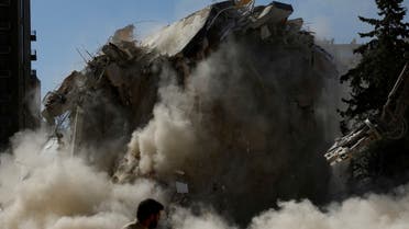
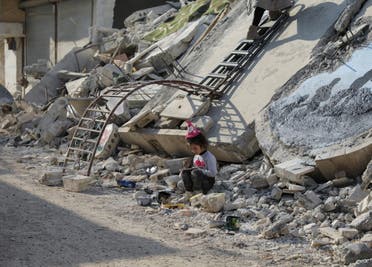
A damaged building gets knocked down in the aftermath of a deadly earthquake in Adana, Turkey, March 6, 2023. (Reuters)

Jennifer Bell, Al Arabiya English
Published: 26 January ,2024

After some of the most devastating earthquakes to decimate the region in recent years, some may fear quakes and seismic shocks are becoming a more common occurrence around the world.

Tremors have ripped apart communities across Afghanistan, Morocco, Turkey and Syria in the past 18 months.

Seismologists and geologists, however, have told Al Arabiya English that while shocks that cause such devastating damage are not increasing in frequency, they are nonetheless becoming more deadly due to densely packed populations, poor infrastructure, and a lack of earthquake-protected building codes to keep up with rampant population growth.
Turkey-Syria devastation, one year on

Almost a year has passed since the devastating and powerful earthquake that struck Turkey and Syria on February 6, 2023, claiming more than 60,000 lives and causing widespread destruction.


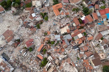
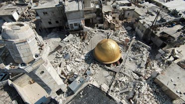
An aerial view shows Antakya's historical city center, the worst hit in an earthquake which killed more than 50,000 people in Turkey and leaving millions homeless, in Hatay province, Turkey May 5, 2023.

The 7.8-magnitude quake, followed by a second earthquake that notched up a 7.5 on the Richter Scale, was among the strongest ever recorded in the region, with hundreds of thousands more injured and scores of buildings leveled.

Other violent seismic shocks have since been reported across the Middle East and the wider world.

On September 8, 2023, a strong earthquake struck Morocco, killing more than 2,900 and leaving 5,500 injured. The 6.8 magnitude quake struck 72 kilometers southwest of Marrakech and leveled housing blocks.


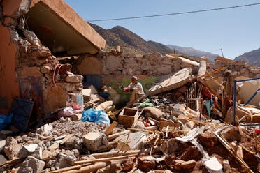
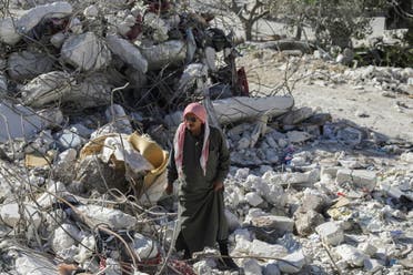
Ait Abdellah Brahim, 86, gestures among rubble, in the aftermath of a deadly earthquake, in Talat N'Yaaqoub, Morocco, September 16, 2023. (Reuters)

Afghanistan is also frequently hit by earthquakes, especially in the Hindu Kush Mountain range, near the junction of the Eurasian and Indian tectonic plates. In October 2023, around 1,000 people were killed when a series of quakes with magnitudes measuring between 4.2 and 6.3 jolted western Afghanistan.

Speaking to Al Arabiya English, Suzan van der Lee, a professor in Earth and Planetary Sciences at Northwestern University, US, said each year, worldwide, there are about a dozen earthquakes with magnitudes of at least seven on the Richter scale, ten times more of magnitudes of at least 6, 100 times more of magnitudes of at least 5, and many more minor tremors across the globe.

“If one of these occurs near dense population and infrastructure and is unanticipated, then it can have devastating consequences,” said Van der Lee, who co-developed Earthtunes. In her research, she applies data science to millions of records of seismic waves in order to decode seismic signals, which hold vital information about the Earth’s interior dynamics.

Judith Hubbard, a Harvard graduate and earthquake scientist in the US, told Al Arabiya English that hundreds of thousands of earthquakes are recorded each year, but most of them are either too small or too far away from human habitation to cause any damage.

In most years, she says, there are more than 150 earthquakes with a magnitude of 6 on the Richter Scale, 10-15 with a magnitude of more than seven and up to four magnitude 8+ earthquakes.

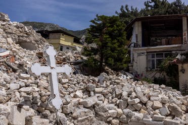
A cross is seen on the wreckage of Greek Orthodox Church at Antakya's historical city center, the worst hit in an earthquake which killed more than 50,000 people in Turkey and leaving millions homeless, in Hatay province, Turkey May 4, 2023. (Reuters)

“Whether or not these cause damage really depends on where they occur: Whether they are close to population centers, and shallow or deep.”
What causes earthquakes, and how common are they?

The majority of earthquakes occur in the vicinity of tectonic plate boundaries, where large sections of the Earth’s crust and the uppermost portion of the mantle, situated directly beneath the crust, converge.

Van der Lee says in the Middle East and Asia, several belts of heightened seismic activity are associated with the present-day Eurasian, Arabian, Somalian, and Nubian tectonic plates. Additionally, a past plate boundary that subducted the Tethys Ocean contributes to seismicity in the region.

“They are associated with present or past tectonic plate boundaries. There may only be a few of the strongest earthquakes in a certain place in a given millennium. So, compared to human lifetimes, they are not frequent,” Van der Lee reasoned.

Hubbard said the Middle East lies along a boundary between colliding tectonic plates, and the whole region is deforming as a result.

“A large number of active faults have formed to accommodate that deformation, including the Dead Sea Fault (which runs through Syria, Lebanon and Israel), the East Anatolian Fault and North Anatolian Fault in Turkey, the various faults on the Zagros Thrust Belt in Iran, and many more.”
Are more earthquakes being detected?

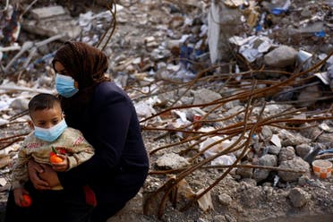
Vefa Abdullah holds her nephew Ali Sulo, 3, as they sit in the rubble of what used to be their home in the aftermath of a deadly earthquake in Kahramanmaras, Turkey, March 9, 2023.

Van der Lee said experts have only been counting earthquakes for precisely half a century, “which is very short from a geological perspective.”

“In that context, most unexpected events are the results of typical statistical fluctuations (they are the result of chance) rather than systematic global trends, Van der Lee said, adding: “However, if one happens in our lifetimes, followed by a typical sequence of aftershocks, then it sure seems like earthquakes are becoming more frequent. Of course, they are more frequent during any aftershock sequence, but on a timescale of decades, the occurrences of these earthquakes are typical.”

However, the world “should expect more” of the types of earthquakes seen in Turkey and Syria, she said.

According to Hubbard, there has not been any significant change in earthquake patterns worldwide in recent years. “Earthquake patterns are by their nature irregular, so each year we see a different set of events,” she said. “However, there are no global trends in

the fundamental tectonics. There are, however, trends in how and where people live and their exposure to earthquake hazards.”

Hubbard said this also holds for the Middle East.

“People naturally focus on recent events, but the Middle East has always suffered periodic damaging earthquakes,” she said. “The February 6, 2023, earthquakes in Turkey were terrible, but so was the 1999 Izmit earthquake (17,000 deaths) and the 1939 Erzincan earthquake (32,000 deaths), among others.”

Hubbard said the 2022 earthquake in Kabul killed more than 1,000 people. The more recent October 2023 earthquakes near Herat killed more than 2,500. The 2003 earthquake in Bam, Iran, killed 26,000.

“Some of these extremely damaging earthquakes were not even that large by global standards. Their high death tolls reflect their location (close to people) and the vulnerability of the populations living near them (buildings that are not resistant to earthquakes).”
Denser populations lead to higher death tolls

Dr. Brian Baptie, a seismologist with the British Geographical Survey, told Al Arabiya English that more reportage of such natural disasters – and news shared on social media channels – can lead to the assumption that more earthquakes are happening, though that is not the case.

“I mean, all these devastating earthquakes that occurred do definitely give you the impression that there are more earthquakes and that they didn’t happen before. However, if you actually look back at the average statistics over the last 30 or even 100 years or so, on an average, the number of earthquakes is pretty much the same, or at least the average of the number of big earthquakes a year is the same,” he reasoned.

However, while the frequency of earthquakes is not changing, the scale of their devastation is, said Baptie, because global population is increasing, with many living in densely built-up areas. That includes areas such as Turkey in the Middle East and regions in India and Pakistan.

Eduardo Kausel, professor at the Massachusetts Institute of Technology, also told Al Arabiya English that earthquakes have produced more damage in recent decades “mainly because of the explosive rise in population and the fast growth of the built environment, but measured over millennia, quakes are surely not more intense or more frequent.”

Syrian artist Salam Hamed's daughter Sima sits in the rubble of damaged buildings in the rebel-held town of Jandaris, in the aftermath of a deadly earthquake, in Syria February 22, 2023.

Kausel added: “The known, historic seismic activity in that area of the world stretches back thousands of years. Although the activity itself hasn’t increased over the centuries, its reporting has increased, given that there are many more witnesses and people affected, not to mention modern media.”
Where do earthquakes most commonly occur?

Earthquakes predominantly strike in three major zones globally. The circum-Pacific seismic belt, known as the “Ring of Fire,” encircles the Pacific Ocean, hosting 81 percent of the world’s largest earthquakes. This belt thrives along tectonic plate boundaries, where plates subduct, causing slips and ruptures. Examples include the powerful M9.5 Chilean Earthquake (1960) and the M9.2 Alaska Earthquake (1964).

The Alpide earthquake belt spans Java to Sumatra, through the Himalayas, the Mediterranean, and the Atlantic, contributing to 17 percent of major earthquakes. Notably, the 2005 M7.6 Pakistan quake claimed over 80,000 lives, and the 2004 M9.1 Indonesia earthquake triggered a tsunami that killed over 230,000.

The third significant belt aligns with the submerged mid-Atlantic Ridge, a divergent plate boundary. While mostly underwater, Iceland, directly above this Ridge, has witnessed earthquakes up to at least M6.9. Though most seismic activity occurs in these belts, damaging earthquakes can still surprise outside these regions.

Hubbard also says most earthquakes occur along plate boundaries. Some places that are particularly prone to damaging earthquakes are the west coast of the Americas, the borders of Southeast Asia, the Philippines/Taiwan/Japan, eastern Africa, and the wide zone of collision between Eurasia and Africa/Arabia/India.

“This collisional belt, in particular, is especially hazardous,” she said. “It is more than 10,000 km long, reaching from North Africa and Spain in the west to India and China in the east. Deformation occurs at shallow depth over a very broad area, in some places more than 2,000 km wide. A huge number of countries are impacted by this

system, including parts of southern Europe, North Africa, the Middle

East, and South and East Asia.”
Deadliest earthquakes in history

In recent memory, the colossal Indian Ocean earthquake on December 26, 2004, stands as a stark reminder of nature’s destructive force. Recorded as the fifth deadliest earthquake in history, its epicenter was off the west coast of Sumatra in Indonesia. Ranging from 9.1 to 9.3 in magnitude, the earthquake occurred as the Indian Plate was subducted by the Burma Plate. Following the seismic shock, a series of deadly tsunamis swept through, eradicating everything in the path of the colossal waves. Indonesia bore the brunt of the disaster, followed by Sri Lanka, India, and Thailand. The US Geological Survey reported a staggering total of 227,898 casualties.

Salih Dogru, 12, and his cousin Eren Dogru, 14, visit earthquake victims' graves at Cankaya cemetery, where they moved to in the aftermath of a deadly earthquake in Iskenderun, Turkey, March 12, 2023. Last month's devastating earthquakes killed more than 54,000 people in Turkey and Syria and left millions homeless. Shortly after the first earthquake struck on Feb. 6, Salih’s uncle, undertaker Ali Dogru, 46, moved his family to the cemetery. They have been living there since (Reuters)

The Tangshan earthquake, another catastrophic event etched in history, struck Tangshan in Hebei, China, on July 28, 1976. This industrial city, home to about one million residents, faced unprecedented devastation, resulting in the loss of approximately 240,000 lives and severe injuries to an additional 164,000 people.

More recently, Hubbard said, the Turkey-Syria earthquakes were notable because of their magnitudes and the fact that there were two of them – the first a magnitude of 7.8 on the Richter Scale and the second a magnitude of 7.7 – occurring about nine hours after the first on a different Faultline, in addition to the usual aftershocks.

“Shaking intensities were very high along the faults that slipped,” she explained. “In the first earthquake, three-quarters of a million people experienced intense shaking ... we saw widespread building damage, including the collapse of a number of tall apartment complexes.”

In comparison, the 2022 earthquake in Afghanistan’s Kabul was much smaller.

“The October 2023 earthquakes in Afghanistan caused significant damage – a series of four M6.3 events over a series of about a week. The 2002 Bam earthquake in Iran was particularly damaging,” she further said.
Are climate change and human activity the factors?

Significantly, contrary to popular perception, Van der Lee says climate change is not a factor in earthquakes. “Most effects of climate or weather on seismic activity are small at best and only manifest in regions undergoing rapid melting of ice caps, for example. It is very unlikely that the seismicity in the Middle East is influenced by climate change,” she said.

However, human activities such as mining, reservoir-induced seismicity, or oil-and-gas extraction can contribute to seismic events in the Middle East, she added. “Human activities like that have induced and triggered small to moderate-magnitude earthquakes in several places around the world, so I wouldn’t be surprised if this included the Middle East.”

Hubbard also said there is no evidence linking climate change to seismic activity in the Middle East – or anywhere else – but agreed that “human activities can indeed cause earthquakes.” She pointed to reservoir-triggered seismicity, which has been observed near dams during construction, impoundment, and cyclic filling in many parts of the Earth, including Turkey.

“Occasional moderate earthquakes have been linked to reservoirs. For instance, the Atatürk Dam in Turkey has been linked to several (seismic) events,” Hubbard further said.

“It is well known that the oil-and-gas extraction process can trigger seismicity (especially the process of injecting wastewater back into the Earth). This has definitely been implicated in parts of the US.

Moreover, groundwater extraction has also been observed to be linked to earthquakes in some parts of the Middle East – for instance, along the Dead Sea Fault in Jordan at the Wadi Al-Arab basin.”

Shaking events associated with mining are regularly detected, said Hubbard.

“These are mostly detections of actual blasting and are not considered ‘earthquakes’ in the traditional sense, in that they don’t involve slip-on faults in the Earth. (In contrast, wastewater injection weakens faults, allowing them to slip.) Some forms of mining do involve injecting water into the subsurface, in which case they can

trigger earthquakes. However, thus far, the largest and most damaging earthquakes have not been linked to anthropogenic activities,” Hubbard further explained.
Monitoring earthquakes

Van de Lee said there is more that could be done to forewarn and forearm countries ahead of earthquakes.

Fadel El Jaber, stands on rubble of the building his son lived with his family, that collapsed from last month's deadly earthquake in the town of Salqin, Syria March 10, 2023.

“Earthquake monitoring has improved with humanity having expanded its instrumental sensing and recording activities, as well as methodologies for analyzing seismic data,” she said.

However, to date, no one is able to predict earthquakes accurately, she added. “The best we can do is anticipate and be prepared for them.”

That, she says, means early-warning systems in place to alert the public during any seismic activity.

Van der Lee says building codes in earthquake-prone countries are also key in order for new or existing buildings to meet the structural standards to cope with seismic disturbances. These ratings are instrumental in gauging a structure’s ability to withstand tremors, providing crucial insights into potential risks.
Building codes are key

A building, or specific sections of it, earns the ominous label of “earthquake-prone” if it is projected to surpass its ultimate capacity during a moderate earthquake. The implications are dire, as such structures, if they were to collapse, pose a significant threat of causing injury or even death to individuals within or near the building. Additionally, the collateral damage extends to adjacent properties, intensifying the urgency for comprehensive seismic assessments and mitigation strategies.

“Turkey, for example, has building codes,” said Van der Lee. “These codes need to be regularly reviewed and, updated and adhered to. This can really help prevent devastation. Most risks are posed by the built environment.”

Measures to mitigate earthquake damage include incorporation of comprehensive geoscience education into the national curriculum, the establishment of local earthquake centers to enhance monitoring and research, and effective science communication to dispel misinformation.

Development of an “earthquake culture” is the central theme, encouraging a collective consciousness about earthquakes through initiatives that promote memory, awareness, and community engagement.

Baptie also said there are ways the world can mitigate the impact of earthquakes – and making sure buildings are safer is priority number one.

“We cannot predict earthquakes, but we do have a pretty good idea of where most of those earthquakes occur, so we can establish where they’re likely to occur.”

Many countries that are in areas of high earthquake hazard activity said Baptie, have building codes, and that’s true in countries like Turkey and Iran.

The crucial thing is that building codes need to be enforced. He said it was “pretty clear” in the Turkey earthquakes last year that there were a lot of modern buildings that were recently constructed, after a time when other buildings had been strengthened following the major earthquakes in Turkey in 1999.

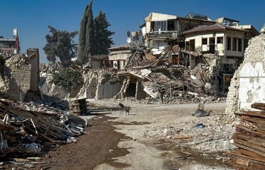
The remains of buildings destroyed during the earthquake are pictured in Antakya, southeastern Turkey Saturday, Aug. 5, 2023.

“The other things we can do is retrofit existing buildings, so we can do things to our buildings to make them stronger,” Baptie added.

The problem is that in many earthquake-sensitive areas, there are still large numbers of people living in quite vulnerable buildings.

“In places like Afghanistan, there are a lot of people who are living in just un-reinforced brick buildings. These are very, very vulnerable to earthquake shaking and that’s a major problem,” Baptie added.

Hubbard said the “only truly useful approach” to mitigating the impact of potential earthquakes is to build resilient buildings.
Effective disaster management

Another key step in minimizing the devastation from future earthquakes is by ensuring international coordination, said Van der Lee. “Every earthquake reveals new information that, after analysis and related research, helps us better understand earthquakes in general,” she said.

“Seismology has a long tradition of international collaboration that can and should be further strengthened. The power of the Earth and earthquakes surpasses humanity’s combined powers. We should, therefore, be united in learning to understand them and how to minimize the devastation that might result from some of them.”

Hubbard agrees.

“Earthquake prediction remains impossible,” she said. “Instead, we rely on earthquake forecasting (i.e. detecting zones that could be impacted by earthquakes on nearby active faults), aftershock forecasting (understanding the risk of continued events after a large earthquake), and earthquake early warning (detecting an earthquake early and sending a warning signal to nearby phones to alert people to incoming shaking, giving tens of seconds of warning time).”

Seismometer networks in the Middle East vary from country to country, said Hubbard. For instance, she says, Turkey has “excellent networks”, but some nearby countries have few seismometers.

Some countries in the Middle East are part of the EMSC (European-Mediterranean Seismological Centre) and report their data to that group – but not all, said Hubbard.

“The EMSC also operates a novel system that uses human responses to detect earthquakes, which really helps in areas where there are not so many seismometers.”

Hubbard said it was very clear following the February 2023 Turkey-Syria earthquakes that the world’s ability to “see” earthquakes was very regional.

“For instance, many people in Syria and Lebanon reported feeling aftershocks that were not detected by global seismological networks. In contrast, reports of shaking in Turkey were almost always matched to a detected event.”
International collaboration

Hubbard also stressed the importance of international collaboration to understanding earthquakes.

“Earthquakes are global phenomena. There are many cases where we know comparatively little about what happened in an earthquake because it occurred in an area without good instrumentation or a good understanding of the geology of a region. I have found that in most cases, scientists are willing to collaborate across political borders, but they are sometimes held up by regulations that prevent easy or effective collaboration,” she said.

“More work on building international links through science and hazard mitigation could strengthen existing relationships and help vulnerable communities,” Hubbard added.

A general view shows a damaged mosque in the aftermath of a deadly earthquake, in rebel-held al-Maland village, in Idlib province, Syria February 24, 2023. (Reuters)
Can AI future-predict earthquakes?

Baptie said, going forward, the use of artificial intelligence (AI) may be an incredibly helpful tool for earth scientists and geologists in earthquake mitigation and management.

“What we are interested in now is using AI to first detect and characterize earthquakes,” he said. “There have been big advances in this over the last four or five years.”

“AI at the moment is incredibly good at finding patterns. It can detect really small earthquakes that some of our other systems can’t. So, what it means is that we can get very data-rich catalogs of information that can help us understand the hazards a little better,” Baptie added.

“The next step is probably to try and use AI knowledge systems to try and make forecasts of earthquakes and to try and make short-term forecasts about earthquakes. That is still pretty much a work in progress. But it has potential.”

So, could one day earthquakes be predicted?

“That is the holy grail,” said Baptie.