It’s possible that I shall make an ass of myself. But in that case one can always get out of it with a little dialectic. I have, of course, so worded my proposition as to be right either way (K.Marx, Letter to F.Engels on the Indian Mutiny)
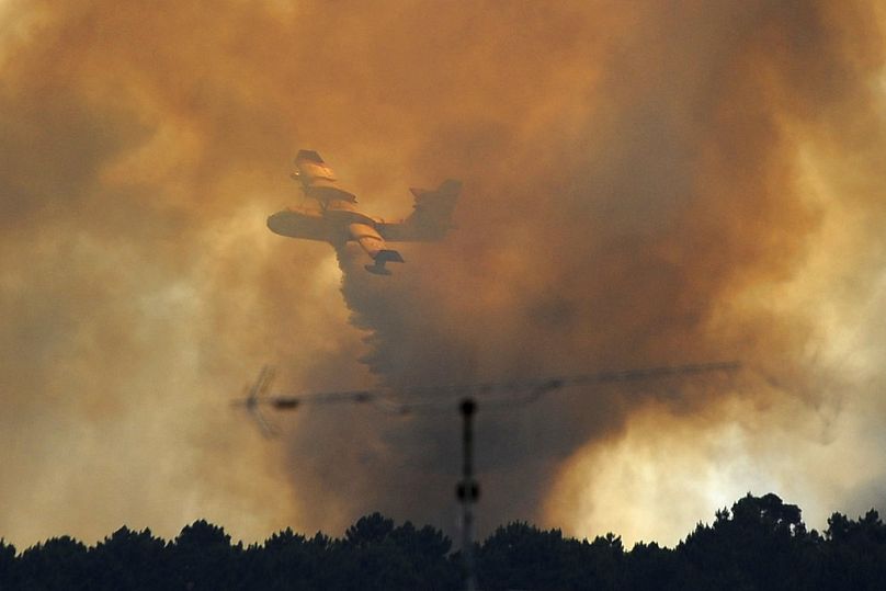
A helicopter buckets water onto smouldering fires outside Jasper, Alberta, Canada, on Friday July 26, 2024. AMBER BRACKEN/Pool via REUTERS
Officials said Thursday that they feared as much as half the town of Jasper, Alberta, had been destroyed by wildfires so intense they generated their own weather.
“It’s a sad day here because Jasper is such a gorgeous place,” Mike Flannigan, a professor of wildland fire at Thompson Rivers University in British Columbia, said Thursday.
The town is the gateway to Jasper National Park, a crown jewel of the Canadian parks system. At least 25,000 residents and tourists were evacuated from their homes before firefighters and emergency personnel also had to flee toxic smoke. The mayor called the destruction “almost beyond comprehension.” That fire was worsened by a pyrocumulonimbus, or a fire-generated thunderstorm, according to Flannigan.
“They’re by far the most intense fires in the world,” he said.
What are these storms?
A pyrocumulonimbus is a huge, smoke-filled thunderstorm generated when the intense heat from wildfires combines with atmospheric conditions ripe for storm formation.
Although these heat-generated storms don’t produce much rain, they can create other types of weather such as hail, strong winds, lightning and tornadoes. Tornadolike winds were reported near the Park fire, which is burning in California.
These storms can also create smoke plumes that can surpass the cruising altitude of a commercial aircraft. They act like a giant chimney: Smoke is pulled up from the wildfire and as the air escapes, more air moves quickly in at the ground level, feeding the fire more oxygen before funneling up and away.
This feedback loop can push out so many smoke particles that the result can be similar to a volcanic eruption.
In the 2019-20 Black Summer fire season in Australia, for example, 38 such storms, also known as pyroCbs, were observed. They injected enough smoke into the atmosphere that scientists likened it to a nuclear winter.
Wildfires that are exacerbated by these types of storms can become nearly impossible to put out. They’re also more hazardous for firefighters, creating more extreme wind conditions and darkening skies.
“They tried to put helicopters on it,” Flannigan said of the wildfires that fueled at least two of these storms this week near Jasper. “They couldn’t stop it, which is unfortunate because it led to a good chunk of the town burning down.”
Why are fire-generated storms happening more often?
Unlike the study of other extreme weather events such as heat waves and hurricanes, the study of these storms is relatively new in scientific circles.
Because data only dates to 2013, it’s difficult to determine a trend, said David Peterson, a meteorologist at the U.S. Naval Research Laboratory in Monterey, California.
“There’s been an increasing number of large and intense wildfires in North America in recent years that likely would suggest there would be more pyroCbs,” Peterson said. “But we still don’t know enough.”
But over the past decade, the number of these storms has grown.
In 2017, four pyroCbs in British Columbia created a volcanic-scale smoke plume that traveled around the globe, lasting more than six months. Then, the Black Summer in Australia sent a smoke plume up that lasted more than year. In 2021, 100 pyroCbs were recorded worldwide, but 2023 shattered that record with 169.
Western Canada seems to be a hot spot. The country’s 2023 fire season spawned 142 of these storms, almost tripling its previous record of 50 in 2021.
Although research has yet to link these types of storms to climate change, studies show that as climate change increases how often extreme wildfires happen, they could also become more frequent.
“In a general sense, if you have more fires, you’ll have more pyroCbs because there are more opportunities to have them sink up, but it depends on atmospheric conditions, too,” Peterson said. “An intense wildfire definitely increases the odds.”
More than 50 pyroCbs have been observed in western North America so far this year, which already puts 2024 in the top three years in the 12-year-old record. When will we know more?
In October, Peterson and his partners will begin a five-year, NASA-funded study to better understand the effect these wildfires could have on our climate.
“The big open question right now is what is the role of pyroCbs in a warming climate system?” Peterson said. “What are the effects of pushing smoke up extremely high into the stratosphere, especially when smoke that high persists for a year?”
The study will use two NASA aircraft: one that can fly up to 70,000 feet above the storm, requiring the pilot to wear a spacesuit, and a second that can fly through the storm’s upper clouds. The aircraft will collect data in the summers of 2026 and 2027.
In the meantime, the U.S. Naval Research Laboratory is also working with the National Oceanic and Atmospheric Administration and other agencies to develop a more sophisticated warning system. The science is complex because it merges wildfire science with thunderstorm meteorology.
“We need to develop a warning capability for fires that are more likely to generate pyroCbs because it means something different if you’re fighting it, evacuating people, and predicting where the smoke is going,” Peterson said. “Right now, we’re in catch-up mode.”
Pyrocumulonimbus clouds are thunder clouds created by intense heat from the Earth’s surface. They are formed similarly to cumulonimbus clouds, but the intense heat that results in the vigorous updraft comes from fire, either large wildfires or volcanic eruptions. So it is, for this reason, the prefix ‘pyro’ is used – meaning fire in Greek.
Pyrocumulonimbus clouds were reported during the Australian bushfires in late 2019/early 2020, and a number have more recently been observed in Siberia with the Arctic heatwave. These intense wildfires reach temperatures above 800°C and can essentially create their own weather systems.
The hot smoke released from these fires acts as a plume of heat into the atmosphere. Hot and very buoyant, the air in the plume rapidly rises. As it rises, it cools and expands. Once cooled sufficiently, water vapour condenses on the ash to form a grey or brown cloud above the plume. At this stage, the cloud is called a pyrocumulus. Still, if enough water vapour is available and the updraft intensifies, it can develop into a pyrocumulonimbus cloud. Then, similar to other thunderstorms, there may be a downburst of intense localised rain. This rain can create a downdraft of cooler air, which can then carry embers from the fire, igniting spot fires away from the source. In some cases, dry lightning from these storms can strike without rain, further spreading the wildfire. They have also been known to dangerously generate fire tornadoes.
Pyrocumulonimbus clouds are thought to be responsible for several aerosol pollutants (such as smoke and ash) trapped in the stratosphere and upper atmosphere. However, a paper by the American Meteorological Society, ‘The Untold Story of Pyrocumulonimbus’, re-evaluated the data from previous stratosphere studies to conclude that volcanic eruptions had been wrongly attributed to these pollutants. Dr Glenn K. Yue, one of the paper’s authors, stated in an article by NASA that one of the reasons for this misinterpretation was that it was initially thought the only force strong enough to penetrate the tropopause in a short period was a volcanic eruption.
As our climate changes, these unusual but significant storms could occur more frequently due to hotter and drier conditions increasing the risk of wildfires.
Wash U researchers quantify solar absorption by black carbon in fire clouds
New findings from Chakrabarty lab will help make climate models more accurate as massive wildfires become more common
\
WASHINGTON UNIVERSITY IN ST. LOUIS
In an actively warming world, large-scale wildfires are becoming more common. These wildfires emit black carbon to our atmosphere, one of the most potent short-lived atmospheric warming agents. This is because of its strong sunlight absorption characteristics. But scientists have yet to get a handle on the extent of atmospheric warming caused by black carbon in pyrocumulonimbus (pyroCb) clouds that develop from high-intensity wildfires.
In their most extreme form, these wildfire clouds will inject smoke into the upper troposphere and lower stratosphere where it can linger and impact stratospheric temperatures and composition for several months. Some of the details of that impact have been investigated now thanks to new research from Washington University in St. Louis’ Center for Aerosol Science & Engineering (CASE).
The research was led by Rajan Chakrabarty, a professor in WashU’s McKelvey School of Engineering and his former student Payton Beeler, now a Linus Pauling distinguished post-doctoral fellow at Pacific Northwest National Laboratory. The study was published in Nature Communications.
“This work addresses a key challenge in quantifying black carbon’s radiative effect in the upper atmosphere,” Chakrabarty said.
The team made airborne measurements from within the upper portion of an active pyroCb thunderstorm in Washington state as part of the 2019 NOAA/NASA Fire Influence on Regional to Global Environments and Air Quality (FIREX-AQ) field campaign, he added.
“We considered the full complexity and diversity of the measured black carbon size and morphology on a per-particle basis for accurate estimation of its solar absorption. What we discovered is that a pyroCb black carbon particle absorbs visible sunlight two times as much as a nascent black carbon particle emitted from smaller fires and urban sources,” he said.
The authors uniquely combined measurements of black carbon mass and the thickness of organic coatings on individual particles in the plumes with a detailed single-particle optics model. They used a numerically exact particle-resolved model to calculate the black carbon optical properties and quantified how much light those black carbon particles are absorbing (and thus how much more heat they bring to the upper atmosphere).
In addition, the work highlights the unique light absorption properties of black carbon in pyroCbs clouds versus black carbon from wildfires that does not end up in pyroCbs and black carbon from urban sources.
The next step in this research is to take further measurements and do a more precise study of the black carbon behavior in the stratosphere.
Black carbon injected into the lower stratosphere by recent pyroCb events in Canada and Australia have traveled around the globe, persisted for months, and altered dynamic circulation and radiative forcing across large regions, Chakrabarty noted. These thunderstorms are deemed responsible for 10% to 25% of the black carbon in the present day lower stratosphere, with impacts extending to both the Northern and Southern Hemispheres. Scientists are increasingly observing how much it impacts climate but there is more to learn.
“We need more direct measurements of pyroCb black carbon light absorption measurements to better constrain climate model predictions of stratospheric warming,” Chakrabarty said.
Beeler P, Kumar J, Schwarz JP, Adachi K, Fierce L, Perring AE, Katich JM, Chakrabarty RK. Light absorption enhancement of black carbon in a pyrocumulonimbus cloud. Nat Commun 15,6243 (2024). DOI: https://doi.org/10.1038/s41467-024-50070-0
This research has been supported by the National Aeronautics and Space Administration (grant nos. 80NSSC18K1414 and NNH20ZDA001N- ACCDAM), the National Oceanic and Atmospheric Administration (grant no. NA16OAR4310104), the National Science Foundation (grant nos. AGS-1455215 and AGS-1926817), the US Department of Energy (grant no. DE-SC0021011), and the Simons Foundation’s Mathematics and Physical Sciences division. L.F. was supported by the U.S. Department of Energy (DOE) Atmospheric System Research (ASR) program via the Integrated Cloud, Land-Surface, and Aerosol System Study (ICLASS) Science Focus Area. Additional support was provided by the Laboratory Directed Research and Development program (Linus Pauling Distinguished Postdoctoral Fellowship Program). Pacific Northwest National Laboratory is operated for DOE by Battelle Memorial Institute under contract DE-AC05-76RL01830.
Canada could face more record-breaking heat this year. How can we prepare for wildfires?
Low snowpack and higher temperatures forecast for El Niño year already raising wildfire concerns CBC Fri, January 5, 2024
The Eagle Bluff Wildfire crosses the border from Washington State on July 30, prompting evacuation orders in Osoyoos, B.C. (Jesse Winter/Reuters)
The first week of January isn't usually wildfire season. But as 2024 began, more than 100 "zombie fires" were actively burning in British Columbia — holdovers from last summer that typically go dormant over winter.
"That is mind boggling to me. Just unheard of," said Lori Daniels, a professor with the University of British Columbia's department of forest and conservation sciences.
The warm, dry weather that capped off what is expected to be declared the planet's hottest year on record — and Canada's most destructive wildfire season by a longshot, with more than 6,500 fires burning close to 19 million hectares — is not over.
With the global El Niño weather system continuing through this spring, forecasts suggest 2024 could be even hotter — prompting wildfire and public policy experts to call for more wildfire prevention efforts now.
"The whole concept of business as usual is out the window," said John Robinson, a professor at the Munk School of Global Affairs and Public Policy and the School of the Environment at the University of Toronto, adding governments, NGOs and social support organizations have to learn to be more adaptive.
"Unfortunately, response to disaster isn't a time where you get a lot of creative policy," he said. "We need proactive or pre-emptive response."
Why 2024 is already worrying
Environment and Climate Change Canada (ECCC) is projecting above-normal temperatures across the country at least through fall, and about 70 per cent above normal in April through June.
"There's really no indication of below normal or, until we get maybe to the late fall, even near normal," said Bill Merryfield, a research scientist with ECCC's Canadian Centre for Climate Modelling and Analysis.
ECCC is also projecting below-normal snowpack across all provinces through spring, leading to drier conditions come summer. In December, snowpack was less than a quarter of what's normal across much of southern Canada, Merryfield said.
NASA and the National Oceanic and Atmospheric Administration (NOAA) will release their official 2023 temperature numbers on Jan. 12, but all data so far indicates 2023 was the hottest on record globally.
Tom Di Liberto, climate scientist and public affairs specialist with NOAA, said when El Niño events straddle two years, it is typically the second year that ends up being hotter, indicating a strong possibility that temperatures could increase again in 2024. A recent example was 2016, the previous hottest year on record following El Niño.
"When you have back-to-back years of such extreme temperatures, it's kind of allowing the possibility to be a bit more severe," Di Liberto said.
Two people are pictured waiting for a boat ride across Shuswap lake to Celista from Sorrento, B.C., while evacuating from wildfires on Aug. 19. (Ben Nelms/CBC)
Kevin Hanna, director of the University of British Columbia's Centre for Environmental Assessment Research and a former wildfire fighter, says the increasingly extreme heat and drought conditions have led people in disaster-prone regions to develop a "fear of summer and what it will bring."
"Is this the summer where my farm or ranch gets hit? Is this the summer when my town has to evacuate? You see it on people's face, you hear it in their voice," " Hanna said. "I know ranchers who have lost property— terrible flood damage, terrible wildfire damage."
Protecting infrastructure
Daniels said it is time for governments to increase investment in programs to help people make their homes more fire resistant, and to ensure all new builds in fire-prone areas follow FireSmart principles like those laid out by Natural Resources Canada.
She said Canadians in fire-prone areas can implement these principles themselves by tidying up yards, making sure there is no burnable debris in the gutters or under decks, and reconfiguring gardens so rocks are closer to buildings and flammable vegetation is pulled further away.
She said communities across Canada should start making emergency plans of action before spring, and accepting that it's not a matter of "if, but when" fire is coming to their communities.
The Eagle Bluff Wildfire crosses the border from Washington State on July 30, prompting evacuation orders in Osoyoos, B.C. (Jesse Winter/Reuters)
Hanna said Canada needs to have a bigger conversation about prevention and managing risk by reducing the vulnerability of infrastructure, and suggests wildfire vulnerability assessments and considerations become "part of everything we do in the permitting and review process" for major infrastructure projects like pipelines, power lines, highways and railways.
A likely unpopular suggestion heading into a dry and drought-prone year is that we might have to rethink some routine summer activities Canadians take for granted, Hanna says, including potentially limiting access to certain parts of the backcountry.
"If we want to keep areas safe, we might have to say people aren't allowed to go there. Because some people do things they shouldn't do," Hanna said.
"One spark from an ATV or a hot muffler on a dirt bike or something is going to potentially cause a huge amount of trouble."
Michael Norton, director general of the Canadian Forest Service with Natural Resources Canada, said the federal government is working on preventative measures through programs like the Wildfire Resilient Futures Initiative, which is investing $285 million over five years with a focus on prevention and mitigation, including reinforcing the FireSmart Canada program.
Fighting fire with fire
Counterintuitively, more fire could help prevent the most destructive blazes this summer.
"[Fire] is maybe the only natural disaster, where on one hand, it's extremely destructive, and on the other hand, is part of the solution," Daniels said, adding that Canada's forest management has focused primarily on maximizing economic benefit, which has increased the landscape's fire vulnerability.
"We've just left too much woody debris down on the ground, and that's fueling these new fires. And it's killing regenerating young forests that are 20 and 30 years old," she said.
A firefighter watches a prescribed burn proceed near Lytton in 2014. (B.C. Wildfire Management Branch)
Norton, said prescribed burns, forest thinning and Indigenous cultural burning practices are an important piece of fire mitigation that fire managers are deploying more often.
"Prescribed fire is not is not putting something artificial onto the landscape. It's using something that is in fact part of nature, in a controlled way to reduce risks," he said.
"Part of the challenge that we've had in this country over many decades of fire management is a disproportionate emphasis on only fire suppression activities," Norton said.
"All the provinces and territories are increasingly trying to shift focus towards a greater emphasis on preventing human-caused wildfires in the first place, and proactively mitigating risks from fires before they occur." Collaboration and local expertise
Hanna says it is important to identify institutional barriers that are preventing controlled burns from being done sooner, such as multiple levels of decision making spread across different agencies.
He said that applies to Canada's model of firefighting as well, which has become "very centralized" and "elitist," run by provincial bodies that do not always work as closely as they could with locals.
"I think we have to rediscover the value of local people, their expertise and knowledge. Particularly in parts of rural communities in Canada, remote communities in Canada, where there's a lot of folks who know the land, know how to run machinery, who can work in a collaborative way with forest wildfire services to to be proactive, as well as reactive," he said.
The burned remains of the Scotch Creek & Lee Creek Fire Department and community hall are seen in Scotch Creek, B.C. in September. (Darryl Dyck/The Canadian Press)
Those people also have a vested interest in protecting their homes and communities, but getting them on board can sometimes be a last-minute scramble.
"How can you deploy those resources quickly without going through a two-day procurement process or form-filling process? That's very important," Hanna said.
Norton said the federal government has recognized this and is committing more than $800 million to invest and train additional firefighters with a particular focus on Indigenous people, and working to bolster firefighting equipment on reserves.
"Our training funding is targeting a fairly local level," he said.
Daniels said Canada's wildfire response has been strong, as evidenced by a lack of civilian deaths last year despite the massive destruction of property. She worries, however, that our past successes may be "one of our barriers to future adaptation."
The dangers to human life are also becoming evident, with eight firefighters losing their lives fighting wildfires across Canada in 2023.
"The firefighter deaths rocked the wildfire community across the country," Norton said.
Apart from the sheer number and size of fires in 2023, firefighters are dealing with increasingly severe fire behaviour like the proliferation of pyrocumulonimbus clouds, thunderstorms created and driven by the heat of extreme fires that can sometimes create new fires.
But among the challenges, Norton points to some major federal successes. He said Canada brought in more than 5,600 firefighters from 12 other countries to help fight fires in 2023 and signed new agreements to ensure support from other countries moving forward.
The Canadian Forest Service also delivered new wildfire intelligence tactical mapping products to provinces and territories, and in 2023 the U.S. Department of Defense deployed FireGuard, a new high-tech fire detection system, to help Canada battle wildfires using real-time data from drones and satellites to help detect new flareups in remote areas for the first time.
"We had, under incredible pressure, had some quite striking successes that we are working very hard to learn from to be able to reproduce as and when necessary in the future," Norton said.
Friday, January 05, 2024
Canada could face more record-breaking heat this year. How can we prepare for wildfires?
Low snowpack and higher temperatures forecast for El Niño year already raising wildfire concerns CBC Fri, January 5, 2024
The Eagle Bluff Wildfire crosses the border from Washington State on July 30, prompting evacuation orders in Osoyoos, B.C. (Jesse Winter/Reuters)
The first week of January isn't usually wildfire season. But as 2024 began, more than 100 "zombie fires" were actively burning in British Columbia — holdovers from last summer that typically go dormant over winter.
"That is mind boggling to me. Just unheard of," said Lori Daniels, a professor with the University of British Columbia's department of forest and conservation sciences.
The warm, dry weather that capped off what is expected to be declared the planet's hottest year on record — and Canada's most destructive wildfire season by a longshot, with more than 6,500 fires burning close to 19 million hectares — is not over.
With the global El Niño weather system continuing through this spring, forecasts suggest 2024 could be even hotter — prompting wildfire and public policy experts to call for more wildfire prevention efforts now.
"The whole concept of business as usual is out the window," said John Robinson, a professor at the Munk School of Global Affairs and Public Policy and the School of the Environment at the University of Toronto, adding governments, NGOs and social support organizations have to learn to be more adaptive.
"Unfortunately, response to disaster isn't a time where you get a lot of creative policy," he said. "We need proactive or pre-emptive response."
Why 2024 is already worrying
Environment and Climate Change Canada (ECCC) is projecting above-normal temperatures across the country at least through fall, and about 70 per cent above normal in April through June.
"There's really no indication of below normal or, until we get maybe to the late fall, even near normal," said Bill Merryfield, a research scientist with ECCC's Canadian Centre for Climate Modelling and Analysis.
ECCC is also projecting below-normal snowpack across all provinces through spring, leading to drier conditions come summer. In December, snowpack was less than a quarter of what's normal across much of southern Canada, Merryfield said.
NASA and the National Oceanic and Atmospheric Administration (NOAA) will release their official 2023 temperature numbers on Jan. 12, but all data so far indicates 2023 was the hottest on record globally.
Tom Di Liberto, climate scientist and public affairs specialist with NOAA, said when El Niño events straddle two years, it is typically the second year that ends up being hotter, indicating a strong possibility that temperatures could increase again in 2024. A recent example was 2016, the previous hottest year on record following El Niño.
"When you have back-to-back years of such extreme temperatures, it's kind of allowing the possibility to be a bit more severe," Di Liberto said.
Two people are pictured waiting for a boat ride across Shuswap lake to Celista from Sorrento, B.C., while evacuating from wildfires on Aug. 19. (Ben Nelms/CBC)
Kevin Hanna, director of the University of British Columbia's Centre for Environmental Assessment Research and a former wildfire fighter, says the increasingly extreme heat and drought conditions have led people in disaster-prone regions to develop a "fear of summer and what it will bring."
"Is this the summer where my farm or ranch gets hit? Is this the summer when my town has to evacuate? You see it on people's face, you hear it in their voice," " Hanna said. "I know ranchers who have lost property— terrible flood damage, terrible wildfire damage."
Protecting infrastructure
Daniels said it is time for governments to increase investment in programs to help people make their homes more fire resistant, and to ensure all new builds in fire-prone areas follow FireSmart principles like those laid out by Natural Resources Canada.
She said Canadians in fire-prone areas can implement these principles themselves by tidying up yards, making sure there is no burnable debris in the gutters or under decks, and reconfiguring gardens so rocks are closer to buildings and flammable vegetation is pulled further away.
She said communities across Canada should start making emergency plans of action before spring, and accepting that it's not a matter of "if, but when" fire is coming to their communities.
Hanna said Canada needs to have a bigger conversation about prevention and managing risk by reducing the vulnerability of infrastructure, and suggests wildfire vulnerability assessments and considerations become "part of everything we do in the permitting and review process" for major infrastructure projects like pipelines, power lines, highways and railways.
A likely unpopular suggestion heading into a dry and drought-prone year is that we might have to rethink some routine summer activities Canadians take for granted, Hanna says, including potentially limiting access to certain parts of the backcountry.
"If we want to keep areas safe, we might have to say people aren't allowed to go there. Because some people do things they shouldn't do," Hanna said.
"One spark from an ATV or a hot muffler on a dirt bike or something is going to potentially cause a huge amount of trouble."
Michael Norton, director general of the Canadian Forest Service with Natural Resources Canada, said the federal government is working on preventative measures through programs like the Wildfire Resilient Futures Initiative, which is investing $285 million over five years with a focus on prevention and mitigation, including reinforcing the FireSmart Canada program.
Fighting fire with fire
Counterintuitively, more fire could help prevent the most destructive blazes this summer.
"[Fire] is maybe the only natural disaster, where on one hand, it's extremely destructive, and on the other hand, is part of the solution," Daniels said, adding that Canada's forest management has focused primarily on maximizing economic benefit, which has increased the landscape's fire vulnerability.
"We've just left too much woody debris down on the ground, and that's fueling these new fires. And it's killing regenerating young forests that are 20 and 30 years old," she said.
A firefighter watches a prescribed burn proceed near Lytton in 2014. (B.C. Wildfire Management Branch)
Norton, said prescribed burns, forest thinning and Indigenous cultural burning practices are an important piece of fire mitigation that fire managers are deploying more often.
"Prescribed fire is not is not putting something artificial onto the landscape. It's using something that is in fact part of nature, in a controlled way to reduce risks," he said.
"Part of the challenge that we've had in this country over many decades of fire management is a disproportionate emphasis on only fire suppression activities," Norton said.
"All the provinces and territories are increasingly trying to shift focus towards a greater emphasis on preventing human-caused wildfires in the first place, and proactively mitigating risks from fires before they occur." Collaboration and local expertise
Hanna says it is important to identify institutional barriers that are preventing controlled burns from being done sooner, such as multiple levels of decision making spread across different agencies.
He said that applies to Canada's model of firefighting as well, which has become "very centralized" and "elitist," run by provincial bodies that do not always work as closely as they could with locals.
"I think we have to rediscover the value of local people, their expertise and knowledge. Particularly in parts of rural communities in Canada, remote communities in Canada, where there's a lot of folks who know the land, know how to run machinery, who can work in a collaborative way with forest wildfire services to to be proactive, as well as reactive," he said.
The burned remains of the Scotch Creek & Lee Creek Fire Department and community hall are seen in Scotch Creek, B.C. in September. (Darryl Dyck/The Canadian Press)
Those people also have a vested interest in protecting their homes and communities, but getting them on board can sometimes be a last-minute scramble.
"How can you deploy those resources quickly without going through a two-day procurement process or form-filling process? That's very important," Hanna said.
Norton said the federal government has recognized this and is committing more than $800 million to invest and train additional firefighters with a particular focus on Indigenous people, and working to bolster firefighting equipment on reserves.
"Our training funding is targeting a fairly local level," he said.
Daniels said Canada's wildfire response has been strong, as evidenced by a lack of civilian deaths last year despite the massive destruction of property. She worries, however, that our past successes may be "one of our barriers to future adaptation."
The dangers to human life are also becoming evident, with eight firefighters losing their lives fighting wildfires across Canada in 2023.
"The firefighter deaths rocked the wildfire community across the country," Norton said.
Apart from the sheer number and size of fires in 2023, firefighters are dealing with increasingly severe fire behaviour like the proliferation of pyrocumulonimbus clouds, thunderstorms created and driven by the heat of extreme fires that can sometimes create new fires.
But among the challenges, Norton points to some major federal successes. He said Canada brought in more than 5,600 firefighters from 12 other countries to help fight fires in 2023 and signed new agreements to ensure support from other countries moving forward.
The Canadian Forest Service also delivered new wildfire intelligence tactical mapping products to provinces and territories, and in 2023 the U.S. Department of Defense deployed FireGuard, a new high-tech fire detection system, to help Canada battle wildfires using real-time data from drones and satellites to help detect new flareups in remote areas for the first time.
"We had, under incredible pressure, had some quite striking successes that we are working very hard to learn from to be able to reproduce as and when necessary in the future," Norton said.
Tuesday, July 18, 2023
Forest fires in British Columbia are 30 times worse than average, say researchers
This summer has seen a violent outbreak of forest fires across Canada and North America. According to the Canadian Interagency Forest Fire Center (CIFFC), there were 911 active fires across the country on July 13, nearly 600 of which were characterized as "out-of-control."
More than half of these active fires are taking place in the provinces of British Columbia, driven by a combination of unusual heat, dry lightning, and drought. The situation is becoming increasingly common thanks to rising global temperatures, diminished rainfall, changing weather patterns, and other related effects of Climate Change.
Monitoring forest fires and other meteorological phenomena is an important task for which Earth Observation missions like NASA's Aqua satellite were created. On July 12, with six weeks left in the Canadian fire season, Aqua captured images of some of the largest fires over British Columbia using its Moderate Resolution Imaging Spectroradiometer (MODIS) instrument.
The image above shows some of the biggest "hot spots" in the province, which produced dense plumes of smoke blowing eastward through the Rocky Mountains and into Alberta and the Northwest Territories.
The Aqua and Terra satellite work in tandem to acquire data twice daily at mid-latitudes using their MODIS instruments. These four daily observations inform operational fire management while advancing global monitoring of wildfires and their effects on the local environment, the planet's atmosphere, and climate.
In addition, these fires produce massive plumes of smoke that reach the upper atmosphere, where high-level winds spread the smoke and particulate matter to neighboring areas. Several of these fires have produced smoke-infused storm clouds in recent weeks, known as pyrocumulonimbus (pyroCb).
"We observed 14 pyroCbs with satellites on July 9-10 alone—several in British Columbia and some in Quebec," said David Peterson, an atmospheric scientist with the U.S. Naval Research Laboratory. "This surge in activity has made 2023 the most active year for pyroCbs both in Canada and worldwide since we began tracking their numbers closely about a decade ago."
As of July 13, Peterson and colleagues observed 90 pyroCbs in Canada and 104 worldwide. This set a new record for Canada and the world, the previous of which were set in 2021 (50 and 100, respectively), and prompted Environment Canada to issue air quality warnings for communities throughout British Columbia, Alberta, and the Northwest Territories.
In addition, more than 1.2 million hectares were damaged by fire in British Columbia as of July 12, 2023, roughly 30 times the average by this point in the year.
A major outbreak in June struck the eastern province of Quebec and led to air quality issues in neighboring Ontario and parts of Minnesota, Wisconsin, Illinois, and Michigan. This year's totals represent 13% of the 9.4 million hectares that burned nationwide as of July 12. It's also an almost 25% increase over the 7.1 million hectares that burned in 1997, the second-highest year recorded by the CIFFC. Monitoring and tracking these firestorms is vital to mitigation and adaptation efforts as average global temperatures continue to rise.
Smoke from Australian bushfires depleted ozone layer by up to 5% in 2020, study finds
Donna Lu Wed, 8 March 2023
Photograph: Saeed Khan/AFP/Getty Images
Particles in bushfire smoke can activate molecules that destroy the ozone layer, according to new research that suggests future ozone recovery may be delayed by increasingly intense and frequent fires.
A study published in the journal Nature has found that smoke from the 2019-2020 Australian bushfires temporarily depleted the ozone layer by 3% to 5% in 2020.
In the ozone layer – part of the stratosphere – molecules of ozone gas absorb high-energy ultraviolet rays from the sun. This lessens the amount of radiation that reaches the Earth’s surface.
Lead researcher Prof Susan Solomon, an atmospheric scientist at the Massachusetts Institute of Technology in the US, said the ozone destruction by smoke particles was similar to the process of the Antarctic ozone hole forming each spring, “but at much warmer temperatures”.
Smoke aerosols, the researchers found, can activate chlorine to form compounds that then destroy ozone molecules.
Solomon said that chlorine in the stratosphere had been decreasing since the 1987 Montreal Protocol phased out the use of ozone-depleting chlorofluorocarbons. “There’s a tremendous science policy success story there,” she said. “The slow recovery of the ozone layer is on the order of 1% per decade in the mid-latitudes.”
But she warned that more frequent fires could delay ozone recovery. “All of a sudden, in one year [2020], we had a 3% to 5% loss. It’ll recover if that’s the only year that it happens, but not if it keeps happening.
“The question in my mind is: is the man-made chlorine going to get … diluted and destroyed out of the atmosphere faster than global climate change is going to increase the frequency and intensity of this kind of fire? I think it’s going to be a race.”
Dr Martin Jucker, a lecturer at the University of New South Wales who was not involved in the research, agreed that the ozone hole might recover more slowly than expected as the result of more bushfires in future.
“Of particular interest for Australia is the extension of the ozone hole further equatorward, which means that the ozone layer can become thinner much closer to where millions of Australians live,” he said.
Dr Laura Revell, an atmospheric scientist at the University of Canterbury in New Zealand, said: “Early signs of Antarctic ozone recovery have been visible since approximately the mid-2010s. In the absence of any major changes, we expect that stratospheric chlorine concentrations will gradually decrease this century and that the ozone hole will get smaller year by year.
“Of concern is that while the ozone hole usually forms over Antarctica because of the cold temperatures there, wildfire aerosols appear to be capable of promoting ozone losses at the relatively warmer temperatures present at mid-latitudes which are heavily populated.”
Solomon and her colleagues identified that the ozone-destruction process is triggered by hydrochloric acid in the stratosphere dissolving in the smoke aerosols.
Hydrochloric acid dissolved about a thousand times more readily in the smoke aerosols than in the “the normal sulphuric acid and water stratospheric particles”, Solomon said.
“From a scientific point of view, it’s very exciting to see this brand new effect,” she said. “From a planetary point of view … it would be just tragic to have mankind screw up solving the ozone hole by deciding that we’re going to [allow] a lot more of these fires if we don’t mitigate climate change.”
Solomon added it was important to determine whether the smoke from fires in Australia – where native forests are dominated by eucalypts – differed in composition from fires in other areas. “I don’t really see a chemical reason why that would be so, but it needs to be looked at.
Thursday, December 29, 2022
Witness to Paradise Lost: My Year in the Dying Amazon
The mass rainforest extermination is a climate catastrophe—and much more.
Burning of the Amazon rainforest. Fernando Souza/ZUMA
This story was originally published by the Guardian and is reproduced here as part of the Climate Desk collaboration.
I thought it was a blood moon at first. The dark orange glow appeared at dusk on the far side of the shimmering silver band that is the Xingu River. It was just before 8pm, after the parrots had squawked back to their nests and the insects and frogs were noisily starting the forest nightshift. A flash of lightning from a cloud appeared above almost the same location but the rest of the sky was clear. How could there be a storm? I peered more intently and took a photograph that I could magnify. And there was the answer—a fire, which grew fiercer as I watched, the flames spreading sideways and upwards, flickering red and yellow, billowing smoke into the sky, sparking flashes of lightning every couple of minutes.
I felt sick to the stomach. The Amazon rainforest was being destroyed in front of my eyes. I have been writing about the climate crisis for 16 years, always with a sense of horror but until now, mostly with a sense of distance. This was the first time I had seen it from my home, and it was stranger than I expected. I had not realized until that moment that fire can create its own lightning storms, by creating pyrocumulonimbus, which scientists describe as “the fire-breathing dragon of clouds.”
There was no immediate danger—the fire was several miles away on the other side of one of the world’s biggest rivers—but it felt personal. More than 90 percent of fires in the Amazon are started deliberately to clear trees so the land can be used for cattle ranching or crop cultivation. That meant this arson attack against nature was almost certainly carried out by one of my neighbors. I knew it was probably illegal and that, according to climate science, it would nudge the world’s biggest rainforest that much closer to an irreversible tipping point. But there was nothing I could do except watch. The chances of anyone else lifting a finger while Jair Bolsonaro was Brazil’s president were next to zero.
This was on August 27 . The next morning I learned there were several fires in the rainforest that night. In fact, this was one of the most devastating nights for the Amazon in a decade. Landowners and land-grabbers were rushing to burn with impunity before a presidential election that the polls showed was likely to result in a change of power. August, September, and October were months of fire, a human-made season wedged between the driest point of summer and the onset of the winter monsoons. A haze of charred vegetation shrouded many parts of the rainforest for weeks. My asthma returned for the first time in nine months. Viewed from the forest, the contest between Bolsonaro and his main challenger, Luiz Inácio Lula da Silva, was not about tax rises or government spending—it was life or death.
I moved to the Amazon last December. The journey itself was eye-opening. I travelled here with my nine-month-old dog, Frida, who wasn’t allowed on the last leg of the plane journey from Belem to Altamira so we had to do that 500-mile stretch by car along the dusty Trans-Amazonian highway.
This road, the BR230, was the starting point for the past half-century of destruction. When the first section opened in 1972 the president of Brazil’s military dictatorship, Gen. Emílio Garrastazu Médici, marked the occasion in Altamira by cutting down a giant Brazil nut tree to symbolize the conquest of nature. The road was designed to bring in a wave of settlers. “Land without men for men without land” was the misleading slogan of the regime, which had trampled over and often killed the Indigenous communities that had lived there for millennia. The road has since become a vector for land clearance and violence.
As Frida and I passed through, I could see the bio-rich primary forest on the side of the road had been replaced by soy and cacau monocultures. The Tocantins and Xingu rivers were dammed by huge hydroelectric at Tucuruí and Belo Monte. Again and again, along the 12-hour drive, the hillsides were stripped of trees and replaced with pastures scattered with white cows. Beef consumes more of the forest than any other commodity. There are now 90 million cows in the Amazon, grazing on an area of cleared land the size of France.
Few outside Brazil have heard of our destination, Altamira, but it is one of the biggest municipalities on the planet with a surface area of 62,000 square miles, making it larger than half of the world’s countries. It is in the state of Pará, which is the main exporter of cattle and gold in the Amazon, and as a result suffers the worst deforestation and the deadliest violence.Now I am surrounded by forest, I see flames as the death of trees and all the living creatures that depend on them.
Like all frontier towns, Altamira has thrived on the destruction of nature, which has accelerated rapidly in the past five decades. Most of the land used to be covered in forest occupied by Indigenous communities, but waves of invasion have brought ever greater threats in the name of colonization, civilization, or development. First came the Jesuit missionaries in the 18th century, followed by the rubber barons in the 19th, then the big agricultural companies and the road and dam builders in the 20th. Today, it is primarily a cowboy and mining town, with a parade each November of hundreds of ranchers riding through the streets on horseback. In the hardware store, the staff shout out greetings to recognized customers, “Hey, garimpeiro (gold prospector)!”
I remember my first visit here eight years ago to cover the construction of the Belo Monte dam, the biggest hydroelectric plant in the Amazon. “The vast construction site is like something out of Mordor—an immense wall of stone, steel and concrete that towers above a blasted plain,” I wrote at the time, when I thought, rather sniffily, “Who would want to live here?”
The answer, it seems, is me. To my surprise and delight, I have now lived in the rainforest for 12 months. During this time, I have learned much more intimately that, instead of living as part of nature as we should, much of humanity is now at war with it. Fire is the main weapon against the forest; guns and intimidation against its protectors, the Indigenous communities.
Two friends, the land and environment activists Erasmo and Natalha Theofilo, are in hiding for the fifth time since Bolsonaro took power after multiple death threats to them and their children. Another friend, the first woman to be an Indigenous chief, Juma Xipaya, came to dinner with a bodyguard because she, too, has a price on her head after speaking out against illegal mines.
The dangers were made horribly real in June when my friend and fellow journalist Dom Phillips was murdered in the Javari Valley while researching a book entitled How to Save the Amazon. He was killed alongside the Brazilian Indigenous expert Bruno Pereira, who was targeted because he had encouraged and trained Indigenous communities to resist illegal fishing in their territory. Dom sent encouraging messages when I arrived in Altamira and he planned to visit. Now he and Bruno are victims of a global war against nature that is almost always one-sided.
I feel different about the fire now that I live here. It is not just that it feels closer. It is because I realize how much loss of life is involved. When I wrote about forest clearance from afar, I would calculate the damage in the sterile terms of carbon tons or real estate. But now I am surrounded by forest, I see flames as the death of trees and all the living creatures that depend on them—insects, lichen, fungi, mammals. The burn-off is not just a climate disaster, it is a mass extermination of other species. Two of Brazil’s most respected Amazon research institutes, Imazon and MapBiomas, told me that in the past four years under Bolsonaro’s watch, at least 2 billion trees have been killed in the Amazon, along with up to nearly 4 million monkeys, while 90 million birds and countless other species have died, been injured, or lost their habitat.
To be in the Amazon in 2022 is to live between a tipping point that humanity must avoid and a turning point that we must invent. The world’s rainforest has degraded perilously close to a stage where it can no longer regenerate. As more trees are cleared, the forest is less able to produce its own rain. It starts to dry out, to become more vulnerable to fire and lightning strikes, until it changes into another ecosystem entirely, a savannah, which is less biodiverse, less capable of storing carbon, less powerful in generating the rainfall and storms that keep weather systems moving.
This is already happening along the arc of deforestation in the south and south-east Amazon, where the forest is turning to savannah as it emits more carbon than it absorbs. The rest of the rainforest is heading in the same direction: 17 percent has now been cleared and another 17 percent degraded. Scientists estimate the tipping point will occur when 20 percent to 25 percent of the Amazon is lost, which, at the current rate of ecocide, is more likely to be years rather than decades away.
Being here helps me understand a little better why the forest is sacrificed. Pará is one of the poorest states in Brazil, with a per capita income half the national average, and with dire inequality. Since the opening of the Trans-Amazonian highway there have been four types of settlers in Altamira. First there is an already wealthy white elite, who were invited to migrate and given substantial landholdings on condition they started agricultural businesses that would benefit the town’s economy. Instead, many of them simply kept the property for themselves, became fazendeiros (farmers), and set about expanding their empires through illegal and often violent land grabs.
The second group are white settlers from the south of Brazil who were given state support and cheap credit, which has enabled some of them to thrive. These two groups show little desire to be part of the forest, or to protect it. To them it is “the other,” either a threat or something to exploit. When they acquire a plot of land, their first step is always to “clean” it, which means destroying all traces of life with bulldozers. This creates a semi-sterile perimeter, which can be fenced off and grassed over.The election victory of Lula was a gasp of fresh air. But can he rein back the destructive forces unleashed by Bolsonaro?
About 70 percent of this illegally cleared land is then opened up for cattle ranches. It is these two groups that thrived when Bolsonaro and his ministers gutted the forest protection and Indigenous agencies, which led to a surge of invasions by land-grabbers, illegal miners, loggers, ranchers, and organized crime gangs. These are the people who trot through the streets on horseback during the annual cowboy parade. These are the customers I shop with at the hardware store, which does a booming trade in chainsaws and gold-panning equipment. These are the listeners of Sertanejo, the country music that has pushed samba and funk aside to dominate the Brazilian music industry. These are also the diehard Bolsonarists, who drive through town in their SUVs with a Brazil flag emblazoned on their bonnet.
But Altamira is also a base for those seeking a turning point for social equality and the environment. The third group of residents are descendants of people from the poorer north-east of Brazil, who either arrived as rubber tappers a century ago, or took their chances when the Trans-Amazonian was opened. Many of this group are afro-Brazilians, who were given little or no state support to settle in their new homes. They either work for the wealthy or fend for themselves by farming or mining in more remote areas. Many are under the sway of the evangelical church and criminal organizations, neither of which show any inclination to value the forest. But social activists, such as Daniela Silva, and artists such as Joaka Barros and Soll, are aiming to change this by reconnecting the young from poor urban communities with nature, through rap, art and visits.
They often find common cause with the fourth group: middle-class liberals from São Paulo and other cities who move to Altamira as academics, lawyers, medical professionals or conservation workers. Bold thinkers are looking for a new way of doing things. They include the human rights campaigner Antónia Melo, who led much of the resistance against the Belo Monte dam; doctors such as Erika Pellegrino, who are trying to use medicine to strengthen the remote communities who protect the forest; legal experts like Thais Santi, who are building new legal precedents of ecocide; and entrepreneurs such as Marcelo Salazar, who is searching for new business models to gather and market brazil nuts, acai, babassu oil, and other sustainably produced forest products.
Switching to a new model, something more natural, sustainable and fairer for future generations and other species, requires persistence and patience. That does not come easy, as I have learned in our small community, which is divided between those who are environmentally progressive and those who want to follow the path of carbon capital development that the world has been on for the past 250 years and which has brought incredible advances for human wellbeing at the expense of everything else. The argument between the two, which has manifested in several heated community meetings, is a microcosm of the directions that Brazil and the world are being pulled in.
For the past four years, the farmers have had the upper hand. For anyone who cares about the Amazon, this has been a horrendous period. Bolsonaro and his ministers dismantled much of the forest protection machinery that had been built up over the previous three decades, leading to a 60 percent rise in the rate of deforestation. Meanwhile, Brazil’s congress pushed forward with a package of bills to legitimize land thefts, weaken environmental licensing of new projects, and permit mining inside Indigenous territory. Narco-trafficking gangs have expanded their presence in the forest and started supplying cocaine to remote riverside communities.
Amid this moral and physical haze, the election victory of Lula was a gasp of fresh air. But can he rein back the destructive forces unleashed by Bolsonaro? It will not be easy and it will not be cheap. Tens of thousands of illegal miners will have to be relocated and retrained. The forest communities they have co-opted into land clearance, alcoholism, and prostitution will need support and their traditional practices treated with more respect. The Brazilian economy, which has become ever more dependent on agriculture and mining, will need alternative ways to generate income. Lula will have to find a way to work with a hostile congress and a sceptical agricultural sector, while strengthening forest protection and Indigenous rights. All of this will require one thing that has not happened since the first European colonizers set foot on this continent—the outside world will need to value the forest more alive than dead.
One way or another, this year has to be a turning point. With the firestorm on the horizon, I have seen more than enough of paradise lost. The wild abyss of the Amazon can not go on as it is. The womb of nature must not become her grave.
Tuesday, September 06, 2022
Smoke from the Black Summer wildfires in Australia impacted the climate and high altitude winds of the southern hemisphere for more than a year and a half
Wildfire smoke becomes increasingly important for climate models due to climate change, study
LEIBNIZ INSTITUTE FOR TROPOSPHERIC RESEARCH (TROPOS)
Leipzig. The 2019/20 wildfires in Australia transported more smoke into the atmosphere than observed ever before anywhere in the world. In the so-called Black Summer, three times as many particles reached high air layers as in the previous record wildfires in Canada during summer 2017. Two analyses led by the Leibniz Institute for Tropospheric Research (TROPOS) now reveal the climate impact of these huge fires: Smoke particles with a total mass of around one million tonnes spread across the southern hemisphere and affected the climate for about one and a half years by warming the upper atmosphere and cooling the lower atmosphere close to Earth’s surface. From the subtropics to Antarctica, sunlight was dimmed even more than during the eruption of the volcano Pinatubo in 1991. The smoke probably also contributed to the record ozone hole over Antarctica in 2020, forming a vortex of 1000 kilometres in diameter that passed over the southern hemisphere for several weeks, which is considered the first evidence that smoke from wildfires can also alter high-altitude winds in the stratosphere. Since such extreme fires are expected to become more frequent due to climate change, it is very important to consider the smoke and its effects on the Earth's energy balance in climate scenarios, the researchers write in the journal Atmospheric Chemistry and Physics (ACP).
Record forest fires in Australia
Between September 2019 and January 2020, almost twice as much area burned as in any other extreme fire in Australia documented to date. The fires peaked between 29 December 2019 and 4 January 2020, which is why they are now referred in scientific literature as the Australian New Year Super Outbreak (ANYSO) and colloquially known as the Black Summer bushfires. Due to the high heat, 38 fire clouds (Pyrocumulonimbus, PyroCb for short) were formed, which transported the smoke to great heights at ten times the speed of an elevator. More than half of these PyroCb clouds transported the smoke particles directly up to a height of 14 to 16 kilometres into the lower stratosphere. As with a volcanic eruption, the same applies to wildfires: the higher the particles reach, the further they spread and the more long-lasting is their effect on the climate. Particles in the lower atmospheric layers are usually washed out quickly by precipitation (within days to a few weeks) and therefore have little effect on the climate.
The wildfires in South-eastern Australia emitted about 1 million tonnes of smoke particles into the atmosphere around the turn of the year 2019/20. This is about four times as much as in previous years' forest fires. The smoke particles dispersed through the mid-latitudes of the southern hemisphere within a few days due to the high-altitude winds and contain, among other things, soot aerosol. These dark particles absorb solar energy and are among the strongest warming short-lived climate forcers. However, smoke from such extreme forest fires has not yet been adequately represented in aerosol climate models. An international research team led by TROPOS has therefore analysed the Black Summer wildfires to better understand the impact of such events on the climate.
CAPTION
The measuring containers of TROPOS with the PollyXT lidar during DACAPO-PESO in Punta Arenas, Chile.
CREDIT
Patric Seifert, TROPOS
Many measurements in the southern hemisphere provide a puzzle picture
For their study, the researchers used satellite data of the optical thickness of aerosol layers (AVHRR of the National Oceanic and Atmospheric Administration (NOAA) and the CALIOP space lidar). They compared the atmospheric opacity with the solar photometer measurements of the international AERONET network, which operates stations in Punta Arenas (Chile), Amsterdam Island (Indian Ocean), Marambio (near the Antarctic Peninsula), Vechernaya Hill (East Antarctica) and at the South Pole, among others. Moreover, the long-term observations carried out with two ground-based Raman lidars in Punta Arenas (Chile) and Río Grande (Argentina) at the southernmost tip of South America were decisive. These measurements can be considered representative of the southern part of the Southern Hemisphere and also allowed comparisons with other extreme wildfires in the Northern Hemisphere. Both measurements originally had different scientific objectives: The lidar observations in Punta Arenas took place as part of the DACAPO-PESO campaign (Dynamics, Aerosol, Cloud And Precipitation Observations in the Pristine Environment of the Southern Ocean) from November 2018 to November 2021. The main objective of this measurement campaign by the University of Magallanes (UMAG), TROPOS and Leipzig University was to study aerosol-cloud interaction processes under the clean conditions of the Southern Hemisphere. The lidar observations in Río Grande were part of the HALO mission SOUTHTRAC-GW (Southern Hemisphere Transport, Dynamics, and Chemistry-Gravity Waves), in which a large international team led by the German Aerospace Center (DLR) investigated atmospheric gravity waves in South America with the HALO research aircraft in September 2019. DLR's Compact Rayleigh Autonomous Lidar (CORAL) was also used, providing important data on the optical properties of the smoke between 15 and 30 kilometres altitude. The large amount of data made it possible to observe a new phenomenon, to compare the wildfires with previous record wildfires in North America and also to establish connections to the ozone hole:
CAPTION
Polarstern during MOSAiC in the Arctic.
CREDIT
Hannes Griesche, TROPOS
A unique smoke vortex
It has long been known that wildfires virtually make their own weather, but a new phenomenon was observed in connection with the Black Summer fires in January-March 2020: A self-sustaining vortex with a diameter of about 1000 km and a vertical extent of about 5 km. This extremely stable vortex persisted in the stratosphere for over 13 weeks, crossed the Pacific eastwards within two weeks and hovered over the tip of South America for more than a week. This was followed by a 10-week journey around the world in a westerly direction that could be tracked for more than 66 000 km by early April 2020. The vortex transported smoke and moisture up to an altitude of 35 km - an altitude not reached by tropospheric aerosols since the eruption of the Pinatubo volcano. This vortex trapped the smoke particles, keeping them from being dispersed and diluted. The absorption of solar radiation by the smoke in the centre led to warming and counter clockwise circulation, like a high-pressure area in the southern hemisphere. "Nothing like this has been observed before. This is the first evidence that smoke also causes changes in winds in the stratosphere and opens up a whole new direction of scientific research. The influence of wildfires on the atmosphere could be much greater than we previously thought," underlines Dr Albert Ansmann from TROPOS.
CAPTION
Interior of the OCEANET container with the green laser of the TROPOS lidar during the MOSAiC expedition in the Arctic 2019/2020.
CREDIT
Martin Radenz, TROPOS
ANYSO as the new "record holder
Lidar measurements by TROPOS from previous years made it possible to compare the wildfires in Australia with two other large fires: The record-breaking wildfires in Canada (Pacific Northwest Event, PNE) in August 2017 had transported only about a third of aerosol mass into the upper stratosphere in comparison. During this event, the smoke from five fire clouds over British Columbia could be observed over Europe until January 2018. Extremely strong fires also occurred in July/August 2019 in Siberia north and northeast of Lake Baikal (SIberian Lake Baikal Event, SILBE), where no fire clouds were observed. The smoke therefore probably rose slowly to high altitudes via solar radiation within a week. Through lidar measurements on the research icebreaker Polarstern, smoke from these fires could be observed in the region around the North Pole during the international MOSAiC expedition between October 2019 and May 2020.
The smoke from the 2017 Canadian wildfires (PNE) comprised about 0.3 million tonnes of material, formed a layer about 1 to 4 kilometres thick, rose to an altitude of 20 kilometres and hovered in the atmosphere for about 8 months. The smoke from the 2019 Siberian wildfires (SILBE) formed a layer about 7 to 10 kilometres thick, rose to an altitude of 18 kilometres and remained suspended in the atmosphere for about 5 months. The smoke from the 2019/20 Australian wildfires (ANYSO) comprised about 1 million tonnes of material, formed a layer about 10 to 14 kilometres thick, rose to an altitude of 24 kilometres and hovered in the atmosphere for about 20 months. "The Australian wildfires of 2019/20 are definitely the wildfires with the largest impact on the atmosphere and global climate to date. The dimensions are comparable to the eruption of Pinatubo in the Philippines in 1991. At that time, the particles reached heights of 25 kilometres and hovered in the atmosphere for about 14 months. Only the size of the particles differs significantly: The ash particles of the volcano, with a diameter of about 1 micrometre, were about twice as large as the smoke particles of the Australian wildfires," reports Albert Ansmann from TROPOS.
CAPTION
Lidar of the OCEANET container during the polar night at MOSAiC.
CREDIT
Ronny Engelmann, TROPOS
Smoke as a catalyst for the ozone hole?
In 2020/21, three events with record-breaking ozone depletion were observed: An extremely strong ozone hole formed over the central Arctic in March/April 2020, and further extreme ones over Antarctica in September to November 2020 and 2021, respectively. During all three events, an unusually large amount of smoke floated in the atmosphere of the polar regions, as shown by the lidar measurements. From the researchers' point of view, this is a clear indication of correlations, as they observed a clear correspondence between the layer with the strongest ozone depletion above the stations of the ozone probes (14-25 km altitude), the layer with an increased particle surface concentration above Punta Arenas (10-24 km altitude) and the altitude range in which the CALIOP satellite data detected polar stratospheric clouds (mainly above Antarctica at 13-26 km altitude). "Polar stratospheric clouds (PSCs) are known to have chemical processes at their surfaces that accelerate ozone depletion. Therefore, we strongly suspect that the smoke has led to these high clouds and that these clouds in turn have led to severe ozone depletion. This would not be good news for the people in and around the polar regions. If, as expected, climate change leads to more frequent and more severe wildfires, the ozone holes would spread over the Arctic and Antarctic, and with them the risk of skin cancer," explains Kevin Ohneiser from TROPOS.
Cooling effect like a large volcanic eruption
The data were also used for a simulation with the modern global aerosol climate model ECHAM6.3-HAM2.3. This model uses an aerosol microphysics model to describe the development of different aerosol types. This allows to estimate their influence on the radiation balance of the atmosphere: The model simulations determined a heating effect in the upper atmosphere (TOA) of +0.5 watts per square metre in the southern hemisphere and +0.25 watts per square metre globally. At the Earth's surface (bottom of the atmosphere, BOA), the solar radiative forcing was estimated to be about -0.75 watts per square metre under clear skies. This corresponds to the cooling effect caused by a large volcanic eruption. "We were surprised at how much the wildfires in southeastern Australia increased the opacity of the upper air layers of the southern hemisphere, hence, changing the radiation balance. These changes influenced the climate in the southern hemisphere for one and a half years. However, they can essentially be attributed to only four days of smoke from pyroconvection," emphasises Dr Bernd Heinold from TROPOS.
Wildfires become more important for climate models
The impact of wildfire aerosol on the energy balance of fires with such high-level fire clouds has probably been underestimated in models so far, as the vertical smoke distribution is crucial for the radiative effect, but there has been little knowledge about this wildfire property. "Such improvements are essential for any estimate of the Earth's energy balance and climate state. Therefore, it is becoming increasingly important to better enable climate models to deal with the impact of wildfires on the atmosphere, as they are expected to increase in frequency and severity worldwide in response to anthropogenic climate warming," explains Prof. Ina Tegen from TROPOS. "The increased risk of severe wildfires is related to extreme drought. More frequent and intense weather extremes also increase the likelihood that these very high reaching fire clouds will form more frequently in the future." Record-breaking fires like the one in Australia in 2019/20 could be repeated in other regions of the world in the years to come and have an increasing impact on the global climate.
High-flying wildfire smoke may threaten ozone layer. Record Arctic ozone loss linked to Siberian wildfires (SCIENCE, 18 Nov 2021): https://doi.org/10.1126/science.acx9681
Project „Dynamics, Aerosol, Cloud and Precipitation Observations in the Pristine Environment of the Southern Ocean (DACAPO-PESO)“: https://dacapo.tropos.de/
Australian wildfire smoke in the stratosphere: the decay phase in 2020/2021 and impact on ozone depletion
COI STATEMENT
At least one of the (co-)authors is a member of the editorial board of Atmospheric Chemistry and Physics. The peer-review process was guided by an independent editor, and the authors also have no other competing interests to declare.