Showing posts sorted by date for query VOLCANO. Sort by relevance Show all posts

Sunday, September 06, 2026


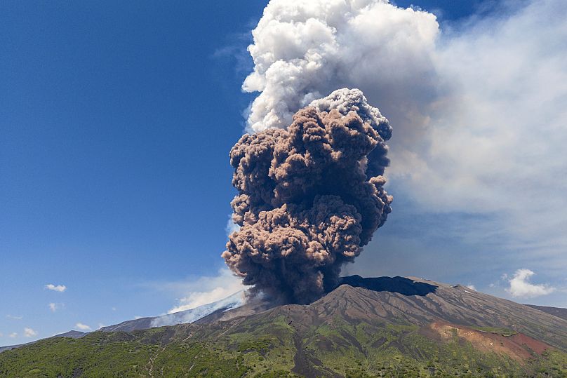
Indonesia on fire as four volcanoes erupt in 24 hours

Indonesia on fire as four volcanoes erupt in 24 hours
/ Kementerian ESDMFacebook

By IntelliNews - Surabaya Bureau September 6, 2026

Heightened tectonic and volcanic activity have spread out across the Indonesian archipelago with four major volcanoes erupting within a single 24-hour window, CNN Indonesia reports. According to official bulletins issued by the Geological Agency of the Ministry of Energy and Mineral Resources (ESDM), PVMBG, and BMKG, as of September 6, at 9am local time, Mount Anak Krakatau, Mount Ibu, Mount Ili Lewotolok, and Mount Semeru have all experienced active eruptive pulses.

The eruptions span multiple island chains across the Pacific Ring of Fire, from the Sunda Strait and East Java to East Nusa Tenggara and North Maluku.

Among the active sites, Mount Anak Krakatau generated the broadest environmental impact. Based on Darwin Volcanic Ash Advisory Centre (VAAC) data and Himawari-9 satellite RGB imagery, its volcanic ash split into two main plumes: one drifting northeast-south across the country’s capital city of Jakarta, Banten, and West Java, and another moving southwest-northwest across Lampung, Bengkulu, and the Indian Ocean.

In East Java, Mount Semeru produced the highest eruption plume at 1,000 metres above its peak, prompting the Geological Agency to enforce a strict 13-kilometre exclusion zone along the Besuk Kobokan river corridor to protect against pyroclastic density currents and cold lava flows. In East Nusa Tenggara, Mount Ili Lewotolok registered a 600-metre ash column following four eruptive pulses over 48 hours, while Mount Ibu in North Maluku recorded a 400-meter plume.

To protect civil aviation and regional populations, geological monitoring agencies are routing real-time satellite imagery directly into flight advisories and localised evacuations.

The simultaneous eruptions across four provinces is also pushing Indonesia's disaster management system to prioritise the management of cross-province aviation safety via VAAC tracking. Monitoring volcanic ash dispersion via Darwin VAAC and BMKG Himawari-9 satellite imagery is helping to protect air corridors and coordinate necessary airport closures across Java, Sumatra, and Eastern Indonesia.

Restricting access along the 13-kilometer Besuk Kobokan sector is also aimed at protecting local residents from potential hot ash clouds and cold lava flows during rain events.

Flights suspended at Indonesia's main airport due to volcanic eruption
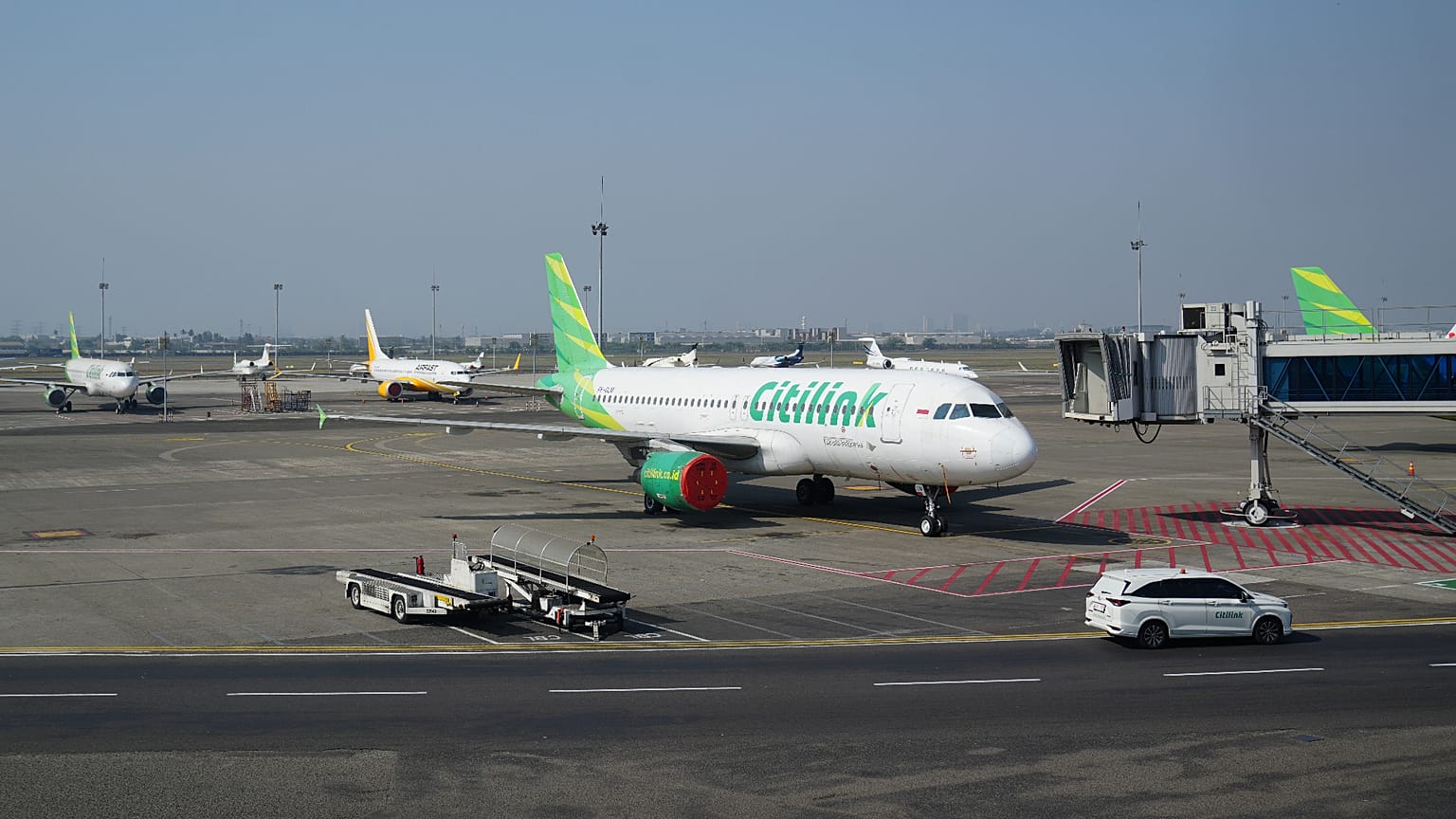
Airplanes are parked at Soekarno-Hatta International Airport in Tangerang, Indonesia, Sunday, Sept. 6, 2026.
Copyright Copyright 2026 The Associated Press. All rights reserved.

By Nathan Rennolds
Published on

Mount Anak Krakatoa is an active volcano that sits in the Sunda Strait, between the islands of Java and Sumatra.

Indonesia's Soekarno–Hatta International Airport suspended flight operations on Sunday after an eruption of the Anak Krakatoa volcano.

Mount Anak Krakatoa began erupting on Saturday, producing a lava fountain and "booming sounds and tremors" that were reported by residents in several parts of the country, according to Indonesia's geology agency.

Authorities suspended operations at the airport from 1:30 am local time on Sunday morning after ash from the volcano was detected in the airspace surrounding the airport.

"The latest paper test…showed positive results indicating the spread of volcanic ash in the Soekarno-Hatta International Airport area, consequently the airport closure was extended until Sunday at 09:30 am (0230 GMT)," Indonesia's transport ministry said in a statement.

More than 22,000 passengers have been affected by the suspension, the ministry said, with 209 flights impacted, in particular to and from Singapore.

Routes to destinations including Doha, Sydney, and Kuala Lumpur have also been affected. At least 16 domestic flights to Bali were also cancelled, per local airport authorities.

Anak Krakatoa is an active volcano that sits in the Sunda Strait, between the islands of Java and Sumatra.


Saturday, September 05, 2026

Anak Krakatau erupts in Indonesia

Anak Krakatau erupts in Indonesia
/ Bureau of Meteorology - AustraliaFacebook
By IntelliNews - Surabaya Bureau September 5, 2026

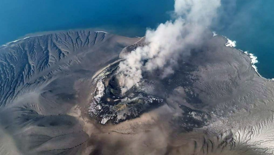
Signalling heightened volcanic activity across the Sunda Strait maritime corridor, Mount Anak Krakatau in Indonesia experienced a series of explosive eruptions spanning from late Friday, September 4 into the early weekend hours of September 5, CNN Indonesia reports. According to official monitoring bulletins issued by Magma Indonesia, under the Centre for Volcanology and Geological Hazard Mitigation (PVMBG) and the Ministry of Energy and Mineral Resources (ESDM), Mount Anak Krakatau erupted again at 00:01 local time. The midnight eruption followed multiple eruptive pulses recorded throughout the day before on September 4.

According to official seismographic logs, the eruptive sequence began on September 4, at 04:28 local time with a maximum seismograph amplitude of 70 mm and a duration of 31 seconds. A second primary eruption occurred at 05:46 local time, generating a dense black ash column that reached approximately 300 metres above the peak (~457 metres above sea level), drifting west and northwest. Volcanic activity intensified after 22:00 local time on September 4, culminating in the continuous eruption recorded through to September 5.

PVMBG authorities have issued an official safety advisory instructing tourists, fishermen, hikers, and local residents to maintain a strict 3-kilometre safety radius from the active crater. The exclusion zone aims to protect maritime traffic and coastal communities along the Banten and Lampung coastlines from potential ash fall, incandescent rock ejecta, and volcanic hazards.

To safeguard regional maritime traffic and coastal communities, volcanological monitoring agencies route real-time seismic data directly into public hazard advisories. At this time, the local government continues to track seismic amplitude changes and ash plume directions, allowing PVMBG to provide timely updates to regional authorities in Banten and Lampung.

Coordinating between the Coast Guard (KPLP), Navy, and local harbour masters ensures commercial shipping and ferry routes maintain a safe distance from the volcano. Providing clear public safety updates helps prevent panic while ensuring local disaster management agencies (BPBD) remain prepared for potential ash fall, the report adds.

There have been a total of six volcanic eruptions from Indonesian volcanoes recorded in 2026 alone, Jakarta Globe reports. PVMBG said that there’s no evidence that a single geological event triggered all the activity.

Tuesday, September 01, 2026

Is Germany's Laacher See volcano stirring again? Scientists detect hundreds of deep earthquakes

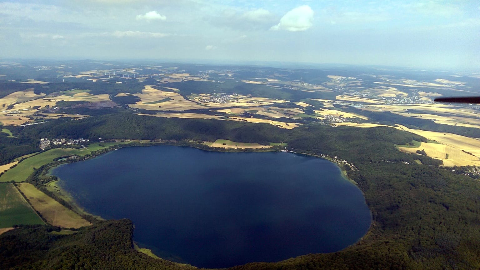
Germany's most formidable volcano: the Laacher See erupted 13,000 years ago, devastating parts of Europe
Copyright Df1paw, CC BY-SA 4.0, via Wikimedia Commons


By Franziska Müller
Published on

The Laacher See volcano last erupted around 13,000 years ago. Now, deep below the Eifel, scientists are reporting signs it remains active.

Earthquakes occur in Germany again and again, but many never notice them.

That's because these tremors occur deep below the ground and often have low frequencies.

But far beneath the surface, something could be stirring. That is the suspicion of researchers who have been monitoring Lake Laach in the Eifel region in western Germany over the last few years.

Between September 2022 and August 2023, they used several monitoring stations to record more than 500 micro-earthquakes beneath the lake - which formed in the crater of a volcano that last erupted around 13,000 years ago.

Germany's most powerful volcano

That last explosion was so powerful that ashfall was carried as far as Sweden and Italy, and experts still call for continuous monitoring of the site today.

Several studies show that there is still activity underground. In October 2025, a renewed increase in seismic activity was reported in the Eastern Eifel, most recently confirmed by a study published in 2019.

Researchers refer to these movements as deep low-frequency earthquakes, or DLF for short. These DLF quakes are seen as a sign that the Laacher See volcano could one day erupt again.

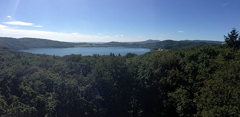
The focus of investigations is Lake Laach in Rhineland-Palatinate, the largest lake in the federal state.

The region is known as the Volcanic Eifel for good reason - the Eastern Eifel alone is home to a volcanic field with around 100 volcanoes.

"DLF earthquakes are regarded worldwide as an indication of the movement of magmatic fluids at great depth," explains Torsten Dahm, head of the Earthquake and Volcano Physics section at the GFZ, referring to a study from 2019. "Under active volcanoes, for example in Iceland, Japan or Kamchatka, such earthquakes can be observed regularly."

According to the study, magmatic fluids appear to accumulate at depths of about 12 to 14 kilometres. Magmatic fluids can be water, oxygen, sulphur compounds or halogens. They are released from molten rock and play a key role in determining how explosively a volcano erupts. Their movement can also trigger earthquakes in the subsurface.

These magmatic fluids could rise from the upper mantle into the Earth's crust. According to the Helmholtz Centre Potsdam GFZ German Research Centre for Geosciences, they would ascend along the Ochtendung fault zone - evidence that the volcanic system at Lake Laach is still active.

They also indicate that magma chambers exist in the Earth's crust beneath Lake Laach and may be slowly filling.

On the night of 10 October 2025, there was an unusual earthquake swarm with around 92 small microquakes within twelve hours. The strongest quake had a magnitude of just 0.9.

"In total, four spatially confined clusters of such DLF earthquakes have been detected in the Eastern Eifel over the past five years," said lead author Martin Hensch from the Association of State Seismological Services in 2019.

However, researchers do not expect any volcanic activity in the near future. Dating of the magma produced when the volcano last erupted suggests that it may have taken around 30,000 years for the upper magma chamber beneath Lake Laach to fill before the eruption eventually occurred, according to a GFZ statement.

"The ascent of magma into the shallow crust is almost always accompanied by high-frequency earthquake swarms. Such activity has not yet been observed in the Eastern Eifel," said Joachim Ritter from the Geophysical Institute (GPI) at KIT.

"Moreover, there is no evidence of uplift of the Earth's surface, which would have to be clearly detectable in the event of massive magma ascent," adds Dahm.

In addition to the small quakes and, most recently, a so-called earthquake swarm, there are further signs of ongoing CO2 degassing from the mantle.

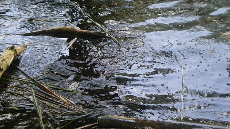
Bubbles of carbon dioxide can repeatedly be seen on the surface of the lake. Gases rise up from the depths.
Bubbles of carbon dioxide can repeatedly be seen on the surface of the lake. Gases rise up from the depths. RaSlaMa, CC BY 3.0, via Wikimedia Commons

In 2024, the GFZ carried out RMT measurements at two locations around Lake Laach. At both sites the emission of CO2 gases of magmatic origin was detected. Taken together, all these activities ultimately indicate that underground processes are active.

From September 2022 to August 2023, geologists recorded more than 500 local micro-earthquakes in a study published in 2026. In the process, the rock is hydraulically fractured; the researchers describe this as an example of natural hydraulic fracking.

They also found that there is likely a reservoir structure, such as a possible magma chamber, at a depth of around 12 to 14 kilometres. It extends horizontally over 15 kilometres beneath the active earthquake zone.

Ice Age eruption

During the Ice Age, the volcano in the Eifel erupted. Recent studies have redated the eruption: it is now thought to have occurred 13,084 years ago, around 184 years earlier than previously thought.

The eruption was enormous. Volcanic ash is thought to have risen into the stratosphere and probably reached an altitude of 30 kilometres. Winds are believed to have transported the ash over thousands of kilometres - north as far as Sweden and south as far as northern Italy. Today, its explosive power is estimated to be equivalent to around 500 Hiroshima bombs, according to the website of nearby Maria Laach abbey.

Volcanic ash and pumice formed a seven-metre-thick layer in the Rhine valley. Near the volcano, this layer is thought to be around 60 metres thick. In what is now the Cologne-Bonn region, volcanic ash accumulated to a depth of up to one metre.

Lake Laach is the largest lake in Rhineland-Palatinate.
Lake Laach is the largest lake in Rhineland-Palatinate. Bungert55, CC BY-SA 3.0, via Wikimedia Commons

It was only after this that Lake Laach formed. The eruption lasted for 10 days, interrupted by several periods of relative calm. Hot gases, which shattered the basement rock and ancient lava flows when they came into contact with groundwater, cleared a path for magma rising from below.

To date the eruption precisely, a research team from the universities of Mainz, Frankfurt and Heidelberg searched for sulphur deposits in various natural climate archives. They found evidence both in an ice core from Greenland and in a stalagmite from a cave in the Westerwald, with the sulphate concentration proving key.

The volcanic rocks produced during the eruption were later used, among other things, as building material in the 19 Century.

Monday, August 17, 2026


Montana State researchers reconstruct environmental history of Yellowstone’s geyser basins


Montana State University


By Diana Setterberg. MSU News Service

BOZEMAN – A study led by a Montana State University research professor reveals how climate and hydrothermal activity have shaped the vegetation, wildfire and aquatic ecosystem history of the Yellowstone Plateau over the past 15,000 years. 

The results of the National Science Foundation-funded project were published this week in the journal Proceedings of the National Academy of Sciences

Cathy Whitlock, MSU Regents Professor emerita of earth sciences in the College of Letters and Science and the first scientist to be elected to the National Academy of Sciences from a Montana university, has spent decades working in the Greater Yellowstone Ecosystem. Her interest in Yellowstone National Park’s Lower Geyser Basin was piqued in 2020 after she and co-author Chris Schiller took sediment cores from the bottom of one of the basin’s small lakes. They noticed that its contents differed from those in lakebeds in other parts of the park, suggesting that distinct geologic factors may have influenced the lake’s evolution. At about the same time, she read a paper speculating that a lack of water in the geyser system caused Old Faithful to stop erupting in the early 13th century for about 100 years. 

As founder and past director of MSU’s 22-year-old Paleoecology Laboratory, which studies how past ecosystems responded to changing climates, Whitlock said the opportunity to learn more about Yellowstone’s geyser basins was irresistible. but also required the expertise of many scientific disciplines.  

“I thought, ‘Well, there have been long, dry periods in Yellowstone in the past, some of them lasting for several centuries. I wonder if we could document how periods of sustained drought affected ancient geyser activity,’” she said. 

Collaborators on the project included MSU professor of earth sciences Dave McWethy, two MSU post-doctoral researchers, two MSU students, and scientists from the U.S. Geological Survey, Oregon State University, Manchester University and Colorado State University.

Throughout her career, Whitlock has reconstructed the histories of ecosystems from tiny clues deposited over time in the layers of lake sediments. By examining sediment cores, scientists can pinpoint the age of the layers through radiocarbon dating or from the buried evidence of known, natural events, such as past volcanic eruptions. Pollen assemblages tell scientists what type of vegetation was present at particular times. Layers with abundant charcoal identify past wildfire events. The concentration of arsenic and cesium and the composition of the diatoms in the sediments provide information on changes in hydrothermal activity, lake chemistry and water depth.

In this study, the team collected core samples from small lakes of different ages in the Lower Geyser Basin, which is Yellowstone’s largest geyser system. The lakes are closed, meaning that they have no inflowing or outflowing streams. Whitlock said they likely developed in depressions left by hydrothermal explosions that occurred during wet climate periods. Two of the lakes, in fact, formed shortly after the glaciers that once covered the region melted; removal of ice released overlying pressure that probably led to lake-forming, hydrothermal eruptions. 

Pollen records from the lakes indicate that after the ice receded, a grassy steppe ecosystem developed on the rhyolite volcanic soils. Steppe was replaced by a lodgepole pine forest that established between 12,800 and 11,000 years ago. Despite subsequent changes in climate, these pine forests have changed little in composition, leading the authors to suggest that lodgepole pine will continue to dominate the vegetation on the plateau even as the climate continues to warm in the future.

“The persistence of lodgepole pine for thousands of years is explained by the infertile soils on the rhyolite volcanic plateau and lodgepole’s adaptation to fire. It’s been very hard for anything else to get established in that area given limited nutrients and well-drained substrates,” Whitlock said. “While the vegetation has been remarkably insensitive to past climate change, fire activity on the plateau has responded dramatically.”

The team realized the importance of both geology and climate in explaining the environmental history of the geyser basin when the lake records were compared with high-resolution paleoclimate model results for Yellowstone. For example, the model showed that summers in the geyser basin were warmer and drier than today’s between 12,000 and 6,000 years ago, an observation that matched the charcoal evidence for more fires and the diatom records for lower lake levels then.

Whitlock said reconstructing a long-term fire history is extraordinarily complex, and the project wouldn’t have been possible without the baseline research her group conducted for 10 years after the Yellowstone fires of 1988.

“As soon as the fires were over, we started studying charcoal deposition into lakes to determine how far charcoal particles traveled during a fire, how long they took to get buried in the mud, that kind of thing,” she said. “The charcoal analytical techniques we developed for Yellowstone are now used in fire history studies on every continent.  We have a much better understanding of fire as a global phenomenon because of the work we did following the 1988 fires.”

Sediments in the Lower Geyser Basin lakes reveal that Yellowstone’s hydrothermal systems were more active in the past during wet periods than dry ones, suggesting that future warming in Yellowstone may result in reduced hydrothermal activity, as well as increased wildfire incidence. 

Research geophysicist Michael Poland, scientist-in-charge of the USGS Yellowstone Volcano Observatory, said such changes likely won’t be noticeable on the timescale of a human lifetime, though the study does point to interesting possibilities for near-term changes in the timing, force and frequency of geysers in Yellowstone’s hydrothermal areas.

“This study and ones like it help to give us a sense of what might be expected in the future for hydrothermal activity given current trends in climate,” he said. “That’s always been a key aspect of geology, and these sorts of studies show the past is the key to the present, which is then the key to the future. The more we understand past conditions and what drove them, the more we understand what’s likely to occur in the future.” 

Friday, August 14, 2026


Etna eruption enters seventh day in phenomenon unseen since the 1970s

Mount Etna's eruption continues, with lava flows along its slopes seen from Serracozzo on 11 August 2026. (AP Photo/Simone Genovese)
Copyright AP Photo

By Greta Ruffino
Published on

Euronews has gathered the views of experts and local guides on the unusual length of the eruption and on the precautions to take to watch it safely.

The eruption of Mount Etna has been ongoing for seven days, causing disruption to air traffic in Sicily at the height of the summer season.

Catania airport has extended the suspension of flights until 08:00 on 14 August because of volcanic ash.

In the meantime, Etna, affectionately nicknamed "Her Majesty" by locals, continues to attract large numbers of visitors.

Euronews has gathered the views of experts and local guides on the unusual length of the eruption and on the precautions to take to watch it safely.

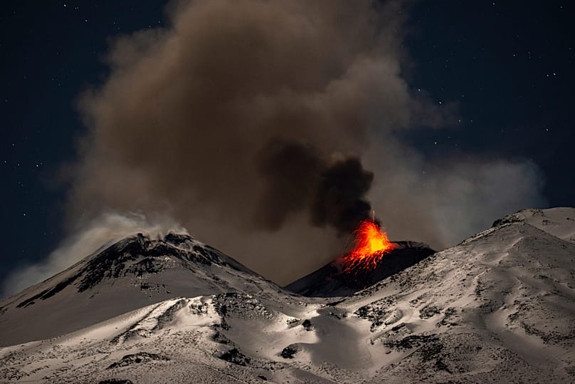
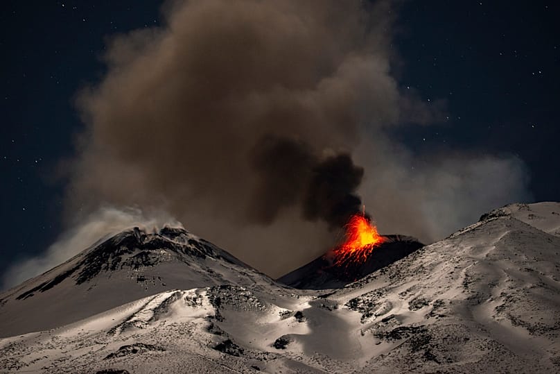
Explosive activity concentrates at the north-east crater of the Mount Etna, 29 December, 2025
Explosive activity concentrates at the north-east crater of the Mount Etna, 29 December, 2025 AP Photo

An exceptionally long eruption

According to Salvo Gambino, director of the Etnean Observatory in Catania at the National Institute of Geophysics and Volcanology (INGV), the current eruptive phase of Etna shows characteristics already observed in the past, but it is its duration that makes it stand out.

"Similar phenomena were seen in the late 1970s," Gambino told Euronews. In recent decades, lava fountains and flows have occurred on several occasions, but "these processes generally lasted for a very limited time, from a few hours to half a day. In this case we have seven days of continuous activity, which is a distinctive feature of the current eruption."

Behind the length of the eruption, Gambino believes there may be "magma rising from greater depth and richer in gas."

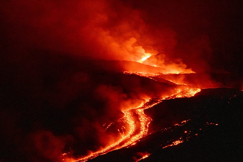
The eruption is affecting several sectors of the volcano at the same time. At the Voragine crater, activity and lava fountains are ongoing, accompanied by a steady emission of ash, while in the Valle del Bove several vents are feeding a lava field. For now, Gambino stresses, the flows do not pose a danger to inhabited areas.

Eruptive activity continues on Mount Etna, 11 August, 2026
Eruptive activity continues on Mount Etna, 11 August, 2026 AP Photo

The ash cloud is instead causing the greatest disruption. Southerly winds have pushed it towards Catania airport and even beyond Sicily.

"The biggest problem at the moment is mainly linked to the continuous plume coming from the Voragine. This plume is clearly a cloud that is dispersed in the atmosphere and in recent days the wind has been blowing towards the south, which has complicated matters, in the sense that this cloud is being pushed towards the airport area and causing disruption," the director explained.

The minister for Civil Protection and Sea Policies, Nello Musumeci, stressed on Wednesday that "it is not the volcano that is out of place, but the airport," whose proximity to Etna makes Catania airport particularly vulnerable to eruptions.

An increasingly crowded Etna

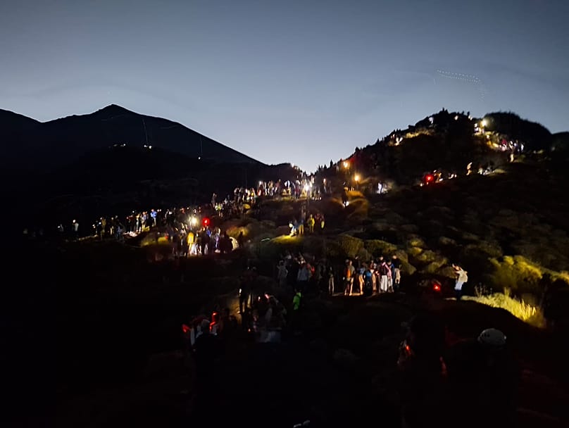
The eruption has drawn an exceptional number of people to Etna, creating traffic and disorder along the roads and paths leading to the spots from which volcanic activity can be observed.

"There are too many people and too many cars parked in a chaotic way," Cristian Alessi, a nature guide with EtnaWay, told Euronews. To describe the crowds on the volcano, Alessi compares them to the busiest resorts and roads in the area: "It feels like being in Taormina or Catania on a Saturday."

The crowds are also pushing towards the points closest to the lava flows. Alessi says he has seen people on the rim of the Valle del Bove, "on that very unstable slope," just a short distance from the area affected by volcanic activity.

"It is wonderful to see, but it has to be done safely, with guides."

The Alpine Rescue service has in turn urged caution after several call-outs on Etna during the current eruption.

Tourists on Etna during the eruption, 12 August 2026. Photo: courtesy of Cristian Alessi.
Tourists on Etna during the eruption, 12 August 2026. Photo: courtesy of Cristian Alessi. Cristian Alessi

How to visit Etna safely?

According to Gambino, it is vital to exercise particular caution during hikes on Etna, especially in the evening.

The director urged people to "go to areas where it is possible to watch without venturing too far" and to wear suitable clothing, including hiking boots and long trousers.

After sunset it is also important to carry a torch, as paths can become difficult to negotiate in the dark.

"The trails are rough, so it is not that hard to fall," Gambino warned.

Wednesday, August 12, 2026

Mount Etna eruption: Catania airport closes and ash cloud reaches as far as Libya


By Isidoro Patalano
Published on

The eruption of Mount Etna continues to bring air traffic in Sicily to a standstill, forcing Catania–Fontanarossa airport to close temporarily as ash reached Malta and as far away as Libya.

The eruption of Sicil's Mount Etna volcano, now in its sixth consecutive day, continues to disrupt air traffic in the island at the height of the summer season.

On Wednesday, Catania–Fontanarossa Airport was forced to suspend all arrivals and departures until 6 pm.

According to data from the airport's tracking system, around 55 outbound flights have been cancelled, on top of roughly 388 departures scrapped between the start of the eruption and the previous day.

Dozens of other flights have been rescheduled or diverted to other airports in the region, notably Palermo, Trapani and Comiso.

At the latter airport, operations were halted for several hours on Wednesday morning, until 10 am, because of volcanic ash.

The airport later resumed operations, with both departures and arrivals restored.

Explosive activity concentrates at the north-east crater of Mount Etna in Sicily, 29 December, 2025
Explosive activity concentrates at the north-east crater of Mount Etna in Sicily, 29 December, 2025 AP Photo

Etna causes disruption beyond Italy's borders

Etna is Europe's most active volcano, located around 220 kilometres north of Malta. The impact of its activity has spread beyond Italy's borders.

Ash clouds have forced some aircraft arriving in and departing from Malta to alter their routes.

The disruption has also affected some local celebrations on the island. The Socjeta Muzikali La Stella Levantina of Attard postponed the fireworks display scheduled for Tuesday, the Feast of Santa Marija.

The organiser explained that the fireworks launch site is close to the runway approach path and that, after consulting with authorities, it decided to postpone the display for as long as operational restrictions remain in force at the airport.

The Volcanic Ash Advisory Centre in Toulouse (VAAC) has noted that the volcanic ash cloud continues to drift south and southwest.

According to a VAAC bulletin issued on Tuesday evening, the highest concentration of ash remains over Sicily, while lower levels have been reported between eastern Malta and as far as northern Libya.

Eruptive activity continues on Mount Etna, 11 August, 2026
Eruptive activity continues on Mount Etna, 11 August, 2026 AP Photo

A political issue

Catania airport, just a few kilometres from the volcano, has been forced to close several times in recent weeks, with numerous flights cancelled or diverted to Palermo at the height of the summer season. The repeated shutdowns have reignited a political and infrastructure debate.

The Minister for Civil Protection and Maritime Policies, Nello Musumeci, has weighed in on the issue.

"What has been happening in recent days at the airports of Catania and Comiso, with cancellations, delays and serious disruption for thousands of citizens and tourists at the height of the summer season, brings back to the fore a problem that Sicily has known about for a long time," the minister said.

Smoke billows from Mount Etna volcano, 2 June, 2025
Smoke billows from Mount Etna volcano, 2 June, 2025 AP Photo

The minister said this is an issue he had already highlighted during his time as president of the Province of Catania, when he put forward a plan for the Sicilian airport that failed to win support.

"As far back as 1999, as president of the Province of Catania, I had pointed out the limitations of the Fontanarossa airport and its particular vulnerability linked to its proximity to Etna," he said.

"We did not stop at raising the issue: we included in the provincial spatial plan a proposal to relocate the airport. We also commissioned a preliminary study for a new airport on the plain between Catania and Enna, designed to serve seven of the island's nine provinces."

"That idea of mine did not receive any backing," Musumeci added, explaining that he returned to the issue when he was president of the region, only to encounter opposition from the airport operator and indifference from local authorities.

"The events of recent days show just one thing: it is not the volcano that is in the wrong place, but the airport."