WATCH: Meteosat-12 takes a picture of the weather systems below it every 10 minutes
By Jonathan Amos
BBC Science Correspondent
@BBCAmos
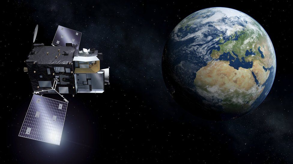
The first images from Europe's new weather satellite, Meteosat-12, have just been released.
The spacecraft, which sits 36,000km above the equator, was launched in December and is currently in a testing phase that will last most of this year.
When Meteosat-12's data is finally released to meteorological agencies, it's expected to bring about a step-change in forecasting skill.
Warnings of imminent, hazardous conditions should improve greatly.
This is something called "nowcasting" - the ability to say with greater confidence that violent winds, lightning, hail or heavy downpours are about to strike a particular area.
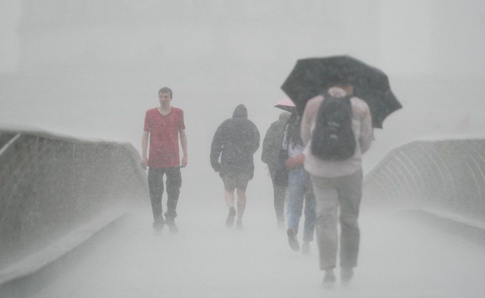
Meteosat-12 should help forecasters identify those places about to experience extreme conditions
Part of this advance will come from the increased resolution of Meteosat-12. For previous generation satellites, a feature in a storm had to be at least 1km across to be detected. The new spacecraft will track features as small as 500m in diameter.
"We can now see very fine structures," said Jochen Grandell from Eumetsat, the intergovernmental agency that manages Europe's weather satellites.
"You may have heard the term 'overshooting top', for example, which is a part of a thunderstorm's cloud development where you might see very strong updrafts and downdrafts. These are very rapidly changing, and they are very small as well. But they are also very powerful," he told BBC News.
Europe has had its own meteorological spacecraft sitting high above the planet since 1977. The new imager is the third iteration in the series.
Meteosat-12 sits in a "stationary" position, keeping a permanent eye on Europe, the Middle East and Africa.
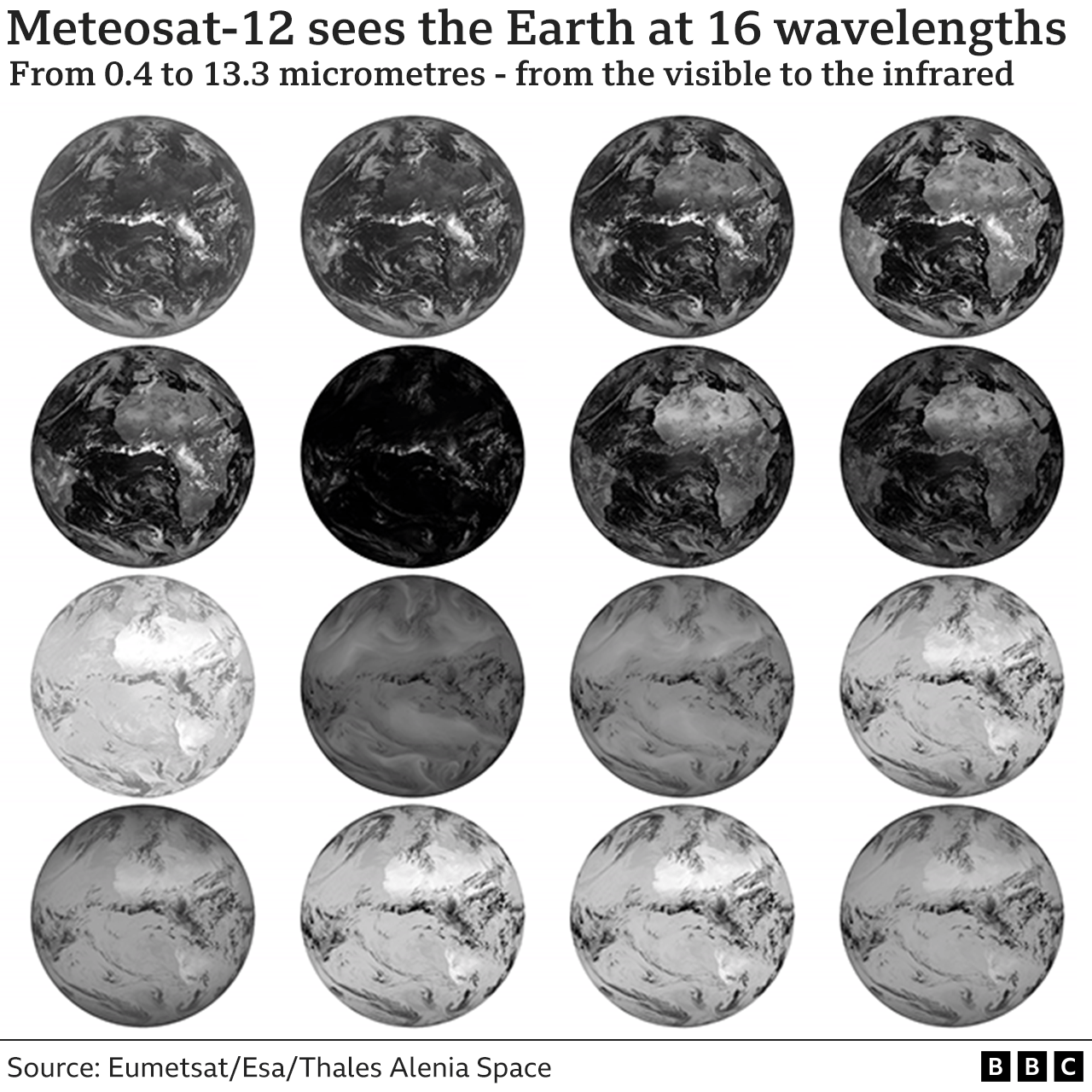
It will return a full picture of the weather systems racing across Earth's surface at a rate of one every 10 minutes, five minutes faster than has been the case up to now. It also views the planet in more wavelengths of light. Sixteen instead of the previously available 12.
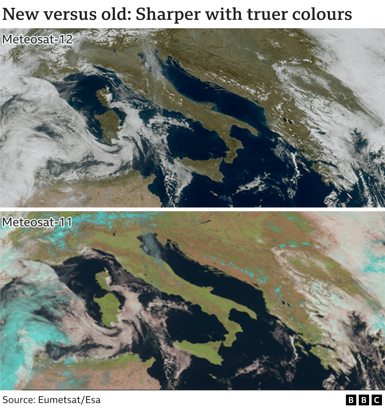
The additional bands of light allow for true colour images. In other words, the pictures are much closer to what the human eye might perceive if looking down from the same vantage point.
"The first time we received the data, there were huge emotions because we could see the high quality of the sensor," recalled Eumetsat colleague Alessandro Burini.
"The optical quality of the images, of the radiometry, of the navigation - in other words the accuracy of the position of the individual pixels in an image - is really very good."
Part of this advance will come from the increased resolution of Meteosat-12. For previous generation satellites, a feature in a storm had to be at least 1km across to be detected. The new spacecraft will track features as small as 500m in diameter.
"We can now see very fine structures," said Jochen Grandell from Eumetsat, the intergovernmental agency that manages Europe's weather satellites.
"You may have heard the term 'overshooting top', for example, which is a part of a thunderstorm's cloud development where you might see very strong updrafts and downdrafts. These are very rapidly changing, and they are very small as well. But they are also very powerful," he told BBC News.
Europe has had its own meteorological spacecraft sitting high above the planet since 1977. The new imager is the third iteration in the series.
Meteosat-12 sits in a "stationary" position, keeping a permanent eye on Europe, the Middle East and Africa.
It will return a full picture of the weather systems racing across Earth's surface at a rate of one every 10 minutes, five minutes faster than has been the case up to now. It also views the planet in more wavelengths of light. Sixteen instead of the previously available 12.
The additional bands of light allow for true colour images. In other words, the pictures are much closer to what the human eye might perceive if looking down from the same vantage point.
"The first time we received the data, there were huge emotions because we could see the high quality of the sensor," recalled Eumetsat colleague Alessandro Burini.
"The optical quality of the images, of the radiometry, of the navigation - in other words the accuracy of the position of the individual pixels in an image - is really very good."
1903 storm one of windiest to pummel British Isles
UK also broke its land surface temperature record
UK's rainfall records rescued by volunteer army
UK also broke its land surface temperature record
UK's rainfall records rescued by volunteer army
IMAGE SOURCE,EUMETSATImage caption,
Artwork: The near-4 tonne satellite sits 36,000km above the equator
The new third-generation system will eventually comprise a trio of spacecraft working in unison.
A second imager will go up in 2026 to acquire more rapid - every 2.5 minutes - pictures of just Europe. Before that, in 2024, a "sounding" spacecraft will launch to sample the temperature and humidity down through the atmosphere.
With replacement satellites already ordered for the first working threesome, Europe is guaranteed coverage well into the 2040s.
The overall cost is expected to be about €4.3bn (£3.7bn).
If that sounds like a lot of money (and it is), it pales next to the value society accrues from accurate weather forecasting - in preventing loss of life, infrastructure damage and economic disruption.
Repeated analyses have judged the benefits to be worth tens of billions every year across Europe as a whole.
National forecasting agencies, such as the UK Met Office, Meteo France and DWD (the German Meteorological Service), should be ingesting Meteosat-12 information into their supercomputers on a routine basis early next year.
Related Topics
Earth observation
No comments:
Post a Comment