CBC
Fri, May 10, 2024
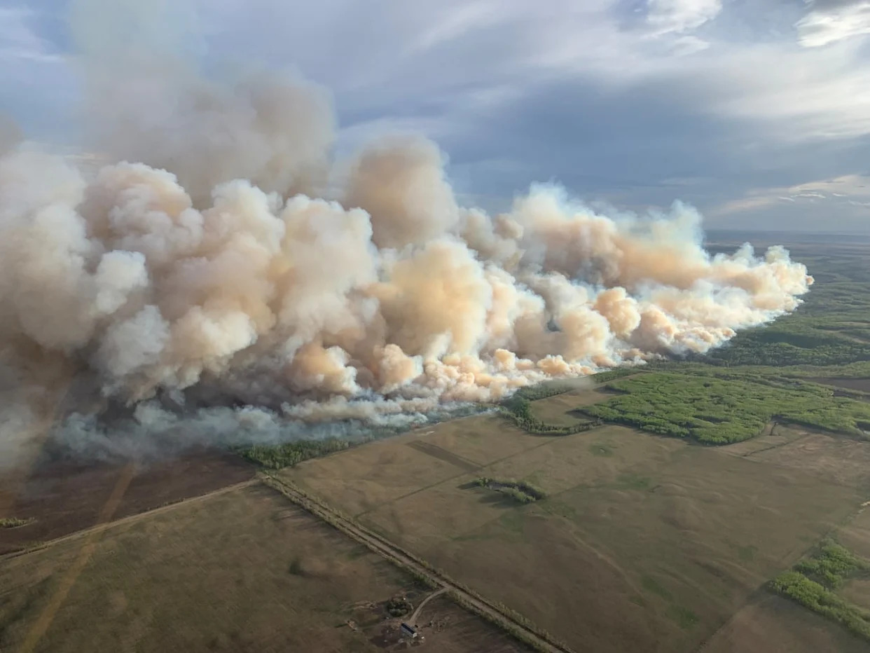
Some residents in County of Grande Prairie are being told to evacuate their homes due to the threat of a nearby wildfire. (County of Grande Prairie - image credit)
Some residents in the County of Grande Prairie in northern Alberta need to immediately leave their homes due to the danger posed by a nearby wildfire.
The county issued an evacuation order at 8:46 p.m. MT, stating a fire is located four kilometres east of Teepee Creek near Range Road 31 and Township Road 740. The fire is moving away from the community, the alert states.
According to a post on Facebook from the county, the order is in effect from Kleskun Creek north to Township Road 742. The order is also in effect for the Riverstone Golf Course.
The alert says residents should travel north to Township Road 742 and west onto Highway 733. Evacuees should register at the Pomeroy Hotel and Conference Centre located at 11633 100 Street in Grande Prairie.
In addition to the area that is under evacuation, all residents from Township Road 744 to 750 and Township Road 744 to 730 and Range Road 32 are on evacuation alert, the county said. Residents should be prepared to leave, but no evacuation is required at this time.
Evacuees are advised to bring pets, important documents, medication, medical devices and enough food and water to be away from your home for seven days.
According to the Alberta Wildfire map, the fire was estimated to cover about 40 hectares as of 5:44 p.m.
'Risk has risen' in Fort Liard, N.W.T., after wildfire crosses river west of community
CBC
Fri, May 10, 2024
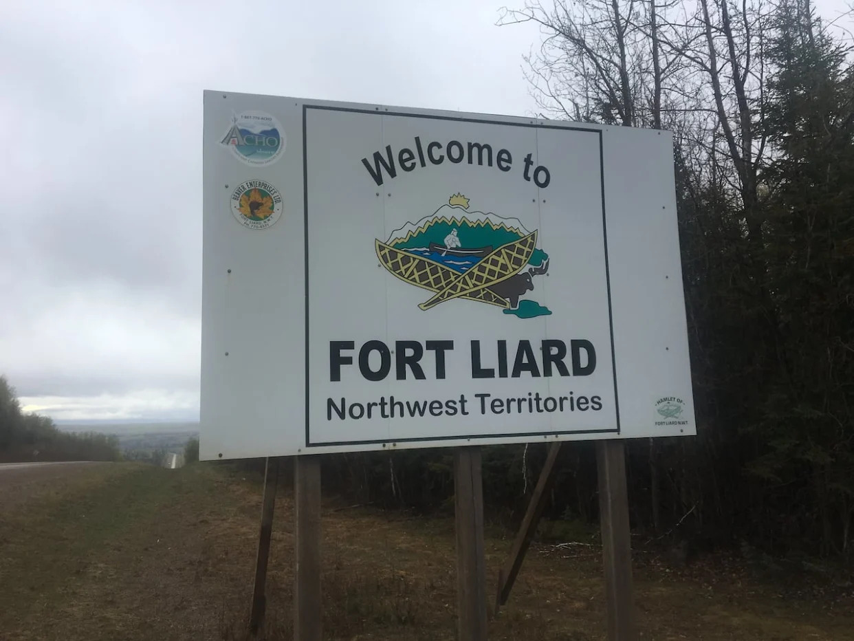
A photo of the Fort Liard sign. The highway south of the community in northern B.C. has been reduced to single lane traffic due to poor visibility from smoke. (Alex Brockman/CBC - image credit)
What you need to know about the N.W.T. wildfires as of 7:00p.m. Friday:
Evacuation notice put out for Fort Liard, telling residents to prepare in case they need to evacuate
N.W.T. Fire says fire has crossed Liard River, increasing risk to Fort Liard
High winds preventing firefighting aircraft from taking off
Highway 7 closed due to B.C. wildfires
Highway 35 in northern Alberta closed due to fire near N.W.T. border
Highway 1 closed due to wildfire between Jean Marie River access road and Highway 3 junction
A wildfire burning west of Fort Liard, N.W.T., jumped the Liard River on Friday evening, posing a greater threat to the community that's under an evacuation notice.
"Risk has risen to the community of Fort Liard," reads an update from fire officials, issued just before 6:30 p.m. MT.
Fire information officer Mike Westwick said the river was a natural fuel break that the fire has now breached.
"That puts it on the same side of the river as Fort Liard," he said, early Friday evening.
"It's classified as out of control, it is uncontained, it is growing, and we are not able to suppress that growth directly at this time due to the safety conditions."
The fire had been burning to the west of Fort Liard and the Liard River earlier on Friday. Strong winds from the west through the day pushed the fire eastward, and across the river, Westwick said.
As of Friday evening, firefighters were unable to directly attack the fire because of unsafe conditions. Westwick said high winds and poor visibility meant that firefighting aircraft couldn't be used.
It was also hard to say how far the fire was from the community, he said.
"There's no road access, we can't fly. So we don't have an exact location," he said.
An evacuation notice was issued earlier Friday afternoon for Fort Liard as the wildfire was then burning about 22 kilometres away.
Westwick said fire crews are in Fort Liard, setting up sprinklers and focusing on "critical infrastructure" and protecting the perimeter of the community.
Fort Liard under evacuation notice
The evacuation notice posted earlier Friday on the N.W.T.'s public safety website said residents should keep vehicles fuelled and prepare an emergency kit.
"It's a notice to just be prepared," said John McKee, Fort Liard's SAO.
"You can't wait until the last minute."
McKee said a lot of people in the community have cleared brush from their properties, and the hamlet has done the same around different municipal buildings.
McKee said in the case of an evacuation order, the destination for residents would be determined by highway conditions. He said as of Friday, it wouldn't be in B.C. because of the closure or Highway 7.
Highway 35 was also closed late Friday afternoon, just south of the Alberta/N.W.T. border.
Sean Whelly, mayor of Fort Simpson, told CBC News the community is listed as the evacuation centre in case Fort Liard residents are told to leave.
An evacuation notice is the first of three levels of emergency. The second would be an evacuation alert and the final is an evacuation order.
The hamlet of Fort Liard said on its website that a fire ban was implemented on Thursday and it also posted a list of necessities in the case of an evacuation.
Highway 7 closed
Two separate active wildfires have closed Highway 7 at the N.W.T./B.C. border, the territory's Department of Infrastructure said on Friday.
The department said residents and travellers should know that conditions in the area can change with little to no warning, and that they should expect smoky conditions and poor visibility in the area.
Residents should also stay out of the bush in the areas surrounding Highway 7.
"High winds are expected to continue through this region. Under these conditions, there is a high chance of tree fall - which is a serious danger to those on the land," the update said.
An evacuation alert has also been issued by the Northern Rockies Regional Municipality for the area stretching from southeast to the northwest of Fort Nelson, B.C. That's due to fires located near Nogah Creek and Patry Creek.
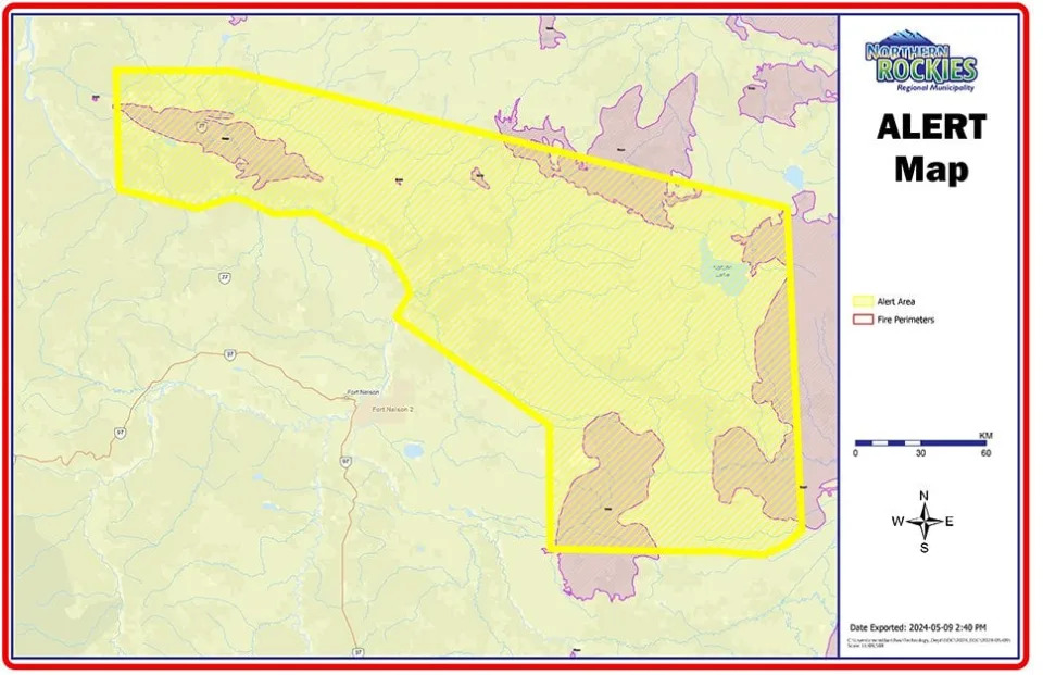
An evacuation alert map that was posted on the Northern Rockies Regional Municipality website.
An evacuation alert map that was posted on the Northern Rockies Regional Municipality website. (Northern Rockies Regional Municipality website)
N.W.T. fire officials are also warning that high winds and dry conditions could mean extreme fire activity in the South Slave and Dehcho regions. They said winds could gust from 50 to 85 km/h.
The Town of Hay River posted on Facebook that it was implementing a full-fire ban until after the wind event on Saturday. The town also said that the fire department is responding to an underground fire on Patterson Road, but that it is contained to an area that's been previously burned.
"There is no risk to the public but smoke will be visible," the post reads.
New fire detected east of Sambaa K'e
A holdover fire has also flared up near Sambaa K'e, roughly one kilometre southeast of the community. It is not considered a threat to the community. Winds were expected to push it away from the community, N.W.T. Fire said in an update.
Storms are also in the forecast for numerous areas, including the northern Dehcho and southern Sahtu, increasing the likelihood of lightning-caused fires.
Winds are expected to come from the west around Hay River and Fort Smith, and from west to northwest around Fort Simpson.
The M.V. Lafferty ferry at the Liard River crossing in Fort Simpson was briefly suspended Friday due to high winds.
But Jacqueline Demers, the regional superintendent for the Dehcho region with the Department of Infrastructure, said it reopened around 12:30.
The high winds are expected to end Saturday in most areas, the post reads, with some higher moisture levels returning to the Hay River and Fort Smith areas.
"However, Dehcho is expected to stay very dry and hot with continuing brisk winds," an N.W.T. Fire Facebook post reads.
Highway 1 partially closed east of Jean Marie River, N.W.T., as fire grows to 1,500 hectares
CBC
Fri, May 10, 2024

Highway 1 in the N.W.T. is closed between the Jean Marie River access road and the Highway 3 junction. (Francis Tessier-Burns/CBC - image credit)
What you need to know about the N.W.T. wildfires as of 7:00 p.m. Friday:
Evacuation notice issued for Fort Liard, telling residents to prepare in case they need to evacuate
N.W.T. Fire says fire has crossed Liard River, increasing risk to Fort Liard
High winds preventing firefighting aircraft from taking off
Highway 7 closed due to B.C. wildfires
Highway 35 in northern Alberta closed due to fire near N.W.T. border
Highway 1 closed due to wildfire between Jean Marie River access road and Highway 3 junction
A wildfire that is now 1,500 hectares in size has closed part of Highway 1 about 72 kilometres southeast of Jean Marie River, N.W.T.
The fire is about 100 kilometres west of the Enterprise junction at Highway 1 toward Fort Simpson.
"It's grown really, really quickly," fire information officer Mike Westwick told CBC News on Friday afternoon.
The fire is from a previously undiscovered holdover fire from last year.
Westwick said his team is "working to assess that and take the right actions."
He said the quick growth was driven by extreme wind.
Westwick said no communities are currently under threat.
The fire comes after N.W.T. fire officials warned of a "major wind event" expected in some areas of the territory on Friday, along with warm, dry conditions — significantly raising the risk of wildfire.
Fort McMurray residents told to be ready to evacuate on short notice due to wildfire threat
CBC
Fri, May 10, 2024
This photo shows a wildfire burning near Fort McMurray at 3:30 p.m. on May 10. (Alberta Wildfire - image credit)
Poor internet connection? Access a low-bandwidth, accessible version of this story on CBC Lite.
Alberta residents in the Fort McMurray area are being told to be ready to leave their homes due to the threat of an out-of-control wildfire in the region.
The Regional Municipality of Wood Buffalo issued an evacuation alert at 6:38 p.m. MT for Fort McMurray and Saprae Creek Estates as the MWF-017 wildfire burns nearby.
The alert states the fire is southwest of Fort McMurray, and smoke could affect visibility on Highway 63 south of the northern Alberta community that was devastated by wildfire in 2016.
An evacuation order has not been issued at this time. Residents are advised to keep essential items like medications, important documents and emergency kits ready for a quick departure.
The municipality provided an update on the situation just before 8 p.m.
Wood Buffalo Regional Fire Chief Jody Butz told media the community is more prepared to deal with wildfires compared to 2016.
"From our experiences, we've continued to recognize that wildfires are the number one hazard in the region. And it's clear our community is prepared and more responsive to that reality," Butz said.
"When you're dealing with ... the powers of Mother Nature and the forces of wildfire, I'll take any advantage I can get," he said when asked whether the burned area from 2016 could play a factor in battling the current blaze.
Butz said the wind is also favourable as it is pushing the fire away from the community. He also said that neither Fort McMurray nor Saprae Creek were in imminent danger, but the municipality issued the alert out of an abundance of caution.
According to Alberta Wildfire's latest update, the wildfire is currently classified as out of control at 1,000 hectares and is about 16 kilometres away from Fort McMurray. It's located on the south side of the Athabasca River valley and is moving east.
The update states the fire danger in the area is extreme and fire restriction remains in effect for the Fort McMurray region.
The cause of the fire is still under investigation said Melissa Story, provincial information officer with Alberta Wildfire.
"There is a cold front that's passing through the province which generated some elevated wind for us today, which made the fire grow," she said.
There are four crews working on the fire with about 40 people on the ground, she said.
Three helicopters and air tankers and currently deployed with an additional three more night vision helicopters to be deployed overnight.
"Usually overnight, we see more subdued fire behaviour. And we're hoping that the wind speeds will reduce throughout the overnight activity that we can get the opportunity to get in there and hit it with some water."
Residents in Saprae Creek were put on evacuation alert late last month for a separate wildfire.
There are currently 52 fires burning across Alberta.
No comments:
Post a Comment