The Met Office issues yellow alert for Scotland and northern England.
By Graeme Demianyk

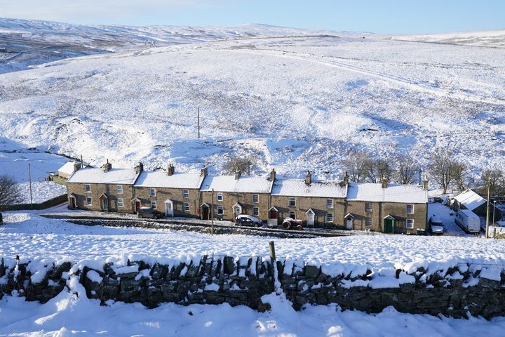
Snow covered fields and rooftops in Allenheads in the Pennines to the north of Weardale in Northumberland.
OWEN HUMPHREYS - PA IMAGES VIA GETTY IMAGES
Forecasters have warned so-called “thundersnow” – a thunderstorm that produces snow instead of rain – could hit large swathes of Scotland and northern England, knocking homes off the power grid.
The Met Office has warned of dangerous weather conditions on Thursday and Friday, and the forecaster said there could be as much as 10cm of snow falling on the highest ground, as well as the risk of dangerous icy patches and of lightning strikes from isolated thunderstorms.
Thundersnow is not meteorologically different to thunder in the summer, but rather than hail or rain there is snow which can affect the acoustics of the thunder.
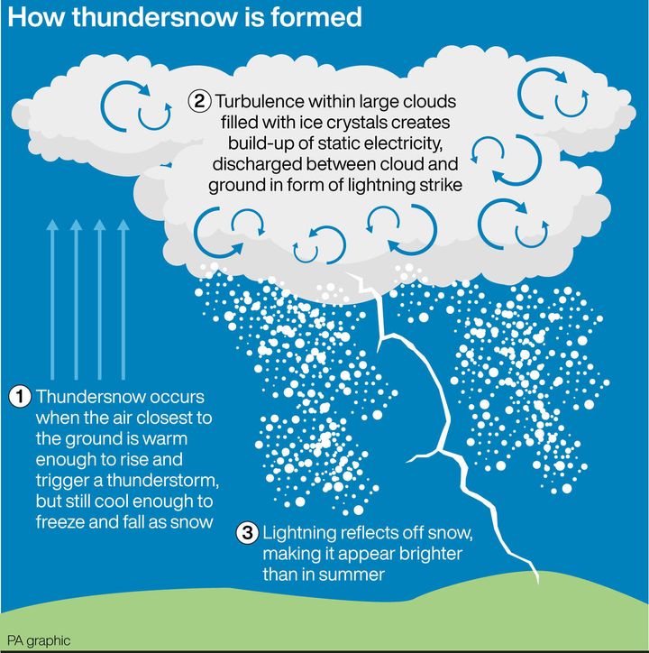
The Met Office added that the prospect of thundersnow was driven by the same conditions which cause thunder in the summer, the difference in temperature between the ground and the air surrounding it.
Grahame Madge, spokesman at the Met Office, said: “Because you have got that differential it’s possible, quite easily, for warm air at ground level when it heats up to start to rise very quickly up through the cold air and that’s what creates the potential for thunderstorms, so we are likely to see along with the other wintery showers, likely to see hail and snow.”

How thundersnow is formed.
PA GRAPHICS VIA PA GRAPHICS/PRESS ASSOCIATION IMAGES
The yellow weather warning is set to be in place at 8pm on Thursday until 11am on Friday, and the alert, which includes Glasgow, stretches along the east of Scotland and into the north of England beyond Manchester. It also includes part of Northern Ireland, the Met Office said.
By Graeme Demianyk

Snow covered fields and rooftops in Allenheads in the Pennines to the north of Weardale in Northumberland.
OWEN HUMPHREYS - PA IMAGES VIA GETTY IMAGES
Forecasters have warned so-called “thundersnow” – a thunderstorm that produces snow instead of rain – could hit large swathes of Scotland and northern England, knocking homes off the power grid.
The Met Office has warned of dangerous weather conditions on Thursday and Friday, and the forecaster said there could be as much as 10cm of snow falling on the highest ground, as well as the risk of dangerous icy patches and of lightning strikes from isolated thunderstorms.
Thundersnow is not meteorologically different to thunder in the summer, but rather than hail or rain there is snow which can affect the acoustics of the thunder.
The Met Office added that the prospect of thundersnow was driven by the same conditions which cause thunder in the summer, the difference in temperature between the ground and the air surrounding it.
Grahame Madge, spokesman at the Met Office, said: “Because you have got that differential it’s possible, quite easily, for warm air at ground level when it heats up to start to rise very quickly up through the cold air and that’s what creates the potential for thunderstorms, so we are likely to see along with the other wintery showers, likely to see hail and snow.”

How thundersnow is formed.
PA GRAPHICS VIA PA GRAPHICS/PRESS ASSOCIATION IMAGES
The yellow weather warning is set to be in place at 8pm on Thursday until 11am on Friday, and the alert, which includes Glasgow, stretches along the east of Scotland and into the north of England beyond Manchester. It also includes part of Northern Ireland, the Met Office said.
No comments:
Post a Comment