SCOTLAND
What is the ‘Troll of Trondheim’, how could it affect Yorkshire and where is Trondheim?
A big winter chill is expected to reach Yorkshire, with parts of the coast already being blanketed with snow. We’ve explained how the Troll of Trondheim will impact the region.
By Liana Jacob
Severe cold weather is set to hit areas across England as the Met Office issues an alert for the country, warning that temperatures will plummet this week and this could increase health risks for vulnerable people and disrupt services. Many areas in Yorkshire are already seeing temperatures drop to lower numbers and even into minus numbers overnight.
The weather service has warned of severe conditions in England between 6pm on Wednesday, December 7 and 9am on Monday, December 12. The alert advises social and healthcare services to take action to protect high-risk groups.
Temperatures are set to drop even more across most of the UK throughout the day today (December 8). Yorkshire is expected to see temperatures in the minus numbers today, as the Met Office said: “Wintry showers gradually clearing by evening.
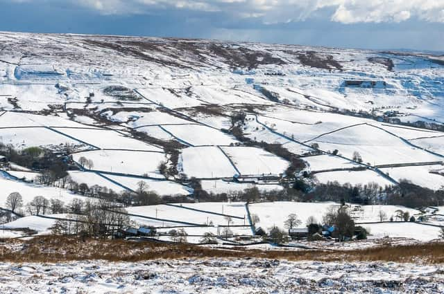
Snow covered hills of the North York Moors National Park. (Pic credit: James Hardisty)
“Becoming largely dry with clear skies developing overnight, leading to a widespread frost and risk of icy surfaces. Chances of isolated freezing fog patches. Minimum temperature -4C.”
When talking about Friday, December 9, the Met Office said: “A chilly start, with a widespread sharp frost and risk of icy surfaces.
“Otherwise largely dry with sunny spells. Feeling rather cold. Chance of some coastal wintry showers. Light winds. Maximum temperature 3C.”
What is the Troll of Trondheim?
With temperatures dropping across the UK in the coming days, this weather has come from Scandinavian countries in a weather phenomenon called Troll of Trondheim.
The mixture of high pressure over Greenland and an area of low pressure over Scandinavia results in the cold Arctic air spreading southwards across the UK.
This weather is predicted to be very severe and the cold period is likely to be quite lengthy with a risk of snow.
How could the Troll of Trondheim affect Yorkshire?
This cold Arctic air is expected to cross the UK, particularly in the northern region as the Met Office has already issued yellow ice alerts for parts of the Yorkshire coast and North Yorkshire.
These low temperatures could see the region being hit with snow as we get closer to Christmas.
Met Office chief meteorologist, Steve Willington, said: “As an Arctic maritime airmass settles across the UK temperatures will fall with widespread overnight frosts, severe in places, and daytime temperatures only a few degrees above freezing. However, the cold air from the Arctic will also bring brighter conditions, with some dry, sunny spells, particularly away from the coast and where winds are light it could feel pleasant in the sunshine. Some patchy freezing fog is also likely.
“Yellow National Severe Weather Warnings for ice and snow have been issued for parts of Scotland, Northern Ireland, Wales and the east coast and South West England. Showers will turn more wintry with an increasing risk of snow as the week progresses, particularly in coastal areas or over higher ground. There will be widespread frosts with temperatures falling to as low as -10C overnight in isolated spots by the end of the week. More severe weather warnings may be needed as we head through the week.”
The UK Health Security Agency (UKHSA) has also issued a Level 3 Cold Weather Alert covering England from Wednesday, December 7 to Monday, December 12.
There are some uncertainties around how long this cold period will last, but it is predicted to remain cold into next week with temperatures staying well below average for this time of year.
Throughout the weekend and into next week, sleet, snow and ice is possible, especially along the east coast, while inland will mainly be dry, hard frosts and patchy freezing fog is expected.
Met Office deputy chief meteorologist, Jason Kelly, said: “Through the weekend and into next week cold weather will continue, with an ongoing chance of wintry showers, mainly for coasts, and freezing fog patches inland.
“An area of low pressure may then threaten southern and southwestern parts of the UK through mid-week. Confidence in the exact track of this system is low, but should it push precipitation into the UK, then this would readily turn to snow, with a lower chance of freezing rain. How far north the milder air gets is also open to a lot of uncertainty, but for now, many central and northern areas are likely to remain in the Arctic airmass.”
Where is Trondheim?
Trondheim, historically known as Kaupangen, Nidaros and Trondhjem, is a city and municipality in the Trondelag county of Norway.
Trondheim has a mild climate for its northerly latitude, which leads to moderate summers and winters that regularly remain above the freezing point in seaside areas
It is situated where the River Nidelva meets Trondheim Fjord with a harbour and sheltered condition.
No comments:
Post a Comment