Saturday, August 01, 2020


Plastics, pathogens and baby formula: What's in your shellfish?


by University of California, Irvine
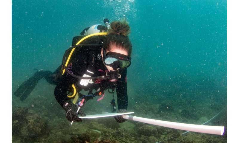
Joleah Lamb, assistant professor of ecology & evolutionary biology at UCI, collecting data on urban reefs in Myanmar. Credit: Michelangelo Pignani

The first landmark study using next-generation technology to comprehensively examine contaminants in oysters in Myanmar reveals alarming findings: the widespread presence of human bacterial pathogens and human-derived microdebris materials, including plastics, kerosene, paint, talc and milk supplement powders.


The study—led by scientists from the University of California, Irvine, in collaboration with Environmental Defense Fund, Cornell University and the University of Queensland—was conducted in the eastern Andaman Sea through partnerships with local researchers in Myanmar in the densely populated but still rural Tanintharyi region. The study concludes that coastal urbanization and lack of sewage treatment increases contamination in seafood and can cause potential health risks to humans, even large distances from pollution sources.

Study results appear in Science of the Total Environment.

The area covered by the study spanned nine coral reefs off Myanmar's Mergui Archipelago, situated roughly 40 miles from Myeik, a city with a population of over 250,000 people. The study examined contaminants in seawater and in oysters using next-generation DNA sequencing to reveal 5,459 potential human pathogens belonging to 87 species of bacteria. More than half of these pathogens are considered detrimental to human health. In addition, the scientists used infrared spectroscopy to examine individual microdebris particles found in the oysters. Of the 1,225 individual microdebris particles examined, 78 different types of contaminant materials were found.

"While 48 percent of the microparticles were microplastics—a finding representative across numerous ocean ecosystems—many other particles were not plastic and originated from a variety of human-derived materials that are constituents of fuels, paints and cosmetics," said senior author Joleah Lamb, assistant professor of ecology & evolutionary biology at UCI. "We were particularly surprised to find three different brands of milk powder formula, which comprised 14 percent of the microdebris contaminants."

Both types of contaminants—pathogens and microparticles—reflect the pervasive presence of sewage and runoff from human and animal sources. The implications for other coastal regions are significant, since coastal marine environments worldwide are being increasingly subjected to reduced water quality from urbanization that could be leading to the contamination of important fishery species on a global scale.


Implications for human health are also significant. Oysters in this region and elsewhere are part of the local diet and typically consumed raw and whole. The contaminants found in this study indicate that even the Mergui Archipelago in largely rural Myanmar has significant and widespread pollution from runoff of agricultural and human waste that can affect downstream food sources over a wide area far from urban centers.

Today more than half of seafood exports by value originate in developing countries, raising more general concerns about local food safety and food security worldwide.

"It's important to keep in mind that much of our seafood is imported from overseas, from places that may be contaminated, emphasizing the importance of both adequate testing and improvements to coastal water quality worldwide," said lead author Raechel Littman, a postdoctoral scholar in ecology & evolutionary biology at UCI.

Apart from human bacterial pathogens, the predominance of microplastics and other types of microparticles present in seafood could have implications for both the environment and human health.

"Scientists are only beginning to explore the human health consequences from consuming microplastics," said Lamb.

Many plastic particles can carry toxins, such as persistent organic pollutants, or POPs, like dichlorodiphenyltrichloroethane (DDT), polychlorinated biphenyls (PCBs) and bisphenol A (BPA), that subsequently enter the ocean and marine food webs, and can eventually be transferred to people through food. Therefore, the uptake of microplastics in the marine environment could have far-reaching consequences for human consumption of seafood and can be an emerging risk to public health globally.

Also concerning is that over half of the microdebris contaminants detected in the Myanmar oyster tissues were composed of non-polymer materials that can be harmful to human health if ingested, such as kerosene, saponin and talc. Moreover, the prominence of milk supplement detected suggests a direct fecal-oral link between human waste and sewage making its way back into the food chain, thereby elevating the risk of contamination or disease transmission.

"This study in important in its global implications. There is strong evidence of transferability of the findings from Myanmar to other seafood sources around the world," said Douglas Rader, chief scientist for the EDF Oceans program and collaborator on this study. "These findings highlight both the risks of coastal urbanization and the importance of adequate wastewater and stormwater management. It also shows clearly the need for better science related to the potential impacts of these contaminants, and the need for better testing programs so that seafood consumers can rely on its wholesomeness.


Explore further  Research: Crop plants are taking up microplastics

More information: Raechel A. Littman et al, Coastal urbanization influences human pathogens and microdebris contamination in seafood, Science of The Total Environment (2020). DOI: 10.1016/j.scitotenv.2020.139081
Sharks are thriving at the Kermadec Islands, but not the rest of New Zealand, amid global decline

by Adam Smith, The Conversation

Basking sharks were once common in some coastal areas in New Zealand. Credit: Martin Prochazkacz/Shutterstock

VIDEOS AT THE BOTTOM

A recent global assessment of shark populations at 371 coral reefs in 58 countries found no sharks at almost 20% of reefs and alarmingly low numbers at many others.

The study, which involved over 100 scientists under the Global FinPrint project, gave New Zealand a good score card. But because it focused on coral reefs, it included only one region—Rangitāhua (Kermadec Islands), a pristine subtropical archipelago surrounded by New Zealand's largest marine reserve.

It is a different story around the main islands of New Zealand. Many coastal shark species may be in decline, and less than half a percent of territorial waters is protected by marine reserves.

Sharks in Aotearoa

In New Zealand, there are more than a hundred species of sharks, rays, and chimeras. They belong to a group of fishes called chondrichthyans, which have skeletons of cartilage instead of bone.

Some 55% of New Zealand's chondrichthyan species are listed as "not threatened" by the International Union for Conservation of Nature (IUCN). Not so encouraging is the 32% of species listed as "data deficient", meaning we don't know the status of their populations. Most species (77%) live in waters deeper than 200 meters.

Seven species are fully protected under the Wildlife Act 1953. They are mostly large, migratory species such as the giant manta ray. Some are threatened with extinction according to the IUCN, including great white sharks, basking sharks, whale sharks and oceanic white tip sharks.

Historically, basking sharks were caught as bycatch in New Zealand fisheries, and seen in their hundreds in some inshore areas. Sightings of these giant plankton-feeders suddenly dried up over a decade ago. We don't know why.
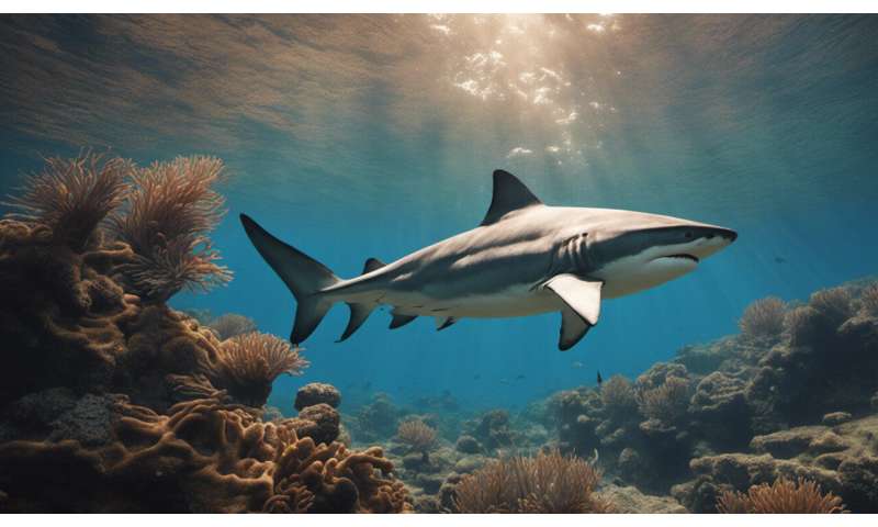
The first global survey of reef sharks shows they are virtually absent in many areas.

Commercial shark fisheries


Eleven chondrichthyan species are fished commercially in New Zealand under the quota management system. Commercial fisheries for school shark, rig and elephant fish took off from the 1970s and now catch around 8,000 tons per year in total.

Finning of sharks has been illegal throughout New Zealand since 2014.

Most of New Zealand's shark fisheries are considered sustainable. But a sustainable fishery can mean sustained at low levels, and we must tread carefully. School shark was recently added to the critically endangered list after the collapse of fisheries in Australia and elsewhere, and there's a lot we don't know about the New Zealand population.

We do know sharks were much more abundant in pre-European times. In Tīkapa Moana (Hauraki Gulf), sharks have since declined by an estimated 86%. An ongoing planning process provides some hope for the ecosystems of the gulf.

Protecting sharks

Not surprisingly, the global assessment found a ban on shark fishing to be the most effective intervention to protect sharks. Several countries have recently established large shark sanctuaries, sometimes covering entire exclusive economic zones.

These countries tend to have ecotourism industries that provide economic incentives for protection—live sharks can be more valuable than dead ones.

Other effective interventions are restrictions on fishing gear, such as longlines and set nets.
Grey reef, silver tip and hammerhead sharks circle a baited camera station set up near Walpole Island in the Southwest Pacific.

Waters within 12 nautical miles of the Kermadec Islands have been protected by a marine reserve since 1990. In 2015, the Kermadec Ocean Sanctuary was announced but progress has stalled. The sanctuary would extend the boundaries to the exclusive economic zone, some 200 nautical miles offshore, and increase the protected area 83-fold.

A large population of Galapagos sharks, which prefer isolated islands surrounded by deep ocean, thrive around the Kermadec Islands but are found nowhere else in New Zealand. Great white sharks also visit en route to the tropics. Many other species are found only at the Kermadecs, including three sharks and a sex-changing giant limpet as big as a saucer.

New technologies are revealing sharks' secrets

What makes the Global FinPrint project so valuable is that it uses a standard survey method, allowing data to be compared across the globe. The method uses a video camera pointed at a canister of bait. This contraption is put on the seafloor for an hour, then we watch the videos and count the sharks.

Baited cameras have been used in a few places in New Zealand but there are no systematic surveys at a national scale. We lack fundamental knowledge about the distribution and abundance of sharks in our coastal waters, and how they compare to the rest of the world.

Satellite tags are another technological boon for shark research. It is difficult to protect sharks without knowing where they go and what habitats they use. Electronic tags that transmit positional data via satellite can be attached to live sharks, revealing the details of their movements. Some have crossed oceans.

Sharks have patrolled the seas for more than 400 million years. In a few decades, demand for shark meat and fins has reduced their numbers by around 90%.

Sharks are generally more vulnerable to exploitation than other fishes. While a young bony fish can release tens of millions of eggs in a day, mature sharks lay a few eggs or give birth to a few live young. Females take many years to reach sexual maturity and, in some species, only reproduce once every two or three years.

These biological characteristics mean their populations are quick to collapse and slow to rebuild. They need careful management informed by science. It's time New Zealand put more resources into understanding our oldest and most vulnerable fishes, and the far-flung subtropical waters in which they rule.


Explore further Sharks almost gone from many reefs

Provided by The Conversation

This article is republished from The Conversation under a Creative Commons license. Read the original article.
Unwelcome sea change: New research finds coastal flooding may cost up to 20% of global economy by 2100

by Ebru Kirezci, Ian Young, The Conversation
Credit: CC0 Public Domain

Over the past two weeks, storms pummeled the New South Wales coast have left beachfront homes at Wamberal on the verge of collapse. It's stark proof of the risks climate change and sea level rise pose to coastal areas.


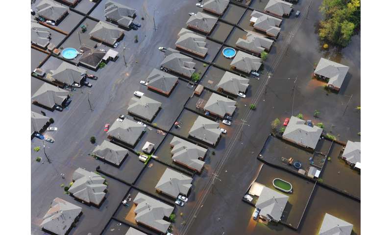
Our new research published today puts a potential price on the future destruction. Coastal land affected by flooding—including high tides and extreme seas—could increase by 48% by 2100. Exposed human population and assets are also estimated to increase by about half in that time.

Under a scenario of high greenhouse gas emissions and no flood defenses, the cost of asset damage could equate up to 20% of the global economy in 2100.

Without a dramatic reduction in greenhouse gas emissions, or a huge investment in sea walls and other structures, it's clear coastal erosion will devastate the global economy and much of the world's population.

In Australia, we predict the areas to be worst-affected by flooding are concentrated in the north and northeast of the continent, including around Darwin and Townsville.

Our exposed coasts

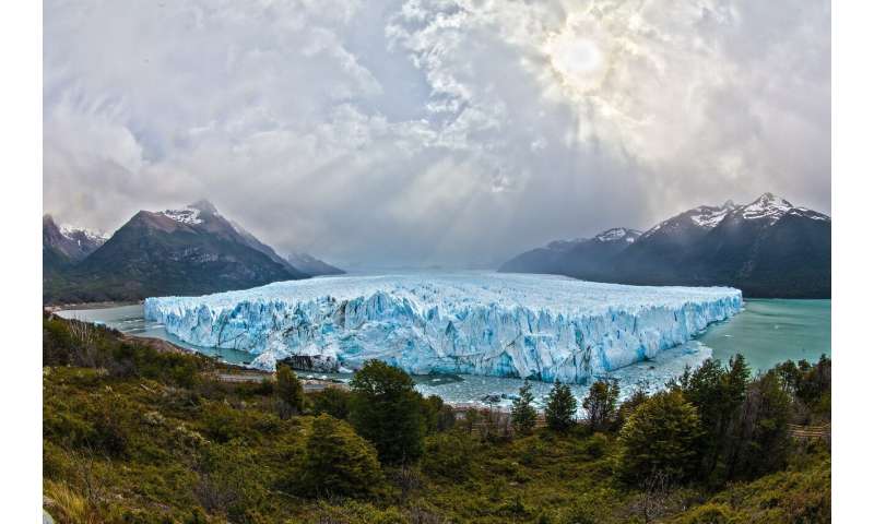
Sea levels are rising at an increasing rate for two main reasons. As global temperatures increase, glaciers and ice sheets melt. At the same time, the oceans absorb heat from the atmosphere, causing the water to expand. Seas are rising by about 3-4 millimeters a year and the rate is expected to accelerate.

These higher sea levels, combined with potentially more extreme weather under climate change, will bring damaging flooding to coasts. Our study set out to determine the extent of flooding, how many people this would affect and the economic damage caused.

We combined data on global sea levels during extreme storms with projections of sea level rises under moderate and high-end greenhouse gas emission scenarios. We used the data to model extreme sea levels that may occur by 2100.

We combined this model with topographic data (showing the shape and features of the land surface) to identify areas at risk of coastal flooding. We then estimated the population and assets at risk from flooding, using data on global population distribution and gross domestic product in affected areas.


Alarming findings

So what did we find? One outstanding result is that due to sea level rise, what is now considered a once-a-century extreme sea level event could occur as frequently as every ten years or less for most coastal locations.

Under a scenario of high greenhouse gas emissions and assuming no flood defenses, such as sea walls, we estimate that the land area affected by coastal flooding could increase by 48% by 2100.

This could mean by 2100, the global population exposed to coastal flooding could be up to 287 million (4.1% of the world's population).

Under the same scenario, coastal assets such as buildings, roads and other infrastructure worth up to US$14.2 trillion (A$19.82 trillion) could be threatened by flooding.

This equates to 20% of global gross domestic product (GDP) in 2100. However this worst-case scenario assumes no flood defenses are in place globally. This is unlikely, as sea walls and other structures have already been built in some coastal locations.

In Australia, areas where coastal flooding might be extensive include the Northern Territory, and the northern coasts of Queensland and Western Australia.

Elsewhere, extensive coastal flooding is also projected in Southeast China, Bangladesh, and India's states of West Bengal and Gujurat; U.S. states of North Carolina, Virginia, and Maryland; northwest Europe including the UK, northern France and northern Germany.

Keeping the sea at bay

Our large-scale global analysis has some limitations, and our results at specific locations might differ from local findings. But we believe our analysis provides a basis for more detailed investigations of climate change impacts at the most vulnerable coastal locations.

It's clear the world must ramp up measures to adapt to coastal flooding and offset associated social and economic impacts.

This adaptation will include building and enhancing coastal protection structures such as dykes or sea walls. It will also include coastal retreat—allowing low-lying coastal areas to flood, and moving human development inland to safer ground. It will also require deploying coastal warning systems and increasing flooding preparedness of coastal communities. This will require careful long-term planning.

All this might seem challenging—and it is. But done correctly, coastal adaptation can protect hundreds of millions of people and save the global economy billions of dollars this century.


Explore further  Coastal flooding set to get more frequent, threatening coastal life and global GDP

Provided by The Conversation
Remote islands: Stepping stones to understanding evolution

by Okinawa Institute of Science and Technology

The scientists used Winkler traps to extract the trap-jaw ants out of leaf litter into flasks of ethanol. Credit: OIST

For millions of years, remote islands have been hotbeds of biodiversity, where unique species have flourished. Scientists have proposed different theories to explain how animals and plants colonize and evolve on islands but testing ideas for processes happening over long time scales has always been a challenge.

Recently, cutting-edge techniques in DNA sequencing, 3-D imaging, and computation have opened up opportunities for investigating historical processes. In a new study published in Evolution, researchers from the Okinawa Institute of Science and Technology Graduate University (OIST) and collaborators from the University of the Ryukyus investigated evolutionary and ecological changes in ants in the South Pacific archipelago of Fiji to examine a controversial theory for how evolution occurs on islands.

"Islands like Fiji, which are small and remote, act as perfect natural laboratories to study the interplay between ecological and evolutionary processes," said Dr. Cong Liu, first author and former Ph.D. student from the OIST Biodiversity and Biocomplexity Unit. "But until recently, there haven't been many studies on ants."

The team focused on Strumigenys trap-jaw ants, the genus with the greatest number of ant species in Fiji. They collected many specimens of trap-jaw ants during an expedition to Fiji in 2007.

The researchers set out to examine how well the changes in appearance and distribution observed in trap-jaw ants over time fit with a theory called the taxon cycle hypothesis, which describes how species colonize and evolve on islands. According to this theory, species pass through a predictable "life cycle" of colonization, geographic range expansion, decline, and (sometimes) extinction, with this cycle then restarted by a new colonizer.

Cracking the colonization stage

The scientists extracted and sequenced DNA from Strumigenys species endemic to the Fijian archipelago—in other words, they are only found in these islands. The team also included samples of the trap-jaw ants more regionally and globally distributed relatives. Based on the DNA sequences, the scientists constructed an evolutionary tree, showing how closely related all the species were.

"We discovered that all 14 of the trap-jaw ant species endemic to Fiji were descended from a single original colonizer, rather than from multiple colonizers," Dr. Liu explained.


These results contradict what would be expected by the taxon cycle hypothesis, which predicts that later colonizers arrive and kickstart new taxon cycles of radiation and decline.

"There are a few reasons why repeated colonizations may not have occurred," said Dr. Liu. He explained that the first trap-jaw colonizers could have diversified and occupied all the niches, closing the door to any newcomers. Or perhaps, he added, the Fijian archipelago is so remote that additional colonizers never arrived.
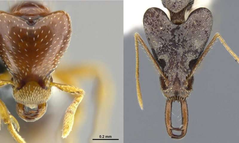
The scientists saw extreme diversification in mandible length, relative to the size of the head, in different species of Fijian trap-jaw ants. (Left) S. oasis has a relatively short mandible. (Right) S. nidifex has a relatively long mandible. Credit: OIST

Revealing the radiation stage

According to the taxon cycle hypothesis, a species first colonizes an island, and then undergoes a huge expansion in range, specializing to the available niches in each habitat.

When the scientists looked at the distribution of the 14 trap-jaw species endemic to Fiji, they found that soon after colonization, the initial lineage split in two, with one giving rise to species living in lowland habitats, and one giving rise to species in upland habitats.

The scientists then measured key morphological features of the ants to determine whether they established their niches through adaptive radiation. "Adaptive radiation often occurs on islands, with the most iconic example being Darwin's finches," said Dr. Liu. "This sudden explosion in abundance, diversity and appearance is often due to a greater number of empty niches that the ants can adapt to, due to a lack of competitors or predators."

The scientists used micro-CT scanners to create 3-D models of each Fijian ant species. They also measured the size of the ants' bodies, jaws (mandibles) and eyes.

"We saw a clear diversification of form that is associated with the niches they are occupying, which was clearly a result of adaptive radiation," said Dr. Liu. In general, the ants in the upland lineage evolved larger bodies, allowing them to catch larger prey. These ants also developed shorter mandibles, defining how they hunt.

Delving into the decline stage

The taxon cycle hypothesis predicts that over time, as species adapt to increasingly specialized niches, their population size and the range of their habitat declines. These predictions only held true for the Fijian trap-jaw ants in the upland habitats.

The team found that the populations of upland species of ants had shrunk in numbers over time and had greater genetic differences between populations, suggesting that they were less able to disperse and breed across the Fijian archipelago.

This loss of competitive ability increases the vulnerability of these older, more specialized ants, which are currently threatened by deforestation—a major environmental issue in Fiji. "Because these endemic species only occupy a small geographical area and only have a limited ability to disperse, deforestation can quickly lead to extinction of these species," said Dr. Liu.

The team now plans to apply their approach, which combines population genomics, phylogenetics and morphological studies, to all ant species on Fiji.

It's still not clear how closely data from the trap jaw ants aligns with the taxon cycle hypothesis, said Dr. Liu. This study, as well as one published last year that examined the Pheidole genus of Fijian ants, "only provided partial support" for the hypothesis, he said. "More data is needed to determine whether evolution on these islands does follow these predictable stages, or whether it is a more random process that differs each time."


Explore furtherLarger than life: Augmented ants

More information: Cong Liu et al, Colonize, radiate, decline: Unraveling the dynamics of island community assembly with Fijian trap‐jaw ants, Evolution (2020). 

Journal information: Evolution

Provided by Okinawa Institute of Science and Technology


THEM! Gordon Douglas, 1954 - Giant Ants!


THE

A win for the Everglades': 5,000 pythons removed in state-sponsored capture program


by Adriana Brasileiro
Credit: CC0 Public Domain 
THAT'S A LOT OF SHOES AND PURSES

Florida's fight against the invasive Burmese python has hit a new milestone: 5,000 snakes captured in the Everglades since wildlife managers started paying hunters to remove the destructive constrictors in 2017.


The South Florida Water Management District and the Florida Fish and Wildlife Conservation Commission, which manage the state's python elimination programs, announced the achievement on Tuesday.

"Another win for the Everglades," said "Alligator Ron" Bergeron, a water district board member and an avid python hunter. "Each invasive python eliminated represents hundreds of native Florida wildlife saved."

The giant snakes are everywhere in South Florida, devouring mammals in the Everglades and disrupting the natural balance of predator and prey. They are such a threat to the health of the fragile ecosystem that state and federal wildlife managers have put a bounty on their heads and enlisted teams of hunters to track them down and take them out.

Pythons are believed to have appeared in the Everglades in the early 1980s, having been kept as pets and then released by frustrated owners who got tired of feeding them mice and other live meals. In the wild, they found perfect conditions: plenty of water in which to mate and abundant food.

The slithery invaders have been successful at reproducing in the wetlands because they have no predators, and females can lay up to 100 eggs a year.

The state pays registered hunters a minimum wage hourly rate for up to 10 hours of work a day, plus a bonus for the catch: $50 for each python measuring up to 4 feet plus $25 more for each foot measured above four feet. An additional $200 is paid for a nesting female.

It's hard to say if the removed snakes actually made a dent in the overall python population in the Everglades because scientists don't know exactly how many are out there. Estimates range from 100,000 to as many as 300,000 snakes.


Explore further Pandemic hasn't slowed Florida's python captures, even with fewer hunters on the prowl

©2020 Miami Herald
Distributed by Tribune Content Agency, LLC.
125 shares
Tierra del Fuego: Marine ecosystems from 6,000 to 5,000 years ago
by University of Barcelona
Credit: Pixabay/CC0 Public Domain

Global warming will modify the distribution and abundance of fish worldwide, with effects on the structure and dynamics of food networks. However, making precise predictions on the consequences of this global phenomenon is hard without having a wide historical perspective.


A study carried out at the University of Barcelona and the Southern Centre for Scientific Research (CADIC-CONICET, Argentina), analyzed the potential implications in the distribution of the Argentinian hake (Merluccius hubbsi), caused by the warming of marine waters. The study is based on the analysis of the structure of the marine ecosystems from 6,000 to 500 years ago, when temperatures were warmer than now. The results show this species could expand towards south and reach the coast of the South America extreme southern area, like it happened in the past. According to the researchers, this approach allows researchers to make predictions on the transformations to be caused by the climate change in the marine environment with important ecogical and economic implications.

The study, published in the journal Oecologia, is part of the doctoral thesis by the researcher Maria Bas, member of CADIC-CONICET and the Biodiversity Research Institute (IRBio) of the University of Barcelona, co-supervised by the tenure-track 2 lecturer Lluís Cardona, from the Research Groups on Large Marine Vertebrates at the Department of Evolutionary Biology, Ecology and Environmental Sciences of the Faculty of Biology and IRBio, and by the expert Ivan Briz i Godino, from CADIC-CONICET. York University (United Kingdom) and British Columbia University (Canada) have also taken part in the study.

The Middle Holocene, a plausible view of the future

Researchers focused on the Atlantic coast of Isla Grande in Tierra del Fuego, in the extreme south of Argentina, where the hake is a key species for industrial fisheries. They collected samples from two archaeological sites dating from the Middle Holocene, that is, between 6,000 and 500 years ago, a period when temperatures would be analogous to those we are heading to in the future -according to climate models. "Remains from fish that lived in the warmest periods of the Holocene are specially interesting since they offer a plausible view of the future in the context of global warming. At the moment, the average annual temperature of the sea surface in Tierra del Fuego is about 7ºC, but during the Middle Holocene it reached 11 and 12ºC. Therefore, data on the biology of the hake during this period can provide information on the distribution of this species in a near future," note the authors.


The presence of remains from other models of hake in the archaeological site Río Chico 1, in the north of Tierra del Fuego (Argentina), show the existence of a large population of hake in the northern east of Tierra del Fuego during the Middle Holocene. Since then, this population has disappeared due to the cooling temperatures, and their habitat remained unknown.

Changes in the distribution of the Argentinian hake

In order to discover the habitat of these fish, the first step in the study was to identify the remains through the mitochondrial DNA analysis and make a reconstruction of the size of old models. Then, researchers used the technique of carbon and nitrogen stable isotope analysis to study changes in the trophic position and the use of the habitat over time. This technique enables researchers to get information on the food intake, and the environment of the species that lived in a recent past, since the information is registered in the bone isotopic signal.

Results show that Argentinian hake that lived in the Atlantic coast of Tierra del Fuego during the Middle Holocene had a broader isotopic niche and fed in more coastal habitats compared to those in current times. "This information, combined with strong winds and currents of the region, together with the lack of sailing technology during the Middle Holocene suggest that groups of aboriginal hunter-fisher-gatherers were likely to fish in the shore," note the authors. If the environmental conditions of a warmer world coincide with what prevails in the Middle Holocene, the Argentinian hake could be more abundant in the continental Argentinian platform of Tierra del Fuego. "From a fishing perspective, this situation suggests a potential increase of resources in shallow waters regarding Tierra del Fuego with important changes in the fishing industry in this region," highlights Lluís Cardona.

According to the researchers, this methodology can be used with other species and in other areas of the planet. "In the future, we would like to know the changes that have taken place in the distribution and ecological niche of the hake and the cod in European waters," concludes the researcher.


Explore further  Global change could also affect hake fisheries in Tierra del Fuego

More information: Maria Bas et al, Predicting habitat use by the Argentine hake Merluccius hubbsi in a warmer world: inferences from the Middle Holocene, Oecologia (2020). 

Journal information: Oecologia

Provided by University of Barcelona
New method lets scientists peer deeper into ocean
by Bigelow Laboratory for Ocean Sciences
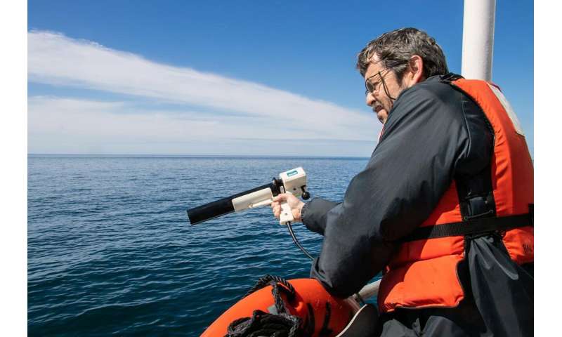
Senior Research Scientist Barney Balch collects ocean optics data during a research cruise in the Gulf of Maine. Balch is part of a team of researchers that has established a new approach to detect algae and measure key ocean properties using light, based on their research in the Gulf of Maine and beyond. Credit: Bigelow Laboratory for Ocean Sciences
Researchers have advanced a new way to see into the ocean's depths, establishing an approach to detect algae and measure key properties using light. A paper published in Applied Optics reports using a laser-based tool, lidar, to collect these measurements far deeper than has been typically possible using satellites.

"Traditional satellite remote sensing approaches can collect a wide range of information about the upper ocean, but satellites typically can't 'see' deeper than the top five or 10 meters of the sea," said Barney Balch, a senior research scientist at Bigelow Laboratory for Ocean Sciences and an author of the paper. "Harnessing a tool that lets us look so much deeper into the ocean is like having a new set of eyes."

Lidar uses light emitted by lasers to gain information about particles in seawater, much as animals like bats and dolphins use sound to echolocate targets. By sending out pulses of light and timing how long it takes the beams to hit something and bounce back, lidar senses reflective particles like algae in the water.

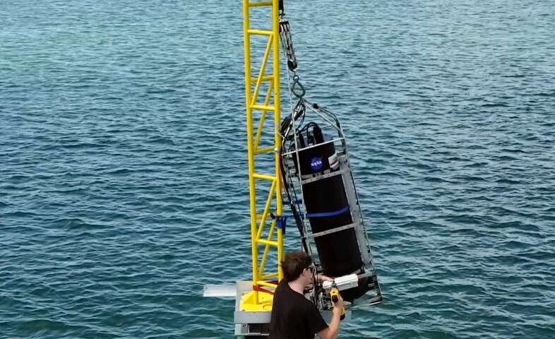
Lead study author Brian Collister used a shipboard lidar system to detect algae and learn about conditions deeper in the ocean than satellites can measure. The research team on this 2018 cruise was composed of scientists from Old Dominion University and Bigelow Laboratory for Ocean Sciences.

"The lidar approach has the potential to fill some important gaps in our ability to measure ocean biology from space," said Collister, a Ph.D. student at Old Dominion University. "This technique will shed new light on the distribution of biology in the upper oceans, and allow us to better understand their role in Earth's climate."
Brian Collister, a doctoral student at Old Dominion University, tends to a laser-based lidar system during a research cruise in the Bahamas. Collister is part of a team of researchers that has established a new approach to detect algae and measure key ocean properties using this tool. Credit: Richard Zimmerman/Old Dominion University

In the Gulf of Maine, the team used lidar to detect and measure particles of the mineral calcium carbonate, gathering information about a bloom of coccolithophores. These algae surround themselves with calcium carbonate plates, which are white in color and highly reflective. The plates scatter light in a unique way, fundamentally changing how the light waves are oriented—and creating an identifiable signature that the lidar system can recognize.

Balch's research team has studied the Gulf of Maine for over two decades through the Gulf of Maine North Atlantic Time Series. Their experience in finding and identifying algae in this ecosystem provided key background information for testing the lidar system in what turned out to be the largest coccolithophore bloom observed in the region in 30 years.


"This cruise allowed us an ideal opportunity to try the lidar system out with the ability to sample the water and know exactly what species were in it," Balch said. "Lidar has been used in the ocean for decades, but few, if any, studies have been done inside a confirmed coccolithophore bloom, which profoundly changes how light behaves in the environment."

Coccolithophores thrive around the global ocean and exert a huge level of control on the biogeochemical cycles that shape the planet. Studying them is key to understanding global ocean dynamics, but field research is always costly. The team established that using lidar could potentially allow researchers to remotely estimate coccolithophore populations without stopping the ship to collect water samples—increasing their ability to collect valuable data, thus also conserving precious ship-time funds.

The research team also tested this approach in ocean environments that included the clear depths of the Sargasso Sea and the turbid waters off the coast of New York City. They found it to be effective across these diverse environments. Lidar systems can probe the ocean up to three times deeper than passive satellite remote sensing techniques that rely on the sun. Further research may establish approaches that allow lidar measurements to be taken by satellites, as well.

"It's a huge deal that we are learning to reliably identify particles in the ocean from a lidar system positioned above the water," said Richard Zimmerman, a study author and professor at Old Dominion University. "This is a significant advance, and it could revolutionize our ability to characterize and model marine ecosystems."New satellite method enables undersea estimates from space

More information: Brian L. Collister et al, Polarized lidar and ocean particles: insights from a mesoscale coccolithophore bloom, Applied Optics (2020). DOI: 10.1364/AO.389845

Ocean research in a time of COVID-19


by Kim Fulton-Bennett, Monterey Bay Aquarium Research Institute
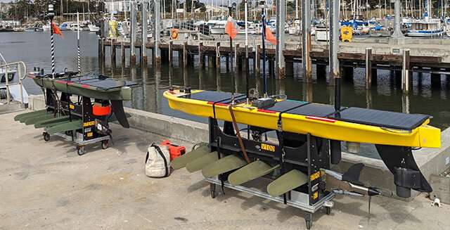
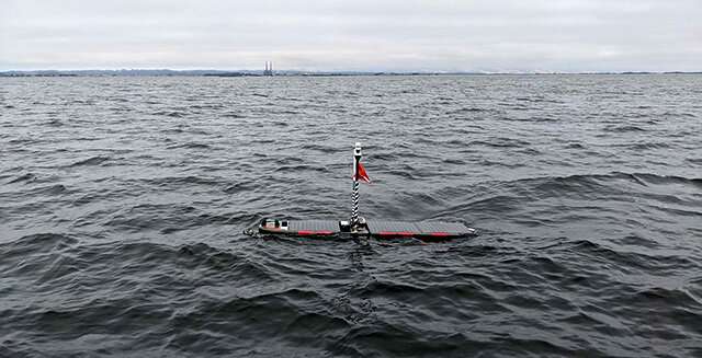
During the Summer 2020 CANON experiment, these two Wave Gliders have been zig-zagging over Monterey Canyon, using echosounders to locate fish and other animals in the water below. The echosounders are the cylindrical devices near the back of each Wave Glider. The olive-green foils under the Wave Gliders help propel these autonomous robots across the sea surface. Credit: Chris Wahl/MBARI
The COVID-19 pandemic has made it especially challenging for marine scientists to make observations and carry out experiments at sea. Research cruises have been cut back or canceled because it is difficult to keep a safe distance between scientists and crew in the tight spaces on a research vessel. In this current situation, MBARI's robotic vehicles and instruments have proven to be very useful.


A case in point is MBARI's Summer 2020 Controlled, Agile, and Novel Ocean Network (CANON) experiment, which runs from July 14 to August 4. Research Associate Katie Pitz, who was involved in planning the operation, explained, "For this year's experiment, the actual sampling is being done by autonomous instruments and vehicles that can be monitored remotely by scientists onshore. MBARI has been advancing autonomous technologies for a long time, so this is a great example of how we can apply these technologies."

MBARI's annual CANON experiments typically employ large numbers of ships, robots, and instruments that are deployed more or less simultaneously on Monterey Bay to collect data related to a specific physical and biological process in the bay. CANON experiments are also opportunities for researchers to test out new, cutting-edge technologies.

This year's CANON experiment is designed to study large groups of anchovies and other animals in and around Monterey Canyon. To figure out where and when these animals congregate in the canyon, researchers from MBARI and the National Oceanic and Atmospheric Administration (NOAA) are combining two very different technologies—high-resolution echosounders and environmental DNA (eDNA).
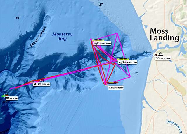
This map, created by MBARI’s Oceanographic Decision Support System, shows the paths that Wave Gliders and long-range AUVs took as they monitored animals in Monterey Canyon during the Summer 2020 CANON experiment. Credit: MBARI

Scientific echosounders use sound waves to create images of layers of animals at different depths and, in some cases, even allow scientists to identify these animals. With eDNA analysis, biologists can determine what kinds of organisms are in a patch of ocean simply by collecting a sample of seawater and extracting DNA from that seawater. DNA sequences from the seawater are then compared with known DNA sequences for a variety of different organisms.

"This technology is analogous to a forensic investigator who finds DNA at a crime scene and compares it to the bank of suspects in the FBI genetic repository," said Francisco Chavez, lead researcher on the CANON experiments. "Our suspects," he continued, "are life in the sea."

As Pitz noted, NOAA is very interested in exploring this new approach. "Microbiologist Kelly Goodwin at NOAA arranged the funding for MBARI to collect eDNA samples and compare the results with echosounder observations. Originally we were going to have a NOAA ship be part of the experiment, but because of the pandemic, the ship was not able to be here."
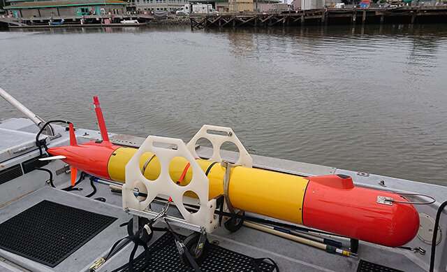
Inside of this underwater robot (a long-range autonomous underwater vehicle or LRAUV) is a robotic laboratory called an Environmental Sample Processor, which collects samples of seawater then extracts environmental DNA for later analysis onshore. Credit: Erik Trauschke/MBARI

"This research applies directly to NOAA's studies of fish stocks," Pitz explained. "They use echosounders on ships to map the distribution of fish and nets to verify which fish are present. During CANON, we are doing the same thing, except we are using echosounders mounted on robots at the surface and collecting eDNA using underwater robots."


The surface robots used in the CANON experiment are called "Wave Gliders," and look like squared-off surfboards. Throughout the experiment, one Wave Glider is traveling a zig-zag path over the inner part of Monterey Canyon, where anchovy schools are often found. As the Wave Glider moves across the surface, its echosounders capture images of schools of anchovies and other animals in the water below.

Following the Wave Glider on its zig-zag course is an underwater robot called a long-range autonomous underwater vehicle (LRAUV), which is collecting water samples for eDNA analysis. Over the two-week experiment, the LRAUV will collect up to 60 water samples using an MBARI-designed robotic sampling device called an Environmental Sample Processor (ESP). "This is one of the first times we have used the LRAUV to collect samples underwater at the same locations the acoustic Wave Glider is visiting at the surface," said Pitz.
A Wave Glider glides across Monterey Bay during the Summer 2020 CANON experiment. Image: Chris Wahl/MBARI

Though robots are doing most of the sample and data collection, over two dozen humans are also involved in this experiment. All of these scientists, engineers, and marine operations staff are needed to launch, recover, and maintain the robots, and to process and analyze the samples and data.

At the end of the experiment, after all the robots return to shore, CANON scientists and engineers will begin processing hundreds of samples for eDNA analysis. "During my first CANON experiment in Spring 2017, we collected only four eDNA samples autonomously," said Pitz. "Now, with multiple ESPs, we have a huge increase in the number of samples we can collect and will need to process."

"It's a lot of work," she added. "But having more samples is great for the science. And the samples can be stored in a freezer and preserved for years. Analytical methods for eDNA are improving rapidly, so it's nice to preserve some samples for later analysis in case a better technique comes along."
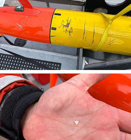
Studying the ocean can be risky for robots as well as for humans. During the Summer 2020 CANON experiment, one LRAUV was bitten by a shark. Researchers pulled several fragments of shark teeth from the hull of the vehicle. Credit: Top image: Brian Kieft/MBARI; Bottom image: Ben Yair Raanan/MBARI
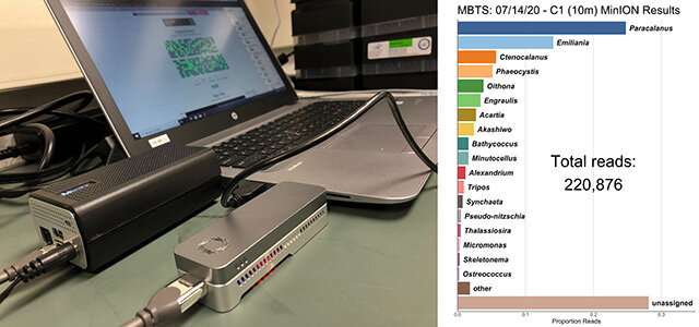
During the Summer 2020 CANON experiment, researchers are testing small “benchtop” DNA sequencers that plug directly into a laptop computer. After analyzing one water sample, the sequencer produced a graph showing how much DNA was detected from different types of animals, including anchovies, copepods, and microscopic algae. Credit: Charles Nye/MBAR
"Speaking of cutting edge technologies," Pitz said, "Another cool aspect of this experiment is that MBARI scientists Nathan Truelove and Charles Nye are using a desktop sequencer to sequence eDNA from water samples in near real-time—within a day or so."

"Benchtop sequencing has a higher error rate in reading the DNA than next-generation methods that involve large sequencing machines," she explained. "So the data processing is a lot more challenging. But being able to sequence DNA in a day would be great compared to shipping samples out to a lab, which can take several weeks. Eventually, we hope to be able to host this tiny sequencer on our LRAUV."

Although MBARI engineers have had great success building robots that communicate effectively with one another, Pitz noted that one of the biggest challenges in this experiment is keeping lines of communication open among the humans involved. "We need to decide the best times and places to collect samples while making sure the LRAUV doesn't burn out its battery or hit the bottom. This requires lots of communicating between the scientists, engineers, and marine operations staff. As a scientist at MBARI, one of the things I've learned is that, in order to get good scientific data, you need to work closely with the engineers to understand and adapt to the limitations of the equipment."

The Summer 2020 CANON experiment is a prime example of how researchers can collect vast amounts of useful data by sending robots instead of people out to sea. "This mode of operation will increase dramatically in the future," said Chavez. "Not only because of COVID but because of the need for persistent and globally distributed observations of life in the sea."


Explore furtherAn autonomous vehicle coupled with a robotic laboratory proves its worth

Tiny plants crucial for sustaining dwindling water supplies
by University of New South Wales
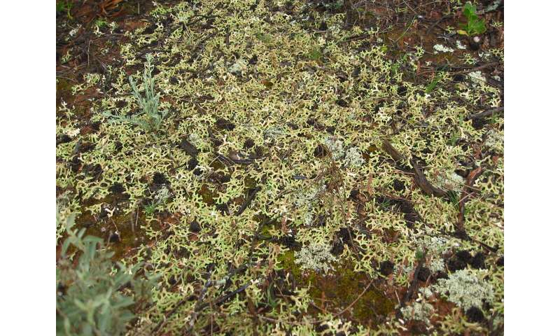
A diverse biocrust community in western New South Wales. Credit: David Eldridge

A global meta-analysis led by UNSW scientists shows tiny organisms that cover desert soils—so-called biocrusts—are critically important for supporting the world's shrinking water supplies.


Biocrusts are a rich assortment of mosses, lichens, cyanobacteria, and microscopic organisms such as bacteria and fungi that live on the surface of dryland soils. Drylands, collectively, are the world's largest biome.

"Biocrusts are critically important because they fix large amounts of nitrogen and carbon, stabilize surface soils, and provide a home for soil organisms," said lead author Professor David Eldridge from UNSW Science.

"But we still have a poor understanding of just how biocrusts influence hydrological cycles in global drylands. Accounting for biocrusts and their hydrological impacts can give us a more accurate picture of the impacts of climate change on dryland ecosystems and improve our capacity to manage those effects," Prof. Eldridge said.

Exploring more than 100 scientific papers

For the study, the team assembled and then analyzed the largest ever global database of evidence on the effects of biocrusts on water movement, storage and erosion, focussing on drylands.

"Our emphasis was on dryland soils because biocrusts are often the dominant surface covering on these soils, particularly during dry times," Prof. Eldridge said.

A huge increase in the number of publications on biocrusts over the past decade had prompted the group to critically assess the links between water capture and storage, and landscape stability in drylands.

Co-author Dr. Samantha Travers from UNSW Science helped retrieve and analyze data from more than 100 scientific papers published over the past 30 years.

"The global literature on biocrust effects on hydrology has often been conflicting, preventing us from making broadscale recommendations on how to manage them to manage water," Dr. Travers said.

Importantly, the researchers showed that globally, the presence of biocrusts on the soil surface reduced water erosion by an average of 68%.

"Cyanobacteria in the crusts secrete organic gels and polysaccharides that help to bind small soil particles into stable surfaces. Mosses in the crusts also trapped water and sediment on the soil surface, preventing the removal of soil particles," Dr. Travers said.


Although biocrusts reduced the infiltration of water into the soil, they tended to increase water storage in the uppermost layers.

"This upper layer is where most of the nutrients and microbes are found—it is a critical zone for plant production and stability in dryland soils," Prof. Eldridge said.

"More water in the upper layers means greater productivity and stability."

Prof. Eldridge said we now had a better understanding of how biocrusts affect water relations in drylands.

"However, the effects depend on factors such as the type of crust and whether it is intact or disturbed," he said.

Three decades of biocrust research

Prof. Eldridge and his team have been studying the role of biocrusts on Australia's soils for more than 30 years.

The focus of the team's research is on drylands because they occupy almost half of Earth's land surface and support almost 40% of the global human population.

"Many people in drylands rely on pastoralism for their livelihoods, so the capture and use of water is critically important in these water-limited environments," Prof. Eldridge said.

"Anything that alters the hydrological balance in drylands has the potential therefore to affect millions of people, hence the importance of these tiny surface communities."

He said a major problem for sustainable management of drylands was overgrazing by livestock.

"Trampling by sheep and cattle breaks up the crust, destabilizing the soil surface and leading to increased water erosion—effects that are supported by our global analyses," he said.

"Preventing overgrazing by livestock is critical if we are to prevent the loss of biocrusts, but until recently, the magnitude of the effects have not been known. The results of this work will be incorporated into global water balance and soil loss models so that managers and governments have a better understanding of the implications of losing biocrusts on the world's dwindling water supplies," Prof. Eldridge said.

The study, published in Global Change Biology today, was a collaborative effort between UNSW Sydney, and scientists from the United States, Spain, Germany, Mexico and China.

The work is part of a larger global study, supported by the John Wesley Powell Center for Analysis and Synthesis to predict the impacts of climate change on biological crust communities.

The research team is now examining how global land use changes affect biocrust communities, and developing best management practices to restore biocrusts as we move towards a hotter and drier world.

Explore further New research offers global drylands solution to climate change

More information: David J. Eldridge et al. The pervasive and multifaceted influence of biocrusts on water in the world's drylands, Global Change Biology (2020).

Journal information: Global Change Biology

Provided by University of New South Wales

Reduced coral reef fish biodiversity under temperatures that mirror climate predictions
by New York University
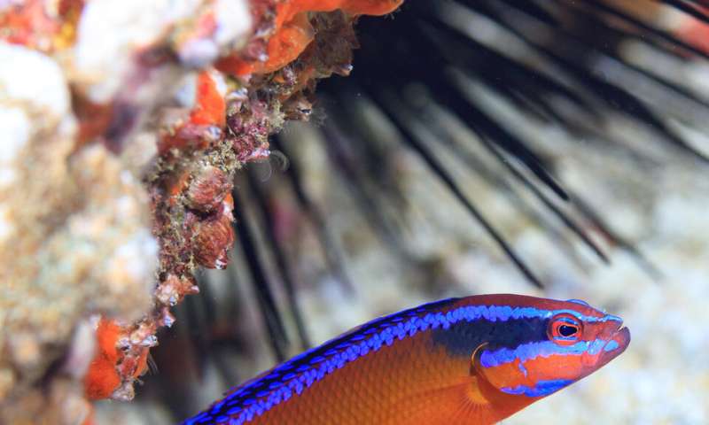
Cryptobenthic reef fish. Credit: Jordan M. Casey

As global warming continues to escalate, there are lasting implications to consider, including the changes to biological communities in vital habitats such as coral reefs. A team of researchers, led by Simon Brandl (currently at the Center de Recherches Insulaires et Observatoire de l'Environnement, CRIOBE, France) and Jacob Johansen, an assistant research professor at Hawai'i Institute of Marine Biology (and previously a research scientist at NYU Abu Dhabi's Marine Biology Lab), recently studied cryptobenthic reef fishes (small, bottom-dwelling fish that are at the base of coral reef food webs) in the Arabian Gulf and the Sea of Oman and found that the more thermally extreme coral reef habitat in the Arabian Gulf adversely impacted the diversity and productivity of these important fishes.


In the paper, "Extreme environmental conditions reduce coral reef fish biodiversity and productivity," published in the journal Nature Communications, the researchers use a variety of techniques to compare organismal traits, diversity and productivity of cryptobenthic reef fish in the environmentally extreme Arabian Gulf with those in the Sea of Oman.

"The Arabian Gulf is the world's hottest sea each summer with temperatures well beyond those experienced by fishes elsewhere in the tropics, while the adjacent Sea of Oman is considerably more benign. This makes this region a useful natural laboratory for understanding how climate extremes affect fish function and diversity," said senior author Associate Professor of Biology at NYU Abu Dhabi John Burt.

Fish communities in the Arabian Gulf were found to be half as diverse and less than 25 percent as abundant as those in the Gulf of Oman, despite broad similarities in the amount of live coral. Surprisingly, this does not seem to be related to absolute temperature tolerances of cryptobenthic fishes.
Coral reef fish species. Credit: Tane Sinclair

"We expected to see much lower temperature tolerances in species that occur in the Sea of Oman, but not in the southern Arabian Gulf," said Johansen. "Yet, the critical thermal tolerances of all species found in the Sea of Oman were, in theory, sufficient to survive even the maximum summer temperatures of 36°C in the southern Arabian Gulf."

Instead, differences in prey eaten and body condition in the species present at both locations suggest that the thermal extremes of the Arabian Gulf are an energetically challenging environment for these smallest marine vertebrates. While hotter waters require more energy, a distinct, less diverse set of prey items in the Arabian Gulf may make it difficult for these small-bodied fishes to satisfy their energetic demands.
Reef bottom fish. Credit: Tane Sinclair

Importantly, the reduced diversity and abundance of cryptobenthic fishes greatly impairs the unique functional role of these animals. "These tiny fishes normally feed a lot of the larger, predatory animals on coral reefs by growing and dying rapidly, while constantly replenishing their populations," explains Brandl. "But on reefs in the southern Arabian Gulf, cryptobenthic fish communities provide only a fraction of the fish flesh that they can produce in more benign environments."

Johansen said, "Our findings highlight an imminent threat to cryptobenthic reef fishes and their essential role for coral reef functioning. These smallest marine ectotherms may struggle to compensate for increasing costs of growth and maintenance as they adapt to more extreme temperatures. Extreme environmental conditions, as predicted for the end of the 21st century, could, therefore, disrupt the community structure and productivity of coral reefs in the Arabian Gulf and beyond."


Explore furtherLive fast, die young: Study shows tiny fishes fuel coral reefs

More information: Extreme environmental conditions reduce coral reef fish biodiversity and productivity, Nature Communications (2020). www.nature.com/articles/s41467-020-17731-2
Journal information: Nature Communications


Provided by New York University