Thawing permafrost affecting northern Alaska's land-to-ocean river flows

A new analysis of the changing character of runoff, river discharge and other hydrological cycle elements across the North Slope of Alaska reveals significant increases in the proportion of subsurface runoff and cold season discharge, changes the authors say are "consistent with warming and thawing permafrost."
First author and lead climate modeler Michael Rawlins, associate professor of geosciences at the University of Massachusetts Amherst and associate director of its Climate Systems Research Center, says warming is expected to shift the Arctic from a surface water-dominated system to a groundwater-dominated system, with deeper water flow paths through newly thawed soils.
"Our model estimates of permafrost thaw are consistent with the notion that permafrost region ecosystems are shifting from a net sink to a net source of carbon," he says.
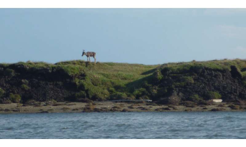
Freshwater and riverborne nutrients, mainly dissolved organic carbon, are transported to coastal estuaries and lagoons that lie at the land-sea interface, he explains. Field measurements of river discharge and other hydrological cycle elements in this region are sparse, which requires a modeling approach to quantify the land-ocean flows and their changing character. Details of this investigation into Arctic watersheds between Utqiagvik (formerly Barrow) and just west of the Mackenzie River over the period 1981-2010 are in the current issue of the open access journal, The Cryosphere.
Rawlins explains, "Our model includes a state-of-the-art simulation of soil freeze-thaw cycles that allows us to better understand how permafrost thaw is influencing the magnitude and timing of hydrological flows. Our results point to greater impacts of warming across the Brooks Range, including increasing cold season (November to April) river discharge and a higher proportion of subsurface runoff."
Further, the changing terrestrial inflows may be influencing food web structure within the lagoons, he adds. "Local native communities rely on the fish and other resources in the lagoon ecosystem for their subsistence lifestyle. More than 150 species of migratory birds and waterfowl are supported by the region's food webs, and the lagoons are a rich source of fish for native communities." In particular, Barrow, Nuiqsut and Kaktvik hunters and residents rely on the high productivity of the Beaufort Lagoon systems to support fish and bird populations they live on, Rawlins points out.
In this study, the Permafrost Water Balance Model was validated against available measurements of river discharge and water held in the snow pack. Rawlins and colleagues are developing models and leveraging in situ and remote sensing measurements to better understand flows into the Beaufort Lagoons and predict how permafrost thaw and water cycle intensification will affect lagoon ecosystem dynamics in the future.
The researchers observed significant increases in cold season discharge, such as 134% of the long-term average for the North Slope, and 215% in the Colville River basin, for example. They report a significant increase in the ratio of subsurface runoff to total runoff for the region and for 24 of the 42 study basins, with the change most prevalent across the northern foothills of the Brooks Range. They also observed a decline in terrestrial water storage, which they attribute to losses in soil ice that outweigh gains in soil liquid water storage. The timing of peak spring freshet discharge, the flow of snowmelt into the sea, also has shifted earlier by 4.5 days.
The authors say findings have implications for water, carbon and nutrient cycling in coastal ecosystems and beyond. North Slope rivers are a primary source of new organic nutrients to the Beaufort Sea lagoons, with half of the annual freshwater export occurring in a two-week window following snowmelt in spring. As the climate warms, carbon that has been sequestered for thousands of years in permafrost soils thaws and is mobilized and transferred to river systems, with some emitted to the atmosphere as carbon dioxide and methane, accelerating warming.
Ice sheet melting: estimates still uncertain, experts warn

Estimates used by climate scientists to predict the rate at which the world's ice sheets will melt are still uncertain despite advancements in technology, new research shows.
These ice sheet estimates feed directly into projections of sea-level rise resulting from climate change. They are made by measuring how much material ice sheets are gaining or losing over time, known as mass balance, to assess their long-term health. Snowfall increases the mass of an ice sheet, while ice melting or breaking off causes it to lose mass, and the overall balance between these is crucial.
Although scientists now have a much better understanding of the melting behaviour of ice sheets than they did in previous decades, there are still significant uncertainties about their future melt rates, researchers found.
The new study, published in the scientific journal Earth Science Reviews, shows that despite recent advances in computer modelling of ice sheets in response to climate change, there are still key deficiencies in the models used to estimate the long-term health of ice sheets and related global sea-level predictions. Improving these estimates could prove vital to informing the scale of response needed to mitigate the potential impacts of climate change.
Edward Hanna, Professor of Climate Science and Meteorology at the University of Lincoln, UK, co-ordinated the research in co-operation with a leading international group of glaciologists.
Professor Hanna said: "The ice sheets are highly sensitive indicators of climate change, but despite significant recent improvements in data and knowledge, we still don't understand enough about how rapidly they are likely to lose mass during and beyond the current century.
"Enhanced observations of ice sheets, mainly from satellite data fed into improved computer simulations, are vital to help refine predictions of future sea-level rise that will result from continued global warming. They are urgently needed to assist climate adaptation and impact planning across the world."
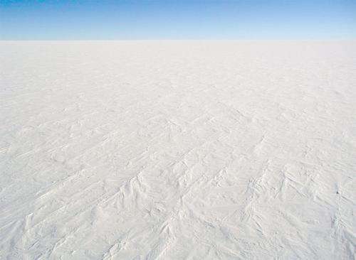
In the last decade, the Antarctic and Greenland ice sheets have overtaken thousands of smaller glaciers as the major contributors to rising sea levels—it is thought that combined, the sheets contain enough ice to raise global sea levels by as much as 65 metres. However, while some estimates project a contribution of as much as one and a half metres from Antarctica to global sea-level rise by 2100, others suggest only a few tens of centimetres contribution.
The researchers say there is a pressing need for further research that involves enhanced satellite and ground-based observations, together with more sophisticated, interactive computer models that combine ice masses, the atmosphere, ocean and solid Earth systems.
Their study involved analysis of recent estimates of ice sheet and glacier mass balance, as well as highlighting recent advances and limitations in computer-model simulations of ice sheet change as an important basis for future work. The World Climate Research Programme, the Scientific Committee on Antarctic Research and the International Arctic Science Committee part-sponsored the research.
Professor Hanna also contributed to a recent paper in the scientific journal Nature analysing the Greenland Ice Sheet mass balance. That study, involving 96 polar scientists, showed that in the last decade, Greenland has lost ice seven times faster than in the 1990s. This tracks a high-end global warming scenario, with tens of millions more people being exposed to coastal flooding by 2100.
No comments:
Post a Comment