Friday, June 23, 2023

The Titanic sub disaster was 'clearly preventable' and the vessel wouldn't have been allowed in US, British, or Canadian waters uncertified, expert says

Sinéad Baker
Fri, June 23, 2023 

The Titan submersible in water.OceanGate

The Titan submersible disaster was "clearly preventable," William Kohnen, an industry expert, said.


He said regulations gave the industry a "stellar record of success" but OceanGate bypassed them.


He said the sub would not have been allowed to operated like it did in US, UK or Canadian waters.


The implosion of the Titan submersible en route to the wreckage of the Titanic with five people on board was "clearly preventable" and the vessel would not have been allowed to operated like it did in many countries' waters, including those of the US, an industry expert said.

William Kohnen, chair of the Manned Underwater Vehicles Committee of the US-based industry group Marine Technology Society, told the BBC on Friday that industry regulations are strong, but that OceanGate Expeditions got around them by operating in international waters.

"This was clearly preventable. We do have regulations," he said.

Kohnen said that industry rules meant there has been a "stellar record of success."

But he said that OceanGate's Titan submersible was able to avoid those regulations by operating in international waters "where no coast guard has jurisdiction" and because the company made it for themselves.

Kohnen said that a submersible like the Titan, with tourists on board, would not be allowed to operate in US waters by the US Coast Guard.

It would also "not be allowed to work in British coastal waters because it would have required it to be certified. Same thing in Canada," he said.

The vessel lost contact with its mothership an hour and 45 minutes into its dive on Sunday, sparking a major search operation.

But on Thursday the US Coast Guard announced that the sub appeared to have imploded amid a "catastrophic loss of the pressure chamber." It said all five passengers were believed to have been killed.

Experts raised a raft of safety concerns with the submersible both before and after it went missing.

This included a 2018 letter sent to OceanGate CEO Stockton Rush, who was on the submersible when it imploded, that was signed by experts including Kohnen.

In the letter they said that the company's "experimental" approach and its decision not to pay for a leading agency to inspect the Titan could result in "catastrophic" problems.

They also said they had "unanimous concern" about the way the Titan was developed.

Former passengers of the Titan have detailed worrying issues like communication being lost on multiple trips.

One CBS journalist who went on the submersible last year was made to sign a waiver that said the Titan was an "experimental vessel" that had not been "approved or certified by any regulatory body."

Before the accident Rush had repeatedly criticized safety regulations. He also said in a 2021 interview that he had "broken some rules" with the Titan's manufacturing, highlighting the mix of carbon fiber and titanium the company used on its hull, despite solid metals like steel or titanium normally being used.

OceanGate and Rush repeatedly defended the safety of its design.

A spokesman for the mothership that launched the Titan also defended OceanGate during the search, saying the company has an "extremely safe operation."


'Mythbusters' video shows what a deep-sea implosion does to a faux human in a scuba suit

Jessica Orwig
Fri, June 23, 2023 

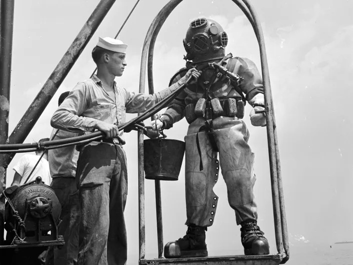
A US navy diver on a ‘diving stage’ before a dive in 1955
.Al Barry/Three Lions/Getty

A clip from an old episode of the TV show "Mythbusters" has resurfaced on Twitter.


Account @ChudsOfTikTok posted the clip as a comparison of what happened on the Titan submersible.

But what is shown in the video clip is under extremely different circumstances from the lost sub.

Typical diving suits are pressurized so the diver doesn't have to worry about decompression sickness when they resurface.

But if something goes wrong with the suit's pressurization, it could be catastrophic for the diver.


To understand what exactly would happen to a diver in this bleak situation, TV show hosts Jessi Combs, Kari Byron, Tory Belleci, and Grant Imahara conducted a science experiment for season 7, episode 19, of "Mythbusters," according to Newsweek.

They created a human-shaped mannequin from pig parts. The meat dummy came complete with bones, muscle, fat, skin, and a midsection of guts. Then they put the mannequin in an old diving suit and sunk it 300 feet underwater, where the pressure is about nine times great than at sea level.

The Twitter account ChudsofTikTok recently resurfaced the clip from the episode in an attempt to conceptualize what may have happened to the Titan passengers who were recently reported dead after their submersible likely imploded during its descent to the Titanic wreck site.

However, it's worth noting that the passengers were not wearing diving suits and they were likely much deeper than 300 feet when the submersible was thought to have imploded — meaning the implosion that the faux meat mannequin experiences in the "Mythbusters" experiment is probably much slower than what the Titan passengers may have experienced. They likely died within milliseconds.

In the clip below, the rapid change in air pressure once the air supply is cut forces most of the suit's meaty contents into the helmet as the suit itself collapses inward. Warning: seeing the process unfold is a gruesome sight.


What we know about the ocean’s depths — and why it’s so risky to explore it

Jackie Wattles CNN
Fri, June 23, 2023 

The submersible vehicle that was lost at sea is part of a relatively new effort enabling tourists and other paying customers to explore the depths of the ocean, the vast majority of which has never been seen by human eyes.

Though people have been exploring the ocean’s surface for tens of thousands of years, only about 20% of the seafloor has been mapped, according to 2022 figures from the National Oceanic and Atmospheric Administration.

Researchers often say that traveling to space is easier than plunging to the bottom of the ocean. While 12 astronauts have spent a collective total of 300 hours on the lunar surface, only three people have spent around three hours exploring Challenger Deep, the deepest known point of Earth’s seabed, according to the Woods Hole Oceanographic Institution.

In fact, “we have better maps of the moon and Mars than we do of our own planet,” said Dr. Gene Feldman, an oceanographer emeritus at NASA who spent more than 30 years at the space agency.

There’s a reason deep-sea exploration by humans has been so limited: Traveling to the ocean’s depths means entering a realm with enormous levels of pressure the farther you descend — a high-risk endeavor. The environment is dark with almost no visibility. The cold temperatures are extreme.

The submersible, which is believed to have been destroyed in a catastrophic implosion, killing all five people aboard, was en route to explore the wreckage of the RMS Titanic. The remnants of the ship lie about 900 miles (1,450 kilometers) off the coast of Cape Cod, Massachusetts, and about 12,500 feet (3,800 meters) underwater. Operated by OceanGate Expeditions, a private company based in Washington state, the tourist vessel lost contact with its mother ship after departing on Sunday.

The US Navy later revealed that it had detected a sound on Sunday that would match an implosion, indicating the vessel, called the Titan, was rapidly destroyed. The disaster could have occurred during the submersible’s descent, as pressure on the vehicle grew.

Many of the factors that made the multiday search for the vessel so difficult are also the reasons a comprehensive exploration of the ocean floor remains elusive.

“Aquatic search is pretty tricky, as the ocean floor is a lot more rugged than on land,” said Dr. Jamie Pringle, a reader in forensic geoscience at England’s Keele University, in a statement.

In the days before the submersible’s likely implosion was confirmed, search and rescue teams relied on sonar, a technique that uses sound waves to explore the opaque depths of the ocean, to attempt to pinpoint the vehicle in case it had been stranded on the seafloor. The challenging process requires a very narrow beam with a high frequency to offer a clear picture of where objects might be.
A history of ocean exploration

The first submarine was built by Dutch engineer Cornelis Drebbel in 1620, but it stuck to shallow waters. It would take nearly 300 years — in the aftermath of the Titanic disaster — before sonar technology began to offer scientists a clearer picture of what lies in the ocean’s depths.

A major step forward in human exploration came in 1960 with the historic dive of the Trieste bathyscaphe, a type of free-diving submersible, to the Challenger Deep, located more than 35,800 feet (10,916 meters) underwater.


Explorer and physicist Auguste Piccard is seen wearing a life jacket as he emerges from the bathyscaphe Trieste, which he designed, after making a world record dive of 10,335 feet (3,150 meters) on October 3, 1953. The dive was made off the west coast of Italy. -
Keystone/Hulton Archive/Getty Images

Only a few missions since have returned to such depths. And the trips are extremely dangerous, Feldman said.

For every 33 feet (10 meters) traveled beneath the ocean’s surface, the pressure increases by one atmosphere, according to NOAA. An atmosphere is a unit of measure that’s 14.7 pounds per square inch. That means a trip to the Challenger Deep can put a vessel under pressure that is “equivalent to 50 jumbo jets,” Feldman noted.

At high pressure, the tiniest structural defect can spell disaster, Feldman added.

During the 1960 dive of the Trieste, passengers Jacques Piccard and Don Walsh said they were stunned to see living creatures.

“Right away, all of our preconceptions about the ocean were blown out the window,” Feldman said.

What lies at the bottom of the ocean


While what’s considered the deep ocean extends from 3,280 feet to 19,685 feet (1,000 meters to 6,000 meters) beneath the surface, deep-sea trenches can plunge to 36,000 feet (11,000 meters), according to the Woods Hole Oceanographic Institution in Massachusetts. This region, called the hadal or hadalpelagic zone, is named for Hades, the Greek god of the underworld. In the hadal zone, the temperatures are just above freezing, and no light from the sun penetrates.

Scientists were first able to prove that life existed below 19,685 feet in 1948, according to the institution.

Discoveries at the Challenger Deep have been remarkable, including “vibrantly colorful” rocky outcrops that could be chemical deposits, prawnlike supergiant amphopods, and bottom-dwelling Holothurians, or sea cucumbers.

Feldman also remembers his own attempt in the 1990s to catch a glimpse of the evasive giant squid, which lurks in the inky depths of the ocean. The first video of a live creature, which can grow to nearly 60 feet (18 meters) long, was captured in the deep sea near Japan in 2012, according to NOAA.

A new world also opened in the 1970s, Feldman said, when “an entirely alien ecosystem” was discovered by marine geologist Robert Ballard, then with the Woods Hole Oceanographic Institution, within the sea near the Galápagos Rift — “with these giant worms, giant clams, and crabs and things that lived at these … vents under the sea.”


A female deep-sea anglerfish attracts prey with a lure projecting from her head in the Atlantic Ocean. - Bluegreen Pictures/Alamy Stock Photo

The unusual creatures — some of which glow with bioluminescence to communicate, lure prey and attract mates — have carved out habitats within the steep walls of ocean trenches. These life forms have adapted to live in the extreme environment and don’t exist anywhere else on the planet. Instead of relying on sunlight for fundamental processes, they use chemical energy belched out from hydrothermal seeps and vents formed by magma rising from beneath the ocean floor.

The chilly seawater seeps through seafloor cracks and becomes heated to 750 degrees Fahrenheit (400 degrees Celsius) as it interacts with the magma-heated rocks. The chemical reactions produce minerals containing sulfur and iron, and the vents spew out the nutrient-rich water that supports the ecosystem of unusual marine life clustered around them.

Researchers have used the submersible Alvin to discover strange sea life, study plate tectonics and hydrothermal vents — and to explore the Titanic in 1986 after Ballard located the famed shipwreck.

Researchers from the WHOI and NASA have collaborated to develop uncrewed autonomous underwater vehicles that can descend through the tricky terrain of the trenches and withstand pressures greater than 1,000 times that at the ocean’s surface. The vehicles can investigate the diversity of life within the trenches, and they could also help scientists explore oceans on the moons around Jupiter and Saturn in the future.


A giant isopod is a deep-sea crustacean. 
- Alessandro Mancini/Alamy Stock Photo


Why mapping the ocean is so challenging

From a strictly scientific perspective, touristic trips to the ocean floor do little to advance our understanding of the ocean’s mysteries.

“Humans like superlatives,” Feldman said. “We want to go to the highest, the lowest, the longest.”

But only a “very small percentage of the deep ocean, and even the middle ocean, has been seen by human eyes — an infinitesimal amount. And a very, very small amount of the ocean floor has been mapped,” he added.

The reason, Feldman noted, largely comes down to cost. Boats equipped with sonar technology can rack up exorbitant expenses. Fuel alone can total up to $40,000 per day, Feldman said.

There is, however, currently an effort underway to create a definitive map of the ocean floor, called Seabed 2030.

Still, there are huge gaps in what’s known of the deep sea. Of the 2.2 million species believed to exist in Earth’s oceans, only 240,000 have been described by scientists, according to the Ocean Census, an initiative to record and discover marine life.

However, it’s impossible to know for certain just how many sea creatures exist, Feldman noted.


Most of the seafloor explored during Dive 07 of the 2019 Southeastern US Deep-sea Exploration, conducted by NOAA and its partners, was covered with these manganese nodules, the subject of the Deep Sea Ventures pilot test nearly five decades ago. - Courtesy NOAA Office of Ocean Exploration/Research, 2019 Southeastern U.S. Deep-sea Exploration

“We can make estimates all the time but then … you go somewhere new and discover an entirely new genus or an entirely new way of living,” he said.

Advances in technology may make human exploration of the ocean depths unnecessary. Innovations such as deep-sea robots, high-resolution underwater imaging, machine learning, and sequencing of DNA contained in seawater will help accelerate the speed and scale of discovery of new life forms.

“We have better maps of the moon’s surface than of the seafloor because seawater is opaque to radar and other methods we use to map land,” said marine ecologist Alex Rogers, a professor of conservation biology at the University of Oxford in the United Kingdom. “However, 150 years of modern oceanography have led to better understanding of many aspects of the ocean such as the life it contains, its chemistry and its role in the Earth system.”

Mapping the ocean “helps us to understand how the shape of the seafloor affects ocean currents, and where marine life occurs,” Rogers added. “It also helps us to understand seismic hazards. So it is basic fundamental science of overwhelming importance to human well-being.”
Human health and scientific research

The ocean is thought to be a gold mine of compounds, and its exploration has led to several biomedical breakthroughs.

The first marine-derived drug, Cytarabine, was approved in 1969 for the treatment of leukemia. The medication was isolated from a marine sponge.

Work on bioactive compounds in the venom of cone snails, a type of sea mollusk, led to the development of a potent pain reliever called ziconotide (commercially known as Prialt).

Scientists developed PCR, or polymerase chain reaction, a technique widely used to copy strands of DNA, with the help of an enzyme isolated from a microbe found in marine hydrothermal vents. And a green fluorescent protein observed in jellyfish allows researchers to watch once-invisible processes, including the spread of cancer cells and the development of nerve cells.

These are just a few examples. Researchers say the ocean and the life it contains could provide answers to some of medicine’s biggest challenges, such as antibiotic drug resistance. Studying the sea can also tell us about how life evolved.

“The ocean contains many more of the deep branches of life that have evolved over 4 billion years on Earth and so marine life can tell us a lot about the evolution of both whole organisms and specific biological systems such as developmental genes and immune system,” Rogers said via email.


6 incredible facts about the Challenger Deep, the deepest point on Earth


Jackie Wattles
Fri, June 23, 2023 

Just as Earth’s land surface has enormous peaks and valleys, the oceanic world has similarly varied topography.

Perhaps the most intriguing of these features is the Mariana Trench — a chasm in the western Pacific Ocean that spans more than 1,580 miles (2,540 kilometers) and is home to the Challenger Deep, the deepest known point on Earth’s surface that plunges more than 36,000 feet (about 11,000 meters) underwater.

That’s nearly three times deeper than the site where the wreckage of the RMS Titanic lies in the Atlantic Ocean, and it’s deeper than Mount Everest is tall.

Here are some fascinating facts about this deep-sea phenomenon.

1. ‘Titanic’ director James Cameron is one of the few people who have visited

Few human expeditions have ventured to the Challenger Deep.

The first came in 1960 with the historic dive of the Trieste bathyscaphe, a type of free-diving submersible. During the dive, passengers Jacques Piccard and Don Walsh said they were stunned to see living creatures where scientists once imagined it was impossible for anything to survive.

“Right away, all of our preconceptions about the ocean were blown out the window,” Dr. Gene Feldman, an oceanographer emeritus at NASA, previously told CNN. He spent more than 30 years at the space agency.


Deep-sea explorer and Academy Award-winning filmmaker James Cameron sits in a scale model of the Deepsea Challenger's pilot chamber at an exhibition about his history-making ocean expeditions in Sydney on May 28, 2018. - Saeed Khan/AFP/Getty Images

James Cameron, director of the 1997 film “Titanic,” was the next deep-sea explorer to follow. He piloted a submersible — one that he personally had helped design — to about 35,787 feet (10,908 meters), setting a world record in 2012.

2. A plastic bag was found in the trench

Another explorer who returned to the site was Victor Vescovo, a Texas investor who journeyed 35,853 feet (10,927 meters) down and claimed a world record in 2019.

Vescovo gave depressing insight into humankind’s impact on these seemingly untouchable remote locations when he observed a plastic bag and candy wrappers at the bottom of the Mariana Trench.

A handful of explorers have trekked to the Challenger Deep since then, but the expeditions are not common — and the journey is extremely dangerous.


Explorer and Texas investor Victor Vescovo said he saw a plastic bag and candy wrappers at the bottom of the Mariana Trench. - Atlantic Productions for Discovery Channel

For every 33 feet (10 meters) traveled beneath the ocean’s surface, the pressure on an object increases by one atmosphere, according to National Oceanic and Atmospheric Administration. An atmosphere is a unit of measure that’s 14.7 pounds per square inch. A trip to the Challenger Deep can put a vessel under pressure that is “equivalent to 50 jumbo jets,” Feldman noted.

3. It lies in the hadal zone, named for the god of the underworld

Much like the Earth’s atmosphere, the ocean can be described in terms of layers.

The uppermost portion is called the epipelagic zone, or the sunlight zone, and extends just 660 feet (200 meters) below the water’s surface, according to NOAA.

The mesopelagic zone, or the so-called twilight zone, stretches from the end of the sunlight zone to about 3,300 feet (1,000 meters).


ROV Deep Discoverer images a newly discovered hydrothermal vent field at Chamorro Seamount, which is located west of the Mariana Trench. - NOAA Office of OER/2016 Deepwater Exploration of the Marianas

Then there’s the bathypelagic zone, also called the midnight zone, and, beneath that, the abyssopelagic zone — as in, the abyssal zone — that extends from 13,100 feet (4,000 meters) to 19,700 feet (6,000 meters). That’s nearly 4 miles underwater. Within the abyssal zone, few life-forms can survive, the water is completely devoid of light, and temperatures are near freezing.

But the Challenger Deep lies even further — in the hadalpelagic zone, or the hadal zone. It’s named for Hades, the Greek god of the underworld thought to rule over the dead.

4. It’s home to unique aquatic life and mud volcanoes

The hadal zone is one of the least explored habitats on Earth. At bone-crushing depths with no sunlight, it was long thought that nothing could survive there.

But that belief has been dispelled.

“Even at the very bottom, life exists. In 2005, tiny single-celled organisms called foraminifera, a type of plankton, were discovered in the Challenger Deep,” according to NOAA.


A hydrothermal-vent chimney belches nutrient-rich fluid, which appears as dark smoke (center) due to its high levels of minerals and sulfides. The chimney is crawling with Chorocaris shrimp and Austinograea wiliamsi crabs. - NOAA Office of OER/2016 Deepwater Exploration of the Marianas

Discoveries at the Challenger Deep have included colorful rocky outcrops and bottom-dwelling sea cucumbers.

A series of undersea mud volcanoes and hydrothermal vents in the Mariana Trench also support unusual life-forms, according to NOAA. Despite the highly acidic and infernally hot water produced by hydrothermal vents in mud volcanoes, exotic species and microscopic organisms there are able to survive.

In the absence of sunlight, the creatures instead benefit from the nutrient-rich waters belched out from hydrothermal vents. The life-supporting medium results from chemical reactions between the seawater and magma rising from beneath the ocean floor.

5. The Mariana Trench was designated as a US national monument in 2009

The Marianas Trench Marine National Monument was established in 2009, in part to protect the rare organisms that thrive within its depths.

Objects of interest include the submerged ecosystem and its life-forms, such as deep-sea shrimp and crabs, and — higher up in the water column — stony coral reefs.

“A great diversity of seamount and hydrothermal vent life (is) worth preservation,” according to NOAA.

The entire national monument protects about 95,000 square miles (246,049 square kilometers).

This stunning sea jelly was seen while exploring the Enigma Seamount at 12,139 feet (3,700 meters) in the Marianas Trench Marine National Monument. - NOAA Office of OER/2016 Deepwater Exploration of the Marianas

6. It’s difficult to know just how deep the trench goes

The ocean floor remains one of the most mysterious places in the universe.

In fact, “we have better maps of the moon and Mars than we do of our own planet,” Feldman previously told CNN.


Though people have been exploring the ocean’s surface for tens of thousands of years, only about 20% of the seafloor has been mapped, according to 2022 figures from NOAA.

Given high interest in the Mariana Trench, however, researchers have made several efforts to give increasingly detailed pictures of its features. But that’s not easy: Due to the vastness and deepness of the bottommost ocean zone, scientists must rely on sonar, or acoustic, technology to attempt to give a full picture of what’s below.

Because instrumentation and technology are constantly improving, the estimated depth of the Challenger Deep has been updated as recently as 2021 to about 35,876 feet (10,935 meters).

How deep is the ocean? Deeper than the highest point on Earth's surface, by more than a mile

Jessica Orwig
Thu, June 22, 2023 

Shot from an underwater cave looking up to the sun at the water's surface.
Most of the ocean is unexplored terrain.
Inusuke/Getty Images

The ocean is significantly deeper than the highest point on Earth's surface.

The Titanic is farther down than the deepest-diving mammal, the Cuvier's beaked whale, ventures.


Even this wreck doesn't come close to the deepest-crewed mission that reached 35,839 feet in 2019.


This article is primarily transcribed from a 2017 Insider video: "This incredible animation shows how deep the ocean really is." Some of the information has been updated.

Just how deep does the ocean go? If you took the highest point on land and submerged it, you would still have more than a mile between you and the deepest point in the ocean.

The oceans harbor 99% of all living space on Earth and have enough water to fill a bathtub that's 685 miles long on each side. To compare, the state of California is about 720 miles long.

For scale, the average height of a human is about one-sixteenth the typical length of a blue whale — the largest animal on Earth. Blue whales usually hunt at depths of around 330 feet, within the well-lit zone of the ocean.


Blue whales can dive to depths of more than 1,600 feet.
Robert Smits/Getty Images

Deeper down, at 700 feet, the USS Triton became the first submarine to circumnavigate the Earth in 1960.

At 831 feet, we reach the deepest free dive in recorded history by the Austrian-born diver Herbert Nitsch. The pressure is 26 times greater here than at the surface, which would crush most human lungs. But blue whales manage it when they dive to a max depth of 1,640 feet to hunt giant squid.

During his descent, Nitsch developed severe decompression syndrome, which led to multiple brain strokes. However, he reached the surface, recovered inside a hyperbaric chamber, and ultimately survived to tell the tale.

At 2,400 feet, we reach the danger zone for modern nuclear-attack submarines. Any deeper and the submarine's haul would implode.

Reaching 2,722 feet down is where the tip of the world's tallest building, the Burj Khalifa, would reach. A little farther at 3,280 feet, we're deep enough that sunlight can't reach us. We've now entered the midnight zone.

Many animals down here can't see, such as the eyeless shrimp at 7,500 feet which thrive near scalding hot underwater volcanoes.


Underwater volcanoes are a haven for deep-sea life.
Ralph White/Getty Images

At this depth, temperatures are just a few degrees above freezing, but the water around hydrothermal vents can heat up to 800 degrees Fahrenheit.

Around 9,816 feet is the deepest any mammal has been recorded swimming — the record was set by the Cuvier's beaked whale.

But not even Cuvier's beaked whales could explore the wreck of the Titanic, which rests at a staggering depth of 12,500 feet.

The pressure is now 378 times greater than at the surface. Yet you can still find life like the fangtooth hagfish and dumbo octopus, the deepest-living octopus on Earth.

At 20,000 feet is the hadal zone, an area designated for the ocean's deepest trenches, such as the Mariana Trench.


The Challenger Deep is the deepest point on Earth.
blueringmedia/Getty Images

If you tipped Mount Everest into the Mariana Trench, its summit would reach down to 29,029 feet — that still doesn't compare to the two deepest-crewed missions in history.

In 1960, the oceanographer Jacques Piccard and Lt. Don Walsh descended to the lowest point on Earth, the Challenger Deep, at a record 25,979 feet below the surface.

They held the record for decades until the explorer Victor Vescovo came along in 2019. Vescovo made three dives to the Challenger Deep that year and set a new record on the third dive, reaching a depth of 35,839 feet.

Scientists have sent half a dozen unmanned submersibles to explore the Challenger Deep, including Kaiko, which collected more than 350 species on the seafloor from 1995 to 2003. But scientists estimate there are potentially thousands of marine species we have yet to discover.

Humans have explored an estimated 5% to 10% of Earth's oceans. We've only just begun to understand the deep, dark world that flows beneath us.

Watch the original video here:


Did a tsunami hit Florida? Sort of. Here’s what experts are saying about the phenomena.


Samantha Neely, Fort Myers News-Press
Fri, June 23, 2023

For a state that sees natural disasters regularly, the words "Florida" and "tsunami" rarely, if ever, go together within a sentence.

Yet, some residents of Clearwater Beach found themselves at the scene of a small one on Wednesday afternoon, even if they might not realize it.

According to experts, the Gulf of Mexico beach was hit by a meteotsunami, a small type of tsunami. Here's what we know about the situation so far.

Meteotsunmai causes tragedy: A rogue wave caused a cruise ship tragedy. They occur more often than you think.

Did Florida get a tsunami?

Yes, it did, but more of a "tiny" one. According to the Weather Channel's Ari Salsalari, on Wednesday, June 21, Clearwater Beach experienced a meteotsunami.

The meteorologist explained that the strong squall line, known as a line of thunderstorms, showed it was in a small tsunami.

"Before the storms arrived, the wind was pretty light and out of the Southwest … and then sort of like a cold front, the winds switched out of the Northwest, so they kind of switched directions and they became pretty gusty right as the heavy rain arrived," Salsalari said in a video posted to the Weather Channel site. "But here's the thing, unlike a cold front, the pressure actually rose as the squalls made it to the shoreline."

He showed that the pressure picked by around 2 p.m., adding that the rising pressure and changing direction of the wind caused water levels to jump by roughly two and a half feet.

What is a meteotsunami?

The National Oceanic and Atmospheric Administration writes that meteotsunamis, unlike tsunamis triggered by seismic activity, are driven by air-pressure disturbances often associated with fast-moving weather events, such as severe thunderstorms, squalls, and other storm fronts. The storm generates a wave that moves toward the shore and is amplified by a shallow continental shelf and inlet, bay, or other coastal features.

These are still being studied and understood by scientists. So far, meteotsunamis have been observed to reach heights of over 6 feet and occur in many places around the world, including the Great Lakes, the Gulf of Mexico, the Atlantic Coast, and the Mediterranean and Adriatic Seas.

What is the difference between a meteotsunami and seiches?


NOAA shares that meteotsunamis and seiches will be confused for one another, as winds and atmospheric pressure can contribute to the formation of both.

However, winds are typically more important to a seiche motion, while pressure often plays a substantial role in meteotsunami formation. Seiches are standing waves with longer periods of water-level oscillations, typically exceeding periods of three or more hours. Meteotsunamis are progressive waves limited to the tsunami frequency band of wave periods anywhere from two minutes to two hours.

What is a rip current? How to stay safe in the ocean when risks are high

Has Florida ever had a tsunami?

There have been eight tsunamis in Florida since 1848, with the most recent one being in 2001.
Is it likely for a tsunami to happen in Florida?

Experts claim the Atlantic Ocean has a relatively low rate of tsunami occurrences. Florida very rarely experiences many tsunamis, but it is still at risk.

This article originally appeared on Fort Myers News-Press: Tsunami in Florida? What to know about tiny hit to Clearwater Beach
Tonga 2022 eruption triggered the most intense lightning storm ever recorded

Kiley Price
Fri, June 23, 2023 

The underwater Hunga Tonga-Hunga Ha'apai volcano eruption on Jan. 15, 2022.

When the Hunga Tonga-Hunga Ha'apai volcano in Tonga erupted in 2022, it generated the most intense lightning ever recorded, a new study finds.

Located off the coast of the Kingdom of Tonga in the South Pacific, the submarine volcano produced one of the most violent eruptions in history, with more explosive force than 100 simultaneous Hiroshima bombs, according to NASA. The volcano spewed magma that immediately vaporized the seawater, sending a mushroom cloud of ash, gas and more than 50 million tons (45 million metric tons) of water vapor into the sky.

According to the new study, published Tuesday (June 20) in the journal Geophysical Research Letters, these conditions produced electrically charged collisions between ash, supercooled water and hailstones in the plume and triggered "a supercharged thunderstorm, the likes of which we've never seen," study lead author Alexa Van Eaton, a volcanologist at the U.S. Geological Survey (USGS), said in a statement. The storm generated more than 192,000 lightning flashes — composed of nearly 500,000 electrical pulses — and peaked at 2,615 flashes per minute. Some of the lightning reached altitudes of up to 19 miles (30 kilometers) above sea level, the highest lightning flashes ever measured, the researchers said.

Related: Tonga's massive volcanic eruption wiped out unique, never-before-seen life-forms

"With this eruption, we discovered that volcanic plumes can create the conditions for lightning far beyond the realm of meteorological thunderstorms we've previously observed," Van Eaton said. "It turns out, volcanic eruptions can create more extreme lightning than any other kind of storm on Earth." That includes lightning from supercell storms and tropical cyclones, according to the study.

For their analysis, the scientists compiled data from four sources, including the satellite-based Geostationary Lightning Mapper, a NASA tool that tracks lightning from space. When the volcanic plume mushroomed outward after reaching its maximum height, in a pattern known as a gravity wave, some of the lightning followed suit, rippling out around the volcano in concentric rings that expanded and contracted, the study found.

The GOES-17 satellite captured images of an umbrella cloud generated by the underwater eruption of the Hunga Tonga-Hunga Ha’apai volcano on Jan. 15, 2022. Crescent-shaped bow shock waves and numerous lighting strikes are also visible.

"It wasn't just the lightning intensity that drew us in," Van Eaton said. "The scale of these lightning rings blew our minds. We've never seen anything like that before; there's nothing comparable in meteorological storms. Single lightning rings have been observed, but not multiples, and they're tiny by comparison."

RELATED STORIES

1st mega-tsunami on record since antiquity was triggered by Tonga volcanic eruption

Record-breaking Tonga volcano generated the fastest atmospheric waves ever seen

Tonga eruption's towering plume was the tallest in recorded history

The data also revealed that the plumes created by the Hunga Tonga-Hunga Ha'apai eruption grew for at least 11 hours — much longer than original projections of only an hour or two, the researchers said. This method of tracking lightning intensity alongside eruptive activity could enable scientists to better monitor the duration of volcanic eruptions and thus warn people about eruption-related risks.

"These findings demonstrate a new tool we have to monitor volcanoes at the speed of light and help the USGS's role to inform ash hazard advisories to aircraft," Van Eaton said.
90% of people experiencing homelessness in California are from the state, rather than outsiders moving there for services

Eliza Relman
Fri, June 23, 2023

People wait in line for a morning meal at the Fred Jordan Missions Los Angeles, California on April 22, 2020.
Frederic J. Brown/Getty Images

California is home to 30% of people experiencing homelessness and half of those unsheltered in the US.


A major new study dispelled misconceptions that people move to California to take advantage of the safety net.


90% of unhoused people in California lived in the state before losing their housing, the report found.


California has long been home to a disproportionate share of unhoused people in the US. The state makes up less than 12% of the nation's total population, but is home to 30% of people experiencing homelessness and half of the unsheltered population in the US.

Despite lots of research to the contrary, some believe that unhoused people move to blue states like California from out of state to take advantage of the wider safety net available in more progressive places.

In reality, 90% of those experiencing homelessness in California lived in California before losing their housing, according to a major new study from the Benioff Homelessness and Housing Initiative at the University of California, San Francisco. Three-quarters of unhoused adults lived in the same county as they did before they lost their last home.

The researchers surveyed 3,200 people across the state and conducted 365 in-depth interviews with adults experiencing homelessness between October 2021 and November 2022.

The report also found that California's homeless population is aging — 47% are 50 years old or older, the study found. Black, Latino, and Native American people are significantly overrepresented among the state's homeless.

The study supports the conclusion that many other experts have come to: that homelessness is caused by a lack of affordable housing. Almost 90% of participants said that their main barrier to be housed was cost.

California is facing one of the most severe housing crises in the country. Housing costs have skyrocketed in the state in recent years, largely due to housing shortages brought on by high building costs, restrictive zoning and other regulations, and local opposition to new housing.

"The results of the study confirm that far too many Californians experience homelessness because they cannot afford housing," Dr. Margot Kushel, M.D., who directs the UCSF Homeless and Housing Initiative and led the study, said in a statement.

About half of the study's participants said they last lived in a home where their name wasn't on the lease or mortgage, 32% were last housed in a place with their name on the lease or mortgage, and 19% were last housed while incarcerated.

And they largely lost their last homes with little notice. Those with leases said they were given a median of 10 days notice before they were forced out of their homes, while the median timeframe for non-leaseholders was just one day, the report found.

The vast majority of those who participated in the study said that a Housing Choice Voucher — a federally-funded benefit that subsidizes rent — or similar housing assistance would have prevented them from becoming homeless.

The UCSF report recommended six policy changes, including creating more affordable housing for very low-income people, expanding rental assistance, and making it easier for people to access rental subsidies. It also recommended more financial, legal, and behavioral health support.

Read the original article on Business Insider
Earth's thermosphere reaches highest temperature in 20 years after being bombarded by solar storms

Harry Baker
Fri, June 23, 2023 

Green and pink auroras shine above trees


Earth's thermosphere recently hit a near 20-year temperature peak after soaking up energy from geomagnetic storms that bashed Earth this year. The temperature in the second-highest layer of the atmosphere will likely continue to climb over the next few years as the sun's activity ramps up, which could impact Earth-orbiting satellites, experts warn.

The thermosphere extends from the top of the mesosphere, at around 53 miles (85 kilometers) above ground, to the bottom of the exosphere, which begins at around 372 miles (600 km) above the ground, according to NASA. Beyond the exosphere is outer space.


For more than 21 years, NASA has measured the thermosphere temperature via infrared radiation emitted by carbon dioxide and nitric oxide molecules. Scientists convert data collected by NASA's Thermosphere, Ionosphere, Mesosphere, Energetics and Dynamics (TIMED) satellite, into the Thermosphere Climate Index (TCI), which is measured in terawatts, or TW. (1 TW is equal to 1 trillion watts.)

The TCI value, which spiked on March 10, peaked at 0.24 TW, Martin Mlynczak, a leading researcher on the TIMED mission at NASA's Langley Research Center in Virginia and creator of the TCI, told Live Science. The last time the TCI was this high was Dec. 28, 2003. (The temperature spike data has been submitted to a journal but has not yet been peer-reviewed.)

Related: 10 solar storms that blew us away in 2022

The temperature spike was caused by three geomagnetic storms in January and February — major disturbances to Earth's magnetic field that are triggered by chunks of fast-moving magnetized plasma, known as coronal mass ejections (CMEs), and less often by streams of highly charged particles, known as solar wind, which are both spat out by the sun.

"These 'storms' deposit their energy in the thermosphere and cause it to heat up," Mlynczak said. "The increased heating results in increased levels of infrared emission from nitric oxide and carbon dioxide in the thermosphere." Normally, infrared emissions after a storm cool the thermosphere, he added, but when the storms come back to back the temperature stays high.

Since the spike, at least two more geomagnetic storms have hit our planet — one on March 24, which was the most powerful solar storm to hit Earth for more than six years, and another equally powerful storm on April 24. The TCI values following these storms have remained high but have not yet passed the March peak, Mlynczak said.

A graph charting the TCI value over past solar cycles. The value is highest during each solar maximum

Geomagnetic storms become more frequent and intense during solar maximum, a part of the roughly 11-year solar cycle in which the sun is most active and covered in dark sunspots and plasma loops that spit out CMEs and solar wind.

As a result, Earth's thermosphere also follows a roughly 11-year cycle, Mlynczak said. Government scientists from NASA and NOAA predicted the next solar maximum will arrive in 2025, which means the warming trend will likely continue over the next few years.

Changes to the thermosphere can pose challenges for satellites in low-Earth orbit that are positioned around the thermosphere's upper boundary, Mlynczak said.

"The thermosphere expands as it warms," Mlynczak said, resulting in "increased aerodynamic drag on all satellites and on space debris." This increased drag can pull satellites closer to Earth, he said, which could cause satellites to crash into one another or completely fall out of orbit, as SpaceX Starlink satellites did in February 2022 after a surprise geomagnetic storm.

Satellite operators can avoid these issues by positioning their spacecraft in a higher orbit when needed, but the unpredictability of space weather makes it hard to know when these manoeuvres are required until it is often too late.

related stories

Hidden tide in Earth's magnetospheric 'plasma ocean' revealed in new study

Mysterious aurora-like phenomenon 'STEVE' appears during strongest solar storm for more than half a decade

Powerful X-class flare spat out a rare 'solar tsunami,' and you can hear it smashing into Earth

Solar maximum could also arrive sooner than predicted. A recent study published Jan. 30 in the journal Frontiers in Astronomy and Space Sciences suggests that the solar activity peak could arrive as early as late 2023 and be more powerful than initially predicted. If this scenario plays out, then the risk of a satellite disaster further increases.

However, over longer timescales, temperatures in the thermosphere are declining, because excess CO2 in the thermosphere due to climate change increases infrared emissions into space, a May 8 study in the journal Earth Atmospheric and Planetary Sciences found.
Northern Ontario is hotter than Florida, claiming Canada’s hot spot


Dennis Mersereau
Thu, June 22, 2023 


If you’re looking for bright sunshine and summery temperatures, pack your sunscreen and hop the next flight to Moosonee.

A firm ridge of high pressure parked over northern Ontario made the sunny shores of James Bay the national hotspot two days in a row this week. It’s not exactly a dry heat, either, which makes this rare spell of early summer warmth even more uncomfortable for the region.

DON’T MISS: Living in an Earthship, this Ontario couple inspired others to build their own

Thermometers in Moosonee registered a balmy 33.4°C on Thursday afternoon, making it the hottest town in Canada on June 22. That high is more than 10 degrees above seasonal for the first full day of summer.

Hudson Bay Heat

Thursday’s high in northern Ontario was also hotter than the afternoon high in most of Florida’s major cities, including Miami, Tampa, Orlando, and Key West, though it was muggier in the Sunshine State than it was in Moosonee.

Despite the difference, there certainly is a touch of humidity in the air to accentuate the warmth up north. Moosonee’s afternoon dew point value registered around 16°C on Thursday. A dew point that high represents enough moisture for anyone to break a sweat beneath the toasty afternoon sun.

Humidex values in the area approached 40 at times on Thursday—a formidable reading for anywhere in Canada, let alone communities way up north.


WARMTHONSetup

The staying power of the ridge made this heat a multi-day affair. Wednesday’s national high temperature peaked not far from Moosonee, with Attawapiskat registering an afternoon high of 33.5°C.

Heat warnings issued by Environment and Climate Change Canada (ECCC) continue across northern Ontario for at least one more day.

Forecasters expect daytime highs to hit or exceed the 30-degree mark in far northern Ontario again on Friday before a cold front arrives to bump temperatures back down toward seasonal. Thunderstorms are possible across northern Ontario on Friday as the cold front plows into the warm, unstable air parked over the region.

FridayAnomaly

Communities throughout northern sections of Ontario and Quebec will have to closely monitor the potential for wildfire ignition and growth over the next couple of days. This spell of hot temperatures could exacerbate ongoing wildfires and allow additional blazes to spark throughout the region.
WATCH: What a ‘Rex block’ means for your weather

Click here to view the video

This is northern Ontario’s second stretch of impressive heat so far this season. We saw a similar run of 30-degree readings in Moosonee at the end of May, during which the town came close to breaking its all-time May temperature record.

Much like the heat we saw here a month ago, this week’s unusual warmth is the result of a Rex block over the eastern half of North America. This pattern occurs when an upper-level low essentially gets ‘stuck’ south of a ridge of high pressure aloft, jamming up the atmosphere with consistent weather for days on end.

RELATED: Seekers of heat and storms in southern Ontario may be disappointed, again


REX BLOCK

Folks beneath the ridge generally see calm conditions and unseasonable warmth, while those experiencing the trough see an extended period of cooler and unsettled weather.

Sure enough, that trough is keeping the summer heat away from southern Ontario and casting an unseasonable chill over much of the eastern United States. Charlotte, North Carolina, only hit 22°C beneath a grey sky on Wednesday, which is nearly 10 degrees below seasonal for the city around the summer solstice

This pattern will begin to progress as we head into the weekend, allowing the ridge to break down and finally move east toward the Atlantic provinces. We’ll likely see a trough take its place by next week, allowing cooler-than-seasonal temperatures and periods of rain to return to most of Ontario for the final week of June.
WATCH: This Canadian beach feels so tropical it's nicknamed 'Little Mexico'

Click here to view the video

Canada was an extreme global hotspot in an extremely hot May


Scott Sutherland
Fri, June 23, 2023 


Canada was an extreme global hotspot in an extremely hot May

Earth just experienced one of its hottest months of May of the past 172 years, but parts of Canada were so warm during the month that it pushed temperatures to a new record high for the entire continent of North America.

NOAA and NASA have ranked May 2023 as the third warmest month of May since record keeping began in the 1800s. From their data, only May of 2020 and 20216 were hotter. Meanwhile, Europe’s Copernicus Climate Change Service says that the month was tied for 2nd warmest with May 2015, and the data collected by the Japanese Meteorological Agency has it ranked even higher, as the hottest month of May since 1891.

May-2023-GISTEMP-Seasonal-graph-NASA-GISS

(NASA GISS)

According to NOAA, a major contribution to the month being so warm was the extreme heat of the planet’s oceans. Based on their records, sea surface temperatures in May were 0.85°C above the 20th century average — nearly one-tenth of a degree higher than the previous record, set during the super El Niño of 2016.

This is quite remarkable, given that in May 2016 we were still in the midst of that record-setting El Niño event, while in 2023 the new El Niño had not even been officially declared.

Global-Ocean-Temp-Anom-May-2023-NOAA

Global ocean sea surface temperature anomalies for the month of May from 1850-2023, as compared to the 20th century average. May 2023 ranks as the hottest of the 173 monthly records. (NOAA NCEI)

From the first five months of global temperatures they’ve gathered, and with comparisons to how month-to-month temperatures progressed in previous years, NOAA scientists give 2023 a nearly 90 per cent chance of ending up as one of the top five warmest years in the record books. There is a roughly 50 per cent chance that it will be one of the top three hottest.
Canada sets climate extremes

During the month of May, the western half of Canada set new records due to a severe ‘heat dome’ that settled over the region.

Record-Temps-Northern-Canada-May13-2023

Although NOAA ranked the month as only the 11th warmest across the contiguous United States, due to this extreme heat across Canada, it was still the hottest month of May for the entire continent of North America.

The severity of the heat becomes more obvious when viewed on the global scale. The map below shows global temperature anomalies (compared to the 30-year average temperature from 1991-2020). Canada, and especially across eastern Northwest Territories and western Nunavut, stands out prominently.

May-2023-map-blended-mntp-NOAA

(NOAA)
Record-low Antarctic sea ice

After tracking at record-low levels through the end of 2022 and the beginning of 2023, Antarctic sea ice reached a new minimum extent at the end of February, beating out the previous record minimum set just a year earlier.

Since the beginning of May, sea ice extent in the Southern Ocean has, once again, been at record-low levels. As of June 22, the second day of southern winter, there is roughly 11.3 million square kilometres of ice in the waters around Antarctica. Compared to the same day in 2022, which had just barely set a new record low at the time, there is over 2 million square kilometres of ice ‘missing’ this year.


Antarctic-Sea-ice-Jun-22-2023-NSIDC

Antarctic sea ice extent, in millions of square kilometres, as of June 22, 2023, compared to the previous years, going back to 1979. The inset graph shows a close-up view to emphasize how much lower the extent is now compared to the previous record minimum from 2022. (NSIDC)
Record-high carbon dioxide

One of the driving forces behind the heat and loss of sea ice is the new record-high levels of carbon dioxide in Earth’s atmosphere.

According to the World Meteorological Organization, “Carbon dioxide levels measured at NOAA’s Mauna Loa observatory in Hawaii peaked at 424 parts per million in May, continuing a steady climb further into territory not seen for millions of years, according to the US National Oceanic and Atmospheric Administration (NOAA). Mauna Loa is the benchmark monitoring station in WMO's Global Atmosphere Watch network.”

Carbon dioxide June 23 2023 - mlo two years

The past two years worth of carbon dioxide measurements at Mauna Loa and Mauna Kea in Hawaii show that the peak concentration (in May of each year) has exceeded 420 ppm, and reached 424 ppm in 2023. (Scripps Institution of Oceanography)

“Measurements of CO2 obtained by NOAA’s Global Monitoring Laboratory averaged 424.0 parts per million (ppm) in May, the month when CO2 peaks in the Northern Hemisphere. That's an increase of 3.0 ppm over May 2022.”

Prior to the Industrial Revolution, going back roughly 10,000 years, carbon dioxide levels fluctuated in the atmosphere, but remained around an average of about 280 parts per million (ppm).


Carbon dioxide June 23 2023 - mlo 10k years

Carbon dioxide levels measured from proxies (ice cores, tree rings, etc) are combined here with modern records to produce a look at the past 10,000 years. (Scripps Institution of Oceanography)

With CO2 now consistently reaching a peak of over 420 ppm, this represents a more than 50 per cent increase compared to pre-industrial levels.

“The findings are of particular concern, given that the lifetime of CO2 in the atmosphere lasts for many decades, thus committing the planet to future warming,” the WMO stated.

(Thumbnail courtesy NASA GISS)
Satellites observe record-breaking marine heatwave hit North Atlantic

Tereza Pultarova
SPACE.COM
Fri, June 23, 2023 

Satellite measurements show extremely high water temperatures around the coast of Britain and Ireland.

Ocean water temperatures around the U.K. and Ireland are over 9 degrees Fahrenheit (5 degrees Celsius) above long-term averages for this part of the year, sparking concerns of marine life die-off later this year.

Satellite measurements show that the unexpected marine heatwave hit particularly hard around the northeastern coast of the usually cool Scotland and northwestern Ireland. Similar extremes have been detected in the Baltic Sea off the coast of Germany and Poland.

Climate scientists classify the current marine heatwave as an extreme to beyond-extreme category IV or V, which, according to the European Space Agency's (ESA) earth observation specialist Craig Donlon, is extremely unusual for this time of the year.

Related: 10 devastating signs of climate change satellites can see from space

"Extreme marine heatwaves are not an everyday event in U.K, waters," Donlon said in an ESA statement. "Satellite data, together with data on the ground, will allow us to document the impact of this marine heatwave including stress on the marine ecosystem, the impact on industries such as aquaculture and fisheries, modification of local wind patterns and potential rainfall events that may emerge later."

The current heatwave is a culmination of a period of rising temperatures across the North Atlantic ocean that began in April. The U.K. weather forecasting authority Met Office reported that ocean temperatures in the North Atlantic during the month of May were the warmest since records began in 1850, reaching on average 2.25 degrees F (1.25 degrees C) above the mean values for the 1961 to 1990 period.

According to professor Albert Klein Tank, the head of the Met Office Hadley Centre, unusually mild winds over the ocean contributed to the unexpected warming.

"Typically, airborne dust from the Sahara helps to cool this region by blocking and reflecting some of the sun’s energy; but weaker than average winds have reduced the extent of dust in the region’s atmosphere potentially leading to higher temperatures," Tank said in a Met Office statement.

The month of June is also turning out to be one of the warmest on record globally, adding further fuel to the heating oceans.

The marine heatwave in the North Atlantic ocean coincides with the onset of the warming El Niño pattern that has developed in the Pacific in recent months, but which tends to have wide-ranging consequences worldwide. Scientists worry that the current extreme marine heatwave is only a beginning of what might be a challenging summer of further weather extremes.

Related stories:

Earth is getting hotter at a faster rate despite pledges of government action
Climate change keeps space debris afloat longer
Space station data show how dust contributes to climate change

"This is a really startling global situation because the additional surface heating we see at this time will eventually be mixed into the ocean water column," Donlon said. "Some of this excess heat will find its way into the Arctic Ocean via ocean currents through the Fram Strait and Norwegian Sea further exacerbating the demise of Arctic sea ice. We will be monitoring in detail to see how all these aspects evolve with great interest”.

Jules Kajtar of the National Oceanography Centre, Southampton, the U.K., told the Science Museum Group that the unusually warm sea temperatures may have devastating impacts on the marine ecosystem in the U.K. waters

"The reason we are worried is the ecosystem has not experienced these temperatures at this time of year before," he said. "Warming oceans can make waters more acidic and drive a decrease in oxygen levels in the water."
Watch the world choke on CO2 in eerie NASA videos of manmade emissions

Sascha Pare
Fri, June 23, 2023

A screenshot from a NASA video shows CO2 emissions across North and South America in 2021.


Earth is being choked by a thick, curling fog of carbon dioxide that coats the planet as the months go by, a series of NASA videos shows. The newly released animations visualize the astonishing scale of human carbon dioxide (CO2) emissions over a year by coloring the invisible greenhouse gas.

The animations were produced by NASA's Scientific Visualization Studio and show CO2 emissions, which are cooking the planet, during the year 2021, with contributions from various human and natural sources highlighted in different colors.

In the animations, emissions from fossil fuel combustion are shown in orange, and those from burning biomass — living or dead vegetation burned to clear land for agriculture or set on fire by lightning, for example — appear in red. Carbon dioxide produced by land ecosystems through plant respiration is depicted in green, and emissions escaping from the oceans are in blue.

The model also shows where CO2 is absorbed by marine and land ecosystems, such as rainforests, via photosynthesis (in the oceans, this is done by algae). Collectively, these natural ecosystems soak up half of human emissions every year and play a vital role in mitigating climate change by periodically acting as carbon "sinks."

Related: New map of methane 'super-emitters' shows some of the largest methane clouds ever seen

"Though the land and oceans are each carbon sinks in a global sense, individual locations can be sources at different times," scientists noted in a NASA statement.

The three videos present the ebb and flow of CO2 across different regions of the world and highlight where the gas is emitted and absorbed over the course of a year.

In an animation featuring North and South America, a yellowish-brown cloud representing emissions from fossil fuels and burning biomass gradually builds in the Northern Hemisphere. Even on such a large scale, emissions can be attributed to specific regions.

"Some interesting features include fossil fuel emissions from the northeastern urban corridor that extends from Washington D.C. to Boston in the United States," scientists wrote in the statement.

Small green streaks that show emissions from land ecosystems curl in and out of this cloud during the winter months. That's because plants that absorb CO2 through photosynthesis during the growing season release much of this carbon in the wintertime, according to the statement.

The dotted green surface pulsing across South America depicts the absorption of CO2 by trees, which occurs only during the day. "The fast oscillation over the Amazon rainforest shows the impact of plants absorbing carbon while the sun is shining and then releasing it during nighttime hours," the scientists wrote in the statement.

A second animation covers parts of Asia and Australia. "The most notable feature is fossil fuel emissions from China," the statement said. Australia acts mainly as a carbon sink — as illustrated by flashing, green dots across most of the country — because the relatively sparse population emits less CO2 than its neighbors. Toward the end of the animation, the cloud of fossil fuel emissions from the Northern Hemisphere drifts southward and envelopes Australia too.

What the NASA video doesn't show is that Australia has the world's highest CO2 emissions from coal per person.

RELATED STORIES

Could we ever pull enough carbon out of the atmosphere to stop climate change?

The Amazon rainforest is officially creating more greenhouse gases than it is absorbing

Global warming will likely cross dangerous 1.5 C threshold within 5 years, UN report warns

The third video highlights Africa, Europe and the Middle East, with the vast majority of fossil fuel emissions produced in Europe and Saudi Arabia. Wispy red clouds hovering over central Africa depict emissions from fires that people light to clear leftover crops, according to the statement.

While CO2 emissions from fossil fuels are the main driver of climate change, fires contribute to global warming by reducing the amount of carbon that land ecosystems will soak up in the future, according to the statement. That's because charred soils lock up less carbon, and because fires diminish the density and size of trees.

Hog Herds to Shrink as US Farms Lose Money, Smithfield Warns


Michael Hirtzer
Thu, June 22, 2023 


CORN IN US IS USED FOR BIOFUEL NOT FOOD

(Bloomberg) -- American pig farmers are losing so much money that some may soon start selling the corn they would normally use to feed animals, according to the world’s largest hog producer.

It’s a sign that producers will soon take steps to shrink their herds, with growers losing as much as $80 a head, said Shane Smith, chief executive officer of Smithfield Foods. Demand from top buyer China is waning as the cost to feed animals is surging.

A drought in the Midwest has deteriorated crops, with corn at its worst conditions for this time of year since 1992. That’s squeezing profits and making it more appealing for growers to sell the grain, which has risen more than 20% from its May lows.

“There’s a concentration of people in the industry who grow their own corn, they grow their corn and they feed it to the animal,” he said in an interview Wednesday at the Wall Street Journal’s Global Food Forum in Chicago. “They’re going to have to make a decision. Do I sell my corn and just forget about the animal?”

US growers usually only start shrinking herds when they face cash flow losses, and that is already happening, Smith said. He declined to comment on whether Smithfield, owned by Hong Kong-listed WH Group, is planning to cut back as well.

The US meat market is facing a glut that may take until the end of next year and into 2025 to normalize, he said. That’s all happening just as only 55% of the US corn crop was rated good to excellent, the lowest for this time of year in more than three decades, according to data from the US Department of Agriculture.

California Rules

To make matters worse, California — which consumes about 15% of the nation’s pork — passed a law requiring meat sold in the state to come from animals raised in larger spaces, raising costs for producers. Beginning July 1, only meat from animals raised under the new regulations can be sold in the state, although pork that’s already in the supply chain by that date can be sold until the end of the year, the California Department of Food and Agriculture said Wednesday.

Smithfield stopped slaughtering hogs at its only California plant earlier this year. Smith said he’s now worried other states may add their own laws, forcing more costly farm conversions.

“My concern is that at some point without intervention from the USDA or other federal bodies, we’re going to end up with a patchwork of 50 different rules to govern how food is processed, it doesn’t just have to be pork or chicken,” he said.

Meanwhile, a lack of available workers for US meat plants and little movement in immigration policy means the labor issue won’t be solved any time soon, he said.

“This industry is in an incredibly difficult cycle,” Smith said.