Showing posts sorted by date for query WATERSPOUTS. Sort by relevance Show all posts

Saturday, April 05, 2025

Search for long-missing flight MH370 suspended: Malaysia minister


ByAFP
April 3, 2025


An event was held to mark the 10th year since the Malaysia Airlines flight MH370 disappeared from radar screens - Copyright AFP Arif Kartono


Raevathi SUPRAMANIAM

The latest search for Malaysia Airlines flight MH370 has been suspended, Kuala Lumpur’s transport minister said, more than a decade after the plane went missing.

“They have stopped the operation for the time being, they will resume the search at the end of this year,” Transport Minister Anthony Loke said in a voice recording sent to AFP on Thursday by his aide.

The Boeing 777 carrying 239 people disappeared from radar screens on March 8, 2014, while en route from Kuala Lumpur to Beijing.

Despite the largest search in aviation history, the plane has not been found.

Loke’s comments come just one month after authorities said the search had resumed, following earlier failed attempts that covered vast swaths of the Indian Ocean.

An initial Australia-led search covered 120,000 square kilometres (46,300 square miles) in the Indian Ocean over three years, but found hardly any trace of the plane other than a few pieces of debris.

Maritime exploration firm Ocean Infinity, based in Britain and the United States, led an unsuccessful hunt in 2018, before agreeing to launch a new search this year.

“Right now, it’s not the season,” Loke said in the recording, which was made during an event at Kuala Lumpur International Airport on Wednesday.

“Whether or not it will be found will be subject to the search, nobody can anticipate,” Loke said, referring to the wreckage of the plane.


– Aviation mystery –


The search was put on hold “due to seasonal weather changes and unavoidable prior commercial commitments”, a separate statement posted on the “MH370 Families” Facebook group said.

Loke said in December that a new 15,000 square kilometre area of the southern Indian Ocean would be scoured by Ocean Infinity.

The most recent mission was conducted on the same “no find, no fee” principle as Ocean Infinity’s previous search, with the government only paying out if the firm finds the aircraft.

The plane’s disappearance has long been the subject of theories — ranging from the credible to outlandish — including that veteran pilot Zaharie Ahmad Shah had gone rogue.

A final report into the tragedy released in 2018 pointed to failings by air traffic control and said the course of the plane was changed manually.

Two-thirds of the passengers were Chinese, while the others were from Malaysia, Indonesia, Australia, and elsewhere.

Relatives of passengers lost on the flight have continued to demand answers from Malaysian authorities.

Family members of Chinese passengers gathered in Beijing outside government offices and the Malaysian embassy last month on the 11th anniversary of the flight’s disappearance.

Attendees of the gathering shouted, “Give us back our loved ones!”

Some held placards asking, “When will the 11 years of waiting and torment end?”


MY THEORY


Friday, August 23, 2024

Twin waterspouts appear near Palm Beach amid storm warning


The National Weather Service issued a marine warning for local waters, with 46 mph wind gusts forecast.

Thursday 22 August 2024 


THE BAYESIAN Yacht Sinking: Climate Change Created Perfect Storm for Waterspouts


While the exact cause of the deadly sinking of the Bayesian superyacht remains unknown, dangerous waterspouts were spotted in the area. Scientists say they may become far more common.


Photograph: koto_feja/Getty Images

The waterspout blamed for the deadly sinking of a luxury superyacht carrying the British tech billionaire Mike Lynch in Italy has been called a freak “black swan” event. But scientists believe this kind of marine tornado is becoming more common with global warming.

While the cause of the sinking of the Bayesian hasn’t officially been determined, weather conditions and witness reports from Sicily, where the yacht was anchored off the coast, have led experts to suspect a waterspout, a whirling column of air and water mist. The key factor for waterspout formation is warm water—and the past year has seen the ocean surface heat up to record-breaking temperatures, in part due to climate change.

“If this rate of warming is going to be continuing in the future, it’s very possible these phenomena will be common and not rare,” says Michalis Sioutas, a meteorology PhD who studies waterspouts in Greece and is a board member of the Hellenic Meteorological Society. “It’s very possible to talk about waterspouts or even tornadoes and extreme storms becoming common.”

The 180-foot Bayesian sank in a matter of minutes after being caught in a sudden storm with strong winds and intense lightning at around 4 am on Monday. Fifteen people who had been aboard were rescued, and one person was found dead. Six people are missing, including British tech billionaire Mike Lynch, who was recently cleared of fraud charges over the sale of his company to Hewlett-Packard. On Wednesday, the bodies of five people were recovered from the sunken ship but have yet to be identified.

Fishermen saw a waterspout near the yacht shortly before it sank, and a nearby schooner was tossed about by what its captain, Karsten Borner, called a “hurricane gust,” which he believes capsized the Bayesian. Experts have said the conditions were ripe for a waterspout.

This extreme weather phenomenon occurs when warm, moist air rises rapidly over water, spinning as winds change direction at different heights. The result is a long, bending funnel of spray between the water and the clouds, tapering off as it rises as much as 10,000 feet into the heavens.

It comes in two flavors. The more vanilla kind is a fair weather waterspout, which forms in relatively calm and even sunny conditions, often under a billowy cumulus cloud. It happens more often in places like the Great Lakes and the Florida Keys, reaches wind speeds of 50 miles per hour, and usually breaks up before it can cause significant damage.

Then there are severe waterspouts, essentially tornadoes over water, which “are another beast” entirely, according to Wade Szilagyi, a retired forecaster at the Meteorological Service of Canada who now directs the International Center for Waterspout Research. These tornadic waterspouts can move from land to water, or vice versa, and twist at 125 miles per hour or more. They’ve been known to throw debris, rip apart buildings, and overturn boats.

A waterspout documented by Sioutas in Methoni, Greece, in 2004 picked up a boat and sent it sailing through the air, striking and killing a 10-year-old boy. Last year, a sudden storm and waterspout with winds of over 40 miles per hour overturned a tourist boat carrying off-duty intelligence agents on Italy’s Lake Maggiore, killing four. Sioutas says waterspouts can even generate “massive water displacements similar to tsunamis,” citing the gigantic waves that struck the coast of the Greek island of Samos during a 2004 cyclone, tossing boulders like toys.

Tornadic waterspouts spring up only in stormy weather with strong winds, lightning, and sometimes hail, and are the product of two main ingredients: wind shear and rising, unstable air. The process begins when masses of cold and warm air collide. This brings together winds from different directions that start to spin around each other, creating vortices. If a thunderstorm also converges in the area, it can provide the instability, sucking warm air up into itself at dizzying speeds. Over water, it starts carrying moisture up as well. Szilagyi compares the waterspout’s development to a twirling figure skater.

“You can think of the skater, if she just spins around normally, that’s like the little vortex that’s already started,” he says. “But if she brings her arms in, then that’s like the column of that unstable warm air, pulling, stretching that vortex upward. She starts to spin faster.”

Waterspouts have been known and feared since ancient times. In the 1550s in Malta, a waterspout plowed through the harbor of Valletta, reportedly destroying an armada of warships and killing hundreds of people. It’s even thought that old stories of fish or frogs raining down on land may be the product of waterspouts sweeping the creatures up into the clouds.

Now global warming may be supercharging the phenomenon. The International Panel on Climate Change has not found a definite link—there hasn’t been much research into how climate change may be affecting waterspouts—but experts say that the conditions for waterspouts to form are happening more often. A 2022 study of 234 waterspouts in the Spanish Mediterranean over the past three decades found that they were more likely to break out when the sea surface was warmer, especially above 23 degrees Celsius (73 degrees Fahrenheit). And water temperatures are now at unprecedented levels.

Last year was the warmest on record for the ocean. The heat content of the upper 6,500 feet of the seas was the highest ever seen. The seas broke temperature records every single day between May 2023 and May 2024. Marine heat waves struck areas from Antarctica to the Mediterranean.

“Warmer oceans have more energy and more humidity to transfer to the atmosphere, the most important fuels for storms,” says Luca Mercalli, president of the Italian Meteorological Society. “The contrast of warm sea and colder air that flows over energizes vertical winds that could result in downbursts or waterspouts.” (A downburst is a powerful cascade of wind and rain from a thundercloud.)

That perfect storm of waterspout conditions hit Italy around the time the Bayesian sank. In recent days, a mass of high-level cold air has swept down from the Alps and over the country’s western coast, meeting the exceptionally warm air just above the sea surface. Four days before the Bayesian went down, sea surface temperatures were the hottest ever recorded across the Mediterranean Sea, with a daily median of 28.71 degrees Celsius. The ocean near where the Bayesian was anchored has reached almost 30 degrees Celsius this week, four degrees higher than the 20-year summer average, according to the European Union’s Copernicus Climate Change Service.

Cold and warm air clashed. Winds started spinning, and overheated water provided the ingredient of instability needed for a waterspout outbreak. As a result, a total of 28 waterspouts were documented off the western coast of Italy from August 17 to August 20, according to the International Center for Waterspout Research.

The total number of waterspouts reported has been increasing in recent years, although a major factor has been that more people are able to capture them with phone cameras and post them on social media, Szilagyi says. But he says that warming waters and a longer waterspout season due to climate change are also contributing. In particular, he believes the number of severe waterspouts are on the rise.

“With the increased water temperatures, that’s probably resulting in more frequent tornadic waterspouts,” Szilagyi says. “There’s no scientific evidence yet that they’re getting even stronger. It’s just that they’re becoming more frequent.”

Warming sea waters are also expected to boost other extreme weather events like Mediterranean hurricanes, or “medicanes,” one of which contributed to the flash flood that killed thousands of people in Libya last year.

In this brave new world, countries need to improve early-warning systems and invest more in research to forecast and observe trends in waterspouts, scientists say. “We have to prepared for more dangerous waterspouts possibly in the future,” Sioutas says. “Significantly warmer waters contribute very significantly to the creation of waterspouts, especially the violent ones.”

Updated 8-22-2024 1:15 pm BST: A previous version of the story stated that the ship’s mast had snapped; this detail has been removed as damage to the mast has not been confirmed.


LA REVUE GAUCHE - Left Comment: Search results for MH370 

LA REVUE GAUCHE - Left Comment: Search results for WATERSPOUT 

Friday, April 26, 2024

WATERSPOUTS

Rare sight of five funnel clouds captured on camera

2 hours ago
Barra Best,BBC News NI weather presenter
Share
David De CourcyThe funnel clouds were captured by wildlife photographer David De Courcy over Wicklow Harbour on Friday morning

A rare sighting of five funnel clouds forming over County Wicklow in the Republic of Ireland has been captured on camera.

They were spotted by wildlife photographer David De Courcy over Wicklow Harbour on Friday morning.

Funnel clouds are cone-shaped formations that appear to dangle from a larger cloud above.

They are typically associated with cumulonimbus thunderclouds, according to the Met Office.
'Completely on the fly'

Although more used to capturing an array of wildlife, photographer David De Courcy told BBC News NI he could not pass up an opportunity to capture the five funnel clouds.

"It was completely on the fly," Mr De Courcy said.

"I saw the lovely sunrise and thought, I'll take a photo.

"I had an idea that they were some sort of vortex. They are a cool weather phenomenon."

Funnel clouds become tornados when they touch the ground and water spouts when they make contact with a body of water.

When they touch the ground, funnel clouds are classed as tornadoes.

They form when the atmosphere is unstable.

Although delighted with his photo, Mr De Courcy is not planning on making the switch from wildlife to weather photography.

"Photographing the weather is more hit and miss," he explained.

"Birds and wildlife are more my thing."

Funnel cloud spotted in Cornwall


Thursday, May 25, 2023

What makes a storm a typhoon? 
What’s a super typhoon?

ByThe Associated Press
today

This Himawari-9 infrared satellite image taken at 2 p.m. EDT and provided by NOAA shows Typhoon Mawar passing over the U.S. Pacific territory of Guam, Wednesday, May 24, 2023. (NOAA via AP)

Typhoon Mawar was a Category 4 super typhoon with maximum sustained winds of 150 mph (241 kph) or greater when it crossed the northern tip of Guam on Wednesday night. It was the strongest typhoon to hit the U.S. Pacific territory since 2002.

A few commonly used weather terms and their definitions, which rely on material from the National Weather Service:

atmospheric river — Long and wide plumes of moisture that form over an ocean and flow through the sky over land.

blizzard — Wind speeds of 35 mph (56 kph) or more and considerable falling and/or blowing of snow with visibility of less than one-quarter mile (0.40 kilometer) for three or more hours.

cyclone — A storm in which strong winds rotate around a moving center of low atmospheric pressure. Depending on their size and location, cyclonic storms can be called tornadoes, waterspouts, typhoons or hurricanes.

derecho — A widespread and usually fast-moving straight-line windstorm. It is usually more than hundreds of miles long and more than 100 miles (161 kilometers) across.

El Nino, La Nina — El Nino is a naturally occurring climate phenomenon that starts with unusually warm water in the central and eastern equatorial Pacific and then changes weather worldwide. The flip side of El Nino is La Nina. It is an occasional but natural cooling of the equatorial Pacific that also changes weather worldwide.

hurricane or typhoon — A warm-core tropical cyclone in which the minimum sustained winds are 74 mph (119 kph) or more. Hurricanes are spawned east of the international date line. Typhoons develop west of the line. They are known as cyclones in the Indian Ocean and Australia.

microburst — Occurs when a mass of cooled air rushes downward out of a thunderstorm, hits the ground and rushes outward in all directions.


polar vortex — Usually refers to the gigantic circular upper air weather pattern in the Arctic region, enveloping the North Pole (but it can apply to the South Pole, too). It is a normal pattern that is stronger in the winter and keeps some of the coldest weather bottled up near the North Pole. The jet stream usually pens the polar vortex in and keeps it north. But at times some of the vortex can break off or move south, bringing unusually cold weather south and permitting warmer weather to creep up north.

snow squall — An intense but short-lived period of moderate to heavy snowfall, with strong winds and possible lightning.

storm surge — An abnormal rise of water above the normal tide, generated by a storm.

super typhoon — A typhoon with maximum sustained winds of 150 mph (241 kph) or stronger. Some places in Asia have lower wind thresholds.

tornado — A violent rotating column of air forming a pendant, usually from a cumulonimbus cloud, and touching the ground. On a local scale, it is the most destructive of all atmospheric phenomena. Tornadoes can appear from any direction, but in the U.S. most move from southwest to northeast. Measured on F-scale from EF0 to EF5, which considers 28 different types of damage to structures and trees. An EF2 or higher is considered a significant tornado.

tornado warning — National Weather Service issues to warn public of existing tornado.

tornado watch — Alerts public to possibility of tornado forming.

tropical depression — A tropical cyclone in which the maximum sustained surface wind is 38 mph (61 kph) or less.

tropical storm — A warm-core tropical cyclone in which the maximum sustained surface winds range from 39 mph (63 kph) to 73 mph (117 kph).

nor’easter — The term used by the National Weather Service for storms that either exit or move north along the East Coast, producing winds blowing from the northeast.

waterspout — A tornado over water.

wind chill factor — A calculation that describes the combined effect of the wind and cold temperatures on exposed skin.

wind shear — A sudden shift in wind direction and/or speed.

___

Associated Press climate and environmental coverage receives support from several private foundations. See more about AP’s climate initiative here. The AP is solely responsible for all content.

Tuesday, April 11, 2023

Stopping storms from creating dangerous urban geysers

Expelled from sewer systems during intense rainstorms, massive water jets can cause significant flooding and damage

Peer-Reviewed Publication

AMERICAN INSTITUTE OF PHYSICS

Simulation of a storm geyser life cycle. 

IMAGE: SIMULATION OF A STORM GEYSER LIFE CYCLE. view more 

CREDIT: LI ET AL.

WASHINGTON, April 11, 2023 – During intense rainstorms, residents of urban areas rely on stormwater sewers to keep streets and homes from flooding. But in some cases, air pockets in sewers combine with fast-moving water to produce waterspouts that can reach dozens of feet high and last for several minutes. These so-called storm geysers can flood the surrounding area, cause damage to nearby structures, injure bystanders, and compromise drainage pipes.

In Physics of Fluids, by AIP Publishing, researchers from Sichuan University, Ningbo University, University of Alberta, and Hohai University developed a computational model of stormwater piping to study storm geysers. They used this model to understand why storm geysers form, what conditions tend to make them worse, and what city planners can do to prevent them from occurring.

Perhaps the biggest cause of storm geysers is poor city planning. With extreme weather events becoming more common due to climate change, cities can often find themselves unprepared for massive amounts of rain. Growing cities are especially vulnerable. Small cities have small drainage pipes, but new streets and neighborhoods result in added runoff, and those small pipes may not be able to handle the increased volume.

“This can lead to pressurized flow and the potential for air pockets to become entrapped and transported through the pipeline,” said author Jianmin Zhang, of Sichuan University. “These air pockets can ultimately be discharged through maintenance holes, resulting in storm geysers.”

The authors say the best cure for a storm geyser is bigger pipes.

“The most effective preventive measure for newly planned drainage pipelines is to increase the pipeline diameter and improve system design, which reduces the likelihood of full-flow conditions and eliminates storm geysers,” said Zhang.

However, that advice is little help to cities with existing pipeline infrastructure. In these systems, the focus must be on minimizing the potential damage by reducing the height of the geysers, the volume of expelled water, or the resulting damage to the pipeline.

“Scholars have proposed prevention measures such as increasing the maintenance hole diameter, using expansion segments in maintenance holes, installing orifice plates, and adding structures to allow air release while preventing the outflow of water,” said Zhang. “However, these measures often cannot achieve all of the aforementioned objectives simultaneously.”

While their model provides substantial guidance to city planners, the team hopes to expand their work to evaluate a range of prevention measures and identify the best overall solutions.

“We plan to systematically evaluate existing prevention measures that have received significant attention from scholars, analyze their advantages and disadvantages, and propose a comprehensive measure that achieves optimal results,” said Zhang. “Our ultimate goal is to apply this comprehensive approach in practical engineering applications to eliminate storm geysers.”

###

The article “Modeling geysers triggered by an air pocket migrating with running water in a pipeline” is authored by Xin Li, Jianmin Zhang, David Z. Zhu, and Shangtuo Qian. It will appear in Physics of Fluids on April 11, 2023 (DOI: 10.1063/5.0138342). After that date, it can be accessed at https://doi.org/10.1063/5.0138342.

ABOUT THE JOURNAL

Physics of Fluids is devoted to the publication of original theoretical, computational, and experimental contributions to the dynamics of gases, liquids, and complex fluids. See https://aip.scitation.org/journal/phf.

###

Monday, October 10, 2022

How we tracked one small seabird species' remarkable flight into a typhoon

How we tracked one small seabird species' remarkable flight into a typhoon
Fluttering Shearwater. Credit: Francesco Veronesi from Italy/Wikimedia Commons, CC BY-SA

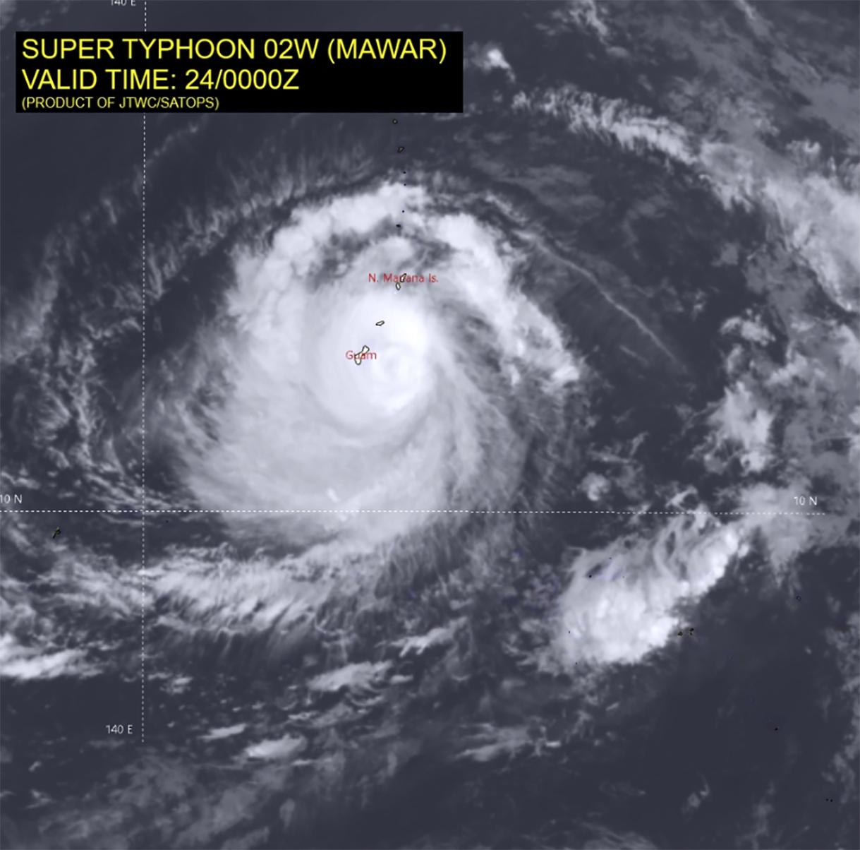
In 2018, 49,000 people in Japan were ordered to evacuate their homes as the strongest typhoon in 25 years, Typhoon Jebi, was on course to make landfall. Among those heading for shelter were my colleague Ken Yoda, professor of behavior and evolution, and his team, who were doing their annual field season studying a type of seabird called streaked shearwaters.

Typhoon Jebi broke wind records at 100 Japanese weather stations, with sustained wind speeds of 120 mp/h. These winds damaged nearly 98,000 houses, caused insurance payouts of $13 billion to £14 billion (£11.4 billion to £12.3 billion) and resulted in the deaths of seven people.

The experience of Typhoon Jebi made Ken realize he had amassed a unique tracking dataset that could be used to study how these seabirds respond to storms out on the open ocean. This information revealed the shearwaters he studied sometimes did the unthinkable: flying straight towards the eye of the .

So how does an animal that weighs the same as a pint of milk, weather such conditions?

Using GPS tracking data collected by tagging streaked shearwaters over 11 years on Awashima Island in the Sea of Japan, Ken Yoda teamed up with biologists Manos Lempidakis and I, and meteorologist Andrew Ross, to find out. Manos analyzed the tagging data to see which birds where flying over the Sea of Japan during the passage of a typhoon or . Then he analyzed their GPS tracks in relation to the wind.

We never imagined the result would show that shearwaters sometimes fly directly towards the eye of a storm. The few previous studies that tracked seabirds responding to storms showed that adults flew hundreds of miles to circumnavigate them. Yet our results showed the shearwaters chased the storm eye, tracking it for up to eight hours.

How it works

Like albatrosses and other tubenose birds so-called due to the arrangement of their nostrils, shearwaters are adapted for windy conditions, using energy in the wind to fly with little flapping.

Their  allows them to glide for long distances without losing much altitude. Tubenoses tend to live in windy regions, including many that are prone to cyclones.

When shearwaters fly towards the eye of the storm, they are sometimes in or near the eye wall (the region surrounding the storm eye, where the strongest  winds are). But there comes a point where they cannot match the wind speed. When this happens, the birds start to drift with the wind and lose control of their direction of travel.

We used statistical modeling to delve deeper into the shearwater's movements. This work revealed shearwaters sometimes circumvented storms, but only when they were far out to sea and had a clear path around the storm system.

Most shearwaters in the study colony foraged close to the Japanese mainland. It was here, when birds were sandwiched between the storm and the land, that birds flew towards the eye of the storm.

In the northern hemisphere, cyclones move anti-clockwise. So birds foraging close to Japan could have been caught in the strong onshore winds behind the storm eye and forced to fly over land.

Flying over land is dangerous for shearwaters, due to the risk of uncontrolled landings. These birds, which are so agile in the air, are clumsy on land. They struggle to take off, even in normal conditions, which makes them vulnerable to predators, including crows and birds of prey.

Flying towards the eye of the storm, away from land, is the safer option. But birds need to know where land is in order to avoid it. While adults appear to have an internal map, research suggests younger birds have not had the time to build up this knowledge. This might help explain why it is the juvenile shearwaters that sometimes wash up in their thousands in the aftermath of storms.

Stormy weather ahead

We know very little about how seabirds respond to storms, because this kind of extreme weather is, by definition, a rare event. And no two storms are the same. So we need huge amounts of tracking data (and luck) to capture the times when birds are exposed to storms and find patterns in how they behave.

One of the things that makes our study particularly valuable is the amount of data we had. We examined data from 401 shearwaters over 11 years. Within this, 75 birds flew during ten typhoons or tropical storms, making this the largest tracking dataset for animals in storms at the time of publication.

But the strategy of flying towards the eye is probably only an option for fast-flying, -adapted  such as albatrosses and shearwaters. We will need more data to understand whether and how seabirds with different flight styles and energy costs respond to to typhoons that are increasing in intensity, as well as potentially in size and duration.Pelagic seabirds fly into the eye of the storm when faced with extreme weather conditions

Provided by The Conversation 

This article is republished from The Conversation under a Creative Commons license. Read the original article.The Conversation

https://www.dictionary.com/e/typhoons-hurricanes-cyclones

Sep 18, 2021 ... The word cyclone is a general term for a large storm system, the most severe kind of which is called a tropical cyclone. The words hurricane and ...

https://timesofindia.indiatimes.com/what-is-the-difference-between-cyclone-hurricane-tornado-and-twister/articleshow/1317404.cms

Dec 3, 2005 ... In the Philipines, it is called typhoon. Hurricanes occur in the Atlantic and typhoons, in the Pacific. Basically, hurricanes and typhoons form ...

https://armorbuildingsolutions.com/what-to-know-about-tornados-waterspouts-hurricanes

Feb 13, 2020 ... Luckily, a tornado never touched down. But if it did, would you have been fully prepared to weather the storm in the safest way possible? While ...


https://www.washingtonpost.com/climate-environment/2022/08/18/waterspouts-tornado-greece-florida-london

Aug 18, 2022 ... No injuries or damage were reported from this storm. On Tuesday, what appeared to be a strong waterspout formed off Destin, Fla., ...

Monday, September 26, 2022

CLIMATE CHANGE WILL INCREASE THEM
Environment Canada issues waterspout watch for much of Great Lakes region

(Courtesy: Gavin van Camp)

Abby O'Brien, CTV News Toronto
 Multi-Platform Writer
Published Monday, September 26, 2022

Environment Canada (EC) has issued waterspout watches for much of the Great Lakes region in Ontario Monday.

In a statement issued Monday morning, EC said waterspout watches are in effect for a large portion of the Great Lakes, including Lake Huron, Lake St. Clair, Lake Simcoe, Lake Erie, and Lake Ontario.

In most regions, the waterspout watches have been issued alongside warnings for strong winds.


Environment Canada (EC) has issued waterspout watches for much of the Great Lakes region in Ontario Monday.According to Environment Canada, waterspouts can form during unstable conditions when cool air moves over relatively warmer water, resulting in what looks like a tornado of water, hovering over the surface.

“Mariners are urged to take all necessary precautions and prepare for the possibility of waterspout activity,” EC said Monday. “Postpone voyage or seek safe harbour if possible.”

Waterspouts are generally isolated in nature, ECCC says, but can occur in families of two or more. The agency says they are “short-lived” in nature, typically lasting approximately 20 minutes or less.

On Aug. 29, a tornado that initially developed as a waterspout over Lake Huron caused minor damage in Lambton and Bruce counties.


First significant Great Lakes waterspout outbreak of the season


Monday, September 26th 2022,  - Cooler air spreading into central Canada will heighten the threat for waterspouts, thunderstorms, and windy conditions this

Multi-day threat for waterspouts across the Great Lakes

The first significant Great Lakes waterspout outbreak of the season is upon us, as a broad upper level trough creeps across Ontario this week bringing the threat for multiple days of waterspouts, pesky rain showers and isolated pop-up thunderstorms. A chillier temperature trend will also mark the first half of the week, with the threat for frost lingering outside of urban areas. More more on what the final week of September will bring, read below.

Visit our Complete Guide to Fall 2022 for an in-depth look at the Fall Forecast, tips to plan for it and much more!

This week: Pesky rain showers and waterspouts

The fall season certainly wasted no time kicking into high gear, as temperatures took a significant tumble last week, remaining cooler as we start this final week of September.

"These types of weather patterns will bring a little bit of everything including sunshine, cloud, showers and thunderstorms," says Kelly Sonnenburg, a meteorologist at The Weather Network. "Temperatures are crisp, but can always temporarily warm when the sun shines. They make it extremely difficult to plan your outfit for the day."

Along with the cooler, early October-like temperatures, will be the threat for waterposuts as an upper level low pressure system tracks over the warm waters of the Great Lakes sparking the risk for waterspouts to develop.

8 (1)

According to Sonnenburg, this will be the first significant waterspout outbreak of the season across the Great Lakes.


As of Monday morning, numerous waterspouts had already be spotted across Lake Erie.

This specific weather pattern is expected to stick around through Wednesday before pushing east and making way for the return of drier conditions late week and into the weekend with high pressure.

The next round of precipitation expected early next week could be the remnant moisture from Hurricane Ian, however this is not a complete guarantee as not all long range computer models have it tracking into the Great Lakes.

A milder pattern is expected to return and dominate during early and mid October.

WATCH: Waterspout spotted over Erie amid multi-day threat for Great Lakes

Large waterspout spins across Erie as outbreak likely for Great Lakes
A waterspout was caught on camera along the shore of Lake Erie. Watch dark clouds move slowly over the open waters.
0 seconds of 33 secondsVolume 40%