Semisopochnoi volcano (Aleutian Islands): strong ash emissions
Wed, 8 Sep 2021, 04:42
04:42 AM | BY: MARTIN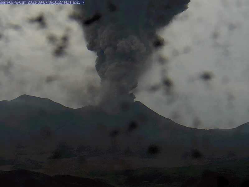
Large amounts of ash from Semisopochnoi volcano this morning (image: AVO)
Strong short-lived ash emissions, several minutes in duration, are being observed by the Alaska Volcano Observatory's surveillance cameras this morning at about 09:00 local time. Large amounts of ash, judging from the webcam imagery, rose to estimated 12,000 ft (3,7 km) altitude. The Alaska Volcano Observatory cited further: "Additional explosions were detected in seismic and infrasound data but were not observed in web camera images or satellite data due to cloudy conditions."
Sulfur dioxide emissions continue to be observed in satellite data and extended 273 km to the northeast of the volcano.
Continuous periods of low-level ash emissions at the volcano are now in progress, regardless of the events mentioned above.
Source: Alaska Volcano Observatory volcano activity update 8 September 2021
Askja volcano (Iceland): significant ground deformation since August
Wed, 8 Sep 2021, 05:02
05:02 AM | BY: MARTIN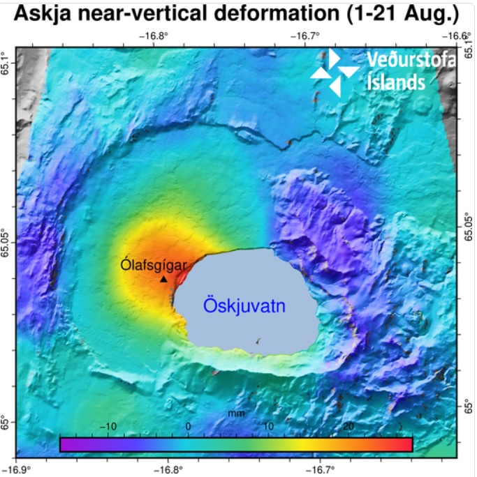
The image depicts the near-vertical deformation in mm for the period 1-21 August. The InSAR image is obtained from two passages of Sentinel-1 satellite. The red color indicates uplift and the blue corresponds to subsidence (see the scale). The area experiencing the highest inflation is north-west Öskjuvatn. The black triangle indicates the location of the closest GPS station Ólafsgíga (OLAC) (image: IMO)
The cause of such inflation is uncertain, but most likely it is due to a new batch of magma as a larger gas bubble rose towards the surface inside the magma-filled conduit.
Source: Icelandic Meteorological Office volcano activity update 8 September 2021
- All news about: Askja volcano
- Information about: Askja volcano
No comments:
Post a Comment