Sediment loading key to predicting post-wildfire debris flows

The mudslides that follow wildfires in Southern California can be deadly and difficult to predict. New research can help officials identify areas prone to these mudslides and respond before disaster occurs, according to scientists.
Mudslides, or debris flows, can occur when rainfall washes away the buildup of sediment in mountain channels. Roughly equal parts water and sediment, debris flows are strong enough to carry large boulders downhill and threaten communities on or near the mountains. The debris flows in January 2018 that hit Montecito, California, killed 23 people and caused hundreds of millions of dollars in damage. Authorities attributed the mudslides to the wildfires that swept through the area the previous month.
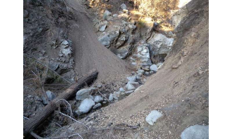
Vegetation holds back the sediment in these steep landscapes, but as the vegetation burns during a wildfire, gravity transports the sediment from the hillsides down to the channel in a process called dry sediment loading, said Roman DiBiase, assistant professor of geosciences at Penn State.
In steep landscapes like those in Southern California, dry sediment loading plays a more significant role in the severity of post-wildfire mudslides than rainfall, shallow landslides and burn severity, according to the scientists. They reported their findings in the February issue of Geology.
"The channels typically are covered with cobbles and boulders that don't move very easily or very often with storms," DiBiase said. "The transported sediment that was trapped behind the vegetation is much finer, so you end up filling the channel with fine-grained materials that make it easier to start a debris flow in the channel itself."
DiBiase and Michael Lamb, professor of geology at the California Institute of Technology, looked at three lidar datasets of the western San Gabriel Mountains. Lidar involves flying a laser scanner over a landscape and sensing the returning light. It allows scientists to reconstruct the topography at a high resolution.
The datasets were collected before the 2009 Station Fire, immediately following the fire and before the first rainfall, and then six years later, after rainfall had led to erosion and debris flows.
The researchers found widespread evidence that dry sediment loading added anywhere from 3 to 10 feet of debris to mountain channels, which were subsequently washed out by rainfall. Channel clearing was absent in areas where dry sediment loading did not occur.
Authorities can use lidar as a rapid response tool to map patterns of sediment loading after a fire and decide which mountain channels to clear before a storm hits, DiBiase said.
The study suggests that understanding how the landscape will respond to a changing climate depends more on soil regeneration rates than future storms.
"Most models assume that you have fully soil-covered conditions on the hillside, so you have an infinite reservoir of material to draw from," DiBiase said. "Our study shows that, at least in the steep landscapes, there's a finite amount of material on the hillside."
The current fire frequency—or time between fires—in Southern California landscapes gives the bedrock enough time to erode and become soil, and vegetation to grow back to hold the soil in place, continued DiBiase.
"If the fire frequency in Southern California doubles, when the next fire hits, the piles of sediment that have accumulated behind the plants are only half full," he said. "So, the volume of debris flows that comes out won't be too high. But we still have some work to do to understand what controls how fast the sediment is produced from bedrock and how quickly these piles fill up."
More information: Roman A. DiBiase et al, Dry sediment loading of headwater channels fuels post-wildfire debris flows in bedrock landscapes, Geology (2019). DOI: 10.1130/G46847.1
No comments:
Post a Comment