Nathan HowesDigital Journalist
Updated on May. 28, 2023
Canada's first-ever disaster report at the national level showcases the threats the country faces, the regions at risk, and what is needed for agencies and people to better handle future catastrophes
The release of Canada's inaugural national disaster risk assessment this month couldn't have been more timely with Alberta's expanding and damaging wildfires.
On May 11, the federal government unveiled the country's first national-level disaster risk assessment, highlighting the catastrophe threats facing Canada and the current measures and resources in its emergency management systems to address them. The inaugural report addressed three hazards: Earthquakes, wildland fires, and floods, along with a section on the effects of pandemics such as COVID-19.
SEE ALSO: Is Canada prone to a devastating earthquake? Answer isn't so simple
The goal of the assessment is to help Canadians understand the disaster risks they face so they can prepare for, manage and recover from emergencies, assist all emergency management partners make informed decisions to reduce, prepare for and respond to disasters, and aid in identifying strengths and weaknesses nationally to lessen the impacts of disasters for all Canadians.
To address the problems posed by the various disasters, millions of dollars have been bookmarked in the 2023 federal budget
.
(Shoshi Soni/Submitted)
“When we understand the risks we face, we can better protect ourselves and our communities from them. The national risk profile is a foundational piece of emergency preparedness work that draws upon scientific evidence and stakeholder perspectives to support decision-making that will strengthen Canada’s emergency management and resiliency to climate-related risks and disasters," said Bill Blair, Canada's Emergency Preparedness Minister, in a press release.
The analysis outlined several impacts and findings about earthquakes, wildland fires and floods in Canada.
Earthquakes
Expected direct losses from a large earthquake could be as high as $75 billion
The risks from earthquakes are increasing due to population growth and rising number of people and property density in urban areas, as well as a growing reliance on infrastructure systems
The national risk profile identified gaps in Canada's earthquake resilience including seismic retrofit programs to make existing buildings stronger and more resistant; access to public information; the number of Canadians underinsured or uninsured for earthquake damages; and challenges in the emergency management system and limited access to services in remote, isolated and Indigenous communities
MOST EARTHQUAKES IN BC AND ALBERTA ARE FRACKING QUAKES (FRACKQUAKES)
Wildland fires
The area burned annually by wildland fires has more than doubled since the 1970s. It is predicted that, by 2100, the area burned could double again
The risk of wildland fires will likely increase over time because climate change is creating longer and more intense fire seasons
Current trends point to more people and infrastructure in harm's way in the event of a wildland fire
The report identified the following gaps in Canada's wildland fire resilience including low public awareness and preventive action to protect homes, properties, and neighbourhoods; gaps in scientific knowledge and wildland fire management tools and technologies; inclusion of Indigenous peoples and diverse Indigenous knowledge in wildland fire management and response; and structural resilience to wildland fires, especially in high-risk areas
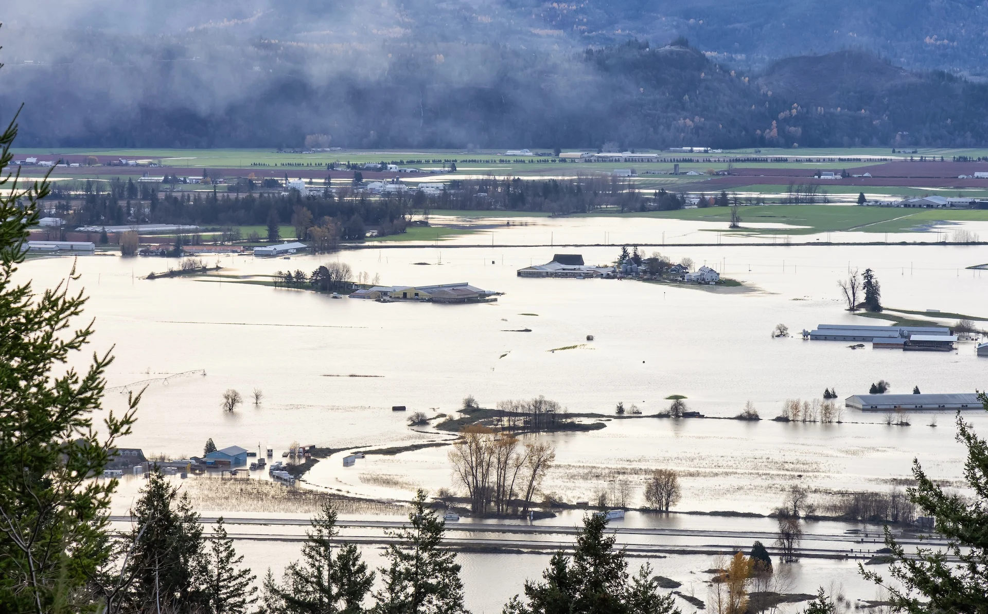
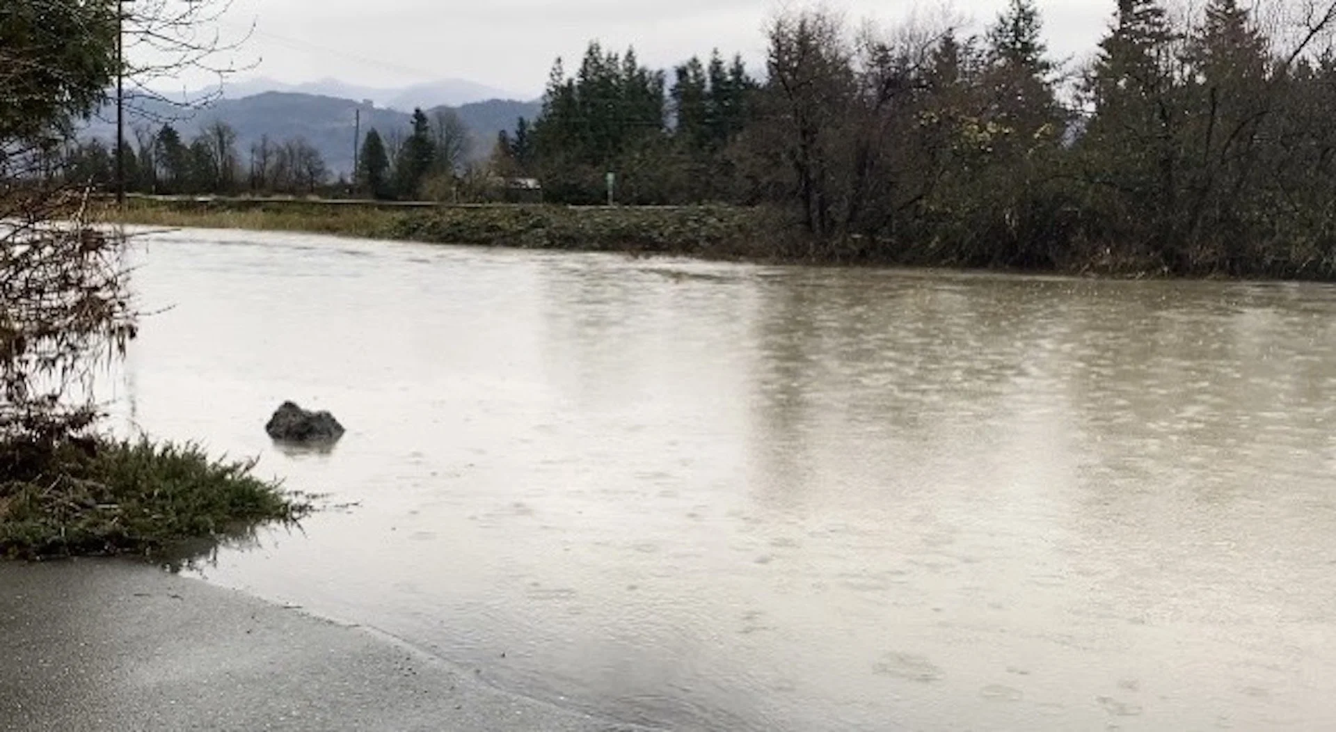
Floods
The risks from flood events will increase over time due to the impacts of climate change on weather patterns and the increasing number of people living in urban areas
The threat profile identified the following gaps in Canada's flood resilience including co-ordination among governments to manage flood risk; lack of flood risk information that impacts the management of evacuations; low awareness among Canadians of their personal flood risk; and lack of sustained investment in a national flood insurance arrangement and in countrywide infrastructure measures for prevention, like planting trees to prevent erosion
(Jaclyn Whittal/The Weather Network)
The next component to the national risk profile will focus on heat events, hurricanes and space weather. The federal government stated these three hazards were selected given their high impacts on public health, critical infrastructure, the economy, and ecosystems.
The full report can be viewed here.
Thumbnail courtesy of Getty Images-1356603199.
Firefighters in east Canada battle ‘unprecedented’ blazes
By AFP
Published May 31, 2023

Firefighters with Halifax Regional Fire and Emergency work to put out fires in the Tantallon area of Nova Scotia - Copyright Nova Scotia Government/AFP Handout
Firefighters on Wednesday faced a grueling uphill battle against wildfires in Canada’s Nova Scotia province, including one threatening suburbs of Halifax.
Federal help was coming, officials said, along with firefighters from the United States.
“We’re in a crisis in the province and we want and we need and we will take all the support we can get,” Nova Scotia Premier Tim Houston told a news conference. “These fires are unprecedented.”
Already, additional kit have been shipped in from Ontario, and a dozen water bombers from neighboring regions and the Coast Guard joined efforts to douse the flames and assist with evacuations.
Houston said he has also asked for the military to help out.
Prime Minister Justin Trudeau called the wildfires “heartbreaking,” and vowed unlimited support.
As of Wednesday, 14 wildfires were burning in Nova Scotia, including three out of control. They’ve so far destroyed or damaged more than 200 homes and other structures including a wooden bridge, but no injuries have been reported.
One couple described to public broadcaster CBC having lost both their home and their childcare business. “That’s my life,” a tearful Terri Kottwitz said.
Others said they saw trees on fire in their backyard as they fled with just a moment’s notice.
Evacuee Janis Churchill-Moher told CBC that she didn’t know if her home in the picturesque rural south of the province was still standing.
“Our neighbors have working farms and they just had to pack up their kids, pack up as many animals as fast as they could and run,” she said.
More than 2,000 residents of the area were ordered to evacuate earlier in the week as fires swept through the area.
“It’s a devastating situation for everybody,” she said.
– ‘Frustrated and frightened’ –
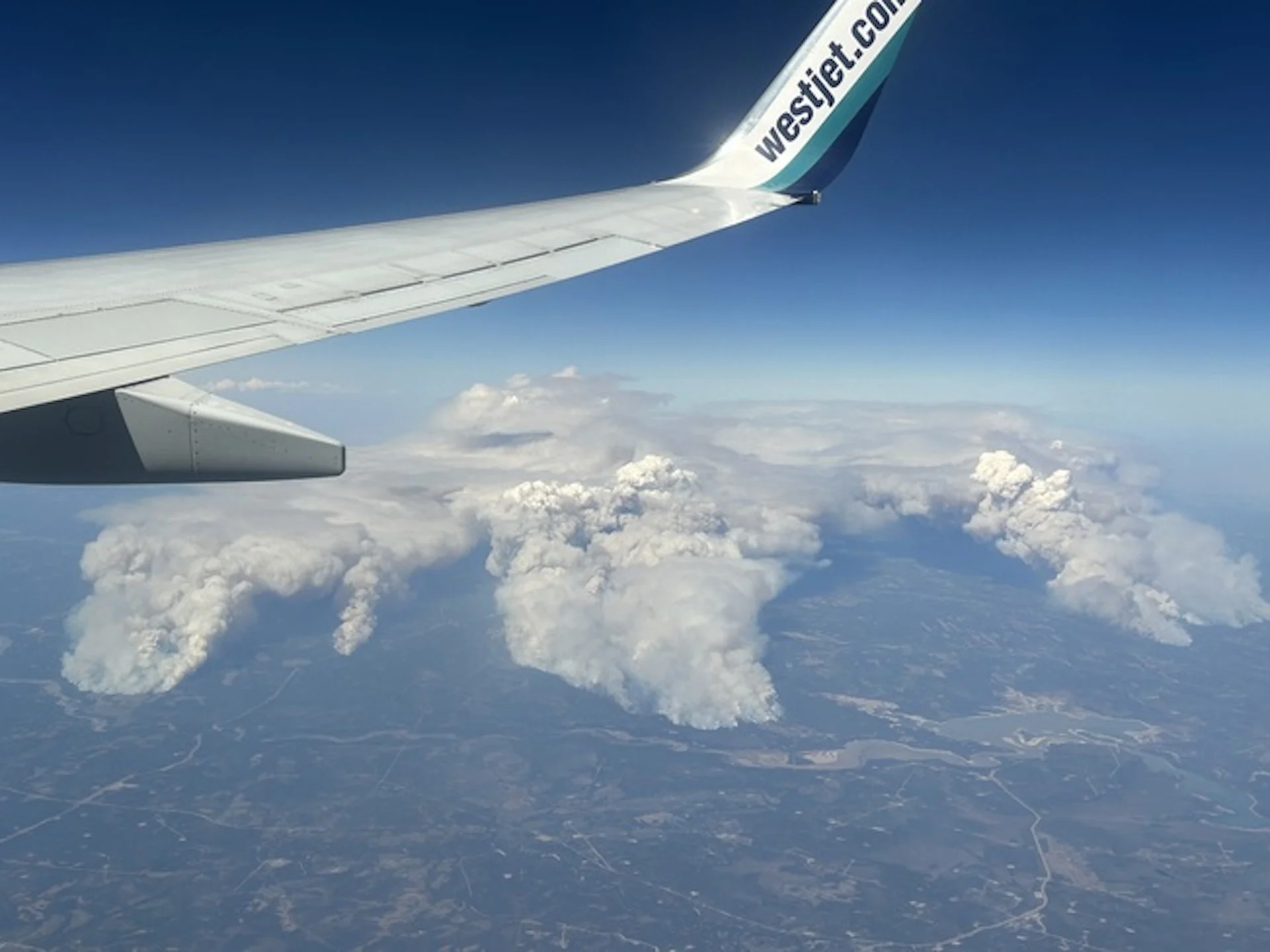
Smoke from the wildfires blew down the Atlantic coast, prompting air quality alerts for the US state of New Jersey and parts of Pennsylvania, including the Philadelphia area.

More than 16,000 people were forced to evacuate their homes in Canada’s eastern province of Nova Scotia. — © AFP
David Meldrum of the Halifax Regional Fire and Emergency, pointing to record-high temperatures forecast this week, warned of “a prolonged operation” to bring under control a large fire northwest of the port city that has displaced more than 16,000 residents.
“People are understandably tired, frustrated and frightened,” said Halifax Mayor Mike Savage, adding that “some have no home to return to.”
Houston announced a ban on all activities in Nova Scotia forests, including hiking, camping, fishing, hunting, the use of off-road vehicles and logging.
“For God’s sake, stop burning. Stop flicking cigarette butts out of the car window. Just stop it. Our resources are stretched incredibly thin right now fighting existing fires,” he pleaded after several illegal burns were reported by conservation officers.
Government data shows a decline in the number of wildfires in Canada since the 1980s, likely due to improved fire prevention.
But the past decade also saw more disastrous wildfires scorching a lot more land and displacing many more people — problems set to worsen with climate change.
In recent years western Canada has been hit repeatedly by extreme weather, including floods and mudslides, forest fires that destroyed an entire town, and record-high summer temperatures that killed more than 500 people in 2021.
On Tuesday, 800 residents of Fort Chiepwyan in northern Alberta had to be airlifted to safety as fires beared down on the remote hamlet.
Earlier this month, wildfires in Alberta burned nearly one million hectares of forests and grasslands, and at one point displaced 30,000 people.
By AFP
Published May 31, 2023
Firefighters with Halifax Regional Fire and Emergency work to put out fires in the Tantallon area of Nova Scotia - Copyright Nova Scotia Government/AFP Handout
Firefighters on Wednesday faced a grueling uphill battle against wildfires in Canada’s Nova Scotia province, including one threatening suburbs of Halifax.
Federal help was coming, officials said, along with firefighters from the United States.
“We’re in a crisis in the province and we want and we need and we will take all the support we can get,” Nova Scotia Premier Tim Houston told a news conference. “These fires are unprecedented.”
Already, additional kit have been shipped in from Ontario, and a dozen water bombers from neighboring regions and the Coast Guard joined efforts to douse the flames and assist with evacuations.
Houston said he has also asked for the military to help out.
Prime Minister Justin Trudeau called the wildfires “heartbreaking,” and vowed unlimited support.
As of Wednesday, 14 wildfires were burning in Nova Scotia, including three out of control. They’ve so far destroyed or damaged more than 200 homes and other structures including a wooden bridge, but no injuries have been reported.
One couple described to public broadcaster CBC having lost both their home and their childcare business. “That’s my life,” a tearful Terri Kottwitz said.
Others said they saw trees on fire in their backyard as they fled with just a moment’s notice.
Evacuee Janis Churchill-Moher told CBC that she didn’t know if her home in the picturesque rural south of the province was still standing.
“Our neighbors have working farms and they just had to pack up their kids, pack up as many animals as fast as they could and run,” she said.
More than 2,000 residents of the area were ordered to evacuate earlier in the week as fires swept through the area.
“It’s a devastating situation for everybody,” she said.
– ‘Frustrated and frightened’ –
Smoke from the wildfires blew down the Atlantic coast, prompting air quality alerts for the US state of New Jersey and parts of Pennsylvania, including the Philadelphia area.
More than 16,000 people were forced to evacuate their homes in Canada’s eastern province of Nova Scotia. — © AFP
David Meldrum of the Halifax Regional Fire and Emergency, pointing to record-high temperatures forecast this week, warned of “a prolonged operation” to bring under control a large fire northwest of the port city that has displaced more than 16,000 residents.
“People are understandably tired, frustrated and frightened,” said Halifax Mayor Mike Savage, adding that “some have no home to return to.”
Houston announced a ban on all activities in Nova Scotia forests, including hiking, camping, fishing, hunting, the use of off-road vehicles and logging.
“For God’s sake, stop burning. Stop flicking cigarette butts out of the car window. Just stop it. Our resources are stretched incredibly thin right now fighting existing fires,” he pleaded after several illegal burns were reported by conservation officers.
Government data shows a decline in the number of wildfires in Canada since the 1980s, likely due to improved fire prevention.
But the past decade also saw more disastrous wildfires scorching a lot more land and displacing many more people — problems set to worsen with climate change.
In recent years western Canada has been hit repeatedly by extreme weather, including floods and mudslides, forest fires that destroyed an entire town, and record-high summer temperatures that killed more than 500 people in 2021.
On Tuesday, 800 residents of Fort Chiepwyan in northern Alberta had to be airlifted to safety as fires beared down on the remote hamlet.
Earlier this month, wildfires in Alberta burned nearly one million hectares of forests and grasslands, and at one point displaced 30,000 people.
Nearly 200 structures damaged in Halifax-area wildfire
By Karen Graham
Published May 30, 2023
Westwood Hills, Tantallon update: The wildfire, estimated to cover 788.3 hectares, is out of control. Firefighters on scene include 170 from the HRM, 32 DNRR staff, 3 helicopters and 1 waterbomber from Newfoundland and Labrador. Source - Nova Scotia Natural Resources and Renewables
Early estimates are that about 200 structures have been damaged in the wildfire in the Upper Tantallon, N.S., area.
CBC News is reporting today that most of the damaged or destroyed structures are single-family homes. Halifax Fire Deputy Chief David Meldrum asked for patience from some 16,400 residents who are anxiously awaiting information about their properties.
He added that fire officials working on compiling information and creating a geographic map with the precise locations of every damaged property, but it will take some time.
Officials are reminding people not to try and return to their homes.
The fire was first reported on Sunday around 3:30 p.m. in the Westwood Hills subdivision off Hammonds Plains Road. The cause of that fire is under investigation, though it is likely that human activity played a role, according to Scott Tingley, the DNR’s manager of forest protection,
“It’s safe to say they have all been human-caused, we haven’t had reports of lightning in the area, so it’s human activity that’s causing them,” Tingley said.
Progress made on out-of-control wildfire
David Steeves of the Nova Scotia Department of Natural Resources said while some progress has been made in fighting the out-of-control wildfire outside Halifax overnight, a change in the weather today is expected to pose a “dangerous” challenge for firefighters.
Steeves said that southwest winds are expected to pick up during the afternoon, and the sun is expected to heat up.
“We are hopeful that we can make some gain today, but we’ll have to wait and see how the environment is going to work with us on that,” Steeves said during a press conference at the incident command center in the community of Tantallon.
“There’s going to be an increasingly dangerous situation for the firefighters that are on the ground. Safety is going to be paramount in all our tactical decisions.”
In an update from Nova Scotia Natural Resources and Renewables, the wildfire, estimated at 788 hectares (1,947 acres), remains out of control at 10:51 a.m. ET. Winds are expected to gust up to 30 kph (19 mph) throughout today, May 30, so fire may spread further this afternoon
‘Wilderness Urban Interface’ wildfires are on the rise across North America
By Karen Graham
Published May 30, 2023

The Simi Valley Fire in Southern California was a devastating 2003 wildfire that burned 108,204 acres. and destroyed 37 residences and 278 outbuildings. Credit - U.S. Air Force photo by Senior Master Sgt. Dennis W. Goff, Public Domain
Wildfires that put homes at risk are growing larger and more frequent as people move into transitional zones.
CTV News Canada is reporting on the severe consequences created as the number of wildfires crashing into communities continues to grow.
They cite the 2011 Slave Lake, Alberta wildfire that – despite suppression measures – pushed past fire barriers and destroyed several hundred homes and other buildings. The wildfire burned 4,700 hectares (12,000 acres) and ended up costing $750 million.
Close to one-third of Slave Lake, a community of 7,000 people, was destroyed, with 374 properties destroyed and 52 damaged in the town, and another 59 destroyed and 32 damaged in the surrounding Municipal District.


By Karen Graham
Published May 30, 2023
The Simi Valley Fire in Southern California was a devastating 2003 wildfire that burned 108,204 acres. and destroyed 37 residences and 278 outbuildings. Credit - U.S. Air Force photo by Senior Master Sgt. Dennis W. Goff, Public Domain
Wildfires that put homes at risk are growing larger and more frequent as people move into transitional zones.
CTV News Canada is reporting on the severe consequences created as the number of wildfires crashing into communities continues to grow.
They cite the 2011 Slave Lake, Alberta wildfire that – despite suppression measures – pushed past fire barriers and destroyed several hundred homes and other buildings. The wildfire burned 4,700 hectares (12,000 acres) and ended up costing $750 million.
Close to one-third of Slave Lake, a community of 7,000 people, was destroyed, with 374 properties destroyed and 52 damaged in the town, and another 59 destroyed and 32 damaged in the surrounding Municipal District.
On May 15, 2011, a fireball rises over the town of Slave Lake, at 5:40 pm as residents evacuate themselves from town as a wildfire destroys a third of the town. Credit – Mrsramsey, CC SA 3.0.
“I think that was the most shocking time of my entire career and maybe of my life, where you’re so sure that something’s going to work, and then it doesn’t with crushing consequences,” said Jamie Coutts, the former Slave Lake fire chief.
A firefighter for more than 30 years, Coutts said wildfires have been burning “hotter, faster (and) crazier” over the last decade, and “every single person that lives in the forest is on a collision course with something disastrous happening.”
The wildland-urban interface (WUI)
Research suggests that so-called Wildland-Urban Interface wildfires, which occur where forests and flames meet human development, are on the rise. This area is sometimes called a transitional zone. Keep in mind that on Sunday, a WUI fire crashed into Halifax, destroying or damaging dozens of homes in the west of the city.
As the risk of forest fire increases, so does the risk to urban peripheries in Canada that come into contact with wild or forested areas. Following are just two devastating examples:
In 2016, a wildfire forced 80,000 people in Fort McMurray and other parts of northern Alberta to evacuate, destroyed more than 2400 buildings, and caused an estimated $3.8 billion in damage.
2016 Fort McMurray wildfire. Large flames and heavy smoke surround congested Highway 63 South.
Credit – DarrenRD, CC SA 4.0.
In 2018, British Columbia experienced its worst fire season on record forcing 3,200 people to evacuate, and close to another 22,000 to be on alert.
In the United States, which has a much larger population than its neighbor to the north, over 60,000 communities are situated where they are at risk for WUI wildfires.
And between 2002 and 2016, an average of over 3,000 structures per year were lost to WUI wildfires in the United States. In the meantime, people continue to move to parts of the country more likely to burn, raising the odds of catastrophe.
Nowhere is this dynamic more visible than in California, where eight of the largest blazes on record have struck in the past five years. The state now has roughly 5.1 million homes in what’s known as the “wildland-urban interface.”
The rapid growth of housing in flammable areas is a key reason wildfires have become more destructive over time. Not only are the homes themselves more likely to burn, but when more people live near forests and grasslands, there’s also a greater chance that fires will start in the first place.
No comments:
Post a Comment