By Paul Brinkmann
3/11/2021
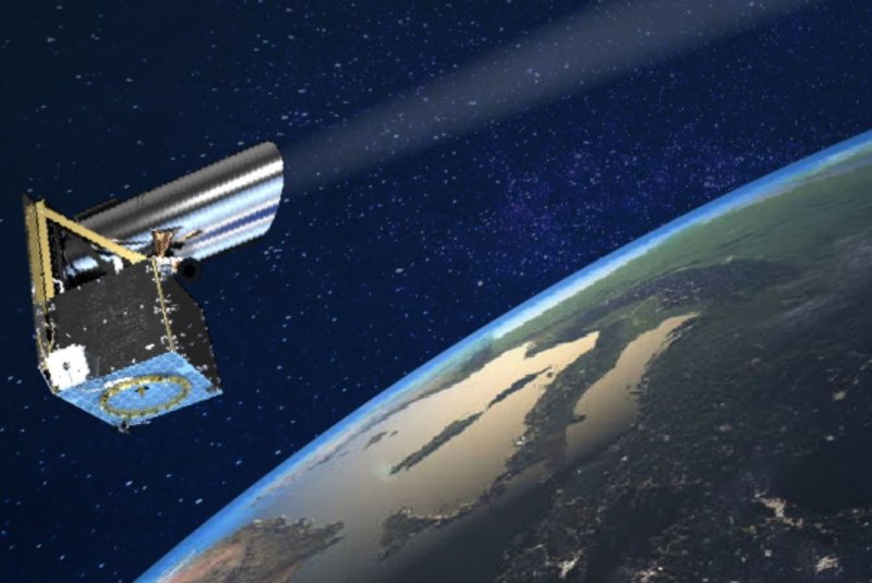
An illustration shows a space debris-tracking satellite that is under construction by Canadian firm NorthStar. Image courtesy of NorthStar

An illustration depicts orbital debris, or space trash, above the Earth. Image courtesy of European Space Agency
March 11 (UPI) -- A Canadian startup plans to launch the first-ever commercial fleet of satellites designed to track dangerous space trash in 2022.
Montreal-based NorthStar Earth & Space has three of its Skylark satellites under construction for the new network, which eventually will number about 52 spacecraft.
The fleet would be the first of its kind to track space trash from space, rather than from ground-based radar or other technology.
The satellites would address an orbital debris problem that NASA says is growing and "poses a safety risk to people and property in space and on Earth." Most space trash travels at about 18,000 mph, almost seven times faster than a bullet.
RELATED Satellite company Spire Global plans to expand with new funds
"We looked at the way [debris tracking] was being done on the ground, and we said it would be better to do it from space," said Stewart Bain, NorthStar co-founder and CEO.
"Our goal is to make it much easier to navigate your satellite in space so you don't have to have a Ph.D. in imagery or $100 million worth of equipment to be able to process the information," Bain said.
The satellites, being built by France-based Thales Alenia Space, will be relatively small at 220 pounds, with a telescope and small thrusters. NorthStar has raised $65 million for the first stages of the satellite program, some of it from the Canadian government.
RELATED Rocket Lab plans new Neutron rocket, intends to go public
The company is talking to launch providers and plans to choose one soon, Bain said. He declined to say which providers he's considering, but said it would be one with a proven track record.
NorthStar's satellites would image known space objects about six times per day when fully operational, Bain said. That compares with only sporadic observations available for certain objects today, especially if they are owned by a nation that doesn't publish details about their space operations, such as China or Russia.
NorthStar's tracking would provide about 80% to 90% more accurate distance predictions for two space objects, according to the company.
RELATED SpaceX successfully launches 20th Starlink mission
For example, ground-based tracking systems predicted two satellites that collided in 2009 would be almost 2,000 feet away from each other at the closest point. NorthStar said its system would have sounded an alarm with a "miss distance" of only around 200 feet apart.
In that instance, one of the satellites -- Iridium 33 -- could have moved away from the other, a defunct Russian craft named Kosmos-2251. The collision produced 2,000 pieces of debris, one of which passed fewer than 400 feet away from the International Space Station in 2012.
"We can't afford to have significant accidents in space as we are watching companies like SpaceX and OneWeb launch thousands of new satellites," Bain said. "We just can't afford to delay this anymore."
Once NorthStar launches 12 of its Skylark satellites to monitor space debris, it plans to launch dozens more that also have Earth-imaging capability to attract more customers, he said.
NorthStar's plans are a significant step toward better space debris tracking, also known as situational awareness, said Moriba Jah, associate professor of aerospace at the University of Texas at Austin.
Jah, who has provided technical advice to NorthStar, said the company's spacecraft are only a good first step toward better management of space traffic.
That's because even a space-based observation system like NorthStar's must still send data to and from the Earth for processing, and that causes delays, Jah said.
"The goal should be that each space-based platform or spacecraft has the computational framework onboard, to be able to process data and actually extract information from the data without having to send it to the ground," he said.
Most current U.S.-based satellite networks only have data about where their own satellites are, and they rely on data from the U.S. military to make any automatic adjustments to flight paths for collision avoidance, Jah said. Such reliance on third-party data also produces delays.
NASA and other space agencies around the world have knowledge gaps regarding space debris that could be filled with better data and space-based systems, Jah said.
There may be orbital planes where "you shouldn't put anything else up there because, basically, it's just going to lead to more debris," he said.
No comments:
Post a Comment