Wildfire on Cyprus caused by 'carelessly discarded cigarette,' ATF report finds
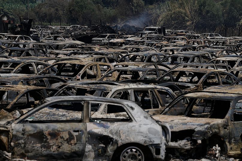
The fire in July near the coastal town of Limassol claimed the lives of two people, wrecked 700 structures and scorched more than 100 square kilometres of land.
One of Cyprus' most devastating wildfires in recent memory was caused by a cigarette discarded by the side of a mountain road, a report by US experts said on Thursday.
The report by the Bureau of Alcohol, Tobacco, Firearms and Explosives (ATF) concluded that the "accidental" cause of the fire was a "carelessly discarded cigarette coming into contact with dry vegetation."
The fire in July near the coastal town of Limassol claimed the lives of two people, wrecked 700 structures and scorched more than 100 square kilometres of land.
The ATF report said that a search of the area where the wildfire initially ignited revealed several cigarette butts strewn on the ground by the side of a road connecting the mountain villages of Malia and Arsos.
Investigators noted that the environmental conditions at the time were “extremely favourable to any ignition, including the ignition from carelessly discarded smoking materials.”
Strong winds, low humidity and temperatures reaching 39 degrees Celsius at the time had made the likelihood of ignition 100%, according to the experts who also took into account witness statements, video and photographs as well as the input of Cyprus Fire Service investigators.
The ATF team visited the east Mediterranean island to conduct their 10-day investigation at the request of President Nikos Christodoulides.
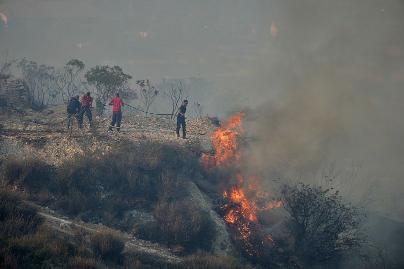
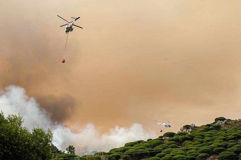
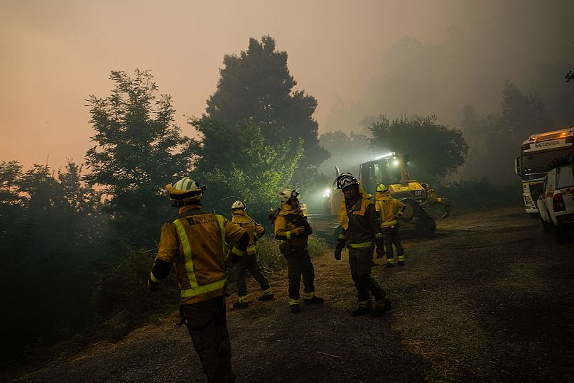
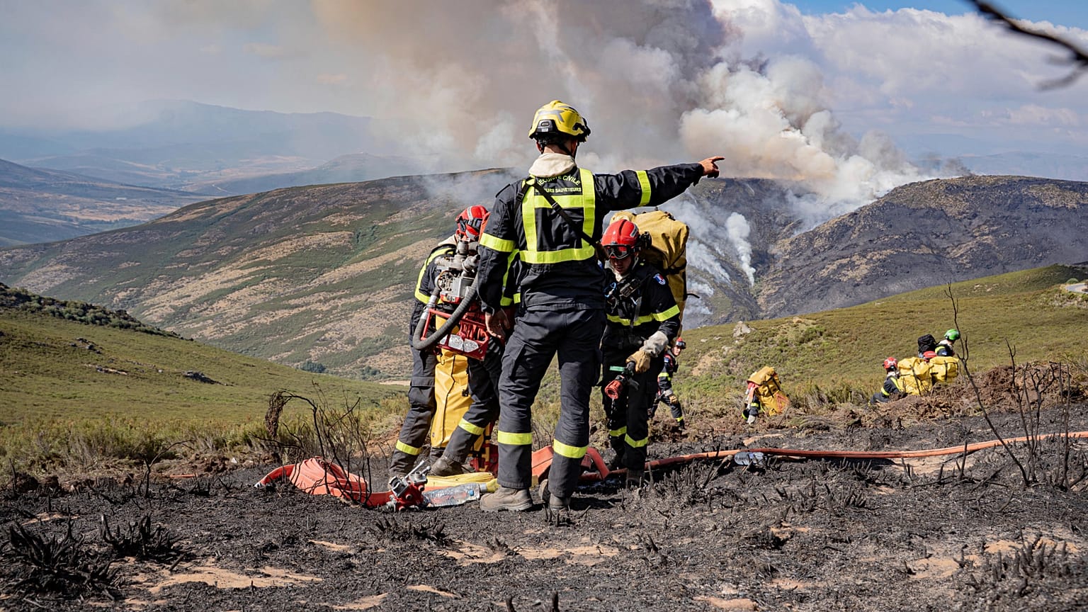
More than 250 firefighters and 14 aircraft struggled to contain the wildfire that burned across multiple fronts on hilly terrain over two days.
At the time, the government said the combination of strong winds, high temperatures and very arid conditions after three winters of minimal rainfall created a perfect storm at the wildfire’s peak.
An elderly couple died while trying to flee the fast-moving flames in their car that fire crews found at the side of a mountain road leading to Limassol.
Publication of the ATF report coincided with the release of a study showing how climate change that has driven scorching temperatures and dwindling rainfall made wildfires in Turkey, Greece and Cyprus this summer burn much more fiercely.
The World Weather Attribution study said the fires that killed 20 people, forced 80,000 to evacuate and burned more than 10,000 square kilometres were 22% more intense in 2025, Europe's worst recorded year of wildfires.
Record amount of wildfire destruction marks dark year for Europe
Experts say that the higher temperatures and lower rainfall brought by climate change are making forest fires worse.
In Europe, the 2025 wildfire season has broken records for the amount of land burnt.
More than a million hectares has gone up in flames in the EU so far this year, a larger surface area than the entirety of Corsica. That's more than four times as much as last year.
In total, more than 1,800 forest fires have been declared, emitting more than 38 million tonnes of CO₂.
Out of the European Union's 27 member states, only the Czech Republic, Estonia, Lithuania, Luxembourg and Malta have reported no wildfires.
At the top of the list, Italy and Romania recorded more than 450 blazes each.
However, the countries that have suffered the most damage are not necessarily those that reported the most fires.
Cyprus, for example, reported only three fires, but they were particularly devastating.
Since the first of January, more than 400,000 hectares have burnt in Spain and more than 260,000 hectares in Portugal. That is equivalent to 3% of Portugal and 0.8% of Spain's total land mass.
"Many of the fires we have monitored and observed are occurring where climate anomalies show that it is much drier than average and warmer than average," Mark Parrington, a scientist at the European Centre for Medium-Range Weather, told Euronews.
"Where hot, dry winds are blowing, any ignition can ignite very quickly on a large scale and become very intense," Parrington added.
Climate change fuels fire risk
Experts have sounded the alarm that climate change is to blame for this year's more aggressive wildfire season.
Alexander Held, a fire management specialist at the European Forest Institute, explained that a combination of different factors are needed to spark a fire, including weather conditions, topography, vegetation, biomass and fuel.
However, Held stressed that "the prerequisite for everything to happen is the weather".
"Climate change scenarios provide the perfect envelope for all the other factors to work together to produce a perfect fire day or a perfect firestorm," Held told Euronews.
Such conditions are only set to become more common in the future, Held warned, putting strain on firefighting resources
"Our fire-fighting system is reaching its limits, and the only thing we can do is prepare the landscape, making it more resilient and better prepared. That way, firefighters will have a chance to work safely and efficiently," Held said.
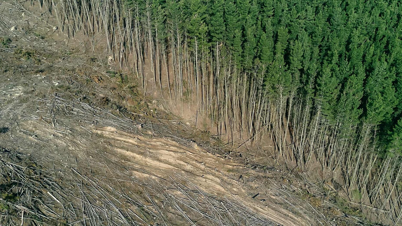
One technique is to reduce vegetation through clearing, grazing or controlled burning.
Other approaches include agroforestry systems that combine agricultural production and trees in the same location.
No, Spain’s wildfires were not started on
purpose to clear land for construction
projects
Copyright AP Photo
Published on 28/08/2025 -
Spain has battled several devastating wildfires. The disaster is prompting claims that the fires were deliberately caused to make way for construction projects. Here is why these claims are false.
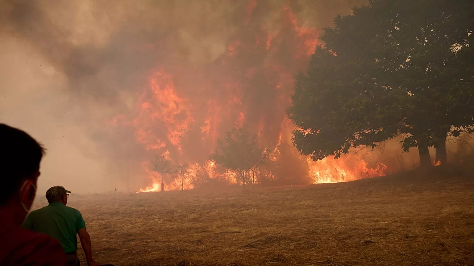
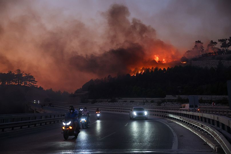
Spain is facing its worst wildfire season in 30 years. Fuelled by the severe summer heatwave, these fires have already destroyed over 150,000 hectares of land, mainly in the regions of Galicia and Castilla y León in the northwest.
Firefighters are battling the blazes with support from military forces deployed by the Spanish government. Meanwhile, around 30,000 people have been evacuated, with residents urged to wear face masks and stay indoors to avoid the smoke and ash.
As the blaze ravages forests and natural areas, it often clears vegetation and makes land easier and cheaper to develop. Because of this, a social media wave of disinformation content is claiming that the wildfires were caused on purpose, to clear land for construction projects.
Misleading projects in Canarias and Madrid
Viral posts suggest that the wildfires in Spain were deliberately set so developers can later build on the burned land, but this is untrue. Spain’s Law of Montes explicitly bans changing the use of forest land for 30 years after a fire to prevent intentional burning for profit.
The law was tightened in 2006 under Spain’s prime minister at the time, José Luis Rodríguez Zapatero (PSOE), to enforce the 30-year ban nationwide and only allowed one exception: if the change of use (like turning forest into urban land) was already approved before the fire.
In 2015, under former PM Mariano Rajoy (PP), a second exception was added, but only for cases where a new law declares the change necessary for “reasons of overriding public interest”, like building essential infrastructure. But it’s a complex that requires parliamentary or regional legislation, not something a private developer can trigger independently.
So, as per these legal safeguards, fires do not open the door to real estate development because new projects cannot bypass the 30-year restriction.
The supposed “loopholes” circulated online (like the idea that selling the land or burning it allows instant requalification) do not exist in the law.
Any project seeking to change land use must have been planned and approved long before a fire, or it must go through lengthy legal and environmental procedures, making arson an ineffective and illegal path to development.
In that same vein, another set of posts claims that the August 2025 fires in Tarifa (Cádiz, Andalusia) were started to enable coastal urban developments, but the facts don’t support this.
Viral claims, including headlines from established Spanish media, like El Español, mention “more than eight projects” and suggest the fires would allow land to be reclassified for construction.
The fire near Atlanterra in Tarifa indeed passed close to two housing developments, but the plots were already designated as urban land in the local planning documents (PGOU) and were not damaged by the fire.
Another rumour points to a luxury tourism project in El Lentiscal, but this site is inside the Parque Natural del Estrecho, and is far from the burned area. It also faces strict environmental protections, with no application for construction submitted as of August 2025.
Another claim says that the wildfire in Tres Cantos, a neighbourhood in the Madrid district, was linked to a nearby solar farm project – the GR Mandarín photovoltaic project.
But in reality, the solar plant’s panels will be installed in Soto del Real, a different municipality 12 km from the burned area, while Tres Cantos only hosts part of the transmission line.
The project had already secured its environmental clearance in May 2023 and received its construction permit from the Ministry for the Ecological Transition in November 2024, months before the fire.
The posts also misrepresent an early 2022 draft of the project to claim that Tres Cantos was the planned installation site, ignoring the updated, approved plans that show otherwise.
But sources from the Tres Cantos city council told Spanish fact-checker Maldita.es that the municipality has no additional permits pending for the project, which means that construction could proceed regardless of the local fires.
Climate change intensified weather that
fuelled deadly wildfires in Türkiye, Greece
and Cyprus
Copyright AP Photo/Petros Karadjias
By Rosie Frost
Published on 28/08/2025 -
Researchers found that weather conditions which drove deadly fires in Türkiye, Greece and Cyprus were made more intense by climate change. They expect similar results from their ongoing analysis of blazes in Spain.
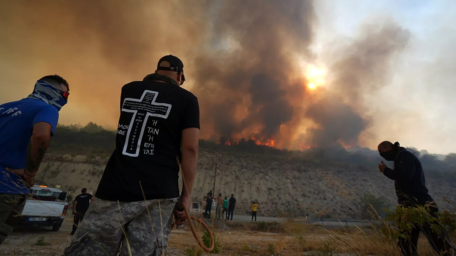
Weather conditions that fuelled deadly wildfires in Türkiye, Greece and Cyprus were made more intense by climate change, new research has found.
The rapid analysis from World Weather Attribution (WWA) shows that the hot, dry and windy conditions, which drove the spread of blazes in the three countries, were around 22 per cent more intense because of human-caused climate change.
The findings follow data confirming that 2025 has become Europe’s worst year on record for wildfires, with more than a million hectares of land burned. As of 26 August, an area bigger than Cyprus and higher than the total for any other year on record has been ravaged by blazes, according to data from the European Forest Fire Information System (EFFIS).
Researchers warn that the risk of larger, harder-to-control fires will continue to increase if the world continues to burn fossil fuels. These simultaneous blazes are already stretching firefighting resources with more intense events outpacing efforts to adapt.
“These results are concerning. Today, with 1.3°C of warming, we are seeing new extremes in wildfire behaviour that has pushed firefighters to their limit,” says Theodore Keeping, researcher at the Centre for Environmental Policy, Imperial College London.
“But we are heading for up to 3°C this century unless countries more rapidly transition away from fossil fuels.”
Climate change set the scene for deadly wildfires
In June and July, hundreds of wildfires broke out in the eastern Mediterranean.
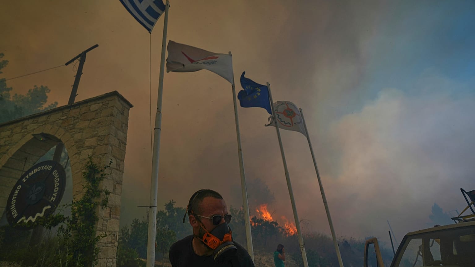
Türkiye was hardest hit with 17 people killed, among them firefighters who died when winds suddenly changed direction, leaving them trapped by the flames. Two people were killed in Cyprus and one in Greece. Across the three countries, more than 80,000 people were forced to evacuate.
Climate change, researchers say, set the scene for these fires in Türkiye, Greece and Cyprus by influencing the weather in the months, weeks and days leading up to them.
Total rainfall during winter in the region has decreased by around 14 per cent since the pre-industrial era, before humans began burning fossil fuels. This has led to drier conditions in the summer which, combined with intense dry heat, primed plants to burn.
A week of “highly evaporative” conditions that cause plants to dry out is now around 18 per cent more intense and 13 times more likely due to climate change, the analysis found.
Next, researchers looked at the combination of hot, dry and windy conditions that drove the chaotic spread of the fires. Without climate change, similar events would only occur about once every 100 years. But today, with 1.3°C of warming, they are expected about once every 20 years.
These fire-prone conditions were overall made about 10 times more likely and 22 per cent more intense by climate change.
Lastly, they looked at extreme northerly winds known as the Etesian winds. They found an increase in the intensity of high-pressure weather systems, like the one that drove the devastating fires. The findings agree with previous research from the region, which shows that these fire-fanning Etesian winds are becoming stronger.
Europe’s blazes risk overwhelming firefighting efforts
WWA warns that, with hundreds of wildfires occurring at the same time across Europe, firefighting resources are already strained at 1.3°C of global warming.
As of 21 August, the EU Civil Protection Mechanism, which coordinates support during emergencies, had been activated 17 times for wildfires this year, including by Greece, Spain, Bulgaria, Montenegro and Albania over the course of just one week.
“The fire season still has weeks to go in Europe, but it is already the continent’s worst ever recorded with more than a million hectares burned,” says Dr Clair Barnes, researcher at the Centre for Environmental Policy, Imperial College London.
Spain and Portugal have been the hardest hit, together making up around two-thirds of the EU’s total burnt area this year. A sharp increase occurred between 5 and 19 August according to EFFIS data - a period which overlapped with a 16-day heatwave in the Iberian Peninsula.
Dr Barnes adds that WWA has already started a rapid analysis on the wildfires in Spain, and are expecting to find the fingerprints of climate change there, too.
As the climate warms, researchers say more countries across Europe will need to tackle wildfires that stretch resources. In some places, they say there is a risk that extreme fires could overwhelm efforts to adapt.
In Türkiye, Greece and Cyprus, warming of 2.6°C, which is expected under current global climate policies, would see periods of intense hot, dry and windy conditions become nine times more likely and 25 per cent more intense.
Dr Bikem Ekberzade, researcher at the Eurasia Institute of Earth Sciences, Istanbul Technical University, explains that wildfires in Türkiye peaked unexpectedly in June this year, when the season usually falls within the four weeks from mid-July to mid-August.
“Human ignitions were the primary cause, while meteorological conditions – especially high surface wind speeds – contributed to the rapid spread and severity of the fires.”
When vegetation is dry and winds are strong, a single ignition can rapidly turn into a large, hard-to-control wildfire, Dr Ekberzade adds.
“And in a warming world, with more overlap between urban and wildland areas, larger, more severe and fatal fires could soon become the norm.”
Can Europe adapt to increasing wildfire risks?
The study highlights the need for forward-looking efforts to decrease the risk of wildfires starting and spreading.
Currently, strategies in Türkiye, Greece and Cyprus focus on fire suppression with large forces of firefighters and fleets of water bombing planes and helicopters. Nearly 650 firefighters from 14 different countries were deployed ahead of fire season in high-risk areas.
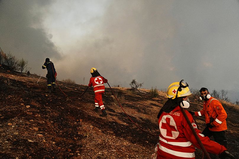
“Even with hundreds of pre-deployed firefighters, reinforcements from neighbouring countries, and water-dropping planes, the blazes have been devastating,” says Maja Vahlberg, technical advisor at the Red Cross and Red Crescent Climate Centre
WWA says that while international deployments like this will still be needed, more focus needs to be placed on preventing fires. That includes efforts like improving community fire risk awareness and strategies to manage fuel for blazes, such as removing or altering vegetation.
“The hard work to implement long-term wildfire management strategies that proactively manage fuel availability and empower communities to prepare for wildfires must continue to help keep people safe,” Vahlberg adds.