It’s possible that I shall make an ass of myself. But in that case one can always get out of it with a little dialectic. I have, of course, so worded my proposition as to be right either way (K.Marx, Letter to F.Engels on the Indian Mutiny)
Alberta hasn't been able to catch a break since wildfires burned through the province in May and June. Since then, there have been floods — some even in the same places affected by wildfires.
This year has also seen one of the strongest tornadoes in Alberta's history — it touched downtown between Didsbury and Carstairs Saturday.
The province is still adding up totals of all the natural disasters, but said so far this year wildfires alone have cost $700 million. Public safety minister Mike Ellis stressed the Alberta government is not focused on cost, but just getting through the season.
"We know that it's the worst alberta wildfire event in Alberta's history we are closing in on 1.5 million hectares burnt," Ellis said.
"We will do whatever it takes to keep Alberta safe."
The Insurance Bureau of Canada's Craig Stewart said natural disasters have been on the rise. He points to 15-years-ago when payouts averaged $400 million across the country. In the last five years, it's grown to five times that amount.
"Last year was $3 billion," he said. "We are going to be in that range again of $2 to 3 billion."
Stewart said these trends have led insurance premiums across the country to jump by 14 per cent — a hit that's been felt more in western provinces.
"Alberta and British Columbia are the two riskiest places in the country based on natural disasters that we've seen in recent years. So unfortunately premiums are going to go up more," Stewart said.
He added no single event makes premiums rise, rather, extreme weather events over time create trends and as it gets worseit will cost taxpayers, homeowners and governments more combined.
This is echoed by the Canadian Climate Institute's Dave Sawyer.
"In the long run taxes have to rise to cover the damages that government are backing. There are hits on productivity (in industry) so there are direct hits on households and there's these indirect impacts," Sawyer said.
He said the government can help by climate-proofing housing and working with homeowners to install equipment to help reduce floods and help with fire breaks in communities.
"There's income hits for people and then supply chain disruptions. Costs rise, inventories are hard to get, so it has this ripple impact through the economy," Stewart said.
Stewart said Alberta has been prone to natural disasters dating back to data bases from the 1970s. He said Alberta accounts for 50 per cent of insured losses associated with an extreme weather event like floods, hail storm and the like.
"Alberta gets the lion's share of economic damage in the country."
Monday, June 19, 2023
Central Alberta records ‘tremendous’ amounts of rain; flooding a concern
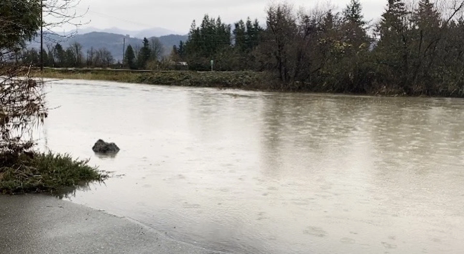
Edmonton saw nearly half of the average amount of rain it usually sees for all of June in just one day.
As of 6 p.m. Sunday, the city had recorded up to 38 millimetres of rainfall. For Edmonton, the June average is 77 mm.
“We’ve seen a tremendous amount of rain so far in the city and over the course of just Sunday," said Global Edmonton weather specialist Phil Darlington.
Darlington pointed out that the University of Alberta weather station has recorded about 129 mm of rainfall so far this June.
Some private rain gauges recorded over 40 mm of rain by Sunday night. Over the course of 24 hours, some parts of Edmonton recorded nearly 80 mm of rain.
“We’ve already exceeded our June normal, which is very interesting considering we started the month off well below normal," said Sara Hoffman, a meteorologist for Environment and Climate Change Canada.
She said the first two weeks of June were incredibly dry. Calgary recorded zero precipitation and Edmonton recorded just 0.5 mm.
“So really, over the past six days, we’ve seen a month’s worth of rain -- and more -- fall in the Edmonton region," Hoffman said.
“This amount of rain, at this time, especially for west-central portions of the province, is a little bit unusual and not as common. These rainfall amounts in 24 hours are definitely not the norm.”
Much of central and northern Alberta also saw a lot of rainfall thanks to this significant low-pressure system.
“The most rain fell west of us in Yellowhead County, around Hendrickson Creek and the Edson area," Hoffman added.
Accumulated precipitation amounts (over an approximately 48-hour period) as of noon Monday were:
Hendrickson Creek: 132.8 mm
Carrot Creek: 128 mm
Evansburg: 108 mm
Edson: 107.5 mm
Edmonton area: 52-76 mm
Jasper: 73.5 mm
“The dichotomy of how it started and how it is right now is kind of giving us whiplash," Hoffman said.
"It started off so hot and dry. Now we’re well below normal temperatures, with some portions of the province seeing a crazy amount of precipitation.”
Environment Canada still had rainfall warnings in effect Monday for much of central and western Alberta, including places like Yellowhead County. The weather agency said those regions could see between 40 and 80 mm of rain.
"A long period of heavy rain continues," Environment Canada said. "Widespread rain amounts of 50 to 80 mm have already fallen, with some areas receiving over 100 mm so far.
"Heavy downpours can cause flash floods and water pooling on roads. Localized flooding in low-lying areas is possible."
The town said crews were out with pumps, directing water to avoid flooding issues. Residents experiencing flooding in their homes are being told to call 780-723-6300.
"Crews are extremely busy right now and may not be able to respond right away," town officials said in a post on Facebook.
"Once our main office lines are open again, please contact Infrastructure and Planning to make sure you’re on the tracking list of flooded properties.
"Please stay away from creeks, streams, and other bodies of water right now. We are monitoring Hillendale Pond, Centennial, and other areas and trying to mitigate issues as best we can."
According to Alberta weather station data, the Edmonton Blatchford station accumulated about 52 mm of rain between June 16 and 19. Over the same time period, the Carrot Creek daily station recorded nearly 85 mm.
Bruce Webb, a rancher in Carrot Creek, said the flooding happened really quickly.
"It (Lobstick River) was dry – nothing flowing through it or nothing. Just overnight – like late (Sunday) afternoon around supper it was just a little stream and (Monday) morning it’s all flooded.”
There were six 24-hour rainfall records set: Bretton, Camrose, Edmonton, Edson, Elk Island and Grande Prairie.
“For the higher elevations in the Rocky Mountains, this actually fell as snow," Hoffman said. "So we’ve had some accumulating snow especially on Highway 93 and portions of Jasper, Nordegg.
"At this time of year, most people have their summer tires on, so if you’re planning to be in the Rocky Mountains for the next couple of days here, you’ll have to drive to conditions because there’s snow on the roads.”
“Conditions in Jasper are very snowy right now," said Brian Rode, vice-president of Marmont Basin, on Monday at 11:30 a.m.
"It’s been snowing probably for about seven or eight hours now.
"We’ve got a foot on the ground up in Marmont Basin and some trees down in Jasper, so lots of snow but it looks like the weather is going to be sunny here in a few days," Rode said.
High streamflow advisories were also in place for much of central and western Alberta Monday, including for tributaries of the North Saskatchewan River (from Rocky Mountain House to the city of Edmonton, mainstem within the city of Edmonton), the Swan Hills watershed, the Peace River Basin (all streams in the Smoky River Basin) and the Athabasca River Basin (Pembina River Basin).
According to Alberta Rivers, water level rises in the tributaries of over 1.2 metres are possible but no flooding impacts are expected at this time.
Water levels of the North Saskatchewan as it flows through Edmonton are expected to peak late Wednesday into early Thursday, rising 1.5 metres more.
"This may impact boat launches as well as the docks near Dawson Park, Edmonton riverboat."
There was also a flood watch for the Athabasca River Basin (parts of McLeod River near Whitecourt and Paddle River near Barrhead).
Edmonton is no longer under any rainfall alerts, but there's still a risk of rain over the next several days.
Panex Oil and Gas controller Brenda Toews arrived at work on Monday to six inches of water in the Edmonton shop.
The building, located at 37 Street and 69 Avenue in Edmonton, experienced a bit of flooding on Thursday, Toews said, but they were able to sweep it out with brooms.
EPCOR drained it on Friday, she said, but the water returned Monday with a vengeance.
“Now we’ve got five pumps pumping out the water as fast as we can because sweeping it wasn’t working," Toews said.
“It’s really hard to weld when you’re standing in water. So we have no production and I’m paying all my welders to sweep water."
She said it's very frustrating.
"Stressful because we’re going to miss deadlines… and stressful that no one’s being held accountable."
Toews thinks the flooding is connected to a train track and ditch behind the shop.
“I’ve been here 23 years and it’s never happened before. Obviously there’s a big issue. It’s going to continue happening until someone decides what’s wrong.”
When the rain started really coming down Sunday, Charity Sagart knew her older home might have some issues.
“Last night, of course, it was flooding outside. The (basement) carpet was saturated with water so I just lifted it up and cut through the drywall and saw a little bit of a crack and followed it up and it’s there."
She found a crack in her foundation so she called to have it assessed and repaired Monday.
“We’re getting over 100 calls a day," said Todd Ivanochko, president of Shield Foundation Repair.
“This is just that time of year. You get a month’s worth of rain in less than three days.”
He said the most common issues are deficiencies in foundation walls, vertical cracks, leaking snap ties (the wires going through the foundation) and honeycombing (when the concrete separates and becomes porous).
“Water can be terrible. It not only wrecks the drywall, it’ll wreck the baseboards, it can wreck your flooring, it can damage any furniture in the area, and if you don’t catch it right way, it can create mould and other issues.”
“I’m in homes that were built in 2023. I’m in homes that were built in 1910. It doesn’t matter.
"We live in an environment that has a very high plastic clays, which means the more moisture you get, the more the ground swells (and) the less moisture you get, the more it shrinks. So the house is always wiggling and moving," Ivanochko said.
He added that if homeowners notice water damage, they should try to contain the water and minimize its impact by rolling up carpet and moving any belongings away.
“People should pay attention to their downspouts and where they’re going, any negative sloping grating towards the house, that’s just encouraging more water to go up against the foundation wall.”
Fire to floods: Edson declares local state of emergency due to massive rainfall
To say it's been a trying few weeks for the people of Edson, Alta., may be an understatement.
After being forced to evacuate twice in the the span of a month due to wildfires fuelled by dry conditions, residents in the town about 180 kilometres west of Edmonton are now dealing with an opposite extreme: too much water.
"We asked for rain and boy, did we get it. Way too much and if it wants to stop now, I'm thinking we would be very happy about that," Edson Mayor Kevin Zahara said Monday afternoon.
"Really shocking. From one extreme to the next."
More than 105 millimetres (mm) of rain has fallen in Edson in the past 48 hours and Zahara said the bulk of it — about 85 mm — came over the course of couple of hours Monday morning.
"Which is the types of rainfall you would see over a period of a month. So our infrastructure — no town infrastructure, city infrastructure — can handle that much water at that amount of time."
Late Monday afternoon, Yellowhead County issued an emergency alert for flash flooding.
"We are experiencing heavy rainfall resulting in overland flooding, snow accumulation, fallen powerlines, and in some areas, power outages," the Alberta Emergency Alert issued at 4:19 p.m. said.
People were advised to avoid driving through flooded areas, stay away from downed power lines and be prepared for outages.
Just before 6 p.m., the county also said part of a hamlet about 60 kilometres south of Edson and Hinton was being told to evacuate.
An evacuation order is being issued for residents in Lower Robb due to heavy rainfall. They were told to head to a reception centre up the road at the Robb Multiplex/Curling Hall.
As of 1 p.m., the town of Edson said 13 properties had reported flooding but the number is expected to change. Zahara said he's never seen this much rain or flooding in the community.
During a update in which a state of local emergency was declared by the town due to heavy rainfall and flooding, Zahara became overwhelmed with emotion.
"Listen, folks. This has been incredibly difficult the last number of weeks..." he said, choking up and having to pause to collect himself.
"Today is hard to watch, to see people struggling with their homes... But I am incredibly proud of our staff here at the Town of Edson and our emergency responders. Thank you," he said through tears.
Zahara said residents are dealing with flooded basements and homes and the flooding is taxing the town's already exhausted resources.
"We know this is a lot to deal with right now."
All available staff in the town have pivoted to deal with the flooding.
"We have every available resource within the Town of Edson deployed right now. Many of them were working during the fires as well. So they are a bit taxed and we are looking at bringing additional resources in," Zahara said.
Phone landlines and internet were also down in the town Monday, which the community noted was an issue with Telus and the telecommunications company was working to fix it.
By declaring the state of local emergency, Zahara said the town will be in contact with the Alberta Emergency Management Agency to get more resources in to help, as well as requesting assistance from surrounding municipalities.
"We're going to be reaching out to our neighbouring municipalities if they can help support us with some crews, to help our teams to be able to divert this water," Town CAO Christine Beveridge said during the update.
Some roads have been closed and pumps have been set up to deal with localized flooding in Edson, she added.
The Edson landfill is also closed until further notice due to deteriorating road conditions and bridge concerns, the town said later in the afternoon.
The town noted the storm surge being experienced Monday is unprecedented, adding the majority of the sewer system was designed back in the 1960s and 1970s and is undersized for today's needs.
"No amount of infrastructure funding and infrastructure upgrades would deal with this kind of rainfall over this short of a period of time," Zahara said.
The town said once the system becomes overwhelmed, roads become the natural path for runoff to any one of the three creeks that flow through Edson.
With the past few days of continual rainfall, the ground has soaked up as much as moisture as it could, and Edson said the waste treatment system is running at capacity.
"We have pumps that are diverting sanitary past the (sewage) treatment plant to holding ponds to relieve the pressure on our system," Beveridge said.
"We've had over 85 millimetres of rain in a very short time and obviously we're trying our best to minimize the damage."
The mayor shared a photo on social media showing Bench Creek through Centennial Park had overflowed its banks and turned into a lake, with water levels reaching a pedestrian bridge that runs through the park in the middle of town.
Beveridge said a "beaver specialist" has been called in to free blockages (presumably caused by beaver dams) downstream on the creek.
Widespread rain amounts of 50 to 80 mm have fallen with some areas receiving over 100 mm so far, the national weather agency said Monday afternoon. Edmonton itself saw nearly half of the average amount of rain it usually sees for all of June in just one day.
A noon update from Environment Canada said Hendrickson Creek near Grande Cache has received 132.8 mm of rain, while Carrot Creek got 128 mm. Edson is located between those two communities.
Additional amounts of 40 to 80 mm are expected before rain tapers off Tuesday night, the government said.
Monday's town update was actually supposed to be a wildfire update but that is no longer the main threat to the community.
"At this point in time, we will have a further update later this week as the water is now our issue over fire," Beveridge said, adding 84 mm of rain has fallen at the head of the wildfire as of Monday morning.
"We still can't let our guard down as as when conditions dry, we'll start to see more risk again. But at this moment in time, it's really about the water."
The flooding comes as the town is still working to get back to normal after the wildfire evacuations.
Beveridge praised the patience of residents and the efforts of workers to re-open stores and restore services and utilities.
She said ATCO Gas has gotten 3,400 homes back online since last week. She thanked all the help provided by other municipalities in recent weeks, including the City of Edmonton which opened a reception centre.
"It's second-to-none when it comes to how our residents were treated. It's just been ... amazing."
The wildfire danger is low in the Edson area now and while the fire burning near town is still classified as out of control, Alberta Wildfire said little fire spread is forecasted due to the mild weather.
"I wish we would have had some of this rain a few weeks ago," Zahara said.
"Obviously, this is going to help our wildfire situation, but has brought a whole bunch of new problems to our community."
Zahara said administration would have a further update on Tuesday.
Ralph Klein attended the 1995 Bilderberg meeting while floods ravished the south of the province and forest fires decimated the North. It was a good time for a trip abroad. He was invited by long standing Bilderberg Steering Committee member and international corporate criminal; Conrad Black.
Sunday, May 07, 2023
CLIMATE CRISIS
Canada’s Alberta announces state of emergency over wildfires
Almost all of Northern Alberta and much of neighbouring Saskatchewan province face extreme fire risks.
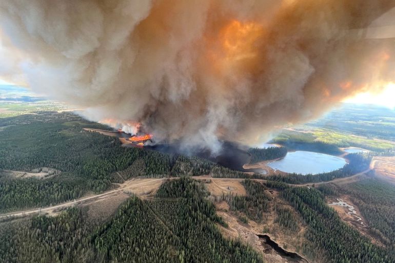
A smoke column rises from a wildfire near Lodgepole, Alberta, Canada
[Alberta Wildfire/Handout via Reuters]
Published On 7 May 2023
Alberta has announced a state of emergency as wildfires flare across the Canadian province, forcing 25,000 people to flee their homes in what a top official said was an “unprecedented” crisis.
Thousands more have been told to be prepared to leave on a moment’s notice, as the number of fires – fanned by strong winds – jumped to 110.
One-third of the blazes were listed as out of control.
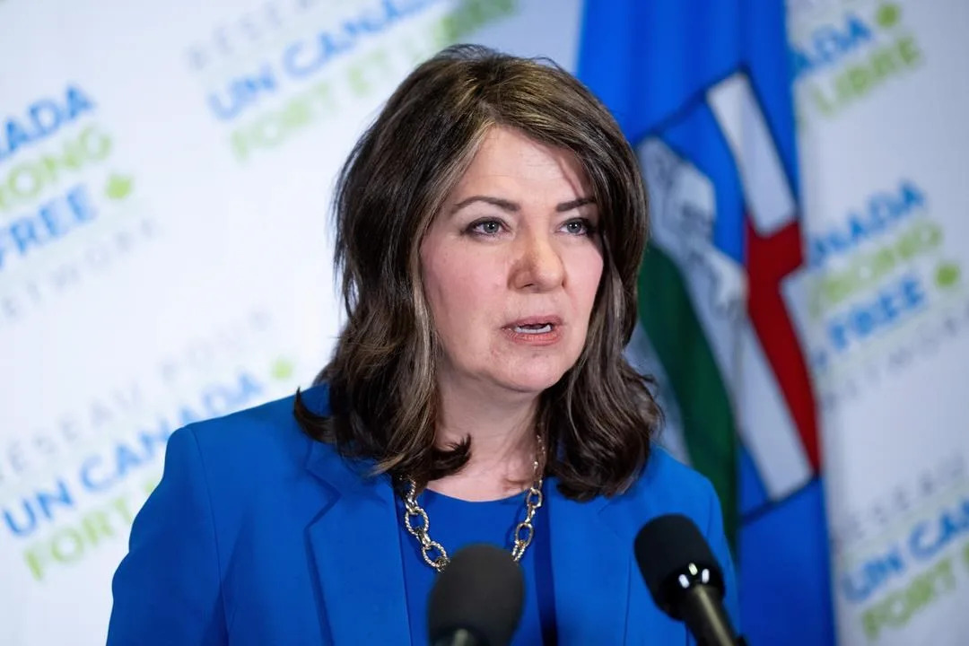
“We’ve declared a provincial state of emergency to protect the safety, health and welfare of Albertans,” the province’s Premier Danielle Smith told a news conference on Saturday after a meeting of her government’s emergency management committee.
Earlier, she said the province – one of the world’s largest oil-producing regions – “has been experiencing a hot, dry spring, and with so much kindling, all it takes is a few sparks to ignite some truly frightening wildfires”.
“These conditions have resulted in the unprecedented situation our province is facing today,” she said.
According to Smith, more than 20 communities have been evacuated and at least 122,000 hectares (301,000 acres) have burned so far.
The state of emergency declaration gives the government of Alberta “greater powers to respond to extreme situations,” she said, including mobilising additional resources and unlocking emergency funds
.
Some 110 fires were active, with 33 of them listed as out of control
[Alberta Wildfire/Handout via Reuters]
Almost all of Alberta – in the midst of an election – and much of neighbouring Saskatchewan province as well as a large swath of the Northwest Territories face extreme fire risks, according to a federal government fire danger map.
Federal Emergency Preparedness Minister Bill Blair tweeted that Ottawa stood ready to provide federal assistance if needed.
Oil sands facilities closely monitored the dangers, but none reported production disruptions.
Drayton Valley, with 7,000 residents – about 140km (87 miles) west of Edmonton – was among the communities evacuated as firefighters battled an out-of-control blaze.
Some 550km (342 miles) north of the provincial capital, a severe fire consumed 20 homes, a general store and a police station in the community of Fox Lake.
Residents were evacuated by boat and by helicopter.
In the town of Edson, which has a population of more than 8,000, residents have also been ordered to “evacuate immediately”.
In recent years, extreme weather has hit western Canada repeatedly, growing in intensity and frequency due to global warming.
Forest fires in Canada’s oil sands region in 2016 disrupted production and forced out 100,000 residents from Fort McMurray, pummelling the nation’s economy.
More recently in 2021, the westernmost British Columbia province suffered record-high temperatures over the summer that killed more than 500 people, as well as wildfires that destroyed an entire town.
That was followed by devastating floods and mudslides.
SOURCE: REUTERS
More than 24,000 evacuate in western Canada as 103 wildfires rage across Alberta 2023/05/06
Officials say more than 100 separate fires are burning across western Canada, prompting the evacuation of more than 24,000 people. - Dreamstime/Dreamstime/TNS
Wildfires raged across western Canada on Saturday, forcing 24,000 people to evacuate their homes, authorities said.
Roughly 301,243 acres burned in 103 separate blazes, said Alberta Premier Danielle Smith.
Forty-five new fires took during Friday and Saturday, said NBC News.
At least 31 of the 92 fires reported Friday were considered to be out of control, said the Alberta Emergency Management Agency.
A total of 24,511 people have been effected by mandatory evacuations across northern and central Alberta.
Another 5,200 have been placed under evacuation alert in what is being described as a “rapidly-evolving situation,” said Smith.
In response to the wildfires, Smith also activated her Cabinet’s emergency management committee, and said the government is prepared to use its emergency powers.
“Our top priority is and always will be public safety and we’re being briefed regularly by the experts who are handling the response,” Smith added.
As of Saturday, 14 Alberta counties and communities had declared states of emergency.
A wildfire in Fox Lake in northern Alberta destroyed 20 homes, a police station and a water treatment plant, reported the emergency management agency.
“This is a stark reminder of just how unpredictable and powerful wildfires can be,” said Stephen Lacroix, the Alberta emergency management agency’s managing director. “I ask you to keep the affected folks in your thoughts today.”
National report reveals Canada's disaster vulnerabilities, risk areas Nathan HowesDigital Journalist Updated on May. 28, 2023
Canada's first-ever disaster report at the national level showcases the threats the country faces, the regions at risk, and what is needed for agencies and people to better handle future catastrophes
On May 11, the federal government unveiled the country's first national-level disaster risk assessment, highlighting the catastrophe threats facing Canada and the current measures and resources in its emergency management systems to address them. The inaugural report addressed three hazards: Earthquakes, wildland fires, and floods, along with a section on the effects of pandemics such as COVID-19.
The goal of the assessment is to help Canadians understand the disaster risks they face so they can prepare for, manage and recover from emergencies, assist all emergency management partners make informed decisions to reduce, prepare for and respond to disasters, and aid in identifying strengths and weaknesses nationally to lessen the impacts of disasters for all Canadians.
“When we understand the risks we face, we can better protect ourselves and our communities from them. The national risk profile is a foundational piece of emergency preparedness work that draws upon scientific evidence and stakeholder perspectives to support decision-making that will strengthen Canada’s emergency management and resiliency to climate-related risks and disasters," said Bill Blair, Canada's Emergency Preparedness Minister, in a press release. The analysis outlined several impacts and findings about earthquakes, wildland fires and floods in Canada.
Earthquakes
Expected direct losses from a large earthquake could be as high as $75 billion
The risks from earthquakes are increasing due to population growth and rising number of people and property density in urban areas, as well as a growing reliance on infrastructure systems
The national risk profile identified gaps in Canada's earthquake resilience including seismic retrofit programs to make existing buildings stronger and more resistant; access to public information; the number of Canadians underinsured or uninsured for earthquake damages; and challenges in the emergency management system and limited access to services in remote, isolated and Indigenous communities
MOST EARTHQUAKES IN BC AND ALBERTA ARE FRACKING QUAKES (FRACKQUAKES)
Wildland fires
The area burned annually by wildland fires has more than doubled since the 1970s. It is predicted that, by 2100, the area burned could double again
The risk of wildland fires will likely increase over time because climate change is creating longer and more intense fire seasons
Current trends point to more people and infrastructure in harm's way in the event of a wildland fire
The report identified the following gaps in Canada's wildland fire resilience including low public awareness and preventive action to protect homes, properties, and neighbourhoods; gaps in scientific knowledge and wildland fire management tools and technologies; inclusion of Indigenous peoples and diverse Indigenous knowledge in wildland fire management and response; and structural resilience to wildland fires, especially in high-risk areas
Floods
The risks from flood events will increase over time due to the impacts of climate change on weather patterns and the increasing number of people living in urban areas
The threat profile identified the following gaps in Canada's flood resilience including co-ordination among governments to manage flood risk; lack of flood risk information that impacts the management of evacuations; low awareness among Canadians of their personal flood risk; and lack of sustained investment in a national flood insurance arrangement and in countrywide infrastructure measures for prevention, like planting trees to prevent erosion
(Jaclyn Whittal/The Weather Network)
The next component to the national risk profile will focus on heat events, hurricanes and space weather. The federal government stated these three hazards were selected given their high impacts on public health, critical infrastructure, the economy, and ecosystems. The full report can be viewed here.
Thumbnail courtesy of Getty Images-1356603199.
Firefighters in east Canada battle ‘unprecedented’ blazes
By AFP Published May 31, 2023 Firefighters with Halifax Regional Fire and Emergency work to put out fires in the Tantallon area of Nova Scotia - Copyright Nova Scotia Government/AFP Handout
Firefighters on Wednesday faced a grueling uphill battle against wildfires in Canada’s Nova Scotia province, including one threatening suburbs of Halifax.
Federal help was coming, officials said, along with firefighters from the United States.
“We’re in a crisis in the province and we want and we need and we will take all the support we can get,” Nova Scotia Premier Tim Houston told a news conference. “These fires are unprecedented.”
Already, additional kit have been shipped in from Ontario, and a dozen water bombers from neighboring regions and the Coast Guard joined efforts to douse the flames and assist with evacuations.
Houston said he has also asked for the military to help out.
Prime Minister Justin Trudeau called the wildfires “heartbreaking,” and vowed unlimited support.
As of Wednesday, 14 wildfires were burning in Nova Scotia, including three out of control. They’ve so far destroyed or damaged more than 200 homes and other structures including a wooden bridge, but no injuries have been reported.
One couple described to public broadcaster CBC having lost both their home and their childcare business. “That’s my life,” a tearful Terri Kottwitz said.
Others said they saw trees on fire in their backyard as they fled with just a moment’s notice.
Evacuee Janis Churchill-Moher told CBC that she didn’t know if her home in the picturesque rural south of the province was still standing.
“Our neighbors have working farms and they just had to pack up their kids, pack up as many animals as fast as they could and run,” she said.
More than 2,000 residents of the area were ordered to evacuate earlier in the week as fires swept through the area.
“It’s a devastating situation for everybody,” she said. – ‘Frustrated and frightened’ –
Smoke from the wildfires blew down the Atlantic coast, prompting air quality alerts for the US state of New Jersey and parts of Pennsylvania, including the Philadelphia area.
David Meldrum of the Halifax Regional Fire and Emergency, pointing to record-high temperatures forecast this week, warned of “a prolonged operation” to bring under control a large fire northwest of the port city that has displaced more than 16,000 residents.
“People are understandably tired, frustrated and frightened,” said Halifax Mayor Mike Savage, adding that “some have no home to return to.”
Houston announced a ban on all activities in Nova Scotia forests, including hiking, camping, fishing, hunting, the use of off-road vehicles and logging.
“For God’s sake, stop burning. Stop flicking cigarette butts out of the car window. Just stop it. Our resources are stretched incredibly thin right now fighting existing fires,” he pleaded after several illegal burns were reported by conservation officers.
Government data shows a decline in the number of wildfires in Canada since the 1980s, likely due to improved fire prevention.
But the past decade also saw more disastrous wildfires scorching a lot more land and displacing many more people — problems set to worsen with climate change.
In recent years western Canada has been hit repeatedly by extreme weather, including floods and mudslides, forest fires that destroyed an entire town, and record-high summer temperatures that killed more than 500 people in 2021.
On Tuesday, 800 residents of Fort Chiepwyan in northern Alberta had to be airlifted to safety as fires beared down on the remote hamlet.
Earlier this month, wildfires in Alberta burned nearly one million hectares of forests and grasslands, and at one point displaced 30,000 people.
Nearly 200 structures damaged in Halifax-area wildfire
Westwood Hills, Tantallon update: The wildfire, estimated to cover 788.3 hectares, is out of control. Firefighters on scene include 170 from the HRM, 32 DNRR staff, 3 helicopters and 1 waterbomber from Newfoundland and Labrador. Source - Nova Scotia Natural Resources and Renewables
Early estimates are that about 200 structures have been damaged in the wildfire in the Upper Tantallon, N.S., area.
CBC News is reporting today that most of the damaged or destroyed structures are single-family homes. Halifax Fire Deputy Chief David Meldrum asked for patience from some 16,400 residents who are anxiously awaiting information about their properties.
He added that fire officials working on compiling information and creating a geographic map with the precise locations of every damaged property, but it will take some time.
Officials are reminding people not to try and return to their homes.
The fire was first reported on Sunday around 3:30 p.m. in the Westwood Hills subdivision off Hammonds Plains Road. The cause of that fire is under investigation, though it is likely that human activity played a role, according to Scott Tingley, the DNR’s manager of forest protection,
“It’s safe to say they have all been human-caused, we haven’t had reports of lightning in the area, so it’s human activity that’s causing them,” Tingley said.
Progress made on out-of-control wildfire
David Steeves of the Nova Scotia Department of Natural Resources said while some progress has been made in fighting the out-of-control wildfire outside Halifax overnight, a change in the weather today is expected to pose a “dangerous” challenge for firefighters.
Steeves said that southwest winds are expected to pick up during the afternoon, and the sun is expected to heat up.
“We are hopeful that we can make some gain today, but we’ll have to wait and see how the environment is going to work with us on that,” Steeves said during a press conference at the incident command center in the community of Tantallon.
“There’s going to be an increasingly dangerous situation for the firefighters that are on the ground. Safety is going to be paramount in all our tactical decisions.”
In an update from Nova Scotia Natural Resources and Renewables, the wildfire, estimated at 788 hectares (1,947 acres), remains out of control at 10:51 a.m. ET. Winds are expected to gust up to 30 kph (19 mph) throughout today, May 30, so fire may spread further this afternoon
‘Wilderness Urban Interface’ wildfires are on the rise across North America
By Karen Graham Published May 30, 2023 The Simi Valley Fire in Southern California was a devastating 2003 wildfire that burned 108,204 acres. and destroyed 37 residences and 278 outbuildings. Credit - U.S. Air Force photo by Senior Master Sgt. Dennis W. Goff, Public Domain
Wildfires that put homes at risk are growing larger and more frequent as people move into transitional zones.
CTV News Canada is reporting on the severe consequences created as the number of wildfires crashing into communities continues to grow.
They cite the 2011 Slave Lake, Alberta wildfire that – despite suppression measures – pushed past fire barriers and destroyed several hundred homes and other buildings. The wildfire burned 4,700 hectares (12,000 acres) and ended up costing $750 million.
Close to one-third of Slave Lake, a community of 7,000 people, was destroyed, with 374 properties destroyed and 52 damaged in the town, and another 59 destroyed and 32 damaged in the surrounding Municipal District.
“I think that was the most shocking time of my entire career and maybe of my life, where you’re so sure that something’s going to work, and then it doesn’t with crushing consequences,” said Jamie Coutts, the former Slave Lake fire chief.
A firefighter for more than 30 years, Coutts said wildfires have been burning “hotter, faster (and) crazier” over the last decade, and “every single person that lives in the forest is on a collision course with something disastrous happening.”
The wildland-urban interface (WUI)
Research suggests that so-called Wildland-Urban Interface wildfires, which occur where forests and flames meet human development, are on the rise. This area is sometimes called a transitional zone. Keep in mind that on Sunday, a WUI fire crashed into Halifax, destroying or damaging dozens of homes in the west of the city.
As the risk of forest fire increases, so does the risk to urban peripheries in Canada that come into contact with wild or forested areas. Following are just two devastating examples:
In 2016, a wildfire forced 80,000 people in Fort McMurray and other parts of northern Alberta to evacuate, destroyed more than 2400 buildings, and caused an estimated $3.8 billion in damage.
2016 Fort McMurray wildfire. Large flames and heavy smoke surround congested Highway 63 South.
Credit – DarrenRD, CC SA 4.0.
In 2018, British Columbia experienced its worst fire season on record forcing 3,200 people to evacuate, and close to another 22,000 to be on alert.
In the United States, which has a much larger population than its neighbor to the north, over 60,000 communities are situated where they are at risk for WUI wildfires.
And between 2002 and 2016, an average of over 3,000 structures per year were lost to WUI wildfires in the United States. In the meantime, people continue to move to parts of the country more likely to burn, raising the odds of catastrophe.
Nowhere is this dynamic more visible than in California, where eight of the largest blazes on record have struck in the past five years. The state now has roughly 5.1 million homes in what’s known as the “wildland-urban interface.”
The rapid growth of housing in flammable areas is a key reason wildfires have become more destructive over time. Not only are the homes themselves more likely to burn, but when more people live near forests and grasslands, there’s also a greater chance that fires will start in the first place.
Friday, May 10, 2024
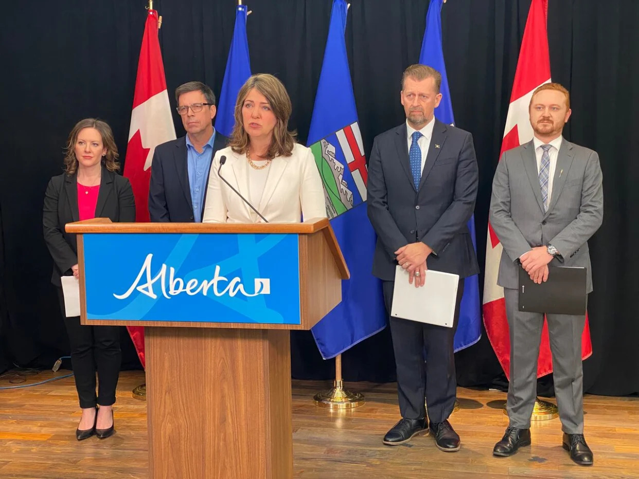
TYRANNY IN LIBERTARIAN CLOTHING New bill would allow Alberta government to take command of local emergencies
CBC Thu, May 9, 2024 Alberta Premier Danielle Smith, centre, says legal changes are required to allow the provincial government to more quickly respond to natural disasters. Ministers with portfolios included in Bill 21 are, from left: Environment Minister Rebecca Schulz, Forestry and Parks Minister Todd Loewen, Smith, Public Safety and Emergency Services Minister Mike Ellis, and Justice Minister Mickey Amery. (Marc-Antoine LeBlanc - image credit)More
The Alberta government wants to give itself new powers to speed its response in managing forest fires, floods, droughts and other emergencies.
Bill 21, tabled Wednesday by Public Safety and Emergency Services Minister Mike Ellis, proposes several amendments to the Emergency Management Act and five other pieces of legislation.
If passed, the legislation would also move Alberta's fixed provincial election date to Oct. 18, 2027, about five months later than the currently scheduled date of May 31, 2027.
At a news conference, Premier Danielle Smith said the record-setting May 2023 wildfires coincided with a provincial election campaign, which made the emergency difficult to manage.
"It was bizarre for ministers and other candidates to have to go through these motions while so much of Alberta was burning and so many Albertans were out of their homes," Smith said.
Cabinet ministers lacked access to government information and devices during the campaign period, while they were tasked with making rapid and high-stakes decisions, she said.
Election dates in October are less likely to conflict with natural disasters in the province, she said.
During the writ period, the provincial government goes into "caretaker mode," limiting the power of elected officials and handing responsibilities to top civil servants.
Some candidates running in areas affected by the spring 2023 wildfires temporarily suspended campaigning to respond to the crisis. Elections Alberta moved some polling stations to accommodate evacuees.
A new election date also necessitates changes to the legislation governing senate elections and campaign financing, which are also included in the bill.
The growing threat of natural disasters such as larger, more ferocious wildfires prompts the need for the province to be able to rapidly assume command of a local emergency, Smith said.
If passed, Bill 21 would allow the government to take over emergency management in a municipality or region if local leaders ask for more help, become overwhelmed and unable to respond, and where local priorities are at "cross purposes" with the province, said briefing notes provided to reporters.
The government could also do this without the blessing of local leaders.
The bill would also require local authorities to provide more information to the province during a local state of emergency.
Government officials like Alberta Premier Danielle Smith and Edmonton Mayor Amarjeet Sohi visited wildfire evacuees at the Edmonton Expo Centre on Sunday.
Government officials including Alberta Premier Danielle Smith and Edmonton Mayor Amarjeet Sohi visited wildfire evacuees at the Edmonton Expo Centre in May 2023. ( Wildinette Paul/Radio-Canada)
Smith said local authorities asked for these measures, saying the province was too slow to react to past disasters.
"Everybody's come to the same conclusion — that we can't sit back and wait for the fire to jump the border and burn down Slave Lake or burn down Fort McMurray or potentially burn down Drayton Valley," she said.
Alberta Municipalities president Tyler Gandam said in an interview Tuesday afternoon that municipalities asked for extra resources and help during the 2023 wildfire season, but he's unaware of any municipality asking for the province to take control of the emergency response.
Bill 21 is the third piece of legislation the government has tabled in the last month without consulting first with municipalities, despite having potentially profound effects on municipalities, Gandam said.
The organization needs time to understand what problems the government is trying to solve with this latest bill, he said.
Although Wednesday's announcement did not make reference to the role of climate change leading to more catastrophic natural disasters, Smith said the government does have to be concerned about climate change, but must also send a message to the public to be cautious when burning garbage, lighting campfires or driving vehicles that could lead to wildfires.
More control to respond to fire and floods
If passed, the bill would give the provincial government the authority to fight fires on any Crown land, including land that is outside its forest management area. Right now, it would be a municipality's responsibility to battle a blaze on Crown land within its borders, although it can ask for provincial help.
The bill would clarify the province's power to fight fires in Alberta's eight Métis settlements.
The bill would also authorize firefighting crews to remove private buildings or fences if they need to build a fireguard to protect a community.
Although Alberta has never had to declare an emergency under the Water Act, past floods and currently parched land are prompting government officials to prepare for that possibility. The government says it needs to be able to control the flow of scarce water to prioritize human and animal health and safety.
If the province declares a water emergency, the bill would allow cabinet to decide how to prioritize water use in an area, and when water licence holders can and cannot divert water.
Right now, the legislature must pass a bill to move water between major basins. Bill 21 would allow the province to move water during an emergency.
Some drought or flood mitigation initiatives could also skip approval processes during an emergency, and emergency decisions would be protected from appeal.
People responding to the emergency could also go onto private land and temporarily place equipment, such as hoses.
Alberta NDP Leader Rachel Notley told Albertans that they pension "was not safe" during a press event held Thursday.
Alberta NDP Leader Rachel Notley questions the UCP government's motivation for moving the province's fixed election date four-and-a-half months later. (CBC News)
Bill could give government more time in power
NDP Leader Rachel Notley, who was premier from 2015 to 2019, said government leaders lose some access to information during an election campaign, but that lack of information is "not quite the problem that they're trying to claim it is" during an emergency.
Ministers would still have access to emergency briefings from staff during a campaign. Top public servants could give media briefings instead of politicians, she said.
Notley said the government should have consulted with the Opposition before proposing a timing change, or moved the fixed election date to October 2026. She said the proposed move, which could potentially extend the UCP's rule by more than four months, is "self-serving and opportunistic."
Alberta Municipalities president Gandam questioned why the election date change was necessary more than three years in advance of the next provinicial election. Alberta to shift the fixed election date to fall when natural disaster risk is lower
The Canadian Press Thu, May 9, 2024
EDMONTON — Alberta is moving its election date from the spring to the fall to avoid clashing with major natural disasters -- but the Opposition says in doing so, Premier Danielle Smith’s government is conveniently granting itself six extra months of power.
Smith’s United Conservatives introduced a bill Thursday to move the scheduled vote date from the fourth week of May every four years to the third week of October.
That would mean the next election will be Oct. 18, 2027, a time when there is less risk the province will face wildfires, droughts and floods.
Smith told reporters last year’s election was a prime example of the dilemma as her government had to campaign while also fighting fires and organizing evacuations.
She had to be careful to not appear to be using the crisis to boost her profile while also needing to raise her profile to get the word out to Albertans on what was happening with the fires.
"Running an election parallel to this crisis made a difficult situation more challenging," Smith said prior to the bill being introduced in the house.
She noted she and her ministers faced the threat of fines from Elections Alberta for using government resources during the campaign.
"I also found myself answering questions about the election at wildfire briefings as well as questions about wildfires at campaign events," said Smith.
An election requires the government go into caretaker mode, while cabinet ministers are still technically in their posts.
Last year's record-breaking wildfire season saw almost 30,000 people forced from their homes by early May, days after the spring election campaign had officially kicked off.
NDP Leader Rachel Notley said given climate change is making natural emergencies more frequent, she is not opposed to reconsidering the fixed election date.
But she said Smith could have looked at going to the polls earlier than the current date, such as February 2027 or October 2026.
"Giving themselves an extra six months seems very self-serving and opportunistic from a government that has a strong record of being very self-serving and opportunistic," Notley told reporters.
Notley said if the problem is a need for proper communication, the government could instead have had public servants lead public emergency updates.
The bill, if passed, would also give the province the authority to quickly take over local emergency response efforts in what it considers extreme circumstances.
That includes situations where the municipality becomes overwhelmed or is working at cross purposes with the province.
Smith said if the province had that authority last season, they could have stepped in sooner to help fight jurisdictions, particularly those that threatened to stretch across local jurisdictions.
Forestry Minister Todd Loewen said the legislation is about providing clarity to powers that already exist.
"This isn't about taking over or trying to control municipalities. They still have the right to be there, and we still respect that," he said.
The legislation would allow cabinet, during emergencies, to direct water use and make "temporary low-risk" water transfers between major water basins.
The proposed legislation comes after two other pieces of legislation have already sparked backlash from municipalities over concerns the province is making an unnecessary power grab.
One bill would give the province gatekeeping power to veto federal funding deals with cities and towns. Another would give Smith's cabinet the power to fire councillors and overturn local bylaws.
Tyler Gandam, the head of Alberta Municipalities, which represents Alberta towns, cities and villages, said he was still examining the bill but has concerns.
"Once again, another bill was introduced and tabled without consultation with municipalities," said Gandam.
This report by The Canadian Press was first published May 9, 2024.
Lisa Johnson, The Canadian Press
Sunday, March 08, 2026
Canadian drinking water at risk long after wildfires, UBC study warns
Canada’s drinking water can remain at risk long after wildfires burn out, according to a UBC-led global review that found water-quality impacts often emerge months or years later—not just immediately after a fire.
Researchers analyzed 23 studies across 28 watersheds worldwide, comparing pre- and post-fire levels of sediment, nutrients, metals, organic carbon, ions and wildfire-fighting chemicals. Across climates, contamination often intensified over time, particularly when storms or snowmelt washed stored ash and debris into rivers.
The findings carry particular weight for Canada, where wildfire activity has intensified. In 2023, over 15 million hectares burned, more than twice the previous national record.
Alberta studies show long-lasting impacts
The review focused on studies tracking water quality for at least six months to determine whether impacts fade or grow.
“The same delayed contamination pattern kept appearing,” said Raúl de León Rábago, study author and master’s student in civil engineering.
After the 2016 Fort McMurray wildfire, rivers showed elevated sediment, nitrogen, phosphorus and lead even where less than one-quarter of the watershed had burned. The Regional Municipality of Wood Buffalo increased annual treatment chemical spending by roughly $500,000 to manage wildfire-related changes in raw water.
In Alberta’s southern Rockies following the 2003 Lost Creek wildfire, phosphorus and nitrogen remained high for years. Floods in 2013 washed stored ash and soil back into rivers, causing phosphorus levels to jump to seven to nine times higher, with some increases persisting more than 14 years downstream. Similar long-term effects have been documented internationally.
“Imagine emptying a bucket of ash into a bathtub,” said Dr. Qingshi Tu, assistant professor in the faculty of forestry and environmental stewardship. “When the water is stirred, the ash resurfaces. That’s what can happen in watersheds after large fires.”
Smoke and firefighting chemicals add to risk
Across the reviewed studies, wildfire activity increased sediment, nutrients, heavy metals and polycyclic aromatic hydrocarbons—chemicals formed when vegetation and other materials burn. Smoke can also carry contaminants into unburned watersheds.
Canada relies heavily on long-term fire retardants such as Phos-Chek in B.C. and Alberta. These products contain nutrients and trace metals that can fuel algal blooms and raise treatment costs. After the Fort McMurray wildfire, higher chemical dosing was required to treat wildfire-affected water.
Protecting communities through long-term monitoring
Researchers note that water utilities’ ability to respond depends on fire intensity, duration, size, what burned, weather conditions and treatment system design. Not all systems have equal capacity to adapt, and smaller communities with limited budgets face greater risk from prolonged post-fire impacts.
The team is developing a model linking wildfire behaviour, smoke and river systems to help Canadian utilities anticipate multiyear risks. They say fire-prone provinces such as B.C. and Alberta need coordinated long-term water monitoring and preparedness planning, especially when fires burn near drinking water sources.
“Canada is entering a new era of wildfire risk,” said Dr. Loretta Li, senior author and UBC civil engineering professor. “If we want to protect drinking water, we have to treat wildfire impacts as long-term, not short-term.”
Researchers at Lund University have produced the most detailed map of carbon emissions from Swedish forest fires to date. The results show that the largest emissions occur below the ground surface, in peat and organic soils.
During the extremely hot summer of 2018, 324 forest fires were reported in Sweden. Using field measurements, models, and data from the Swedish Forest Agency, the Swedish Environmental Protection Agency, and the Swedish Meteorological and Hydrological Institute, researchers have now mapped where and why the carbon was released.
The study shows that emissions from intense above‑ground fires are overestimated in fire databases. Emissions from deep organic soils and peatlands, on the other hand, are underestimated - during the summer of 2018 by as much as 50 percent. These smoldering underground fires are rarely visible in satellite images, but can release very large amounts of carbon.
“What looks dramatic from above is not always what affects the climate the most. The significantly large emissions actually occur silently underground,” says Johan A. Eckdahl, forest fire researcher at Lund University and the University of California, Berkeley.
In boreal forests - the coniferous forest region that stretches around the Northern Hemisphere - more carbon is stored than exists in the atmosphere today. A large portion is found in deep peat soils that have built up over thousands of years. When these soils dry out and ignite, they can continue to burn below the surface for long periods. This means that traditional methods used in today’s fire databases, which rely on the size of the burning area, smoke density, and visible fire intensity, risk missing a crucial part of forest fires’ climate impact.
A telling example is the comparison between the 2018 year of fires and the 2014 forest fire in Sala, Sweden. Despite the total burned area being much larger in 2018, the results show that the Sala fire alone released roughly as much carbon as all 324 fires in 2018 combined.
“What matters is where it burns. A fire in deep peat soils can have a greater climate impact than hundreds of more intense fires on land with thin soil layers,” says Johan A. Eckdahl.
The study also provides new perspectives on forestry and land use. The high‑resolution maps show certain patterns suggesting that recently clear‑felled areas could serve as pathways for fire to spread into older, carbon‑rich forests and wetlands. The researchers also conclude that population density plays an important role in enabling early containment of high‑intensity fires. There were also some indications that early firefighting efforts and active forest management can reduce fire damage.
The researchers believe that the findings have relevance far beyond Sweden’s borders. If emissions have been underestimated during a Swedish year of fires of the scale seen in 2018, it raises the question of how large emissions may have been during recent extreme fires in North America and Siberia in 2021. In the latter case, adequate baseline data is lacking, making it difficult to calibrate satellites and models.
“Satellites that show burning above ground are important for understanding where underground burning will begin. However, we need to combine satellite overviews with field work. Only then can we understand how much carbon is actually released, and how to best protect the most vulnerable carbon stores in a warming climate,” concludes Johan A. Eckdahl.


