Saturday, August 29, 2026


Off-equatorial warming triggered air–sea antagonism that suppressed 2024 La Niña


Institute of Atmospheric Physics, Chinese Academy of Sciences
Upper panel illustrates Bjerknes feedback sustains La Niña; lower panel shows Off-equatorial warm pools generate westerly anomalies, suppressing La Niña in 2024. 

image: 

Upper panel illustrates Bjerknes feedback sustains La Niña; lower panel shows Off-equatorial warm pools generate westerly anomalies, suppressing La Niña in 2024.

view more 

Credit: Jiayi Shen


ENSO (El Niño-Southern Oscillation), the dominant interannual air-sea oscillation, shapes worldwide seasonal weather. Unfortunately, its prediction skill has declined since 2000, especially for weak neutral events like the 2024 case. Most climate models overestimated the intensity of cold ENSO conditions that year, sparking a critical forecasting conundrum. Early spring ocean subsurface cooling initially favored La Niña, yet the event stalled and stayed neutral, confusing most multi-model ensembles.

Addressing this bias, Prof. Fei Zheng's research team from Institute of Atmospheric Physics, Chinese Academy of Sciences, China, carried out a new study revealing that off-equatorial Pacific warming acts as the core factor halting La Niña development, delivering key insights to mitigate systematic forecast biases. These results were recently published in Atmospheric and Oceanic Science Letters.

The team used the ENSO Ensemble Prediction System and pattern clustering to split 100 March 2024 forecast members into best and worst performers for comparison. The analysis found clear air-sea decoupling from May to July. Off-equatorial warm sea surface temperature anomalies in the northeastern and southeastern Pacific induced equatorial westerly wind anomalies via wind-evaporation-SST feedback. These westerlies blocked cold ocean signals from spreading eastward and broke the Bjerknes feedback, arresting La Niña at an early stage.

Poor-performing simulations failed to capture subtropical warming, generating fake strong cooling and overestimating La Niña intensity. Extra tests with GloSea6 and grouped ensemble samples further verified this conclusion.

"Subtropical Pacific signals are decisive for ENSO phase shifts, yet most models poorly represent them," said Dr. Jia-Yi Shen. The team will refine ensemble forecasting frameworks to fully integrate off-equatorial ocean signals, aiming to deliver more reliable seasonal climate predictions for disaster prevention.


El Niños more intense over last 40 years than previous 1,000, according to U-M study


University of Michigan

Galápagos coral colony 

image: 

The Galápagos Islands are known for their astounding biodiversity, a result of high nutrients and the mixing of cool and warm waters, according to Julia Cole, chair of the University of Michigan Department of Earth and Environmental Sciences.

view more 

Credit: Credit: Courtesy photo, Greg Asner


ANN ARBOR—As an El Niño of historic proportions is taking shape in the tropical Pacific, a University of Michigan study has found that El Niño events have become nearly 40% stronger in the last 40 years than they were in the pre-industrial era.

In fact, the study, which examined modern and ancient corals in the Galápagos Islands, found that El Niño events in the last four decades were stronger than any in the 1,000 years prior to about 1850, when humans began impacting the climate with greenhouse gases.

"We don't see a time in the past where El Niños have been as strong as today, and we show that the strength of El Niño changes in parallel with the warming of global temperature," said lead author Julia Cole, professor and chair of the U-M Department of Earth and Environmental Sciences. "Our findings tell us that the big El Niño events of the last 40 years are not normal in the context of the last thousand years."

El Niño is a natural phenomenon that, every few years, causes the tropical Pacific to become warmer than usual. Under normal conditions, trade winds blow along the equator from east to west. This pushes warm water from South America toward Australia. But when the trade winds weaken, warm water spreads eastward, back towards South America, kicking off an El Niño event. 

The atmospheric circulation responds, as strong rainfall shifts from Indonesia into the central Pacific, leaving the western Pacific in drought. This weakens the trade winds further, locking in El Niño conditions that can persist for one to two years. These temperature and precipitation fluctuations originate in the tropical Pacific, but they affect weather all over the world. 

Storm tracks over the U.S. shift southward, bringing more rain to the desert southwest and less to the northwest. Similar shifts around the world lead to droughts and flooding that bring disease, crop failure, wildfires and other crises that impact people's health and well-being.

"The question is not whether the current El Niño is going to happen, but how bad is it going to be, and how bad will the impacts be?" Cole said. "This event is superimposed on global warming, and it's likely to supercharge the temperature increase that we would normally see from greenhouse gases. There are forecasts that we might get as hot as 1.7 or 1.8 degrees Celsius above pre-industrial temperatures, which is quite a bit higher than the current record."

The findings, published in Science, were supported by the U.S. National Science Foundation and the United Kingdom Natural Environmental Research Council.

A history written in coral

To examine historic El Niño patterns, Cole and fellow researchers sampled cores from 13 corals, including living colonies and boulders of ancient coral, from the Galápagos Islands. Corals grow one to two centimeters per year by secreting layers of calcium carbonate. The chemistry of these layers provides a record of the seawater temperature in which the corals grew. 

El Niño extremes occur every few years, so the researchers focused on core samples that spanned at least 20 years. Sampling the cores a millimeter at a time, the group measured two aspects of the coral skeleton's chemistry. They analyzed the ratio of the elements strontium to calcium, which depends on the temperature at which the coral grew, and supplemented these results with analysis of the ratio of oxygen isotopes, also a measure of temperature at this site. 

They were left with a history of variations in temperature in the Galápagos—a location, Cole says, where El Niño has its largest impact. They saw that strong El Niños occurred in the last 40 to 50 years, whereas the El Niños prior to that time period showed "a pretty consistent pattern of lower intensity El Niños."

"We kept adding records thinking well, this is going to get more complicated, but it really didn't," Cole said. "This is such a clear story."

Confirming the connection

The researchers then examined whether natural processes could have caused similar intensifications of El Niño over the past thousand years. To do this, they used climate models that simulate the last thousand years using histories of volcanic eruptions and solar variability. The models found no large shifts in El Niño that suggested natural processes could create such large changes. 

Cole says their findings underscore the need to mitigate more global warming.

"El Niño is a really big source of climate extremes, and so if it's getting stronger, the impacts are getting stronger. Impacts like droughts, floods, wildfire and food insecurity," she said. "Changes in the hydrologic cycle also lead to issues like damage to infrastructure: floods that wipe out homes, highways or railroads, or to health effects, such as diseases like cholera. 

"We believe global warming is supercharging El Niño, and if that's true, then we expect stronger climate extremes that will amplify ecological, infrastructural and human losses. No country has the resources to be fully protected from these impacts. This is one more reason we need to move away from fossil fuels, the root cause of the problem." 

The Galápagos National Park and the Charles Darwin Research Station in Galápagos also provided support for the research. Cole's co-authors include U-M researchers Kelsey Dyez, Cameron Tripp, Jonathan Overpeck and alumnus Jake Okun; University of Arizona researchers Diane Thompson and Marcus Lofverstrom; Samantha Stevenson-Karl of the University of California, Santa Barbara; University of Edinburgh researcher Sandy Tudhope; Colorado College researcher Allison Lawman; University of Illinois researcher Jessica Conroy; Gloria Jimenez of Moody's Risk Management Services; and University of Minnesota researcher R. Lawrence Edwards.


Ancient coral 

Ancient corals like these at Urvina Bay in the western Galápagos preserve a history of ocean temperature going back millennia.

Credit

Julia Cole, University of Michigan


Turkey’s defence ministry hires Trump and Israel-linked lobbyist Ballard on $2.4mn contract

Turkey’s defence ministry hires Trump and Israel-linked lobbyist Ballard on $2.4mn contract
Mind your step. Turkey’s defence ministry has hired a fit lobbyist in Washington, DC. / @BallardFirm

By Akin Nazli in Belgrade August 28, 2026

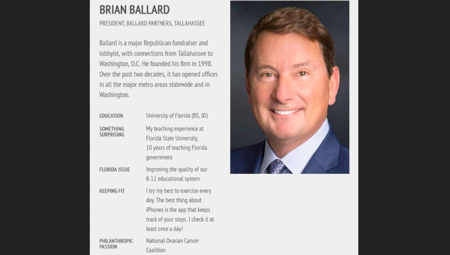
Turkey’s defence ministry has signed a $2.4mn year-long contract with Washington, DC-based Ballard Partners led by Brian Ballard, Middle East Eye reported on August 26.

Ballard is a Republican fundraiser in Florida. His firm is currently the top-earning lobby shop in the US capital. It generated more than $30m in federal lobbying revenues in 1Q.

Filings with the US justice department reveal the firm will receive $200,000 per month to provide “government relations services, strategic consulting and advocacy” to the Turkish ministry as well as to monitor congressional developments.

The contract runs from August 15, 2026 to August 14, 2027. Additional expenses will also be billed to the Turkish defence ministry.

Speculation says F-35s on agenda

Given that the hiring party is the defence ministry, Middle East Eye speculated that the task in hand is to secure F-35 fighter jet purchases from the US for Turkey. However, no official information is available on the matter.

The F-35 saga has run for around a decade. Turkey was among the partners developing the fifth-generation fighter jets, the most advanced such stealth aircraft in the world. However, the US ended the Turkish role in the programme and took away Ankara's right to acquire F-35s after Turkey's Erdogan administraton defied its wishes by buying S-400 missile defence systems from the Kremlin following the failed coup attempt made against President Recep Tayyip Erdogan in 2016.

To this day, analysts are unsure of what truly drove Erdogan to make the headline-grabbing military hardware acquisition from Vladimir Putin's Russia. Ankara keeps the missile systems inactive.

Donald Trump has lately indicated he may act to remove the ban on selling F-35s to Turkey, but there is a lot of opposition in Congress to any such change in policy and Turkey's regional rival, Israel, which itself deploys F-35s, is fiercely opposed to any such threat to its air supremacy.  

Old customer

This is not the first time Ankara has turned to Ballard’s firm. In 2017, during Trump’s first term in office, Turkey awarded Ballard Partners a $1.5mn contract. It was one of the first big deals secured by Ballard following the opening of his lobbying outfit. In 2018, Turkey renewed the contract for $0.75mn.

Media reports suggested that the 2017 contract centred on mitigating fallout from a US sanctions-evasion case brought against Halkbank (Istanbul/HALKB), a Turkish government-run lender. The US justice department under the Trump administration ultimately dropped the charges against the bank in June.

In 2019, US title Courthouse News reported how Turkish lobbying expenditures in the US ballooned during the first Trump presidency. An investigation by the publication studied the US Justice Department’s foreign lobbying database to identify the five largest recipients of money linked to the Turkish government between 2014 and 2018: Amsterdam & Partners, Ballard Partners, Gephardt Group, Greenberg Traurig and Mercury Public Affairs.

It found that their budgets, along with those of their subcontractors, more than quadrupled collectively, from more than $1.7mn in 2014 to more than $7.3mn in 2018.

Pro-Israel circles

To execute the mandate, Ballard has assembled a bipartisan team with extensive connections to influential establishment figures. It includes Robert Wexler, a former Democratic congressman from Florida who co-founded the Congressional Caucus on US-Turkey Relations and maintains strong links to pro-Israel circles in Washington.

The account team also features Thomas Boodry, a former special assistant to Trump and senior director for legislative affairs at the National Security Council. Boodry was dismissed from his White House post in April 2025 during a purge of officials following an intervention by far-right activist Laura Loomer, who presented opposition research accusing several staff members of disloyalty to the president.

Syl Lukis, a senior partner and close associate of Ballard, will also advise on the account.

Ballard Partners’ network of alumni includes White House chief of staff Susie Wiles and former attorney-general Pam Bondi.


Survivors of Guinea's deadly landfill collapse say authorities ignored warnings

Two days after a deadly landfill collapse in Guinea, rescuers are using giant excavators to search for victims. Anger is rising among residents, who say they had warned authorities that the rubbish dump was precarious.


Issued on: 25/08/2026 - RFI

Residents and rescue workers use an excavator to search for bodies following a landslide that occurred overnight at the Dar-es-Salam landfill in Conakry, Guinea, on 23 August 2026. AFP - -


The landfill collapse occurred in the early hours of Sunday in the Guinean capital Conakry's Dar es Salam neighbourhood, following heavy rain.

At least 31 people were killed, more than 20 injured and several homes were destroyed.

Rescue workers using excavators were at the site on Monday to search for victims and the area was cordoned off by security.

Around 358 people affected by the landslide were sheltering at a school in the city's Dixinn Centre neighbourhood, Lancei Toure, director general of the National Agency for Humanitarian Emergency and Disaster Management (ANGUCH), said on Monday.

Some 72 households were assessed as still directly at risk of harm, and those living in dangerous areas were told to evacuate, he said.

Housing, food, clothing and healthcare are being provided, the agency said, with a mobile clinic to be set up and mobilisation of a psychological and social support team.

Prime Minister Amadou Oury Bah visited the scene on Sunday. He said measures were being taken "to ensure medical care for the injured" and "assistance for those affected by this tragedy".
Toxic waste

Meanwhile, residents said they had previously tried to alert Guinea's authorities to the danger.

"We young people did everything to prevent this. We organised meetings and invited officials, but they didn't take the matter seriously", Abou Hamza, a local resident who serves as a youth community leader, told French news agency AFP at the scene.

"The state failed to take steps to close the dump. Yet they had promised us they would a year ago."

In the days prior to the collapse, the government had announced operations to evacuate residents and secure the area surrounding the landfill due to the risk of landslides, especially in the long rainy season.

The government has been planning to close the landfill for several years – not only because it frequently collapses (nine people lost their lives there under similar circumstances in 2017) but because it is also a major source of pollution.

Fires are regularly lit there, as there is no other way to dispose of the waste, and the resulting toxic smoke poisons the air in the surrounding area.

To address the problem, a project to build a new landfill in the commune of Coyah, on the outskirts of Conakry, was launched in 2022.

Cellou Dalein Diallo, a leading Guinean opposition figure and former prime minister currently living in exile, described Sunday's collapse as "a tragedy that plunges us into dismay".

In a Facebook post, exiled former Guinean president Alpha Condé wrote that "the dignity and safety of [our] most vulnerable populations" must be protected. "Guinea is in mourning today," he added.

Guinea has been under junta rule following a coup in 2021, led by General Mamadi Doumbouya, who was elected president in December 2025.

(with AFP)
Algeria mourns wildfire victims as firefighters battle deadly blazes

Algeria entered a second day of national mourning on Friday as firefighters continued to battle wildfires in the north of the country that have killed at least 12 people and injured dozens.


Issued on: 28/08/2026 - RFI

A man walks along a road bordering a forest scorched by a wildfire in Jijel, northeast Algeria, 27 August, 2026. © AP

President Abdelmadjid Tebboune declared three days of national mourning on Thursday and cancelled all cultural events and sporting competitions.

“With a heavy heart and a soul in mourning at the tragedy of the loss of our fellow citizens,” Tebboune said in a statement announcing the mourning period.

Five people died in Jijel province, four in Bejaia and three in Tizi Ouzou, Interior Minister Said Sayoud said on Wednesday. Another 54 people were being treated in hospital for burns, including six in a serious condition.

Fires still burning

Algeria’s civil protection service said on Thursday morning that 46 fires were still burning out of 193 recorded over the previous 24 hours.

Videos shared online overnight on Wednesday showed fires engulfing large areas as residents were trapped by the flames. AFP was not immediately able to verify the footage.

Three major roads connecting regions in eastern Algeria were closed because of forest fires near the cities of Bejaia, Jijel and Setif, the gendarmerie said.

Weather conditions were complicating firefighting operations, the interior ministry said.

“Adverse weather conditions, rising temperatures, strong and intense winds, and high concentrations of smoke prevented the continued deployment of aircraft in the fire-fighting operations,” Sayoud said on Thursday.
Extreme heat

Three Algerian cities were at the top of a global list of the highest temperatures, with Bouchegouf reaching 49.8C, the latest data published by international weather portal Eldorado Weather showed.

Forest fires occur regularly in northern Algeria during the summer, but climate change is amplifying their impact by causing increasingly frequent droughts and intense heat.

More than 30 people were killed in July 2023 when fires tore through thousands of hectares of forests and farmland, as well as hundreds of homes, in the area around Bejaia.

Authorities recorded nearly 2,000 fires nationwide in July this year.

Neighbouring Morocco is also living through an intense heatwave, with temperatures reaching 49C.

(with newswires)


How a glacier collapse may have triggered the Nepal-Tibet disaster

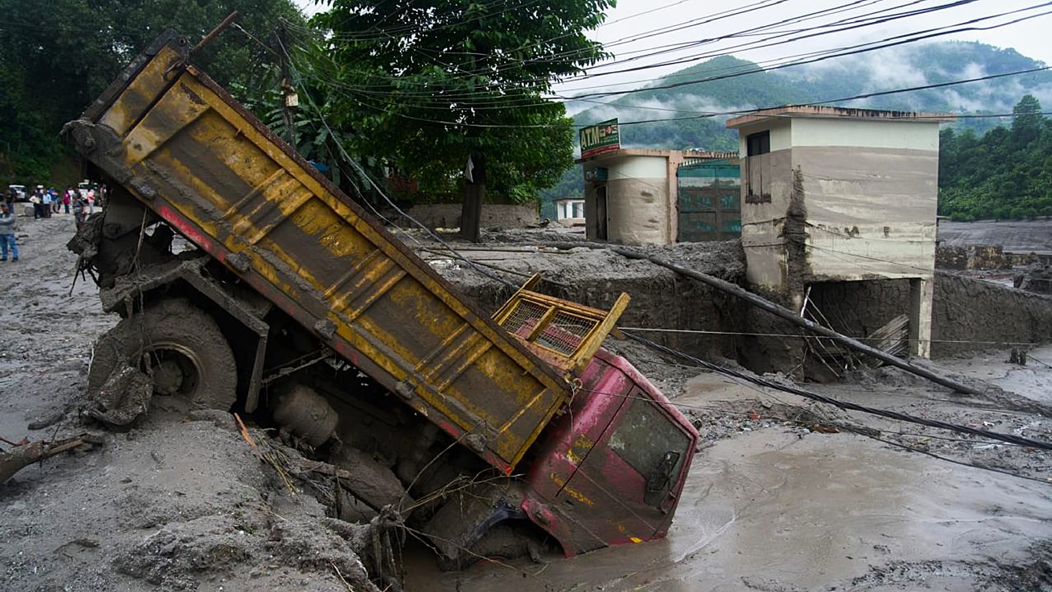
A vehicle is seen in the aftermath of a flash floods in Devighat in the Nuwakot district in Nepal. Thursday, 27 Aug., 2026.
Copyright Niranjan Shrestha/Copyright 2026 The AP. All rights reserved.

By Greta Ruffino
Published on

While individual glacial events cannot be directly attributed to climate change, experts say rising global temperatures are putting increasing pressure on glaciers.

A massive piece of ice that fell thousands of metres from a glacier into a river below may have triggered the disaster in Nepal and Tibet.

Scientists are still piecing together information from satellite and ground-level data to figure out exactly what happened to cause the flood, which killed at least 353 people and left more than 1,300 missing, including foreigners and pilgrims.

"A large chunk of glacier fell from about 5,200 metres into a valley," said Simon Cox, principal scientist at New Zealand's GNS Science.

It "transformed into this raging mass of debris... where it picks up rocks and sediment and trees and anything in the way and fires it on down through the canyon," he told AFP.

The wall of water first hit a border post, with CCTV footage showing mud and debris engulfing the area as people fled. It then travelled downstream into Nepal, flooding villages and destroying bridges and buildings.

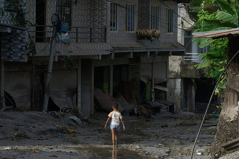
A child walks in mud in the aftermath of a flash floods in Devighat in the Nuwakot district in Nepal, Thursday, 27 Aug., 2026. Copyright 2026 The Associated Press. All rights reserved.

What caused the wall of water?

Early speculation suggested a glacial lake outburst flood (GLOF), which occurs when a barrier holding back glacial meltwater suddenly collapses and releases the water downstream.

"Water does flow within glaciers and flows beneath glaciers," said Adrian McCallum, a glaciologist at the University of the Sunshine Coast.

"But to my mind, the only reason why a large volume of water should all of a sudden flow down a valley is because it has been released," he told AFP.

However, other experts said they found no existing glacial lakes near the site of the collapse. They suggested that water may instead have accumulated beneath the glacier and been released as the ice fell.

Another possibility is that the falling ice temporarily dammed the river, allowing water to build up before being suddenly released.

Summer glacier melt and monsoon rains may also have already raised river levels, while debris and mud picked up along the way further increased the volume of the flow, according to Cox.

Water levels across the flood-affected region rose by as much as nine metres in just 30 minutes following the surge from the glacier collapse, according to researchers at a Kathmandu-based climate research group.

“It was a huge rise, a huge surge of water that happened suddenly,” Saswata Sanyal said.

The glacier collapse was powerful enough to register as a magnitude 5.2 seismic event at 8:37 am (4:52 am CEST) and was initially mistaken for an earthquake.

After further analysis, the US Geological Survey determined that the event was a glacial collapse and debris flow and that no earthquake had occurred.

How satellites helped reconstruct the disaster

With much of the affected area inaccessible, experts are using satellite imagery and available ground measurements to reconstruct the disaster

"We can look at satellite imagery taken before and after the event, and try and see what has changed, essentially looking for what is missing from the mountains in the 'after' imagery," said Lauren Vargo, a glaciologist at New Zealand's Victoria University of Wellington.

Shortly after the seismic activity was recorded, a nearby water monitoring station stopped transmitting, according to Nepali authorities.

Stations downstream then began going offline one by one. Water levels in Kalikhola, near the Tibet border, reached up to 12.3 metres at 2:14 pm (10:29 am CEST), authorities said.

Why warnings may not have been enough

Nepali authorities first received reports of flooding at around 9:00 am local time (5:15 am CEST) and warned communities along the Bhote Khoshi river to "stay on high alert and stay in safe areas".

However, it remains unclear how many people received the warning or how much time they had to respond.

"The reality is, if you are in a community underneath a large glacier and potentially a glacier lake where a GLOF could occur, then to some extent, it's a ticking time bomb," said McCallum.

Even for those who received a warning, options would have been limited, said Hatim Sharif, a hydrologist at the University of Texas San Antonio.

"Running will not help," nor will trying to flee by vehicle, he told AFP, because the mud and water moving at high speed form a lethal combination "like liquid concrete."

The only solution is to climb up a hill, at least six metres, he estimated.


INTERVIEW


Nepal’s deadly glacier collapse exposes climate risks across the Himalayas


A massive glacier collapse that triggered deadly flooding on the Nepal-Tibet border has exposed the growing dangers facing the rapidly warming Himalayas, where scientists say retreating ice and thawing ground are making mountain landscapes increasingly unstable.


Issued on: 27/08/2026 - RFI

A drone view shows mud covering buildings and property following a flash flood in Trishuli, in the Nuwakot district of Nepal, on 27 August 2026. © REUTERS - Navesh Chitrakar

Scientists are still investigating what caused Wednesday's collapse and say it is too early to attribute this particular disaster to climate change.

But rising temperatures are already changing glaciers, glacial lakes and permafrost across the region, increasing the risk of destructive events involving ice, rock and water.

The disaster began when a huge mass of ice and rock fell from a glacier high in the Himalayas and temporarily blocked the Lhende Khola river. When the blockage gave way, water, rock and debris surged downstream, devastating communities along the Nepal-Tibet border.

The US Geological Survey initially recorded a magnitude 4.4 earthquake in the area, but later concluded that no earthquake had occurred. Instead, the glacier collapse and debris flow generated the seismic signal, which was later measured as a magnitude 5.2 event.

Hundreds of people have been killed and more than 1,000 remain missing. Water levels on the Trishuli River at Galchhi rose by as much as nine metres in just 30 minutes, according to the International Centre for Integrated Mountain Development, or ICIMOD.

The disaster comes as the Hindu Kush Himalaya region undergoes rapid changes. ICIMOD says glacier ice-loss rates across the mountain range have doubled since 2000, while permafrost is degrading and snow patterns are changing.

Prashant Baral, a cryosphere analyst and permafrost research consultant at ICIMOD in Kathmandu, spoke to RFI about what may have triggered the disaster, how climate change is reshaping the Himalayas, and the risk of another collapse.

RFI: What do scientists know about the causes of the massive landslide and floods on the Nepal-Tibet border?

Prashant Baral: We analysed the satellite images today [Thursday], and we can see that there has been a rock-ice avalanche. The possible trigger could have been a glacier collapse or bedrock failure or climate change-related conditions, but we cannot ascertain that as of now.

What we can say for sure is that there was a huge mass of debris, rock and ice that fell down from the glacier and it temporarily blocked the river channel. And then the dam was breached. And then this led to a deposit of debris downstream, which affected the settlements and infrastructure downstream. All of this happened within a very short period of time.

RFI: Can you give us more information about the amount of material involved?

PB: Regarding deposits, we need to do further investigations to precisely ascertain what volume of deposits came down the valley and then got deposited downstream. But as of now, it seems that there were millions of cubic meters of rock, ice and debris that fell down and blocked the river channel, but then were subsequently mixed with the river water. And then they moved downstream and flooded the settlements and infrastructure.

RFI: Did this phenomenon cause an earthquake, or did an earthquake cause the movement in the mountains?

PB: I cannot say for sure whether the earthquake resulted due to the event or that the earthquake caused the event. But it could have been that due to this massive rock avalanche, an earthquake of small size could have occurred, or vice versa. I cannot ascertain this for now.

RFI: The US Geological Survey has said the collapse of the glacier caused an earthquake.

PB: If you look at the volume of deposits that have come downstream and the volume of the mass movement that has occurred, it is significantly large. And it's quite likely that that could have triggered an earthquake of that magnitude on the Richter scale. But we will know more for sure in the coming days.


Mud covers houses and a road after deadly flash flooding in Trishuli, Nuwakot district, Nepal, on 26 August 2026. © Navesh Chitrakar / Reuters

Preserving the planet's glaciers is a 'matter of survival', says UN

RFI: Is this big landslide or ice slide a result of climate change in the Himalayas?

PB: Like I said before, we would require detailed investigation of temperature records and other details to ascertain this event or attribute this event to climate change. But we've seen in the past that one thing we can say for sure is that climate change has led to increase in temperature, and this rise in temperature has caused changes in the cryosphere and the components of the cryosphere – such as glaciers, glacial lakes, permafrost. And due to these changes in these cryosphere components, the likelihood of the occurrence of these kind of events is growing. So the frequency and magnitude of these events certainly can be associated with the increase in temperature.

RFI: Is there a risk of another landslide of rocks, debris and ice occurring in the same area?

PB: If we look into the trigger of this event, it occurred due to the failure of the glacier tongue [a floating platform of ice attached to the front of marine-terminating glaciers that extend into the sea]. But whether the bedrock failure led to the collapse of the glacier tongue or vice versa, we understand that the ground is quite unstable for now. So we would certainly need to monitor this area in the immediate future, because as of now, it seems that the mass movement has made the area unstable.

We cannot deny the possibility of occurrence of similar events in the future. Having said that, the magnitude and scale of this event is quite rare in the Himalayan region. Monitoring is extremely necessary to see if the ground is still unstable and if we have to prepare ourselves for another event, even if not of this scale, but of a smaller scale, and yet quite devastating.

Himalayan glaciers melting 65 percent faster than previous decade: study

RFI: There is still an obstruction that could contain rocks, ice or water. Could it collapse and release them?

PB: We haven't looked into the detail of that. But given the amount of rock, ice and debris that has fallen into the valley, I believe if all of that amount has already been released, due to the water channel, then a certain volume of that debris and rock and ice would still be remaining in the river channel and would require monitoring in the coming days.

RFI: Is this kind of climate-related risk threatening people across the Himalayan region?

PB: You can see that. There's quite a contradiction that [on the one hand there's] the increase in temperature, our cryosphere is changing and the grounds are becoming unstable, the glaciers are retreating, and the deglaciated landscapes are quite unstable. And then there’s the formation of these glacial lakes, and their volume is expanding.

But on the contrary, the infrastructure and the settlements are moving up into the mountains.

These two things are occurring together. Climate change can cause changes in the cryosphere and then contribute to the occurrence of these kind of events. If you look into these details, then certainly climate change is threatening the lives and livelihoods of people in the Himalayan region.

RFI: Why are settlements moving up into the mountains?

PB: Settlements for tourism and also infrastructure such as hydropower are being built. And when hydropower is built, then there is also a community there.

This interview by Lucile Gimberg has been edited for clarity.