DHADING, Nepal (AP) — Authorities in Nepal warned of possible fresh flooding on Sunday and urged residents in flood-affected districts to remain on high alert after water levels rose in the Bhotekoshi River.
Flood warning notices were sent to people’s phones early Sunday as rescue crews worked to clear a major highway connecting Kathmandu to one of the areas worst hit by Wednesday’s catastrophic floods, which killed at least 800 people and left more than 3,000 missing in Nepal and Tibet.
The latest warnings came after Chinese authorities informed their Nepalese counterparts of increased water flow upstream, according to Dharam Raj Uprety, chief executive of Nepal’s National Disaster Risk Reduction and Management Authority.
The Chinese state news agency Xinhua, citing the country’s water resources ministry, said a new lake formed after Wednesday’s floods high in the mountains had largely drained.
But Xinhua said the ministry warned that a crater located 5.6 kilometers (3.5 miles) upstream, which held an estimated 1.4 million cubic meters (370 million gallons) of water, still posed some risk and required close monitoring.
Nepal’s disaster agency said Sunday the death toll had climbed to 788 with 2,502 missing, while Chinese authorities reported 16 deaths and 546 missing on the Chinese side of the border.
The missing include hundreds of people from over a dozen countries who were in the region to work, visit the mountains or make a pilgrimage to a sacred peak. On Sunday, Chinese state media said 261 foreigners were missing in Tibet, including over a hundred Nepalis and others from around the world.
Some are returning to what remained of their homes
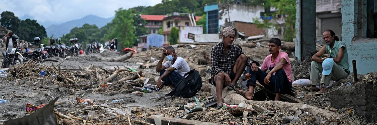
In Dhading, one of the worst-hit regions in Nepal, some residents began returning to ruined homes to see what can be salvaged.
Residents sat in homes with walls washed away by the floods, shoveling sludge-like mud and rubble off balconies or window frames. Others scanned the ground for items they could pick out of the mud and rinse off. One man had returned for his chickens, which he found alive. He tied them up and put them in the cabin of his truck.
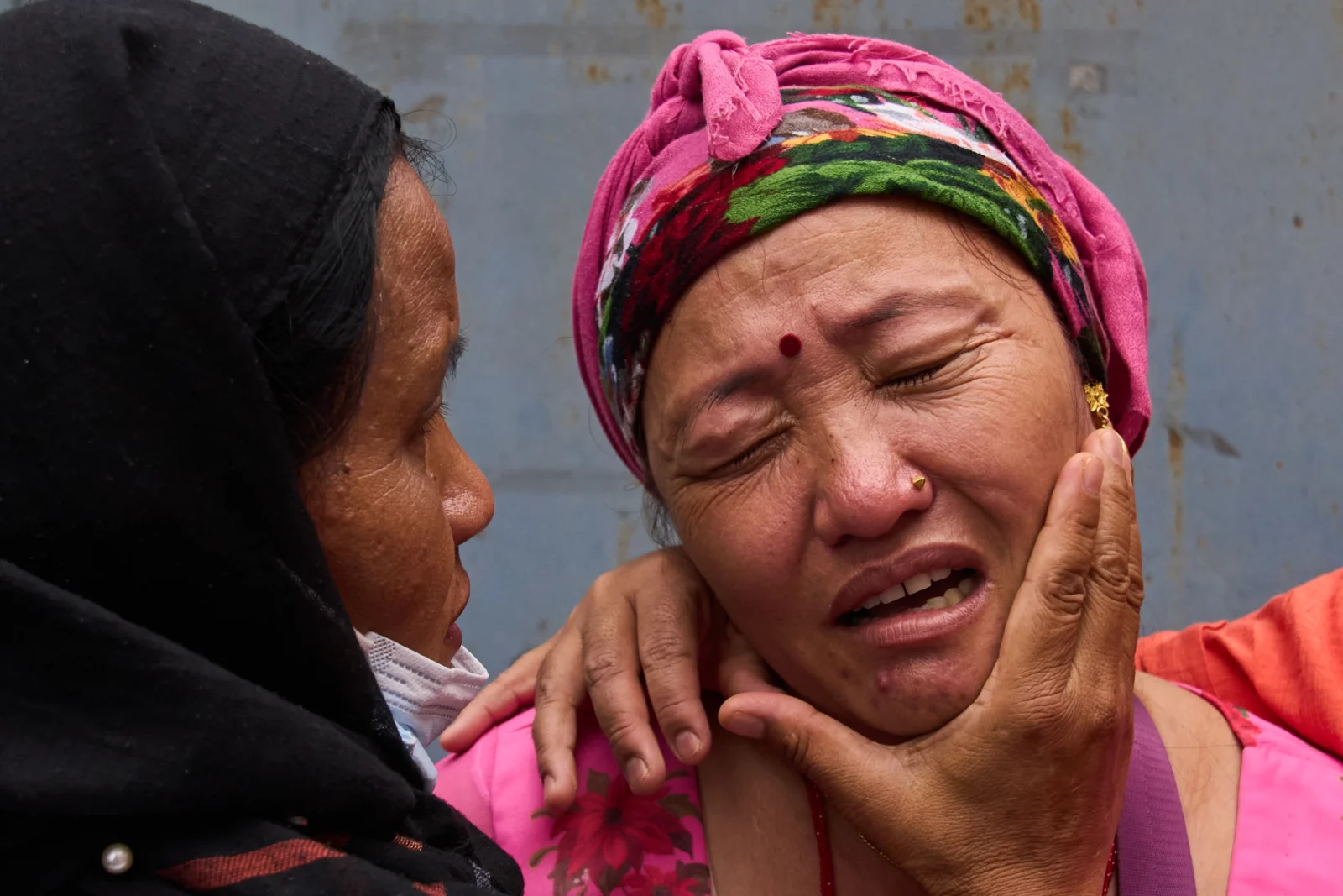
“Everything is finished. Nothing is left. Not even our home,” Sharmila Tamang, a Dhading resident who was trying to salvage items from her home, told The Associated Press.
At a key power plant that was severely damaged by the floods, workers started inspecting the facilities Sunday to survey the destruction. The plant serves over 20,000 people across four districts.
In the town of Galchhi, a group of residents sought higher ground on a nearby bridge and watched as the river roared by. Some pointed to enormous rocks washed downriver during the earlier floods, while others standing on a suspension bridge were warned off with whistles.
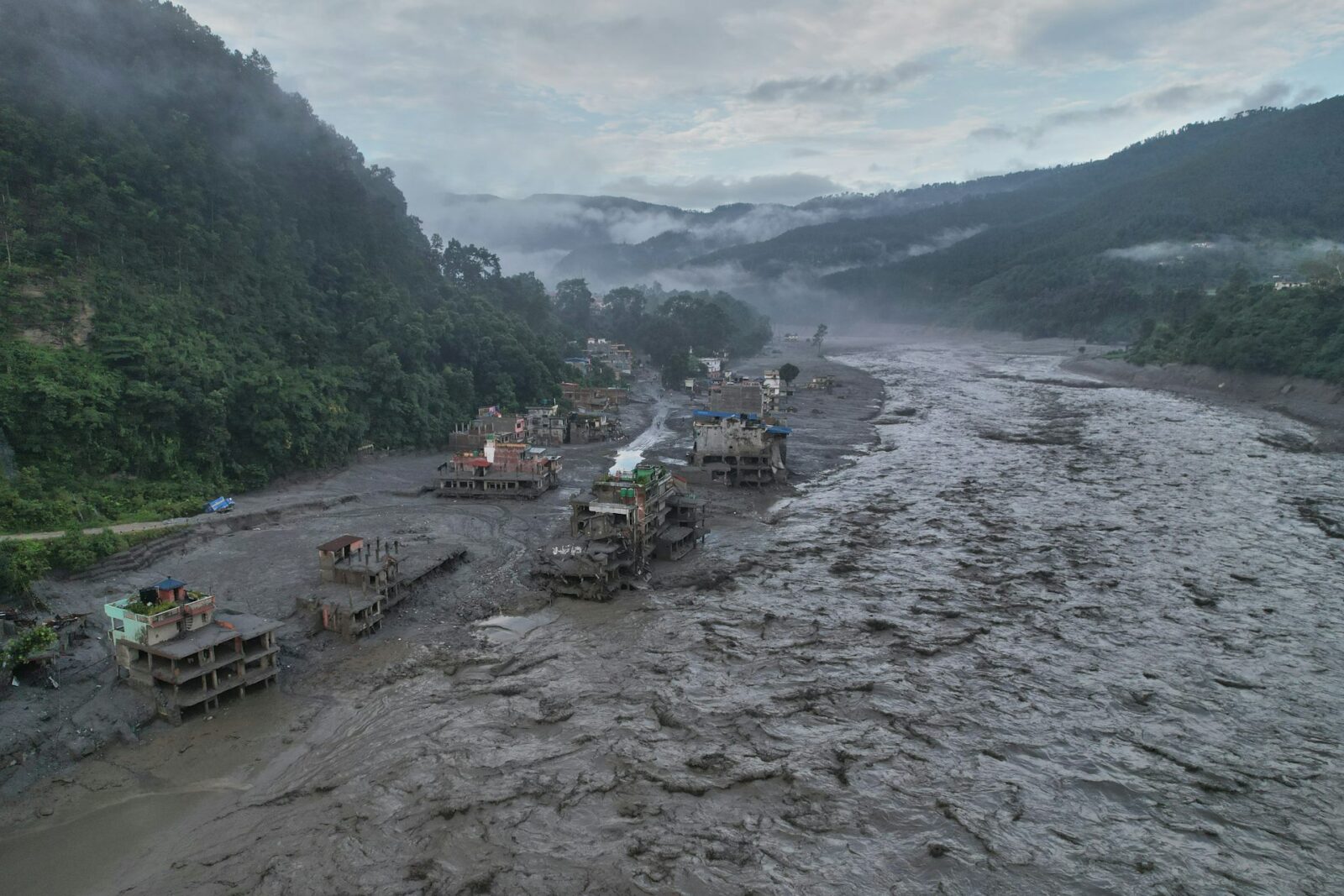
Along the river, homes, vehicles and farm tractors could be seen jutting from the thick gray-brown sediment that enveloped entire villages in some areas. Parts of rice terraces along the riverside had dropped into the river after landslides hit them.
Residents are receiving constant flood warnings
Homes and businesses left intact after the flooding were still without electricity on Sunday, as twisted power line poles and wires lay tangled in the mud.
Residents of flood-hit villages said they were struggling to make sense of near-constant alarms they’ve received since the initial floods.
“Sometimes they say a flood is coming, then we have to run again to higher ground, even at night. There is also rain,” said Govind Shreshta, a resident. “It’s really difficult for me. I have a 72-year-old father and 70-year-old mom. I must carry them and I am exhausted. It’s going on like this for those who are still alive.”
Large concrete and smaller suspension bridges were destroyed, leaving communities on the other side of the river with less easy access.
“Those who are there are now stuck there. Those who are here are stuck here. It’s going to be very difficult,” said Sattan Singh Tamang, 47, who was working near a bridge when Wednesday’s floods came.
Minister says Nepalis have become victims of climate change
Wednesday’s flash floods started after a glacial collapse high in the Himalayan region. Scientists who studied satellite images said bedrock underneath a glacier high in the Himalayan region had collapsed, taking part of the glacier with it. The rockfall was so extreme that it registered as a magnitude 5.2 earthquake.
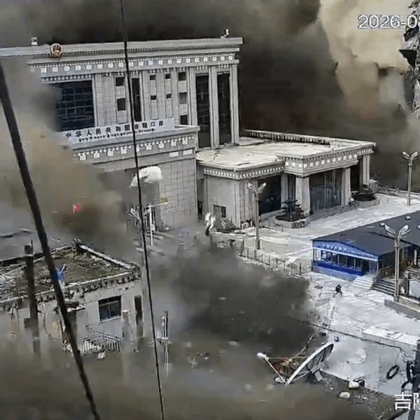
The rocks and melted water then swelled the rivers in the valleys below, causing a torrent of water that swept buildings, bridges and earth downstream in Tibet and Nepal.
Nepal’s foreign minister called for a global response to climate change, saying Nepal was bearing a disproportionate share of its impact.
“Despite having only 0.1% contribution to the global emissions, people of Nepal have become major victims of climate change,” Shisir Khanal said Saturday.
Scientists have said it is too early to draw a direct connection between global warming and Wednesday’s catastrophe. However, they said that as Earth’s temperature rises because of human activities such as burning oil, gas and coal, the chances of such disasters increase, especially in the Himalayan mountains, which are warming considerably faster than many other parts of the world.
Meanwhile, Malaysia’s Prime Minister Anwar Ibrahim said Sunday his country will send a search-and-rescue team to Nepal to assist with relief efforts and help evacuate Malaysians affected by the disaster.
Malaysia has also pledged $1 million in financial aid to Nepal, he said in a statement.
___
Associated Press writers Aijaz Hussain in New Delhi and Shristi Kafle in Kathmandu, Nepal, and video journalist Shonal Ganguly in Dhading, Nepal, contributed to this report.
(The Conversation) — Hundreds of pilgrims traveling to Mount Kailash were among those affected by devastating floods that struck the Nepal–Tibet border on Aug. 26, 2026. The floods destroyed the border crossing most commonly used to reach what is arguably the most revered holy mountain in the world, which sits in the Tibet autonomous region of China.
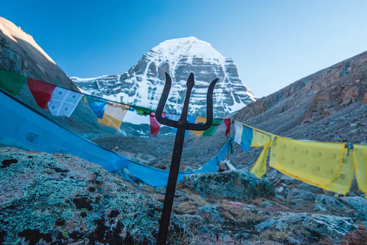
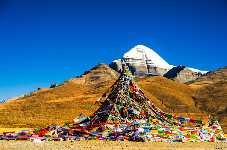
Hindus know the peak as the dwelling place of the god Shiva, Tibetan Buddhists as the abode of the deity Demchok, and Jains as the site where Rishabhanatha, their first spiritual teacher, achieved liberation. Today it also draws nonreligious travelers, who come for the harsh beauty of the landscape and the difficulty of the journey itself. Pilgrims and travelers do not climb Kailash. Instead, they walk a path roughly 33 miles around its base, which many believe to provide blessings and purification.
The legend of Kailash goes back thousands of years, to ancient Indian traditions describing a mountain at the center of the universe. But for most of that history, the Kailash of Indian literature was not associated with the peak that pilgrims travel to now.
In 2025, I published a book about Tibetan pilgrimage to Kailash. While researching it, I learned that it took centuries for a mythical mountain to become identified with this particular peak in western Tibet.
Kailash as legend
Indian religious texts describe a range of snowy mountains to the north called the Himalaya, or “abode of snows.” Beyond them, Indian cosmologies described a cosmic mountain called Meru, believed to stand at the center of the world.
The historian Alex McKay writes that the earliest mentions of a mountain named Kailash – Kailasa in Sanskrit – appear in the Hindu epics, composed roughly between the 4th century B.C.E. and the 4th century C.E.
In the “Ramayana,” an epic recounting of the god-king Rama’s search for his abducted wife, the monkey king Sugriva describes the far-off north, including Mount Kailash and Mount Meru. In the “Mahabharata,” an epic of dynastic war, the prince Arjuna visits a hermitage located on Mount Kailash.
However, these epics do not provide a specific location for Kailash. They portray it as a forbidding mountain realm of sages and gods, not as a pilgrimage destination for humans. The Mahabharata lists sacred places pilgrims should visit – sites across northern and western India – but Kailash is not among them. In fact, the epic states repeatedly that mere mortals cannot travel to the Himalayas.
It is in the “Puranas,” a body of Hindu religious texts composed between roughly the 3rd and 10th centuries, that Kailash is described as the abode of Shiva. The Puranas also begin to describe Kailash as the earthly form of the divine Meru. But it is still not a place of pilgrimage and still not fixed to a particular point on the map.
Kailash as physical place
Eventually, though scholars do not know exactly when, local traditions in North India began to identify particular peaks as Kailash. At least five different mountains, in the states of Jammu, Himachal Pradesh and Uttarakhand, have been claimed as the Kailash, and local pilgrimage to them continues today.
As Buddhism spread from India to Tibet beginning in the 7th century, Tibetans inherited Buddhist scriptures that spoke of Meru, Kailash and other sacred mountains. They also had their own long-standing practices of mountain veneration, making offerings to mountains that were believed to be the homes of local deities. Among them was the mountain now known as Kailash in western Tibet.
A mountain claimed
Tibetan traditions record that the geographical site of Kailash was claimed by practitioners of more than one religious tradition, and that the 11th-century saint Milarepa converted it to being a Buddhist site after defeating a non-Buddhist rival in a contest of magical power.
In the centuries that followed, Kailash became known as a particularly auspicious place to meditate and to visit on pilgrimage. Tibetans believed that while the mountain was the dwelling place of the deity Demchok, its true nature was only visible to the spiritually advanced. Any pilgrim who visited Kailash, known to Tibetans as Gang Rinpoche, would obtain blessings.
Even in Tibet, however, Kailash was only one pilgrimage site among many. Far more pilgrims visited the capital city of Lhasa.
The first clear reference to Indian Hindu pilgrims visiting the Tibetan Kailash comes in 1670, according to McKay, although earlier visits are possible. Its identity as the Kailash was not fully settled until the Indian subcontinent came under British colonial rule in the 19th century. Geographic surveyors mapping the border regions traced the sources of rivers such as the Indus to areas near Kailash. This matched ancient descriptions of Kailash as giving rise to rivers, and so the identification stuck.
By the 19th century, a small but steady flow of pilgrims traveled from India and Nepal, usually alongside the trade caravans crossing the Himalayan passes.
A pilgrimage closed and reopened
After China asserted control over Tibet in 1950, China and India negotiated official pilgrimage routes in a 1954 agreement. That arrangement did not last long. In 1959, a Tibetan uprising against Chinese rule was suppressed, and the Dalai Lama – the spiritual leader of Tibetan Buddhism – fled to India; religious life inside Tibet was severely restricted in the following years. In 1962, India and China fought a war over their disputed border, after which the border closed to Indian pilgrims for nearly two decades.
Routes reopened in 1981, and Tibetans were permitted to resume pilgrimage as well. But since then many Tibetans have found it difficult to obtain the necessary permits, and others have criticized excessive construction of hotels and roads at Kailash.
Most pilgrims today travel with private tour companies. Demand this year ran well above the Chinese government’s quota of 24,000 permits for Indian pilgrims. The Indian government also sponsors an official pilgrimage, with participants chosen by lottery, but places are limited to 1,000 people. Pilgrimage by Indian travelers had reopened only in 2025, after being suspended since 2020 because of COVID-19 and a deadly clash between Indian and Chinese troops in the Galwan Valley over the still-disputed India-China border.
Today, Kailash receives more pilgrims than at any point in its history. Most travelers from India now fly to Kathmandu and continue by bus through Gyirong, a road crossing between Nepal and Tibet that was expanded in 2014 and opened to international travelers in 2017. It became the most popular route after the 2015 earthquake damaged the main alternative. It was this crossing that the August 26 floods destroyed.
(Catherine Hartmann, Associate Professor of Religious Studies, University of Wyoming. The views expressed in this commentary do not necessarily reflect those of Religion News Service.)




.JPG)