Sunday, March 22, 2020


2019: The Year Fracking Earthquakes Turned Deadly

The first fracking-induced earthquake to claim human lives shows why magnitude may underestimate the danger such earthquakes pose.


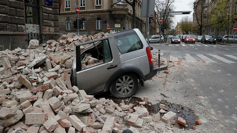
Image credits:Inked Pixels/Shutterstock

Friday, February 21, 2020 - Nala Rogers, Staff Writer

(Inside Science) -- On Feb. 25, 2019, an earthquake shook the village of Gaoshan in China's Sichuan Province, leaving 12 people injured and two dead. New research indicates the earthquake and its two foreshocks were likely triggered by hydraulic fracturing, also called fracking. If this is true, it would mark the first time in history that a fracking-induced earthquake has killed people.

The study shows why magnitude, the most common way of reporting earthquake size, could lead people to underestimate the true threat fracking-induced earthquakes might pose. The Feb. 25 earthquake was only a magnitude 4.9, which would not traditionally be considered very dangerous. But it was able to destroy older and more vulnerable buildings because it was so close to the surface -- only about one kilometer deep according to the new study. That's shallow even by fracking standards, but fracking-induced earthquakes do tend to be much shallower than natural ones.

"The shallower it is, then for the same magnitude of earthquake, the stronger the shaking," said Hongfeng Yang, a seismologist at the Chinese University of Hong Kong and senior author of the study. The findings are not yet published, but Yang and graduate student Pengcheng Zhou presented them last December at a meeting of the American Geophysical Union in San Francisco.
How it happened

Fracking involves drilling wells in shale deposits, then pumping in water and other additives at high pressure to break the rock and release trapped oil. In some regions fracking can trigger earthquakes by causing faults in the rock to slip. The slipping happens either because fluids seep into the fault itself, or because the weight or volume of the fluid presses against the fault indirectly, said Thomas Eyre, a seismologist at the University of Calgary in Canada.

Most fracking operations in North America don't cause earthquakes, and the earthquakes that do occur have generally been small. Some media reports have attributed damaging earthquakes in Oklahoma to fracking, but experts believe most of those earthquakes were caused by wastewater that oil and gas developers disposed of by injecting it deep underground. Some of the wastewater included fluids used during the fracking process, but most of it came from ancient underground aquifers, according to Mike Brudzinski, a seismologist at Miami University in Oxford, Ohio. The oil beneath Oklahoma is naturally mixed with large volumes of water, and developers must filter out the water before they can sell the oil.

Western Canada has experienced a few moderate-sized fracking earthquakes with magnitudes up to about 4.5, but they mostly occurred in remote locations far from major human settlements. And even in western Canada, only about one in 300 fracking operations causes earthquakes large enough for a person to feel, said Eyre.

"In North America at the moment, we haven't had any hydraulic fracturing-induced earthquakes that have actually caused any damage," said Eyre.

It's a different story in China, however. Several recent studies have shown that the fracking boom that began in about 2014 is triggering destructive earthquakes in formerly tranquil parts of China's Sichuan basin. For example, a magnitude 4.7 earthquake on Jan. 28, 2017, a magnitude 5.7 on Dec. 16, 2018, and a magnitude 5.3 on Jan. 3, 2019 were all caused by fracking, according to published research. The 2018 earthquake injured 17 people and damaged more than 390 houses, nine of which collapsed.

The deadly February 2019 event included a magnitude 4.9 main shock and two smaller foreshocks of magnitudes of 4.7 and 4.3. Using seismic sensors and satellite data, Yang, Zhou and their colleagues found that the foreshocks occurred on a previously unknown fault located within half a kilometer of a fracking well. The foreshocks were between 2.5 and 3 km underground, the same depth where fracking is typically conducted in this region. The main shock struck about eight hours later, on a different, shallower fault a short distance away. The findings suggest that the first two earthquakes and the fluid pumped during fracking may have combined to change the pressures in the rock, causing the second fault to slip.

"It looks to me like some very solid research," wrote Art McGarr, a seismologist with the U.S. Geological Survey in Menlo Park, California, in an email, after reviewing a digital copy of the researchers' poster. McGarr has studied induced earthquakes extensively, and was one of the researchers who conducted a recent paper attributing prior Sichuan Basin earthquakes to fracking.
Shallow depth increases danger

The magnitude 4.9 earthquake last February damaged buildings in Gaoshan in part because the buildings were old and not designed for earthquake safety, said Yang. The location was densely populated and didn't have a history of dangerous earthquakes, so it was highly vulnerable.

But even so, the earthquake would have been less damaging had it occurred 5 to 20 km underground, as most natural earthquakes do, according to Brudzinski. Instead, it occurred about a kilometer underground, with hardly any rock to absorb the shock before it reached the surface. Most fracking-related earthquakes are less than 5 km deep.

"We always pin everything on the magnitude, so that can be kind of misleading," said Pradeep Talwani, a geophysicist at the University of South Carolina in Columbia. According to Talwani, people in Gaoshan probably felt more shaking from the shallow magnitude 4.9 quake than someone in Seattle would feel from a natural magnitude 6.5 earthquake that struck deep beneath their feet.

Magnitude is a measure of the total amount of energy released during an earthquake, and researchers estimate it by calculating the surface area of a fault and the distance it has slipped, said Brudzinski. What actually matters to a person on the surface is how much the ground they're standing on shakes and how that affects structures around them -- a concept known as intensity, which researchers estimate using a variety of scales. Intensity depends in part on the earthquake's magnitude, but also on its depth, lateral distance away, and the types of rock and soil in the area.

"Right now, most regulations are still based on the magnitude. But there's a recognition now, a growing recognition, that the true risk is related to what kind of structures are there, what kind of soil they're built on, how shallow those earthquakes might be," said Brudzinski.
Deadly earthquakes continue

After the Feb. 25 earthquake that killed two people in Gaoshan, the local government halted fracking, said Yang. But in surrounding parts of the Sichuan Basin, fracking continues. According to online reports by the China Earthquake Administration, several more damaging earthquakes struck the region later in 2019:

• A magnitude 6.0 on June 17 in Changning County that killed at least 13 people and injured 220

• A magnitude 5.4 on Sept. 8 in Weiyuan County that killed one person and injured 63

• A magnitude 5.2 on Dec. 18 in Zizhong County that injured at least nine

Yang, Zhou and their colleagues have not yet analyzed these earthquakes, and according to Zhou, it is not yet clear whether they were fracking-induced. The Chinese government has denied that the June 17 earthquake that killed 13 people was caused by fracking, according to reporting by Reuters. A recent study suggested it may have been triggered by a combination of salt mining and a previous fracking-induced quake.

Despite multiple attempts over several weeks, Inside Science has been unable to obtain comment from anyone affiliated with the China Earthquake Administration regarding either the earthquakes in 2017, 2018 and early 2019 or the more recent ones that haven't yet been analyzed in detailed studies. The administration has reported greater depths for Sichuan Province earthquakes than would be expected if they were caused by fracking. However, those numbers don't match up with the shallow depth estimates from detailed studies, including Yang and Zhou's research and several published studies that included China Earthquake Administration researchers as authors.

Yang said he wasn't surprised that the depth estimates differ. He explained that the China Earthquake Administration's online reports use estimates that are generated automatically using a network of stationary seismic sensors and a general-purpose model. He claimed that his own study and other studies that have pinpointed shallower depths are much more accurate. That's because they use additional data sources and models that are customized for specific locations, he said.

It's unlikely that any of the earthquakes highlighted in this story occurred naturally, according to McGarr. The northeastern edge of the Sichuan basin has long been prone to earthquakes because it is bordered by a large, active fault. But the fracking is happening further to the south and east, where natural earthquakes are rare.

"It used to be a very stable region," said Yang.

Researchers in the U.S. are taking note. No fracking-induced earthquakes in North America have exceeded magnitude 5 so far, and they may still be unlikely to do so, given differences in the local geology, said Brudzinski. But most are quite shallow, only about 2-4 km belowground.

In the past, said Brudzinski, researchers have debated whether there might be something about the fracking process itself that keeps earthquakes small, ensuring some measure of safety despite the shallow depth. The recent tragedies in China suggest that people shouldn't depend on that as a safeguard.

"To me, that has been sort of the most important aspect of what I've seen from China," said Brudzinski. "It suggests that, yes: We can have some larger-size events."

Editor’s Note: Yuen Yiu contributed additional reporting to this story.


Nala Rogers is a staff writer and editor at Inside Science, where she covers the Earth and Creature beats. She has a bachelor’s degree in biology from the University of Utah and a graduate certificate in science communication from U.C. Santa Cruz. Before joining Inside Science, she wrote for diverse outlets including Science, Nature, the San Jose Mercury News, and Scientific American. In her spare time she likes to explore wilderness.

Earthquakes in India at three-year high in 2019
SPECIAL CORRESPONDENT NEW DELHI MARCH 05, 2020
A girder of the under-construction Jehangir Chowk-Rambagh flyover slipped off pillars near Aloochibagh due to the earthquake that shook Kashmir in Srinagar on January 31, 2018.A girder of the under-construction Jehangir Chowk-Rambagh flyover slipped off pillars near Aloochibagh due to the earthquake that shook Kashmir in Srinagar on January 31, 2018.


A girder of the under-construction Jehangir Chowk-Rambagh flyover slipped off pillars near Aloochibagh due to the earthquake that shook Kashmir in Srinagar on January 31, 2018. | Photo Credit: NISSAR AHMAD


The Indian subcontinent has suffered some of the deadliest earthquakes globally, with more than 60% of its land area prone to shaking of intensity VII and above

A total of 768 earthquakes of magnitude 3.0 and above were located by the National Seismological Network from 2017 to January 31, 2020 according to a response to a question in the Rajya Sabha this week.

There were 226 earthquakes in 2017, 203 in 2018, and 309 earthquakes in 2019. Earthquakes of magnitude 4 and above nearly doubled from 78 in 2018 to 159 in 2019, the response from the Union Earth Sciences Ministry revealed.

India has been grouped into four seismic zones, that is, Zone II, III, IV and V. Zone V is considered to be the most seismically active, while Zone II is the least so.

The Indian subcontinent has suffered some of the deadliest earthquakes globally, with more than 60% of its land area prone to shaking of intensity VII and above on the Modified Mercalli Intensity scale.

Extremely vulnerable

The Himalayan belt is particularly susceptible to earthquakes exceeding 8.0 magnitude, with Jammu and Kashmir considered extremely vulnerable. The Indian plate consists of India and Pakistan and the vast Eurasian tectonic plates that comprise Europe, Russia and most of the Middle East. The Himalayas are a result of the collision of these plates, and because the Indian plate moves northwards into the Eurasian plate a few centimetres every year, this has led to a build-up of a lot of strain, that scientists say, has not been adequately released. A study published in the journal Nature Communications, in 2019, says that moderate earthquakes, that is less than 7 magnitude, may in fact be adding strain and priming the region for a massive quake greater than 8.5 magnitude. Though such a quake is imminent, scientists are not able to say when such a quake is likely.
Active faults

There are over 66 active faults in India, with the Himalayan belt, extending for 2,400 km, itself dissected by 15 major active faults. The Indo-Gangetic and Brahmaputra Plains have 16 tectonically active faults, while Peninsular India is marked with around 30 neo-tectonic faults.

Earthquakes disrupt sperm whales' ability to find food, study finds

Earthquakes disrupt sperm whales' ability to find food, study finds
Dr Marta Guerra tracking sperm whales. Credit: Marine Mammal Research Lab, University of Otago.
Otago scientists studying sperm whales off the coast of Kaikōura have discovered earthquakes affect their ability to find food for at least a year.
The University of Otago-led research is the first to examine the impact of a large  on a population of marine mammals, and offers new insight into how top predators such as  react and adapt to a large-scale natural disturbance.
Changes in habitat use by a deep-diving predator in response to a coastal earthquake, has recently been published in Deep Sea Research Part I.
Earthquakes and aftershocks can affect sperm whales in several ways, the study explains.
The whales depend on sound for communication, detection of prey and navigation and are also highly sensitive to noise.
Earthquakes produce among the loudest underwater sounds which can induce injuries, hearing damage, displacement and behavioural modifications.
While earthquakes and other extreme natural events are rare occurrences, they can really shift the state of ecosystems by wiping out animals and plants, lead author and Marine Sciences Teaching Fellow Dr. Marta Guerra says.
"Understanding how wild populations respond to earthquakes helps us figure out their level of resilience, and whether we need to adjust management of these populations while they are more vulnerable."
The fatal 7.8 magnitude Kaikōura earthquake on November 14, 2016 produced strong ground shaking which triggered widespread underwater mudslides in the underwater canyon off the coastline.
This caused what's known as 'canyon flushing', which in the case of the Kaikōura earthquake, involved high-energy currents flushing 850 tonnes of sediment from the underwater canyon into the ocean.
The Kaikōura canyon is an important year-round foraging ground for sperm whales, which have an important ecological role as top predators and are a key attraction for the local tourism industry—the main driver of the town's economy.
Just why the canyon is important to sperm whales is "a piece of the puzzle we are still trying to nut out", says Dr. Guerra.
"But it's likely related to the immense productivity of the canyon's seabed, and a combination of how the currents interact with the steep topography of the submarine canyon."
Scientists examined data collected on the behaviour of 54 sperm whales between January 2014 and January 2018—a timeframe which allowed an opportunity to determine any significant changes in pre and post-earthquake whale foraging behaviour.
Earthquakes disrupt sperm whales' ability to find food, study finds
Male sperm whale Tiaki (guardian). Credit: Marine Mammal Lab, University of Otago
"We really didn't know what to expect, as there is so little known about how  react to earthquakes," Dr. Guerra says.
The researchers found clear changes in the whales' behaviour in the year following the earthquake: most noticeably whales spent about 25 per cent more time at the surface—which potentially meant they needed to spend more effort searching for prey, either by diving deeper or for longer times
There are two main reasons the whales may have expanded their search effort, the study explains.
Firstly, benthic invertebrate communities which lived in the upper canyon may have been removed by the canyon flushing event, resulting in sparser prey and reduced foraging abilities.
Secondly, sediment deposition and erosion may have required sperm whales to 're-familiarise' with a modified habitat, increasing the effort to navigate and locate prey whose location may have changed.
"The flushing of almost 40,000 tonnes of biomass from the canyon's seabed probably meant that the animals that normally fed on the seabed had a short supply of food, possibly moving away," Dr. Guerra says.
"This would have indirectly affected the prey of sperm whales (deep-water fish and squid), becoming scarce and making it harder for the whales to find food."
Scientists were particularly surprised by how clear the changes were, especially in terms of where the sperm whales were feeding.
"The head of the Kaikōura canyon, where we used to frequently find sperm whales foraging, was quiet as a desert," Dr. Guerra says.
Although earthquakes happen relatively frequently in areas where marine mammals live, this study was the first to document the impact on a population, thanks to a long-term monitoring programme which has been in place since 1990.
Globally, there have been punctual observations, such as a fin whale displaying an 'escape response' after an earthquake on the Gulf of California, or particularly low sightings of humpback whales coinciding with the months following an earthquake off Alaska, Dr. Guerra says.
"Deep-sea systems are so out of sight that we rarely consider the consequences of them being disturbed, whether by natural of human impacts.
"I think our results emphasise how far-reaching the impacts to the sea bed can be, affecting even animals at the top of the food chain such as  whales."
The study found the ' behavioural changes lasted about a year after the 2016 earthquake and returned to normal levels in the summer of 2017-18.
Dr. Guerra believes this study also highlights the importance of long-term monitoring of marine wildlife and ecosystems, without which scientists wouldn't be able to detect changes that occur after marine mammals are exposed to disturbance.Origin of ambergris verified through DNA analyses

More information: M. Guerra et al, Changes in habitat use by a deep-diving predator in response to a coastal earthquake, Deep Sea Research Part I: Oceanographic Research Papers (2020). DOI: 10.1016/j.dsr.2020.103226

How earthquakes deform gravity

How earthquakes deform gravity
Spatial distribution of PEGS signal strength during the Tohoku quake in 2011, shortly before the arrival of the primary seismic wave. Credit: Earth and Planetary Science Letters, Vol 536, Zhang et al. 2020, „Prompt elasto-gravity signals (PEGS) and their potential use in modern seismology",sciencedirect.com/journal/earth-and-planetary-science-letters, with permission from Elsevier
Lightning—one, two, three—and thunder. For centuries, people have estimated the distance of a thunderstorm from the time between lightning and thunder. The greater the time gap between the two signals, the further away the observer is from the location of the lightning. This is because lightning propagates at the speed of light with almost no time delay, while thunder propagates at the much slower speed of sound of around 340 metres per second.
Earthquakes also send out signals that propagate at the  (300,000 kilometers per second) and can be recorded long before the relatively slow seismic waves (about 8 kilometers per second). However, the signals that travel at the speed of light are not lightning bolts, but sudden changes in  caused by a shift in the earth's internal mass. Only recently, these so-called PEGS signals (PEGS = prompt elasto-gravity signals) were detected by seismic measurements. With the help of these signals, it might be possible to detect an  very early before the arrival of the destructive earthquake or tsunami waves.
However, the gravitational effect of this phenomenon is very small. It amounts to less than one billionth of the earth's gravity. Therefore, PEGS signals could only be recorded for the strongest earthquakes. In addition, the process of their generation is complex: they are not only generated directly at the source of the earthquake, but also continuously as the earthquake waves propagate through the earth's interior.
Until now, there has been no direct and exact method to reliably simulate the generation of PEGS signals in the computer. The algorithm now proposed by the GFZ researchers around Rongjiang Wang can calculate PEGS signals with high accuracy and without much effort for the first time. The researchers were also able to show that the signals allow conclusions to be drawn about the strength, duration and mechanism of very . The study was published in the journal Earth and Planetary Science Letters.
An earthquake shifts the rock slabs in the earth's interior abruptly, and thus changes the  in the earth. In strong earthquakes, this displacement can amount to several meters. "Since the gravity that can be measured locally depends on the mass distribution in the vicinity of the measuring point, every earthquake generates a small but immediate change in gravity," says Rongjiang Wang, scientific coordinator of the new study.
However, every earthquake also generates waves in the earth itself, which in turn change the density of the rocks and thus the gravitation a little bit for a short time—the earth's gravity oscillates to some extent in sync with the earthquake. Furthermore, this oscillating gravity produces a short-term force effect on the rock, which in turn triggers secondary seismic waves. Some of these gravitationally triggered secondary seismic waves can be observed even before the arrival of the primary seismic waves.
"We faced the problem of integrating these multiple interactions to make more accurate estimates and predictions about the strength of the signals," says Torsten Dahm, head of the section Physics of Earthquakes and Volcanoes at GFZ. "Rongjiang Wang had the ingenious idea of adapting an algorithm we had developed earlier to the PEGS problem—and succeeded."
"We first applied our new algorithm to the Tohoku quake off Japan in 2011, which was also the cause of the Fukushima tsunami," says Sebastian Heimann, program developer and data analyst at GFZ. "There, measurements on the strength of the PEGS signal were already available. The consistency was perfect. This gave us certainty for the prediction of other earthquakes and the potential of the signals for new applications."
In the future, by evaluating the changes in gravity many hundreds of kilometres away from the epicentre of an earthquake off the coast, this method could be used to determine, even during the earthquake itself, whether a strong earthquake is involved that could trigger a tsunami, according to the researchers. "However, there is still a long way to go," says Rongjiang Wang. "Today's measuring instruments are not yet sensitive enough, and the environmentally induced interference signals are too great for the PEGS signals to be directly integrated into a functioning tsunami early warning system."
New early signals to quantify the magnitude of strong earthquakes

More information: Shenjian Zhang et al, Prompt elasto-gravity signals (PEGS) and their potential use in modern seismology, Earth and Planetary Science Letters (2020). DOI: 10.1016/j.epsl.2020.116150
Strongest earthquake in 140 years rattles Croatia's capital, leaves at least 1 dead

Renee Duff, AccuWeather•March 22, 2020

The star marks the epicenter of a strong earthquake that rattled Croatia on Sunday morning, local time. (USGS)

A strong earthquake rattled Zagreb on Sunday morning, local time, killing at least one person and littering the streets with debris.

The temblor, which struck 5.7 miles (9.2 km) to the north of Zagreb and had a depth of 6.2 miles (10 km), was rated a magnitude 5.4, according to the United States Geological Survey (USGS).

There has been at least one strong aftershock thus far with a magnitude of 4.6.

Zagreb hit by 5.3 magnitude earthquake ~30 minutes ago just as full lockdown started. Now everyone's outside grouped in front of their buildings. This won't help. pic.twitter.com/QPzAIqUSkM
— Filip Radelic (@fichek) March 22, 2020

A teenage boy has reportedly died after a roof collapse in Zagreb.

"We received a report of the collapse of the building at Djordjiceva 13. An ambulance team took to the field and found a seriously injured child who showed no signs of life," said Zarko Rasic, director of the Zagreb Institute of Emergency Medicine, via a local news outlet. The boy's death was confirmed at a nearby hospital.

People across the capital shared images on Twitter of debris from damaged buildings littering the streets. Vehicles were also seen nearly completely crumpled.
A car is crushed by falling debris after an earthquake in Zagreb, Croatia, Sunday, March 22, 2020. A strong earthquake shook Croatia and its capital on Sunday, causing widespread damage and panic. (AP Photo/Darko Bandic)
The historic Zagreb Cathedral also suffered damage, with the top of one of the spires being broken off. The cathedral was severely damaged in 1880 when a significant earthquake shook the city.

Zagreb Cathedral tower is damaged pic.twitter.com/Pazq7ghNOp
— Ankica Zovko (@anacasey17) March 22, 2020


One of the damaged spires, right, of Zagreb's iconic cathedral is seen after an earthquake in Zagreb, Croatia, Sunday, March 22, 2020. The cathedral was rebuilt after it toppled in the 1880 earthquake. A strong earthquake shook Croatia and its capital on Sunday, causing widespread damage and panic. (AP Photo/Darko Bandic)

"It felt like a train was coming through my apartment, in all my time in the city I have never felt anything like that before," a resident told The Dubrovnik Times.

Electricity has been cut in parts of the capital, the news agency reported.

All occupants at Zagreb's airport were evacuated from the building after the earthquake. No infrastructure or runway damage was found and the airport is now operating on a normal schedule.

Prior to the earthquake, a lockdown was put in place in Zagreb and elsewhere across Croatia to combat the spread of coronavirus.

"Now everyone's outside grouped in front of their buildings. This won't help," wrote one person on Twitter after the earthquake struck.

"This was the strongest earthquake in Zagreb in the last 140 years, but there is no need to panic and go to gas stations in large numbers," government officials stated on Twitter. "Regardless of the situation, we emphasize once again the importance of keeping a distance and following the instructions to combat #COVID ー 19!"
A car is crushed by falling debris after an earthquake in Zagreb, Croatia, Sunday, March 22, 2020. A strong earthquake shook Croatia and its capital on Sunday, causing widespread damage and panic. (AP Photo/Filip Horvat)


For cleanup and recovery efforts in the coming days, AccuWeather meteorologists expect a storm to move into the area with snow by Tuesday.

#Zagreb earthquake pic.twitter.com/vLaDbaAaNz
— Dante Buu (@DanteBuu) March 22, 2020

Ovo je jezivo u Zagrebu sa zemljotresom sta se desilo. Usred sranja sa koronom. #zagreb #zemljotres pic.twitter.com/qp9mapMpbV
(This is creepy in Zagreb with the earthquake what happened. In the middle of shit with a coronavirus)
— Sale (@SaleVieDub) March 22, 2020


Croatia's Zagreb rocked by powerful earthquake

Magnitude 5.3 quake wrecks buildings and causes fires as officials urge people in the streets to keep social distancing.


A destroyed car in Zagreb, Croatia is seen following the earthquake [Darko Bandic/AP Photo]

A powerful earthquake has struck north of Croatia's capital, Zagreb, damaging buildings, burying vehicles in rubble and causing several fires.

As firefighting and rescue operations were ongoing at several locations across Zagreb on Sunday, news outlets reported that a 15-year-old was in critical condition and others were injured.

More:

Major earthquake strikes in Caribbean between Jamaica and Cuba

Turkey 'seriously' preparing for possible Istanbul earthquake

The Take: Haiti's unnatural disasters

GFZ German Research Centre for Geosciences said the quake, which was felt across the Western Balkans, struck at a depth of 10km (six miles). It downgraded the magnitude to 5.3 from an initial reading of 6.0.

The quake struck at a depth of 10km and was felt across the Western Balkans [Antonio Bronic/Reuters]

"It lasted over 10 seconds. By far the strongest I have ever felt," one witness said, adding that it was followed by several aftershocks.

Croatia's Interior Minister Davor Bozinovic issued an appeal on Twitter for people in the streets to keep a social distance from each other as the country struggles to contain the spread of the coronavirus. So far, Croatia has confirmed 206 cases of the virus and one death.

In Zagreb, people fled apartments and took to the streets while parts of the capital experienced electricity cuts. A church bell tower was damaged and some buildings collapsed, Reuters news agency reported.

Ines Ivancic, a seismologist at Croatia's government institute for seismology, said the tremor was strong but the immediate damage could not be assessed. She added that the internet was down in some areas.

The US Geological Survey said the quake measured 5.4, while the European Mediterranean Seismological Centre (EMSC) also reported a 5.3 magnitude, followed by another 5.1 magnitude earthquake.

The earyhquake damaged buildings, burried vehicles in rubble and caused several fires [Filip Horvat/AP Photo]

SOURCE: AL JAZEERA AND NEWS AGENCIES
22/3/2020


Strong quake shakes Croatia, damaging buildings in capital

 By DARKO BANDIC, Associated Press 
People walk past a damaged house after an earthquake in Zagreb, Croatia, Sunday, March 22, 2020. A strong earthquake shook Croatia and its capital on Sunday, causing widespread damage and panic.(AP Photo/Filip Horvat)

People walk past a damaged house after an earthquake in Zagreb, Croatia, Sunday, March 22, 2020. A strong earthquake shook Croatia and its capital on Sunday, causing widespread damage and panic.(AP Photo/Filip Horvat)1/14 SLIDES © Provided by Associated Press
https://www.msn.com/en-us/news/world/strong-quake-shakes-croatia-damaging-buildings-in-capital/ar-BB11wAHa#image=BB11wAHa_1|5
People inspect the damage caused by an earthquake at the main square in central Zagreb, Croatia, Sunday, March 22, 2020. A strong earthquake shook Croatia and its capital on Sunday, causing widespread damage and panic. (AP Photo/Filip Horvat)

ZAGREB, Croatia (AP) — A strong earthquake shook Croatia and its capital on Sunday, causing widespread damage and panic. A 15-year-old was reported in critical condition and others were injured, news outlets reported.

The European seismological agency, EMSC, said the earthquake measured 5.3 and struck a wide area north of the capital, Zagreb, at 6:23 a.m. (0523 GMT) Sunday. The epicenter was 7 kilometers (4 miles) north of Zagreb at a depth of 10 kilometers (6 miles). 
People stand on the street after an earthquake in Zagreb, Croatia, Sunday, March 22, 2020. A strong earthquake shook Croatia and its capital on Sunday, causing widespread damage and panic. (AP Photo/Darko Bandic): One of the damaged spires, right, of Zagreb's iconic cathedral is seen after an earthquake in Zagreb, Croatia, Sunday, March 22, 2020. The cathedral was rebuilt after it toppled in the 1880 earthquake. A strong earthquake shook Croatia and its capital on Sunday, causing widespread damage and panic. (AP Photo/Darko Bandic)
Many buildings in Zagreb cracked and walls and rooftops were damaged. Downtown streets were littered with debris. Concrete slabs fell on cars and chimneys landed in front of entrances.
A car is crushed by falling debris after an earthquake in Zagreb, Croatia, Sunday, March 22, 2020. A strong earthquake shook Croatia and its capital on Sunday, causing widespread damage and panic.(AP Photo/Darko Bandic)
Photographs from the scene show mothers dressed in nightgowns hugging their newborn babies in a parking lot as they evacuated a maternity hospital amid freezing temperatures.

Zagreb's iconic cathedral was also damaged with the top of one of its two spires collapsing. The cathedral was rebuilt after it toppled in the 1880 earthquake.
One of the damaged spires, right, of Zagreb's iconic cathedral is seen after an earthquake in Zagreb, Croatia, Sunday, March 22, 2020. The cathedral was rebuilt after it toppled in the 1880 earthquake. A strong earthquake shook Croatia and its capital on Sunday, causing widespread damage and panic.(AP Photo/Darko Bandic)
Power was cut as people ran out of their homes. Several fires were also reported. At least two other tremors were recorded later. Residents shared photos of belongings falling off shelves, broken bottles and glass inside homes. 

Officials first said a 15-year-old was killed, but doctors later said that she is in critical condition and that they are fighting for her life. They gave no immediate details on the extent of other injuries. 

The earthquake struck amid a partial lockdown of the capital because of the spread of the coronavirus. People were told to avoid public areas, such as parks and public squares, but had little choice as they fled their residences.
People rest in park after an earthquake in Zagreb, Croatia, Sunday, March 22, 2020. A strong earthquake shook Croatia and its capital on Sunday, causing widespread damage and panic.(AP Photo/Darko Bandic)

Up to five people are allowed to be together while keeping distance.
People rest on the street after an earthquake in Zagreb, Croatia, Sunday, March 22, 2020. A strong earthquake shook Croatia and its capital on Sunday, causing widespread damage and panic. (AP Photo/Darko Bandic)Prime Minister Andrej Plenkovic said earthquake was the biggest in Zagreb in the last 140 years.

He urged the citizens to remain calm and stay outside their homes in the central parts of Zagreb, which sustained the most damage.

“We have two parallel crisis that contradict each other,” Plenkovic said after an emergency meeting of Croatia's top officials.

Croatia's army and all emergency services will start clearing the streets as soon as possible, while assessment will start of the damage at the same time.

"We will try to clear the streets as soon as possible," he said. “Stay outside your homes and keep distance.”

Interior Minister Davor Bozinovic said the situation was complicated by the restrictive virus-related measures in place.

"There are rules for when there is an earthquake, but when there is an earthquake at the same time when there is a global pandemic, then it's a much more complex situation." Bozinovic told the state HINA news agency.
__


Associated Press writers Dusan Stojanovic and Jovana Gec contributed to this report

.A car is crushed by falling debris after an earthquake in Zagreb, Croatia, Sunday, March 22, 2020. A strong earthquake shook Croatia and its capital on Sunday, causing widespread damage and panic. (AP Photo/Darko Bandic)
POLLUTION SILVER LINING
Venice's canals are clear, and it could be because everyone is isolating themselves to avoid spreading the coronavirus
Kelly McLaughlin 19/3/2020


10 SLIDES © REUTERS/Manuel Silvestri

Venice is a tourist hotspot in Italy, and the canals are usually filled with boat traffic.

  • Italy has been on lockdown in an attempt to prevent the further spread of coronavirus, which has infected more than 35,000 people nationwide.
  • As people stay home, Venice's canals are finally clear.
  • The canals' bottoms can be seen clearly, and photos from Venice and nearby Burano show fish and seaweed in the canals.
  • The office of Venice Mayor Luigi Brugnaro told CNN that the waters were clearer because less boat traffic means the sediment stays at the bottom of the canals.
  • He said the country's water pollution has not decreased, but air quality has improved since the city went on lockdown earlier in March.
  • Visit Insider's homepage for more stories.
Venice's canals have turned clear, thanks to the stoppage of motorboat traffic while the country is on lockdown amid the coronavirus pandemic.
Italy is currently on lockdown as residents try to prevent the spread of the novel coronavirus, which has infected more than 35,000 people in the country and caused more than 2,500 deaths. The country is one of the hardest-hit in the world. On Wednesday, it reported 475 new deaths, the most of any nation yet.
And while the city is generally bustling with tourists riding gondolas and going from island to island on water taxis and motorboats, Venice, much like the rest of Italy, is now quiet.
Photos taken across Venice show seaweed on the canals' bottoms, while photos of the nearby island of Burano show fish and swans in the water.
The office of Venice Mayor Luigi Brugnaro said marine life has long lived in the canals, though less boat traffic means it's more visible.
"The water now looks clearer because there is less traffic on the canals, allowing the sediment to stay at the bottom," a spokesman told CNN. "It's because there is less boat traffic that usually brings sediment to the top of the water's surface."
Here's a look at what the canals look like now that Italy is on lockdown

Slide 5 of 10:  Source:  CNN
Slide 7 of 10:  Source:  CNN
Slide 8 of 10:  Source:  New York Post
Slide 9 of 10:  Source:  CNN
Slide 10 of 10:  Source:  CNN, Insider


Coronavirus: Why are wet markets still open in China amid coronavirus crisis?

WET MARKETS in China are still operating despite being blamed for the outbreak of coronavirus. 

Why are they still open?

Experts warn wet markets, where animals are butchered in front of shoppers, are a “ticking time bomb” and could lead to another outbreak of a disease similar to coronavirus. The disease is thought to have first leaped to humans from a wet market in Wuhan, China, which sold animals like bats, chickens and reptiles. Another coronavirus named SARS (Severe Acute Respiratory Syndrome), which broke out in 2002/2003 and led to the deaths of hundreds, was also believed to have originated in a wet market.

China has now banned the sale of wildlife for consumption under President Xi Jinping in a bid to protect “public health and ecological security”.

A number of countries in Asia, including Laos, Malaysia, Thailand and Vietnam, have a culture whereby it’s considered normal to sell exotic animals for human consumption at wet markets.

According to The Mirror and local sources, Tomohon market in Indonesia is still operating “business as usual”, despite the local mayor calling for a ban on wild meat.

Meanwhile, in Chatuchak, Bangkok, Thailand, a range of wild animals including African wild cats, tortoises and snakes all continue to be sold despite the coronavirus pandemic.

Monkeys, dogs, cats and bats are sold at the “Extreme markets” - nicknamed for their cruelty.
Traders often use a single knife to slaughter all the animals, regardless of contamination from blood or faeces, before selling on body parts in other countries.

In the town of Mong-La, Burma, near the Chinese border, drugs, wildlife and women are notoriously trafficked.

The town's markets sell a selection of body parts ranging from endangered species, including tiger skins, bear paws and pangolin scales – which are considered an invaluable item in Chinese medicine.

Professor Andrew Cunningham from the Zoological Society of London has called for an international ban on wet markets and insists species which don’t usually mix in the world are much more prone to catching viruses from one another.

Both COVID-19 and SARS are understood to have originated in a bat.

Market

China has shut down around 20,000 of their own wet markets (Image: Getty)
Steve Gagster, of Bangkok-based anti-trafficking group Freeland, said: “Wuhan is a major wake-up call - mother nature’s revenge.

“The way to prevent further outbreaks is to stop the trade. China has put in place a ban, but this needs to be permanent as it is the biggest importer of wildlife in the world.

“Most wildlife is trafficked by gangsters. This is not a regulated trade so no wonder there are infections and the viruses spreading.

“HIV, SARS and bird flue all came from animals and now this one too. These markets are ticking time bombs."

The Vietnamese Government has ordered its officials to draft a legal ban on wildlife markets following pressure from the rest of the world.

An estimated 20,000 markets in China are believed to have been closed down.

Jerry Flocked from the Humane Society International said that “it would be a grave mistake to think that the threat is isolated to China.”

He added: “Wildlife markets across the globe, but particularly in Asia and Africa, could easily be the start of disease outbreaks in the future.”


---30---

Wednesdays Magnitude 5.7 earthquake in Utah, state's strongest since 1992


A magnitude 5.7 earthquake rocked parts of Utah, the state's strongest since 1992, ABC News reported.


Wednesday, March 18, 2020 9:16 AM

A 5.7-magnitude earthquake shook Salt Lake City and its suburbs early Wednesday, sending spooked residents fleeing their homes, knocking out power for tens of thousands and closing the city's airport.

The epicenter was just southwest of Salt Lake City and about 2.8 million in the state probably felt the quake, the U.S. Geological Survey reported.

There were no initial reports of major damage to buildings or injuries, said Utah Emergency Management spokesman Joe Dougherty

I know the last thing we need right now is an earthquake, but here we are, and it sounds like aftershocks are likely. The City is assessing the situation now and I’ll circle back with an update when I have it. Be safe. #utpol #slc— SLC Mayor Erin Mendenhall (@slcmayor) March 18, 2020

Operations at Salt Lake City International Airport came to a halt and the control tower and concourses were evacuated, the airport tweeted. The quake also shut down the light rail service for Salt Lake City and its suburbs.

Residents reported feeling shaking across a 100-mile (160 kilometer) area, with the heaviest impact in Salt Lake County, officials said.

Some residents ran from their homes and into the streets as they felt the earthquake shake buildings for 10 to 15 seconds.

The quake knocked pictures from walls and dishes from shelves, and people reported feeling it in the neighboring states of Colorado, Idaho, Wyoming and Nevada. Gov. Gary Herbert warned people to stay away from downtown Salt Lake City while officials assess damage.

About 55,000 people lost electricity in the Salt Lake City area, said utility Rocky Mountain Power.

The road to the Salt Lake International Airport was closed and officials asked people not to head to the airport.

#FAA statement below regarding the evacuation of the air traffic control tower at @SLCairport following an earthquake this morning. pic.twitter.com/GYgdhSHHBL— The FAA (@FAANews) March 18, 2020

It was the largest earthquake to hit Utah since a 5.9 magnitude quake shook southern Utah in 1992, according to Utah Emergency Management.

Most shaking was reported in the Salt Lake County area, near the epicenter in the Salt Lake City suburb of Magna but the quake was felt 80 miles away (130 kilometers) in the Utah city of Logan.

After the initial quake struck at 7:09 am, the geological survey recorded four smaller quakes over the next 23 minutes, ranging in magnitude from 3.7 to 3.9.

It is very likely that you will feel aftershocks today.— Utah Emergency Mgmt (@UtahEmergency) March 18, 2020


A 30-year look at Utah's earthquake history + photos of today's quake


By Josh Furlong, KSL.com | Posted - Mar. 18, 2020


SALT LAKE CITY — Wednesday's 5.7 magnitude earthquake was the largest in Utah in the last 28 years.

Utah has been relatively quiet for significant earthquakes over the last 30 years, though the "big one" has loomed over Utahns' collective heads for as long as anyone can remember. Wednesday's earthquake was not the "big one," according to the University of Utah.

To put things in context it's important to look at the state's history. Earthquakes of large magnitudes in the state are rare; in fact, only two quakes over a 5.0 have shaken the state in the last 30 years — a 5.9 earthquake in the St. George area in 1992 and Wednesdays 5.7 earthquake near Magna.

Interact with the map below to see the various earthquakes in the last 30 years (none lower than a 2.5 magnitude). If you can't see the map below, click here. All data collected comes from the United States Geological Survey, which tracks earthquakes around the country.


Also, check out the gallery below of all the photos related to Wednesday's earthquake.
PHOTOS 56


THE EARTHQUAKE OCCURRED IN THE MINING AREA OF MAGNA


Update on Rio Tinto Kennecott after SLC earthquake


Business Wire•March 18, 2020


Rio Tinto’s Kennecott mine near Salt Lake City (SLC), Utah, was today impacted as a result of a 5.7-magnitude earthquake close to the town of Magna. All employees have been safely accounted for and evacuated from the potential risk areas. At this stage we have identified limited damage to the operation or risk to the surrounding community. A detailed inspection of the complex is currently being conducted, in conjunction with the local emergency services and Utah Department of Transportation.

As a precaution, all operations have been temporarily halted and, in line with standard procedures pre-agreed with the Utah Department of Transportation, State Road 201 has been temporarily closed while the inactive South (Magna) tailings storage facility is inspected. This is an inactive historic tailings storage facility that is stable and being actively monitored and managed, under a plan reviewed and endorsed by a panel of independent geotechnical experts and Utah’s dam regulatory authorities.

Rio Tinto Copper & Diamonds chief executive Arnaud Soirat said "The safety of our employees and wider community is our first priority and having ensured that all our employees are safe and the operations are shut, we are now working with the local emergency services and regulators to ensure the asset is safe before resuming any operations."

View source version on businesswire.com: https://www.businesswire.com/news/home/20200318005741/en/


90 aftershocks reported as of 4:30 p.m., experts report

Of the 90 aftershocks on Wednesday, 43 were 2.5 or greater with the largest was being 4.6, Utah Geological Survey reported.