US Pacific Northwest deluged with rain, snow due to ‘Bomb Cyclone’
Two people killed in greater Seattle; heavy rain and snow pound alil major cities of California, Washington and Oregon, recently plagued with wildfire
By DTE Staff
Published: Monday 25 October 20

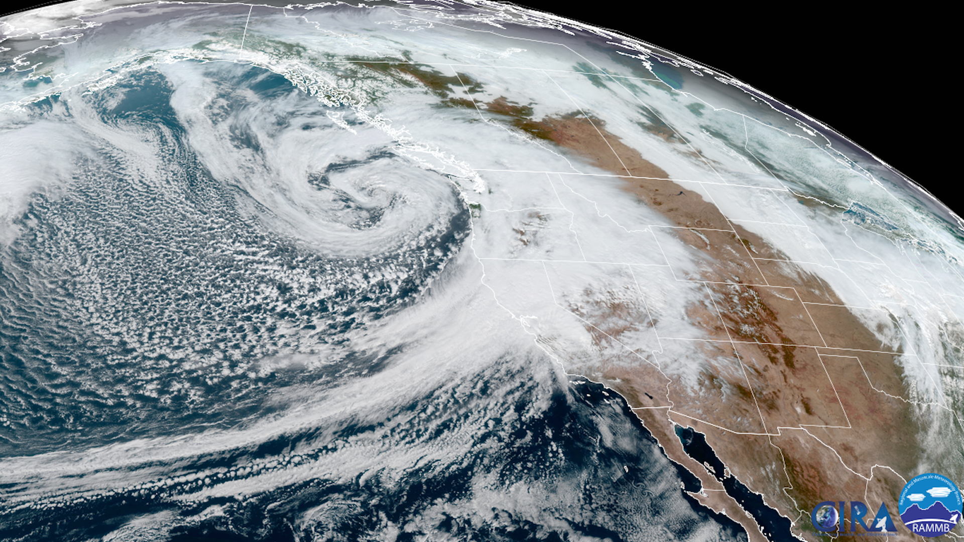
 The 'Bomb Cyclone' off the US Pacific Northwest. Photo: @NWSWPC / Twitte
The United States Pacific Northwest, consisting of the states of Washington, Oregon and California, has been deluged with rain and snow as a ‘bomb cyclone’ took effect and unleashed a storm October 24, 2021.
The USA Today daily reported that over 160,000 homes and businesses in California, more than 170,000 in Washington and over 28,000 in Oregon had been left without power October 24 due to the extreme weather.
USA Today further reported that the storm had been most severe in the northern and central portions of California and parts of southern Oregon. Two people were killed when a tree fell on a vehicle in the greater Seattle area.
Almost all the big cities of the US west coast including Seattle, those in the San Francisco Bay Area, including San Francisco, Berkeley, Oakland and San Rafael as well as the capital of California, Sacramento, received heavy rain. In fact, Sacramento was well on its way to breaking a precipitation record.
USA Today quoted Jon Porter, a meteorologist, as saying that a bomb cyclone forms when air pressure rapidly drops as the storm explosively strengthens. The bomb cyclone has been pulling deep tropical moisture from the Pacific, creating an “atmospheric river”, according to Porter.
He described the river as a “firehose of moisture in the sky” capable of unleashing intense rain and mountain snow.
American climate scientist Daniel Swain expressed amazement at the bomb cyclone as seen in satellite photographs.
California and the Pacific Northwest of North America are witnessing the rain after having been through a brutal heatwave this summer.
The rain and snow are expected to extinguish the various wildfires that have been burning in California since the summer. These include the Caldor fire that started August 14 in the Sierra Nevada mountain range, east of Sacramento and had burned 221,775 acres till October 24. The fire has now been contained, according to reports
However, the fires created another problem in the lead-up to the bomb cyclone. They had stripped a large part of the landscape of foliage, stripping the ground naked. Experts had predicted that such burnt areas would be more prone to mudlsides.
Several parts of California, including the Santa Cruz mountains and parts of western Santa Barbara county, had instated evacuation orders because of their proximity to burnt areas.
In photos: Drought-ravaged
California lashed by major storm
Rebecca Falconer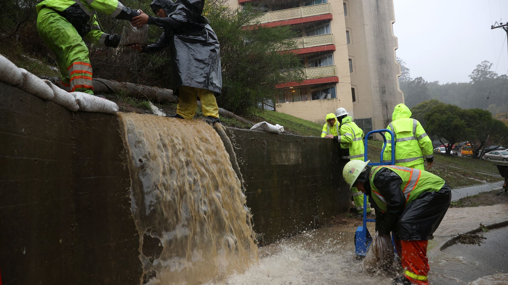
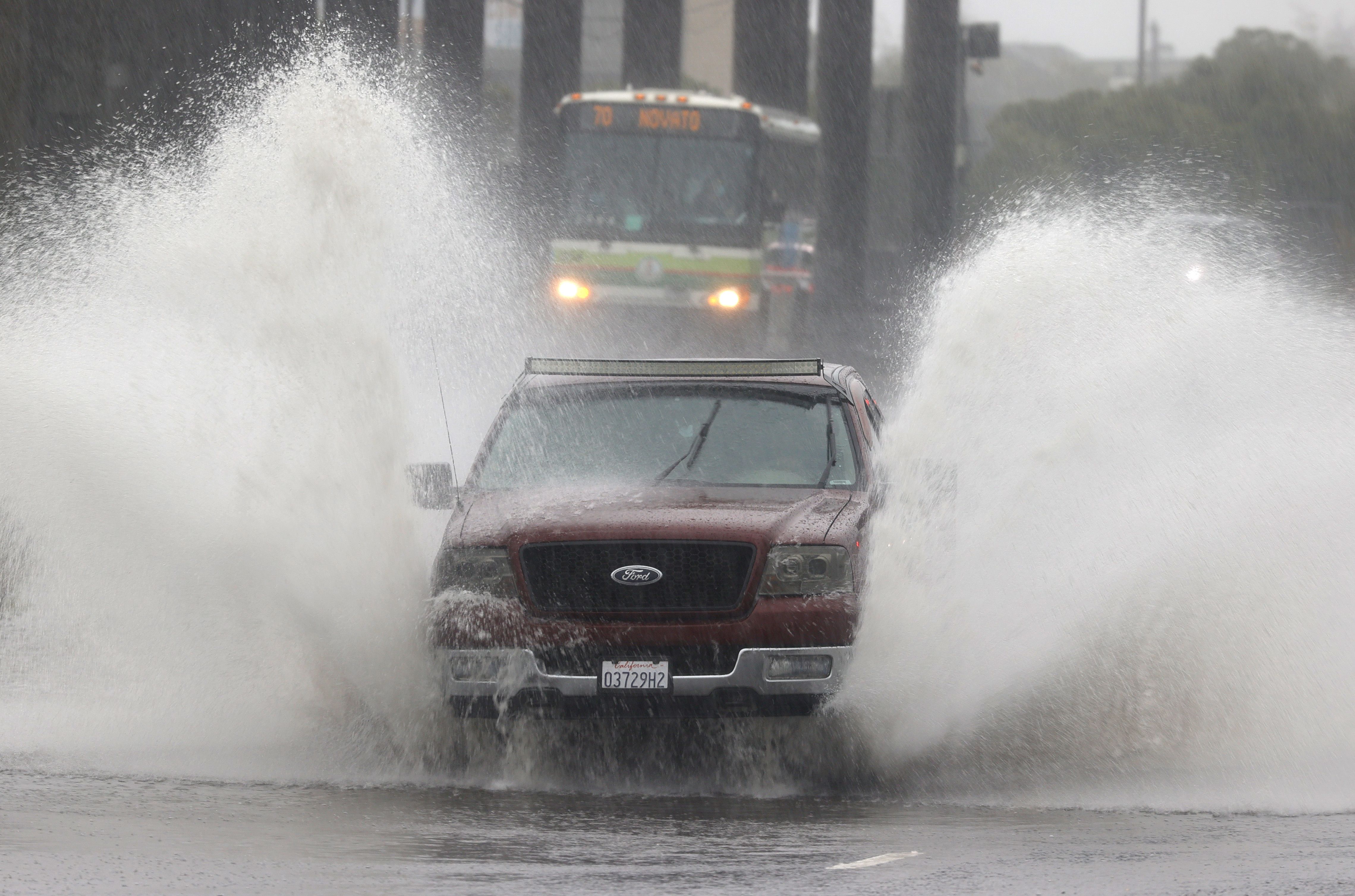
Workers try to divert water into drains as rain pours down on Oct. 24 in Marin City, California. Photo: Justin Sullivan/Getty Images
A major storm system was pummeling Northern California and parts of the Pacific Northwest with heavy rains overnight.
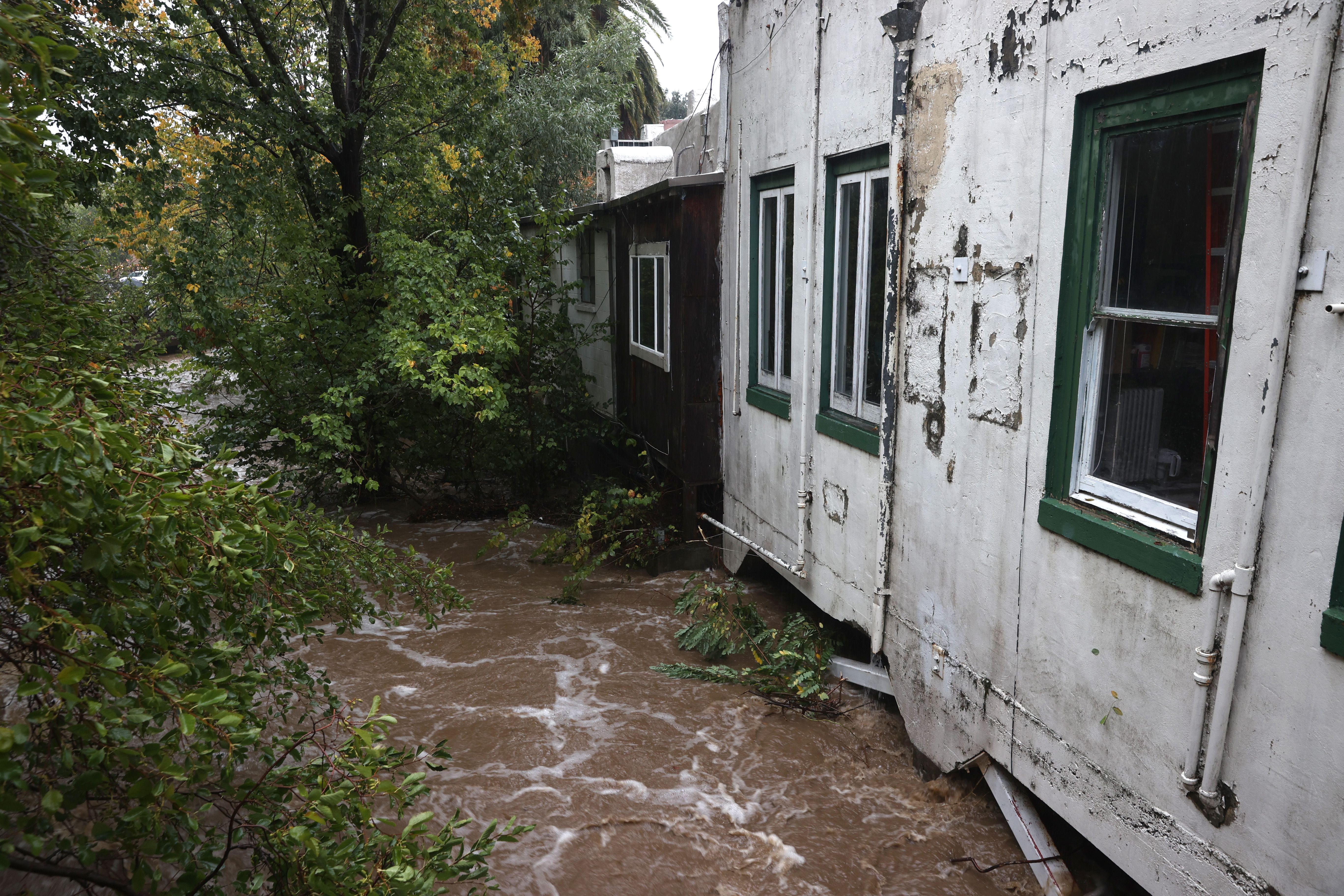
The big picture: The "atmospheric river" storms, associated with a record-strong "bomb cyclone" offshore from the Pacific Northwest, have brought flooding and mudslides to parts of California that were razed by recent wildfires and in severe drought. It's also caused widespread power outages in California and Washington state.
Rebecca Falconer, Andrew Freedman
Satellite view of the bomb cyclone swirling off the coast of the Pacific Northwest and the atmospheric river affecting California on Oct. 24.
A series of powerful "atmospheric river" storms are delivering historic amounts of rainfall across parts of drought-stricken California and the Pacific Northwest.
Why it matters: The atmospheric river, packing large amounts of moisture, was causing Northern California to whiplash from drought to flood, as it slowly moved south overnight. It's triggered widespread power outages, flooding and mudslides.
The storm system claimed the lives of two people in Washington state after a tree fell on a vehicle amid powerful winds Sunday.
Threat level: The storm is associated with a record-strong "bomb cyclone" off the Pacific Northwest, which was forecast to remain at sea. But it's bringing wind gusts of up to 60-70 mph and greater than 40-foot waves off the coasts of northern California, Oregon, Washington and British Columbia.
A bomb cyclone refers to a non-tropical storm whose pressure drops at least 24mb in 24 hrs. This one more than doubled that rate, and is likely to become the strongest low-pressure area on record off the coast of the Pacific Northwest.
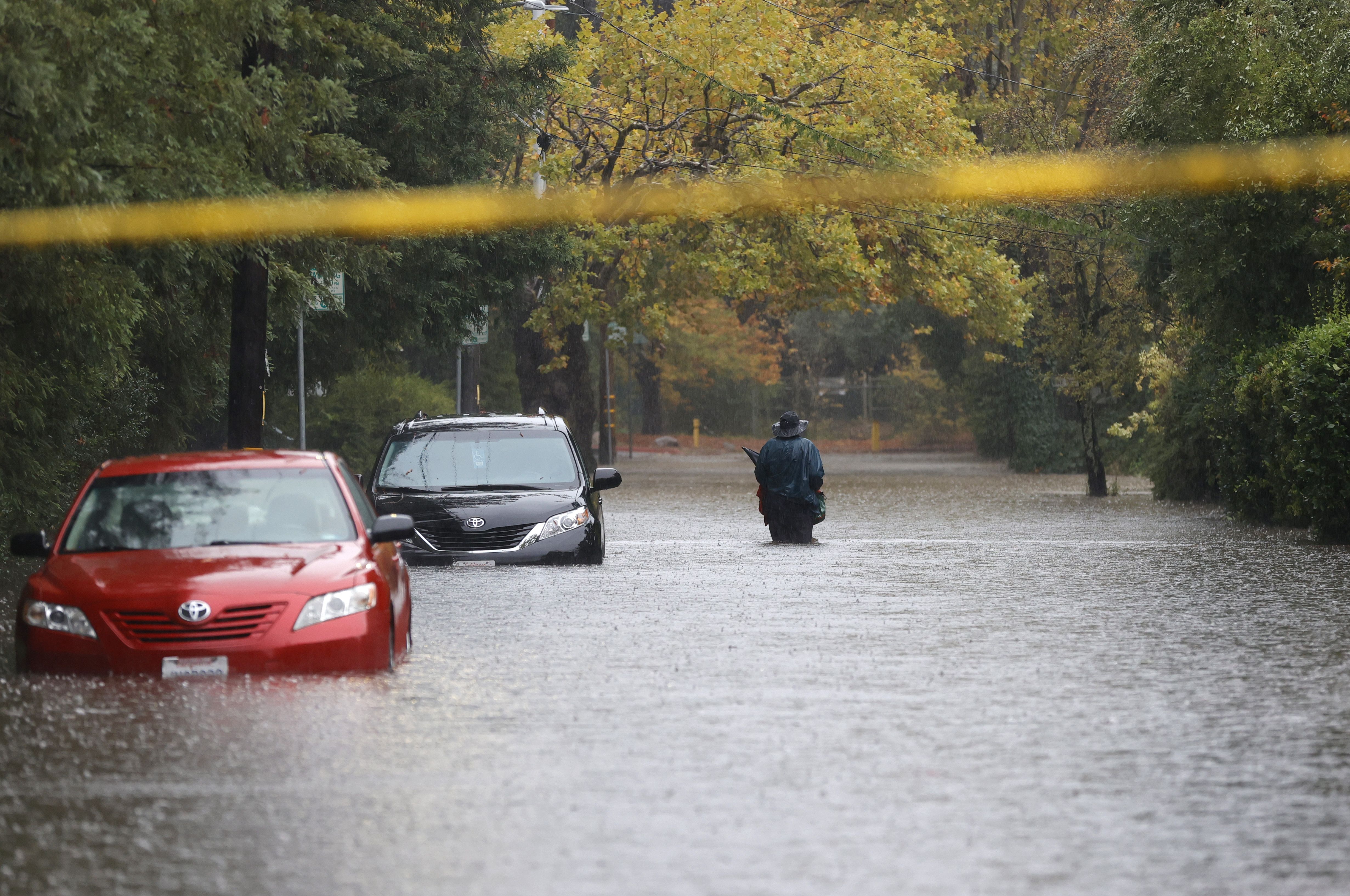
Widespread flooding was reported in the San Francisco Bay area amid potentially record rainfall.
The atmospheric river in this region was elevated to a Category 5 — the highest level on a scale based on strength and duration, per the Center for Western Weather and Water Extremes at Scripps Institution of Oceanography.
By the numbers: Over 116,000 customers had lost power in California and 72,000 others in Washington state were also without electricity early Monday, according to utility tracking site poweroutage.us.
The big picture: The storm was hitting with historic intensity, dumping 8-10 inches of rain across the region Sunday — and has already triggered potentially life-threatening flash floods and mudslides near the Dixie Fire and Calder Fire burn scars, per the National Weather Service.
Other burn areas during the devastating fire seasons from 2018 to 2021 were also under flash flood warning.
Evacuation orders were announced for the Santa Cruz Mountains ahead of the storm's expected arrival early Monday amid concerns the rain could cause debris flows in the CZU Lightning Complex Fire burn scar.
Tho NWS warned residents near burn scars in Sacramento to be prepared to evacuate if ordered to do so, noting that in some areas it may be too late for evacuation and residents should shelter in the highest parts of their homes.
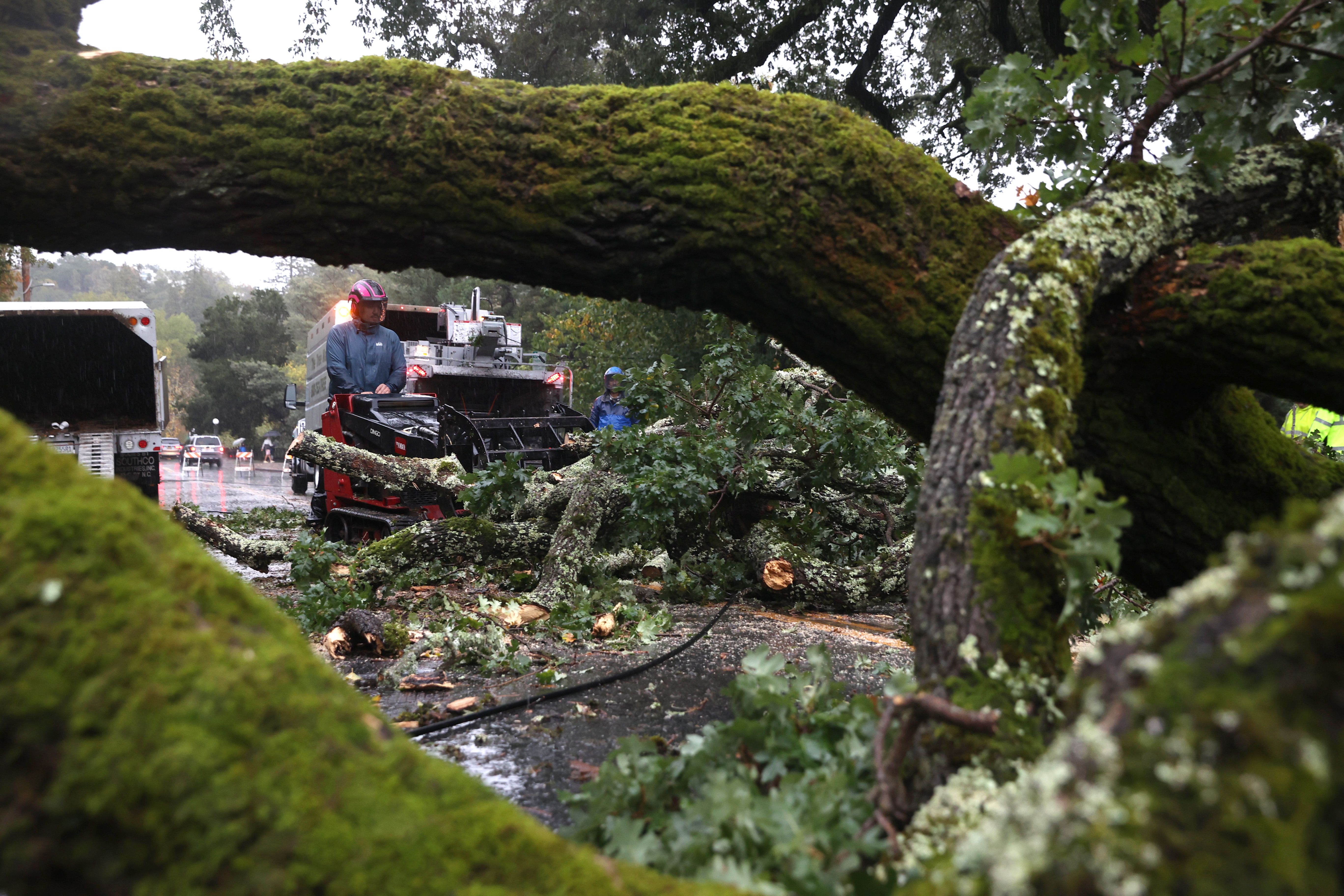
California's Department of Transportation said mudslides in Colusa and Yolo counties caused state highways 16 and 20 to close.
Of note: Sacramento, which just experienced its longest dry spell ever recorded, after breaking a record set in 1880, saw 5.44 inches of rainfall by Sunday evening.
This broke the all-time record for the city's highest 24-hour rainfall total, the NWS Sacramento office noted in a statement.
Reno, Nev., meanwhile, set a new October rainfall record, with 2.82 inches of rainfall by 5 a.m. PDT Monday. That includes 2.59 inches of rain that fell in the past 24 hours, according to NWS Reno.
The previous October record was set in 2010 when 2.65 inches of rain fell in the city.
"The rain hasn't ended!" NWS Reno tweeted Monday.
Between the lines: That turnaround marks an example of the extremes that are known to buffet California, with precipitation going from "feast to famine" and back again — except the odds are stacked even further in favor of extremes now with climate change.
Yes, but: The extreme rainfall won't be enough to end the drought for most places, though it will help.
Not all of California was forecast to be hit by this rainfall, and fire season was set to continue in the south part of the state.
Editor's note: This article has been updated with new details throughout.
While meteorologists on Sunday morning were still predicting large, but not record-breaking rain totals, a storm system rolled in off the Pacific and pummeled the Bay Area with way more rain than most of us were expecting, causing flooded roads, neighborhoods, and more.
It seems to be a story that fits with the climate-change narratives about extreme weather that defies historical precedent. And Sunday's "bomb cyclone" and atmospheric river event, centered off the Pacific around the Alaska and and Pacific Northwestern coast, looked a lot more like the Category 3 and 4 hurricanes that we've watched from afar drenching the South and the eastern seaboard.
While meteorologists had predicted that the North Bay and San Francisco would see the heaviest rains earlier in the day Sunday, the weather system actually moved slower toward the south than predicted, leading to more steady rainfall accumulation and a somewhat different storm trajectory Sunday than originally predicted.
This resulted in flooding across most Bay Area counties — and flooding that was not relegated to just extremely low-lying areas. Also, parts of San Francisco, including I-280 where it crosses Mission Street, experienced flooding.
The storm that came to drench Northern California on Sunday continues to break records, and we'll likely still be tallying the numbers well into Monday and Tuesday. But here are are a few:
The San Francisco-based Golden Gate Weather Services, which maintains the Bay Area Storm Index, said Sunday that this was the strongest storm to hit the Bay Area in 26 years.
The area of low pressure on the Pacific Coast that helped create the atmospheric river is being called the deepest in decades.
Just after noon on Sunday, a wind gust was recorded at SFO at 60 miles per hour.
The Russian River in Sonoma County, running at extremely low levels all summer, went from a level of less than 6 feet to over 12 feet at 2 p.m. on Sunday, per the Santa Rosa Press Democrat.
Meteorologist Daniel Swain pointed back to his own 2018 article that predicted that more extreme precipitation events like this one were likely to hit the California coast due to climate change — and here, in October, well ahead of the traditional "rainy season", we have one.
In San Francisco, small floods formed throughout the city, including this one in the Outer Richmond that was being battled by residents with brooms.
Climate scientists have continued to try to tell the globe that extreme, unseasonable events likes these are likely to become the norm, even if we still see them as new and abnormal. And parts of the Bay Area are now going through the whiplash of a very tense fire season that gave way to record-setting rain, flooding, mudslides, and a historic and fire-season-ending storm.
It's a lot to take. But welcome to the 2020s
No comments:
Post a Comment