By Georgina Torbet
DIGITAL TRENNDS
October 16, 2021
Like any good tourist, NASA’s Perseverance rover has been snapping photos as it explores the wilderness of Mars. Now, NASA has released a stunning panoramic view of the Martian surface, composed of pictures taken by the rover.

Cropped version of a mosaic composed of 84 pictures taken by the Mastcam-Z imager aboard NASA’s Perseverance rover.
NASA/JPL-Caltech/ASU/MSSS
The image shows the South Séítah area of the Jezero Crater, where the Perseverance rover is currently exploring and searching for signs of ancient life. This region is of particular interest because it contains some of the oldest rocks in Jezero, allowing researchers to get a view into Mars’s past.s

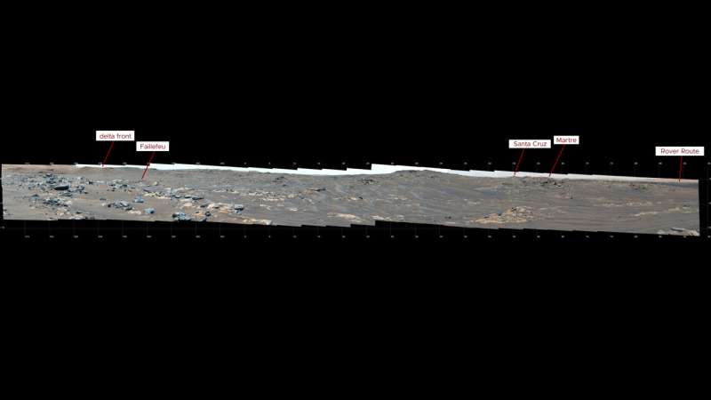
The complete image is an incredible mosaic, stitched together from 84 separate images taken using the rover’s Mastcam-Z instrument. These images were taken on September 12 after Perseverance had completed its longest drive to date, traveling 175 meters. To get the full effect of the stunning view of Mars, head over to the Jet Propulsion Laboratory’s website to see the high-definition version.This image indicates the location of several prominent geologic features visible in a mosaic composed of 84 pictures taken by the Mastcam-Z imager aboard NASA’s Perseverance rover.
The image shows the South Séítah area of the Jezero Crater, where the Perseverance rover is currently exploring and searching for signs of ancient life. This region is of particular interest because it contains some of the oldest rocks in Jezero, allowing researchers to get a view into Mars’s past.s

The complete image is an incredible mosaic, stitched together from 84 separate images taken using the rover’s Mastcam-Z instrument. These images were taken on September 12 after Perseverance had completed its longest drive to date, traveling 175 meters. To get the full effect of the stunning view of Mars, head over to the Jet Propulsion Laboratory’s website to see the high-definition version.This image indicates the location of several prominent geologic features visible in a mosaic composed of 84 pictures taken by the Mastcam-Z imager aboard NASA’s Perseverance rover.
NASA/JPL-Caltech/ASU/MSSS
“Just like any excited tourist approaching the end of a major road trip, we stopped at a lookout to get a first view of our destination,” said Jorge Núñez, an astrobiologist and planetary scientist on the Perseverance team, in a statement. “This panorama is spectacular because you feel like you are there. It shows not only the incredible scale of the area, but also all the exploration possibilities South Séítah has to offer. With multiple intriguing rocky outcrops and ridgelines, each one is seemingly better than the last. If it’s not a field geologist’s dream, it’s pretty close.”
The image shows the different colors and textures of rocks that the rover has encountered, which geologists can analyze to understand more about Mars and its history.
“Another cool thing about this image is that one can also see in the background, on the right, the path Perseverance took as it made its way to South Séítah,” said Núñez. “And finally, there is the peak of ‘Santa Cruz’ far in the distance. We’re currently not planning on going there; it’s too far out of our way. But it is geologically interesting, reinforcing just how much great stuff the team gets to pick and choose from here at Jezero. It also looks cool.”

No comments:
Post a Comment